| Location |
Co-Ordinates
(Latitude, Longitude and Elevation) |
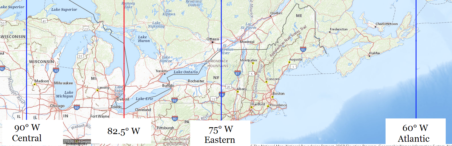
Mean solar time at noon
Central Standard Time
(Mountain Daylight Saving Time) |
Mean solar time at noon
Eastern Standard Time
(Central Daylight Saving Time) |
Mean solar time at noon
Atlantic Standard Time
(Eastern Daylight Saving Time) |
A L Holmes Elementary School,
Wayne County
|
Elevation: 191 meters*
Latitude: 42.3946° N
Longitude: 83.0151° W
|
12:27:56 |
11:27:56 |
10:27:56 |
A Philip Randolph Career and Technical Center,
Wayne County
|
Elevation: 202 meters*
Latitude: 42.4175° N
Longitude: 83.1908° W
|
12:27:14 |
11:27:14 |
10:27:14 |
AA Claytor Elementary School,
Saginaw County
|
Elevation: 184 meters*
Latitude: 43.4211111° N
Longitude: 83.9005556° W
|
12:24:23 |
11:24:23 |
10:24:23 |
AE Seaton Elementary School,
Lapeer County
|
Elevation: 252 meters*
Latitude: 43.0966667° N
Longitude: 83.4286111° W
|
12:26:17 |
11:26:17 |
10:26:17 |
AG Schmidt Middle School,
Genesee County
|
Elevation: 279 meters*
Latitude: 42.7872222° N
Longitude: 83.7305556° W
|
12:25:04 |
11:25:04 |
10:25:04 |
Aarwood Post Office (historical),
Kalkaska County
|
Elevation: 184 meters*
Latitude: 44.8438889° N
Longitude: 85.3083333° W
|
12:18:46 |
11:18:46 |
10:18:46 |
Abbot Elementary School,
Washtenaw County
|
Elevation: 288 meters*
Latitude: 42.2938103° N
Longitude: 83.7856394° W
|
12:24:51 |
11:24:51 |
10:24:51 |
Abbott Junior High School,
Oakland County
|
Elevation: 287 meters*
Latitude: 42.6000329° N
Longitude: 83.3502136° W
|
12:26:35 |
11:26:35 |
10:26:35 |
Abbott School,
Lapeer County
|
Elevation: 256 meters*
Latitude: 43.1391935° N
Longitude: 83.0346605° W
|
12:27:51 |
11:27:51 |
10:27:51 |
Abbott School,
Van Buren County
|
Elevation: 241 meters*
Latitude: 42.1400408° N
Longitude: 86.1289067° W
|
12:15:29 |
11:15:29 |
10:15:29 |
Abbottsford Post Office (historical),
St. Clair County
|
Elevation: 213 meters*
Latitude: 43.02° N
Longitude: 82.6333333° W
|
12:29:28 |
11:29:28 |
10:29:28 |
Aberdeen Elementary School,
Kent County
|
Elevation: 215 meters*
Latitude: 43.00583° N
Longitude: 85.64583° W
|
12:17:25 |
11:17:25 |
10:17:25 |
Abke School,
Tuscola County
|
Elevation: 197 meters*
Latitude: 43.625852° N
Longitude: 83.3927336° W
|
12:26:25 |
11:26:25 |
10:26:25 |
Abronia Post Office (historical),
Allegan County
|
Elevation: 218 meters*
Latitude: 42.5227778° N
Longitude: 85.7597222° W
|
12:16:57 |
11:16:57 |
10:16:57 |
Abscota Post Office (historical),
Calhoun County
|
Elevation: 286 meters*
Latitude: 42.1455556° N
Longitude: 85.1583333° W
|
12:19:22 |
11:19:22 |
10:19:22 |
Abscota School,
Calhoun County
|
Elevation: 287 meters*
Latitude: 42.1444895° N
Longitude: 85.1577601° W
|
12:19:22 |
11:19:22 |
10:19:22 |
Academic Building,
Genesee County
|
Elevation: 222 meters*
Latitude: 43.0133333° N
Longitude: 83.7138889° W
|
12:25:08 |
11:25:08 |
10:25:08 |
Academy for Business and Technology Elementary School,
Wayne County
|
Elevation: 180 meters*
Latitude: 42.3263° N
Longitude: 83.1748° W
|
12:27:18 |
11:27:18 |
10:27:18 |
Academy for Business and Technology,
Wayne County
|
Elevation: 190 meters*
Latitude: 42.2738° N
Longitude: 83.2934° W
|
12:26:49 |
11:26:49 |
10:26:49 |
Academy of Detroit-West,
Wayne County
|
Elevation: 200 meters*
Latitude: 42.416° N
Longitude: 83.2096° W
|
12:27:09 |
11:27:09 |
10:27:09 |
Academy of Detroit-West,
Wayne County
|
Elevation: 189 meters*
Latitude: 42.3687° N
Longitude: 83.2726° W
|
12:26:54 |
11:26:54 |
10:26:54 |
Academy of Excellence,
Wayne County
|
Elevation: 190 meters*
Latitude: 42.4197° N
Longitude: 83.0038° W
|
12:27:59 |
11:27:59 |
10:27:59 |
Academy of Fine and Performing Arts East,
Wayne County
|
Elevation: 190 meters*
Latitude: 42.4217° N
Longitude: 83.0022° W
|
12:27:59 |
11:27:59 |
10:27:59 |
Academy of Inkster,
Wayne County
|
Elevation: 192 meters*
Latitude: 42.3041° N
Longitude: 83.3212° W
|
12:26:42 |
11:26:42 |
10:26:42 |
Academy of Lathrup Village,
Oakland County
|
Elevation: 213 meters*
Latitude: 42.493° N
Longitude: 83.222° W
|
12:27:06 |
11:27:06 |
10:27:06 |
Academy of Michigan,
Wayne County
|
Elevation: 203 meters*
Latitude: 42.4457° N
Longitude: 83.2005° W
|
12:27:11 |
11:27:11 |
10:27:11 |
Academy of Oak Park,
Oakland County
|
Elevation: 201 meters*
Latitude: 42.450152° N
Longitude: 83.165195° W
|
12:27:20 |
11:27:20 |
10:27:20 |
Academy of Oak Park,
Wayne County
|
Elevation: 195 meters*
Latitude: 42.3914° N
Longitude: 83.1967° W
|
12:27:12 |
11:27:12 |
10:27:12 |
Academy of Southfield,
Oakland County
|
Elevation: 207 meters*
Latitude: 42.4712° N
Longitude: 83.2237° W
|
12:27:06 |
11:27:06 |
10:27:06 |
Academy of Waterford,
Oakland County
|
Elevation: 297 meters*
Latitude: 42.6841° N
Longitude: 83.3733° W
|
12:26:30 |
11:26:30 |
10:26:30 |
Academy of Westland,
Wayne County
|
Elevation: 195 meters*
Latitude: 42.309° N
Longitude: 83.3397° W
|
12:26:38 |
11:26:38 |
10:26:38 |
Academy of the Americas Elementary School,
Wayne County
|
Elevation: 182 meters*
Latitude: 42.3273° N
Longitude: 83.1098° W
|
12:27:33 |
11:27:33 |
10:27:33 |
Ace High School,
Iron County
|
Elevation: 498 meters*
Latitude: 46.0816667° N
Longitude: 88.6333333° W
|
12:05:28 |
11:05:28 |
10:05:28 |
Achill Post Office (historical),
Roscommon County
|
Elevation: 342 meters*
Latitude: 44.18° N
Longitude: 84.5194444° W
|
12:21:55 |
11:21:55 |
10:21:55 |
Ackerson Lake School,
Jackson County
|
Elevation: 297 meters*
Latitude: 42.1978153° N
Longitude: 84.3435651° W
|
12:22:37 |
11:22:37 |
10:22:37 |
Ackerson Post Office (historical),
Jackson County
|
Elevation: 298 meters*
Latitude: 42.1805556° N
Longitude: 84.3452778° W
|
12:22:37 |
11:22:37 |
10:22:37 |
Ackley School,
Van Buren County
|
Elevation: 203 meters*
Latitude: 42.3458679° N
Longitude: 86.1103028° W
|
12:15:33 |
11:15:33 |
10:15:33 |
Acme Post Office,
Grand Traverse County
|
Elevation: 181 meters*
Latitude: 44.7646438° N
Longitude: 85.5061286° W
|
12:17:58 |
11:17:58 |
10:17:58 |
Acorn School,
Van Buren County
|
Elevation: 225 meters*
Latitude: 42.2453163° N
Longitude: 85.8644579° W
|
12:16:32 |
11:16:32 |
10:16:32 |
Ada Christian School,
Kent County
|
Elevation: 214 meters*
Latitude: 42.9488889° N
Longitude: 85.5141667° W
|
12:17:56 |
11:17:56 |
10:17:56 |
Ada Elementary School,
Kent County
|
Elevation: 221 meters*
Latitude: 42.9527778° N
Longitude: 85.4941667° W
|
12:18:01 |
11:18:01 |
10:18:01 |
Ada Post Office,
Kent County
|
Elevation: 195 meters*
Latitude: 42.9573435° N
Longitude: 85.4927087° W
|
12:18:01 |
11:18:01 |
10:18:01 |
Ada Vista Elementary School,
Kent County
|
Elevation: 213 meters*
Latitude: 42.9539184° N
Longitude: 85.4933566° W
|
12:18:01 |
11:18:01 |
10:18:01 |
Adair Post Office (historical),
St. Clair County
|
Elevation: 196 meters*
Latitude: 42.7980556° N
Longitude: 82.6338889° W
|
12:29:27 |
11:29:27 |
10:29:27 |
Adams Elementary School,
Midland County
|
Elevation: 198 meters*
Latitude: 43.6461111° N
Longitude: 84.2161111° W
|
12:23:08 |
11:23:08 |
10:23:08 |
Adams Junior High School,
Wayne County
|
Elevation: 188 meters*
Latitude: 42.3072599° N
Longitude: 83.2452061° W
|
12:27:01 |
11:27:01 |
10:27:01 |
Adams Junior High School,
Wayne County
|
Elevation: 198 meters*
Latitude: 42.2942045° N
Longitude: 83.368821° W
|
12:26:31 |
11:26:31 |
10:26:31 |
Adams Post Office (historical),
Hillsdale County
|
Elevation: 350 meters*
Latitude: 41.9333333° N
Longitude: 84.5344444° W
|
12:21:51 |
11:21:51 |
10:21:51 |
Adams Protestant Reformed Christian School,
Kent County
|
Elevation: 222 meters*
Latitude: 42.8641943° N
Longitude: 85.7233633° W
|
12:17:06 |
11:17:06 |
10:17:06 |
Adams School,
Hillsdale County
|
Elevation: 331 meters*
Latitude: 41.8547704° N
Longitude: 84.658288° W
|
12:21:22 |
11:21:22 |
10:21:22 |
Adams School,
Huron County
|
Elevation: 223 meters*
Latitude: 43.8427916° N
Longitude: 82.8574393° W
|
12:28:34 |
11:28:34 |
10:28:34 |
Adams School,
Oakland County
|
Elevation: 238 meters*
Latitude: 42.5500345° N
Longitude: 83.2063191° W
|
12:27:10 |
11:27:10 |
10:27:10 |
Adams School,
Oakland County
|
Elevation: 297 meters*
Latitude: 42.6947534° N
Longitude: 83.3477166° W
|
12:26:36 |
11:26:36 |
10:26:36 |
Adams School,
Van Buren County
|
Elevation: 279 meters*
Latitude: 42.1125422° N
Longitude: 85.7730595° W
|
12:16:54 |
11:16:54 |
10:16:54 |
Adams School,
Washtenaw County
|
Elevation: 233 meters*
Latitude: 42.2486498° N
Longitude: 83.6021603° W
|
12:25:35 |
11:25:35 |
10:25:35 |
Adams School,
Wayne County
|
Elevation: 193 meters*
Latitude: 42.390592° N
Longitude: 83.322709° W
|
12:26:42 |
11:26:42 |
10:26:42 |
Adamsville Post Office (historical),
Cass County
|
Elevation: 250 meters*
Latitude: 41.7852778° N
Longitude: 85.9938889° W
|
12:16:01 |
11:16:01 |
10:16:01 |
Addams School,
Oakland County
|
Elevation: 205 meters*
Latitude: 42.5111463° N
Longitude: 83.1718721° W
|
12:27:18 |
11:27:18 |
10:27:18 |
Addison Community Schools,
Lenawee County
|
Elevation: 331 meters*
Latitude: 41.9875° N
Longitude: 84.3441667° W
|
12:22:37 |
11:22:37 |
10:22:37 |
Addison Post Office,
Lenawee County
|
Elevation: 320 meters*
Latitude: 41.9864707° N
Longitude: 84.3469507° W
|
12:22:36 |
11:22:36 |
10:22:36 |
Adelphian Academy,
Oakland County
|
Elevation: 293 meters*
Latitude: 42.7922505° N
Longitude: 83.6413369° W
|
12:25:26 |
11:25:26 |
10:25:26 |
Adlai Stevenson High School,
Macomb County
|
Elevation: 187 meters*
Latitude: 42.5866217° N
Longitude: 83.0128517° W
|
12:27:56 |
11:27:56 |
10:27:56 |
Adler School,
Oakland County
|
Elevation: 207 meters*
Latitude: 42.4775355° N
Longitude: 83.2327069° W
|
12:27:04 |
11:27:04 |
10:27:04 |
Adrian College,
Lenawee County
|
Elevation: 243 meters*
Latitude: 41.8975471° N
Longitude: 84.0604995° W
|
12:23:45 |
11:23:45 |
10:23:45 |
Adrian High School,
Lenawee County
|
Elevation: 243 meters*
Latitude: 41.9105556° N
Longitude: 84.0477778° W
|
12:23:48 |
11:23:48 |
10:23:48 |
Adrian Middle School 5-6,
Lenawee County
|
Elevation: 243 meters*
Latitude: 41.8955556° N
Longitude: 84.0322222° W
|
12:23:52 |
11:23:52 |
10:23:52 |
Adrian Middle School 7-8,
Lenawee County
|
Elevation: 238 meters*
Latitude: 41.9083333° N
Longitude: 84.0416667° W
|
12:23:49 |
11:23:49 |
10:23:49 |
Adrian Post Office,
Lenawee County
|
Elevation: 243 meters*
Latitude: 41.89722° N
Longitude: 84.0305813° W
|
12:23:52 |
11:23:52 |
10:23:52 |
Advance Post Office (historical),
Charlevoix County
|
Elevation: 179 meters*
Latitude: 45.2213889° N
Longitude: 85.0775° W
|
12:19:41 |
11:19:41 |
10:19:41 |
Advanced Technology Academy,
Wayne County
|
Elevation: 184 meters*
Latitude: 42.3446° N
Longitude: 83.1757° W
|
12:27:17 |
11:27:17 |
10:27:17 |
Advantage Alternative Junior High School,
Oakland County
|
Elevation: 193 meters*
Latitude: 42.4578° N
Longitude: 83.1032° W
|
12:27:35 |
11:27:35 |
10:27:35 |
Advent School,
Menominee County
|
Elevation: 208 meters*
Latitude: 45.6166368° N
Longitude: 87.3679042° W
|
12:10:31 |
11:10:31 |
10:10:31 |
Adventist School,
St. Clair County
|
Elevation: 188 meters*
Latitude: 42.9719741° N
Longitude: 82.4818614° W
|
12:30:04 |
11:30:04 |
10:30:04 |
Aetna Post Office (historical),
Newaygo County
|
Elevation: 252 meters*
Latitude: 43.5677778° N
Longitude: 85.9208333° W
|
12:16:19 |
11:16:19 |
10:16:19 |
African Heritage Cultural Center,
Wayne County
|
Elevation: 193 meters*
Latitude: 42.413° N
Longitude: 83.2543° W
|
12:26:58 |
11:26:58 |
10:26:58 |
Afton Post Office (historical),
Cheboygan County
|
Elevation: 240 meters*
Latitude: 45.3738889° N
Longitude: 84.4966667° W
|
12:22:00 |
11:22:00 |
10:22:00 |
Afton Post Office,
Cheboygan County
|
Elevation: 239 meters*
Latitude: 45.3743507° N
Longitude: 84.496325° W
|
12:22:00 |
11:22:00 |
10:22:00 |
Agape Christian Academy,
Wayne County
|
Elevation: 207 meters*
Latitude: 42.2757° N
Longitude: 83.4781° W
|
12:26:05 |
11:26:05 |
10:26:05 |
Agate Post Office (historical),
Ontonagon County
|
Elevation: 363 meters*
Latitude: 46.4741667° N
Longitude: 89.0702778° W
|
12:03:43 |
11:03:43 |
10:03:43 |
Agnew Post Office (historical),
Ottawa County
|
Elevation: 191 meters*
Latitude: 42.965° N
Longitude: 86.1766667° W
|
12:15:17 |
11:15:17 |
10:15:17 |
Ahmeek Post Office,
Keweenaw County
|
Elevation: 265 meters*
Latitude: 47.2969537° N
Longitude: 88.3967916° W
|
12:06:24 |
11:06:24 |
10:06:24 |
Ainger Post Office (historical),
Eaton County
|
Elevation: 269 meters*
Latitude: 42.4827778° N
Longitude: 84.9344444° W
|
12:20:15 |
11:20:15 |
10:20:15 |
Ainsworth High School,
Genesee County
|
Elevation: 241 meters*
Latitude: 42.9555833° N
Longitude: 83.707733° W
|
12:25:10 |
11:25:10 |
10:25:10 |
Airport High School,
Monroe County
|
Elevation: 187 meters*
Latitude: 42.0383773° N
Longitude: 83.3788211° W
|
12:26:29 |
11:26:29 |
10:26:29 |
Aisha Shule-WEB Dubois Preparatory School,
Wayne County
|
Elevation: 201 meters*
Latitude: 42.4093° N
Longitude: 83.1678° W
|
12:27:19 |
11:27:19 |
10:27:19 |
Akiva Hebrew Day School,
Oakland County
|
Elevation: 215 meters*
Latitude: 42.5017° N
Longitude: 83.2528° W
|
12:26:59 |
11:26:59 |
10:26:59 |
Akron Post Office,
Tuscola County
|
Elevation: 195 meters*
Latitude: 43.5665776° N
Longitude: 83.5160933° W
|
12:25:56 |
11:25:56 |
10:25:56 |
Akron-Fairgrove Elementary School,
Tuscola County
|
Elevation: 194 meters*
Latitude: 43.5677778° N
Longitude: 83.5180556° W
|
12:25:55 |
11:25:55 |
10:25:55 |
Akron-Fairgrove High School,
Tuscola County
|
Elevation: 193 meters*
Latitude: 43.5461111° N
Longitude: 83.5416667° W
|
12:25:49 |
11:25:49 |
10:25:49 |
Al-Ikhlas Training Academy,
Wayne County
|
Elevation: 190 meters*
Latitude: 42.4169° N
Longitude: 83.0401° W
|
12:27:50 |
11:27:50 |
10:27:50 |
Alabaster Post Office (historical),
Iosco County
|
Elevation: 179 meters*
Latitude: 44.1863889° N
Longitude: 83.5580556° W
|
12:25:46 |
11:25:46 |
10:25:46 |
Alaiedon Elementary School,
Ingham County
|
Elevation: 279 meters*
Latitude: 42.6322457° N
Longitude: 84.4341646° W
|
12:22:15 |
11:22:15 |
10:22:15 |
Alama Middle School,
Gratiot County
|
Elevation: 224 meters*
Latitude: 43.3805556° N
Longitude: 84.6577778° W
|
12:21:22 |
11:21:22 |
10:21:22 |
Alamando Post Office (historical),
Midland County
|
Elevation: 213 meters*
Latitude: 43.7319444° N
Longitude: 84.5266667° W
|
12:21:53 |
11:21:53 |
10:21:53 |
Alameda Early Childhood Center,
Oakland County
|
Elevation: 242 meters*
Latitude: 42.4794838° N
Longitude: 83.3662382° W
|
12:26:32 |
11:26:32 |
10:26:32 |
Alameda School,
Oakland County
|
Elevation: 243 meters*
Latitude: 42.4794793° N
Longitude: 83.3668772° W
|
12:26:31 |
11:26:31 |
10:26:31 |
Alamo Post Office (historical),
Kalamazoo County
|
Elevation: 238 meters*
Latitude: 42.3752778° N
Longitude: 85.7077778° W
|
12:17:10 |
11:17:10 |
10:17:10 |
Alamo Valley School,
Kalamazoo County
|
Elevation: 246 meters*
Latitude: 42.3686481° N
Longitude: 85.6775123° W
|
12:17:17 |
11:17:17 |
10:17:17 |
Alan B Shepard School,
Macomb County
|
Elevation: 187 meters*
Latitude: 42.5267022° N
Longitude: 82.9899222° W
|
12:28:02 |
11:28:02 |
10:28:02 |
Alanson Post Office,
Emmet County
|
Elevation: 184 meters*
Latitude: 45.4409814° N
Longitude: 84.7875157° W
|
12:20:50 |
11:20:50 |
10:20:50 |
Alaska Post Office (historical),
Kent County
|
Elevation: 208 meters*
Latitude: 42.84° N
Longitude: 85.4780556° W
|
12:18:05 |
11:18:05 |
10:18:05 |
Alba Post Office,
Antrim County
|
Elevation: 362 meters*
Latitude: 44.9751385° N
Longitude: 84.9714077° W
|
12:20:06 |
11:20:06 |
10:20:06 |
Albee School,
Saginaw County
|
Elevation: 182 meters*
Latitude: 43.2555821° N
Longitude: 83.9730268° W
|
12:24:06 |
11:24:06 |
10:24:06 |
Albert Township School,
Montmorency County
|
Elevation: 385 meters*
Latitude: 44.8877889° N
Longitude: 84.3055686° W
|
12:22:46 |
11:22:46 |
10:22:46 |
Albert for McMichael Middle School,
Wayne County
|
Elevation: 190 meters*
Latitude: 42.3573° N
Longitude: 83.0955° W
|
12:27:37 |
11:27:37 |
10:27:37 |
Albion College,
Calhoun County
|
Elevation: 294 meters*
Latitude: 42.2444444° N
Longitude: 84.7419444° W
|
12:21:01 |
11:21:01 |
10:21:01 |
Albion High School,
Calhoun County
|
Elevation: 303 meters*
Latitude: 42.2597222° N
Longitude: 84.7505556° W
|
12:20:59 |
11:20:59 |
10:20:59 |
Albion Post Office,
Calhoun County
|
Elevation: 289 meters*
Latitude: 42.2472175° N
Longitude: 84.7535111° W
|
12:20:59 |
11:20:59 |
10:20:59 |
Alcona Elementary School,
Alcona County
|
Elevation: 248 meters*
Latitude: 44.6627778° N
Longitude: 83.4055556° W
|
12:26:22 |
11:26:22 |
10:26:22 |
Alcona High School,
Alcona County
|
Elevation: 250 meters*
Latitude: 44.6572355° N
Longitude: 83.4055267° W
|
12:26:22 |
11:26:22 |
10:26:22 |
Alcona Post Office (historical),
Alcona County
|
Elevation: 180 meters*
Latitude: 44.76° N
Longitude: 83.2977778° W
|
12:26:48 |
11:26:48 |
10:26:48 |
Alcott School,
Oakland County
|
Elevation: 301 meters*
Latitude: 42.6658653° N
Longitude: 83.317715° W
|
12:26:43 |
11:26:43 |
10:26:43 |
Alden Post Office,
Antrim County
|
Elevation: 185 meters*
Latitude: 44.8811183° N
Longitude: 85.2750421° W
|
12:18:53 |
11:18:53 |
10:18:53 |
Alderson Post Office (historical),
Newaygo County
|
Elevation: 258 meters*
Latitude: 43.8072222° N
Longitude: 85.85° W
|
12:16:36 |
11:16:36 |
10:16:36 |
Alembic Post Office (historical),
Isabella County
|
Elevation: 226 meters*
Latitude: 43.5975° N
Longitude: 84.6683333° W
|
12:21:19 |
11:21:19 |
10:21:19 |
Alert Post Office (historical),
Oakland County
|
Elevation: 287 meters*
Latitude: 42.7694444° N
Longitude: 83.1375° W
|
12:27:26 |
11:27:26 |
10:27:26 |
Alexander Elementary School,
Kent County
|
Elevation: 226 meters*
Latitude: 42.94417° N
Longitude: 85.64361° W
|
12:17:25 |
11:17:25 |
10:17:25 |
Alexander Hamilton School,
Kent County
|
Elevation: 215 meters*
Latitude: 42.9039175° N
Longitude: 85.6083599° W
|
12:17:33 |
11:17:33 |
10:17:33 |
Alexander Macomb Academy,
Macomb County
|
Elevation: 186 meters*
Latitude: 42.6° N
Longitude: 82.8818° W
|
12:28:28 |
11:28:28 |
10:28:28 |
Alexander Music Building,
Washtenaw County
|
Elevation: 225 meters*
Latitude: 42.2494444° N
Longitude: 83.62° W
|
12:25:31 |
11:25:31 |
10:25:31 |
Alexander School,
Lenawee County
|
Elevation: 238 meters*
Latitude: 41.9067135° N
Longitude: 84.0424436° W
|
12:23:49 |
11:23:49 |
10:23:49 |
Alfred Post Office (historical),
Dickinson County
|
Elevation: 333 meters*
Latitude: 46.0838889° N
Longitude: 87.6325° W
|
12:09:28 |
11:09:28 |
10:09:28 |
Algansee Post Office (historical),
Branch County
|
Elevation: 317 meters*
Latitude: 41.8325° N
Longitude: 84.8808333° W
|
12:20:28 |
11:20:28 |
10:20:28 |
Alger Elementary School,
Kent County
|
Elevation: 211 meters*
Latitude: 42.92139° N
Longitude: 85.64444° W
|
12:17:25 |
11:17:25 |
10:17:25 |
Alger Post Office,
Arenac County
|
Elevation: 239 meters*
Latitude: 44.125437° N
Longitude: 84.1203864° W
|
12:23:31 |
11:23:31 |
10:23:31 |
Alger School,
Wayne County
|
Elevation: 192 meters*
Latitude: 42.386704° N
Longitude: 83.0779782° W
|
12:27:41 |
11:27:41 |
10:27:41 |
Algodon Post Office (historical),
Ionia County
|
Elevation: 260 meters*
Latitude: 42.8333333° N
Longitude: 85.1902778° W
|
12:19:14 |
11:19:14 |
10:19:14 |
Algoma Post Office (historical),
Kent County
|
Elevation: 244 meters*
Latitude: 43.1611111° N
Longitude: 85.6111111° W
|
12:17:33 |
11:17:33 |
10:17:33 |
Algoma School,
Kent County
|
Elevation: 250 meters*
Latitude: 43.1561374° N
Longitude: 85.6117017° W
|
12:17:33 |
11:17:33 |
10:17:33 |
Algoma School,
Kent County
|
Elevation: 235 meters*
Latitude: 43.1383591° N
Longitude: 85.6411467° W
|
12:17:26 |
11:17:26 |
10:17:26 |
Algona Christian School,
Kent County
|
Elevation: 245 meters*
Latitude: 43.2286111° N
Longitude: 85.7113889° W
|
12:17:09 |
11:17:09 |
10:17:09 |
Algonac Elementary School,
St. Clair County
|
Elevation: 178 meters*
Latitude: 42.6208333° N
Longitude: 82.5333333° W
|
12:29:52 |
11:29:52 |
10:29:52 |
Algonac High School,
St. Clair County
|
Elevation: 177 meters*
Latitude: 42.6272562° N
Longitude: 82.5824092° W
|
12:29:40 |
11:29:40 |
10:29:40 |
Algonac Post Office,
St. Clair County
|
Elevation: 178 meters*
Latitude: 42.6164587° N
Longitude: 82.5329857° W
|
12:29:52 |
11:29:52 |
10:29:52 |
Algonquin Lake School,
Barry County
|
Elevation: 248 meters*
Latitude: 42.6680901° N
Longitude: 85.3422318° W
|
12:18:37 |
11:18:37 |
10:18:37 |
Algonquin Middle School,
Macomb County
|
Elevation: 187 meters*
Latitude: 42.5719444° N
Longitude: 82.9225° W
|
12:28:18 |
11:28:18 |
10:28:18 |
Alice Post Office (historical),
Oceana County
|
Elevation: 231 meters*
Latitude: 43.5375° N
Longitude: 86.3711111° W
|
12:14:30 |
11:14:30 |
10:14:30 |
Alicia Post Office (historical),
Saginaw County
|
Elevation: 178 meters*
Latitude: 43.2708333° N
Longitude: 84.0325° W
|
12:23:52 |
11:23:52 |
10:23:52 |
All Saints Catholic Academy,
Gogebic County
|
Elevation: 468 meters*
Latitude: 46.4567915° N
Longitude: 90.16449° W
|
11:59:20 |
10:59:20 |
9:59:20 |
All Saints Catholic School,
Alpena County
|
Elevation: 180 meters*
Latitude: 45.0650128° N
Longitude: 83.4280305° W
|
12:26:17 |
11:26:17 |
10:26:17 |
All Saints Central High School,
Bay County
|
Elevation: 181 meters*
Latitude: 43.5877778° N
Longitude: 83.8847222° W
|
12:24:27 |
11:24:27 |
10:24:27 |
Allan College of Liberal Arts and Sciences,
Oakland County
|
Elevation: 202 meters*
Latitude: 42.4678° N
Longitude: 83.1822° W
|
12:27:16 |
11:27:16 |
10:27:16 |
Allegan High School,
Allegan County
|
Elevation: 215 meters*
Latitude: 42.53° N
Longitude: 85.8725° W
|
12:16:30 |
11:16:30 |
10:16:30 |
Allegan Post Office,
Allegan County
|
Elevation: 196 meters*
Latitude: 42.5289417° N
Longitude: 85.8510003° W
|
12:16:35 |
11:16:35 |
10:16:35 |
Allegan Street Elementary School,
Allegan County
|
Elevation: 217 meters*
Latitude: 42.4608333° N
Longitude: 85.7030556° W
|
12:17:11 |
11:17:11 |
10:17:11 |
Allegheny School,
Cass County
|
Elevation: 281 meters*
Latitude: 41.9547682° N
Longitude: 85.9744511° W
|
12:16:06 |
11:16:06 |
10:16:06 |
Allen Park Community School,
Wayne County
|
Elevation: 181 meters*
Latitude: 42.2397° N
Longitude: 83.2038° W
|
12:27:11 |
11:27:11 |
10:27:11 |
Allen Park High School,
Wayne County
|
Elevation: 183 meters*
Latitude: 42.2486497° N
Longitude: 83.2254826° W
|
12:27:05 |
11:27:05 |
10:27:05 |
Allen Park Junior High School,
Wayne County
|
Elevation: 182 meters*
Latitude: 42.2542052° N
Longitude: 83.2146488° W
|
12:27:08 |
11:27:08 |
10:27:08 |
Allen Park Post Office,
Wayne County
|
Elevation: 182 meters*
Latitude: 42.2578008° N
Longitude: 83.2138705° W
|
12:27:08 |
11:27:08 |
10:27:08 |
Allen Post Office,
Hillsdale County
|
Elevation: 328 meters*
Latitude: 41.957752° N
Longitude: 84.7661771° W
|
12:20:56 |
11:20:56 |
10:20:56 |
Allen School,
Cass County
|
Elevation: 235 meters*
Latitude: 41.8842135° N
Longitude: 86.1655655° W
|
12:15:20 |
11:15:20 |
10:15:20 |
Allen School,
Jackson County
|
Elevation: 291 meters*
Latitude: 42.2505911° N
Longitude: 84.3960684° W
|
12:22:24 |
11:22:24 |
10:22:24 |
Allen School,
Van Buren County
|
Elevation: 238 meters*
Latitude: 42.2139282° N
Longitude: 86.012796° W
|
12:15:56 |
11:15:56 |
10:15:56 |
Allen School,
Washtenaw County
|
Elevation: 229 meters*
Latitude: 42.139208° N
Longitude: 83.6799388° W
|
12:25:16 |
11:25:16 |
10:25:16 |
Allen School,
Washtenaw County
|
Elevation: 259 meters*
Latitude: 42.2511498° N
Longitude: 83.7107734° W
|
12:25:09 |
11:25:09 |
10:25:09 |
Allen School,
Wayne County
|
Elevation: 215 meters*
Latitude: 42.3628144° N
Longitude: 83.4443791° W
|
12:26:13 |
11:26:13 |
10:26:13 |
Allen Street School,
Ingham County
|
Elevation: 262 meters*
Latitude: 42.7297572° N
Longitude: 84.5269224° W
|
12:21:53 |
11:21:53 |
10:21:53 |
Allen's Post Office (historical),
Eaton County
|
Elevation: 267 meters*
Latitude: 42.6261111° N
Longitude: 84.895° W
|
12:20:25 |
11:20:25 |
10:20:25 |
Allencreek Post Office (historical),
Oceana County
|
Elevation: 265 meters*
Latitude: 43.7575° N
Longitude: 86.0583333° W
|
12:15:46 |
11:15:46 |
10:15:46 |
Allendale Christian School,
Ottawa County
|
Elevation: 200 meters*
Latitude: 42.9719444° N
Longitude: 85.9433333° W
|
12:16:13 |
11:16:13 |
10:16:13 |
Allendale High School,
Ottawa County
|
Elevation: 200 meters*
Latitude: 42.9652778° N
Longitude: 85.9533333° W
|
12:16:11 |
11:16:11 |
10:16:11 |
Allendale Middle School,
Ottawa County
|
Elevation: 198 meters*
Latitude: 42.9813889° N
Longitude: 85.9477778° W
|
12:16:12 |
11:16:12 |
10:16:12 |
Allendale Post Office,
Ottawa County
|
Elevation: 200 meters*
Latitude: 42.9710154° N
Longitude: 85.9435066° W
|
12:16:13 |
11:16:13 |
10:16:13 |
Allendale School (historical),
St. Clair County
|
Elevation: 188 meters*
Latitude: 42.9797518° N
Longitude: 82.4824173° W
|
12:30:04 |
11:30:04 |
10:30:04 |
Allenton Post Office,
St. Clair County
|
Elevation: 250 meters*
Latitude: 42.9169067° N
Longitude: 82.9452306° W
|
12:28:13 |
11:28:13 |
10:28:13 |
Allenville Post Office (historical),
Mackinac County
|
Elevation: 213 meters*
Latitude: 45.9847222° N
Longitude: 84.8205556° W
|
12:20:43 |
11:20:43 |
10:20:43 |
Alleyton Post Office (historical),
Newaygo County
|
Elevation: 253 meters*
Latitude: 43.5411111° N
Longitude: 85.7880556° W
|
12:16:50 |
11:16:50 |
10:16:50 |
Allis Post Office (historical),
Presque Isle County
|
Elevation: 216 meters*
Latitude: 45.4097222° N
Longitude: 84.2472222° W
|
12:23:00 |
11:23:00 |
10:23:00 |
Allouez Post Office (historical),
Keweenaw County
|
Elevation: 307 meters*
Latitude: 47.2872222° N
Longitude: 88.4094444° W
|
12:06:21 |
11:06:21 |
10:06:21 |
Alma College,
Gratiot County
|
Elevation: 230 meters*
Latitude: 43.3797533° N
Longitude: 84.6711168° W
|
12:21:18 |
11:21:18 |
10:21:18 |
Alma Post Office,
Gratiot County
|
Elevation: 224 meters*
Latitude: 43.3773454° N
Longitude: 84.6621807° W
|
12:21:21 |
11:21:21 |
10:21:21 |
Alma Senior High School,
Gratiot County
|
Elevation: 228 meters*
Latitude: 43.3916667° N
Longitude: 84.6552778° W
|
12:21:22 |
11:21:22 |
10:21:22 |
Almena Post Office (historical),
Van Buren County
|
Elevation: 231 meters*
Latitude: 42.2647222° N
Longitude: 85.8252778° W
|
12:16:41 |
11:16:41 |
10:16:41 |
Almena School,
Van Buren County
|
Elevation: 228 meters*
Latitude: 42.2622603° N
Longitude: 85.8344574° W
|
12:16:39 |
11:16:39 |
10:16:39 |
Almer Center School,
Tuscola County
|
Elevation: 217 meters*
Latitude: 43.538076° N
Longitude: 83.4091208° W
|
12:26:21 |
11:26:21 |
10:26:21 |
Almira Post Office (historical),
Benzie County
|
Elevation: 276 meters*
Latitude: 44.7472222° N
Longitude: 85.8755556° W
|
12:16:29 |
11:16:29 |
10:16:29 |
Almira School,
Benzie County
|
Elevation: 266 meters*
Latitude: 44.7330553° N
Longitude: 85.8973085° W
|
12:16:24 |
11:16:24 |
10:16:24 |
Almont Elementary School,
Lapeer County
|
Elevation: 263 meters*
Latitude: 42.9236111° N
Longitude: 83.0483333° W
|
12:27:48 |
11:27:48 |
10:27:48 |
Almont High School,
Lapeer County
|
Elevation: 259 meters*
Latitude: 42.93° N
Longitude: 83.045° W
|
12:27:49 |
11:27:49 |
10:27:49 |
Almont Middle School,
Lapeer County
|
Elevation: 262 meters*
Latitude: 42.9319444° N
Longitude: 83.0358333° W
|
12:27:51 |
11:27:51 |
10:27:51 |
Almont Post Office,
Lapeer County
|
Elevation: 260 meters*
Latitude: 42.9209416° N
Longitude: 83.0449297° W
|
12:27:49 |
11:27:49 |
10:27:49 |
Aloha Post Office (historical),
Cheboygan County
|
Elevation: 184 meters*
Latitude: 45.5263889° N
Longitude: 84.4666667° W
|
12:22:07 |
11:22:07 |
10:22:07 |
Alonzo W Bates Academy,
Wayne County
|
Elevation: 203 meters*
Latitude: 42.4155° N
Longitude: 83.1551° W
|
12:27:22 |
11:27:22 |
10:27:22 |
Alpena Community College-Huron Shores Campus,
Iosco County
|
Elevation: 186 meters*
Latitude: 44.4502778° N
Longitude: 83.3516667° W
|
12:26:35 |
11:26:35 |
10:26:35 |
Alpena Community College,
Alpena County
|
Elevation: 189 meters*
Latitude: 45.0788889° N
Longitude: 83.4455556° W
|
12:26:13 |
11:26:13 |
10:26:13 |
Alpena Post Office,
Alpena County
|
Elevation: 180 meters*
Latitude: 45.0640404° N
Longitude: 83.4297442° W
|
12:26:16 |
11:26:16 |
10:26:16 |
Alpena Senior High School,
Alpena County
|
Elevation: 189 meters*
Latitude: 45.0566667° N
Longitude: 83.4683333° W
|
12:26:07 |
11:26:07 |
10:26:07 |
Alpha Post Office,
Iron County
|
Elevation: 455 meters*
Latitude: 46.0461015° N
Longitude: 88.3783176° W
|
12:06:29 |
11:06:29 |
10:06:29 |
Alpine Elementary School,
Kent County
|
Elevation: 243 meters*
Latitude: 43.0497222° N
Longitude: 85.7177778° W
|
12:17:07 |
11:17:07 |
10:17:07 |
Alpine Post Office (historical),
Kent County
|
Elevation: 231 meters*
Latitude: 43.0727778° N
Longitude: 85.685° W
|
12:17:15 |
11:17:15 |
10:17:15 |
Alston Post Office (historical),
Houghton County
|
Elevation: 281 meters*
Latitude: 46.7683333° N
Longitude: 88.7697222° W
|
12:04:55 |
11:04:55 |
10:04:55 |
Alto Elementary School,
Kent County
|
Elevation: 250 meters*
Latitude: 42.8533333° N
Longitude: 85.3791667° W
|
12:18:28 |
11:18:28 |
10:18:28 |
Alto Post Office,
Kent County
|
Elevation: 250 meters*
Latitude: 42.8557543° N
Longitude: 85.3822351° W
|
12:18:28 |
11:18:28 |
10:18:28 |
Altoff School,
Barry County
|
Elevation: 261 meters*
Latitude: 42.6822571° N
Longitude: 85.2558398° W
|
12:18:58 |
11:18:58 |
10:18:58 |
Altona Post Office (historical),
Mecosta County
|
Elevation: 291 meters*
Latitude: 43.5397222° N
Longitude: 85.3136111° W
|
12:18:44 |
11:18:44 |
10:18:44 |
Alumni Memorial School,
Macomb County
|
Elevation: 189 meters*
Latitude: 42.5155913° N
Longitude: 82.9340859° W
|
12:28:15 |
11:28:15 |
10:28:15 |
Alverno Post Office (historical),
Cheboygan County
|
Elevation: 208 meters*
Latitude: 45.5586111° N
Longitude: 84.3916667° W
|
12:22:25 |
11:22:25 |
10:22:25 |
Alverson Post Office (historical),
Ingham County
|
Elevation: 274 meters*
Latitude: 42.77° N
Longitude: 84.3361111° W
|
12:22:39 |
11:22:39 |
10:22:39 |
Alvin Post Office (historical),
Alcona County
|
Elevation: 213 meters*
Latitude: 44.5244444° N
Longitude: 83.4425° W
|
12:26:13 |
11:26:13 |
10:26:13 |
Alward School,
Ottawa County
|
Elevation: 195 meters*
Latitude: 42.8858587° N
Longitude: 85.8750367° W
|
12:16:29 |
11:16:29 |
10:16:29 |
Alwood School,
Macomb County
|
Elevation: 189 meters*
Latitude: 42.4836474° N
Longitude: 82.9729757° W
|
12:28:06 |
11:28:06 |
10:28:06 |
Amadore Post Office (historical),
Sanilac County
|
Elevation: 222 meters*
Latitude: 43.1944444° N
Longitude: 82.5861111° W
|
12:29:39 |
11:29:39 |
10:29:39 |
Amanda Moore School,
Macomb County
|
Elevation: 241 meters*
Latitude: 42.8055858° N
Longitude: 83.0090985° W
|
12:27:57 |
11:27:57 |
10:27:57 |
Amasa Post Office,
Iron County
|
Elevation: 439 meters*
Latitude: 46.2331495° N
Longitude: 88.4486405° W
|
12:06:12 |
11:06:12 |
10:06:12 |
Amber Post Office (historical),
Mason County
|
Elevation: 207 meters*
Latitude: 43.9555556° N
Longitude: 86.3194444° W
|
12:14:43 |
11:14:43 |
10:14:43 |
Amberly School,
Kalamazoo County
|
Elevation: 276 meters*
Latitude: 42.2205971° N
Longitude: 85.6230598° W
|
12:17:30 |
11:17:30 |
10:17:30 |
Amble Post Office (historical),
Montcalm County
|
Elevation: 282 meters*
Latitude: 43.4313889° N
Longitude: 85.3886111° W
|
12:18:26 |
11:18:26 |
10:18:26 |
Amble School,
Clare County
|
Elevation: 320 meters*
Latitude: 44.0766863° N
Longitude: 84.6736307° W
|
12:21:18 |
11:21:18 |
10:21:18 |
Amboy Post Office (historical),
Hillsdale County
|
Elevation: 284 meters*
Latitude: 41.7088889° N
Longitude: 84.5916667° W
|
12:21:37 |
11:21:37 |
10:21:37 |
Amelia Earhart Junior High School,
Wayne County
|
Elevation: 180 meters*
Latitude: 42.3158714° N
Longitude: 83.0893664° W
|
12:27:38 |
11:27:38 |
10:27:38 |
Amelith Post Office (historical),
Bay County
|
Elevation: 184 meters*
Latitude: 43.5344444° N
Longitude: 83.9847222° W
|
12:24:03 |
11:24:03 |
10:24:03 |
American Islamic Academy,
Wayne County
|
Elevation: 181 meters*
Latitude: 42.3369° N
Longitude: 83.1766° W
|
12:27:17 |
11:27:17 |
10:27:17 |
American Martyrs School,
Dickinson County
|
Elevation: 339 meters*
Latitude: 45.7955117° N
Longitude: 88.0801263° W
|
12:07:40 |
11:07:40 |
10:07:40 |
American Montessori Academy,
Wayne County
|
Elevation: 194 meters*
Latitude: 42.3931° N
Longitude: 83.3341° W
|
12:26:39 |
11:26:39 |
10:26:39 |
Amerman School,
Oakland County
|
Elevation: 271 meters*
Latitude: 42.4400351° N
Longitude: 83.4841026° W
|
12:26:03 |
11:26:03 |
10:26:03 |
Ames School,
Eaton County
|
Elevation: 270 meters*
Latitude: 42.6414247° N
Longitude: 84.9341589° W
|
12:20:15 |
11:20:15 |
10:20:15 |
Amidon School,
Dickinson County
|
Elevation: 350 meters*
Latitude: 45.8282887° N
Longitude: 88.0587382° W
|
12:07:45 |
11:07:45 |
10:07:45 |
Amish School,
Branch County
|
Elevation: 320 meters*
Latitude: 41.8250491° N
Longitude: 84.8932949° W
|
12:20:25 |
11:20:25 |
10:20:25 |
Amish School,
Hillsdale County
|
Elevation: 317 meters*
Latitude: 41.7544939° N
Longitude: 84.6893982° W
|
12:21:14 |
11:21:14 |
10:21:14 |
Amos School,
Wayne County
|
Elevation: 180 meters*
Latitude: 42.3128159° N
Longitude: 83.104367° W
|
12:27:34 |
11:27:34 |
10:27:34 |
Amsden Post Office (historical),
Montcalm County
|
Elevation: 256 meters*
Latitude: 43.1705556° N
Longitude: 85.1236111° W
|
12:19:30 |
11:19:30 |
10:19:30 |
Amy Firth Middle School,
Jackson County
|
Elevation: 296 meters*
Latitude: 42.2533688° N
Longitude: 84.3857906° W
|
12:22:27 |
11:22:27 |
10:22:27 |
Anchor Bay Adult Education School,
Macomb County
|
Elevation: 179 meters*
Latitude: 42.6807° N
Longitude: 82.751° W
|
12:28:59 |
11:28:59 |
10:28:59 |
Anchor Bay High School,
St. Clair County
|
Elevation: 185 meters*
Latitude: 42.7116667° N
Longitude: 82.7413889° W
|
12:29:02 |
11:29:02 |
10:29:02 |
Anchor Bay Middle School North,
Macomb County
|
Elevation: 180 meters*
Latitude: 42.6895937° N
Longitude: 82.7409779° W
|
12:29:02 |
11:29:02 |
10:29:02 |
Anchor Bay Middle School South,
Macomb County
|
Elevation: 177 meters*
Latitude: 42.6636° N
Longitude: 82.7892° W
|
12:28:50 |
11:28:50 |
10:28:50 |
Anchor Bay School,
St. Clair County
|
Elevation: 182 meters*
Latitude: 42.7053101° N
Longitude: 82.6896387° W
|
12:29:14 |
11:29:14 |
10:29:14 |
Anchorville Post Office,
St. Clair County
|
Elevation: 179 meters*
Latitude: 42.6914097° N
Longitude: 82.6894867° W
|
12:29:14 |
11:29:14 |
10:29:14 |
Anderson Junior High School,
Oakland County
|
Elevation: 208 meters*
Latitude: 42.4953132° N
Longitude: 83.1918723° W
|
12:27:13 |
11:27:13 |
10:27:13 |
Anderson Post Office (historical),
Livingston County
|
Elevation: 278 meters*
Latitude: 42.4708333° N
Longitude: 84.0061111° W
|
12:23:58 |
11:23:58 |
10:23:58 |
Anderson School,
Allegan County
|
Elevation: 194 meters*
Latitude: 42.5947507° N
Longitude: 86.0605891° W
|
12:15:45 |
11:15:45 |
10:15:45 |
Anderson School,
Branch County
|
Elevation: 279 meters*
Latitude: 41.8725493° N
Longitude: 85.1874737° W
|
12:19:15 |
11:19:15 |
10:19:15 |
Anderson School,
Genesee County
|
Elevation: 242 meters*
Latitude: 42.950861° N
Longitude: 83.6685648° W
|
12:25:19 |
11:25:19 |
10:25:19 |
Anderson School,
Genesee County
|
Elevation: 235 meters*
Latitude: 43.0339161° N
Longitude: 83.7377361° W
|
12:25:02 |
11:25:02 |
10:25:02 |
Anderson School,
Muskegon County
|
Elevation: 203 meters*
Latitude: 43.3397348° N
Longitude: 86.2864526° W
|
12:14:51 |
11:14:51 |
10:14:51 |
Anderson School,
Wayne County
|
Elevation: 181 meters*
Latitude: 42.1494856° N
Longitude: 83.199093° W
|
12:27:12 |
11:27:12 |
10:27:12 |
Andersonville Post Office (historical),
Oakland County
|
Elevation: 311 meters*
Latitude: 42.73° N
Longitude: 83.4925° W
|
12:26:01 |
11:26:01 |
10:26:01 |
Andrews Academy,
Berrien County
|
Elevation: 202 meters*
Latitude: 41.9583333° N
Longitude: 86.3527778° W
|
12:14:35 |
11:14:35 |
10:14:35 |
Andrews Post Office (historical),
Berrien County
|
Elevation: 203 meters*
Latitude: 41.9625° N
Longitude: 86.3583333° W
|
12:14:34 |
11:14:34 |
10:14:34 |
Andrews Post Office,
Berrien County
|
Elevation: 200 meters*
Latitude: 41.9638402° N
Longitude: 86.3558525° W
|
12:14:34 |
11:14:34 |
10:14:34 |
Andrews School,
St. Joseph County
|
Elevation: 248 meters*
Latitude: 41.9403257° N
Longitude: 85.6424932° W
|
12:17:25 |
11:17:25 |
10:17:25 |
Andrews University,
Berrien County
|
Elevation: 203 meters*
Latitude: 41.9628227° N
Longitude: 86.3580725° W
|
12:14:34 |
11:14:34 |
10:14:34 |
Angell Hall,
Washtenaw County
|
Elevation: 268 meters*
Latitude: 42.2771° N
Longitude: 83.74001° W
|
12:25:02 |
11:25:02 |
10:25:02 |
Angell Post Office (historical),
Grand Traverse County
|
Elevation: 187 meters*
Latitude: 44.8308333° N
Longitude: 85.4152778° W
|
12:18:20 |
11:18:20 |
10:18:20 |
Angell School,
Muskegon County
|
Elevation: 190 meters*
Latitude: 43.2339039° N
Longitude: 86.2297805° W
|
12:15:04 |
11:15:04 |
10:15:04 |
Angell School,
Oakland County
|
Elevation: 213 meters*
Latitude: 42.5008686° N
Longitude: 83.1982615° W
|
12:27:12 |
11:27:12 |
10:27:12 |
Angell School,
Washtenaw County
|
Elevation: 275 meters*
Latitude: 42.2744826° N
Longitude: 83.7277183° W
|
12:25:05 |
11:25:05 |
10:25:05 |
Angell School,
Wayne County
|
Elevation: 190 meters*
Latitude: 42.3625374° N
Longitude: 83.1160348° W
|
12:27:32 |
11:27:32 |
10:27:32 |
Angling Road Elementary School,
Kalamazoo County
|
Elevation: 281 meters*
Latitude: 42.2388889° N
Longitude: 85.6305556° W
|
12:17:28 |
11:17:28 |
10:17:28 |
Angling Road School,
Oakland County
|
Elevation: 213 meters*
Latitude: 42.4917017° N
Longitude: 83.2971532° W
|
12:26:48 |
11:26:48 |
10:26:48 |
Angola Post Office (historical),
Wexford County
|
Elevation: 354 meters*
Latitude: 44.1936111° N
Longitude: 85.6694444° W
|
12:17:19 |
11:17:19 |
10:17:19 |
Angus E Beer Middle School,
Macomb County
|
Elevation: 192 meters*
Latitude: 42.4975358° N
Longitude: 83.0740908° W
|
12:27:42 |
11:27:42 |
10:27:42 |
Angus Elementary School,
Macomb County
|
Elevation: 191 meters*
Latitude: 42.5407° N
Longitude: 83.073° W
|
12:27:42 |
11:27:42 |
10:27:42 |
Ann Arbor Hills Child Development Center,
Washtenaw County
|
Elevation: 262 meters*
Latitude: 42.2628162° N
Longitude: 83.7038289° W
|
12:25:11 |
11:25:11 |
10:25:11 |
Ann Arbor Open School,
Washtenaw County
|
Elevation: 260 meters*
Latitude: 42.287296° N
Longitude: 83.7597785° W
|
12:24:57 |
11:24:57 |
10:24:57 |
Ann Arbor Post Office,
Washtenaw County
|
Elevation: 281 meters*
Latitude: 42.2709459° N
Longitude: 83.7753934° W
|
12:24:53 |
11:24:53 |
10:24:53 |
Ann Arbor STEAM School,
Washtenaw County
|
Elevation: 261 meters*
Latitude: 42.298826° N
Longitude: 83.7335004° W
|
12:25:03 |
11:25:03 |
10:25:03 |
Ann Arbor Trail School,
Wayne County
|
Elevation: 189 meters*
Latitude: 42.3469815° N
Longitude: 83.2610402° W
|
12:26:57 |
11:26:57 |
10:26:57 |
Ann Kellogg School,
Calhoun County
|
Elevation: 264 meters*
Latitude: 42.3275409° N
Longitude: 85.1930485° W
|
12:19:13 |
11:19:13 |
10:19:13 |
Ann L Dolsen Elementary School,
Oakland County
|
Elevation: 284 meters*
Latitude: 42.5101° N
Longitude: 83.614° W
|
12:25:32 |
11:25:32 |
10:25:32 |
Anna Mae Burdi Center for Community Development,
Macomb County
|
Elevation: 184 meters*
Latitude: 42.6896° N
Longitude: 82.81° W
|
12:28:45 |
11:28:45 |
10:28:45 |
Anna Michen Elementary School,
Allegan County
|
Elevation: 202 meters*
Latitude: 42.5986111° N
Longitude: 86.1055556° W
|
12:15:34 |
11:15:34 |
10:15:34 |
Annapolis High School,
Wayne County
|
Elevation: 184 meters*
Latitude: 42.2758714° N
Longitude: 83.2471503° W
|
12:27:00 |
11:27:00 |
10:27:00 |
Annis School,
Ingham County
|
Elevation: 290 meters*
Latitude: 42.451981° N
Longitude: 84.5016386° W
|
12:21:59 |
11:21:59 |
10:21:59 |
Annunciation School,
Wayne County
|
Elevation: 181 meters*
Latitude: 42.3603156° N
Longitude: 82.9846405° W
|
12:28:03 |
11:28:03 |
10:28:03 |
Antioch Baptist Academy,
Macomb County
|
Elevation: 192 meters*
Latitude: 42.517° N
Longitude: 83.0857° W
|
12:27:39 |
11:27:39 |
10:27:39 |
Antrim City Post Office (historical),
Antrim County
|
Elevation: 199 meters*
Latitude: 45.1888889° N
Longitude: 85.3777778° W
|
12:18:29 |
11:18:29 |
10:18:29 |
Antwerp School,
Van Buren County
|
Elevation: 273 meters*
Latitude: 42.1708739° N
Longitude: 85.8036189° W
|
12:16:47 |
11:16:47 |
10:16:47 |
Anvil Location Post Office (historical),
Gogebic County
|
Elevation: 489 meters*
Latitude: 46.4702778° N
Longitude: 90.0186111° W
|
11:59:55 |
10:59:55 |
9:59:55 |
Apolla School,
Oakland County
|
Elevation: 313 meters*
Latitude: 42.6569748° N
Longitude: 83.6193879° W
|
12:25:31 |
11:25:31 |
10:25:31 |
Appin Post Office (historical),
Huron County
|
Elevation: 231 meters*
Latitude: 43.7208333° N
Longitude: 83.0402778° W
|
12:27:50 |
11:27:50 |
10:27:50 |
Appin School,
Huron County
|
Elevation: 235 meters*
Latitude: 43.7039046° N
Longitude: 83.0179992° W
|
12:27:55 |
11:27:55 |
10:27:55 |
Apple Avenue School,
Ottawa County
|
Elevation: 196 meters*
Latitude: 42.7739129° N
Longitude: 86.0889292° W
|
12:15:38 |
11:15:38 |
10:15:38 |
Applegarth School,
Newaygo County
|
Elevation: 233 meters*
Latitude: 43.303632° N
Longitude: 85.850049° W
|
12:16:35 |
11:16:35 |
10:16:35 |
Applegate Post Office,
Sanilac County
|
Elevation: 228 meters*
Latitude: 43.3562143° N
Longitude: 82.636931° W
|
12:29:27 |
11:29:27 |
10:29:27 |
Applegate School,
Sanilac County
|
Elevation: 225 meters*
Latitude: 43.3550237° N
Longitude: 82.6521505° W
|
12:29:23 |
11:29:23 |
10:29:23 |
Aquinas College,
Kent County
|
Elevation: 228 meters*
Latitude: 42.9603051° N
Longitude: 85.6286401° W
|
12:17:29 |
11:17:29 |
10:17:29 |
Aral Post Office (historical),
Benzie County
|
Elevation: 184 meters*
Latitude: 44.7622222° N
Longitude: 86.0747222° W
|
12:15:42 |
11:15:42 |
10:15:42 |
Arbela Post Office (historical),
Tuscola County
|
Elevation: 216 meters*
Latitude: 43.2361111° N
Longitude: 83.6791667° W
|
12:25:16 |
11:25:16 |
10:25:16 |
Arbor School,
Macomb County
|
Elevation: 183 meters*
Latitude: 42.4997582° N
Longitude: 82.9235293° W
|
12:28:18 |
11:28:18 |
10:28:18 |
Arborwood Elementary Campus - South,
Monroe County
|
Elevation: 181 meters*
Latitude: 41.9271248° N
Longitude: 83.3825864° W
|
12:26:28 |
11:26:28 |
10:26:28 |
Arbutus Post Office (historical),
Gladwin County
|
Elevation: 222 meters*
Latitude: 43.9152778° N
Longitude: 84.3861111° W
|
12:22:27 |
11:22:27 |
10:22:27 |
Arcadia Creek Post Office,
Kalamazoo County
|
Elevation: 236 meters*
Latitude: 42.2923732° N
Longitude: 85.5796762° W
|
12:17:40 |
11:17:40 |
10:17:40 |
Arcadia Elementary School,
Kalamazoo County
|
Elevation: 284 meters*
Latitude: 42.2822619° N
Longitude: 85.6350073° W
|
12:17:27 |
11:17:27 |
10:17:27 |
Arcadia Elementary School,
Manistee County
|
Elevation: 180 meters*
Latitude: 44.4936111° N
Longitude: 86.2305556° W
|
12:15:04 |
11:15:04 |
10:15:04 |
Arcadia Post Office,
Manistee County
|
Elevation: 183 meters*
Latitude: 44.4934377° N
Longitude: 86.2360746° W
|
12:15:03 |
11:15:03 |
10:15:03 |
Archie Post Office (historical),
Grand Traverse County
|
Elevation: 180 meters*
Latitude: 44.8375° N
Longitude: 85.5338889° W
|
12:17:51 |
11:17:51 |
10:17:51 |
Arden Park School,
St. Joseph County
|
Elevation: 284 meters*
Latitude: 41.8028281° N
Longitude: 85.4077589° W
|
12:18:22 |
11:18:22 |
10:18:22 |
Arden Post Office (historical),
Berrien County
|
Elevation: 201 meters*
Latitude: 41.9858333° N
Longitude: 86.3919444° W
|
12:14:25 |
11:14:25 |
10:14:25 |
Ardmore School,
Macomb County
|
Elevation: 178 meters*
Latitude: 42.4908694° N
Longitude: 82.8926943° W
|
12:28:25 |
11:28:25 |
10:28:25 |
Arenac Eastern High School,
Arenac County
|
Elevation: 196 meters*
Latitude: 44.1119444° N
Longitude: 83.81° W
|
12:24:45 |
11:24:45 |
10:24:45 |
Arenac Post Office (historical),
Arenac County
|
Elevation: 183 meters*
Latitude: 44.0055556° N
Longitude: 83.8580556° W
|
12:24:34 |
11:24:34 |
10:24:34 |
Argentine Elementary School,
Genesee County
|
Elevation: 263 meters*
Latitude: 42.7922222° N
Longitude: 83.8411111° W
|
12:24:38 |
11:24:38 |
10:24:38 |
Argentine Post Office (historical),
Genesee County
|
Elevation: 267 meters*
Latitude: 42.7913889° N
Longitude: 83.8463889° W
|
12:24:36 |
11:24:36 |
10:24:36 |
Argyle Post Office,
Sanilac County
|
Elevation: 241 meters*
Latitude: 43.5645564° N
Longitude: 82.9362317° W
|
12:28:15 |
11:28:15 |
10:28:15 |
Argyle School,
Sanilac County
|
Elevation: 240 meters*
Latitude: 43.5711291° N
Longitude: 82.9374397° W
|
12:28:15 |
11:28:15 |
10:28:15 |
Arkdale Post Office (historical),
Lapeer County
|
Elevation: 262 meters*
Latitude: 43.0638889° N
Longitude: 83.1283333° W
|
12:27:29 |
11:27:29 |
10:27:29 |
Arkdale School,
Lapeer County
|
Elevation: 261 meters*
Latitude: 43.0644716° N
Longitude: 83.1285509° W
|
12:27:29 |
11:27:29 |
10:27:29 |
Arland Post Office (historical),
Jackson County
|
Elevation: 281 meters*
Latitude: 42.4083333° N
Longitude: 84.5233333° W
|
12:21:54 |
11:21:54 |
10:21:54 |
Arland School,
Jackson County
|
Elevation: 282 meters*
Latitude: 42.4078145° N
Longitude: 84.5271927° W
|
12:21:53 |
11:21:53 |
10:21:53 |
Arlene Post Office (historical),
Missaukee County
|
Elevation: 391 meters*
Latitude: 44.39° N
Longitude: 85.2866667° W
|
12:18:51 |
11:18:51 |
10:18:51 |
Arlington Center School,
Van Buren County
|
Elevation: 222 meters*
Latitude: 42.2936478° N
Longitude: 86.0527999° W
|
12:15:47 |
11:15:47 |
10:15:47 |
Arlington Heights School,
Van Buren County
|
Elevation: 243 meters*
Latitude: 42.258371° N
Longitude: 86.050854° W
|
12:15:47 |
11:15:47 |
10:15:47 |
Arlington Post Office (historical),
Van Buren County
|
Elevation: 241 meters*
Latitude: 42.2730556° N
Longitude: 86.0711111° W
|
12:15:42 |
11:15:42 |
10:15:42 |
Armada Area High School,
Macomb County
|
Elevation: 228 meters*
Latitude: 42.8506° N
Longitude: 82.8806° W
|
12:28:28 |
11:28:28 |
10:28:28 |
Armada Middle School,
Macomb County
|
Elevation: 230 meters*
Latitude: 42.8506° N
Longitude: 82.8829° W
|
12:28:28 |
11:28:28 |
10:28:28 |
Armada Post Office,
Macomb County
|
Elevation: 229 meters*
Latitude: 42.8448897° N
Longitude: 82.8830256° W
|
12:28:28 |
11:28:28 |
10:28:28 |
Arn Post Office (historical),
Bay County
|
Elevation: 181 meters*
Latitude: 43.4936111° N
Longitude: 83.7388889° W
|
12:25:02 |
11:25:02 |
10:25:02 |
Arn School,
Bay County
|
Elevation: 182 meters*
Latitude: 43.4894674° N
Longitude: 83.7383002° W
|
12:25:02 |
11:25:02 |
10:25:02 |
Arnell Engstrom School,
Grand Traverse County
|
Elevation: 195 meters*
Latitude: 44.7516678° N
Longitude: 85.6456323° W
|
12:17:25 |
11:17:25 |
10:17:25 |
Arnheim Post Office (historical),
Baraga County
|
Elevation: 200 meters*
Latitude: 46.9169444° N
Longitude: 88.4825° W
|
12:06:04 |
11:06:04 |
10:06:04 |
Arno School,
Wayne County
|
Elevation: 181 meters*
Latitude: 42.2508719° N
Longitude: 83.2054817° W
|
12:27:10 |
11:27:10 |
10:27:10 |
Arnold Post Office (historical),
Marquette County
|
Elevation: 314 meters*
Latitude: 46.0511111° N
Longitude: 87.4916667° W
|
12:10:01 |
11:10:01 |
10:10:01 |
Arnold Post Office,
Marquette County
|
Elevation: 315 meters*
Latitude: 46.0510725° N
Longitude: 87.4921718° W
|
12:10:01 |
11:10:01 |
10:10:01 |
Arnold School,
Jackson County
|
Elevation: 288 meters*
Latitude: 42.2380916° N
Longitude: 84.3424556° W
|
12:22:37 |
11:22:37 |
10:22:37 |
Arrowhead School,
Saginaw County
|
Elevation: 185 meters*
Latitude: 43.4286371° N
Longitude: 84.0271987° W
|
12:23:53 |
11:23:53 |
10:23:53 |
Art 'n Dot Nursery and Kindergarten Place,
Wayne County
|
Elevation: 202 meters*
Latitude: 42.4111° N
Longitude: 83.17° W
|
12:27:19 |
11:27:19 |
10:27:19 |
Art Building,
Eaton County
|
Elevation: 281 meters*
Latitude: 42.4419444° N
Longitude: 84.9216667° W
|
12:20:18 |
11:20:18 |
10:20:18 |
Art and Architecture Building,
Washtenaw County
|
Elevation: 258 meters*
Latitude: 42.2894444° N
Longitude: 83.7172222° W
|
12:25:07 |
11:25:07 |
10:25:07 |
Arthur Bay Post Office (historical),
Menominee County
|
Elevation: 177 meters*
Latitude: 45.3091667° N
Longitude: 87.4355556° W
|
12:10:15 |
11:10:15 |
10:10:15 |
Arthur Eddy Academy,
Saginaw County
|
Elevation: 182 meters*
Latitude: 43.442525° N
Longitude: 83.9091391° W
|
12:24:21 |
11:24:21 |
10:24:21 |
Arthur School,
Wayne County
|
Elevation: 181 meters*
Latitude: 42.4186481° N
Longitude: 82.9421394° W
|
12:28:13 |
11:28:13 |
10:28:13 |
Arts Academy in the Woods,
Macomb County
|
Elevation: 189 meters*
Latitude: 42.4853° N
Longitude: 82.9956° W
|
12:28:01 |
11:28:01 |
10:28:01 |
Arts in Academics Academy,
Wayne County
|
Elevation: 196 meters*
Latitude: 42.3939° N
Longitude: 83.1346° W
|
12:27:27 |
11:27:27 |
10:27:27 |
Arvon Post Office (historical),
Baraga County
|
Elevation: 323 meters*
Latitude: 46.7869444° N
Longitude: 88.2444444° W
|
12:07:01 |
11:07:01 |
10:07:01 |
Arvon Township School,
Baraga County
|
Elevation: 209 meters*
Latitude: 46.8777778° N
Longitude: 88.2138889° W
|
12:07:08 |
11:07:08 |
10:07:08 |
Ascension School,
Macomb County
|
Elevation: 190 meters*
Latitude: 42.4514255° N
Longitude: 83.0213105° W
|
12:27:54 |
11:27:54 |
10:27:54 |
Ash Technology and Learning Center,
Montcalm County
|
Elevation: 267 meters*
Latitude: 43.1811111° N
Longitude: 85.2783333° W
|
12:18:53 |
11:18:53 |
10:18:53 |
Ashcroft School,
Wayne County
|
Elevation: 191 meters*
Latitude: 42.3628146° N
Longitude: 83.3099307° W
|
12:26:45 |
11:26:45 |
10:26:45 |
Asher School,
Wayne County
|
Elevation: 180 meters*
Latitude: 42.192° N
Longitude: 83.1952° W
|
12:27:13 |
11:27:13 |
10:27:13 |
Ashland Post Office (historical),
Newaygo County
|
Elevation: 249 meters*
Latitude: 43.3363889° N
Longitude: 85.8516667° W
|
12:16:35 |
11:16:35 |
10:16:35 |
Ashley Community School,
Gratiot County
|
Elevation: 204 meters*
Latitude: 43.1869444° N
Longitude: 84.4730556° W
|
12:22:06 |
11:22:06 |
10:22:06 |
Ashley Elementary School,
Macomb County
|
Elevation: 180 meters*
Latitude: 42.6865149° N
Longitude: 82.7372462° W
|
12:29:03 |
11:29:03 |
10:29:03 |
Ashley Post Office (historical),
Kent County
|
Elevation: 289 meters*
Latitude: 43.1186111° N
Longitude: 85.3327778° W
|
12:18:40 |
11:18:40 |
10:18:40 |
Ashley Post Office,
Gratiot County
|
Elevation: 205 meters*
Latitude: 43.1858858° N
Longitude: 84.4754821° W
|
12:22:05 |
11:22:05 |
10:22:05 |
Ashman School,
Midland County
|
Elevation: 204 meters*
Latitude: 43.6244706° N
Longitude: 84.1938767° W
|
12:23:13 |
11:23:13 |
10:23:13 |
Ashton Post Office (historical),
Osceola County
|
Elevation: 357 meters*
Latitude: 43.9730556° N
Longitude: 85.5036111° W
|
12:17:59 |
11:17:59 |
10:17:59 |
Askel Post Office (historical),
Houghton County
|
Elevation: 194 meters*
Latitude: 46.8955556° N
Longitude: 88.5777778° W
|
12:05:41 |
11:05:41 |
10:05:41 |
Aspen Ridge School,
Marquette County
|
Elevation: 477 meters*
Latitude: 46.4802419° N
Longitude: 87.7294775° W
|
12:09:04 |
11:09:04 |
10:09:04 |
Assinins Post Office (historical),
Baraga County
|
Elevation: 200 meters*
Latitude: 46.8102778° N
Longitude: 88.475° W
|
12:06:05 |
11:06:05 |
10:06:05 |
Assumption School,
Kent County
|
Elevation: 204 meters*
Latitude: 43.0791667° N
Longitude: 85.6097222° W
|
12:17:33 |
11:17:33 |
10:17:33 |
Assumption School,
Wayne County
|
Elevation: 188 meters*
Latitude: 42.4280926° N
Longitude: 82.9815862° W
|
12:28:04 |
11:28:04 |
10:28:04 |
Assyria Post Office (historical),
Barry County
|
Elevation: 272 meters*
Latitude: 42.4644444° N
Longitude: 85.1313889° W
|
12:19:28 |
11:19:28 |
10:19:28 |
Athens High School,
Calhoun County
|
Elevation: 272 meters*
Latitude: 42.0861111° N
Longitude: 85.2313889° W
|
12:19:04 |
11:19:04 |
10:19:04 |
Athens High School,
Oakland County
|
Elevation: 200 meters*
Latitude: 42.5816667° N
Longitude: 83.1108333° W
|
12:27:33 |
11:27:33 |
10:27:33 |
Athens Middle School,
Calhoun County
|
Elevation: 272 meters*
Latitude: 42.085° N
Longitude: 85.2286111° W
|
12:19:05 |
11:19:05 |
10:19:05 |
Athens Post Office,
Calhoun County
|
Elevation: 271 meters*
Latitude: 42.088916° N
Longitude: 85.2358039° W
|
12:19:03 |
11:19:03 |
10:19:03 |
Atherton High School,
Genesee County
|
Elevation: 241 meters*
Latitude: 42.98° N
Longitude: 83.615° W
|
12:25:32 |
11:25:32 |
10:25:32 |
Atherton School,
Genesee County
|
Elevation: 242 meters*
Latitude: 42.9780831° N
Longitude: 83.6152306° W
|
12:25:32 |
11:25:32 |
10:25:32 |
Athlone Post Office (historical),
Monroe County
|
Elevation: 188 meters*
Latitude: 42.025° N
Longitude: 83.4194444° W
|
12:26:19 |
11:26:19 |
10:26:19 |
Atkins Post Office (historical),
St. Clair County
|
Elevation: 224 meters*
Latitude: 43.0630556° N
Longitude: 82.5769444° W
|
12:29:41 |
11:29:41 |
10:29:41 |
Atkinson School,
Wayne County
|
Elevation: 191 meters*
Latitude: 42.4294812° N
Longitude: 83.0546446° W
|
12:27:46 |
11:27:46 |
10:27:46 |
Atlanta Junior-Senior High School,
Montmorency County
|
Elevation: 272 meters*
Latitude: 44.9941667° N
Longitude: 84.1491667° W
|
12:23:24 |
11:23:24 |
10:23:24 |
Atlanta Post Office,
Montmorency County
|
Elevation: 268 meters*
Latitude: 45.0046074° N
Longitude: 84.140658° W
|
12:23:26 |
11:23:26 |
10:23:26 |
Atlantic Mine Post Office,
Houghton County
|
Elevation: 320 meters*
Latitude: 47.0977483° N
Longitude: 88.6263505° W
|
12:05:29 |
11:05:29 |
10:05:29 |
Atlas Post Office,
Genesee County
|
Elevation: 264 meters*
Latitude: 42.9382271° N
Longitude: 83.534886° W
|
12:25:51 |
11:25:51 |
10:25:51 |
Attica Post Office,
Lapeer County
|
Elevation: 268 meters*
Latitude: 43.0463367° N
Longitude: 83.1682165° W
|
12:27:19 |
11:27:19 |
10:27:19 |
Attwood Elementary School,
Ingham County
|
Elevation: 264 meters*
Latitude: 42.6750355° N
Longitude: 84.5652567° W
|
12:21:44 |
11:21:44 |
10:21:44 |
Atwood Post Office (historical),
Antrim County
|
Elevation: 261 meters*
Latitude: 45.1791667° N
Longitude: 85.345° W
|
12:18:37 |
11:18:37 |
10:18:37 |
Atwood School,
Macomb County
|
Elevation: 190 meters*
Latitude: 42.6339222° N
Longitude: 82.8751989° W
|
12:28:29 |
11:28:29 |
10:28:29 |
Au Gres Post Office,
Arenac County
|
Elevation: 179 meters*
Latitude: 44.0484658° N
Longitude: 83.695184° W
|
12:25:13 |
11:25:13 |
10:25:13 |
Au Gres Sims Elementary School,
Arenac County
|
Elevation: 180 meters*
Latitude: 44.0472222° N
Longitude: 83.6966667° W
|
12:25:12 |
11:25:12 |
10:25:12 |
Au Gres Sims High School,
Arenac County
|
Elevation: 190 meters*
Latitude: 43.9813889° N
Longitude: 83.9638889° W
|
12:24:08 |
11:24:08 |
10:24:08 |
Au Sable Post Office (historical),
Iosco County
|
Elevation: 182 meters*
Latitude: 44.4108333° N
Longitude: 83.3322222° W
|
12:26:40 |
11:26:40 |
10:26:40 |
Au Sable Primary School,
Crawford County
|
Elevation: 348 meters*
Latitude: 44.6652778° N
Longitude: 84.7072222° W
|
12:21:10 |
11:21:10 |
10:21:10 |
Au Train Post Office,
Alger County
|
Elevation: 186 meters*
Latitude: 46.4305677° N
Longitude: 86.8379838° W
|
12:12:38 |
11:12:38 |
10:12:38 |
Au Train-Onota Public Schools,
Alger County
|
Elevation: 222 meters*
Latitude: 46.4741667° N
Longitude: 87.0422222° W
|
12:11:49 |
11:11:49 |
10:11:49 |
Auburn Elementary School,
Bay County
|
Elevation: 186 meters*
Latitude: 43.6027778° N
Longitude: 84.0555556° W
|
12:23:46 |
11:23:46 |
10:23:46 |
Auburn Elementary School,
Oakland County
|
Elevation: 269 meters*
Latitude: 42.6284257° N
Longitude: 83.2294466° W
|
12:27:04 |
11:27:04 |
10:27:04 |
Auburn Heights Post Office (historical),
Oakland County
|
Elevation: 266 meters*
Latitude: 42.6330556° N
Longitude: 83.2288889° W
|
12:27:05 |
11:27:05 |
10:27:05 |
Auburn Hills Post Office - Great Lakes Crossing Station,
Oakland County
|
Elevation: 311 meters*
Latitude: 42.6983056° N
Longitude: 83.3054432° W
|
12:26:46 |
11:26:46 |
10:26:46 |
Auburn Hills Post Office,
Oakland County
|
Elevation: 266 meters*
Latitude: 42.6331056° N
Longitude: 83.2288239° W
|
12:27:05 |
11:27:05 |
10:27:05 |
Auburn Post Office,
Bay County
|
Elevation: 191 meters*
Latitude: 43.6026187° N
Longitude: 84.0878401° W
|
12:23:38 |
11:23:38 |
10:23:38 |
Auburnshire School,
Macomb County
|
Elevation: 215 meters*
Latitude: 42.6394775° N
Longitude: 83.0771514° W
|
12:27:41 |
11:27:41 |
10:27:41 |
Augusta Post Office,
Kalamazoo County
|
Elevation: 244 meters*
Latitude: 42.3347299° N
Longitude: 85.3520499° W
|
12:18:35 |
11:18:35 |
10:18:35 |
Aura Post Office (historical),
Baraga County
|
Elevation: 250 meters*
Latitude: 46.8627778° N
Longitude: 88.3186111° W
|
12:06:43 |
11:06:43 |
10:06:43 |
Aurelius Post Office (historical),
Ingham County
|
Elevation: 297 meters*
Latitude: 42.5241667° N
Longitude: 84.5222222° W
|
12:21:54 |
11:21:54 |
10:21:54 |
Austa Post Office (historical),
Clare County
|
Elevation: 336 meters*
Latitude: 44.1527778° N
Longitude: 85.0172222° W
|
12:19:55 |
11:19:55 |
10:19:55 |
Austerlitz Post Office (historical),
Kent County
|
Elevation: 204 meters*
Latitude: 43.065° N
Longitude: 85.5758333° W
|
12:17:41 |
11:17:41 |
10:17:41 |
Austin High School,
Wayne County
|
Elevation: 178 meters*
Latitude: 42.4103149° N
Longitude: 82.9160267° W
|
12:28:20 |
11:28:20 |
10:28:20 |
Austin Post Office (historical),
Oakland County
|
Elevation: 336 meters*
Latitude: 42.7877778° N
Longitude: 83.5083333° W
|
12:25:58 |
11:25:58 |
10:25:58 |
Austin School,
Calhoun County
|
Elevation: 301 meters*
Latitude: 42.2505968° N
Longitude: 84.7549752° W
|
12:20:58 |
11:20:58 |
10:20:58 |
Austin School,
Van Buren County
|
Elevation: 218 meters*
Latitude: 42.2811488° N
Longitude: 85.8961275° W
|
12:16:24 |
11:16:24 |
10:16:24 |
Austin's Lake Post Office (historical),
Kalamazoo County
|
Elevation: 264 meters*
Latitude: 42.1911111° N
Longitude: 85.5458333° W
|
12:17:49 |
11:17:49 |
10:17:49 |
Automotive Technology Building,
Jackson County
|
Elevation: 300 meters*
Latitude: 42.1661111° N
Longitude: 84.4038889° W
|
12:22:23 |
11:22:23 |
10:22:23 |
Avalon School,
Macomb County
|
Elevation: 180 meters*
Latitude: 42.4583698° N
Longitude: 82.9193613° W
|
12:28:19 |
11:28:19 |
10:28:19 |
Averill Elementary School,
Ingham County
|
Elevation: 266 meters*
Latitude: 42.7000354° N
Longitude: 84.5988694° W
|
12:21:36 |
11:21:36 |
10:21:36 |
Averill Post Office (historical),
Midland County
|
Elevation: 194 meters*
Latitude: 43.6655556° N
Longitude: 84.3419444° W
|
12:22:37 |
11:22:37 |
10:22:37 |
Avery Early Childhood Center,
Oakland County
|
Elevation: 206 meters*
Latitude: 42.481° N
Longitude: 83.1947° W
|
12:27:13 |
11:27:13 |
10:27:13 |
Avery Post Office (historical),
Berrien County
|
Elevation: 246 meters*
Latitude: 41.8002778° N
Longitude: 85.5713889° W
|
12:17:42 |
11:17:42 |
10:17:42 |
Avis Post Office (historical),
Allegan County
|
Elevation: 195 meters*
Latitude: 42.4844444° N
Longitude: 86.1236111° W
|
12:15:30 |
11:15:30 |
10:15:30 |
Avoca Post Office,
St. Clair County
|
Elevation: 233 meters*
Latitude: 43.0622357° N
Longitude: 82.6890516° W
|
12:29:14 |
11:29:14 |
10:29:14 |
Avon Post Office (historical),
Ionia County
|
Elevation: 264 meters*
Latitude: 42.9802778° N
Longitude: 85.2575° W
|
12:18:58 |
11:18:58 |
10:18:58 |
Avon School,
Macomb County
|
Elevation: 179 meters*
Latitude: 42.5269799° N
Longitude: 82.8879731° W
|
12:28:26 |
11:28:26 |
10:28:26 |
Avon School,
Oakland County
|
Elevation: 229 meters*
Latitude: 42.6603105° N
Longitude: 83.1135422° W
|
12:27:32 |
11:27:32 |
10:27:32 |
Avondale Academy,
Oakland County
|
Elevation: 252 meters*
Latitude: 42.6343706° N
Longitude: 83.1579362° W
|
12:27:22 |
11:27:22 |
10:27:22 |
Avondale Academy,
Oakland County
|
Elevation: 266 meters*
Latitude: 42.6301° N
Longitude: 83.2228° W
|
12:27:06 |
11:27:06 |
10:27:06 |
Avondale High School,
Oakland County
|
Elevation: 252 meters*
Latitude: 42.6344776° N
Longitude: 83.1579873° W
|
12:27:22 |
11:27:22 |
10:27:22 |
Avondale Junior High School,
Oakland County
|
Elevation: 269 meters*
Latitude: 42.6289221° N
Longitude: 83.2291005° W
|
12:27:05 |
11:27:05 |
10:27:05 |
Avondale Meadows School,
Oakland County
|
Elevation: 252 meters*
Latitude: 42.6342° N
Longitude: 83.1575° W
|
12:27:22 |
11:27:22 |
10:27:22 |
Avondale Montessori Pre-Kindergarten,
Oakland County
|
Elevation: 267 meters*
Latitude: 42.6301° N
Longitude: 83.2291° W
|
12:27:05 |
11:27:05 |
10:27:05 |
Avondale Post Office (historical),
Osceola County
|
Elevation: 373 meters*
Latitude: 44.0158333° N
Longitude: 85.2266667° W
|
12:19:05 |
11:19:05 |
10:19:05 |
Avondale School,
Osceola County
|
Elevation: 376 meters*
Latitude: 44.0227938° N
Longitude: 85.2272638° W
|
12:19:05 |
11:19:05 |
10:19:05 |
Avondale School,
Wayne County
|
Elevation: 191 meters*
Latitude: 42.3050377° N
Longitude: 83.3077081° W
|
12:26:46 |
11:26:46 |
10:26:46 |
Axin Post Office (historical),
Wexford County
|
Elevation: 406 meters*
Latitude: 44.21° N
Longitude: 85.5475° W
|
12:17:48 |
11:17:48 |
10:17:48 |
Ayr Post Office (historical),
Emmet County
|
Elevation: 305 meters*
Latitude: 45.4922222° N
Longitude: 84.8533333° W
|
12:20:35 |
11:20:35 |
10:20:35 |
Ayres School,
Manistee County
|
Elevation: 220 meters*
Latitude: 44.1911146° N
Longitude: 86.305918° W
|
12:14:46 |
11:14:46 |
10:14:46 |
Azalia Post Office,
Monroe County
|
Elevation: 205 meters*
Latitude: 42.0188889° N
Longitude: 83.6658333° W
|
12:25:20 |
11:25:20 |
10:25:20 |
B Beck Education Center,
Wayne County
|
Elevation: 193 meters*
Latitude: 42.4185° N
Longitude: 83.3131° W
|
12:26:44 |
11:26:44 |
10:26:44 |
B Beck School,
Wayne County
|
Elevation: 193 meters*
Latitude: 42.4191° N
Longitude: 83.3127° W
|
12:26:44 |
11:26:44 |
10:26:44 |
Babcock School,
Montmorency County
|
Elevation: 249 meters*
Latitude: 45.1738998° N
Longitude: 83.9122197° W
|
12:24:21 |
11:24:21 |
10:24:21 |
Babylon School,
Allegan County
|
Elevation: 206 meters*
Latitude: 42.5525316° N
Longitude: 85.8783601° W
|
12:16:29 |
11:16:29 |
10:16:29 |
Bach Elementary School,
Washtenaw County
|
Elevation: 254 meters*
Latitude: 42.2763305° N
Longitude: 83.755088° W
|
12:24:58 |
11:24:58 |
10:24:58 |
Bach Post Office (historical),
Huron County
|
Elevation: 193 meters*
Latitude: 43.6830556° N
Longitude: 83.3558333° W
|
12:26:34 |
11:26:34 |
10:26:34 |
Bachelor Post Office (historical),
Mason County
|
Elevation: 219 meters*
Latitude: 44.0041667° N
Longitude: 86.1308333° W
|
12:15:28 |
11:15:28 |
10:15:28 |
Bacon School (historical),
St. Clair County
|
Elevation: 200 meters*
Latitude: 42.9625294° N
Longitude: 82.5446413° W
|
12:29:49 |
11:29:49 |
10:29:49 |
Bad Axe High School,
Huron County
|
Elevation: 227 meters*
Latitude: 43.8105556° N
Longitude: 83.0208333° W
|
12:27:55 |
11:27:55 |
10:27:55 |
Bad Axe Intermediate School,
Huron County
|
Elevation: 230 meters*
Latitude: 43.8038889° N
Longitude: 83.0130556° W
|
12:27:56 |
11:27:56 |
10:27:56 |
Bad Axe Junior High School,
Huron County
|
Elevation: 230 meters*
Latitude: 43.8025° N
Longitude: 83.0130556° W
|
12:27:56 |
11:27:56 |
10:27:56 |
Bad Axe Post Office,
Huron County
|
Elevation: 233 meters*
Latitude: 43.8030578° N
Longitude: 82.9977906° W
|
12:28:00 |
11:28:00 |
10:28:00 |
Bagley Post Office (historical),
Menominee County
|
Elevation: 238 meters*
Latitude: 45.5513889° N
Longitude: 87.5755556° W
|
12:09:41 |
11:09:41 |
10:09:41 |
Bagley School,
Oakland County
|
Elevation: 281 meters*
Latitude: 42.6253107° N
Longitude: 83.2952132° W
|
12:26:49 |
11:26:49 |
10:26:49 |
Bagley School,
Wayne County
|
Elevation: 204 meters*
Latitude: 42.4247587° N
Longitude: 83.1524258° W
|
12:27:23 |
11:27:23 |
10:27:23 |
Bagnell Post Office (historical),
Wexford County
|
Elevation: 290 meters*
Latitude: 44.4272222° N
Longitude: 85.7586111° W
|
12:16:57 |
11:16:57 |
10:16:57 |
Baie de Wasai Post Office (historical),
Chippewa County
|
Elevation: 184 meters*
Latitude: 46.4613889° N
Longitude: 84.2447222° W
|
12:23:01 |
11:23:01 |
10:23:01 |
Bailey Elementary School,
Hillsdale County
|
Elevation: 346 meters*
Latitude: 41.9172222° N
Longitude: 84.6333333° W
|
12:21:28 |
11:21:28 |
10:21:28 |
Bailey Lake School,
Oakland County
|
Elevation: 326 meters*
Latitude: 42.7569743° N
Longitude: 83.3718856° W
|
12:26:30 |
11:26:30 |
10:26:30 |
Bailey Post Office,
Muskegon County
|
Elevation: 254 meters*
Latitude: 43.2783732° N
Longitude: 85.810778° W
|
12:16:45 |
11:16:45 |
10:16:45 |
Bailey School,
Gratiot County
|
Elevation: 232 meters*
Latitude: 43.3644752° N
Longitude: 84.6272256° W
|
12:21:29 |
11:21:29 |
10:21:29 |
Bailey School,
Ingham County
|
Elevation: 260 meters*
Latitude: 42.7358681° N
Longitude: 84.4758095° W
|
12:22:05 |
11:22:05 |
10:22:05 |
Bailey School,
Jackson County
|
Elevation: 299 meters*
Latitude: 42.2767024° N
Longitude: 84.5013503° W
|
12:21:59 |
11:21:59 |
10:21:59 |
Baillie School,
Saginaw County
|
Elevation: 181 meters*
Latitude: 43.4444693° N
Longitude: 83.9055279° W
|
12:24:22 |
11:24:22 |
10:24:22 |
Bainbridge Post Office (historical),
Berrien County
|
Elevation: 240 meters*
Latitude: 42.1155556° N
Longitude: 86.2816667° W
|
12:14:52 |
11:14:52 |
10:14:52 |
Baker College of Auburn Hills,
Oakland County
|
Elevation: 283 meters*
Latitude: 42.6608° N
Longitude: 83.2474° W
|
12:27:00 |
11:27:00 |
10:27:00 |
Baker College of Cadillac,
Wexford County
|
Elevation: 402 meters*
Latitude: 44.2683333° N
Longitude: 85.3827778° W
|
12:18:28 |
11:18:28 |
10:18:28 |
Baker College of Cass City,
Tuscola County
|
Elevation: 227 meters*
Latitude: 43.6011111° N
Longitude: 83.17° W
|
12:27:19 |
11:27:19 |
10:27:19 |
Baker College of Jackson,
Jackson County
|
Elevation: 307 meters*
Latitude: 42.2769444° N
Longitude: 84.4513889° W
|
12:22:11 |
11:22:11 |
10:22:11 |
Baker College of Muskegon,
Muskegon County
|
Elevation: 194 meters*
Latitude: 43.2441334° N
Longitude: 86.1967172° W
|
12:15:12 |
11:15:12 |
10:15:12 |
Baker College of Owosso,
Shiawassee County
|
Elevation: 237 meters*
Latitude: 42.9861386° N
Longitude: 84.1727468° W
|
12:23:18 |
11:23:18 |
10:23:18 |
Baker College of Port Huron,
St. Clair County
|
Elevation: 188 meters*
Latitude: 42.98° N
Longitude: 82.4716667° W
|
12:30:06 |
11:30:06 |
10:30:06 |
Baker College-Flint,
Genesee County
|
Elevation: 231 meters*
Latitude: 42.9761111° N
Longitude: 83.6980556° W
|
12:25:12 |
11:25:12 |
10:25:12 |
Baker College,
Ogemaw County
|
Elevation: 288 meters*
Latitude: 44.2769444° N
Longitude: 84.2316667° W
|
12:23:04 |
11:23:04 |
10:23:04 |
Baker Elementary School,
Oakland County
|
Elevation: 300 meters*
Latitude: 42.5955556° N
Longitude: 83.5986111° W
|
12:25:36 |
11:25:36 |
10:25:36 |
Baker Hall,
Ingham County
|
Elevation: 258 meters*
Latitude: 42.7291667° N
Longitude: 84.4738889° W
|
12:22:06 |
11:22:06 |
10:22:06 |
Baker Junior High School,
Oakland County
|
Elevation: 200 meters*
Latitude: 42.56809° N
Longitude: 83.121317° W
|
12:27:30 |
11:27:30 |
10:27:30 |
Baker School,
Allegan County
|
Elevation: 232 meters*
Latitude: 42.6708333° N
Longitude: 85.6488889° W
|
12:17:24 |
11:17:24 |
10:17:24 |
Baker School,
Chippewa County
|
Elevation: 216 meters*
Latitude: 46.4411325° N
Longitude: 84.3997639° W
|
12:22:24 |
11:22:24 |
10:22:24 |
Baker School,
Muskegon County
|
Elevation: 203 meters*
Latitude: 43.3252914° N
Longitude: 86.2353395° W
|
12:15:03 |
11:15:03 |
10:15:03 |
Baker School,
Sanilac County
|
Elevation: 232 meters*
Latitude: 43.4852995° N
Longitude: 82.6529846° W
|
12:29:23 |
11:29:23 |
10:29:23 |
Baker School,
Van Buren County
|
Elevation: 244 meters*
Latitude: 42.1178194° N
Longitude: 86.127517° W
|
12:15:29 |
11:15:29 |
10:15:29 |
Bakers Post Office,
Hillsdale County
|
Elevation: 346 meters*
Latitude: 42.0222222° N
Longitude: 84.4402778° W
|
12:22:14 |
11:22:14 |
10:22:14 |
Balch School,
Wayne County
|
Elevation: 192 meters*
Latitude: 42.364482° N
Longitude: 83.0601994° W
|
12:27:45 |
11:27:45 |
10:27:45 |
Bald Hill School,
Cass County
|
Elevation: 313 meters*
Latitude: 41.9542129° N
Longitude: 85.8149997° W
|
12:16:44 |
11:16:44 |
10:16:44 |
Baldwin Heights School,
Montcalm County
|
Elevation: 274 meters*
Latitude: 43.175309° N
Longitude: 85.2652992° W
|
12:18:56 |
11:18:56 |
10:18:56 |
Baldwin High School,
Lake County
|
Elevation: 251 meters*
Latitude: 43.8888889° N
Longitude: 85.8558333° W
|
12:16:34 |
11:16:34 |
10:16:34 |
Baldwin Post Office,
Lake County
|
Elevation: 250 meters*
Latitude: 43.8914292° N
Longitude: 85.8521751° W
|
12:16:35 |
11:16:35 |
10:16:35 |
Baldwin Prairie School,
Cass County
|
Elevation: 246 meters*
Latitude: 41.7863889° N
Longitude: 85.8513889° W
|
12:16:35 |
11:16:35 |
10:16:35 |
Baldwin Road Church Academy,
Oakland County
|
Elevation: 295 meters*
Latitude: 42.6823° N
Longitude: 83.3014° W
|
12:26:47 |
11:26:47 |
10:26:47 |
Baldwin School,
Alpena County
|
Elevation: 180 meters*
Latitude: 45.0541792° N
Longitude: 83.4433086° W
|
12:26:13 |
11:26:13 |
10:26:13 |
Baldwin School,
Oakland County
|
Elevation: 263 meters*
Latitude: 42.7369758° N
Longitude: 83.1638244° W
|
12:27:20 |
11:27:20 |
10:27:20 |
Baldwin School,
Oakland County
|
Elevation: 238 meters*
Latitude: 42.5464234° N
Longitude: 83.2188194° W
|
12:27:07 |
11:27:07 |
10:27:07 |
Baldwin School,
Oakland County
|
Elevation: 292 meters*
Latitude: 42.6464214° N
Longitude: 83.292436° W
|
12:26:49 |
11:26:49 |
10:26:49 |
Baldwin Street Middle School,
Ottawa County
|
Elevation: 207 meters*
Latitude: 42.9077778° N
Longitude: 85.8783333° W
|
12:16:29 |
11:16:29 |
10:16:29 |
Ballard Junior High School,
Berrien County
|
Elevation: 247 meters*
Latitude: 41.8172693° N
Longitude: 86.2808439° W
|
12:14:52 |
11:14:52 |
10:14:52 |
Ballards Post Office (historical),
Kent County
|
Elevation: 262 meters*
Latitude: 43.1169444° N
Longitude: 85.7097222° W
|
12:17:09 |
11:17:09 |
10:17:09 |
Ballou Post Office (historical),
Wexford County
|
Elevation: 421 meters*
Latitude: 44.3244444° N
Longitude: 85.4791667° W
|
12:18:04 |
11:18:04 |
10:18:04 |
Balsam Post Office (historical),
Iron County
|
Elevation: 463 meters*
Latitude: 46.2077778° N
Longitude: 88.3808333° W
|
12:06:28 |
11:06:28 |
10:06:28 |
Baltic Post Office (historical),
Houghton County
|
Elevation: 337 meters*
Latitude: 47.0675° N
Longitude: 88.6333333° W
|
12:05:28 |
11:05:28 |
10:05:28 |
Bamfield Post Office (historical),
Alcona County
|
Elevation: 270 meters*
Latitude: 44.575° N
Longitude: 83.7986111° W
|
12:24:48 |
11:24:48 |
10:24:48 |
Banat Post Office (historical),
Menominee County
|
Elevation: 241 meters*
Latitude: 45.5177778° N
Longitude: 87.6975° W
|
12:09:12 |
11:09:12 |
10:09:12 |
Bancroft Post Office,
Shiawassee County
|
Elevation: 261 meters*
Latitude: 42.8760938° N
Longitude: 84.0646462° W
|
12:23:44 |
11:23:44 |
10:23:44 |
Banfield Post Office (historical),
Barry County
|
Elevation: 295 meters*
Latitude: 42.4636111° N
Longitude: 85.2886111° W
|
12:18:50 |
11:18:50 |
10:18:50 |
Banfield School,
Barry County
|
Elevation: 297 meters*
Latitude: 42.4672593° N
Longitude: 85.2888917° W
|
12:18:50 |
11:18:50 |
10:18:50 |
Bangor Center School,
Van Buren County
|
Elevation: 213 meters*
Latitude: 42.287258° N
Longitude: 86.1661348° W
|
12:15:20 |
11:15:20 |
10:15:20 |
Bangor Central School,
Bay County
|
Elevation: 179 meters*
Latitude: 43.6411339° N
Longitude: 83.8955332° W
|
12:24:25 |
11:24:25 |
10:24:25 |
Bangor Edison School,
Bay County
|
Elevation: 185 meters*
Latitude: 43.6033568° N
Longitude: 83.9194216° W
|
12:24:19 |
11:24:19 |
10:24:19 |
Bangor High School,
Van Buren County
|
Elevation: 203 meters*
Latitude: 42.3077778° N
Longitude: 86.1216667° W
|
12:15:30 |
11:15:30 |
10:15:30 |
Bangor Middle School,
Van Buren County
|
Elevation: 203 meters*
Latitude: 42.3077778° N
Longitude: 86.1219444° W
|
12:15:30 |
11:15:30 |
10:15:30 |
Bangor North Central School,
Bay County
|
Elevation: 178 meters*
Latitude: 43.6575226° N
Longitude: 83.8933114° W
|
12:24:25 |
11:24:25 |
10:24:25 |
Bangor Post Office,
Van Buren County
|
Elevation: 199 meters*
Latitude: 42.3145023° N
Longitude: 86.1119179° W
|
12:15:33 |
11:15:33 |
10:15:33 |
Bangor Primary School,
Van Buren County
|
Elevation: 199 meters*
Latitude: 42.3091667° N
Longitude: 86.1119444° W
|
12:15:33 |
11:15:33 |
10:15:33 |
Bangor South Central School,
Bay County
|
Elevation: 179 meters*
Latitude: 43.6314118° N
Longitude: 83.8946995° W
|
12:24:25 |
11:24:25 |
10:24:25 |
Bangor South Walnut Elementary School,
Van Buren County
|
Elevation: 202 meters*
Latitude: 42.3055556° N
Longitude: 86.1125° W
|
12:15:33 |
11:15:33 |
10:15:33 |
Bangor West Central Elementary School,
Bay County
|
Elevation: 181 meters*
Latitude: 43.6247222° N
Longitude: 83.925° W
|
12:24:17 |
11:24:17 |
10:24:18 |
Bangor-Lincoln School,
Bay County
|
Elevation: 179 meters*
Latitude: 43.6594671° N
Longitude: 83.9113676° W
|
12:24:21 |
11:24:21 |
10:24:21 |
Bankers Post Office (historical),
Hillsdale County
|
Elevation: 329 meters*
Latitude: 41.8977778° N
Longitude: 84.6913889° W
|
12:21:14 |
11:21:14 |
10:21:14 |
Banks Post Office (historical),
Bay County
|
Elevation: 178 meters*
Latitude: 43.6236111° N
Longitude: 83.8625° W
|
12:24:33 |
11:24:33 |
10:24:33 |
Banner Post Office (historical),
Sanilac County
|
Elevation: 238 meters*
Latitude: 43.5388889° N
Longitude: 82.825° W
|
12:28:42 |
11:28:42 |
10:28:42 |
Banner School,
Saginaw County
|
Elevation: 180 meters*
Latitude: 43.3833589° N
Longitude: 83.9491394° W
|
12:24:12 |
11:24:12 |
10:24:12 |
Bannister Post Office,
Gratiot County
|
Elevation: 204 meters*
Latitude: 43.1325148° N
Longitude: 84.4200921° W
|
12:22:19 |
11:22:19 |
10:22:19 |
Baptist Lake School,
Newaygo County
|
Elevation: 287 meters*
Latitude: 43.3378036° N
Longitude: 85.5847622° W
|
12:17:39 |
11:17:39 |
10:17:39 |
Baptist Park School,
Wayne County
|
Elevation: 187 meters*
Latitude: 42.2147° N
Longitude: 83.2685° W
|
12:26:55 |
11:26:55 |
10:26:55 |
Baraga Area High School,
Baraga County
|
Elevation: 211 meters*
Latitude: 46.7772386° N
Longitude: 88.4950324° W
|
12:06:01 |
11:06:01 |
10:06:01 |
Baraga Post Office,
Baraga County
|
Elevation: 188 meters*
Latitude: 46.784963° N
Longitude: 88.4805778° W
|
12:06:04 |
11:06:04 |
10:06:04 |
Baraga School,
Marquette County
|
Elevation: 210 meters*
Latitude: 46.5418775° N
Longitude: 87.3987502° W
|
12:10:24 |
11:10:24 |
10:10:24 |
Barager School,
Allegan County
|
Elevation: 199 meters*
Latitude: 42.6125262° N
Longitude: 86.176425° W
|
12:15:17 |
11:15:17 |
10:15:17 |
Barbara Jordan Elementary,
Wayne County
|
Elevation: 199 meters*
Latitude: 42.4279° N
Longitude: 83.1386° W
|
12:27:26 |
11:27:26 |
10:27:26 |
Barbeau Post Office (historical),
Chippewa County
|
Elevation: 200 meters*
Latitude: 46.2886111° N
Longitude: 84.2811111° W
|
12:22:52 |
11:22:52 |
10:22:52 |
Barbeau Post Office,
Chippewa County
|
Elevation: 200 meters*
Latitude: 46.288574° N
Longitude: 84.2809763° W
|
12:22:52 |
11:22:52 |
10:22:52 |
Barber Focus School of Math Science and Technology,
Wayne County
|
Elevation: 195 meters*
Latitude: 42.4007° N
Longitude: 83.0957° W
|
12:27:37 |
11:27:37 |
10:27:37 |
Barber School,
Genesee County
|
Elevation: 230 meters*
Latitude: 43.133915° N
Longitude: 83.73496° W
|
12:25:03 |
11:25:03 |
10:25:03 |
Barber School,
Wayne County
|
Elevation: 195 meters*
Latitude: 42.4017037° N
Longitude: 83.0924234° W
|
12:27:37 |
11:27:37 |
10:27:37 |
Barbour School,
Wayne County
|
Elevation: 186 meters*
Latitude: 42.3725377° N
Longitude: 83.004364° W
|
12:27:58 |
11:27:58 |
10:27:58 |
Barclay Hills School,
Kalamazoo County
|
Elevation: 257 meters*
Latitude: 42.3180955° N
Longitude: 85.5666736° W
|
12:17:43 |
11:17:43 |
10:17:43 |
Bard Post Office (historical),
Gladwin County
|
Elevation: 235 meters*
Latitude: 43.9016667° N
Longitude: 84.5841667° W
|
12:21:39 |
11:21:39 |
10:21:39 |
Bard School,
Berrien County
|
Elevation: 192 meters*
Latitude: 42.1175399° N
Longitude: 86.4289112° W
|
12:14:17 |
11:14:17 |
10:14:17 |
Barger Post Office (historical),
Missaukee County
|
Elevation: 359 meters*
Latitude: 44.2713889° N
Longitude: 85.0027778° W
|
12:19:59 |
11:19:59 |
10:19:59 |
Barhitte School,
Genesee County
|
Elevation: 237 meters*
Latitude: 43.0075273° N
Longitude: 83.5913416° W
|
12:25:38 |
11:25:38 |
10:25:38 |
Bark River - Harris Junior / Senior High School,
Menominee County
|
Elevation: 238 meters*
Latitude: 45.7024358° N
Longitude: 87.3445514° W
|
12:10:37 |
11:10:37 |
10:10:37 |
Bark River Post Office,
Delta County
|
Elevation: 226 meters*
Latitude: 45.7108475° N
Longitude: 87.3041189° W
|
12:10:47 |
11:10:47 |
10:10:47 |
Barkell Elementary School,
Houghton County
|
Elevation: 313 meters*
Latitude: 47.1374091° N
Longitude: 88.591436° W
|
12:05:38 |
11:05:38 |
10:05:38 |
Barker Creek Post Office (historical),
Kalkaska County
|
Elevation: 203 meters*
Latitude: 44.7802778° N
Longitude: 85.3133333° W
|
12:18:44 |
11:18:44 |
10:18:44 |
Barlow Post Office,
Grand Traverse County
|
Elevation: 192 meters*
Latitude: 44.7354539° N
Longitude: 85.6065898° W
|
12:17:34 |
11:17:34 |
10:17:34 |
Barnard Center,
Wayne County
|
Elevation: 179 meters*
Latitude: 42.4223° N
Longitude: 82.8953° W
|
12:28:25 |
11:28:25 |
10:28:25 |
Barnard Elementary School,
Oakland County
|
Elevation: 196 meters*
Latitude: 42.5727778° N
Longitude: 83.1052778° W
|
12:27:34 |
11:27:34 |
10:27:34 |
Barnard Post Office (historical),
Charlevoix County
|
Elevation: 232 meters*
Latitude: 45.2511111° N
Longitude: 85.3011111° W
|
12:18:47 |
11:18:47 |
10:18:47 |
Barnes Avenue School,
Ingham County
|
Elevation: 264 meters*
Latitude: 42.7155908° N
Longitude: 84.5669238° W
|
12:21:43 |
11:21:43 |
10:21:43 |
Barnes Early Childhood Center,
Wayne County
|
Elevation: 179 meters*
Latitude: 42.4268° N
Longitude: 82.8902° W
|
12:28:26 |
11:28:26 |
10:28:26 |
Barnes Post Office (historical),
Midland County
|
Elevation: 192 meters*
Latitude: 43.5888889° N
Longitude: 84.3305556° W
|
12:22:40 |
11:22:40 |
10:22:40 |
Barnes School,
Eaton County
|
Elevation: 284 meters*
Latitude: 42.5967027° N
Longitude: 85.0547185° W
|
12:19:46 |
11:19:46 |
10:19:46 |
Barnes School,
Van Buren County
|
Elevation: 220 meters*
Latitude: 42.2436491° N
Longitude: 86.0716871° W
|
12:15:42 |
11:15:42 |
10:15:42 |
Barnes School,
Wayne County
|
Elevation: 179 meters*
Latitude: 42.4264258° N
Longitude: 82.8890813° W
|
12:28:26 |
11:28:26 |
10:28:26 |
Barney School,
Kent County
|
Elevation: 227 meters*
Latitude: 42.7825288° N
Longitude: 85.7530843° W
|
12:16:59 |
11:16:59 |
10:16:59 |
Barnhart School,
Kalkaska County
|
Elevation: 390 meters*
Latitude: 44.8400085° N
Longitude: 84.9886574° W
|
12:20:02 |
11:20:02 |
10:20:02 |
Barnum School,
Oakland County
|
Elevation: 233 meters*
Latitude: 42.5411457° N
Longitude: 83.2127079° W
|
12:27:08 |
11:27:08 |
10:27:08 |
Barnum School,
Van Buren County
|
Elevation: 232 meters*
Latitude: 42.2125394° N
Longitude: 85.9266815° W
|
12:16:17 |
11:16:17 |
10:16:17 |
Baroda Post Office,
Berrien County
|
Elevation: 194 meters*
Latitude: 41.9550473° N
Longitude: 86.4867881° W
|
12:14:03 |
11:14:03 |
10:14:03 |
Barrett School,
Midland County
|
Elevation: 207 meters*
Latitude: 43.6416928° N
Longitude: 84.1972107° W
|
12:23:12 |
11:23:12 |
10:23:12 |
Barron Lake Post Office (historical),
Cass County
|
Elevation: 234 meters*
Latitude: 41.8508333° N
Longitude: 86.18° W
|
12:15:16 |
11:15:16 |
10:15:16 |
Barrow School,
Allegan County
|
Elevation: 192 meters*
Latitude: 42.4547535° N
Longitude: 86.1116959° W
|
12:15:33 |
11:15:33 |
10:15:33 |
Barrow School,
Wayne County
|
Elevation: 177 meters*
Latitude: 42.0653211° N
Longitude: 83.2060382° W
|
12:27:10 |
11:27:10 |
10:27:10 |
Barrows School,
St. Joseph County
|
Elevation: 246 meters*
Latitude: 41.9458813° N
Longitude: 85.6236039° W
|
12:17:30 |
11:17:30 |
10:17:30 |
Barry County Christian School,
Barry County
|
Elevation: 247 meters*
Latitude: 42.6102778° N
Longitude: 85.2361111° W
|
12:19:03 |
11:19:03 |
10:19:03 |
Barry Post Office (historical),
Mecosta County
|
Elevation: 312 meters*
Latitude: 43.6552778° N
Longitude: 85.2758333° W
|
12:18:53 |
11:18:53 |
10:18:53 |
Barryton Elementary School,
Mecosta County
|
Elevation: 300 meters*
Latitude: 43.7516667° N
Longitude: 85.1480556° W
|
12:19:24 |
11:19:24 |
10:19:24 |
Barryton Post Office,
Mecosta County
|
Elevation: 299 meters*
Latitude: 43.7502473° N
Longitude: 85.1451898° W
|
12:19:25 |
11:19:25 |
10:19:25 |
Barryville Post Office (historical),
Barry County
|
Elevation: 258 meters*
Latitude: 42.6036111° N
Longitude: 85.1833333° W
|
12:19:16 |
11:19:16 |
10:19:16 |
Barryville School,
Barry County
|
Elevation: 287 meters*
Latitude: 42.6039246° N
Longitude: 85.1638899° W
|
12:19:20 |
11:19:20 |
10:19:20 |
Bart Alternative Education Center,
Macomb County
|
Elevation: 191 meters*
Latitude: 42.4638° N
Longitude: 83.0644° W
|
12:27:44 |
11:27:44 |
10:27:44 |
Barth Elementary School,
Wayne County
|
Elevation: 199 meters*
Latitude: 42.1895° N
Longitude: 83.4122° W
|
12:26:21 |
11:26:21 |
10:26:21 |
Bartlett Post Office (historical),
Grand Traverse County
|
Elevation: 318 meters*
Latitude: 44.5566667° N
Longitude: 85.6902778° W
|
12:17:14 |
11:17:14 |
10:17:14 |
Barton City Post Office,
Alcona County
|
Elevation: 257 meters*
Latitude: 44.6839465° N
Longitude: 83.6021676° W
|
12:25:35 |
11:25:35 |
10:25:35 |
Barton Junior High School,
Oakland County
|
Elevation: 201 meters*
Latitude: 42.49198° N
Longitude: 83.1429819° W
|
12:27:25 |
11:27:25 |
10:27:25 |
Barton School,
Tuscola County
|
Elevation: 232 meters*
Latitude: 43.380023° N
Longitude: 83.4224527° W
|
12:26:18 |
11:26:18 |
10:26:18 |
Barton School,
Wayne County
|
Elevation: 186 meters*
Latitude: 42.3597595° N
Longitude: 83.1540919° W
|
12:27:23 |
11:27:23 |
10:27:23 |
Base Line Post Office (historical),
Macomb County
|
Elevation: 189 meters*
Latitude: 42.45° N
Longitude: 83.025° W
|
12:27:53 |
11:27:53 |
10:27:53 |
Base Line School,
Van Buren County
|
Elevation: 235 meters*
Latitude: 42.4200341° N
Longitude: 85.9522467° W
|
12:16:11 |
11:16:11 |
10:16:11 |
Baseline Middle School,
Allegan County
|
Elevation: 198 meters*
Latitude: 42.42° N
Longitude: 86.2605556° W
|
12:14:57 |
11:14:57 |
10:14:57 |
Basslake Post Office (historical),
Mason County
|
Elevation: 190 meters*
Latitude: 43.8336111° N
Longitude: 86.3986111° W
|
12:14:24 |
11:14:24 |
10:14:24 |
Bassriver Post Office (historical),
Ottawa County
|
Elevation: 180 meters*
Latitude: 43.0005556° N
Longitude: 86.0083333° W
|
12:15:58 |
11:15:58 |
10:15:58 |
Batavia Post Office (historical),
Branch County
|
Elevation: 280 meters*
Latitude: 41.9125° N
Longitude: 85.0980556° W
|
12:19:36 |
11:19:36 |
10:19:36 |
Batchelor School,
Cass County
|
Elevation: 275 meters*
Latitude: 42.0417108° N
Longitude: 85.8250031° W
|
12:16:41 |
11:16:41 |
10:16:41 |
Bates Academy,
Wayne County
|
Elevation: 203 meters*
Latitude: 42.4136° N
Longitude: 83.1508° W
|
12:27:23 |
11:27:23 |
10:27:23 |
Bates Elementary School,
Washtenaw County
|
Elevation: 269 meters*
Latitude: 42.3291667° N
Longitude: 83.8861111° W
|
12:24:27 |
11:24:27 |
10:24:27 |
Bates Post Office (historical),
Grand Traverse County
|
Elevation: 220 meters*
Latitude: 44.7727778° N
Longitude: 85.4441667° W
|
12:18:13 |
11:18:13 |
10:18:13 |
Bates School,
Iron County
|
Elevation: 494 meters*
Latitude: 46.1055093° N
Longitude: 88.5859666° W
|
12:05:39 |
11:05:39 |
10:05:39 |
Bates School,
Muskegon County
|
Elevation: 206 meters*
Latitude: 43.2491843° N
Longitude: 86.0669987° W
|
12:15:43 |
11:15:43 |
10:15:43 |
Bates School,
Wayne County
|
Elevation: 182 meters*
Latitude: 42.1408746° N
Longitude: 83.2504843° W
|
12:26:59 |
11:26:59 |
10:26:59 |
Bath Elementary School,
Clinton County
|
Elevation: 265 meters*
Latitude: 42.8158333° N
Longitude: 84.4472222° W
|
12:22:12 |
11:22:12 |
10:22:12 |
Bath High School,
Clinton County
|
Elevation: 261 meters*
Latitude: 42.8157486° N
Longitude: 84.4397416° W
|
12:22:14 |
11:22:14 |
10:22:14 |
Bath Middle School,
Clinton County
|
Elevation: 260 meters*
Latitude: 42.8175° N
Longitude: 84.4466667° W
|
12:22:12 |
11:22:12 |
10:22:12 |
Bath Mills School,
Jackson County
|
Elevation: 296 meters*
Latitude: 42.2317071° N
Longitude: 84.6952486° W
|
12:21:13 |
11:21:13 |
10:21:13 |
Bath Post Office,
Clinton County
|
Elevation: 265 meters*
Latitude: 42.8111513° N
Longitude: 84.447922° W
|
12:22:12 |
11:22:12 |
10:22:12 |
Batie School,
Huron County
|
Elevation: 229 meters*
Latitude: 43.7202935° N
Longitude: 83.0880018° W
|
12:27:38 |
11:27:38 |
10:27:38 |
Battelle School,
Tuscola County
|
Elevation: 187 meters*
Latitude: 43.538077° N
Longitude: 83.6030179° W
|
12:25:35 |
11:25:35 |
10:25:35 |
Battelle School,
Tuscola County
|
Elevation: 186 meters*
Latitude: 43.540577° N
Longitude: 83.603018° W
|
12:25:35 |
11:25:35 |
10:25:35 |
Batten School,
Oceana County
|
Elevation: 244 meters*
Latitude: 43.5558434° N
Longitude: 86.2778485° W
|
12:14:53 |
11:14:53 |
10:14:53 |
Battle Creek Academy,
Calhoun County
|
Elevation: 269 meters*
Latitude: 42.3339296° N
Longitude: 85.2074938° W
|
12:19:10 |
11:19:10 |
10:19:10 |
Battle Creek Christian School,
Calhoun County
|
Elevation: 255 meters*
Latitude: 42.3369444° N
Longitude: 85.1527778° W
|
12:19:23 |
11:19:23 |
10:19:23 |
Battle Creek Post Office,
Calhoun County
|
Elevation: 250 meters*
Latitude: 42.3198352° N
Longitude: 85.1879069° W
|
12:19:14 |
11:19:14 |
10:19:14 |
Battle Creek Public Farm School,
Calhoun County
|
Elevation: 286 meters*
Latitude: 42.288653° N
Longitude: 85.1933245° W
|
12:19:13 |
11:19:13 |
10:19:13 |
Bauer Elementary School,
Ottawa County
|
Elevation: 202 meters*
Latitude: 42.9166667° N
Longitude: 85.9016667° W
|
12:16:23 |
11:16:23 |
10:16:23 |
Bauer Post Office (historical),
Ottawa County
|
Elevation: 203 meters*
Latitude: 42.9213889° N
Longitude: 85.9022222° W
|
12:16:23 |
11:16:23 |
10:16:23 |
Bauerwood Elementary School,
Ottawa County
|
Elevation: 189 meters*
Latitude: 42.9219698° N
Longitude: 85.8172576° W
|
12:16:43 |
11:16:43 |
10:16:43 |
Baumont School,
Oakland County
|
Elevation: 292 meters*
Latitude: 42.6455871° N
Longitude: 83.4160498° W
|
12:26:20 |
11:26:20 |
10:26:20 |
Baxman School,
Bay County
|
Elevation: 182 meters*
Latitude: 43.6030794° N
Longitude: 83.9519227° W
|
12:24:11 |
11:24:11 |
10:24:11 |
Baxter Post Office (historical),
Wexford County
|
Elevation: 315 meters*
Latitude: 44.5038889° N
Longitude: 85.5269444° W
|
12:17:53 |
11:17:53 |
10:17:53 |
Baxter School,
Kent County
|
Elevation: 220 meters*
Latitude: 42.952805° N
Longitude: 85.6450294° W
|
12:17:25 |
11:17:25 |
10:17:25 |
Bay City Post Office,
Bay County
|
Elevation: 180 meters*
Latitude: 43.6004356° N
Longitude: 83.8871012° W
|
12:24:27 |
11:24:27 |
10:24:27 |
Bay College,
Delta County
|
Elevation: 192 meters*
Latitude: 45.7728542° N
Longitude: 87.0855014° W
|
12:11:39 |
11:11:39 |
10:11:39 |
Bay De Noc Community Colllege-West Campus,
Dickinson County
|
Elevation: 345 meters*
Latitude: 45.8083333° N
Longitude: 88.0672222° W
|
12:07:43 |
11:07:43 |
10:07:43 |
Bay Mills Charter School,
Chippewa County
|
Elevation: 189 meters*
Latitude: 46.4516667° N
Longitude: 84.6019444° W
|
12:21:35 |
11:21:35 |
10:21:35 |
Bay Mills Community College,
Chippewa County
|
Elevation: 190 meters*
Latitude: 46.4544552° N
Longitude: 84.6070677° W
|
12:21:34 |
11:21:34 |
10:21:34 |
Bay Mills Post Office (historical),
Chippewa County
|
Elevation: 184 meters*
Latitude: 46.4372222° N
Longitude: 84.5838889° W
|
12:21:39 |
11:21:39 |
10:21:39 |
Bay Port Post Office,
Huron County
|
Elevation: 182 meters*
Latitude: 43.8494826° N
Longitude: 83.3748353° W
|
12:26:30 |
11:26:30 |
10:26:30 |
Bay Shore Post Office (historical),
Charlevoix County
|
Elevation: 205 meters*
Latitude: 45.3594444° N
Longitude: 85.0966667° W
|
12:19:36 |
11:19:36 |
10:19:36 |
Bay View Post Office (historical),
Emmet County
|
Elevation: 188 meters*
Latitude: 45.3855556° N
Longitude: 84.9302778° W
|
12:20:16 |
11:20:16 |
10:20:16 |
Bayside Post Office (historical),
Bay County
|
Elevation: 178 meters*
Latitude: 43.6527778° N
Longitude: 83.8727778° W
|
12:24:30 |
11:24:30 |
10:24:30 |
Baysprings Post Office (historical),
Charlevoix County
|
Elevation: 198 meters*
Latitude: 45.2402778° N
Longitude: 85.045° W
|
12:19:49 |
11:19:49 |
10:19:49 |
Beach Elementary School,
Kent County
|
Elevation: 265 meters*
Latitude: 43.2172222° N
Longitude: 85.5472222° W
|
12:17:48 |
11:17:48 |
10:17:48 |
Beach Elementary School,
Muskegon County
|
Elevation: 193 meters*
Latitude: 43.1886383° N
Longitude: 86.176262° W
|
12:15:17 |
11:15:17 |
10:15:17 |
Beach Grove School,
Kent County
|
Elevation: 222 meters*
Latitude: 43.0316909° N
Longitude: 85.764759° W
|
12:16:56 |
11:16:56 |
10:16:56 |
Beach Post Office (historical),
Mackinac County
|
Elevation: 185 meters*
Latitude: 45.9847222° N
Longitude: 84.3627778° W
|
12:22:32 |
11:22:32 |
10:22:32 |
Beach School,
Washtenaw County
|
Elevation: 279 meters*
Latitude: 42.3183696° N
Longitude: 84.0099469° W
|
12:23:57 |
11:23:57 |
10:23:57 |
Beachwood School,
Van Buren County
|
Elevation: 232 meters*
Latitude: 42.3544802° N
Longitude: 85.9352989° W
|
12:16:15 |
11:16:15 |
10:16:15 |
Beacon Day Treatment Center School,
Wayne County
|
Elevation: 192 meters*
Latitude: 42.3048° N
Longitude: 83.3241° W
|
12:26:42 |
11:26:42 |
10:26:42 |
Beacon Hill Post Office (historical),
Houghton County
|
Elevation: 229 meters*
Latitude: 47.1391667° N
Longitude: 88.8066667° W
|
12:04:46 |
11:04:46 |
10:04:46 |
Beacon Post Office (historical),
Marquette County
|
Elevation: 527 meters*
Latitude: 46.5102778° N
Longitude: 87.9855556° W
|
12:08:03 |
11:08:03 |
10:08:03 |
Beacon School,
Wayne County
|
Elevation: 181 meters*
Latitude: 42.4355924° N
Longitude: 82.9388063° W
|
12:28:14 |
11:28:14 |
10:28:14 |
Beacon Tree Elementary School,
Macomb County
|
Elevation: 199 meters*
Latitude: 42.7034569° N
Longitude: 82.9981998° W
|
12:28:00 |
11:28:00 |
10:28:00 |
Beadle Lake School,
Calhoun County
|
Elevation: 284 meters*
Latitude: 42.27282° N
Longitude: 85.1355437° W
|
12:19:27 |
11:19:27 |
10:19:27 |
Beadle Post Office (historical),
Calhoun County
|
Elevation: 272 meters*
Latitude: 42.2688889° N
Longitude: 85.1472222° W
|
12:19:24 |
11:19:24 |
10:19:24 |
Beagle School,
Eaton County
|
Elevation: 258 meters*
Latitude: 42.7472222° N
Longitude: 84.7583333° W
|
12:20:58 |
11:20:58 |
10:20:58 |
Beal City Elementary School,
Isabella County
|
Elevation: 266 meters*
Latitude: 43.6708333° N
Longitude: 84.9091667° W
|
12:20:21 |
11:20:21 |
10:20:21 |
Beal City High School,
Isabella County
|
Elevation: 269 meters*
Latitude: 43.6708333° N
Longitude: 84.9116667° W
|
12:20:21 |
11:20:21 |
10:20:21 |
Beal City Post Office (historical),
Isabella County
|
Elevation: 263 meters*
Latitude: 43.6694444° N
Longitude: 84.9083333° W
|
12:20:22 |
11:20:22 |
10:20:22 |
Bean School,
Jackson County
|
Elevation: 300 meters*
Latitude: 42.2217034° N
Longitude: 84.5024586° W
|
12:21:59 |
11:21:59 |
10:21:59 |
Bear Lake Post Office,
Manistee County
|
Elevation: 243 meters*
Latitude: 44.4224536° N
Longitude: 86.1459374° W
|
12:15:24 |
11:15:24 |
10:15:24 |
Bear Lake School,
Manistee County
|
Elevation: 251 meters*
Latitude: 44.4194444° N
Longitude: 86.1463889° W
|
12:15:24 |
11:15:24 |
10:15:24 |
Beard Early Learning Center,
Wayne County
|
Elevation: 180 meters*
Latitude: 42.3065° N
Longitude: 83.1089° W
|
12:27:33 |
11:27:33 |
10:27:33 |
Beard School,
Wayne County
|
Elevation: 180 meters*
Latitude: 42.3064271° N
Longitude: 83.1090894° W
|
12:27:33 |
11:27:33 |
10:27:33 |
Beaubien High School,
Wayne County
|
Elevation: 205 meters*
Latitude: 42.4380919° N
Longitude: 83.1627041° W
|
12:27:20 |
11:27:20 |
10:27:20 |
Beaver Creek Post Office (historical),
Gratiot County
|
Elevation: 247 meters*
Latitude: 43.4277778° N
Longitude: 84.8366667° W
|
12:20:39 |
11:20:39 |
10:20:39 |
Beaver Creek School,
Crawford County
|
Elevation: 368 meters*
Latitude: 44.5408494° N
Longitude: 84.6914164° W
|
12:21:14 |
11:21:14 |
10:21:14 |
Beaver Creek School,
Crawford County
|
Elevation: 396 meters*
Latitude: 44.583904° N
Longitude: 84.7694753° W
|
12:20:55 |
11:20:55 |
10:20:55 |
Beaver Grove School,
Marquette County
|
Elevation: 196 meters*
Latitude: 46.4635476° N
Longitude: 87.3156968° W
|
12:10:44 |
11:10:44 |
10:10:44 |
Beaver Island Post Office,
Charlevoix County
|
Elevation: 181 meters*
Latitude: 45.7483394° N
Longitude: 85.5181445° W
|
12:17:55 |
11:17:55 |
10:17:55 |
Beaver Lake Post Office (historical),
Ogemaw County
|
Elevation: 378 meters*
Latitude: 44.3488889° N
Longitude: 84.3483333° W
|
12:22:36 |
11:22:36 |
10:22:36 |
Beaver Post Office (historical),
Newaygo County
|
Elevation: 273 meters*
Latitude: 43.715° N
Longitude: 86.0188889° W
|
12:15:55 |
11:15:55 |
10:15:55 |
Beaverdam Post Office (historical),
Ottawa County
|
Elevation: 209 meters*
Latitude: 42.8483333° N
Longitude: 85.96° W
|
12:16:09 |
11:16:09 |
10:16:09 |
Beaverdam School,
Ottawa County
|
Elevation: 206 meters*
Latitude: 42.8630805° N
Longitude: 85.9408719° W
|
12:16:14 |
11:16:14 |
10:16:14 |
Beaverton High School,
Gladwin County
|
Elevation: 222 meters*
Latitude: 43.8736111° N
Longitude: 84.4875° W
|
12:22:02 |
11:22:02 |
10:22:02 |
Beaverton Middle School,
Gladwin County
|
Elevation: 221 meters*
Latitude: 43.8766667° N
Longitude: 84.4875° W
|
12:22:02 |
11:22:02 |
10:22:02 |
Beaverton Post Office,
Gladwin County
|
Elevation: 219 meters*
Latitude: 43.8874581° N
Longitude: 84.4916408° W
|
12:22:02 |
11:22:02 |
10:22:02 |
Beaverton Primary School,
Gladwin County
|
Elevation: 221 meters*
Latitude: 43.8791667° N
Longitude: 84.4880556° W
|
12:22:02 |
11:22:02 |
10:22:02 |
Beaverton Upper Elementary School,
Gladwin County
|
Elevation: 221 meters*
Latitude: 43.8802778° N
Longitude: 84.4861111° W
|
12:22:03 |
11:22:03 |
10:22:03 |
Beck Centennial Elementary School,
Macomb County
|
Elevation: 191 meters*
Latitude: 42.6978° N
Longitude: 82.9759° W
|
12:28:05 |
11:28:05 |
10:28:05 |
Becker School,
Van Buren County
|
Elevation: 219 meters*
Latitude: 42.4014242° N
Longitude: 85.7786283° W
|
12:16:53 |
11:16:53 |
10:16:53 |
Becking School,
Huron County
|
Elevation: 231 meters*
Latitude: 43.7514039° N
Longitude: 83.0193885° W
|
12:27:55 |
11:27:55 |
10:27:55 |
Becksvoort School,
Allegan County
|
Elevation: 219 meters*
Latitude: 42.7144689° N
Longitude: 86.1358725° W
|
12:15:27 |
11:15:27 |
10:15:27 |
Beckwith School,
Genesee County
|
Elevation: 235 meters*
Latitude: 43.0616936° N
Longitude: 83.7402367° W
|
12:25:02 |
11:25:02 |
10:25:02 |
Beckwith School,
Kent County
|
Elevation: 242 meters*
Latitude: 42.9850271° N
Longitude: 85.6105846° W
|
12:17:33 |
11:17:33 |
10:17:33 |
Beddow Post Office (historical),
Oakland County
|
Elevation: 199 meters*
Latitude: 42.4869444° N
Longitude: 83.2505556° W
|
12:26:59 |
11:26:59 |
10:26:59 |
Bedford Junior High School,
Monroe County
|
Elevation: 194 meters*
Latitude: 41.7687971° N
Longitude: 83.5885887° W
|
12:25:38 |
11:25:38 |
10:25:38 |
Bedford Post Office,
Calhoun County
|
Elevation: 268 meters*
Latitude: 42.3958402° N
Longitude: 85.2330407° W
|
12:19:04 |
11:19:04 |
10:19:04 |
Bedford School,
Monroe County
|
Elevation: 199 meters*
Latitude: 41.7697705° N
Longitude: 83.6057694° W
|
12:25:34 |
11:25:34 |
10:25:34 |
Bedford School,
Wayne County
|
Elevation: 183 meters*
Latitude: 42.2758715° N
Longitude: 83.2249272° W
|
12:27:06 |
11:27:06 |
10:27:06 |
Bedford Senior High School,
Monroe County
|
Elevation: 193 meters*
Latitude: 41.7658602° N
Longitude: 83.5891679° W
|
12:25:38 |
11:25:38 |
10:25:38 |
Bedford Station Post Office (historical),
Calhoun County
|
Elevation: 258 meters*
Latitude: 42.3477778° N
Longitude: 85.28° W
|
12:18:52 |
11:18:52 |
10:18:52 |
Bedwin Post Office (historical),
Charlevoix County
|
Elevation: 211 meters*
Latitude: 45.2647222° N
Longitude: 85.1994444° W
|
12:19:12 |
11:19:12 |
10:19:12 |
Beebe Post Office (historical),
Gratiot County
|
Elevation: 226 meters*
Latitude: 43.3352778° N
Longitude: 84.5480556° W
|
12:21:48 |
11:21:48 |
10:21:48 |
Beebe School,
Osceola County
|
Elevation: 374 meters*
Latitude: 44.0880694° N
Longitude: 85.2664326° W
|
12:18:56 |
11:18:56 |
10:18:56 |
Beech Road School,
Wayne County
|
Elevation: 193 meters*
Latitude: 42.4244804° N
Longitude: 83.2974306° W
|
12:26:48 |
11:26:48 |
10:26:48 |
Beechdale School,
Allegan County
|
Elevation: 204 meters*
Latitude: 42.4628078° N
Longitude: 86.1783637° W
|
12:15:17 |
11:15:17 |
10:15:17 |
Beecher High School,
Genesee County
|
Elevation: 244 meters*
Latitude: 43.0908599° N
Longitude: 83.6952356° W
|
12:25:13 |
11:25:13 |
10:25:13 |
Beecher Junior High School,
Genesee County
|
Elevation: 248 meters*
Latitude: 43.0803045° N
Longitude: 83.7007911° W
|
12:25:11 |
11:25:11 |
10:25:11 |
Beecher Junior High School,
Oakland County
|
Elevation: 193 meters*
Latitude: 42.4600362° N
Longitude: 83.10048° W
|
12:27:35 |
11:27:35 |
10:27:35 |
Beechnau Elementary School,
Muskegon County
|
Elevation: 211 meters*
Latitude: 43.19° N
Longitude: 85.9397222° W
|
12:16:14 |
11:16:14 |
10:16:14 |
Beechview School,
Oakland County
|
Elevation: 241 meters*
Latitude: 42.4930904° N
Longitude: 83.3482657° W
|
12:26:36 |
11:26:36 |
10:26:36 |
Beechwood Post Office (historical),
Iron County
|
Elevation: 485 meters*
Latitude: 46.1597222° N
Longitude: 88.7733333° W
|
12:04:54 |
11:04:54 |
10:04:54 |
Beechwood School,
Macomb County
|
Elevation: 177 meters*
Latitude: 42.4736474° N
Longitude: 82.8935272° W
|
12:28:25 |
11:28:25 |
10:28:25 |
Beechwood School,
Ottawa County
|
Elevation: 183 meters*
Latitude: 42.7989121° N
Longitude: 86.1192085° W
|
12:15:31 |
11:15:31 |
10:15:31 |
Beeson School,
Cass County
|
Elevation: 248 meters*
Latitude: 41.9408795° N
Longitude: 86.0891765° W
|
12:15:38 |
11:15:38 |
10:15:38 |
Begole School,
Washtenaw County
|
Elevation: 244 meters*
Latitude: 42.2303169° N
Longitude: 83.6443832° W
|
12:25:25 |
11:25:25 |
10:25:25 |
Beigh School,
Barry County
|
Elevation: 255 meters*
Latitude: 42.5819805° N
Longitude: 85.093331° W
|
12:19:37 |
11:19:37 |
10:19:37 |
Beitner Post Office (historical),
Grand Traverse County
|
Elevation: 227 meters*
Latitude: 44.6722222° N
Longitude: 85.6388889° W
|
12:17:26 |
11:17:26 |
10:17:26 |
Belding High School,
Ionia County
|
Elevation: 254 meters*
Latitude: 43.093365° N
Longitude: 85.221961° W
|
12:19:06 |
11:19:06 |
10:19:06 |
Belding Middle School,
Ionia County
|
Elevation: 248 meters*
Latitude: 43.095° N
Longitude: 85.225° W
|
12:19:06 |
11:19:06 |
10:19:06 |
Belding Post Office,
Ionia County
|
Elevation: 238 meters*
Latitude: 43.0975756° N
Longitude: 85.2271296° W
|
12:19:05 |
11:19:05 |
10:19:05 |
Belknap Post Office (historical),
Allegan County
|
Elevation: 213 meters*
Latitude: 42.5494444° N
Longitude: 86.1888889° W
|
12:15:14 |
11:15:14 |
10:15:14 |
Belknap School,
Allegan County
|
Elevation: 206 meters*
Latitude: 42.5311391° N
Longitude: 86.1875331° W
|
12:15:14 |
11:15:14 |
10:15:14 |
Bell Anne School,
Oakland County
|
Elevation: 295 meters*
Latitude: 42.8275286° N
Longitude: 83.4396662° W
|
12:26:14 |
11:26:14 |
10:26:14 |
Bell Branch Post Office (historical),
Wayne County
|
Elevation: 191 meters*
Latitude: 42.4° N
Longitude: 83.2772222° W
|
12:26:53 |
11:26:53 |
10:26:53 |
Bell Post Office (historical),
Presque Isle County
|
Elevation: 187 meters*
Latitude: 45.2497222° N
Longitude: 83.4327778° W
|
12:26:16 |
11:26:16 |
10:26:16 |
Bell School,
Calhoun County
|
Elevation: 290 meters*
Latitude: 42.3819835° N
Longitude: 84.7344235° W
|
12:21:03 |
11:21:03 |
10:21:03 |
Bell School,
Calhoun County
|
Elevation: 295 meters*
Latitude: 42.073102° N
Longitude: 85.0208052° W
|
12:19:55 |
11:19:55 |
10:19:55 |
Bell School,
Ottawa County
|
Elevation: 223 meters*
Latitude: 42.8297494° N
Longitude: 85.8019765° W
|
12:16:47 |
11:16:47 |
10:16:47 |
Bell School,
Van Buren County
|
Elevation: 234 meters*
Latitude: 42.3314253° N
Longitude: 85.9086302° W
|
12:16:21 |
11:16:21 |
10:16:21 |
Bell School,
Van Buren County
|
Elevation: 237 meters*
Latitude: 42.0847649° N
Longitude: 86.0952928° W
|
12:15:37 |
11:15:37 |
10:15:37 |
Bell School,
Wayne County
|
Elevation: 187 meters*
Latitude: 42.3630934° N
Longitude: 83.0076974° W
|
12:27:58 |
11:27:58 |
10:27:58 |
Bellaire High School,
Antrim County
|
Elevation: 202 meters*
Latitude: 44.9819444° N
Longitude: 85.2122222° W
|
12:19:09 |
11:19:09 |
10:19:09 |
Bellaire Post Office,
Antrim County
|
Elevation: 185 meters*
Latitude: 44.9759373° N
Longitude: 85.209728° W
|
12:19:09 |
11:19:09 |
10:19:09 |
Belle River Elementary School,
St. Clair County
|
Elevation: 178 meters*
Latitude: 42.7008333° N
Longitude: 82.5097222° W
|
12:29:57 |
11:29:57 |
10:29:57 |
Belle River Post Office (historical),
St. Clair County
|
Elevation: 240 meters*
Latitude: 42.9577778° N
Longitude: 82.9055556° W
|
12:28:22 |
11:28:22 |
10:28:22 |
Belleville Post Office,
Wayne County
|
Elevation: 208 meters*
Latitude: 42.2169757° N
Longitude: 83.4874451° W
|
12:26:03 |
11:26:03 |
10:26:03 |
Bellevue Annex School,
Wayne County
|
Elevation: 182 meters*
Latitude: 42.3505936° N
Longitude: 83.0093638° W
|
12:27:57 |
11:27:57 |
10:27:57 |
Bellevue Elementary School,
Eaton County
|
Elevation: 265 meters*
Latitude: 42.445° N
Longitude: 85.0236111° W
|
12:19:54 |
11:19:54 |
10:19:54 |
Bellevue High School,
Eaton County
|
Elevation: 268 meters*
Latitude: 42.4519444° N
Longitude: 85.0263889° W
|
12:19:53 |
11:19:53 |
10:19:53 |
Bellevue Middle School,
Eaton County
|
Elevation: 265 meters*
Latitude: 42.4444444° N
Longitude: 85.0283333° W
|
12:19:53 |
11:19:53 |
10:19:53 |
Bellevue Post Office,
Eaton County
|
Elevation: 264 meters*
Latitude: 42.445115° N
Longitude: 85.0179075° W
|
12:19:55 |
11:19:55 |
10:19:55 |
Bellevue School,
Wayne County
|
Elevation: 183 meters*
Latitude: 42.3517047° N
Longitude: 83.0082527° W
|
12:27:58 |
11:27:58 |
10:27:58 |
Bellview School,
Macomb County
|
Elevation: 189 meters*
Latitude: 42.4764253° N
Longitude: 82.9582526° W
|
12:28:10 |
11:28:10 |
10:28:10 |
Belmont Elementary School,
Kent County
|
Elevation: 202 meters*
Latitude: 43.0741667° N
Longitude: 85.6097222° W
|
12:17:33 |
11:17:33 |
10:17:33 |
Belmont Post Office,
Kent County
|
Elevation: 202 meters*
Latitude: 43.076076° N
Longitude: 85.6089425° W
|
12:17:33 |
11:17:33 |
10:17:33 |
Belsay School,
Genesee County
|
Elevation: 236 meters*
Latitude: 43.0133605° N
Longitude: 83.5943973° W
|
12:25:37 |
11:25:37 |
10:25:37 |
Belsey Post Office (historical),
Genesee County
|
Elevation: 238 meters*
Latitude: 43.0263889° N
Longitude: 83.5958333° W
|
12:25:37 |
11:25:37 |
10:25:37 |
Belvedere Post Office (historical),
Charlevoix County
|
Elevation: 189 meters*
Latitude: 45.2952778° N
Longitude: 85.2525° W
|
12:18:59 |
11:18:59 |
10:18:59 |
Belvidere Post Office (historical),
Montcalm County
|
Elevation: 296 meters*
Latitude: 43.43° N
Longitude: 85.1833333° W
|
12:19:16 |
11:19:16 |
10:19:16 |
Bemis Elementary School,
Oakland County
|
Elevation: 231 meters*
Latitude: 42.5701337° N
Longitude: 83.1814259° W
|
12:27:16 |
11:27:16 |
10:27:16 |
Bemis Junior High School,
Macomb County
|
Elevation: 188 meters*
Latitude: 42.61° N
Longitude: 83.0035° W
|
12:27:59 |
11:27:59 |
10:27:59 |
Ben McComb Elementary School,
Tuscola County
|
Elevation: 236 meters*
Latitude: 43.4919444° N
Longitude: 83.4086111° W
|
12:26:21 |
11:26:21 |
10:26:21 |
Ben Ross Public School Academy,
Macomb County
|
Elevation: 188 meters*
Latitude: 42.508° N
Longitude: 83.021° W
|
12:27:54 |
11:27:54 |
10:27:54 |
Bendle East School,
Genesee County
|
Elevation: 239 meters*
Latitude: 42.9814164° N
Longitude: 83.6571765° W
|
12:25:22 |
11:25:22 |
10:25:22 |
Bendle High School,
Genesee County
|
Elevation: 238 meters*
Latitude: 42.9736387° N
Longitude: 83.6621764° W
|
12:25:21 |
11:25:21 |
10:25:21 |
Bendle South School,
Genesee County
|
Elevation: 242 meters*
Latitude: 42.9650276° N
Longitude: 83.6621762° W
|
12:25:21 |
11:25:21 |
10:25:21 |
Bendle West School,
Genesee County
|
Elevation: 235 meters*
Latitude: 42.9728054° N
Longitude: 83.6785659° W
|
12:25:17 |
11:25:17 |
10:25:17 |
Bendon Post Office (historical),
Benzie County
|
Elevation: 258 meters*
Latitude: 44.6330556° N
Longitude: 85.8377778° W
|
12:16:38 |
11:16:38 |
10:16:38 |
Benedictine High School,
Wayne County
|
Elevation: 198 meters*
Latitude: 42.4180919° N
Longitude: 83.2177059° W
|
12:27:07 |
11:27:07 |
10:27:07 |
Bengal Center School,
Clinton County
|
Elevation: 224 meters*
Latitude: 42.9875328° N
Longitude: 84.660823° W
|
12:21:21 |
11:21:21 |
10:21:21 |
Bengal Post Office (historical),
Clinton County
|
Elevation: 222 meters*
Latitude: 42.9455556° N
Longitude: 84.7113889° W
|
12:21:09 |
11:21:09 |
10:21:09 |
Benjamin Carson Academy,
Wayne County
|
Elevation: 183 meters*
Latitude: 42.3366° N
Longitude: 83.0414° W
|
12:27:50 |
11:27:50 |
10:27:50 |
Benjamin E Mays Male Academy,
Wayne County
|
Elevation: 186 meters*
Latitude: 42.3685° N
Longitude: 83.0012° W
|
12:27:59 |
11:27:59 |
10:27:59 |
Benjamin School,
Muskegon County
|
Elevation: 192 meters*
Latitude: 43.2858456° N
Longitude: 86.3522857° W
|
12:14:35 |
11:14:35 |
10:14:35 |
Bennett School,
Jackson County
|
Elevation: 305 meters*
Latitude: 42.2572577° N
Longitude: 84.4202361° W
|
12:22:19 |
11:22:19 |
10:22:19 |
Bennett School,
Osceola County
|
Elevation: 410 meters*
Latitude: 44.0300154° N
Longitude: 85.2664322° W
|
12:18:56 |
11:18:56 |
10:18:56 |
Bennett School,
Washtenaw County
|
Elevation: 245 meters*
Latitude: 42.2753159° N
Longitude: 83.6224385° W
|
12:25:30 |
11:25:30 |
10:25:30 |
Bennett School,
Wayne County
|
Elevation: 180 meters*
Latitude: 42.3094825° N
Longitude: 83.1290903° W
|
12:27:29 |
11:27:29 |
10:27:29 |
Bennett Woods Elementary School,
Ingham County
|
Elevation: 263 meters*
Latitude: 42.6975° N
Longitude: 84.4475° W
|
12:22:12 |
11:22:12 |
10:22:12 |
Bennett Woods Elementary School,
Ingham County
|
Elevation: 262 meters*
Latitude: 42.6983333° N
Longitude: 84.4483333° W
|
12:22:12 |
11:22:12 |
10:22:12 |
Bennie School,
Wayne County
|
Elevation: 183 meters*
Latitude: 42.2489275° N
Longitude: 83.223538° W
|
12:27:06 |
11:27:06 |
10:27:06 |
Bennington Post Office (historical),
Shiawassee County
|
Elevation: 243 meters*
Latitude: 42.9352778° N
Longitude: 84.2419444° W
|
12:23:01 |
11:23:01 |
10:23:01 |
Benona School,
Oceana County
|
Elevation: 212 meters*
Latitude: 43.5966738° N
Longitude: 86.4586879° W
|
12:14:09 |
11:14:09 |
10:14:09 |
Benson Post Office (historical),
Wexford County
|
Elevation: 396 meters*
Latitude: 44.2086111° N
Longitude: 85.4969444° W
|
12:18:00 |
11:18:00 |
10:18:00 |
Bentheim Elementary School,
Allegan County
|
Elevation: 201 meters*
Latitude: 42.7136111° N
Longitude: 85.9183333° W
|
12:16:19 |
11:16:19 |
10:16:19 |
Bentheim Post Office (historical),
Allegan County
|
Elevation: 199 meters*
Latitude: 42.7094444° N
Longitude: 85.9188889° W
|
12:16:19 |
11:16:19 |
10:16:19 |
Bentley Elementary School,
Wayne County
|
Elevation: 207 meters*
Latitude: 42.29943° N
Longitude: 83.4789° W
|
12:26:05 |
11:26:05 |
10:26:05 |
Bentley High School (historical),
Wayne County
|
Elevation: 196 meters*
Latitude: 42.3958695° N
Longitude: 83.3624324° W
|
12:26:33 |
11:26:33 |
10:26:33 |
Bentley High School,
Genesee County
|
Elevation: 235 meters*
Latitude: 43.0233604° N
Longitude: 83.5916197° W
|
12:25:38 |
11:25:38 |
10:25:38 |
Bentley Post Office,
Bay County
|
Elevation: 225 meters*
Latitude: 43.9480556° N
Longitude: 84.1344444° W
|
12:23:27 |
11:23:27 |
10:23:27 |
Bentley School,
Shiawassee County
|
Elevation: 227 meters*
Latitude: 43.0119711° N
Longitude: 84.188859° W
|
12:23:14 |
11:23:14 |
10:23:14 |
Benton County Intermediate School,
Berrien County
|
Elevation: 179 meters*
Latitude: 42.1055556° N
Longitude: 86.4644444° W
|
12:14:08 |
11:14:08 |
10:14:08 |
Benton Harbor Charter School,
Berrien County
|
Elevation: 179 meters*
Latitude: 42.1105556° N
Longitude: 86.465° W
|
12:14:08 |
11:14:08 |
10:14:08 |
Benton Harbor High School,
Berrien County
|
Elevation: 189 meters*
Latitude: 42.1026636° N
Longitude: 86.4568309° W
|
12:14:10 |
11:14:10 |
10:14:10 |
Benton Harbor Post Office,
Berrien County
|
Elevation: 178 meters*
Latitude: 42.1084668° N
Longitude: 86.4640678° W
|
12:14:08 |
11:14:08 |
10:14:08 |
Benton Post Office (historical),
Washtenaw County
|
Elevation: 256 meters*
Latitude: 42.1288889° N
Longitude: 83.8622222° W
|
12:24:33 |
11:24:33 |
10:24:33 |
Benzie County Central High School,
Benzie County
|
Elevation: 242 meters*
Latitude: 44.6186111° N
Longitude: 86.0531451° W
|
12:15:47 |
11:15:47 |
10:15:47 |
Benzonia Post Office,
Benzie County
|
Elevation: 250 meters*
Latitude: 44.6171026° N
Longitude: 86.0988422° W
|
12:15:36 |
11:15:36 |
10:15:36 |
Berean Baptist Academy,
Lenawee County
|
Elevation: 236 meters*
Latitude: 41.8994444° N
Longitude: 84.0480556° W
|
12:23:48 |
11:23:48 |
10:23:48 |
Berger School,
Kalamazoo County
|
Elevation: 290 meters*
Latitude: 42.1447676° N
Longitude: 85.3519354° W
|
12:18:35 |
11:18:35 |
10:18:35 |
Bergland Post Office,
Ontonagon County
|
Elevation: 401 meters*
Latitude: 46.5912357° N
Longitude: 89.567889° W
|
12:01:43 |
11:01:43 |
10:01:43 |
Berkey Hall,
Ingham County
|
Elevation: 258 meters*
Latitude: 42.7330556° N
Longitude: 84.4777778° W
|
12:22:05 |
11:22:05 |
10:22:05 |
Berkley High School,
Oakland County
|
Elevation: 207 meters*
Latitude: 42.495167° N
Longitude: 83.1811685° W
|
12:27:16 |
11:27:16 |
10:27:16 |
Berkley Post Office,
Oakland County
|
Elevation: 210 meters*
Latitude: 42.5034058° N
Longitude: 83.1880445° W
|
12:27:14 |
11:27:14 |
10:27:14 |
Berkshire Junior High School,
Oakland County
|
Elevation: 224 meters*
Latitude: 42.5297568° N
Longitude: 83.2599312° W
|
12:26:57 |
11:26:57 |
10:26:57 |
Berlamont Post Office (historical),
Van Buren County
|
Elevation: 213 meters*
Latitude: 42.39° N
Longitude: 85.9938889° W
|
12:16:01 |
11:16:01 |
10:16:01 |
Berne Post Office (historical),
Huron County
|
Elevation: 189 meters*
Latitude: 43.8447222° N
Longitude: 83.2694444° W
|
12:26:55 |
11:26:55 |
10:26:55 |
Bernhandt School,
Berrien County
|
Elevation: 226 meters*
Latitude: 41.7692146° N
Longitude: 86.2441742° W
|
12:15:01 |
11:15:01 |
10:15:01 |
Bernice McDowell Elementary School,
Wayne County
|
Elevation: 187 meters*
Latitude: 42.2197° N
Longitude: 83.2575° W
|
12:26:58 |
11:26:58 |
10:26:58 |
Berrien Center Post Office,
Berrien County
|
Elevation: 235 meters*
Latitude: 41.9566667° N
Longitude: 86.2766667° W
|
12:14:53 |
11:14:53 |
10:14:53 |
Berrien Springs High School,
Berrien County
|
Elevation: 200 meters*
Latitude: 41.9294444° N
Longitude: 86.3458333° W
|
12:14:37 |
11:14:37 |
10:14:37 |
Berrien Springs Middle School,
Berrien County
|
Elevation: 202 meters*
Latitude: 41.9286111° N
Longitude: 86.35° W
|
12:14:36 |
11:14:36 |
10:14:36 |
Berrien Springs Post Office,
Berrien County
|
Elevation: 204 meters*
Latitude: 41.9474065° N
Longitude: 86.3384727° W
|
12:14:38 |
11:14:38 |
10:14:38 |
Berry Career Center,
Wayne County
|
Elevation: 185 meters*
Latitude: 42.3389° N
Longitude: 83.2595° W
|
12:26:57 |
11:26:57 |
10:26:57 |
Berry School,
Tuscola County
|
Elevation: 234 meters*
Latitude: 43.4544659° N
Longitude: 83.264392° W
|
12:26:56 |
11:26:56 |
10:26:56 |
Berry School,
Wayne County
|
Elevation: 187 meters*
Latitude: 42.3594822° N
Longitude: 83.0151976° W
|
12:27:56 |
11:27:56 |
10:27:56 |
Berryville Post Office (historical),
Otsego County
|
Elevation: 361 meters*
Latitude: 45.1283333° N
Longitude: 84.7277778° W
|
12:21:05 |
11:21:05 |
10:21:05 |
Bert H Walker Hall,
Jackson County
|
Elevation: 302 meters*
Latitude: 42.1647222° N
Longitude: 84.4052778° W
|
12:22:22 |
11:22:22 |
10:22:22 |
Bertrand Post Office (historical),
Berrien County
|
Elevation: 211 meters*
Latitude: 41.7744444° N
Longitude: 86.2622222° W
|
12:14:57 |
11:14:57 |
10:14:57 |
Berville Post Office (historical),
St. Clair County
|
Elevation: 249 meters*
Latitude: 42.9083333° N
Longitude: 82.8830556° W
|
12:28:28 |
11:28:28 |
10:28:28 |
Berwyn School,
Wayne County
|
Elevation: 190 meters*
Latitude: 42.3367039° N
Longitude: 83.2974301° W
|
12:26:48 |
11:26:48 |
10:26:48 |
Bessemer Post Office,
Gogebic County
|
Elevation: 438 meters*
Latitude: 46.479566° N
Longitude: 90.0505819° W
|
11:59:47 |
10:59:47 |
9:59:47 |
Besser Junior High School,
Alpena County
|
Elevation: 189 meters*
Latitude: 45.084735° N
Longitude: 83.4530318° W
|
12:26:11 |
11:26:11 |
10:26:11 |
Besser Technical School,
Alpena County
|
Elevation: 188 meters*
Latitude: 45.0814017° N
Longitude: 83.4452536° W
|
12:26:13 |
11:26:13 |
10:26:13 |
Bessey Hall,
Ingham County
|
Elevation: 257 meters*
Latitude: 42.7283333° N
Longitude: 84.4783333° W
|
12:22:05 |
11:22:05 |
10:22:05 |
Best Junior High School,
Wayne County
|
Elevation: 185 meters*
Latitude: 42.2725381° N
Longitude: 83.254095° W
|
12:26:59 |
11:26:59 |
10:26:59 |
Best School,
Oakland County
|
Elevation: 200 meters*
Latitude: 42.4703136° N
Longitude: 83.1624267° W
|
12:27:21 |
11:27:21 |
10:27:21 |
Beth Haven Baptist Academy,
Montcalm County
|
Elevation: 258 meters*
Latitude: 43.1491667° N
Longitude: 85.0969444° W
|
12:19:36 |
11:19:36 |
10:19:36 |
Beth Temple of Inkster Christian Academy,
Wayne County
|
Elevation: 190 meters*
Latitude: 42.2757° N
Longitude: 83.2933° W
|
12:26:49 |
11:26:49 |
10:26:49 |
Bethany Christian School,
Oakland County
|
Elevation: 196 meters*
Latitude: 42.5594444° N
Longitude: 83.1094444° W
|
12:27:33 |
11:27:33 |
10:27:33 |
Bethany Christian School,
Sanilac County
|
Elevation: 236 meters*
Latitude: 43.5311111° N
Longitude: 83.0505556° W
|
12:27:47 |
11:27:47 |
10:27:47 |
Bethany Lutheran School,
Saginaw County
|
Elevation: 192 meters*
Latitude: 43.465° N
Longitude: 84.0161111° W
|
12:23:56 |
11:23:56 |
10:23:56 |
Bethany School,
Wayne County
|
Elevation: 182 meters*
Latitude: 42.4058705° N
Longitude: 82.9488062° W
|
12:28:12 |
11:28:12 |
10:28:12 |
Bethel Baptist Christian School,
Schoolcraft County
|
Elevation: 183 meters*
Latitude: 45.9616667° N
Longitude: 86.2477778° W
|
12:15:00 |
11:15:00 |
10:15:00 |
Bethel Post Office (historical),
Branch County
|
Elevation: 304 meters*
Latitude: 41.8328273° N
Longitude: 85.0735791° W
|
12:19:42 |
11:19:42 |
10:19:42 |
Bethel School,
Bay County
|
Elevation: 181 meters*
Latitude: 43.5944676° N
Longitude: 83.8841424° W
|
12:24:27 |
11:24:27 |
10:24:27 |
Bethesda Christian School,
Macomb County
|
Elevation: 185 meters*
Latitude: 42.5668° N
Longitude: 82.978° W
|
12:28:05 |
11:28:05 |
10:28:05 |
Bethesda Christian School,
Macomb County
|
Elevation: 185 meters*
Latitude: 42.56222° N
Longitude: 82.98509° W
|
12:28:03 |
11:28:03 |
10:28:03 |
Bethlehem School,
Macomb County
|
Elevation: 187 meters*
Latitude: 42.5153135° N
Longitude: 82.9260299° W
|
12:28:17 |
11:28:17 |
10:28:17 |
Bethlehem School,
Saginaw County
|
Elevation: 181 meters*
Latitude: 43.4422476° N
Longitude: 83.9513628° W
|
12:24:11 |
11:24:11 |
10:24:11 |
Bethlehem School,
Saginaw County
|
Elevation: 182 meters*
Latitude: 43.4453032° N
Longitude: 83.9521962° W
|
12:24:11 |
11:24:11 |
10:24:11 |
Bethlehem School,
Wayne County
|
Elevation: 194 meters*
Latitude: 42.3758706° N
Longitude: 83.1143682° W
|
12:27:32 |
11:27:32 |
10:27:32 |
Bethume School,
Oakland County
|
Elevation: 282 meters*
Latitude: 42.6266995° N
Longitude: 83.3057689° W
|
12:26:46 |
11:26:46 |
10:26:46 |
Bethune Alternative Education School,
Oakland County
|
Elevation: 283 meters*
Latitude: 42.6257° N
Longitude: 83.3045° W
|
12:26:46 |
11:26:46 |
10:26:46 |
Betsie Valley Elementary School,
Benzie County
|
Elevation: 240 meters*
Latitude: 44.493184° N
Longitude: 85.940021° W
|
12:16:14 |
11:16:14 |
10:16:14 |
Betsy River School,
Keweenaw County
|
Elevation: 186 meters*
Latitude: 47.2982492° N
Longitude: 88.0567769° W
|
12:07:46 |
11:07:46 |
10:07:46 |
Betzer Post Office (historical),
Hillsdale County
|
Elevation: 276 meters*
Latitude: 41.7530556° N
Longitude: 84.4758333° W
|
12:22:05 |
11:22:05 |
10:22:05 |
Beulah Cain Brewer Elementary School,
Wayne County
|
Elevation: 184 meters*
Latitude: 42.422° N
Longitude: 82.9637° W
|
12:28:08 |
11:28:08 |
10:28:08 |
Beulah Post Office,
Benzie County
|
Elevation: 187 meters*
Latitude: 44.6284805° N
Longitude: 86.09583° W
|
12:15:37 |
11:15:37 |
10:15:37 |
Bever School,
Macomb County
|
Elevation: 187 meters*
Latitude: 42.5236467° N
Longitude: 83.0146452° W
|
12:27:56 |
11:27:56 |
10:27:56 |
Beverly School,
Oakland County
|
Elevation: 222 meters*
Latitude: 42.5225348° N
Longitude: 83.2265966° W
|
12:27:05 |
11:27:05 |
10:27:05 |
Beverly School,
Tuscola County
|
Elevation: 238 meters*
Latitude: 43.4436325° N
Longitude: 83.166056° W
|
12:27:20 |
11:27:20 |
10:27:20 |
Beverly School,
Wayne County
|
Elevation: 202 meters*
Latitude: 42.2594827° N
Longitude: 83.3877104° W
|
12:26:26 |
11:26:26 |
10:26:26 |
Bible Missionary Academy,
Wayne County
|
Elevation: 196 meters*
Latitude: 42.2774° N
Longitude: 83.3581° W
|
12:26:34 |
11:26:34 |
10:26:34 |
Bible Truth Christian Academy,
Macomb County
|
Elevation: 248 meters*
Latitude: 42.8016° N
Longitude: 83.0157° W
|
12:27:56 |
11:27:56 |
10:27:56 |
Biddle School,
Wayne County
|
Elevation: 188 meters*
Latitude: 42.3547597° N
Longitude: 83.1190904° W
|
12:27:31 |
11:27:31 |
10:27:31 |
Bidwell School,
Branch County
|
Elevation: 297 meters*
Latitude: 42.0003257° N
Longitude: 85.0105227° W
|
12:19:57 |
11:19:57 |
10:19:57 |
Big Bay Post Office,
Marquette County
|
Elevation: 216 meters*
Latitude: 46.819145° N
Longitude: 87.7313417° W
|
12:09:04 |
11:09:04 |
10:09:04 |
Big Bay de Noc School,
Delta County
|
Elevation: 185 meters*
Latitude: 45.8688634° N
Longitude: 86.5245883° W
|
12:13:54 |
11:13:54 |
10:13:54 |
Big Beaver Post Office (historical),
Oakland County
|
Elevation: 200 meters*
Latitude: 42.5627778° N
Longitude: 83.1241667° W
|
12:27:30 |
11:27:30 |
10:27:30 |
Big Burning Public School,
Huron County
|
Elevation: 226 meters*
Latitude: 43.8388889° N
Longitude: 83.0013889° W
|
12:27:59 |
11:27:59 |
10:27:59 |
Big Jackson School,
Newaygo County
|
Elevation: 308 meters*
Latitude: 43.7425176° N
Longitude: 85.7011644° W
|
12:17:11 |
11:17:11 |
10:17:11 |
Big Lake School,
Otsego County
|
Elevation: 405 meters*
Latitude: 45.0050119° N
Longitude: 84.587803° W
|
12:21:38 |
11:21:38 |
10:21:38 |
Big Prairie Post Office (historical),
Newaygo County
|
Elevation: 287 meters*
Latitude: 43.5186111° N
Longitude: 85.6425° W
|
12:17:25 |
11:17:25 |
10:17:25 |
Big Rapids High School,
Mecosta County
|
Elevation: 314 meters*
Latitude: 43.6816667° N
Longitude: 85.5058333° W
|
12:17:58 |
11:17:58 |
10:17:58 |
Big Rapids Middle School,
Mecosta County
|
Elevation: 274 meters*
Latitude: 43.7041667° N
Longitude: 85.48° W
|
12:18:04 |
11:18:04 |
10:18:04 |
Big Rapids Post Office,
Mecosta County
|
Elevation: 283 meters*
Latitude: 43.6985734° N
Longitude: 85.4800525° W
|
12:18:04 |
11:18:04 |
10:18:04 |
Big River Post Office (historical),
Delta County
|
Elevation: 178 meters*
Latitude: 45.8327778° N
Longitude: 86.7888889° W
|
12:12:50 |
11:12:50 |
10:12:50 |
Big Rock Elementary School,
Saginaw County
|
Elevation: 193 meters*
Latitude: 43.1827778° N
Longitude: 84.1025° W
|
12:23:35 |
11:23:35 |
10:23:35 |
Big Rock Post Office (historical),
Montmorency County
|
Elevation: 312 meters*
Latitude: 45.0075° N
Longitude: 84.2347222° W
|
12:23:03 |
11:23:03 |
10:23:03 |
Big Spring Post Office (historical),
Ottawa County
|
Elevation: 236 meters*
Latitude: 43.1188889° N
Longitude: 85.8480556° W
|
12:16:36 |
11:16:36 |
10:16:36 |
Big Springs School,
Ottawa County
|
Elevation: 232 meters*
Latitude: 43.1191894° N
Longitude: 85.8492098° W
|
12:16:36 |
11:16:36 |
10:16:36 |
Big Whitefish School,
Montcalm County
|
Elevation: 273 meters*
Latitude: 43.3153045° N
Longitude: 85.5439265° W
|
12:17:49 |
11:17:49 |
10:17:49 |
Bigelow School,
Calhoun County
|
Elevation: 293 meters*
Latitude: 42.1872666° N
Longitude: 85.2855458° W
|
12:18:51 |
11:18:51 |
10:18:51 |
Bigelow School,
Newaygo County
|
Elevation: 253 meters*
Latitude: 43.4961318° N
Longitude: 85.7622736° W
|
12:16:57 |
11:16:57 |
10:16:57 |
Biggs Post Office (historical),
Oscoda County
|
Elevation: 340 meters*
Latitude: 44.7105556° N
Longitude: 84.1305556° W
|
12:23:28 |
11:23:28 |
10:23:28 |
Bignell School,
Ottawa County
|
Elevation: 182 meters*
Latitude: 43.0261305° N
Longitude: 86.1658836° W
|
12:15:20 |
11:15:20 |
10:15:20 |
Billings Post Office (historical),
Gladwin County
|
Elevation: 215 meters*
Latitude: 43.8497222° N
Longitude: 84.3472222° W
|
12:22:36 |
11:22:36 |
10:22:36 |
Bimo Post Office (historical),
Lenawee County
|
Elevation: 245 meters*
Latitude: 41.7494444° N
Longitude: 84.1502778° W
|
12:23:23 |
11:23:23 |
10:23:23 |
Bingham Farms Elementary School,
Oakland County
|
Elevation: 218 meters*
Latitude: 42.5156° N
Longitude: 83.2766° W
|
12:26:53 |
11:26:53 |
10:26:53 |
Bingham Post Office (historical),
Leelanau County
|
Elevation: 219 meters*
Latitude: 44.8758333° N
Longitude: 85.6741667° W
|
12:17:18 |
11:17:18 |
10:17:18 |
Bingham School,
Alpena County
|
Elevation: 181 meters*
Latitude: 45.0625126° N
Longitude: 83.4421976° W
|
12:26:13 |
11:26:13 |
10:26:13 |
Bingham School,
Huron County
|
Elevation: 256 meters*
Latitude: 43.7069601° N
Longitude: 82.9791089° W
|
12:28:05 |
11:28:05 |
10:28:05 |
Bingham Street Elementary School,
Ingham County
|
Elevation: 264 meters*
Latitude: 42.73278° N
Longitude: 84.53611° W
|
12:21:51 |
11:21:51 |
10:21:51 |
Biochemistry Building,
Ingham County
|
Elevation: 263 meters*
Latitude: 42.7238889° N
Longitude: 84.4747222° W
|
12:22:06 |
11:22:06 |
10:22:06 |
Birch Beach Post Office (historical),
Sanilac County
|
Elevation: 184 meters*
Latitude: 43.2019716° N
Longitude: 82.5124228° W
|
12:29:57 |
11:29:57 |
10:29:57 |
Birch Post Office (historical),
Marquette County
|
Elevation: 191 meters*
Latitude: 46.6986111° N
Longitude: 87.5780556° W
|
12:09:41 |
11:09:41 |
10:09:41 |
Birch Run High School,
Saginaw County
|
Elevation: 194 meters*
Latitude: 43.2438889° N
Longitude: 83.7955556° W
|
12:24:49 |
11:24:49 |
10:24:49 |
Birch Run Post Office,
Saginaw County
|
Elevation: 193 meters*
Latitude: 43.2494307° N
Longitude: 83.7905533° W
|
12:24:50 |
11:24:50 |
10:24:50 |
Birch Street Elementary School,
Kalkaska County
|
Elevation: 315 meters*
Latitude: 44.7383333° N
Longitude: 85.1861111° W
|
12:19:15 |
11:19:15 |
10:19:15 |
Birchview Elementary School,
Marquette County
|
Elevation: 444 meters*
Latitude: 46.5105556° N
Longitude: 87.6619444° W
|
12:09:21 |
11:09:21 |
10:09:21 |
Birchwood Mall Post Office,
St. Clair County
|
Elevation: 183 meters*
Latitude: 43.0374177° N
Longitude: 82.4532123° W
|
12:30:11 |
11:30:11 |
10:30:11 |
Birchwood School,
Cheboygan County
|
Elevation: 216 meters*
Latitude: 45.5414001° N
Longitude: 84.5692049° W
|
12:21:43 |
11:21:43 |
10:21:43 |
Bird Lake Bible School,
Hillsdale County
|
Elevation: 318 meters*
Latitude: 41.8222222° N
Longitude: 84.5341667° W
|
12:21:51 |
11:21:51 |
10:21:51 |
Bird Post Office (historical),
Oceana County
|
Elevation: 263 meters*
Latitude: 43.6958333° N
Longitude: 86.1069444° W
|
12:15:34 |
11:15:34 |
10:15:34 |
Bird School,
Wayne County
|
Elevation: 227 meters*
Latitude: 42.3722585° N
Longitude: 83.4810469° W
|
12:26:04 |
11:26:04 |
10:26:04 |
Birdsall Post Office (historical),
Lenawee County
|
Elevation: 240 meters*
Latitude: 41.9419444° N
Longitude: 84.0044444° W
|
12:23:58 |
11:23:58 |
10:23:58 |
Birkenstock School,
Livingston County
|
Elevation: 301 meters*
Latitude: 42.5653103° N
Longitude: 83.8068899° W
|
12:24:46 |
11:24:46 |
10:24:46 |
Birkett Post Office (historical),
Washtenaw County
|
Elevation: 269 meters*
Latitude: 42.4025° N
Longitude: 83.9108333° W
|
12:24:21 |
11:24:21 |
10:24:21 |
Birmingham Post Office,
Oakland County
|
Elevation: 230 meters*
Latitude: 42.5441469° N
Longitude: 83.2041734° W
|
12:27:10 |
11:27:10 |
10:27:10 |
Birmingham Public Schools Early Childhood Center,
Oakland County
|
Elevation: 228 meters*
Latitude: 42.541076° N
Longitude: 83.2399307° W
|
12:27:02 |
11:27:02 |
10:27:02 |
Birney High School,
Oakland County
|
Elevation: 209 meters*
Latitude: 42.4894797° N
Longitude: 83.2432629° W
|
12:27:01 |
11:27:01 |
10:27:01 |
Birney School,
Wayne County
|
Elevation: 195 meters*
Latitude: 42.3811482° N
Longitude: 83.1299245° W
|
12:27:28 |
11:27:28 |
10:27:28 |
Bishop Baraga Catholic School,
Dickinson County
|
Elevation: 345 meters*
Latitude: 45.8178758° N
Longitude: 88.071737° W
|
12:07:42 |
11:07:42 |
10:07:42 |
Bishop Baraga School,
Cheboygan County
|
Elevation: 189 meters*
Latitude: 45.6336111° N
Longitude: 84.4888889° W
|
12:22:02 |
11:22:02 |
10:22:02 |
Bishop Borgess High School,
Wayne County
|
Elevation: 191 meters*
Latitude: 42.372259° N
Longitude: 83.2732629° W
|
12:26:54 |
11:26:54 |
10:26:54 |
Bishop Foley High School,
Oakland County
|
Elevation: 196 meters*
Latitude: 42.5286462° N
Longitude: 83.1243712° W
|
12:27:30 |
11:27:30 |
10:27:30 |
Bishop Gallagher High School,
Wayne County
|
Elevation: 180 meters*
Latitude: 42.4280925° N
Longitude: 82.9243609° W
|
12:28:18 |
11:28:18 |
10:28:18 |
Bishop Kelley Catholic School,
Lapeer County
|
Elevation: 261 meters*
Latitude: 43.0516667° N
Longitude: 83.3180556° W
|
12:26:43 |
11:26:43 |
10:26:43 |
Bishop Post Office (historical),
Newaygo County
|
Elevation: 231 meters*
Latitude: 43.4238889° N
Longitude: 85.8997222° W
|
12:16:24 |
11:16:24 |
10:16:24 |
Bismarck Post Office (historical),
Eaton County
|
Elevation: 270 meters*
Latitude: 42.6983333° N
Longitude: 85.0338889° W
|
12:19:51 |
11:19:51 |
10:19:51 |
Bismark School,
Eaton County
|
Elevation: 259 meters*
Latitude: 42.6972573° N
Longitude: 85.014996° W
|
12:19:56 |
11:19:56 |
10:19:56 |
Bitely Post Office,
Newaygo County
|
Elevation: 263 meters*
Latitude: 43.7460969° N
Longitude: 85.8603233° W
|
12:16:33 |
11:16:33 |
10:16:33 |
Bixby Post Office (historical),
Muskegon County
|
Elevation: 216 meters*
Latitude: 43.2791667° N
Longitude: 85.9375° W
|
12:16:15 |
11:16:15 |
10:16:15 |
Black Creek School,
Sanilac County
|
Elevation: 224 meters*
Latitude: 43.2228037° N
Longitude: 82.6271487° W
|
12:29:29 |
11:29:29 |
10:29:29 |
Black Lake Post Office (historical),
Muskegon County
|
Elevation: 188 meters*
Latitude: 43.1333333° N
Longitude: 86.2166667° W
|
12:15:07 |
11:15:07 |
10:15:07 |
Black River Harbor Post Office (historical),
Gogebic County
|
Elevation: 184 meters*
Latitude: 46.6672222° N
Longitude: 90.0494444° W
|
11:59:48 |
10:59:48 |
9:59:48 |
Black River Post Office,
Alcona County
|
Elevation: 178 meters*
Latitude: 44.8152778° N
Longitude: 83.3188889° W
|
12:26:43 |
11:26:43 |
10:26:43 |
Black River School,
Alcona County
|
Elevation: 186 meters*
Latitude: 44.8150126° N
Longitude: 83.3288577° W
|
12:26:41 |
11:26:41 |
10:26:41 |
Black River School,
Cheboygan County
|
Elevation: 212 meters*
Latitude: 45.5591667° N
Longitude: 84.4394444° W
|
12:22:14 |
11:22:14 |
10:22:14 |
Black River School,
Sanilac County
|
Elevation: 229 meters*
Latitude: 43.4250213° N
Longitude: 82.730765° W
|
12:29:04 |
11:29:04 |
10:29:04 |
Black School,
Macomb County
|
Elevation: 187 meters*
Latitude: 42.5436463° N
Longitude: 82.9821446° W
|
12:28:04 |
11:28:04 |
10:28:04 |
Blackbird Elementary School,
Emmet County
|
Elevation: 210 meters*
Latitude: 45.4358333° N
Longitude: 84.9852778° W
|
12:20:03 |
11:20:03 |
10:20:03 |
Blackett School,
Calhoun County
|
Elevation: 294 meters*
Latitude: 42.202544° N
Longitude: 85.2074876° W
|
12:19:10 |
11:19:10 |
10:19:10 |
Blackman School,
Allegan County
|
Elevation: 226 meters*
Latitude: 42.5033664° N
Longitude: 85.7961336° W
|
12:16:48 |
11:16:48 |
10:16:48 |
Blackman School,
Jackson County
|
Elevation: 302 meters*
Latitude: 42.2625356° N
Longitude: 84.4216253° W
|
12:22:18 |
11:22:18 |
10:22:18 |
Blackmar Post Office (historical),
Saginaw County
|
Elevation: 186 meters*
Latitude: 43.2894444° N
Longitude: 83.8355556° W
|
12:24:39 |
11:24:39 |
10:24:39 |
Blackwell Adult Education Center,
Wayne County
|
Elevation: 186 meters*
Latitude: 42.3913° N
Longitude: 83.0021° W
|
12:27:59 |
11:27:59 |
10:27:59 |
Blackwell Christian Academy,
Wayne County
|
Elevation: 199 meters*
Latitude: 42.4159° N
Longitude: 83.2139° W
|
12:27:08 |
11:27:08 |
10:27:08 |
Blackwell Institute,
Wayne County
|
Elevation: 187 meters*
Latitude: 42.3895° N
Longitude: 83.0061° W
|
12:27:58 |
11:27:58 |
10:27:58 |
Blain School,
Kent County
|
Elevation: 235 meters*
Latitude: 42.8111406° N
Longitude: 85.6578036° W
|
12:17:22 |
11:17:22 |
10:17:22 |
Blaine Post Office (historical),
St. Clair County
|
Elevation: 222 meters*
Latitude: 43.1158333° N
Longitude: 82.5808333° W
|
12:29:40 |
11:29:40 |
10:29:40 |
Blair Elementary School,
Grand Traverse County
|
Elevation: 267 meters*
Latitude: 44.6616667° N
Longitude: 85.675° W
|
12:17:18 |
11:17:18 |
10:17:18 |
Blair Post Office (historical),
Barry County
|
Elevation: 255 meters*
Latitude: 42.6838889° N
Longitude: 85.095° W
|
12:19:37 |
11:19:37 |
10:19:37 |
Blanch Simms School,
Oakland County
|
Elevation: 306 meters*
Latitude: 42.7980862° N
Longitude: 83.238828° W
|
12:27:02 |
11:27:02 |
10:27:02 |
Blanchard Elementary School,
Isabella County
|
Elevation: 295 meters*
Latitude: 43.5175° N
Longitude: 85.0777778° W
|
12:19:41 |
11:19:41 |
10:19:41 |
Blanchard Post Office,
Isabella County
|
Elevation: 296 meters*
Latitude: 43.5197597° N
Longitude: 85.0791578° W
|
12:19:41 |
11:19:41 |
10:19:41 |
Blanche Kelso Bruce Academy at Calumet,
Wayne County
|
Elevation: 196 meters*
Latitude: 42.3958° N
Longitude: 83.1042° W
|
12:27:34 |
11:27:34 |
10:27:34 |
Blanche Kelso Bruce Academy at Conner,
Wayne County
|
Elevation: 184 meters*
Latitude: 42.3927° N
Longitude: 82.9829° W
|
12:28:04 |
11:28:04 |
10:28:04 |
Blanche Kelso Bruce Academy,
Wayne County
|
Elevation: 184 meters*
Latitude: 42.3927° N
Longitude: 82.9829° W
|
12:28:04 |
11:28:04 |
10:28:04 |
Blanche Kelso Bruce Academy,
Wayne County
|
Elevation: 189 meters*
Latitude: 42.3481° N
Longitude: 83.0553° W
|
12:27:46 |
11:27:46 |
10:27:46 |
Blanche Sims Elementary School,
Oakland County
|
Elevation: 299 meters*
Latitude: 42.7869669° N
Longitude: 83.2333324° W
|
12:27:04 |
11:27:04 |
10:27:04 |
Blanchette Middle School,
Wayne County
|
Elevation: 194 meters*
Latitude: 42.298° N
Longitude: 83.3393° W
|
12:26:38 |
11:26:38 |
10:26:38 |
Blaney Park Post Office (historical),
Schoolcraft County
|
Elevation: 225 meters*
Latitude: 46.1155556° N
Longitude: 85.9269444° W
|
12:16:17 |
11:16:17 |
10:16:17 |
Blanford School,
Kent County
|
Elevation: 222 meters*
Latitude: 42.9941667° N
Longitude: 85.7458333° W
|
12:17:01 |
11:17:01 |
10:17:01 |
Blendon Post Office (historical),
Ottawa County
|
Elevation: 198 meters*
Latitude: 42.92° N
Longitude: 85.9222222° W
|
12:16:18 |
11:16:18 |
10:16:18 |
Blesch Intermediate School,
Menominee County
|
Elevation: 184 meters*
Latitude: 45.1097222° N
Longitude: 87.6175° W
|
12:09:31 |
11:09:31 |
10:09:31 |
Blessed Sacrament School,
Genesee County
|
Elevation: 238 meters*
Latitude: 43.0083605° N
Longitude: 83.5824524° W
|
12:25:40 |
11:25:40 |
10:25:40 |
Blessed Sacrament School,
Midland County
|
Elevation: 196 meters*
Latitude: 43.6278041° N
Longitude: 84.2074884° W
|
12:23:10 |
11:23:10 |
10:23:10 |
Bliss Post Office (historical),
Emmet County
|
Elevation: 233 meters*
Latitude: 45.6802778° N
Longitude: 84.8841667° W
|
12:20:27 |
11:20:27 |
10:20:27 |
Blissfield Elementary School,
Lenawee County
|
Elevation: 211 meters*
Latitude: 41.8211111° N
Longitude: 83.8669444° W
|
12:24:31 |
11:24:31 |
10:24:31 |
Blissfield Junior High,
Lenawee County
|
Elevation: 210 meters*
Latitude: 41.8216667° N
Longitude: 83.8694444° W
|
12:24:31 |
11:24:31 |
10:24:31 |
Blissfield Post Office,
Lenawee County
|
Elevation: 211 meters*
Latitude: 41.8301973° N
Longitude: 83.8641166° W
|
12:24:32 |
11:24:32 |
10:24:32 |
Blissfield Senior High School,
Lenawee County
|
Elevation: 211 meters*
Latitude: 41.8227778° N
Longitude: 83.8666667° W
|
12:24:31 |
11:24:31 |
10:24:31 |
Bloch School,
Tuscola County
|
Elevation: 224 meters*
Latitude: 43.4777989° N
Longitude: 83.2877263° W
|
12:26:50 |
11:26:50 |
10:26:50 |
Block School,
Kent County
|
Elevation: 238 meters*
Latitude: 43.219469° N
Longitude: 85.6914295° W
|
12:17:14 |
11:17:14 |
10:17:14 |
Blodgett School,
Kent County
|
Elevation: 228 meters*
Latitude: 42.9591937° N
Longitude: 85.6466964° W
|
12:17:24 |
11:17:24 |
10:17:24 |
Bloomer Post Office (historical),
Montcalm County
|
Elevation: 236 meters*
Latitude: 43.1483333° N
Longitude: 84.8958333° W
|
12:20:25 |
11:20:25 |
10:20:25 |
Bloomfield Hills Andover High School,
Oakland County
|
Elevation: 282 meters*
Latitude: 42.579° N
Longitude: 83.284° W
|
12:26:51 |
11:26:51 |
10:26:51 |
Bloomfield Hills Junior High School,
Oakland County
|
Elevation: 272 meters*
Latitude: 42.5600339° N
Longitude: 83.2932664° W
|
12:26:49 |
11:26:49 |
10:26:49 |
Bloomfield Hills Montessori Center,
Oakland County
|
Elevation: 269 meters*
Latitude: 42.5899° N
Longitude: 83.247° W
|
12:27:00 |
11:27:00 |
10:27:00 |
Bloomfield Hills Post Office,
Oakland County
|
Elevation: 281 meters*
Latitude: 42.6191668° N
Longitude: 83.2456235° W
|
12:27:01 |
11:27:01 |
10:27:01 |
Bloomfield Maples Montessori School,
Oakland County
|
Elevation: 292 meters*
Latitude: 42.5419° N
Longitude: 83.385° W
|
12:26:27 |
11:26:27 |
10:26:27 |
Bloomfield School,
Jackson County
|
Elevation: 299 meters*
Latitude: 42.24698° N
Longitude: 84.4305136° W
|
12:22:16 |
11:22:16 |
10:22:16 |
Bloomfield School,
Oakland County
|
Elevation: 261 meters*
Latitude: 42.6039225° N
Longitude: 83.2240994° W
|
12:27:06 |
11:27:06 |
10:27:06 |
Bloomfield School,
Oakland County
|
Elevation: 245 meters*
Latitude: 42.5475343° N
Longitude: 83.2632652° W
|
12:26:56 |
11:26:56 |
10:26:56 |
Bloomfield Township Post Office,
Oakland County
|
Elevation: 288 meters*
Latitude: 42.6059472° N
Longitude: 83.2948484° W
|
12:26:49 |
11:26:49 |
10:26:49 |
Blooming Valley School,
Oceana County
|
Elevation: 272 meters*
Latitude: 43.6147312° N
Longitude: 86.308684° W
|
12:14:45 |
11:14:45 |
10:14:45 |
Bloomingdale Elementary School,
Van Buren County
|
Elevation: 228 meters*
Latitude: 42.3858333° N
Longitude: 85.9533333° W
|
12:16:11 |
11:16:11 |
10:16:11 |
Bloomingdale High School,
Van Buren County
|
Elevation: 234 meters*
Latitude: 42.3852778° N
Longitude: 85.9508333° W
|
12:16:11 |
11:16:11 |
10:16:11 |
Bloomingdale Post Office,
Van Buren County
|
Elevation: 225 meters*
Latitude: 42.3836323° N
Longitude: 85.955729° W
|
12:16:10 |
11:16:10 |
10:16:10 |
Bloomington Post Office (historical),
Huron County
|
Elevation: 258 meters*
Latitude: 43.7444444° N
Longitude: 82.8805556° W
|
12:28:28 |
11:28:28 |
10:28:28 |
Blossom School,
Branch County
|
Elevation: 262 meters*
Latitude: 42.0153261° N
Longitude: 85.2733144° W
|
12:18:54 |
11:18:54 |
10:18:54 |
Blount Post Office (historical),
Menominee County
|
Elevation: 250 meters*
Latitude: 45.6236111° N
Longitude: 87.5486111° W
|
12:09:48 |
11:09:48 |
10:09:48 |
Blue Lake Post Office (historical),
Muskegon County
|
Elevation: 205 meters*
Latitude: 43.4125° N
Longitude: 86.2125° W
|
12:15:08 |
11:15:08 |
10:15:08 |
Blue Lake School,
Kalkaska County
|
Elevation: 406 meters*
Latitude: 44.771677° N
Longitude: 84.9330974° W
|
12:20:16 |
11:20:16 |
10:20:16 |
Blue Star School,
Allegan County
|
Elevation: 232 meters*
Latitude: 42.7013889° N
Longitude: 86.1147222° W
|
12:15:32 |
11:15:32 |
10:15:32 |
Bluffton Post Office (historical),
Muskegon County
|
Elevation: 188 meters*
Latitude: 43.2083333° N
Longitude: 86.3083333° W
|
12:14:46 |
11:14:46 |
10:14:46 |
Bluffton School,
Muskegon County
|
Elevation: 184 meters*
Latitude: 43.2197359° N
Longitude: 86.3292272° W
|
12:14:40 |
11:14:40 |
10:14:40 |
Bly School,
Cass County
|
Elevation: 270 meters*
Latitude: 42.0272667° N
Longitude: 85.7936122° W
|
12:16:49 |
11:16:49 |
10:16:49 |
Boardwalk Post Office,
Saginaw County
|
Elevation: 185 meters*
Latitude: 43.4552877° N
Longitude: 83.9798382° W
|
12:24:04 |
11:24:04 |
10:24:04 |
Bogen School,
St. Joseph County
|
Elevation: 265 meters*
Latitude: 41.7664395° N
Longitude: 85.4277587° W
|
12:18:17 |
11:18:17 |
10:18:17 |
Boisblanc Post Office (historical),
Mackinac County
|
Elevation: 179 meters*
Latitude: 45.7916667° N
Longitude: 84.4472222° W
|
12:22:12 |
11:22:12 |
10:22:12 |
Bolles School,
Wayne County
|
Elevation: 184 meters*
Latitude: 42.288649° N
Longitude: 83.2482616° W
|
12:27:00 |
11:27:00 |
10:27:00 |
Bolsby School,
Sanilac County
|
Elevation: 236 meters*
Latitude: 43.4505761° N
Longitude: 82.8368799° W
|
12:28:39 |
11:28:39 |
10:28:39 |
Bolton Post Office (historical),
Alpena County
|
Elevation: 223 meters*
Latitude: 45.1813889° N
Longitude: 83.5897222° W
|
12:25:38 |
11:25:38 |
10:25:38 |
Bomanville Post Office (historical),
Gladwin County
|
Elevation: 238 meters*
Latitude: 44.0833333° N
Longitude: 84.2466667° W
|
12:23:00 |
11:23:00 |
10:23:00 |
Bond School,
Cass County
|
Elevation: 274 meters*
Latitude: 42.0553216° N
Longitude: 85.9925111° W
|
12:16:01 |
11:16:01 |
10:16:01 |
Bond School,
Kalamazoo County
|
Elevation: 280 meters*
Latitude: 42.1453233° N
Longitude: 85.4313833° W
|
12:18:16 |
11:18:16 |
10:18:16 |
Bond School,
Oakland County
|
Elevation: 263 meters*
Latitude: 42.5144787° N
Longitude: 83.3610443° W
|
12:26:33 |
11:26:33 |
10:26:33 |
Bond's Mills Post Office (historical),
Wexford County
|
Elevation: 411 meters*
Latitude: 44.3611111° N
Longitude: 85.43° W
|
12:18:16 |
11:18:16 |
10:18:16 |
Bonifas Post Office (historical),
Gogebic County
|
Elevation: 500 meters*
Latitude: 46.3119444° N
Longitude: 89.1688889° W
|
12:03:19 |
11:03:19 |
10:03:19 |
Bonisteel Interdisciplinary Research Building,
Washtenaw County
|
Elevation: 258 meters*
Latitude: 42.29° N
Longitude: 83.7133333° W
|
12:25:08 |
11:25:08 |
10:25:08 |
Boody School,
Eaton County
|
Elevation: 283 meters*
Latitude: 42.4944819° N
Longitude: 84.7366502° W
|
12:21:03 |
11:21:03 |
10:21:03 |
Boody School,
Ottawa County
|
Elevation: 220 meters*
Latitude: 43.1036334° N
Longitude: 85.8917108° W
|
12:16:25 |
11:16:25 |
10:16:25 |
Boon Post Office,
Wexford County
|
Elevation: 420 meters*
Latitude: 44.2919876° N
Longitude: 85.6008246° W
|
12:17:35 |
11:17:35 |
10:17:35 |
Booth School,
Mecosta County
|
Elevation: 320 meters*
Latitude: 43.771131° N
Longitude: 85.5433815° W
|
12:17:49 |
11:17:49 |
10:17:49 |
Booth School,
Oakland County
|
Elevation: 239 meters*
Latitude: 42.5336455° N
Longitude: 83.2932655° W
|
12:26:49 |
11:26:49 |
10:26:49 |
Borculo Christian School,
Ottawa County
|
Elevation: 195 meters*
Latitude: 42.8930791° N
Longitude: 86.0200424° W
|
12:15:55 |
11:15:55 |
10:15:55 |
Borculo Post Office (historical),
Ottawa County
|
Elevation: 200 meters*
Latitude: 42.8852778° N
Longitude: 86.0208333° W
|
12:15:55 |
11:15:55 |
10:15:55 |
Borland Elementary School,
Lapeer County
|
Elevation: 251 meters*
Latitude: 43.0125° N
Longitude: 83.0752778° W
|
12:27:41 |
11:27:41 |
10:27:41 |
Borland Post Office (historical),
Mecosta County
|
Elevation: 300 meters*
Latitude: 43.5369444° N
Longitude: 85.4391667° W
|
12:18:14 |
11:18:14 |
10:18:14 |
Born School,
Calhoun County
|
Elevation: 298 meters*
Latitude: 42.1083781° N
Longitude: 84.8649702° W
|
12:20:32 |
11:20:32 |
10:20:32 |
Bosscher School,
Missaukee County
|
Elevation: 455 meters*
Latitude: 44.1933437° N
Longitude: 85.3244913° W
|
12:18:42 |
11:18:42 |
10:18:42 |
Bostwick Post Office (historical),
Kent County
|
Elevation: 264 meters*
Latitude: 43.085° N
Longitude: 85.4505556° W
|
12:18:11 |
11:18:11 |
10:18:11 |
Boswell School,
Menominee County
|
Elevation: 183 meters*
Latitude: 45.1094291° N
Longitude: 87.6281626° W
|
12:09:29 |
11:09:29 |
10:09:29 |
Bothwell Middle School,
Marquette County
|
Elevation: 246 meters*
Latitude: 46.533461° N
Longitude: 87.4127228° W
|
12:10:20 |
11:10:20 |
10:10:20 |
Botsford School,
Wayne County
|
Elevation: 196 meters*
Latitude: 42.4319802° N
Longitude: 83.3257648° W
|
12:26:41 |
11:26:41 |
10:26:41 |
Boughton School,
Calhoun County
|
Elevation: 311 meters*
Latitude: 42.1156° N
Longitude: 84.8077472° W
|
12:20:46 |
11:20:46 |
10:20:46 |
Boughton School,
Calhoun County
|
Elevation: 281 meters*
Latitude: 42.4061501° N
Longitude: 85.1041594° W
|
12:19:35 |
11:19:35 |
10:19:35 |
Boulan Park Middle School,
Oakland County
|
Elevation: 230 meters*
Latitude: 42.5704529° N
Longitude: 83.1784607° W
|
12:27:17 |
11:27:17 |
10:27:17 |
Bovee Post Office (historical),
Mackinac County
|
Elevation: 224 meters*
Latitude: 46.1013889° N
Longitude: 85.6708333° W
|
12:17:19 |
11:17:19 |
10:17:19 |
Bow School,
Wayne County
|
Elevation: 203 meters*
Latitude: 42.436425° N
Longitude: 83.2054834° W
|
12:27:10 |
11:27:10 |
10:27:10 |
Bowen School,
Muskegon County
|
Elevation: 216 meters*
Latitude: 43.2536313° N
Longitude: 85.9192166° W
|
12:16:19 |
11:16:19 |
10:16:19 |
Bowen Station School,
Kent County
|
Elevation: 225 meters*
Latitude: 42.8822509° N
Longitude: 85.6275267° W
|
12:17:29 |
11:17:29 |
10:17:29 |
Bowens Mills Post Office (historical),
Barry County
|
Elevation: 235 meters*
Latitude: 42.6566667° N
Longitude: 85.5166667° W
|
12:17:55 |
11:17:55 |
10:17:55 |
Bowne Post Office (historical),
Kent County
|
Elevation: 244 meters*
Latitude: 42.8127778° N
Longitude: 85.3691667° W
|
12:18:31 |
11:18:31 |
10:18:31 |
Boyce School,
Ionia County
|
Elevation: 256 meters*
Latitude: 43.0403101° N
Longitude: 85.0741752° W
|
12:19:42 |
11:19:42 |
10:19:42 |
Boyd School,
Kent County
|
Elevation: 255 meters*
Latitude: 43.0894683° N
Longitude: 85.7678168° W
|
12:16:55 |
11:16:55 |
10:16:55 |
Boyd School,
Monroe County
|
Elevation: 182 meters*
Latitude: 41.9142121° N
Longitude: 83.4015991° W
|
12:26:23 |
11:26:23 |
10:26:23 |
Boyd School,
Wexford County
|
Elevation: 432 meters*
Latitude: 44.2955619° N
Longitude: 85.5592252° W
|
12:17:45 |
11:17:45 |
10:17:45 |
Boyd W Arthurs Middle School,
Wayne County
|
Elevation: 180 meters*
Latitude: 42.1333° N
Longitude: 83.216° W
|
12:27:08 |
11:27:08 |
10:27:08 |
Boyden Post Office (historical),
Isabella County
|
Elevation: 275 meters*
Latitude: 43.5975° N
Longitude: 84.9077778° W
|
12:20:22 |
11:20:22 |
10:20:22 |
Boykins Continuing Education Center,
Wayne County
|
Elevation: 194 meters*
Latitude: 42.3866° N
Longitude: 83.0924° W
|
12:27:37 |
11:27:37 |
10:27:37 |
Boyne City Elementary School,
Charlevoix County
|
Elevation: 201 meters*
Latitude: 45.2075° N
Longitude: 84.9966667° W
|
12:20:00 |
11:20:00 |
10:20:00 |
Boyne City High School,
Charlevoix County
|
Elevation: 200 meters*
Latitude: 45.2075° N
Longitude: 85.0005556° W
|
12:19:59 |
11:19:59 |
10:19:59 |
Boyne City Post Office,
Charlevoix County
|
Elevation: 181 meters*
Latitude: 45.2137784° N
Longitude: 85.0113697° W
|
12:19:57 |
11:19:57 |
10:19:57 |
Boyne Falls Post Office,
Charlevoix County
|
Elevation: 221 meters*
Latitude: 45.1671324° N
Longitude: 84.9143317° W
|
12:20:20 |
11:20:20 |
10:20:20 |
Boyne Falls Public School,
Charlevoix County
|
Elevation: 217 meters*
Latitude: 45.1680556° N
Longitude: 84.9161111° W
|
12:20:20 |
11:20:20 |
10:20:20 |
Boynton School,
Berrien County
|
Elevation: 195 meters*
Latitude: 42.1078181° N
Longitude: 86.4166886° W
|
12:14:19 |
11:14:19 |
10:14:19 |
Boynton School,
Wayne County
|
Elevation: 178 meters*
Latitude: 42.2692052° N
Longitude: 83.1621467° W
|
12:27:21 |
11:27:21 |
10:27:21 |
Boysville of Michigan-Saint Thomas Assessment Center,
Wayne County
|
Elevation: 192 meters*
Latitude: 42.3897° N
Longitude: 83.0245° W
|
12:27:54 |
11:27:54 |
10:27:54 |
Boysville of Michigan,
Lenawee County
|
Elevation: 239 meters*
Latitude: 42.0683759° N
Longitude: 83.8582745° W
|
12:24:34 |
11:24:34 |
10:24:34 |
Boysville's of Michigan -Saint Rose,
Wayne County
|
Elevation: 178 meters*
Latitude: 42.3685° N
Longitude: 82.9729° W
|
12:28:06 |
11:28:06 |
10:28:06 |
Bozymowski Center Middle School,
Macomb County
|
Elevation: 186 meters*
Latitude: 42.5558° N
Longitude: 83.0065° W
|
12:27:58 |
11:27:58 |
10:27:58 |
Brablec High School,
Macomb County
|
Elevation: 188 meters*
Latitude: 42.5194801° N
Longitude: 82.9360306° W
|
12:28:15 |
11:28:15 |
10:28:15 |
Brace School,
Oakland County
|
Elevation: 203 meters*
Latitude: 42.4511469° N
Longitude: 83.2410403° W
|
12:27:02 |
11:27:02 |
10:27:02 |
Bradford School,
Eaton County
|
Elevation: 285 meters*
Latitude: 42.4439266° N
Longitude: 84.6672008° W
|
12:21:19 |
11:21:19 |
10:21:19 |
Bradley Post Office,
Allegan County
|
Elevation: 252 meters*
Latitude: 42.6310684° N
Longitude: 85.6426987° W
|
12:17:25 |
11:17:25 |
10:17:25 |
Bradley School,
Lenawee County
|
Elevation: 291 meters*
Latitude: 42.0603203° N
Longitude: 84.0660553° W
|
12:23:44 |
11:23:44 |
10:23:44 |
Brady Elementary School,
Saginaw County
|
Elevation: 206 meters*
Latitude: 43.1686111° N
Longitude: 84.2266667° W
|
12:23:05 |
11:23:05 |
10:23:05 |
Brady Post Office (historical),
Saginaw County
|
Elevation: 203 meters*
Latitude: 43.1722222° N
Longitude: 84.2277778° W
|
12:23:05 |
11:23:05 |
10:23:05 |
Brady School,
Kalamazoo County
|
Elevation: 268 meters*
Latitude: 42.0894913° N
Longitude: 85.4513816° W
|
12:18:11 |
11:18:11 |
10:18:11 |
Brady School,
Wayne County
|
Elevation: 193 meters*
Latitude: 42.3722595° N
Longitude: 83.1124237° W
|
12:27:33 |
11:27:33 |
10:27:33 |
Bradyville School,
Oceana County
|
Elevation: 215 meters*
Latitude: 43.5586189° N
Longitude: 86.4270195° W
|
12:14:17 |
11:14:17 |
10:14:17 |
Brague School,
Van Buren County
|
Elevation: 225 meters*
Latitude: 42.1564289° N
Longitude: 86.1952976° W
|
12:15:13 |
11:15:13 |
10:15:13 |
Brainard School,
Monroe County
|
Elevation: 205 meters*
Latitude: 42.0705986° N
Longitude: 83.5857699° W
|
12:25:39 |
11:25:39 |
10:25:39 |
Brainard School,
Wayne County
|
Elevation: 189 meters*
Latitude: 42.3275374° N
Longitude: 83.2865964° W
|
12:26:51 |
11:26:51 |
10:26:51 |
Brake School,
Wayne County
|
Elevation: 187 meters*
Latitude: 42.2075396° N
Longitude: 83.2621509° W
|
12:26:57 |
11:26:57 |
10:26:57 |
Brake School,
Wayne County
|
Elevation: 193 meters*
Latitude: 42.2989266° N
Longitude: 83.3257641° W
|
12:26:41 |
11:26:41 |
10:26:41 |
Brampton Post Office (historical),
Delta County
|
Elevation: 225 meters*
Latitude: 45.9313889° N
Longitude: 87.0713889° W
|
12:11:42 |
11:11:42 |
10:11:42 |
Branch Post Office,
Lake County
|
Elevation: 229 meters*
Latitude: 43.9464639° N
Longitude: 86.038523° W
|
12:15:50 |
11:15:50 |
10:15:50 |
Branch School,
Barry County
|
Elevation: 291 meters*
Latitude: 42.5839248° N
Longitude: 85.1741678° W
|
12:19:18 |
11:19:18 |
10:19:18 |
Brandon High School,
Oakland County
|
Elevation: 295 meters*
Latitude: 42.8375° N
Longitude: 83.4411111° W
|
12:26:14 |
11:26:14 |
10:26:14 |
Brandon Post Office (historical),
Oakland County
|
Elevation: 332 meters*
Latitude: 42.8166667° N
Longitude: 83.3344444° W
|
12:26:39 |
11:26:39 |
10:26:39 |
Brandon School,
Oakland County
|
Elevation: 287 meters*
Latitude: 42.8472506° N
Longitude: 83.4441112° W
|
12:26:13 |
11:26:13 |
10:26:13 |
Brandywine High School,
Berrien County
|
Elevation: 226 meters*
Latitude: 41.7994444° N
Longitude: 86.2333333° W
|
12:15:04 |
11:15:04 |
10:15:04 |
Brandywine Junior High School,
Berrien County
|
Elevation: 232 meters*
Latitude: 41.7819444° N
Longitude: 86.2458333° W
|
12:15:01 |
11:15:01 |
10:15:01 |
Brandywine School,
Van Buren County
|
Elevation: 235 meters*
Latitude: 42.3305921° N
Longitude: 85.8783512° W
|
12:16:29 |
11:16:29 |
10:16:29 |
Brant Post Office,
Saginaw County
|
Elevation: 187 meters*
Latitude: 43.2594444° N
Longitude: 84.2297222° W
|
12:23:04 |
11:23:04 |
10:23:04 |
Brassar Post Office (historical),
Chippewa County
|
Elevation: 224 meters*
Latitude: 46.5061111° N
Longitude: 84.2172222° W
|
12:23:07 |
11:23:07 |
10:23:07 |
Bravo Post Office (historical),
Allegan County
|
Elevation: 203 meters*
Latitude: 42.5130556° N
Longitude: 86.0919444° W
|
12:15:37 |
11:15:37 |
10:15:37 |
Braybrooks School,
Van Buren County
|
Elevation: 233 meters*
Latitude: 42.1717069° N
Longitude: 86.070851° W
|
12:15:42 |
11:15:42 |
10:15:42 |
Breckenridge Elementary School,
Gratiot County
|
Elevation: 221 meters*
Latitude: 43.4116667° N
Longitude: 84.4730556° W
|
12:22:06 |
11:22:06 |
10:22:06 |
Breckenridge High School,
Gratiot County
|
Elevation: 221 meters*
Latitude: 43.415° N
Longitude: 84.4763889° W
|
12:22:05 |
11:22:05 |
10:22:05 |
Breckenridge Post Office,
Gratiot County
|
Elevation: 224 meters*
Latitude: 43.4081831° N
Longitude: 84.4760236° W
|
12:22:05 |
11:22:05 |
10:22:05 |
Breedsville Post Office,
Van Buren County
|
Elevation: 203 meters*
Latitude: 42.3463398° N
Longitude: 86.0721153° W
|
12:15:42 |
11:15:42 |
10:15:42 |
Breitmeyer School,
Wayne County
|
Elevation: 192 meters*
Latitude: 42.3792041° N
Longitude: 83.064922° W
|
12:27:44 |
11:27:44 |
10:27:44 |
Brenda Scott Middle School,
Wayne County
|
Elevation: 191 meters*
Latitude: 42.4289° N
Longitude: 83.0043° W
|
12:27:58 |
11:27:58 |
10:27:58 |
Brendel Elementary School,
Genesee County
|
Elevation: 257 meters*
Latitude: 42.9225° N
Longitude: 83.6294444° W
|
12:25:28 |
11:25:28 |
10:25:28 |
Brentcreek Post Office (historical),
Genesee County
|
Elevation: 209 meters*
Latitude: 43.1177778° N
Longitude: 83.8866667° W
|
12:24:27 |
11:24:27 |
10:24:27 |
Brest Post Office (historical),
Monroe County
|
Elevation: 179 meters*
Latitude: 41.95° N
Longitude: 83.3083333° W
|
12:26:46 |
11:26:46 |
10:26:46 |
Brethren High School,
Manistee County
|
Elevation: 221 meters*
Latitude: 44.3030556° N
Longitude: 86.0222222° W
|
12:15:54 |
11:15:54 |
10:15:54 |
Brethren Post Office,
Manistee County
|
Elevation: 221 meters*
Latitude: 44.30426° N
Longitude: 86.0185044° W
|
12:15:55 |
11:15:55 |
10:15:55 |
Breton Downs School,
Kent County
|
Elevation: 237 meters*
Latitude: 42.9336392° N
Longitude: 85.6075274° W
|
12:17:34 |
11:17:34 |
10:17:34 |
Bretton Woods School,
Eaton County
|
Elevation: 262 meters*
Latitude: 42.7455906° N
Longitude: 84.6141482° W
|
12:21:32 |
11:21:32 |
10:21:32 |
Brevort Post Office (historical),
Mackinac County
|
Elevation: 182 meters*
Latitude: 46.0188889° N
Longitude: 85.0416667° W
|
12:19:49 |
11:19:49 |
10:19:49 |
Brewster Elementary School,
Oakland County
|
Elevation: 289 meters*
Latitude: 42.7027778° N
Longitude: 83.1855556° W
|
12:27:15 |
11:27:15 |
10:27:15 |
Briar Patch School,
Cass County
|
Elevation: 293 meters*
Latitude: 41.9983786° N
Longitude: 85.9144497° W
|
12:16:20 |
11:16:20 |
10:16:20 |
Briarwood School,
Macomb County
|
Elevation: 189 meters*
Latitude: 42.5039249° N
Longitude: 82.9793653° W
|
12:28:04 |
11:28:04 |
10:28:04 |
Brice Post Office (historical),
Gratiot County
|
Elevation: 229 meters*
Latitude: 43.1616667° N
Longitude: 84.7583333° W
|
12:20:58 |
11:20:58 |
10:20:58 |
Brick Elementary School,
Washtenaw County
|
Elevation: 212 meters*
Latitude: 42.1580556° N
Longitude: 83.6019444° W
|
12:25:35 |
11:25:35 |
10:25:35 |
Brick School,
Branch County
|
Elevation: 267 meters*
Latitude: 42.0611583° N
Longitude: 85.234426° W
|
12:19:03 |
11:19:03 |
10:19:03 |
Brick School,
Cass County
|
Elevation: 268 meters*
Latitude: 41.8742139° N
Longitude: 86.0108392° W
|
12:15:57 |
11:15:57 |
10:15:57 |
Brick School,
Cass County
|
Elevation: 225 meters*
Latitude: 41.8414361° N
Longitude: 86.2250098° W
|
12:15:05 |
11:15:05 |
10:15:05 |
Brick School,
Eaton County
|
Elevation: 275 meters*
Latitude: 42.6555912° N
Longitude: 84.9766606° W
|
12:20:05 |
11:20:05 |
10:20:05 |
Bridge School,
Monroe County
|
Elevation: 195 meters*
Latitude: 41.9608786° N
Longitude: 83.5488243° W
|
12:25:48 |
11:25:48 |
10:25:48 |
Bridgehampton Post Office (historical),
Sanilac County
|
Elevation: 235 meters*
Latitude: 43.4680556° N
Longitude: 82.7402778° W
|
12:29:02 |
11:29:02 |
10:29:02 |
Bridgeport Baptist Academy,
Saginaw County
|
Elevation: 183 meters*
Latitude: 43.3786111° N
Longitude: 83.9083333° W
|
12:24:22 |
11:24:22 |
10:24:22 |
Bridgeport High School,
Saginaw County
|
Elevation: 185 meters*
Latitude: 43.3553029° N
Longitude: 83.8691359° W
|
12:24:31 |
11:24:31 |
10:24:31 |
Bridgeport Post Office,
Saginaw County
|
Elevation: 183 meters*
Latitude: 43.3592517° N
Longitude: 83.8805483° W
|
12:24:28 |
11:24:28 |
10:24:28 |
Bridgeport-Spaulding Middle School,
Saginaw County
|
Elevation: 184 meters*
Latitude: 43.3603029° N
Longitude: 83.8696915° W
|
12:24:31 |
11:24:31 |
10:24:31 |
Bridgeton Post Office (historical),
Newaygo County
|
Elevation: 195 meters*
Latitude: 43.3466667° N
Longitude: 85.9372222° W
|
12:16:15 |
11:16:15 |
10:16:15 |
Bridgeville Post Office (historical),
Gratiot County
|
Elevation: 201 meters*
Latitude: 43.1358333° N
Longitude: 84.5927778° W
|
12:21:37 |
11:21:37 |
10:21:37 |
Bridgewater Post Office,
Washtenaw County
|
Elevation: 277 meters*
Latitude: 42.1609911° N
Longitude: 83.9019886° W
|
12:24:23 |
11:24:23 |
10:24:23 |
Bridgman Elementary School,
Berrien County
|
Elevation: 203 meters*
Latitude: 41.9438889° N
Longitude: 86.5469444° W
|
12:13:48 |
11:13:48 |
10:13:48 |
Bridgman High School,
Berrien County
|
Elevation: 207 meters*
Latitude: 41.94° N
Longitude: 86.5430556° W
|
12:13:49 |
11:13:49 |
10:13:49 |
Bridgman Post Office,
Berrien County
|
Elevation: 194 meters*
Latitude: 41.9437737° N
Longitude: 86.5571054° W
|
12:13:46 |
11:13:46 |
10:13:46 |
Brier Post Office (historical),
Midland County
|
Elevation: 208 meters*
Latitude: 43.8138889° N
Longitude: 84.2272222° W
|
12:23:05 |
11:23:05 |
10:23:05 |
Briggs Hall,
Washtenaw County
|
Elevation: 241 meters*
Latitude: 42.2466667° N
Longitude: 83.6255556° W
|
12:25:29 |
11:25:29 |
10:25:29 |
Briggs School,
Kent County
|
Elevation: 285 meters*
Latitude: 43.2775257° N
Longitude: 85.6117059° W
|
12:17:33 |
11:17:33 |
10:17:33 |
Bright Horizons Learning Center,
Iosco County
|
Elevation: 185 meters*
Latitude: 44.3016833° N
Longitude: 83.4280269° W
|
12:26:17 |
11:26:17 |
10:26:17 |
Bright Start Elementary School,
Montcalm County
|
Elevation: 291 meters*
Latitude: 43.4358333° N
Longitude: 85.2738889° W
|
12:18:54 |
11:18:54 |
10:18:54 |
Brightmoor Post Office,
Wayne County
|
Elevation: 191 meters*
Latitude: 42.3999132° N
Longitude: 83.2439988° W
|
12:27:01 |
11:27:01 |
10:27:01 |
Brighton High School,
Livingston County
|
Elevation: 282 meters*
Latitude: 42.5258333° N
Longitude: 83.7941667° W
|
12:24:49 |
11:24:49 |
10:24:49 |
Brighton Montessori School,
Livingston County
|
Elevation: 294 meters*
Latitude: 42.5275° N
Longitude: 83.7641667° W
|
12:24:56 |
11:24:56 |
10:24:56 |
Brighton Post Office,
Livingston County
|
Elevation: 287 meters*
Latitude: 42.5409846° N
Longitude: 83.7895995° W
|
12:24:50 |
11:24:50 |
10:24:50 |
Brimley Middle / High School,
Chippewa County
|
Elevation: 201 meters*
Latitude: 46.4022219° N
Longitude: 84.5732203° W
|
12:21:42 |
11:21:42 |
10:21:42 |
Brimley Post Office,
Chippewa County
|
Elevation: 200 meters*
Latitude: 46.4043485° N
Longitude: 84.5720366° W
|
12:21:42 |
11:21:42 |
10:21:42 |
Brinton Post Office (historical),
Isabella County
|
Elevation: 318 meters*
Latitude: 43.7702778° N
Longitude: 85.0102778° W
|
12:19:57 |
11:19:57 |
10:19:57 |
Brissette School,
Bay County
|
Elevation: 183 meters*
Latitude: 43.7105782° N
Longitude: 83.970538° W
|
12:24:07 |
11:24:07 |
10:24:07 |
Bristol Post Office (historical),
Lake County
|
Elevation: 368 meters*
Latitude: 44.1038889° N
Longitude: 85.5836111° W
|
12:17:39 |
11:17:39 |
10:17:39 |
Britton Post Office,
Lenawee County
|
Elevation: 213 meters*
Latitude: 41.9866479° N
Longitude: 83.8289524° W
|
12:24:41 |
11:24:41 |
10:24:41 |
Broadway School,
Muskegon County
|
Elevation: 192 meters*
Latitude: 43.2033495° N
Longitude: 86.1895007° W
|
12:15:14 |
11:15:14 |
10:15:14 |
Brockway Christian Academy,
Mecosta County
|
Elevation: 297 meters*
Latitude: 43.5105556° N
Longitude: 85.3036111° W
|
12:18:47 |
11:18:47 |
10:18:47 |
Brockway Post Office (historical),
St. Clair County
|
Elevation: 235 meters*
Latitude: 43.075° N
Longitude: 82.7652778° W
|
12:28:56 |
11:28:56 |
10:28:56 |
Brohman Post Office,
Newaygo County
|
Elevation: 295 meters*
Latitude: 43.6915277° N
Longitude: 85.8150352° W
|
12:16:44 |
11:16:44 |
10:16:44 |
Bronson Junior Senior High School,
Branch County
|
Elevation: 280 meters*
Latitude: 41.8688889° N
Longitude: 85.1886111° W
|
12:19:14 |
11:19:14 |
10:19:14 |
Bronson Post Office,
Branch County
|
Elevation: 279 meters*
Latitude: 41.8722884° N
Longitude: 85.1928442° W
|
12:19:13 |
11:19:13 |
10:19:13 |
Bronson School,
Van Buren County
|
Elevation: 210 meters*
Latitude: 42.3750339° N
Longitude: 86.0930815° W
|
12:15:37 |
11:15:37 |
10:15:37 |
Brook School,
Oakland County
|
Elevation: 297 meters*
Latitude: 42.6503084° N
Longitude: 83.5363304° W
|
12:25:51 |
11:25:51 |
10:25:51 |
Brookfield Academy-Rochester Hills,
Oakland County
|
Elevation: 277 meters*
Latitude: 42.66094° N
Longitude: 83.1923° W
|
12:27:13 |
11:27:13 |
10:27:13 |
Brookfield Academyat Troy,
Oakland County
|
Elevation: 209 meters*
Latitude: 42.5763° N
Longitude: 83.1478° W
|
12:27:24 |
11:27:24 |
10:27:24 |
Brookfield Post Office (historical),
Eaton County
|
Elevation: 281 meters*
Latitude: 42.4511111° N
Longitude: 84.7966667° W
|
12:20:48 |
11:20:48 |
10:20:48 |
Brooklands Elementary School,
Oakland County
|
Elevation: 218 meters*
Latitude: 42.6351671° N
Longitude: 83.1215795° W
|
12:27:30 |
11:27:30 |
10:27:30 |
Brooklyn Elementary School,
Jackson County
|
Elevation: 300 meters*
Latitude: 42.1077778° N
Longitude: 84.2425° W
|
12:23:01 |
11:23:01 |
10:23:01 |
Brooklyn Post Office,
Jackson County
|
Elevation: 294 meters*
Latitude: 42.1095229° N
Longitude: 84.2475312° W
|
12:23:00 |
11:23:00 |
10:23:00 |
Brooklyn School,
Cass County
|
Elevation: 259 meters*
Latitude: 41.969768° N
Longitude: 86.0188977° W
|
12:15:55 |
11:15:55 |
10:15:55 |
Brooks Junior High School,
Wayne County
|
Elevation: 188 meters*
Latitude: 42.3644815° N
Longitude: 83.2054828° W
|
12:27:10 |
11:27:10 |
10:27:10 |
Brooks Post Office (historical),
Menominee County
|
Elevation: 259 meters*
Latitude: 45.6666667° N
Longitude: 87.7444444° W
|
12:09:01 |
11:09:01 |
10:09:01 |
Brooks Post Office (historical),
Newaygo County
|
Elevation: 249 meters*
Latitude: 43.3677778° N
Longitude: 85.8202778° W
|
12:16:43 |
11:16:43 |
10:16:43 |
Brooks School,
Oceana County
|
Elevation: 227 meters*
Latitude: 43.6577865° N
Longitude: 86.2981291° W
|
12:14:48 |
11:14:48 |
10:14:48 |
Brooks School,
Osceola County
|
Elevation: 331 meters*
Latitude: 43.9014094° N
Longitude: 85.1467032° W
|
12:19:24 |
11:19:24 |
10:19:24 |
Brookside Elementary School,
Kent County
|
Elevation: 203 meters*
Latitude: 42.91833° N
Longitude: 85.65833° W
|
12:17:22 |
11:17:22 |
10:17:22 |
Brookside Elementary School,
Mecosta County
|
Elevation: 288 meters*
Latitude: 43.6958333° N
Longitude: 85.4916667° W
|
12:18:01 |
11:18:01 |
10:18:01 |
Brookside Post Office (historical),
Newaygo County
|
Elevation: 229 meters*
Latitude: 43.4238889° N
Longitude: 85.9794444° W
|
12:16:04 |
11:16:04 |
10:16:04 |
Brookside School,
Allegan County
|
Elevation: 192 meters*
Latitude: 42.6658614° N
Longitude: 85.9672558° W
|
12:16:07 |
11:16:07 |
10:16:07 |
Brookside School,
Mecosta County
|
Elevation: 288 meters*
Latitude: 43.6958559° N
Longitude: 85.4922671° W
|
12:18:01 |
11:18:01 |
10:18:01 |
Brookside School,
Newaygo County
|
Elevation: 229 meters*
Latitude: 43.4239059° N
Longitude: 85.9806126° W
|
12:16:04 |
11:16:04 |
10:16:04 |
Brookside School,
Oakland County
|
Elevation: 239 meters*
Latitude: 42.5680897° N
Longitude: 83.2429877° W
|
12:27:01 |
11:27:01 |
10:27:01 |
Brookview School,
Berrien County
|
Elevation: 189 meters*
Latitude: 42.0669444° N
Longitude: 86.4469444° W
|
12:14:12 |
11:14:12 |
10:14:12 |
Brookwood School,
Kent County
|
Elevation: 229 meters*
Latitude: 42.8644734° N
Longitude: 85.6269706° W
|
12:17:29 |
11:17:29 |
10:17:29 |
Broomfield Post Office (historical),
Isabella County
|
Elevation: 275 meters*
Latitude: 43.6597222° N
Longitude: 85.0277778° W
|
12:19:53 |
11:19:53 |
10:19:53 |
Brotherton Post Office (historical),
Houghton County
|
Elevation: 397 meters*
Latitude: 46.6244444° N
Longitude: 88.925° W
|
12:04:18 |
11:04:18 |
10:04:18 |
Brown City Community School,
Sanilac County
|
Elevation: 251 meters*
Latitude: 43.2147222° N
Longitude: 82.9908333° W
|
12:28:02 |
11:28:02 |
10:28:02 |
Brown City Post Office,
Sanilac County
|
Elevation: 248 meters*
Latitude: 43.2123747° N
Longitude: 82.9859955° W
|
12:28:03 |
11:28:03 |
10:28:03 |
Brown Elementary School,
Berrien County
|
Elevation: 193 meters*
Latitude: 42.0661452° N
Longitude: 86.5027558° W
|
12:13:59 |
11:13:59 |
10:13:59 |
Brown School,
Allegan County
|
Elevation: 211 meters*
Latitude: 42.4328114° N
Longitude: 85.9914153° W
|
12:16:02 |
11:16:02 |
10:16:02 |
Brown School,
Clinton County
|
Elevation: 253 meters*
Latitude: 42.8708668° N
Longitude: 84.5716495° W
|
12:21:42 |
11:21:42 |
10:21:42 |
Brown School,
Eaton County
|
Elevation: 276 meters*
Latitude: 42.640869° N
Longitude: 84.9944387° W
|
12:20:01 |
11:20:01 |
10:20:01 |
Brown School,
Genesee County
|
Elevation: 222 meters*
Latitude: 43.1030826° N
Longitude: 83.8146841° W
|
12:24:44 |
11:24:44 |
10:24:44 |
Brown School,
Kalamazoo County
|
Elevation: 274 meters*
Latitude: 42.1222682° N
Longitude: 85.4319378° W
|
12:18:16 |
11:18:16 |
10:18:16 |
Brown School,
Kent County
|
Elevation: 226 meters*
Latitude: 42.8178064° N
Longitude: 85.7214174° W
|
12:17:06 |
11:17:06 |
10:17:06 |
Brown School,
Van Buren County
|
Elevation: 246 meters*
Latitude: 42.3725356° N
Longitude: 85.8616857° W
|
12:16:33 |
11:16:33 |
10:16:33 |
Brown School,
Van Buren County
|
Elevation: 218 meters*
Latitude: 42.1922614° N
Longitude: 86.1289085° W
|
12:15:29 |
11:15:29 |
10:15:29 |
Brown's Dale Post Office (historical),
Otsego County
|
Elevation: 335 meters*
Latitude: 45.1125° N
Longitude: 84.5583333° W
|
12:21:46 |
11:21:46 |
10:21:46 |
Brownell Junior High School,
Wayne County
|
Elevation: 177 meters*
Latitude: 42.4092038° N
Longitude: 82.9076929° W
|
12:28:22 |
11:28:22 |
10:28:22 |
Brownell School,
Genesee County
|
Elevation: 236 meters*
Latitude: 43.0694712° N
Longitude: 83.7277364° W
|
12:25:05 |
11:25:05 |
10:25:05 |
Browning Elementary School,
Macomb County
|
Elevation: 188 meters*
Latitude: 42.60891° N
Longitude: 83.00472° W
|
12:27:58 |
11:27:58 |
10:27:58 |
Brownstown Middle School,
Wayne County
|
Elevation: 188 meters*
Latitude: 42.1587° N
Longitude: 83.3055° W
|
12:26:46 |
11:26:46 |
10:26:46 |
Brownsville Post Office (historical),
Cass County
|
Elevation: 256 meters*
Latitude: 41.8780556° N
Longitude: 85.9541667° W
|
12:16:10 |
11:16:10 |
10:16:10 |
Browntown School,
Manistee County
|
Elevation: 260 meters*
Latitude: 44.3141704° N
Longitude: 86.1011942° W
|
12:15:35 |
11:15:35 |
10:15:35 |
Bruce Collins Elementary School,
Macomb County
|
Elevation: 185 meters*
Latitude: 42.5636° N
Longitude: 82.9973° W
|
12:28:00 |
11:28:00 |
10:28:00 |
Bruce Crossing Post Office,
Ontonagon County
|
Elevation: 347 meters*
Latitude: 46.5340142° N
Longitude: 89.1783948° W
|
12:03:17 |
11:03:17 |
10:03:17 |
Brucker School,
Kalamazoo County
|
Elevation: 264 meters*
Latitude: 42.3055962° N
Longitude: 85.5397278° W
|
12:17:50 |
11:17:50 |
10:17:50 |
Brucker School,
Saginaw County
|
Elevation: 187 meters*
Latitude: 43.335581° N
Longitude: 83.8841361° W
|
12:24:27 |
11:24:27 |
10:24:27 |
Brummer Elementary School,
Livingston County
|
Elevation: 276 meters*
Latitude: 42.4602778° N
Longitude: 83.6944444° W
|
12:25:13 |
11:25:13 |
10:25:13 |
Brunkow School,
Saginaw County
|
Elevation: 187 meters*
Latitude: 43.3980808° N
Longitude: 83.9033046° W
|
12:24:23 |
11:24:23 |
10:24:23 |
Brunswick Post Office,
Newaygo County
|
Elevation: 228 meters*
Latitude: 43.4336111° N
Longitude: 86.0383333° W
|
12:15:50 |
11:15:50 |
10:15:50 |
Brunswick School,
Muskegon County
|
Elevation: 227 meters*
Latitude: 43.4230715° N
Longitude: 86.0397811° W
|
12:15:50 |
11:15:50 |
10:15:50 |
Brush Ridge School,
Barry County
|
Elevation: 292 meters*
Latitude: 42.5805907° N
Longitude: 85.3866762° W
|
12:18:27 |
11:18:27 |
10:18:27 |
Brutus Post Office,
Emmet County
|
Elevation: 209 meters*
Latitude: 45.4930556° N
Longitude: 84.7816667° W
|
12:20:52 |
11:20:52 |
10:20:52 |
Bryant Elementary School,
Washtenaw County
|
Elevation: 255 meters*
Latitude: 42.2325° N
Longitude: 83.7158333° W
|
12:25:08 |
11:25:08 |
10:25:08 |
Bryant Junior High School,
Genesee County
|
Elevation: 244 meters*
Latitude: 43.0619713° N
Longitude: 83.7024576° W
|
12:25:11 |
11:25:11 |
10:25:11 |
Bryant Junior High School,
Wayne County
|
Elevation: 191 meters*
Latitude: 42.3153153° N
Longitude: 83.274096° W
|
12:26:54 |
11:26:54 |
10:26:54 |
Bryant Junior High School,
Wayne County
|
Elevation: 199 meters*
Latitude: 42.4183692° N
Longitude: 83.35271° W
|
12:26:35 |
11:26:35 |
10:26:35 |
Bryant School,
Shiawassee County
|
Elevation: 226 meters*
Latitude: 42.9861384° N
Longitude: 84.1833026° W
|
12:23:16 |
11:23:16 |
10:23:16 |
Bryants Post Office (historical),
Cheboygan County
|
Elevation: 218 meters*
Latitude: 45.5708333° N
Longitude: 84.72° W
|
12:21:07 |
11:21:07 |
10:21:07 |
Buchanan Elementary School,
Kent County
|
Elevation: 212 meters*
Latitude: 42.93194° N
Longitude: 85.67194° W
|
12:17:18 |
11:17:18 |
10:17:18 |
Buchanan High School,
Berrien County
|
Elevation: 223 meters*
Latitude: 41.8244444° N
Longitude: 86.3666667° W
|
12:14:31 |
11:14:31 |
10:14:31 |
Buchanan Middle School,
Berrien County
|
Elevation: 228 meters*
Latitude: 41.8338889° N
Longitude: 86.3741667° W
|
12:14:30 |
11:14:30 |
10:14:30 |
Buchanan Post Office,
Berrien County
|
Elevation: 213 meters*
Latitude: 41.8275444° N
Longitude: 86.3618059° W
|
12:14:33 |
11:14:33 |
10:14:33 |
Buchanan School,
Wayne County
|
Elevation: 197 meters*
Latitude: 42.406425° N
Longitude: 83.3588212° W
|
12:26:33 |
11:26:33 |
10:26:33 |
Bucher School,
Cass County
|
Elevation: 274 meters*
Latitude: 41.9939343° N
Longitude: 85.7916664° W
|
12:16:50 |
11:16:50 |
10:16:50 |
Buckeye Post Office (historical),
Hillsdale County
|
Elevation: 274 meters*
Latitude: 41.7244444° N
Longitude: 84.5138889° W
|
12:21:56 |
11:21:56 |
10:21:56 |
Buckingham School,
Lapeer County
|
Elevation: 288 meters*
Latitude: 43.0025277° N
Longitude: 83.2199414° W
|
12:27:07 |
11:27:07 |
10:27:07 |
Buckley Post Office,
Wexford County
|
Elevation: 320 meters*
Latitude: 44.5041606° N
Longitude: 85.6767296° W
|
12:17:17 |
11:17:17 |
10:17:17 |
Buckley School,
Wexford County
|
Elevation: 315 meters*
Latitude: 44.5022222° N
Longitude: 85.6763889° W
|
12:17:17 |
11:17:17 |
10:17:17 |
Buell Post Office (historical),
Sanilac County
|
Elevation: 239 meters*
Latitude: 43.2616667° N
Longitude: 82.7097222° W
|
12:29:09 |
11:29:09 |
10:29:09 |
Buell School,
Genesee County
|
Elevation: 240 meters*
Latitude: 43.0803045° N
Longitude: 83.7055136° W
|
12:25:10 |
11:25:10 |
10:25:10 |
Buena Vista High School,
Saginaw County
|
Elevation: 186 meters*
Latitude: 43.4164137° N
Longitude: 83.8777485° W
|
12:24:29 |
11:24:29 |
10:24:29 |
Buena Vista Post Office (historical),
Saginaw County
|
Elevation: 184 meters*
Latitude: 43.4202778° N
Longitude: 83.8986111° W
|
12:24:24 |
11:24:24 |
10:24:24 |
Buffey School,
Genesee County
|
Elevation: 229 meters*
Latitude: 43.0697489° N
Longitude: 83.6271773° W
|
12:25:29 |
11:25:29 |
10:25:29 |
Buick School,
Genesee County
|
Elevation: 240 meters*
Latitude: 43.0989154° N
Longitude: 83.6888466° W
|
12:25:14 |
11:25:14 |
10:25:14 |
Bulhand School,
Cass County
|
Elevation: 265 meters*
Latitude: 41.8136596° N
Longitude: 85.9350012° W
|
12:16:15 |
11:16:15 |
10:16:15 |
Bullis Post Office (historical),
Livingston County
|
Elevation: 278 meters*
Latitude: 42.4677778° N
Longitude: 84.0330556° W
|
12:23:52 |
11:23:52 |
10:23:52 |
Bullock Creek Elementary School,
Midland County
|
Elevation: 190 meters*
Latitude: 43.5819444° N
Longitude: 84.2461111° W
|
12:23:00 |
11:23:00 |
10:23:00 |
Bullock Creek High School,
Midland County
|
Elevation: 192 meters*
Latitude: 43.5694721° N
Longitude: 84.2938797° W
|
12:22:49 |
11:22:49 |
10:22:49 |
Bullock Creek Junior High School,
Midland County
|
Elevation: 191 meters*
Latitude: 43.5930831° N
Longitude: 84.2938804° W
|
12:22:49 |
11:22:49 |
10:22:49 |
Bunce School,
Muskegon County
|
Elevation: 229 meters*
Latitude: 43.4533485° N
Longitude: 86.0592272° W
|
12:15:45 |
11:15:45 |
10:15:45 |
Bunche Preparatory Academy,
Wayne County
|
Elevation: 186 meters*
Latitude: 42.3441585° N
Longitude: 83.0238722° W
|
12:27:54 |
11:27:54 |
10:27:54 |
Bunche School,
Genesee County
|
Elevation: 243 meters*
Latitude: 43.0528048° N
Longitude: 83.7057908° W
|
12:25:10 |
11:25:10 |
10:25:10 |
Bundy Post Office (historical),
Isabella County
|
Elevation: 279 meters*
Latitude: 43.6394444° N
Longitude: 85.0072222° W
|
12:19:58 |
11:19:58 |
10:19:58 |
Bunkerhill Post Office (historical),
Ingham County
|
Elevation: 288 meters*
Latitude: 42.4755556° N
Longitude: 84.3175° W
|
12:22:43 |
11:22:43 |
10:22:43 |
Bunyea Post Office (historical),
Wexford County
|
Elevation: 414 meters*
Latitude: 44.2805556° N
Longitude: 85.5277778° W
|
12:17:53 |
11:17:53 |
10:17:53 |
Burbank School,
Wayne County
|
Elevation: 185 meters*
Latitude: 42.442259° N
Longitude: 82.9599186° W
|
12:28:09 |
11:28:09 |
10:28:09 |
Burch's Post Office (historical),
Kent County
|
Elevation: 263 meters*
Latitude: 43.1930556° N
Longitude: 85.5513889° W
|
12:17:47 |
11:17:47 |
10:17:47 |
Burden Post Office (historical),
Sanilac County
|
Elevation: 236 meters*
Latitude: 43.4802778° N
Longitude: 82.8133333° W
|
12:28:44 |
11:28:44 |
10:28:44 |
Burdickville Post Office (historical),
Leelanau County
|
Elevation: 185 meters*
Latitude: 44.8488889° N
Longitude: 85.9480556° W
|
12:16:12 |
11:16:12 |
10:16:12 |
Burg School,
Berrien County
|
Elevation: 222 meters*
Latitude: 42.1300408° N
Longitude: 86.2280753° W
|
12:15:05 |
11:15:05 |
10:15:05 |
Burger Development Center,
Wayne County
|
Elevation: 195 meters*
Latitude: 42.3269° N
Longitude: 83.3464° W
|
12:26:36 |
11:26:36 |
10:26:36 |
Burger Junior High School,
Wayne County
|
Elevation: 195 meters*
Latitude: 42.3275373° N
Longitude: 83.3460427° W
|
12:26:36 |
11:26:36 |
10:26:36 |
Burgess Post Office (historical),
Charlevoix County
|
Elevation: 210 meters*
Latitude: 45.3525° N
Longitude: 85.1613889° W
|
12:19:21 |
11:19:21 |
10:19:21 |
Burgess School,
Wayne County
|
Elevation: 194 meters*
Latitude: 42.4344803° N
Longitude: 83.2846526° W
|
12:26:51 |
11:26:51 |
10:26:51 |
Burke School,
Kalamazoo County
|
Elevation: 259 meters*
Latitude: 42.3242066° N
Longitude: 85.5566735° W
|
12:17:46 |
11:17:46 |
10:17:46 |
Burlington Post Office,
Calhoun County
|
Elevation: 281 meters*
Latitude: 42.106182° N
Longitude: 85.078509° W
|
12:19:41 |
11:19:41 |
10:19:41 |
Burlington School,
Lapeer County
|
Elevation: 250 meters*
Latitude: 43.2733587° N
Longitude: 83.1985566° W
|
12:27:12 |
11:27:12 |
10:27:12 |
Burnips Post Office,
Allegan County
|
Elevation: 211 meters*
Latitude: 42.730041° N
Longitude: 85.8403572° W
|
12:16:38 |
11:16:38 |
10:16:38 |
Burns Park Elementary School,
Washtenaw County
|
Elevation: 260 meters*
Latitude: 42.2659667° N
Longitude: 83.730246° W
|
12:25:04 |
11:25:04 |
10:25:04 |
Burns Post Office (historical),
Shiawassee County
|
Elevation: 256 meters*
Latitude: 42.8611111° N
Longitude: 84.0347222° W
|
12:23:51 |
11:23:51 |
10:23:51 |
Burns Post Office (historical),
St. Clair County
|
Elevation: 200 meters*
Latitude: 42.9430556° N
Longitude: 82.6216667° W
|
12:29:30 |
11:29:30 |
10:29:30 |
Burns School,
Sanilac County
|
Elevation: 230 meters*
Latitude: 43.227803° N
Longitude: 82.6871505° W
|
12:29:15 |
11:29:15 |
10:29:15 |
Burns School,
Wayne County
|
Elevation: 179 meters*
Latitude: 42.2105952° N
Longitude: 83.1910368° W
|
12:27:14 |
11:27:14 |
10:27:14 |
Burns School,
Wayne County
|
Elevation: 196 meters*
Latitude: 42.39337° N
Longitude: 83.1913158° W
|
12:27:14 |
11:27:14 |
10:27:14 |
Burnside Post Office (historical),
Lapeer County
|
Elevation: 259 meters*
Latitude: 43.2105556° N
Longitude: 83.0772222° W
|
12:27:41 |
11:27:41 |
10:27:41 |
Burr Oak Community Schools,
St. Joseph County
|
Elevation: 268 meters*
Latitude: 41.8463889° N
Longitude: 85.3147222° W
|
12:18:44 |
11:18:44 |
10:18:44 |
Burr Oak Post Office,
St. Joseph County
|
Elevation: 269 meters*
Latitude: 41.8454319° N
Longitude: 85.317393° W
|
12:18:43 |
11:18:43 |
10:18:43 |
Burr Oak School,
Kent County
|
Elevation: 239 meters*
Latitude: 42.981138° N
Longitude: 85.6291963° W
|
12:17:28 |
11:17:28 |
10:17:28 |
Burr School,
Macomb County
|
Elevation: 195 meters*
Latitude: 42.5964229° N
Longitude: 83.0707607° W
|
12:27:43 |
11:27:43 |
10:27:43 |
Burrell School,
Calhoun County
|
Elevation: 296 meters*
Latitude: 42.1872666° N
Longitude: 85.2466553° W
|
12:19:00 |
11:19:00 |
10:19:00 |
Burroughs School,
Barry County
|
Elevation: 299 meters*
Latitude: 42.4775369° N
Longitude: 85.2616689° W
|
12:18:57 |
11:18:57 |
10:18:57 |
Burroughs School,
Wayne County
|
Elevation: 193 meters*
Latitude: 42.3942041° N
Longitude: 83.0265875° W
|
12:27:53 |
11:27:53 |
10:27:53 |
Burrows Post Office (historical),
Branch County
|
Elevation: 279 meters*
Latitude: 41.7708333° N
Longitude: 85.2863889° W
|
12:18:51 |
11:18:51 |
10:18:51 |
Burrows School,
Allegan County
|
Elevation: 196 meters*
Latitude: 42.4591667° N
Longitude: 86.1105556° W
|
12:15:33 |
11:15:33 |
10:15:33 |
Bursley School,
Ottawa County
|
Elevation: 187 meters*
Latitude: 42.888915° N
Longitude: 85.8111453° W
|
12:16:45 |
11:16:45 |
10:16:45 |
Burt Lake Post Office (historical),
Cheboygan County
|
Elevation: 215 meters*
Latitude: 45.4408447° N
Longitude: 84.7111524° W
|
12:21:09 |
11:21:09 |
10:21:09 |
Burt Lake Post Office,
Cheboygan County
|
Elevation: 202 meters*
Latitude: 45.4406347° N
Longitude: 84.7010446° W
|
12:21:11 |
11:21:11 |
10:21:11 |
Burt Post Office,
Saginaw County
|
Elevation: 194 meters*
Latitude: 43.2370217° N
Longitude: 83.9035139° W
|
12:24:23 |
11:24:23 |
10:24:23 |
Burt School,
Oakland County
|
Elevation: 293 meters*
Latitude: 42.6314211° N
Longitude: 83.3593814° W
|
12:26:33 |
11:26:33 |
10:26:33 |
Burt School,
Osceola County
|
Elevation: 338 meters*
Latitude: 43.9439039° N
Longitude: 85.5417194° W
|
12:17:49 |
11:17:49 |
10:17:49 |
Burt School,
Wayne County
|
Elevation: 191 meters*
Latitude: 42.4064253° N
Longitude: 83.2446512° W
|
12:27:01 |
11:27:01 |
10:27:01 |
Burt Township School,
Alger County
|
Elevation: 194 meters*
Latitude: 46.6680556° N
Longitude: 85.9783333° W
|
12:16:05 |
11:16:05 |
10:16:05 |
Burton Junior High School,
Macomb County
|
Elevation: 187 meters*
Latitude: 42.4958694° N
Longitude: 82.9360297° W
|
12:28:15 |
11:28:15 |
10:28:15 |
Burton Post Office (historical),
Shiawassee County
|
Elevation: 235 meters*
Latitude: 43.0077778° N
Longitude: 84.2847222° W
|
12:22:51 |
11:22:51 |
10:22:51 |
Burton School,
Kent County
|
Elevation: 210 meters*
Latitude: 42.9250272° N
Longitude: 85.6719741° W
|
12:17:18 |
11:17:18 |
10:17:18 |
Burton School,
Oakland County
|
Elevation: 202 meters*
Latitude: 42.4842023° N
Longitude: 83.1749273° W
|
12:27:18 |
11:27:18 |
10:27:18 |
Burton School,
Wayne County
|
Elevation: 187 meters*
Latitude: 42.3444823° N
Longitude: 83.0599213° W
|
12:27:45 |
11:27:45 |
10:27:45 |
Bush Post Office (historical),
Midland County
|
Elevation: 214 meters*
Latitude: 43.4805556° N
Longitude: 84.5183333° W
|
12:21:55 |
11:21:55 |
10:21:55 |
Bush School,
Eaton County
|
Elevation: 277 meters*
Latitude: 42.5214261° N
Longitude: 84.7783187° W
|
12:20:53 |
11:20:53 |
10:20:53 |
Bushnell Centre Post Office (historical),
Montcalm County
|
Elevation: 250 meters*
Latitude: 43.1486111° N
Longitude: 85.0236111° W
|
12:19:54 |
11:19:54 |
10:19:54 |
Bushnell Child Study Club,
Wayne County
|
Elevation: 192 meters*
Latitude: 42.3988° N
Longitude: 83.2175° W
|
12:27:07 |
11:27:07 |
10:27:07 |
Bushnell Elementary School,
Kent County
|
Elevation: 196 meters*
Latitude: 42.9366667° N
Longitude: 85.3472222° W
|
12:18:36 |
11:18:36 |
10:18:36 |
Bushnell Post Office (historical),
Montcalm County
|
Elevation: 254 meters*
Latitude: 43.1472222° N
Longitude: 85.0222222° W
|
12:19:54 |
11:19:54 |
10:19:54 |
Business College Complex,
Ingham County
|
Elevation: 257 meters*
Latitude: 42.7266667° N
Longitude: 84.4730556° W
|
12:22:06 |
11:22:06 |
10:22:06 |
Business Entrepreneurship, Science and Technology Academy,
Wayne County
|
Elevation: 195 meters*
Latitude: 42.3963° N
Longitude: 83.0982° W
|
12:27:36 |
11:27:36 |
10:27:36 |
Bussey Center for Early Child Education,
Oakland County
|
Elevation: 212 meters*
Latitude: 42.5022° N
Longitude: 83.2332° W
|
12:27:04 |
11:27:04 |
10:27:04 |
Butcher Community Center,
Macomb County
|
Elevation: 190 meters*
Latitude: 42.4952° N
Longitude: 83.0595° W
|
12:27:45 |
11:27:45 |
10:27:45 |
Butcher Junior High School,
Macomb County
|
Elevation: 190 meters*
Latitude: 42.4953137° N
Longitude: 83.0596458° W
|
12:27:45 |
11:27:45 |
10:27:45 |
Butler Post Office (historical),
Branch County
|
Elevation: 308 meters*
Latitude: 42.0577778° N
Longitude: 84.8652778° W
|
12:20:32 |
11:20:32 |
10:20:32 |
Butler School,
Newaygo County
|
Elevation: 240 meters*
Latitude: 43.4427963° N
Longitude: 85.8997769° W
|
12:16:24 |
11:16:24 |
10:16:24 |
Butler School,
Sanilac County
|
Elevation: 228 meters*
Latitude: 43.3955776° N
Longitude: 82.719931° W
|
12:29:07 |
11:29:07 |
10:29:07 |
Butman Post Office (historical),
Gladwin County
|
Elevation: 293 meters*
Latitude: 44.1391667° N
Longitude: 84.4675° W
|
12:22:07 |
11:22:07 |
10:22:07 |
Butterfield Post Office (historical),
Missaukee County
|
Elevation: 354 meters*
Latitude: 44.2777778° N
Longitude: 84.9533333° W
|
12:20:11 |
11:20:11 |
10:20:11 |
Butterfield School,
Eaton County
|
Elevation: 288 meters*
Latitude: 42.4361495° N
Longitude: 84.8308177° W
|
12:20:40 |
11:20:40 |
10:20:40 |
Butternut Post Office (historical),
Montcalm County
|
Elevation: 235 meters*
Latitude: 43.1833333° N
Longitude: 84.9155556° W
|
12:20:20 |
11:20:20 |
10:20:20 |
Buttersville Post Office (historical),
Mason County
|
Elevation: 183 meters*
Latitude: 43.945° N
Longitude: 86.4555556° W
|
12:14:10 |
11:14:10 |
10:14:10 |
Butts School,
Ingham County
|
Elevation: 284 meters*
Latitude: 42.4372589° N
Longitude: 84.5258054° W
|
12:21:53 |
11:21:53 |
10:21:53 |
Butzel Junior High School,
Wayne County
|
Elevation: 184 meters*
Latitude: 42.3589268° N
Longitude: 83.0013081° W
|
12:27:59 |
11:27:59 |
10:27:59 |
Buys School,
Allegan County
|
Elevation: 214 meters*
Latitude: 42.4914172° N
Longitude: 86.2275321° W
|
12:15:05 |
11:15:05 |
10:15:05 |
Byers Post Office (historical),
Mecosta County
|
Elevation: 276 meters*
Latitude: 43.6480556° N
Longitude: 85.4402778° W
|
12:18:14 |
11:18:14 |
10:18:14 |
Byers School,
Berrien County
|
Elevation: 240 meters*
Latitude: 42.110597° N
Longitude: 86.2422416° W
|
12:15:01 |
11:15:01 |
10:15:01 |
Byron Center Charter School,
Kent County
|
Elevation: 216 meters*
Latitude: 42.7844444° N
Longitude: 85.7016667° W
|
12:17:11 |
11:17:11 |
10:17:11 |
Byron Center Christian School,
Kent County
|
Elevation: 207 meters*
Latitude: 42.7202778° N
Longitude: 85.8038889° W
|
12:16:47 |
11:16:47 |
10:16:47 |
Byron Center High School,
Kent County
|
Elevation: 215 meters*
Latitude: 42.8111111° N
Longitude: 85.7022222° W
|
12:17:11 |
11:17:11 |
10:17:11 |
Byron Center Post Office,
Kent County
|
Elevation: 225 meters*
Latitude: 42.8135905° N
Longitude: 85.7211556° W
|
12:17:06 |
11:17:06 |
10:17:06 |
Byron Center West Middle School,
Kent County
|
Elevation: 228 meters*
Latitude: 42.8097222° N
Longitude: 85.7530556° W
|
12:16:59 |
11:16:59 |
10:16:59 |
Byron Elementary School,
Shiawassee County
|
Elevation: 260 meters*
Latitude: 42.8244444° N
Longitude: 83.9408333° W
|
12:24:14 |
11:24:14 |
10:24:14 |
Byron High School,
Shiawassee County
|
Elevation: 257 meters*
Latitude: 42.8263889° N
Longitude: 83.95° W
|
12:24:11 |
11:24:11 |
10:24:11 |
Byron Middle School,
Shiawassee County
|
Elevation: 254 meters*
Latitude: 42.8272222° N
Longitude: 83.9486111° W
|
12:24:12 |
11:24:12 |
10:24:12 |
Byron Post Office,
Shiawassee County
|
Elevation: 258 meters*
Latitude: 42.8225438° N
Longitude: 83.9440033° W
|
12:24:13 |
11:24:13 |
10:24:13 |
C E G Ferguson Academy for Young Women,
Wayne County
|
Elevation: 185 meters*
Latitude: 42.3407° N
Longitude: 83.0898° W
|
12:27:38 |
11:27:38 |
10:27:38 |
C Robert Maxfield Training Center,
Oakland County
|
Elevation: 226 meters*
Latitude: 42.4645° N
Longitude: 83.3724° W
|
12:26:30 |
11:26:30 |
10:26:30 |
C S Mott Academic Center,
Eaton County
|
Elevation: 280 meters*
Latitude: 42.4425° N
Longitude: 84.9222222° W
|
12:20:18 |
11:20:18 |
10:20:18 |
C S Mott Engineering and Science Center,
Genesee County
|
Elevation: 216 meters*
Latitude: 43.0111111° N
Longitude: 83.7113889° W
|
12:25:09 |
11:25:09 |
10:25:09 |
CLK Elementary School,
Houghton County
|
Elevation: 363 meters*
Latitude: 47.225° N
Longitude: 88.4644444° W
|
12:06:08 |
11:06:08 |
10:06:08 |
Cadillac High School,
Wexford County
|
Elevation: 393 meters*
Latitude: 44.2519444° N
Longitude: 85.4147222° W
|
12:18:20 |
11:18:20 |
10:18:20 |
Cadillac Junior High School,
Wexford County
|
Elevation: 393 meters*
Latitude: 44.2505556° N
Longitude: 85.4138889° W
|
12:18:20 |
11:18:20 |
10:18:20 |
Cadillac Post Office,
Wexford County
|
Elevation: 404 meters*
Latitude: 44.2504796° N
Longitude: 85.3981497° W
|
12:18:24 |
11:18:24 |
10:18:24 |
Cadillac School,
Wayne County
|
Elevation: 193 meters*
Latitude: 42.3864257° N
Longitude: 83.1943714° W
|
12:27:13 |
11:27:13 |
10:27:13 |
Cadillac School,
Wayne County
|
Elevation: 186 meters*
Latitude: 42.1636518° N
Longitude: 83.2643734° W
|
12:26:56 |
11:26:56 |
10:26:56 |
Cadmus Post Office,
Lenawee County
|
Elevation: 255 meters*
Latitude: 41.8738889° N
Longitude: 84.1605556° W
|
12:23:21 |
11:23:21 |
10:23:21 |
Cady Post Office (historical),
Macomb County
|
Elevation: 187 meters*
Latitude: 42.5602778° N
Longitude: 82.9644444° W
|
12:28:08 |
11:28:08 |
10:28:08 |
Cady School,
Wayne County
|
Elevation: 204 meters*
Latitude: 42.3105931° N
Longitude: 83.389655° W
|
12:26:26 |
11:26:26 |
10:26:26 |
Caffey Post Office (historical),
Mackinac County
|
Elevation: 262 meters*
Latitude: 46.1688889° N
Longitude: 85.1852778° W
|
12:19:15 |
11:19:15 |
10:19:15 |
Cahoon Post Office (historical),
Isabella County
|
Elevation: 239 meters*
Latitude: 43.4805556° N
Longitude: 84.6672222° W
|
12:21:19 |
11:21:19 |
10:21:19 |
Cain School,
Calhoun County
|
Elevation: 289 meters*
Latitude: 42.1775443° N
Longitude: 85.0766472° W
|
12:19:41 |
11:19:41 |
10:19:41 |
Cairn School,
Ingham County
|
Elevation: 260 meters*
Latitude: 42.7433681° N
Longitude: 84.4944213° W
|
12:22:01 |
11:22:01 |
10:22:01 |
Calderwood Post Office (historical),
Ontonagon County
|
Elevation: 455 meters*
Latitude: 46.4097222° N
Longitude: 89.0855556° W
|
12:03:39 |
11:03:39 |
10:03:39 |
Caldwell Post Office (historical),
Isabella County
|
Elevation: 275 meters*
Latitude: 43.6255556° N
Longitude: 84.945° W
|
12:20:13 |
11:20:13 |
10:20:13 |
Caldwell School,
Genesee County
|
Elevation: 220 meters*
Latitude: 43.0897497° N
Longitude: 83.8527406° W
|
12:24:35 |
11:24:35 |
10:24:35 |
Caledonia Elementary School,
Kent County
|
Elevation: 255 meters*
Latitude: 42.7875° N
Longitude: 85.5205556° W
|
12:17:55 |
11:17:55 |
10:17:55 |
Caledonia High School,
Kent County
|
Elevation: 247 meters*
Latitude: 42.8016667° N
Longitude: 85.5261111° W
|
12:17:53 |
11:17:53 |
10:17:53 |
Caledonia Post Office,
Kent County
|
Elevation: 236 meters*
Latitude: 42.7956118° N
Longitude: 85.5090509° W
|
12:17:57 |
11:17:57 |
10:17:57 |
Caledonia School,
Alcona County
|
Elevation: 270 meters*
Latitude: 44.8452894° N
Longitude: 83.556922° W
|
12:25:46 |
11:25:46 |
10:25:46 |
California Post Office (historical),
Branch County
|
Elevation: 323 meters*
Latitude: 41.7963889° N
Longitude: 84.8833333° W
|
12:20:28 |
11:20:28 |
10:20:28 |
California School,
Cass County
|
Elevation: 223 meters*
Latitude: 41.9917122° N
Longitude: 86.1516799° W
|
12:15:23 |
11:15:23 |
10:15:23 |
Call Together Day Care Center,
Wayne County
|
Elevation: 191 meters*
Latitude: 42.3553° N
Longitude: 83.0626° W
|
12:27:44 |
11:27:44 |
10:27:44 |
Calspar Post Office (historical),
Schoolcraft County
|
Elevation: 210 meters*
Latitude: 46.0569444° N
Longitude: 85.9269444° W
|
12:16:17 |
11:16:17 |
10:16:17 |
Calumet High School,
Houghton County
|
Elevation: 379 meters*
Latitude: 47.2438301° N
Longitude: 88.4478852° W
|
12:06:12 |
11:06:12 |
10:06:12 |
Calumet Post Office,
Houghton County
|
Elevation: 373 meters*
Latitude: 47.2454728° N
Longitude: 88.4540973° W
|
12:06:11 |
11:06:11 |
10:06:11 |
Calvary Baptist Academy,
Midland County
|
Elevation: 188 meters*
Latitude: 43.6533333° N
Longitude: 84.2763889° W
|
12:22:53 |
11:22:53 |
10:22:53 |
Calvary Christian Academy,
Washtenaw County
|
Elevation: 230 meters*
Latitude: 42.2358333° N
Longitude: 83.5913889° W
|
12:25:38 |
11:25:38 |
10:25:38 |
Calvary Christian School,
Muskegon County
|
Elevation: 193 meters*
Latitude: 43.1472222° N
Longitude: 86.1716667° W
|
12:15:18 |
11:15:18 |
10:15:18 |
Calvary School,
Genesee County
|
Elevation: 228 meters*
Latitude: 43.0358604° N
Longitude: 83.664678° W
|
12:25:20 |
11:25:20 |
10:25:20 |
Calvary School,
Wayne County
|
Elevation: 177 meters*
Latitude: 42.2367057° N
Longitude: 83.170758° W
|
12:27:19 |
11:27:19 |
10:27:19 |
Calvin Britain School,
Berrien County
|
Elevation: 189 meters*
Latitude: 42.1094844° N
Longitude: 86.4533557° W
|
12:14:11 |
11:14:11 |
10:14:11 |
Calvin Center Seventh Day Adventist School,
Cass County
|
Elevation: 263 meters*
Latitude: 41.8833333° N
Longitude: 85.9347222° W
|
12:16:15 |
11:16:15 |
10:16:15 |
Calvin Christian Elementary School,
Kent County
|
Elevation: 205 meters*
Latitude: 42.899472° N
Longitude: 85.6805849° W
|
12:17:16 |
11:17:16 |
10:17:16 |
Calvin College,
Kent County
|
Elevation: 238 meters*
Latitude: 42.9300285° N
Longitude: 85.5875265° W
|
12:17:38 |
11:17:38 |
10:17:38 |
Calvin High School,
Kent County
|
Elevation: 193 meters*
Latitude: 42.8964156° N
Longitude: 85.7419761° W
|
12:17:01 |
11:17:01 |
10:17:01 |
Calvin Hill School,
Cass County
|
Elevation: 286 meters*
Latitude: 41.8317147° N
Longitude: 85.9713921° W
|
12:16:06 |
11:16:06 |
10:16:06 |
Calvin Post Office (historical),
Cass County
|
Elevation: 283 meters*
Latitude: 41.8416667° N
Longitude: 85.8805556° W
|
12:16:28 |
11:16:28 |
10:16:28 |
Calvin Theological Seminary,
Kent County
|
Elevation: 236 meters*
Latitude: 42.9277778° N
Longitude: 85.5866667° W
|
12:17:39 |
11:17:39 |
10:17:39 |
Cambria Post Office (historical),
Hillsdale County
|
Elevation: 306 meters*
Latitude: 41.7819444° N
Longitude: 84.6505556° W
|
12:21:23 |
11:21:23 |
10:21:23 |
Cambria Post Office (historical),
Hillsdale County
|
Elevation: 329 meters*
Latitude: 41.8222222° N
Longitude: 84.6652778° W
|
12:21:20 |
11:21:20 |
10:21:20 |
Cambridge Center School,
Lenawee County
|
Elevation: 317 meters*
Latitude: 42.0405987° N
Longitude: 84.1988344° W
|
12:23:12 |
11:23:12 |
10:23:12 |
Cambridge Junior High School,
Wayne County
|
Elevation: 192 meters*
Latitude: 42.335315° N
Longitude: 83.3279866° W
|
12:26:41 |
11:26:41 |
10:26:41 |
Cambridge Post Office (historical),
Lenawee County
|
Elevation: 305 meters*
Latitude: 42.0586111° N
Longitude: 84.2202778° W
|
12:23:07 |
11:23:07 |
10:23:07 |
Cambridge School,
Lenawee County
|
Elevation: 312 meters*
Latitude: 42.0572647° N
Longitude: 84.2285576° W
|
12:23:05 |
11:23:05 |
10:23:05 |
Camden Post Office,
Hillsdale County
|
Elevation: 314 meters*
Latitude: 41.7545543° N
Longitude: 84.7578457° W
|
12:20:58 |
11:20:58 |
10:20:58 |
Camden-Frontier School,
Hillsdale County
|
Elevation: 342 meters*
Latitude: 41.781438° N
Longitude: 84.7063438° W
|
12:21:10 |
11:21:10 |
10:21:10 |
Cameron Elementary School,
Delta County
|
Elevation: 220 meters*
Latitude: 45.8566311° N
Longitude: 87.0488969° W
|
12:11:48 |
11:11:48 |
10:11:48 |
Camp Grey Post Office (historical),
Allegan County
|
Elevation: 185 meters*
Latitude: 42.6572467° N
Longitude: 86.216983° W
|
12:15:07 |
11:15:07 |
10:15:07 |
Campau Park School,
Kent County
|
Elevation: 201 meters*
Latitude: 42.9475269° N
Longitude: 85.6689192° W
|
12:17:19 |
11:17:19 |
10:17:19 |
Campau School (historical),
St. Clair County
|
Elevation: 184 meters*
Latitude: 42.9903074° N
Longitude: 82.4501938° W
|
12:30:11 |
11:30:11 |
10:30:11 |
Campau School,
Wayne County
|
Elevation: 191 meters*
Latitude: 42.3650377° N
Longitude: 83.0363096° W
|
12:27:51 |
11:27:51 |
10:27:51 |
Campbell Post Office (historical),
Ionia County
|
Elevation: 255 meters*
Latitude: 42.8061111° N
Longitude: 85.2325° W
|
12:19:04 |
11:19:04 |
10:19:04 |
Campbell School,
Jackson County
|
Elevation: 308 meters*
Latitude: 42.3133713° N
Longitude: 84.620248° W
|
12:21:31 |
11:21:31 |
10:21:31 |
Campbell School,
Macomb County
|
Elevation: 196 meters*
Latitude: 42.5214241° N
Longitude: 83.1243709° W
|
12:27:30 |
11:27:30 |
10:27:30 |
Campbell School,
Muskegon County
|
Elevation: 189 meters*
Latitude: 43.1977926° N
Longitude: 86.2770029° W
|
12:14:53 |
11:14:53 |
10:14:53 |
Campbell School,
Wayne County
|
Elevation: 191 meters*
Latitude: 42.3580934° N
Longitude: 83.0399207° W
|
12:27:50 |
11:27:50 |
10:27:50 |
Campbells Corners Post Office (historical),
Ogemaw County
|
Elevation: 324 meters*
Latitude: 44.3130556° N
Longitude: 84.1455556° W
|
12:23:25 |
11:23:25 |
10:23:25 |
Campus Center,
Genesee County
|
Elevation: 219 meters*
Latitude: 43.0122222° N
Longitude: 83.7125° W
|
12:25:08 |
11:25:08 |
10:25:08 |
Campus Elementary School,
Kent County
|
Elevation: 235 meters*
Latitude: 42.9489163° N
Longitude: 85.6355846° W
|
12:17:27 |
11:17:27 |
10:17:27 |
Canada Corners Post Office (historical),
Muskegon County
|
Elevation: 234 meters*
Latitude: 43.2352778° N
Longitude: 85.8491667° W
|
12:16:36 |
11:16:36 |
10:16:36 |
Canada Corners School,
Muskegon County
|
Elevation: 238 meters*
Latitude: 43.2280773° N
Longitude: 85.8503246° W
|
12:16:35 |
11:16:35 |
10:16:35 |
Canada Creek Post Office (historical),
Montmorency County
|
Elevation: 250 meters*
Latitude: 45.1719556° N
Longitude: 84.2080645° W
|
12:23:10 |
11:23:10 |
10:23:10 |
Canandaigua Post Office (historical),
Lenawee County
|
Elevation: 251 meters*
Latitude: 41.7986111° N
Longitude: 84.2344444° W
|
12:23:03 |
11:23:03 |
10:23:03 |
Canboro Post Office (historical),
Huron County
|
Elevation: 204 meters*
Latitude: 43.7466667° N
Longitude: 83.1805556° W
|
12:27:16 |
11:27:16 |
10:27:16 |
Canboro School,
Huron County
|
Elevation: 209 meters*
Latitude: 43.7458488° N
Longitude: 83.1793943° W
|
12:27:16 |
11:27:16 |
10:27:16 |
Canby Post Office (historical),
Emmet County
|
Elevation: 227 meters*
Latitude: 45.6361111° N
Longitude: 84.9152778° W
|
12:20:20 |
11:20:20 |
10:20:20 |
Canby School,
Emmet County
|
Elevation: 226 meters*
Latitude: 45.6366767° N
Longitude: 84.9156112° W
|
12:20:20 |
11:20:20 |
10:20:20 |
Cannonsburg Elementary School,
Kent County
|
Elevation: 244 meters*
Latitude: 43.0533333° N
Longitude: 85.4694444° W
|
12:18:07 |
11:18:07 |
10:18:07 |
Cannonsburg Post Office,
Kent County
|
Elevation: 240 meters*
Latitude: 43.0564283° N
Longitude: 85.4740226° W
|
12:18:06 |
11:18:06 |
10:18:06 |
Canton Charter Academy,
Wayne County
|
Elevation: 220 meters*
Latitude: 42.3207° N
Longitude: 83.5216° W
|
12:25:54 |
11:25:54 |
10:25:54 |
Canton High School,
Wayne County
|
Elevation: 217 meters*
Latitude: 42.3472222° N
Longitude: 83.4925° W
|
12:26:01 |
11:26:01 |
10:26:01 |
Canton Post Office (historical),
Wayne County
|
Elevation: 208 meters*
Latitude: 42.275° N
Longitude: 83.4758333° W
|
12:26:05 |
11:26:05 |
10:26:05 |
Canton Post Office,
Wayne County
|
Elevation: 209 meters*
Latitude: 42.3097109° N
Longitude: 83.4863922° W
|
12:26:03 |
11:26:03 |
10:26:03 |
Capac Elementary School,
St. Clair County
|
Elevation: 247 meters*
Latitude: 43.0169444° N
Longitude: 82.9316667° W
|
12:28:16 |
11:28:16 |
10:28:16 |
Capac High School,
St. Clair County
|
Elevation: 248 meters*
Latitude: 43.0186111° N
Longitude: 82.9327778° W
|
12:28:16 |
11:28:16 |
10:28:16 |
Capac Middle School,
St. Clair County
|
Elevation: 248 meters*
Latitude: 43.0141667° N
Longitude: 82.9305556° W
|
12:28:16 |
11:28:16 |
10:28:16 |
Capac Post Office,
St. Clair County
|
Elevation: 249 meters*
Latitude: 43.0123777° N
Longitude: 82.9290876° W
|
12:28:17 |
11:28:17 |
10:28:17 |
Capital Area Career Center,
Ingham County
|
Elevation: 273 meters*
Latitude: 42.6005° N
Longitude: 84.4459° W
|
12:22:12 |
11:22:12 |
10:22:12 |
Capitol City Baptist School,
Ingham County
|
Elevation: 271 meters*
Latitude: 42.6539° N
Longitude: 84.54968° W
|
12:21:48 |
11:21:48 |
10:21:48 |
Carbondale Post Office (historical),
Menominee County
|
Elevation: 203 meters*
Latitude: 45.2783333° N
Longitude: 87.6158333° W
|
12:09:32 |
11:09:32 |
10:09:32 |
Cardinal Mooney High School,
St. Clair County
|
Elevation: 178 meters*
Latitude: 42.7122222° N
Longitude: 82.495° W
|
12:30:01 |
11:30:01 |
10:30:01 |
Career Preparation Center,
Macomb County
|
Elevation: 187 meters*
Latitude: 42.5517° N
Longitude: 83.0025° W
|
12:27:59 |
11:27:59 |
10:27:59 |
Career Preparation High School and Adult Education Program,
Oakland County
|
Elevation: 293 meters*
Latitude: 42.4763249° N
Longitude: 83.4975765° W
|
12:26:00 |
11:26:00 |
10:26:00 |
Cargill School,
Oceana County
|
Elevation: 225 meters*
Latitude: 43.7463967° N
Longitude: 86.2989644° W
|
12:14:48 |
11:14:48 |
10:14:48 |
Carl Post Office (historical),
Berrien County
|
Elevation: 195 meters*
Latitude: 42.0436111° N
Longitude: 86.4347222° W
|
12:14:15 |
11:14:15 |
10:14:15 |
Carl T Renton Junior High School,
Wayne County
|
Elevation: 190 meters*
Latitude: 42.1517° N
Longitude: 83.3459° W
|
12:26:36 |
11:26:36 |
10:26:36 |
Carl T Rowan Community Elementary School,
Wayne County
|
Elevation: 190 meters*
Latitude: 42.4174° N
Longitude: 83.0222° W
|
12:27:54 |
11:27:54 |
10:27:54 |
Carland Post Office (historical),
Shiawassee County
|
Elevation: 230 meters*
Latitude: 43.0580556° N
Longitude: 84.3047222° W
|
12:22:46 |
11:22:46 |
10:22:46 |
Carleton Middle School,
Macomb County
|
Elevation: 187 meters*
Latitude: 42.551° N
Longitude: 83.0238° W
|
12:27:54 |
11:27:54 |
10:27:54 |
Carleton Post Office,
Monroe County
|
Elevation: 187 meters*
Latitude: 42.0618892° N
Longitude: 83.3796418° W
|
12:26:28 |
11:26:28 |
10:26:28 |
Carleton School,
Wayne County
|
Elevation: 182 meters*
Latitude: 42.4275369° N
Longitude: 82.9454732° W
|
12:28:13 |
11:28:13 |
10:28:13 |
Carlisle Post Office (historical),
Eaton County
|
Elevation: 280 meters*
Latitude: 42.5530556° N
Longitude: 84.9663889° W
|
12:20:08 |
11:20:08 |
10:20:08 |
Carlshend Post Office (historical),
Marquette County
|
Elevation: 351 meters*
Latitude: 46.3108333° N
Longitude: 87.2211111° W
|
12:11:06 |
11:11:06 |
10:11:06 |
Carlson High School,
Wayne County
|
Elevation: 177 meters*
Latitude: 42.0855984° N
Longitude: 83.2107605° W
|
12:27:09 |
11:27:09 |
10:27:09 |
Carlson Post Office (historical),
Gogebic County
|
Elevation: 480 meters*
Latitude: 46.2916667° N
Longitude: 89.1255556° W
|
12:03:29 |
11:03:29 |
10:03:29 |
Carlson School,
Macomb County
|
Elevation: 189 meters*
Latitude: 42.4839252° N
Longitude: 82.9979769° W
|
12:28:00 |
11:28:00 |
10:28:00 |
Carlton Center Post Office (historical),
Barry County
|
Elevation: 253 meters*
Latitude: 42.7266667° N
Longitude: 85.2513889° W
|
12:18:59 |
11:18:59 |
10:18:59 |
Carlyle E Stewart Elementary School,
Wayne County
|
Elevation: 195 meters*
Latitude: 42.3913° N
Longitude: 83.1141° W
|
12:27:32 |
11:27:32 |
10:27:32 |
Carman High School,
Genesee County
|
Elevation: 231 meters*
Latitude: 43.0255831° N
Longitude: 83.7716258° W
|
12:24:54 |
11:24:54 |
10:24:54 |
Carman Park School,
Genesee County
|
Elevation: 232 meters*
Latitude: 42.9780832° N
Longitude: 83.6999556° W
|
12:25:12 |
11:25:12 |
10:25:12 |
Carney Post Office,
Menominee County
|
Elevation: 248 meters*
Latitude: 45.5913155° N
Longitude: 87.5535219° W
|
12:09:47 |
11:09:47 |
10:09:47 |
Caro Junior-Senior High School,
Tuscola County
|
Elevation: 239 meters*
Latitude: 43.4916667° N
Longitude: 83.41° W
|
12:26:21 |
11:26:21 |
10:26:21 |
Caro Post Office,
Tuscola County
|
Elevation: 220 meters*
Latitude: 43.4908856° N
Longitude: 83.3965564° W
|
12:26:24 |
11:26:24 |
10:26:24 |
Carp Lake Post Office,
Emmet County
|
Elevation: 219 meters*
Latitude: 45.6945604° N
Longitude: 84.7789707° W
|
12:20:53 |
11:20:53 |
10:20:53 |
Carpenter Elementary School,
Washtenaw County
|
Elevation: 254 meters*
Latitude: 42.2486111° N
Longitude: 83.6761111° W
|
12:25:17 |
11:25:17 |
10:25:17 |
Carpenter Post Office (historical),
Emmet County
|
Elevation: 248 meters*
Latitude: 45.3502778° N
Longitude: 85.0755556° W
|
12:19:41 |
11:19:41 |
10:19:41 |
Carpenter School,
Calhoun County
|
Elevation: 267 meters*
Latitude: 42.08588° N
Longitude: 85.2741514° W
|
12:18:54 |
11:18:54 |
10:18:54 |
Carpenter School,
Manistee County
|
Elevation: 331 meters*
Latitude: 44.4905579° N
Longitude: 85.8397989° W
|
12:16:38 |
11:16:38 |
10:16:38 |
Carpenter School,
Midland County
|
Elevation: 192 meters*
Latitude: 43.6200268° N
Longitude: 84.2430451° W
|
12:23:01 |
11:23:01 |
10:23:01 |
Carpenter School,
Oceana County
|
Elevation: 242 meters*
Latitude: 43.5872306° N
Longitude: 86.3734075° W
|
12:14:30 |
11:14:30 |
10:14:30 |
Carpenter School,
Wexford County
|
Elevation: 375 meters*
Latitude: 44.4030615° N
Longitude: 85.4395009° W
|
12:18:14 |
11:18:14 |
10:18:14 |
Carpenter Year Round Elementary School,
Oakland County
|
Elevation: 305 meters*
Latitude: 42.7279721° N
Longitude: 83.2888056° W
|
12:26:50 |
11:26:50 |
10:26:50 |
Carr School,
Muskegon County
|
Elevation: 203 meters*
Latitude: 43.2336279° N
Longitude: 86.1264444° W
|
12:15:29 |
11:15:29 |
10:15:29 |
Carr School,
Saginaw County
|
Elevation: 180 meters*
Latitude: 43.381415° N
Longitude: 84.0280313° W
|
12:23:53 |
11:23:53 |
10:23:53 |
Carr School,
Wayne County
|
Elevation: 177 meters*
Latitude: 42.2280948° N
Longitude: 83.1763139° W
|
12:27:17 |
11:27:17 |
10:27:17 |
Carroll School,
Ottawa County
|
Elevation: 219 meters*
Latitude: 43.0494677° N
Longitude: 85.8472628° W
|
12:16:36 |
11:16:36 |
10:16:36 |
Carrollton High School,
Saginaw County
|
Elevation: 180 meters*
Latitude: 43.4636111° N
Longitude: 83.9369444° W
|
12:24:15 |
11:24:15 |
10:24:15 |
Carrollton Post Office,
Saginaw County
|
Elevation: 179 meters*
Latitude: 43.4576784° N
Longitude: 83.9295536° W
|
12:24:16 |
11:24:16 |
10:24:16 |
Carrs Post Office (historical),
Mason County
|
Elevation: 220 meters*
Latitude: 43.8736111° N
Longitude: 86.0388889° W
|
12:15:50 |
11:15:50 |
10:15:50 |
Carson City Elementary School,
Montcalm County
|
Elevation: 236 meters*
Latitude: 43.1727778° N
Longitude: 84.8386111° W
|
12:20:38 |
11:20:38 |
10:20:38 |
Carson City High School,
Montcalm County
|
Elevation: 233 meters*
Latitude: 43.1786111° N
Longitude: 84.845° W
|
12:20:37 |
11:20:37 |
10:20:37 |
Carson City Post Office,
Montcalm County
|
Elevation: 232 meters*
Latitude: 43.1767798° N
Longitude: 84.848429° W
|
12:20:36 |
11:20:36 |
10:20:36 |
Carsonville Post Office,
Sanilac County
|
Elevation: 243 meters*
Latitude: 43.4253623° N
Longitude: 82.671457° W
|
12:29:18 |
11:29:18 |
10:29:18 |
Carsonville-Port Sanilac Elementary School,
Sanilac County
|
Elevation: 249 meters*
Latitude: 43.4275° N
Longitude: 82.6680556° W
|
12:29:19 |
11:29:19 |
10:29:19 |
Carsonville-Port Sanilac High School,
Sanilac County
|
Elevation: 241 meters*
Latitude: 43.4286111° N
Longitude: 82.6319444° W
|
12:29:28 |
11:29:28 |
10:29:28 |
Carstens School,
Wayne County
|
Elevation: 178 meters*
Latitude: 42.3800375° N
Longitude: 82.9546392° W
|
12:28:10 |
11:28:10 |
10:28:10 |
Carter Elementary School,
Genesee County
|
Elevation: 204 meters*
Latitude: 43.1827778° N
Longitude: 83.8888889° W
|
12:24:26 |
11:24:26 |
10:24:26 |
Carter Middle School,
Macomb County
|
Elevation: 187 meters*
Latitude: 42.5280556° N
Longitude: 83.0041667° W
|
12:27:58 |
11:27:58 |
10:27:58 |
Carter School,
Hillsdale County
|
Elevation: 353 meters*
Latitude: 41.9197695° N
Longitude: 84.6702342° W
|
12:21:19 |
11:21:19 |
10:21:19 |
Cartwright School,
Genesee County
|
Elevation: 238 meters*
Latitude: 43.0055828° N
Longitude: 83.5546736° W
|
12:25:46 |
11:25:46 |
10:25:46 |
Cartwright School,
Oceana County
|
Elevation: 221 meters*
Latitude: 43.5305662° N
Longitude: 86.2592363° W
|
12:14:57 |
11:14:57 |
10:14:57 |
Carver School,
Oakland County
|
Elevation: 201 meters*
Latitude: 42.4494805° N
Longitude: 83.1657599° W
|
12:27:20 |
11:27:20 |
10:27:20 |
Carver School,
Wayne County
|
Elevation: 186 meters*
Latitude: 42.335593° N
Longitude: 83.2238165° W
|
12:27:06 |
11:27:06 |
10:27:06 |
Carver School,
Wayne County
|
Elevation: 195 meters*
Latitude: 42.2817047° N
Longitude: 83.3249307° W
|
12:26:42 |
11:26:42 |
10:26:42 |
Cary School,
Wayne County
|
Elevation: 180 meters*
Latitude: 42.3005939° N
Longitude: 83.1024224° W
|
12:27:35 |
11:27:35 |
10:27:35 |
Casa Richard Academy,
Wayne County
|
Elevation: 181 meters*
Latitude: 42.3214° N
Longitude: 83.0762° W
|
12:27:41 |
11:27:41 |
10:27:41 |
Cascade Post Office (historical),
Kent County
|
Elevation: 202 meters*
Latitude: 42.9122222° N
Longitude: 85.4977778° W
|
12:18:00 |
11:18:00 |
10:18:00 |
Cascades School,
Jackson County
|
Elevation: 300 meters*
Latitude: 42.2358694° N
Longitude: 84.4291242° W
|
12:22:17 |
11:22:17 |
10:22:17 |
Casco Post Office (historical),
St. Clair County
|
Elevation: 195 meters*
Latitude: 42.7527778° N
Longitude: 82.6716667° W
|
12:29:18 |
11:29:18 |
10:29:18 |
Case Post Office (historical),
Presque Isle County
|
Elevation: 236 meters*
Latitude: 45.3291667° N
Longitude: 84.1311111° W
|
12:23:28 |
11:23:28 |
10:23:28 |
Caseville High School,
Huron County
|
Elevation: 183 meters*
Latitude: 43.9427778° N
Longitude: 83.2683333° W
|
12:26:55 |
11:26:55 |
10:26:55 |
Caseville Post Office,
Huron County
|
Elevation: 185 meters*
Latitude: 43.9342756° N
Longitude: 83.2809554° W
|
12:26:52 |
11:26:52 |
10:26:52 |
Cash Post Office (historical),
Sanilac County
|
Elevation: 229 meters*
Latitude: 43.3483333° N
Longitude: 82.7863889° W
|
12:28:51 |
11:28:51 |
10:28:51 |
Casnovia Post Office,
Muskegon County
|
Elevation: 273 meters*
Latitude: 43.2357134° N
Longitude: 85.7907433° W
|
12:16:50 |
11:16:50 |
10:16:50 |
Caspian Post Office,
Iron County
|
Elevation: 453 meters*
Latitude: 46.0649672° N
Longitude: 88.6285216° W
|
12:05:29 |
11:05:29 |
10:05:29 |
Cass City Elementary School,
Tuscola County
|
Elevation: 233 meters*
Latitude: 43.605° N
Longitude: 83.1736111° W
|
12:27:18 |
11:27:18 |
10:27:18 |
Cass City High School,
Tuscola County
|
Elevation: 241 meters*
Latitude: 43.6116667° N
Longitude: 83.175° W
|
12:27:18 |
11:27:18 |
10:27:18 |
Cass City Middle School,
Tuscola County
|
Elevation: 232 meters*
Latitude: 43.605° N
Longitude: 83.1716667° W
|
12:27:18 |
11:27:18 |
10:27:18 |
Cass City Post Office,
Tuscola County
|
Elevation: 226 meters*
Latitude: 43.6018176° N
Longitude: 83.1704664° W
|
12:27:19 |
11:27:19 |
10:27:19 |
Cass High School,
Wayne County
|
Elevation: 185 meters*
Latitude: 42.3378158° N
Longitude: 83.0599212° W
|
12:27:45 |
11:27:45 |
10:27:45 |
Cass School,
Cass County
|
Elevation: 248 meters*
Latitude: 41.9513889° N
Longitude: 86.04° W
|
12:15:50 |
11:15:50 |
10:15:50 |
Cass School,
Wexford County
|
Elevation: 393 meters*
Latitude: 44.2527859° N
Longitude: 85.4158848° W
|
12:18:20 |
11:18:20 |
10:18:20 |
Cassbridge Post Office (historical),
Saginaw County
|
Elevation: 187 meters*
Latitude: 43.3361111° N
Longitude: 83.8352778° W
|
12:24:39 |
11:24:39 |
10:24:39 |
Cassidy Lake Technical School,
Washtenaw County
|
Elevation: 299 meters*
Latitude: 42.3505915° N
Longitude: 84.0752282° W
|
12:23:41 |
11:23:41 |
10:23:41 |
Cassidy School,
Midland County
|
Elevation: 209 meters*
Latitude: 43.7200257° N
Longitude: 84.2261032° W
|
12:23:05 |
11:23:05 |
10:23:05 |
Cassopolis Alternative Education School,
Cass County
|
Elevation: 277 meters*
Latitude: 41.9150781° N
Longitude: 86.0014527° W
|
12:15:59 |
11:15:59 |
10:15:59 |
Cassopolis Post Office,
Cass County
|
Elevation: 268 meters*
Latitude: 41.9103123° N
Longitude: 86.0109811° W
|
12:15:57 |
11:15:57 |
10:15:57 |
Castle Park Post Office (historical),
Allegan County
|
Elevation: 188 meters*
Latitude: 42.7480782° N
Longitude: 86.2069864° W
|
12:15:10 |
11:15:10 |
10:15:10 |
Cathedral Central High School,
Wayne County
|
Elevation: 193 meters*
Latitude: 42.3889261° N
Longitude: 83.0840896° W
|
12:27:39 |
11:27:39 |
10:27:39 |
Cathedral School,
Wayne County
|
Elevation: 189 meters*
Latitude: 42.3483711° N
Longitude: 83.0607547° W
|
12:27:45 |
11:27:45 |
10:27:45 |
Catherine C Blackwell Institute,
Wayne County
|
Elevation: 187 meters*
Latitude: 42.3887° N
Longitude: 83.0051° W
|
12:27:58 |
11:27:58 |
10:27:58 |
Catholic Central High School,
Ingham County
|
Elevation: 261 meters*
Latitude: 42.7394793° N
Longitude: 84.5288671° W
|
12:21:53 |
11:21:53 |
10:21:53 |
Catholic Central High School,
Kent County
|
Elevation: 198 meters*
Latitude: 42.9575267° N
Longitude: 85.6672527° W
|
12:17:19 |
11:17:19 |
10:17:19 |
Cathro Post Office (historical),
Alpena County
|
Elevation: 221 meters*
Latitude: 45.1588889° N
Longitude: 83.5544444° W
|
12:25:46 |
11:25:46 |
10:25:46 |
Cato Post Office (historical),
Montcalm County
|
Elevation: 299 meters*
Latitude: 43.4097222° N
Longitude: 85.2630556° W
|
12:18:56 |
11:18:56 |
10:18:56 |
Cavanaugh Elementary School,
Ingham County
|
Elevation: 260 meters*
Latitude: 42.68944° N
Longitude: 84.55528° W
|
12:21:46 |
11:21:46 |
10:21:46 |
Cecil Post Office (historical),
Emmet County
|
Elevation: 180 meters*
Latitude: 45.7461111° N
Longitude: 84.8288889° W
|
12:20:41 |
11:20:41 |
10:20:41 |
Cedar Creek School,
Grand Traverse County
|
Elevation: 310 meters*
Latitude: 44.6125048° N
Longitude: 85.3542259° W
|
12:18:34 |
11:18:34 |
10:18:34 |
Cedar Crest Academy,
Oakland County
|
Elevation: 313 meters*
Latitude: 42.746° N
Longitude: 83.4655° W
|
12:26:08 |
11:26:08 |
10:26:08 |
Cedar Crest School,
Montcalm County
|
Elevation: 256 meters*
Latitude: 43.1744758° N
Longitude: 85.2444649° W
|
12:19:01 |
11:19:01 |
10:19:01 |
Cedar Lake Academy,
Montcalm County
|
Elevation: 281 meters*
Latitude: 43.4008648° N
Longitude: 84.9747402° W
|
12:20:06 |
11:20:06 |
10:20:06 |
Cedar Lake Post Office (historical),
Calhoun County
|
Elevation: 284 meters*
Latitude: 42.2083333° N
Longitude: 84.9916667° W
|
12:20:01 |
11:20:01 |
10:20:01 |
Cedar Lake Post Office,
Montcalm County
|
Elevation: 270 meters*
Latitude: 43.4054788° N
Longitude: 84.9748331° W
|
12:20:06 |
11:20:06 |
10:20:06 |
Cedar Lake School,
Iosco County
|
Elevation: 183 meters*
Latitude: 44.4269598° N
Longitude: 83.33219° W
|
12:26:40 |
11:26:40 |
10:26:40 |
Cedar Lake School,
Montcalm County
|
Elevation: 287 meters*
Latitude: 43.3966982° N
Longitude: 84.9744623° W
|
12:20:06 |
11:20:06 |
10:20:06 |
Cedar Lane School,
Berrien County
|
Elevation: 248 meters*
Latitude: 41.82838° N
Longitude: 86.3069563° W
|
12:14:46 |
11:14:46 |
10:14:46 |
Cedar Post Office (historical),
Leelanau County
|
Elevation: 182 meters*
Latitude: 44.8477778° N
Longitude: 85.7958333° W
|
12:16:49 |
11:16:49 |
10:16:49 |
Cedar Post Office,
Leelanau County
|
Elevation: 182 meters*
Latitude: 44.8475791° N
Longitude: 85.7958929° W
|
12:16:48 |
11:16:48 |
10:16:48 |
Cedar River Post Office (historical),
Menominee County
|
Elevation: 177 meters*
Latitude: 45.4111111° N
Longitude: 87.3544444° W
|
12:10:34 |
11:10:34 |
10:10:34 |
Cedar Run Post Office (historical),
Benzie County
|
Elevation: 240 meters*
Latitude: 44.7625° N
Longitude: 85.8144444° W
|
12:16:44 |
11:16:44 |
10:16:44 |
Cedar Run School,
Grand Traverse County
|
Elevation: 275 meters*
Latitude: 44.7616668° N
Longitude: 85.7973051° W
|
12:16:48 |
11:16:48 |
10:16:48 |
Cedar School,
Alpena County
|
Elevation: 238 meters*
Latitude: 45.0316766° N
Longitude: 83.8599931° W
|
12:24:33 |
11:24:33 |
10:24:33 |
Cedar Springs High School,
Kent County
|
Elevation: 269 meters*
Latitude: 43.2183333° N
Longitude: 85.5408333° W
|
12:17:50 |
11:17:50 |
10:17:50 |
Cedar Springs Middle School,
Kent County
|
Elevation: 265 meters*
Latitude: 43.2138889° N
Longitude: 85.55° W
|
12:17:48 |
11:17:48 |
10:17:48 |
Cedar Springs Post Office,
Kent County
|
Elevation: 261 meters*
Latitude: 43.2234568° N
Longitude: 85.5504021° W
|
12:17:47 |
11:17:47 |
10:17:47 |
Cedar Street Elementary School,
Ingham County
|
Elevation: 280 meters*
Latitude: 42.5783333° N
Longitude: 84.4530556° W
|
12:22:11 |
11:22:11 |
10:22:11 |
Cedar Street Elementary School,
Ingham County
|
Elevation: 258 meters*
Latitude: 42.74694° N
Longitude: 84.54611° W
|
12:21:48 |
11:21:48 |
10:21:48 |
Cedar Street School,
Newaygo County
|
Elevation: 238 meters*
Latitude: 43.4614061° N
Longitude: 85.9520015° W
|
12:16:11 |
11:16:11 |
10:16:11 |
Cedar Street School,
Van Buren County
|
Elevation: 224 meters*
Latitude: 42.2213889° N
Longitude: 85.8841667° W
|
12:16:27 |
11:16:27 |
10:16:27 |
Cedar Trails Elementary School,
Kent County
|
Elevation: 265 meters*
Latitude: 43.2158333° N
Longitude: 85.5477778° W
|
12:17:48 |
11:17:48 |
10:17:48 |
Cedar View Elementary School,
Kent County
|
Elevation: 265 meters*
Latitude: 43.2161111° N
Longitude: 85.5458333° W
|
12:17:49 |
11:17:49 |
10:17:49 |
Cedarcreek Post Office (historical),
Barry County
|
Elevation: 278 meters*
Latitude: 42.5202778° N
Longitude: 85.3275° W
|
12:18:41 |
11:18:41 |
10:18:41 |
Cedardale Post Office (historical),
Sanilac County
|
Elevation: 251 meters*
Latitude: 43.6° N
Longitude: 82.7569444° W
|
12:28:58 |
11:28:58 |
10:28:58 |
Cedarville Post Office,
Mackinac County
|
Elevation: 181 meters*
Latitude: 45.9976033° N
Longitude: 84.3581488° W
|
12:22:34 |
11:22:34 |
10:22:34 |
Celery Center School,
Van Buren County
|
Elevation: 226 meters*
Latitude: 42.0828207° N
Longitude: 86.0347356° W
|
12:15:51 |
11:15:51 |
10:15:51 |
Cement City Post Office,
Lenawee County
|
Elevation: 322 meters*
Latitude: 42.0696369° N
Longitude: 84.3290362° W
|
12:22:41 |
11:22:41 |
10:22:41 |
Cement School,
Montmorency County
|
Elevation: 245 meters*
Latitude: 45.1433439° N
Longitude: 83.9224975° W
|
12:24:18 |
11:24:18 |
10:24:18 |
Centennial Middle School,
Oakland County
|
Elevation: 282 meters*
Latitude: 42.4466667° N
Longitude: 83.6588889° W
|
12:25:21 |
11:25:21 |
10:25:21 |
Centennial School,
Branch County
|
Elevation: 293 meters*
Latitude: 41.9633817° N
Longitude: 85.0594135° W
|
12:19:45 |
11:19:45 |
10:19:45 |
Centennial School,
Ottawa County
|
Elevation: 215 meters*
Latitude: 43.1050218° N
Longitude: 85.9275455° W
|
12:16:17 |
11:16:17 |
10:16:17 |
Center Line High School,
Macomb County
|
Elevation: 191 meters*
Latitude: 42.4868° N
Longitude: 83.0216° W
|
12:27:54 |
11:27:54 |
10:27:54 |
Center Line Post Office,
Macomb County
|
Elevation: 190 meters*
Latitude: 42.4849581° N
Longitude: 83.0271791° W
|
12:27:53 |
11:27:53 |
10:27:53 |
Center School,
Branch County
|
Elevation: 281 meters*
Latitude: 41.94116° N
Longitude: 85.2338661° W
|
12:19:03 |
11:19:03 |
10:19:03 |
Center School,
Jackson County
|
Elevation: 300 meters*
Latitude: 42.377816° N
Longitude: 84.6602531° W
|
12:21:21 |
11:21:21 |
10:21:21 |
Center School,
Oceana County
|
Elevation: 211 meters*
Latitude: 43.5144539° N
Longitude: 86.3384049° W
|
12:14:38 |
11:14:38 |
10:14:38 |
Center for Creative Studies,
Wayne County
|
Elevation: 193 meters*
Latitude: 42.3609° N
Longitude: 83.0642° W
|
12:27:44 |
11:27:44 |
10:27:44 |
Center for Humanistic Studies,
Wayne County
|
Elevation: 192 meters*
Latitude: 42.3613° N
Longitude: 83.0667° W
|
12:27:43 |
11:27:43 |
10:27:43 |
Center for Literacy and Creativity,
Wayne County
|
Elevation: 197 meters*
Latitude: 42.4152° N
Longitude: 83.223° W
|
12:27:06 |
11:27:06 |
10:27:06 |
Centerpointe Postal Store Post Office,
Kent County
|
Elevation: 226 meters*
Latitude: 42.9151301° N
Longitude: 85.5765863° W
|
12:17:41 |
11:17:41 |
10:17:41 |
Central Christian Academy,
Muskegon County
|
Elevation: 192 meters*
Latitude: 43.2372222° N
Longitude: 86.2063889° W
|
12:15:10 |
11:15:10 |
10:15:10 |
Central Christian School,
Ottawa County
|
Elevation: 187 meters*
Latitude: 42.7836347° N
Longitude: 86.107541° W
|
12:15:34 |
11:15:34 |
10:15:34 |
Central Elementary School,
Alger County
|
Elevation: 193 meters*
Latitude: 46.4083333° N
Longitude: 86.6561111° W
|
12:13:22 |
11:13:22 |
10:13:22 |
Central Elementary School,
Bay County
|
Elevation: 182 meters*
Latitude: 43.8513889° N
Longitude: 83.97° W
|
12:24:07 |
11:24:07 |
10:24:07 |
Central Elementary School,
Emmet County
|
Elevation: 209 meters*
Latitude: 45.3713889° N
Longitude: 84.9544444° W
|
12:20:10 |
11:20:10 |
10:20:10 |
Central Elementary School,
Genesee County
|
Elevation: 241 meters*
Latitude: 43.025° N
Longitude: 83.5186111° W
|
12:25:55 |
11:25:55 |
10:25:55 |
Central Elementary School,
Genesee County
|
Elevation: 242 meters*
Latitude: 43.1186111° N
Longitude: 83.6894444° W
|
12:25:14 |
11:25:14 |
10:25:14 |
Central Elementary School,
Ingham County
|
Elevation: 261 meters*
Latitude: 42.7097222° N
Longitude: 84.4325° W
|
12:22:16 |
11:22:16 |
10:22:16 |
Central Elementary School,
Marquette County
|
Elevation: 429 meters*
Latitude: 46.4894444° N
Longitude: 87.6652778° W
|
12:09:20 |
11:09:20 |
10:09:20 |
Central Elementary School,
St. Joseph County
|
Elevation: 248 meters*
Latitude: 41.7961111° N
Longitude: 85.6380556° W
|
12:17:26 |
11:17:26 |
10:17:26 |
Central High School,
Alpena County
|
Elevation: 182 meters*
Latitude: 45.072235° N
Longitude: 83.4344197° W
|
12:26:15 |
11:26:15 |
10:26:15 |
Central High School,
Bay County
|
Elevation: 182 meters*
Latitude: 43.5886343° N
Longitude: 83.8735862° W
|
12:24:30 |
11:24:30 |
10:24:30 |
Central High School,
Calhoun County
|
Elevation: 254 meters*
Latitude: 42.3228188° N
Longitude: 85.1824922° W
|
12:19:16 |
11:19:16 |
10:19:16 |
Central High School,
Genesee County
|
Elevation: 229 meters*
Latitude: 43.0203051° N
Longitude: 83.6782893° W
|
12:25:17 |
11:25:17 |
10:25:17 |
Central High School,
Grand Traverse County
|
Elevation: 186 meters*
Latitude: 44.7677528° N
Longitude: 85.589022° W
|
12:17:38 |
11:17:38 |
10:17:38 |
Central High School,
Kalamazoo County
|
Elevation: 267 meters*
Latitude: 42.1983759° N
Longitude: 85.5886134° W
|
12:17:38 |
11:17:38 |
10:17:38 |
Central High School,
Kalamazoo County
|
Elevation: 240 meters*
Latitude: 42.2844848° N
Longitude: 85.5908395° W
|
12:17:38 |
11:17:38 |
10:17:38 |
Central High School,
Kent County
|
Elevation: 227 meters*
Latitude: 42.96586° N
Longitude: 85.6583637° W
|
12:17:21 |
11:17:21 |
10:17:21 |
Central High School,
Manistee County
|
Elevation: 194 meters*
Latitude: 44.2333363° N
Longitude: 86.3156415° W
|
12:14:44 |
11:14:44 |
10:14:44 |
Central High School,
Montcalm County
|
Elevation: 268 meters*
Latitude: 43.274754° N
Longitude: 85.0752955° W
|
12:19:41 |
11:19:41 |
10:19:41 |
Central High School,
Muskegon County
|
Elevation: 192 meters*
Latitude: 43.2183478° N
Longitude: 86.2722812° W
|
12:14:54 |
11:14:54 |
10:14:54 |
Central High School,
Wayne County
|
Elevation: 195 meters*
Latitude: 42.3839261° N
Longitude: 83.1121461° W
|
12:27:33 |
11:27:33 |
10:27:33 |
Central High School,
Wayne County
|
Elevation: 202 meters*
Latitude: 42.4192031° N
Longitude: 83.1918716° W
|
12:27:13 |
11:27:13 |
10:27:13 |
Central Junior High School,
Cass County
|
Elevation: 232 meters*
Latitude: 41.985° N
Longitude: 86.1152778° W
|
12:15:32 |
11:15:32 |
10:15:32 |
Central Junior High School,
Saginaw County
|
Elevation: 185 meters*
Latitude: 43.4222475° N
Longitude: 83.9299728° W
|
12:24:16 |
11:24:16 |
10:24:16 |
Central Lake Elementary School,
Antrim County
|
Elevation: 203 meters*
Latitude: 45.0677778° N
Longitude: 85.2683333° W
|
12:18:55 |
11:18:55 |
10:18:55 |
Central Lake High School,
Antrim County
|
Elevation: 202 meters*
Latitude: 45.0694444° N
Longitude: 85.2675° W
|
12:18:55 |
11:18:55 |
10:18:55 |
Central Lake Post Office,
Antrim County
|
Elevation: 195 meters*
Latitude: 45.0703465° N
Longitude: 85.2631687° W
|
12:18:56 |
11:18:56 |
10:18:56 |
Central Michigan University,
Isabella County
|
Elevation: 241 meters*
Latitude: 43.5914187° N
Longitude: 84.7750142° W
|
12:20:53 |
11:20:53 |
10:20:53 |
Central Middle School,
Dickinson County
|
Elevation: 345 meters*
Latitude: 45.8181144° N
Longitude: 88.0706112° W
|
12:07:43 |
11:07:43 |
10:07:43 |
Central Middle School,
St. Clair County
|
Elevation: 187 meters*
Latitude: 42.9830852° N
Longitude: 82.4638054° W
|
12:30:08 |
11:30:08 |
10:30:08 |
Central Mine Post Office (historical),
Keweenaw County
|
Elevation: 368 meters*
Latitude: 47.4072222° N
Longitude: 88.2005556° W
|
12:07:11 |
11:07:11 |
10:07:11 |
Central School (historical),
Clinton County
|
Elevation: 242 meters*
Latitude: 42.9978097° N
Longitude: 84.5602632° W
|
12:21:45 |
11:21:45 |
10:21:45 |
Central School,
Berrien County
|
Elevation: 216 meters*
Latitude: 41.8286583° N
Longitude: 86.2508432° W
|
12:14:59 |
11:14:59 |
10:14:59 |
Central School,
Genesee County
|
Elevation: 266 meters*
Latitude: 42.8089182° N
Longitude: 83.8130091° W
|
12:24:44 |
11:24:44 |
10:24:44 |
Central School,
Genesee County
|
Elevation: 224 meters*
Latitude: 43.0680833° N
Longitude: 83.8469065° W
|
12:24:36 |
11:24:36 |
10:24:36 |
Central School,
Gogebic County
|
Elevation: 464 meters*
Latitude: 46.456892° N
Longitude: 90.1657303° W
|
11:59:20 |
10:59:20 |
9:59:20 |
Central School,
Kent County
|
Elevation: 187 meters*
Latitude: 42.9055819° N
Longitude: 85.7639217° W
|
12:16:56 |
11:16:56 |
10:16:56 |
Central School,
Lenawee County
|
Elevation: 244 meters*
Latitude: 41.8947694° N
Longitude: 84.0321659° W
|
12:23:52 |
11:23:52 |
10:23:52 |
Central School,
Menominee County
|
Elevation: 183 meters*
Latitude: 45.1160955° N
Longitude: 87.6262183° W
|
12:09:29 |
11:09:29 |
10:09:29 |
Central School,
Midland County
|
Elevation: 193 meters*
Latitude: 43.6180824° N
Longitude: 84.233878° W
|
12:23:03 |
11:23:03 |
10:23:03 |
Central School,
Muskegon County
|
Elevation: 190 meters*
Latitude: 43.2047375° N
Longitude: 86.2406133° W
|
12:15:02 |
11:15:02 |
10:15:02 |
Central School,
Muskegon County
|
Elevation: 191 meters*
Latitude: 43.2766667° N
Longitude: 86.2888889° W
|
12:14:50 |
11:14:50 |
10:14:50 |
Central School,
Oakland County
|
Elevation: 285 meters*
Latitude: 42.6378105° N
Longitude: 83.2879912° W
|
12:26:50 |
11:26:50 |
10:26:50 |
Central School,
Ottawa County
|
Elevation: 189 meters*
Latitude: 43.0605735° N
Longitude: 86.2250529° W
|
12:15:05 |
11:15:05 |
10:15:05 |
Central School,
Shiawassee County
|
Elevation: 230 meters*
Latitude: 43.0028048° N
Longitude: 84.178025° W
|
12:23:17 |
11:23:17 |
10:23:17 |
Central School,
Washtenaw County
|
Elevation: 223 meters*
Latitude: 42.2492054° N
Longitude: 83.6171606° W
|
12:25:31 |
11:25:31 |
10:25:31 |
Central Woodlands School,
Kent County
|
Elevation: 214 meters*
Latitude: 42.9569444° N
Longitude: 85.5222222° W
|
12:17:54 |
11:17:54 |
10:17:54 |
Centreville High School,
St. Joseph County
|
Elevation: 253 meters*
Latitude: 41.9180556° N
Longitude: 85.525° W
|
12:17:54 |
11:17:54 |
10:17:53 |
Centreville Post Office,
St. Joseph County
|
Elevation: 251 meters*
Latitude: 41.923164° N
Longitude: 85.5284529° W
|
12:17:53 |
11:17:53 |
10:17:53 |
Ceresco Post Office,
Calhoun County
|
Elevation: 274 meters*
Latitude: 42.2714847° N
Longitude: 85.0595818° W
|
12:19:45 |
11:19:45 |
10:19:45 |
Cerveny Junior High School,
Wayne County
|
Elevation: 201 meters*
Latitude: 42.4080922° N
Longitude: 83.1877047° W
|
12:27:14 |
11:27:14 |
10:27:14 |
Cesar Chavez High School,
Wayne County
|
Elevation: 181 meters*
Latitude: 42.3124° N
Longitude: 83.1139° W
|
12:27:32 |
11:27:32 |
10:27:32 |
Ceylon Post Office (historical),
Barry County
|
Elevation: 286 meters*
Latitude: 42.4872222° N
Longitude: 85.0916667° W
|
12:19:37 |
11:19:37 |
10:19:37 |
Chadsey High School,
Wayne County
|
Elevation: 182 meters*
Latitude: 42.3361488° N
Longitude: 83.1321462° W
|
12:27:28 |
11:27:28 |
10:27:28 |
Chadwick Post Office (historical),
Ionia County
|
Elevation: 259 meters*
Latitude: 43.0938889° N
Longitude: 85.1747222° W
|
12:19:18 |
11:19:18 |
10:19:18 |
Chadwick School,
Tuscola County
|
Elevation: 205 meters*
Latitude: 43.3661344° N
Longitude: 83.5360676° W
|
12:25:51 |
11:25:51 |
10:25:51 |
Challenger Elementary School,
Kent County
|
Elevation: 237 meters*
Latitude: 42.8694444° N
Longitude: 85.6013889° W
|
12:17:35 |
11:17:35 |
10:17:35 |
Challenger Elementary School,
Livingston County
|
Elevation: 281 meters*
Latitude: 42.6127778° N
Longitude: 83.9447222° W
|
12:24:13 |
11:24:13 |
10:24:13 |
Chamberlain School,
Van Buren County
|
Elevation: 287 meters*
Latitude: 42.134486° N
Longitude: 85.851675° W
|
12:16:35 |
11:16:35 |
10:16:35 |
Chambers School,
Van Buren County
|
Elevation: 191 meters*
Latitude: 42.4044761° N
Longitude: 86.1975285° W
|
12:15:12 |
11:15:12 |
10:15:12 |
Champion Post Office,
Marquette County
|
Elevation: 488 meters*
Latitude: 46.5135834° N
Longitude: 87.9660426° W
|
12:08:08 |
11:08:08 |
10:08:08 |
Champion School,
Muskegon County
|
Elevation: 246 meters*
Latitude: 43.2205768° N
Longitude: 85.8800475° W
|
12:16:28 |
11:16:28 |
10:16:28 |
Champlain School,
Cass County
|
Elevation: 224 meters*
Latitude: 41.9344906° N
Longitude: 86.1764008° W
|
12:15:17 |
11:15:17 |
10:15:17 |
Chance School,
Eaton County
|
Elevation: 255 meters*
Latitude: 42.63948° N
Longitude: 85.0555525° W
|
12:19:46 |
11:19:46 |
10:19:46 |
Chandler Building School,
Wayne County
|
Elevation: 186 meters*
Latitude: 42.3854° N
Longitude: 83.0044° W
|
12:27:58 |
11:27:58 |
10:27:58 |
Chandler Park Academy at Oak Park,
Oakland County
|
Elevation: 202 meters*
Latitude: 42.4657° N
Longitude: 83.18° W
|
12:27:16 |
11:27:16 |
10:27:16 |
Chandler Park Academy-Greenfield,
Wayne County
|
Elevation: 202 meters*
Latitude: 42.4337° N
Longitude: 83.1989° W
|
12:27:12 |
11:27:12 |
10:27:12 |
Chandler Park Academy-Haverhill,
Wayne County
|
Elevation: 181 meters*
Latitude: 42.4009° N
Longitude: 82.9431° W
|
12:28:13 |
11:28:13 |
10:28:13 |
Chandler Park Academy-Philip,
Wayne County
|
Elevation: 176 meters*
Latitude: 42.3733° N
Longitude: 82.9419° W
|
12:28:13 |
11:28:13 |
10:28:13 |
Chandler School,
Charlevoix County
|
Elevation: 241 meters*
Latitude: 45.2180661° N
Longitude: 84.8369861° W
|
12:20:39 |
11:20:39 |
10:20:39 |
Chandler School,
Wayne County
|
Elevation: 186 meters*
Latitude: 42.3858708° N
Longitude: 83.0043642° W
|
12:27:58 |
11:27:58 |
10:27:58 |
Chandler Woods Charter Academy,
Kent County
|
Elevation: 256 meters*
Latitude: 43.0866667° N
Longitude: 85.1280556° W
|
12:19:29 |
11:19:29 |
10:19:29 |
Chaney School,
Wayne County
|
Elevation: 184 meters*
Latitude: 42.3403156° N
Longitude: 83.0896446° W
|
12:27:38 |
11:27:38 |
10:27:38 |
Channing Post Office,
Dickinson County
|
Elevation: 425 meters*
Latitude: 46.1398995° N
Longitude: 88.0935296° W
|
12:07:37 |
11:07:37 |
10:07:37 |
Chapel Hill School,
Cass County
|
Elevation: 265 meters*
Latitude: 41.80866° N
Longitude: 85.8474975° W
|
12:16:36 |
11:16:36 |
10:16:36 |
Chapel Post Office (historical),
Kent County
|
Elevation: 195 meters*
Latitude: 43.0069444° N
Longitude: 85.5311111° W
|
12:17:52 |
11:17:52 |
10:17:52 |
Chapelle School,
Washtenaw County
|
Elevation: 241 meters*
Latitude: 42.2392056° N
Longitude: 83.6310497° W
|
12:25:28 |
11:25:28 |
10:25:28 |
Chapin Post Office (historical),
Saginaw County
|
Elevation: 216 meters*
Latitude: 43.1322222° N
Longitude: 84.3047222° W
|
12:22:46 |
11:22:46 |
10:22:46 |
Chapman Academy,
Oakland County
|
Elevation: 280 meters*
Latitude: 42.4497° N
Longitude: 83.6512° W
|
12:25:23 |
11:25:23 |
10:25:23 |
Chapman School,
Cass County
|
Elevation: 292 meters*
Latitude: 41.9478241° N
Longitude: 85.8625017° W
|
12:16:32 |
11:16:32 |
10:16:32 |
Chapman School,
Wayne County
|
Elevation: 180 meters*
Latitude: 42.0778208° N
Longitude: 83.2571515° W
|
12:26:58 |
11:26:58 |
10:26:58 |
Charles C McGlinnen School,
Macomb County
|
Elevation: 186 meters*
Latitude: 42.5617° N
Longitude: 82.9024° W
|
12:28:23 |
11:28:23 |
10:28:23 |
Charles C. Coulter Elementary School,
Saginaw County
|
Elevation: 182 meters*
Latitude: 43.3813889° N
Longitude: 83.9416667° W
|
12:24:13 |
11:24:13 |
10:24:13 |
Charles L Bowers School Farm,
Oakland County
|
Elevation: 258 meters*
Latitude: 42.6051° N
Longitude: 83.2224° W
|
12:27:06 |
11:27:06 |
10:27:06 |
Charles Post Office (historical),
Mackinac County
|
Elevation: 181 meters*
Latitude: 46.0144444° N
Longitude: 84.6925° W
|
12:21:13 |
11:21:13 |
10:21:13 |
Charles R Drew Attendence Center,
Wayne County
|
Elevation: 189 meters*
Latitude: 42.3666° N
Longitude: 83.1567° W
|
12:27:22 |
11:27:22 |
10:27:22 |
Charles Vincent Continuing Education Center,
Wayne County
|
Elevation: 186 meters*
Latitude: 42.3632° N
Longitude: 83.0073° W
|
12:27:58 |
11:27:58 |
10:27:58 |
Charleston Post Office (historical),
Sanilac County
|
Elevation: 228 meters*
Latitude: 43.6591667° N
Longitude: 82.6861111° W
|
12:29:15 |
11:29:15 |
10:29:15 |
Charlesworth Post Office (historical),
Eaton County
|
Elevation: 282 meters*
Latitude: 42.4505556° N
Longitude: 84.6894444° W
|
12:21:14 |
11:21:14 |
10:21:14 |
Charlevoix Elementary School,
Charlevoix County
|
Elevation: 193 meters*
Latitude: 45.3269444° N
Longitude: 85.2472222° W
|
12:19:00 |
11:19:00 |
10:19:00 |
Charlevoix High School,
Charlevoix County
|
Elevation: 230 meters*
Latitude: 45.2827778° N
Longitude: 85.2708333° W
|
12:18:55 |
11:18:55 |
10:18:55 |
Charlevoix Middle School,
Charlevoix County
|
Elevation: 193 meters*
Latitude: 45.3105556° N
Longitude: 85.2563889° W
|
12:18:58 |
11:18:58 |
10:18:58 |
Charlevoix Post Office,
Charlevoix County
|
Elevation: 192 meters*
Latitude: 45.2998915° N
Longitude: 85.2555641° W
|
12:18:58 |
11:18:58 |
10:18:58 |
Charlotte Forten Academy,
Wayne County
|
Elevation: 183 meters*
Latitude: 42.3386° N
Longitude: 83.1367° W
|
12:27:27 |
11:27:27 |
10:27:27 |
Charlotte High School,
Eaton County
|
Elevation: 285 meters*
Latitude: 42.5583333° N
Longitude: 84.8511111° W
|
12:20:35 |
11:20:35 |
10:20:35 |
Charlotte Middle School,
Eaton County
|
Elevation: 286 meters*
Latitude: 42.5541667° N
Longitude: 84.8572222° W
|
12:20:34 |
11:20:34 |
10:20:34 |
Charlotte Post Office,
Eaton County
|
Elevation: 277 meters*
Latitude: 42.5621829° N
Longitude: 84.8368786° W
|
12:20:39 |
11:20:39 |
10:20:39 |
Charwood School,
Macomb County
|
Elevation: 189 meters*
Latitude: 42.4955917° N
Longitude: 82.9865877° W
|
12:28:03 |
11:28:03 |
10:28:03 |
Charyl Stockwell Academy,
Livingston County
|
Elevation: 315 meters*
Latitude: 42.6338889° N
Longitude: 83.7647222° W
|
12:24:56 |
11:24:56 |
10:24:56 |
Chase Post Office,
Lake County
|
Elevation: 333 meters*
Latitude: 43.8884652° N
Longitude: 85.6368812° W
|
12:17:27 |
11:17:27 |
10:17:27 |
Chase School,
Allegan County
|
Elevation: 216 meters*
Latitude: 42.6069702° N
Longitude: 86.2105921° W
|
12:15:09 |
11:15:09 |
10:15:09 |
Chassell Post Office,
Houghton County
|
Elevation: 189 meters*
Latitude: 47.0247219° N
Longitude: 88.527042° W
|
12:05:53 |
11:05:53 |
10:05:53 |
Chassell Township School,
Houghton County
|
Elevation: 193 meters*
Latitude: 47.0166842° N
Longitude: 88.5207185° W
|
12:05:55 |
11:05:55 |
10:05:55 |
Chatfield School,
Lapeer County
|
Elevation: 256 meters*
Latitude: 43.04775° N
Longitude: 83.3385° W
|
12:26:38 |
11:26:38 |
10:26:38 |
Chatham Post Office,
Alger County
|
Elevation: 267 meters*
Latitude: 46.3473226° N
Longitude: 86.9269334° W
|
12:12:17 |
11:12:17 |
10:12:17 |
Chatterton Middle School,
Macomb County
|
Elevation: 191 meters*
Latitude: 42.4719444° N
Longitude: 83.0669444° W
|
12:27:43 |
11:27:43 |
10:27:43 |
Chauncey Post Office (historical),
Kent County
|
Elevation: 191 meters*
Latitude: 43.0502778° N
Longitude: 85.5502778° W
|
12:17:47 |
11:17:47 |
10:17:47 |
Cheboygan Area High School,
Cheboygan County
|
Elevation: 192 meters*
Latitude: 45.6330556° N
Longitude: 84.4947222° W
|
12:22:01 |
11:22:01 |
10:22:01 |
Cheboygan Middle School,
Cheboygan County
|
Elevation: 192 meters*
Latitude: 45.6330556° N
Longitude: 84.4980556° W
|
12:22:00 |
11:22:00 |
10:22:00 |
Cheboygan Post Office,
Cheboygan County
|
Elevation: 179 meters*
Latitude: 45.6440113° N
Longitude: 84.4769238° W
|
12:22:05 |
11:22:05 |
10:22:05 |
Checkered School,
Barry County
|
Elevation: 280 meters*
Latitude: 42.4350382° N
Longitude: 85.1711078° W
|
12:19:18 |
11:19:18 |
10:19:18 |
Chelsea High School,
Washtenaw County
|
Elevation: 281 meters*
Latitude: 42.31146° N
Longitude: 84.00243° W
|
12:23:59 |
11:23:59 |
10:23:59 |
Chelsea Post Office,
Washtenaw County
|
Elevation: 283 meters*
Latitude: 42.3058957° N
Longitude: 84.0197851° W
|
12:23:55 |
11:23:55 |
10:23:55 |
Chemistry Building,
Ingham County
|
Elevation: 258 meters*
Latitude: 42.7269444° N
Longitude: 84.475° W
|
12:22:06 |
11:22:06 |
10:22:06 |
Chemistry Building,
Kalamazoo County
|
Elevation: 275 meters*
Latitude: 42.2822222° N
Longitude: 85.6158333° W
|
12:17:32 |
11:17:32 |
10:17:32 |
Chemistry Building,
Washtenaw County
|
Elevation: 268 meters*
Latitude: 42.2780556° N
Longitude: 83.7375° W
|
12:25:03 |
11:25:03 |
10:25:03 |
Cheney Academy,
Washtenaw County
|
Elevation: 228 meters*
Latitude: 42.2636111° N
Longitude: 83.5827778° W
|
12:25:40 |
11:25:40 |
10:25:40 |
Cherokee Elementary School,
Macomb County
|
Elevation: 182 meters*
Latitude: 42.61372° N
Longitude: 82.92144° W
|
12:28:18 |
11:28:18 |
10:28:18 |
Cherokee Hills School,
Oakland County
|
Elevation: 296 meters*
Latitude: 42.6422544° N
Longitude: 83.3399369° W
|
12:26:38 |
11:26:38 |
10:26:38 |
Cherry Creek Elementary School,
Kent County
|
Elevation: 199 meters*
Latitude: 42.9411111° N
Longitude: 85.3552778° W
|
12:18:34 |
11:18:34 |
10:18:34 |
Cherry Creek Elementary School,
Marquette County
|
Elevation: 205 meters*
Latitude: 46.4785314° N
Longitude: 87.3553778° W
|
12:10:34 |
11:10:34 |
10:10:34 |
Cherry Elementary School,
Kalkaska County
|
Elevation: 315 meters*
Latitude: 44.7327778° N
Longitude: 85.1811111° W
|
12:19:16 |
11:19:16 |
10:19:16 |
Cherry Grove School,
Cass County
|
Elevation: 254 meters*
Latitude: 41.9628237° N
Longitude: 86.0783435° W
|
12:15:41 |
11:15:41 |
10:15:41 |
Cherry Hill High School,
Wayne County
|
Elevation: 192 meters*
Latitude: 42.3050377° N
Longitude: 83.3218751° W
|
12:26:42 |
11:26:42 |
10:26:42 |
Cherry Hill School,
Macomb County
|
Elevation: 186 meters*
Latitude: 42.5636458° N
Longitude: 83.0154801° W
|
12:27:56 |
11:27:56 |
10:27:56 |
Cherry Home Post Office (historical),
Leelanau County
|
Elevation: 184 meters*
Latitude: 45.2013889° N
Longitude: 85.5425° W
|
12:17:49 |
11:17:49 |
10:17:49 |
Cherry Knoll School,
Grand Traverse County
|
Elevation: 222 meters*
Latitude: 44.7136111° N
Longitude: 85.5555556° W
|
12:17:46 |
11:17:46 |
10:17:46 |
Cherry School,
Bay County
|
Elevation: 191 meters*
Latitude: 43.7186352° N
Longitude: 84.1072098° W
|
12:23:34 |
11:23:34 |
10:23:34 |
Cherryhill Post Office (historical),
Wayne County
|
Elevation: 223 meters*
Latitude: 42.3061111° N
Longitude: 83.5361111° W
|
12:25:51 |
11:25:51 |
10:25:51 |
Cherryland School,
Antrim County
|
Elevation: 186 meters*
Latitude: 44.8947247° N
Longitude: 85.3934035° W
|
12:18:25 |
11:18:25 |
10:18:25 |
Chesaning Middle School,
Saginaw County
|
Elevation: 194 meters*
Latitude: 43.19° N
Longitude: 84.1305556° W
|
12:23:28 |
11:23:28 |
10:23:28 |
Chesaning Post Office,
Saginaw County
|
Elevation: 190 meters*
Latitude: 43.1836305° N
Longitude: 84.1137115° W
|
12:23:32 |
11:23:32 |
10:23:32 |
Chesaning Union High School,
Saginaw County
|
Elevation: 194 meters*
Latitude: 43.1930556° N
Longitude: 84.1280556° W
|
12:23:29 |
11:23:29 |
10:23:29 |
Chesire Post Office (historical),
Allegan County
|
Elevation: 216 meters*
Latitude: 42.4516667° N
Longitude: 85.9344444° W
|
12:16:15 |
11:16:15 |
10:16:15 |
Chester Post Office (historical),
Eaton County
|
Elevation: 277 meters*
Latitude: 42.6058333° N
Longitude: 84.9147222° W
|
12:20:20 |
11:20:20 |
10:20:20 |
Chesterfield Post Office (historical),
Macomb County
|
Elevation: 185 meters*
Latitude: 42.6627778° N
Longitude: 82.8425° W
|
12:28:37 |
11:28:37 |
10:28:37 |
Chesterfield School,
Macomb County
|
Elevation: 192 meters*
Latitude: 42.6753103° N
Longitude: 82.8488105° W
|
12:28:36 |
11:28:36 |
10:28:36 |
Chestnut Hill School,
Midland County
|
Elevation: 207 meters*
Latitude: 43.6333595° N
Longitude: 84.1960993° W
|
12:23:12 |
11:23:12 |
10:23:12 |
Chestonia Post Office (historical),
Antrim County
|
Elevation: 195 meters*
Latitude: 45.0602778° N
Longitude: 85.0775° W
|
12:19:41 |
11:19:41 |
10:19:41 |
Chevington Post Office (historical),
Sanilac County
|
Elevation: 238 meters*
Latitude: 43.5513889° N
Longitude: 82.8402778° W
|
12:28:38 |
11:28:38 |
10:28:38 |
Cheyenne Elementary School,
Macomb County
|
Elevation: 184 meters*
Latitude: 42.64765° N
Longitude: 82.91549° W
|
12:28:20 |
11:28:20 |
10:28:20 |
Chicago Street School,
Branch County
|
Elevation: 279 meters*
Latitude: 41.8736111° N
Longitude: 85.1894444° W
|
12:19:14 |
11:19:14 |
10:19:14 |
Chicora Post Office (historical),
Allegan County
|
Elevation: 210 meters*
Latitude: 42.4766667° N
Longitude: 85.9736111° W
|
12:16:06 |
11:16:06 |
10:16:06 |
Chidester School,
Barry County
|
Elevation: 240 meters*
Latitude: 42.6522569° N
Longitude: 85.3380647° W
|
12:18:38 |
11:18:38 |
10:18:38 |
Chikaming Post Office (historical),
Berrien County
|
Elevation: 194 meters*
Latitude: 41.8638889° N
Longitude: 86.6444444° W
|
12:13:25 |
11:13:25 |
10:13:25 |
Chikaming School,
Berrien County
|
Elevation: 196 meters*
Latitude: 41.8703205° N
Longitude: 86.6108561° W
|
12:13:33 |
11:13:33 |
10:13:33 |
Child of Christ Lutheran School,
Livingston County
|
Elevation: 314 meters*
Latitude: 42.655° N
Longitude: 83.7008333° W
|
12:25:11 |
11:25:11 |
10:25:11 |
Childs Academy Montessori Center,
Oakland County
|
Elevation: 211 meters*
Latitude: 42.4834° N
Longitude: 83.2216° W
|
12:27:06 |
11:27:06 |
10:27:06 |
Childs Elementary School,
Washtenaw County
|
Elevation: 217 meters*
Latitude: 42.17144° N
Longitude: 83.61448° W
|
12:25:32 |
11:25:32 |
10:25:32 |
Childs School,
Ingham County
|
Elevation: 287 meters*
Latitude: 42.466148° N
Longitude: 84.5408077° W
|
12:21:50 |
11:21:50 |
10:21:50 |
Childsdale Post Office (historical),
Kent County
|
Elevation: 225 meters*
Latitude: 43.1047222° N
Longitude: 85.5802778° W
|
12:17:40 |
11:17:40 |
10:17:40 |
Chilson Post Office (historical),
Livingston County
|
Elevation: 284 meters*
Latitude: 42.5269444° N
Longitude: 83.8616667° W
|
12:24:33 |
11:24:33 |
10:24:33 |
Chime Street School,
Kalamazoo County
|
Elevation: 293 meters*
Latitude: 42.2564284° N
Longitude: 85.6797296° W
|
12:17:16 |
11:17:16 |
10:17:16 |
Chippendale School,
Macomb County
|
Elevation: 181 meters*
Latitude: 42.4850362° N
Longitude: 82.9235289° W
|
12:28:18 |
11:28:18 |
10:28:18 |
Chippewa Hills High School,
Mecosta County
|
Elevation: 326 meters*
Latitude: 43.6611111° N
Longitude: 85.1483333° W
|
12:19:24 |
11:19:24 |
10:19:24 |
Chippewa Hills Intermediate School,
Mecosta County
|
Elevation: 329 meters*
Latitude: 43.6611111° N
Longitude: 85.1472222° W
|
12:19:24 |
11:19:24 |
10:19:24 |
Chippewa Junior High School,
Macomb County
|
Elevation: 176 meters*
Latitude: 42.4842029° N
Longitude: 82.8899162° W
|
12:28:26 |
11:28:26 |
10:28:26 |
Chippewa Junior High School,
St. Clair County
|
Elevation: 187 meters*
Latitude: 42.986974° N
Longitude: 82.464361° W
|
12:30:08 |
11:30:08 |
10:30:08 |
Chippewa Lake Post Office,
Mecosta County
|
Elevation: 337 meters*
Latitude: 43.7438653° N
Longitude: 85.2942758° W
|
12:18:49 |
11:18:49 |
10:18:49 |
Chippewa Middle School,
Ingham County
|
Elevation: 268 meters*
Latitude: 42.6984369° N
Longitude: 84.427435° W
|
12:22:17 |
11:22:17 |
10:22:17 |
Chippewa Middle School,
Ingham County
|
Elevation: 267 meters*
Latitude: 42.6966667° N
Longitude: 84.4325° W
|
12:22:16 |
11:22:16 |
10:22:16 |
Chippewa School,
Saginaw County
|
Elevation: 185 meters*
Latitude: 43.4233593° N
Longitude: 84.0219206° W
|
12:23:54 |
11:23:54 |
10:23:54 |
Chippewa Station Post Office (historical),
Osceola County
|
Elevation: 315 meters*
Latitude: 43.8794444° N
Longitude: 85.11° W
|
12:19:33 |
11:19:33 |
10:19:33 |
Chippewa Valley Adult and Mohegan Alternative Education School,
Macomb County
|
Elevation: 181 meters*
Latitude: 42.6097° N
Longitude: 82.9261° W
|
12:28:17 |
11:28:17 |
10:28:17 |
Chippewa Valley High School,
Macomb County
|
Elevation: 182 meters*
Latitude: 42.6119782° N
Longitude: 82.9335339° W
|
12:28:15 |
11:28:15 |
10:28:15 |
Chippewassee School,
Midland County
|
Elevation: 186 meters*
Latitude: 43.6166939° N
Longitude: 84.2838805° W
|
12:22:51 |
11:22:51 |
10:22:51 |
Chisholm School,
Muskegon County
|
Elevation: 202 meters*
Latitude: 43.4230556° N
Longitude: 86.3575° W
|
12:14:34 |
11:14:34 |
10:14:34 |
Chittel School,
Ionia County
|
Elevation: 248 meters*
Latitude: 43.1069764° N
Longitude: 85.125291° W
|
12:19:29 |
11:19:29 |
10:19:29 |
Chittenden Hall,
Ingham County
|
Elevation: 258 meters*
Latitude: 42.7322222° N
Longitude: 84.4791667° W
|
12:22:04 |
11:22:04 |
10:22:04 |
Choate Post Office (historical),
Ontonagon County
|
Elevation: 362 meters*
Latitude: 46.4477778° N
Longitude: 89.2952778° W
|
12:02:49 |
11:02:49 |
10:02:49 |
Chormann School,
Wayne County
|
Elevation: 179 meters*
Latitude: 42.1953178° N
Longitude: 83.1857588° W
|
12:27:15 |
11:27:15 |
10:27:15 |
Christ School,
Berrien County
|
Elevation: 192 meters*
Latitude: 42.0394866° N
Longitude: 86.4925209° W
|
12:14:01 |
11:14:01 |
10:14:01 |
Christ the King Lutheran School,
Huron County
|
Elevation: 184 meters*
Latitude: 43.7258333° N
Longitude: 83.4416667° W
|
12:26:13 |
11:26:13 |
10:26:13 |
Christ the King Lutheran School,
Tuscola County
|
Elevation: 189 meters*
Latitude: 43.6502778° N
Longitude: 83.4666667° W
|
12:26:07 |
11:26:07 |
10:26:07 |
Christa McAuliffe Middle School,
Bay County
|
Elevation: 183 meters*
Latitude: 43.6178011° N
Longitude: 83.9238667° W
|
12:24:18 |
11:24:18 |
10:24:18 |
Christi High School,
Jackson County
|
Elevation: 294 meters*
Latitude: 42.2239254° N
Longitude: 84.4574576° W
|
12:22:10 |
11:22:10 |
10:22:10 |
Christian Clemens School,
Macomb County
|
Elevation: 181 meters*
Latitude: 42.6072561° N
Longitude: 82.8671419° W
|
12:28:31 |
11:28:31 |
10:28:31 |
Christian High School,
Allegan County
|
Elevation: 200 meters*
Latitude: 42.7628014° N
Longitude: 86.1278186° W
|
12:15:29 |
11:15:29 |
10:15:29 |
Christian High School,
Kalamazoo County
|
Elevation: 257 meters*
Latitude: 42.2747624° N
Longitude: 85.6147286° W
|
12:17:32 |
11:17:32 |
10:17:32 |
Christian Hill School,
Kent County
|
Elevation: 255 meters*
Latitude: 43.219192° N
Longitude: 85.6503166° W
|
12:17:23 |
11:17:23 |
10:17:23 |
Christian Junior High School,
Newaygo County
|
Elevation: 257 meters*
Latitude: 43.4691667° N
Longitude: 85.9341667° W
|
12:16:15 |
11:16:15 |
10:16:15 |
Christian Junior High School,
Ottawa County
|
Elevation: 188 meters*
Latitude: 42.7797458° N
Longitude: 86.1089298° W
|
12:15:33 |
11:15:33 |
10:15:33 |
Christian Junior High School,
Ottawa County
|
Elevation: 183 meters*
Latitude: 43.0569625° N
Longitude: 86.2150526° W
|
12:15:08 |
11:15:08 |
10:15:08 |
Christian Leadership Academy,
Oakland County
|
Elevation: 208 meters*
Latitude: 42.5721° N
Longitude: 83.1478° W
|
12:27:24 |
11:27:24 |
10:27:24 |
Christian Montessori School of Ann Arbor,
Washtenaw County
|
Elevation: 265 meters*
Latitude: 42.286839° N
Longitude: 83.832996° W
|
12:24:40 |
11:24:40 |
10:24:40 |
Christian School International,
Kent County
|
Elevation: 217 meters*
Latitude: 42.9025292° N
Longitude: 85.5669693° W
|
12:17:43 |
11:17:43 |
10:17:43 |
Christian School,
Chippewa County
|
Elevation: 219 meters*
Latitude: 46.2600186° N
Longitude: 84.5864381° W
|
12:21:39 |
11:21:39 |
10:21:39 |
Christian School,
Midland County
|
Elevation: 189 meters*
Latitude: 43.654749° N
Longitude: 84.2811037° W
|
12:22:52 |
11:22:52 |
10:22:52 |
Christian School,
Ottawa County
|
Elevation: 192 meters*
Latitude: 43.0733526° N
Longitude: 86.1264396° W
|
12:15:29 |
11:15:29 |
10:15:29 |
Christiancy School,
Monroe County
|
Elevation: 181 meters*
Latitude: 41.9192121° N
Longitude: 83.3904877° W
|
12:26:26 |
11:26:26 |
10:26:26 |
Christiancy Street School,
Ingham County
|
Elevation: 262 meters*
Latitude: 42.7178129° N
Longitude: 84.5435896° W
|
12:21:49 |
11:21:49 |
10:21:49 |
Christie School,
Chippewa County
|
Elevation: 213 meters*
Latitude: 46.3383533° N
Longitude: 84.4225419° W
|
12:22:18 |
11:22:18 |
10:22:18 |
Chrysler Center,
Washtenaw County
|
Elevation: 257 meters*
Latitude: 42.2908333° N
Longitude: 83.7166667° W
|
12:25:07 |
11:25:07 |
10:25:07 |
Chrysler Elementary School,
Wayne County
|
Elevation: 182 meters*
Latitude: 42.3373° N
Longitude: 83.0346° W
|
12:27:51 |
11:27:51 |
10:27:51 |
Chubbuck School,
Kent County
|
Elevation: 267 meters*
Latitude: 43.2775229° N
Longitude: 85.761712° W
|
12:16:57 |
11:16:57 |
10:16:57 |
Church Post Office (historical),
Hillsdale County
|
Elevation: 352 meters*
Latitude: 41.9275° N
Longitude: 84.4205556° W
|
12:22:19 |
11:22:19 |
10:22:19 |
Church School,
Huron County
|
Elevation: 224 meters*
Latitude: 43.8814033° N
Longitude: 82.9832779° W
|
12:28:04 |
11:28:04 |
10:28:04 |
Churchill Community Education Center,
Oakland County
|
Elevation: 197 meters*
Latitude: 42.5136° N
Longitude: 83.1354° W
|
12:27:27 |
11:27:27 |
10:27:27 |
Churchill High School,
Wayne County
|
Elevation: 206 meters*
Latitude: 42.3552778° N
Longitude: 83.4083333° W
|
12:26:22 |
11:26:22 |
10:26:22 |
Churchill School,
Muskegon County
|
Elevation: 187 meters*
Latitude: 43.1647378° N
Longitude: 86.2631127° W
|
12:14:56 |
11:14:56 |
10:14:56 |
Churchill School,
Oakland County
|
Elevation: 198 meters*
Latitude: 42.514202° N
Longitude: 83.1352044° W
|
12:27:27 |
11:27:27 |
10:27:27 |
Churchill-Porter School,
Muskegon County
|
Elevation: 184 meters*
Latitude: 43.1575156° N
Longitude: 86.2681126° W
|
12:14:55 |
11:14:55 |
10:14:55 |
City High/Middle School,
Kent County
|
Elevation: 229 meters*
Latitude: 42.9903044° N
Longitude: 85.637808° W
|
12:17:26 |
11:17:26 |
10:17:26 |
Cityside Middle School,
Ottawa County
|
Elevation: 196 meters*
Latitude: 42.8119444° N
Longitude: 86.0105556° W
|
12:15:57 |
11:15:57 |
10:15:57 |
Civic Park School,
Genesee County
|
Elevation: 236 meters*
Latitude: 43.0397493° N
Longitude: 83.7216245° W
|
12:25:06 |
11:25:06 |
10:25:06 |
Clague Middle School,
Washtenaw County
|
Elevation: 282 meters*
Latitude: 42.3113072° N
Longitude: 83.704414° W
|
12:25:10 |
11:25:10 |
10:25:10 |
Claireview Post Office (historical),
Wayne County
|
Elevation: 177 meters*
Latitude: 42.4361111° N
Longitude: 82.8763889° W
|
12:28:29 |
11:28:29 |
10:28:29 |
Clam Lake School,
Wexford County
|
Elevation: 404 meters*
Latitude: 44.2225086° N
Longitude: 85.4375521° W
|
12:18:14 |
11:18:14 |
10:18:14 |
Clam River Post Office (historical),
Antrim County
|
Elevation: 182 meters*
Latitude: 44.9452778° N
Longitude: 85.2802778° W
|
12:18:52 |
11:18:52 |
10:18:52 |
Clapp School,
Hillsdale County
|
Elevation: 344 meters*
Latitude: 42.0650436° N
Longitude: 84.5749556° W
|
12:21:42 |
11:21:42 |
10:21:42 |
Clapp School,
Van Buren County
|
Elevation: 225 meters*
Latitude: 42.2300389° N
Longitude: 85.9002922° W
|
12:16:23 |
11:16:23 |
10:16:23 |
Clara B Ford School,
Wayne County
|
Elevation: 187 meters*
Latitude: 42.343° N
Longitude: 83.243° W
|
12:27:01 |
11:27:01 |
10:27:01 |
Clara Bolen Elementary School,
Iosco County
|
Elevation: 184 meters*
Latitude: 44.2763889° N
Longitude: 83.5369444° W
|
12:25:51 |
11:25:51 |
10:25:51 |
Clara W Rutherford Academy,
Wayne County
|
Elevation: 201 meters*
Latitude: 42.422° N
Longitude: 83.2097° W
|
12:27:09 |
11:27:09 |
10:27:09 |
Clare High School,
Clare County
|
Elevation: 253 meters*
Latitude: 43.8247222° N
Longitude: 84.7622222° W
|
12:20:57 |
11:20:57 |
10:20:57 |
Clare Middle School,
Clare County
|
Elevation: 255 meters*
Latitude: 43.8230556° N
Longitude: 84.7647222° W
|
12:20:56 |
11:20:56 |
10:20:56 |
Clare Post Office,
Clare County
|
Elevation: 255 meters*
Latitude: 43.8194802° N
Longitude: 84.7693812° W
|
12:20:55 |
11:20:55 |
10:20:55 |
Clare Primary School,
Clare County
|
Elevation: 255 meters*
Latitude: 43.8236111° N
Longitude: 84.7663889° W
|
12:20:56 |
11:20:56 |
10:20:56 |
Clare-Gladwin School,
Clare County
|
Elevation: 313 meters*
Latitude: 43.9619444° N
Longitude: 84.7666667° W
|
12:20:55 |
11:20:55 |
10:20:55 |
Clarence B Sabbath School,
Wayne County
|
Elevation: 177 meters*
Latitude: 42.2719° N
Longitude: 83.145° W
|
12:27:25 |
11:27:25 |
10:27:25 |
Clarence Post Office (historical),
Calhoun County
|
Elevation: 292 meters*
Latitude: 42.3805556° N
Longitude: 84.7666667° W
|
12:20:55 |
11:20:55 |
10:20:55 |
Clarence Post Office (historical),
Clare County
|
Elevation: 332 meters*
Latitude: 44.0152778° N
Longitude: 84.9911111° W
|
12:20:02 |
11:20:02 |
10:20:02 |
Clarenceville High School,
Wayne County
|
Elevation: 200 meters*
Latitude: 42.4355913° N
Longitude: 83.3377096° W
|
12:26:38 |
11:26:38 |
10:26:38 |
Clarenceville Junior High School,
Wayne County
|
Elevation: 200 meters*
Latitude: 42.4364246° N
Longitude: 83.3357651° W
|
12:26:39 |
11:26:39 |
10:26:39 |
Clarenceville Post Office (historical),
Oakland County
|
Elevation: 202 meters*
Latitude: 42.4483333° N
Longitude: 83.3372222° W
|
12:26:39 |
11:26:39 |
10:26:39 |
Clarendon Post Office (historical),
Calhoun County
|
Elevation: 296 meters*
Latitude: 42.1302778° N
Longitude: 84.8658333° W
|
12:20:32 |
11:20:32 |
10:20:32 |
Clarion Post Office (historical),
Charlevoix County
|
Elevation: 214 meters*
Latitude: 45.2783333° N
Longitude: 84.9233333° W
|
12:20:18 |
11:20:18 |
10:20:18 |
Clark School,
Genesee County
|
Elevation: 230 meters*
Latitude: 43.0078052° N
Longitude: 83.6802336° W
|
12:25:16 |
11:25:16 |
10:25:16 |
Clark School,
Kent County
|
Elevation: 289 meters*
Latitude: 43.248634° N
Longitude: 85.7719892° W
|
12:16:54 |
11:16:54 |
10:16:54 |
Clark School,
Oakland County
|
Elevation: 193 meters*
Latitude: 42.4675361° N
Longitude: 83.1127028° W
|
12:27:32 |
11:27:32 |
10:27:32 |
Clark School,
Wayne County
|
Elevation: 180 meters*
Latitude: 42.394204° N
Longitude: 82.9413055° W
|
12:28:14 |
11:28:14 |
10:28:14 |
Clark School,
Wayne County
|
Elevation: 190 meters*
Latitude: 42.3233707° N
Longitude: 83.2832629° W
|
12:26:52 |
11:26:52 |
10:26:52 |
Clarke School,
Berrien County
|
Elevation: 196 meters*
Latitude: 42.0444868° N
Longitude: 86.4458537° W
|
12:14:12 |
11:14:12 |
10:14:12 |
Clarklake Post Office,
Jackson County
|
Elevation: 298 meters*
Latitude: 42.1167423° N
Longitude: 84.3454802° W
|
12:22:37 |
11:22:37 |
10:22:37 |
Clarklake School,
Jackson County
|
Elevation: 300 meters*
Latitude: 42.1250402° N
Longitude: 84.3357842° W
|
12:22:39 |
11:22:39 |
10:22:39 |
Clarks Corner School,
Lapeer County
|
Elevation: 249 meters*
Latitude: 43.0266941° N
Longitude: 83.0282694° W
|
12:27:53 |
11:27:53 |
10:27:53 |
Clarksburg Post Office (historical),
Marquette County
|
Elevation: 468 meters*
Latitude: 46.4919444° N
Longitude: 87.8519444° W
|
12:08:35 |
11:08:35 |
10:08:35 |
Clarkston Christian School,
Oakland County
|
Elevation: 310 meters*
Latitude: 42.7403° N
Longitude: 83.4016° W
|
12:26:23 |
11:26:23 |
10:26:23 |
Clarkston Middle School,
Oakland County
|
Elevation: 307 meters*
Latitude: 42.7307° N
Longitude: 83.4163° W
|
12:26:20 |
11:26:20 |
10:26:20 |
Clarkston Post Office,
Oakland County
|
Elevation: 302 meters*
Latitude: 42.7228273° N
Longitude: 83.4195816° W
|
12:26:19 |
11:26:19 |
10:26:19 |
Clarksville Elementary School,
Ionia County
|
Elevation: 251 meters*
Latitude: 42.8402778° N
Longitude: 85.2444444° W
|
12:19:01 |
11:19:01 |
10:19:01 |
Clarksville Post Office,
Ionia County
|
Elevation: 251 meters*
Latitude: 42.8423386° N
Longitude: 85.2423532° W
|
12:19:01 |
11:19:01 |
10:19:01 |
Clawson High School,
Oakland County
|
Elevation: 202 meters*
Latitude: 42.5363° N
Longitude: 83.15° W
|
12:27:24 |
11:27:24 |
10:27:24 |
Clawson Middle School,
Oakland County
|
Elevation: 203 meters*
Latitude: 42.5363° N
Longitude: 83.1505° W
|
12:27:23 |
11:27:23 |
10:27:23 |
Clawson Post Office,
Oakland County
|
Elevation: 203 meters*
Latitude: 42.5361288° N
Longitude: 83.1467925° W
|
12:27:24 |
11:27:24 |
10:27:24 |
Clawson School,
Oakland County
|
Elevation: 202 meters*
Latitude: 42.5380904° N
Longitude: 83.1554837° W
|
12:27:22 |
11:27:22 |
10:27:22 |
Claybanks Post Office (historical),
Oceana County
|
Elevation: 189 meters*
Latitude: 43.5347222° N
Longitude: 86.4875° W
|
12:14:03 |
11:14:03 |
10:14:03 |
Clayton Post Office,
Lenawee County
|
Elevation: 272 meters*
Latitude: 41.865291° N
Longitude: 84.2363003° W
|
12:23:03 |
11:23:03 |
10:23:03 |
Clayton School,
Ottawa County
|
Elevation: 229 meters*
Latitude: 43.059468° N
Longitude: 85.8089284° W
|
12:16:45 |
11:16:45 |
10:16:45 |
Clear Lake School,
Lapeer County
|
Elevation: 260 meters*
Latitude: 43.1522489° N
Longitude: 83.1146632° W
|
12:27:32 |
11:27:32 |
10:27:32 |
Clear Lake School,
Oakland County
|
Elevation: 314 meters*
Latitude: 42.8083634° N
Longitude: 83.2999407° W
|
12:26:48 |
11:26:48 |
10:26:48 |
Clearwater Post Office (historical),
Kalkaska County
|
Elevation: 209 meters*
Latitude: 44.8194444° N
Longitude: 85.2502778° W
|
12:18:59 |
11:18:59 |
10:18:59 |
Cleary University,
Livingston County
|
Elevation: 299 meters*
Latitude: 42.5855556° N
Longitude: 83.8838889° W
|
12:24:27 |
11:24:27 |
10:24:27 |
Cleary University,
Washtenaw County
|
Elevation: 280 meters*
Latitude: 42.3066667° N
Longitude: 83.6902778° W
|
12:25:14 |
11:25:14 |
10:25:14 |
Clement School,
Jackson County
|
Elevation: 300 meters*
Latitude: 42.2511466° N
Longitude: 84.3152333° W
|
12:22:44 |
11:22:44 |
10:22:44 |
Cleveland School,
Calhoun County
|
Elevation: 287 meters*
Latitude: 42.3336518° N
Longitude: 85.0241529° W
|
12:19:54 |
11:19:54 |
10:19:54 |
Cleveland School,
Marquette County
|
Elevation: 447 meters*
Latitude: 46.4877137° N
Longitude: 87.6551359° W
|
12:09:22 |
11:09:22 |
10:09:22 |
Cleveland School,
St. Clair County
|
Elevation: 186 meters*
Latitude: 42.9464191° N
Longitude: 82.4568595° W
|
12:30:10 |
11:30:10 |
10:30:10 |
Cleveland School,
Wayne County
|
Elevation: 192 meters*
Latitude: 42.412537° N
Longitude: 83.0579779° W
|
12:27:46 |
11:27:46 |
10:27:46 |
Cleveland School,
Wayne County
|
Elevation: 192 meters*
Latitude: 42.3600368° N
Longitude: 83.3196531° W
|
12:26:43 |
11:26:43 |
10:26:43 |
Cleveland School,
Wayne County
|
Elevation: 200 meters*
Latitude: 42.2961489° N
Longitude: 83.3777102° W
|
12:26:29 |
11:26:29 |
10:26:29 |
Clew Post Office (historical),
Genesee County
|
Elevation: 235 meters*
Latitude: 43.216311° N
Longitude: 83.570251° W
|
12:25:43 |
11:25:43 |
10:25:43 |
Clifford Post Office,
Lapeer County
|
Elevation: 253 meters*
Latitude: 43.3138037° N
Longitude: 83.1794465° W
|
12:27:16 |
11:27:16 |
10:27:16 |
Clifford School,
Allegan County
|
Elevation: 220 meters*
Latitude: 42.4792001° N
Longitude: 85.8319671° W
|
12:16:40 |
11:16:40 |
10:16:40 |
Clifton Post Office (historical),
Keweenaw County
|
Elevation: 298 meters*
Latitude: 47.3755556° N
Longitude: 88.3033333° W
|
12:06:47 |
11:06:47 |
10:06:47 |
Climax Post Office,
Kalamazoo County
|
Elevation: 296 meters*
Latitude: 42.23876° N
Longitude: 85.33566° W
|
12:18:39 |
11:18:39 |
10:18:39 |
Climax-Scotts Elementary School,
Kalamazoo County
|
Elevation: 280 meters*
Latitude: 42.1938889° N
Longitude: 85.4091667° W
|
12:18:21 |
11:18:21 |
10:18:21 |
Climax-Scotts Junior/Senior High School,
Kalamazoo County
|
Elevation: 295 meters*
Latitude: 42.2327778° N
Longitude: 85.3377778° W
|
12:18:38 |
11:18:38 |
10:18:38 |
Clinch Post Office (historical),
Iron County
|
Elevation: 451 meters*
Latitude: 46.0861111° N
Longitude: 88.3583333° W
|
12:06:34 |
11:06:34 |
10:06:34 |
Clinical Center,
Ingham County
|
Elevation: 263 meters*
Latitude: 42.7180556° N
Longitude: 84.4683333° W
|
12:22:07 |
11:22:07 |
10:22:07 |
Clinton Education Center,
Oakland County
|
Elevation: 202 meters*
Latitude: 42.4575° N
Longitude: 83.1867° W
|
12:27:15 |
11:27:15 |
10:27:15 |
Clinton Elementary School,
Lenawee County
|
Elevation: 260 meters*
Latitude: 42.0697222° N
Longitude: 83.9663889° W
|
12:24:08 |
11:24:08 |
10:24:08 |
Clinton High School,
Lenawee County
|
Elevation: 265 meters*
Latitude: 42.0741667° N
Longitude: 83.9647222° W
|
12:24:08 |
11:24:08 |
10:24:08 |
Clinton Junction Post Office (historical),
Eaton County
|
Elevation: 264 meters*
Latitude: 42.7452778° N
Longitude: 85.0341667° W
|
12:19:51 |
11:19:51 |
10:19:51 |
Clinton Junction Post Office (historical),
Eaton County
|
Elevation: 264 meters*
Latitude: 42.7452778° N
Longitude: 85.0341667° W
|
12:19:51 |
11:19:51 |
10:19:51 |
Clinton Junior High School,
Oakland County
|
Elevation: 202 meters*
Latitude: 42.4583692° N
Longitude: 83.1868718° W
|
12:27:15 |
11:27:15 |
10:27:15 |
Clinton Macomb Annex Post Office,
Macomb County
|
Elevation: 187 meters*
Latitude: 42.6616663° N
Longitude: 82.973018° W
|
12:28:06 |
11:28:06 |
10:28:06 |
Clinton Middle School,
Lenawee County
|
Elevation: 257 meters*
Latitude: 42.07° N
Longitude: 83.9688889° W
|
12:24:07 |
11:24:07 |
10:24:07 |
Clinton Post Office,
Lenawee County
|
Elevation: 255 meters*
Latitude: 42.0729789° N
Longitude: 83.9705303° W
|
12:24:07 |
11:24:07 |
10:24:07 |
Clinton School,
Washtenaw County
|
Elevation: 251 meters*
Latitude: 42.2394834° N
Longitude: 83.7224402° W
|
12:25:06 |
11:25:06 |
10:25:06 |
Clinton School,
Wayne County
|
Elevation: 200 meters*
Latitude: 42.399759° N
Longitude: 83.1513144° W
|
12:27:23 |
11:27:23 |
10:27:23 |
Clinton Street Greater Bethlehem Temple,
Wayne County
|
Elevation: 194 meters*
Latitude: 42.3756° N
Longitude: 83.1152° W
|
12:27:32 |
11:27:32 |
10:27:32 |
Clinton Township Post Office,
Macomb County
|
Elevation: 184 meters*
Latitude: 42.6082648° N
Longitude: 82.9544026° W
|
12:28:10 |
11:28:10 |
10:28:10 |
Clinton Valley School,
Macomb County
|
Elevation: 186 meters*
Latitude: 42.5830899° N
Longitude: 82.8982534° W
|
12:28:24 |
11:28:24 |
10:28:24 |
Clintondale High School,
Macomb County
|
Elevation: 187 meters*
Latitude: 42.5578127° N
Longitude: 82.9085307° W
|
12:28:21 |
11:28:21 |
10:28:21 |
Clintondale Middle School,
Macomb County
|
Elevation: 187 meters*
Latitude: 42.5565° N
Longitude: 82.9104° W
|
12:28:21 |
11:28:21 |
10:28:21 |
Clintonville Post Office (historical),
Oakland County
|
Elevation: 295 meters*
Latitude: 42.6902778° N
Longitude: 83.3561111° W
|
12:26:34 |
11:26:34 |
10:26:34 |
Clio Area Christian School,
Genesee County
|
Elevation: 225 meters*
Latitude: 43.1772222° N
Longitude: 83.7033333° W
|
12:25:11 |
11:25:11 |
10:25:11 |
Clio Area High School,
Genesee County
|
Elevation: 222 meters*
Latitude: 43.1863889° N
Longitude: 83.7280556° W
|
12:25:05 |
11:25:05 |
10:25:05 |
Clio Post Office,
Genesee County
|
Elevation: 220 meters*
Latitude: 43.1706727° N
Longitude: 83.7358583° W
|
12:25:03 |
11:25:03 |
10:25:03 |
Clipper School,
Wayne County
|
Elevation: 181 meters*
Latitude: 42.33226° N
Longitude: 83.1288127° W
|
12:27:29 |
11:27:29 |
10:27:29 |
Clippert Middle School,
Wayne County
|
Elevation: 182 meters*
Latitude: 42.3204° N
Longitude: 83.0983° W
|
12:27:36 |
11:27:36 |
10:27:36 |
Close School,
Jackson County
|
Elevation: 308 meters*
Latitude: 42.2186479° N
Longitude: 84.2285632° W
|
12:23:05 |
11:23:05 |
10:23:05 |
Clover School,
Lapeer County
|
Elevation: 261 meters*
Latitude: 43.0436382° N
Longitude: 83.3618907° W
|
12:26:33 |
11:26:33 |
10:26:33 |
Cloverdale Post Office,
Barry County
|
Elevation: 289 meters*
Latitude: 42.5434711° N
Longitude: 85.3865865° W
|
12:18:27 |
11:18:27 |
10:18:27 |
Cloverdale School,
Oakland County
|
Elevation: 218 meters*
Latitude: 42.4561463° N
Longitude: 83.3721551° W
|
12:26:30 |
11:26:30 |
10:26:30 |
Clowry Post Office (historical),
Marquette County
|
Elevation: 473 meters*
Latitude: 46.5233333° N
Longitude: 87.8980556° W
|
12:08:24 |
11:08:24 |
10:08:24 |
Clyde Post Office (historical),
Oakland County
|
Elevation: 314 meters*
Latitude: 42.6808333° N
Longitude: 83.6180556° W
|
12:25:31 |
11:25:31 |
10:25:31 |
Clymer School,
Berrien County
|
Elevation: 205 meters*
Latitude: 42.2292032° N
Longitude: 86.3400244° W
|
12:14:38 |
11:14:38 |
10:14:38 |
Coalwood Post Office (historical),
Alger County
|
Elevation: 307 meters*
Latitude: 46.3405556° N
Longitude: 86.7319444° W
|
12:13:04 |
11:13:04 |
10:13:04 |
Coates School,
Calhoun County
|
Elevation: 285 meters*
Latitude: 42.1836554° N
Longitude: 85.1788743° W
|
12:19:17 |
11:19:17 |
10:19:17 |
Coatings Research Institute,
Washtenaw County
|
Elevation: 225 meters*
Latitude: 42.2486111° N
Longitude: 83.6191667° W
|
12:25:31 |
11:25:31 |
10:25:31 |
Coats Grove Post Office (historical),
Barry County
|
Elevation: 277 meters*
Latitude: 42.6830556° N
Longitude: 85.1922222° W
|
12:19:13 |
11:19:13 |
10:19:13 |
Cobb School,
Mecosta County
|
Elevation: 320 meters*
Latitude: 43.6858555° N
Longitude: 85.5242126° W
|
12:17:54 |
11:17:54 |
10:17:54 |
Cobblestone School,
Branch County
|
Elevation: 294 meters*
Latitude: 42.05838° N
Longitude: 85.0005256° W
|
12:19:59 |
11:19:59 |
10:19:59 |
Cobblestone School,
Calhoun County
|
Elevation: 289 meters*
Latitude: 42.3483737° N
Longitude: 85.0824892° W
|
12:19:40 |
11:19:40 |
10:19:40 |
Cobbtown School,
Van Buren County
|
Elevation: 231 meters*
Latitude: 42.3450364° N
Longitude: 85.8050156° W
|
12:16:46 |
11:16:46 |
10:16:46 |
Cochran School,
Jackson County
|
Elevation: 321 meters*
Latitude: 42.1505964° N
Longitude: 84.5813489° W
|
12:21:40 |
11:21:40 |
10:21:40 |
Code School,
Van Buren County
|
Elevation: 230 meters*
Latitude: 42.0994869° N
Longitude: 86.0047356° W
|
12:15:58 |
11:15:58 |
10:15:58 |
Cody High School,
Wayne County
|
Elevation: 187 meters*
Latitude: 42.3608704° N
Longitude: 83.22215° W
|
12:27:06 |
11:27:06 |
10:27:06 |
Cody Post Office,
Genesee County
|
Elevation: 231 meters*
Latitude: 42.9879027° N
Longitude: 83.7009003° W
|
12:25:11 |
11:25:11 |
10:25:11 |
Cody School,
Genesee County
|
Elevation: 232 meters*
Latitude: 42.9933608° N
Longitude: 83.6927337° W
|
12:25:13 |
11:25:13 |
10:25:13 |
Coe Post Office (historical),
Isabella County
|
Elevation: 231 meters*
Latitude: 43.4805556° N
Longitude: 84.6422222° W
|
12:21:25 |
11:21:25 |
10:21:25 |
Coffey School,
Wayne County
|
Elevation: 201 meters*
Latitude: 42.4325361° N
Longitude: 83.213817° W
|
12:27:08 |
11:27:08 |
10:27:08 |
Cogsdill School,
Eaton County
|
Elevation: 270 meters*
Latitude: 42.5819807° N
Longitude: 84.976104° W
|
12:20:05 |
11:20:05 |
10:20:05 |
Cohoctah Post Office (historical),
Livingston County
|
Elevation: 266 meters*
Latitude: 42.7550328° N
Longitude: 83.9869024° W
|
12:24:03 |
11:24:03 |
10:24:03 |
Cohoctah Post Office,
Livingston County
|
Elevation: 271 meters*
Latitude: 42.7595858° N
Longitude: 83.9498623° W
|
12:24:12 |
11:24:12 |
10:24:12 |
Coit School,
Kent County
|
Elevation: 226 meters*
Latitude: 42.9741931° N
Longitude: 85.6650309° W
|
12:17:20 |
11:17:20 |
10:17:20 |
Colby Post Office (historical),
Montcalm County
|
Elevation: 262 meters*
Latitude: 43.2644444° N
Longitude: 85.0755556° W
|
12:19:41 |
11:19:41 |
10:19:41 |
Coldbrook School,
Kent County
|
Elevation: 190 meters*
Latitude: 42.9808596° N
Longitude: 85.6686423° W
|
12:17:19 |
11:17:19 |
10:17:19 |
Colden Post Office (historical),
Bay County
|
Elevation: 207 meters*
Latitude: 43.61° N
Longitude: 84.1666667° W
|
12:23:19 |
11:23:19 |
10:23:19 |
Coldwater High School,
Branch County
|
Elevation: 291 meters*
Latitude: 41.95° N
Longitude: 85.0122222° W
|
12:19:57 |
11:19:57 |
10:19:57 |
Coldwater Post Office,
Branch County
|
Elevation: 294 meters*
Latitude: 41.940185° N
Longitude: 85.004992° W
|
12:19:58 |
11:19:58 |
10:19:58 |
Coldwater State Home and Training School,
Branch County
|
Elevation: 299 meters*
Latitude: 41.9614371° N
Longitude: 84.992466° W
|
12:20:01 |
11:20:01 |
10:20:01 |
Cole Post Office (historical),
Oakland County
|
Elevation: 309 meters*
Latitude: 42.7666667° N
Longitude: 83.2791667° W
|
12:26:52 |
11:26:52 |
10:26:52 |
Cole School,
Eaton County
|
Elevation: 276 meters*
Latitude: 42.711702° N
Longitude: 84.8569347° W
|
12:20:34 |
11:20:34 |
10:20:34 |
Cole School,
Lapeer County
|
Elevation: 273 meters*
Latitude: 43.0930827° N
Longitude: 83.1107731° W
|
12:27:33 |
11:27:33 |
10:27:33 |
Coleman A Young Elementary School,
Wayne County
|
Elevation: 201 meters*
Latitude: 42.4064° N
Longitude: 83.1891° W
|
12:27:14 |
11:27:14 |
10:27:14 |
Coleman A Young Elementary School,
Wayne County
|
Elevation: 201 meters*
Latitude: 42.4063° N
Longitude: 83.1896° W
|
12:27:14 |
11:27:14 |
10:27:14 |
Coleman Community High School,
Midland County
|
Elevation: 225 meters*
Latitude: 43.755° N
Longitude: 84.5680556° W
|
12:21:43 |
11:21:43 |
10:21:43 |
Coleman Elementary School,
Midland County
|
Elevation: 228 meters*
Latitude: 43.7547222° N
Longitude: 84.575° W
|
12:21:41 |
11:21:41 |
10:21:41 |
Coleman Middle School,
Midland County
|
Elevation: 228 meters*
Latitude: 43.7525° N
Longitude: 84.5761111° W
|
12:21:41 |
11:21:41 |
10:21:41 |
Coleman Post Office,
Midland County
|
Elevation: 232 meters*
Latitude: 43.7564347° N
Longitude: 84.5848338° W
|
12:21:39 |
11:21:39 |
10:21:39 |
Colerain Post Office (historical),
Oakland County
|
Elevation: 200 meters*
Latitude: 42.5927778° N
Longitude: 83.1091667° W
|
12:27:33 |
11:27:33 |
10:27:33 |
Colerain School,
Oakland County
|
Elevation: 199 meters*
Latitude: 42.5919784° N
Longitude: 83.1088174° W
|
12:27:33 |
11:27:33 |
10:27:33 |
Colf School,
Allegan County
|
Elevation: 219 meters*
Latitude: 42.6555818° N
Longitude: 86.1153144° W
|
12:15:32 |
11:15:32 |
10:15:32 |
Colfax Post Office (historical),
Bay County
|
Elevation: 184 meters*
Latitude: 43.5813889° N
Longitude: 83.9930556° W
|
12:24:01 |
11:24:01 |
10:24:01 |
Colfax School,
Huron County
|
Elevation: 208 meters*
Latitude: 43.8489037° N
Longitude: 83.102171° W
|
12:27:35 |
11:27:35 |
10:27:35 |
Colin Powell Academy,
Wayne County
|
Elevation: 182 meters*
Latitude: 42.3927° N
Longitude: 82.9629° W
|
12:28:08 |
11:28:08 |
10:28:08 |
College Park Post Office,
Wayne County
|
Elevation: 200 meters*
Latitude: 42.4449953° N
Longitude: 83.1423677° W
|
12:27:25 |
11:27:25 |
10:27:25 |
Collidge School,
Oakland County
|
Elevation: 196 meters*
Latitude: 42.4672582° N
Longitude: 83.1343701° W
|
12:27:27 |
11:27:27 |
10:27:27 |
Colling Post Office (historical),
Tuscola County
|
Elevation: 200 meters*
Latitude: 43.6111111° N
Longitude: 83.4091667° W
|
12:26:21 |
11:26:21 |
10:26:21 |
Collins Elementary School,
Macomb County
|
Elevation: 185 meters*
Latitude: 42.5625° N
Longitude: 82.9969444° W
|
12:28:00 |
11:28:00 |
10:28:00 |
Collins Elementary School,
Roscommon County
|
Elevation: 356 meters*
Latitude: 44.2972222° N
Longitude: 84.73° W
|
12:21:04 |
11:21:04 |
10:21:04 |
Collins Post Office (historical),
Ionia County
|
Elevation: 235 meters*
Latitude: 42.9291667° N
Longitude: 84.9438889° W
|
12:20:13 |
11:20:13 |
10:20:13 |
Collins School,
Alpena County
|
Elevation: 238 meters*
Latitude: 45.1261223° N
Longitude: 83.7733239° W
|
12:24:54 |
11:24:54 |
10:24:54 |
Collins School,
Kent County
|
Elevation: 245 meters*
Latitude: 42.960584° N
Longitude: 85.561693° W
|
12:17:45 |
11:17:45 |
10:17:45 |
Collins School,
Muskegon County
|
Elevation: 192 meters*
Latitude: 43.3402898° N
Longitude: 86.3222869° W
|
12:14:42 |
11:14:42 |
10:14:42 |
Coloma Elementary School,
Berrien County
|
Elevation: 207 meters*
Latitude: 42.1827778° N
Longitude: 86.3113889° W
|
12:14:45 |
11:14:45 |
10:14:45 |
Coloma High School,
Berrien County
|
Elevation: 203 meters*
Latitude: 42.1780556° N
Longitude: 86.3136111° W
|
12:14:44 |
11:14:44 |
10:14:44 |
Coloma Middle School-South,
Berrien County
|
Elevation: 201 meters*
Latitude: 42.1822222° N
Longitude: 86.3088889° W
|
12:14:45 |
11:14:45 |
10:14:45 |
Coloma Post Office,
Berrien County
|
Elevation: 199 meters*
Latitude: 42.1880108° N
Longitude: 86.3080162° W
|
12:14:46 |
11:14:46 |
10:14:46 |
Colombiere College,
Oakland County
|
Elevation: 354 meters*
Latitude: 42.7314183° N
Longitude: 83.4582754° W
|
12:26:10 |
11:26:10 |
10:26:10 |
Colon Elementary School,
St. Joseph County
|
Elevation: 263 meters*
Latitude: 41.9572222° N
Longitude: 85.3213889° W
|
12:18:42 |
11:18:42 |
10:18:42 |
Colon High School,
St. Joseph County
|
Elevation: 264 meters*
Latitude: 41.9605556° N
Longitude: 85.3161111° W
|
12:18:44 |
11:18:44 |
10:18:44 |
Colon Post Office,
St. Joseph County
|
Elevation: 263 meters*
Latitude: 41.9579832° N
Longitude: 85.3253886° W
|
12:18:41 |
11:18:41 |
10:18:41 |
Colonville Post Office (historical),
Clare County
|
Elevation: 253 meters*
Latitude: 43.8441667° N
Longitude: 84.7058333° W
|
12:21:10 |
11:21:10 |
10:21:10 |
Colony School,
Macomb County
|
Elevation: 177 meters*
Latitude: 42.4617032° N
Longitude: 82.8876933° W
|
12:28:26 |
11:28:26 |
10:28:26 |
Colt Elementary School,
Ingham County
|
Elevation: 264 meters*
Latitude: 42.7338889° N
Longitude: 84.6102778° W
|
12:21:33 |
11:21:33 |
10:21:33 |
Colt School,
Eaton County
|
Elevation: 265 meters*
Latitude: 42.7350351° N
Longitude: 84.6108146° W
|
12:21:33 |
11:21:33 |
10:21:33 |
Columbia Central High School,
Jackson County
|
Elevation: 308 meters*
Latitude: 42.0922635° N
Longitude: 84.2824487° W
|
12:22:52 |
11:22:52 |
10:22:52 |
Columbia Middle School,
Jackson County
|
Elevation: 301 meters*
Latitude: 42.1069444° N
Longitude: 84.2425° W
|
12:23:01 |
11:23:01 |
10:23:01 |
Columbia Post Office (historical),
Tuscola County
|
Elevation: 199 meters*
Latitude: 43.6108333° N
Longitude: 83.4316667° W
|
12:26:16 |
11:26:16 |
10:26:16 |
Columbia School,
Van Buren County
|
Elevation: 214 meters*
Latitude: 42.3975339° N
Longitude: 86.0469704° W
|
12:15:48 |
11:15:48 |
10:15:48 |
Columbian Annex School,
Wayne County
|
Elevation: 184 meters*
Latitude: 42.3422599° N
Longitude: 83.1038119° W
|
12:27:35 |
11:27:35 |
10:27:35 |
Columbian School,
Wayne County
|
Elevation: 186 meters*
Latitude: 42.3453155° N
Longitude: 83.1040897° W
|
12:27:35 |
11:27:35 |
10:27:35 |
Columbiaville Elementary School,
Lapeer County
|
Elevation: 234 meters*
Latitude: 43.1625° N
Longitude: 83.4038889° W
|
12:26:23 |
11:26:23 |
10:26:23 |
Columbiaville Post Office,
Lapeer County
|
Elevation: 237 meters*
Latitude: 43.1561497° N
Longitude: 83.4091594° W
|
12:26:21 |
11:26:21 |
10:26:21 |
Columbus Post Office (historical),
St. Clair County
|
Elevation: 206 meters*
Latitude: 42.8822222° N
Longitude: 82.6625° W
|
12:29:21 |
11:29:21 |
10:29:21 |
Columbus School,
Berrien County
|
Elevation: 190 meters*
Latitude: 42.1030959° N
Longitude: 86.4489111° W
|
12:14:12 |
11:14:12 |
10:14:12 |
Columbus School,
Wayne County
|
Elevation: 184 meters*
Latitude: 42.4283703° N
Longitude: 82.9629741° W
|
12:28:08 |
11:28:08 |
10:28:08 |
Colwood Post Office (historical),
Tuscola County
|
Elevation: 203 meters*
Latitude: 43.6116667° N
Longitude: 83.3522222° W
|
12:26:35 |
11:26:35 |
10:26:35 |
Comfort Post Office (historical),
Antrim County
|
Elevation: 356 meters*
Latitude: 44.5763889° N
Longitude: 85.2083333° W
|
12:19:10 |
11:19:10 |
10:19:10 |
Comins Post Office,
Oscoda County
|
Elevation: 319 meters*
Latitude: 44.8045912° N
Longitude: 84.0509594° W
|
12:23:47 |
11:23:47 |
10:23:47 |
Commerce Building School,
Wayne County
|
Elevation: 205 meters*
Latitude: 42.441° N
Longitude: 83.158° W
|
12:27:22 |
11:27:22 |
10:27:22 |
Commerce Post Office (historical),
Oakland County
|
Elevation: 288 meters*
Latitude: 42.5911111° N
Longitude: 83.4908333° W
|
12:26:02 |
11:26:02 |
10:26:02 |
Commonwealth Community Development Academy,
Wayne County
|
Elevation: 192 meters*
Latitude: 42.4162° N
Longitude: 83.0552° W
|
12:27:46 |
11:27:46 |
10:27:46 |
Commonwealth Elementary Academy,
Wayne County
|
Elevation: 191 meters*
Latitude: 42.4167° N
Longitude: 83.0561° W
|
12:27:46 |
11:27:46 |
10:27:46 |
Commonwealth Middle Academy,
Wayne County
|
Elevation: 197 meters*
Latitude: 42.3882° N
Longitude: 83.1571° W
|
12:27:22 |
11:27:22 |
10:27:22 |
Communication and Media Arts High School,
Wayne County
|
Elevation: 196 meters*
Latitude: 42.3978° N
Longitude: 83.2052° W
|
12:27:10 |
11:27:10 |
10:27:10 |
Communication and Media Arts High School,
Wayne County
|
Elevation: 196 meters*
Latitude: 42.3983° N
Longitude: 83.2058° W
|
12:27:10 |
11:27:10 |
10:27:10 |
Community Baptist Christian School,
Saginaw County
|
Elevation: 183 meters*
Latitude: 43.415° N
Longitude: 84.0777778° W
|
12:23:41 |
11:23:41 |
10:23:41 |
Community Christian School,
Mecosta County
|
Elevation: 325 meters*
Latitude: 43.7555556° N
Longitude: 85.1755556° W
|
12:19:17 |
11:19:17 |
10:19:17 |
Community Education Center,
Oakland County
|
Elevation: 303 meters*
Latitude: 42.7880864° N
Longitude: 83.2427169° W
|
12:27:01 |
11:27:01 |
10:27:01 |
Community Education Resource Center,
Oakland County
|
Elevation: 315 meters*
Latitude: 42.7537172° N
Longitude: 83.2380427° W
|
12:27:02 |
11:27:02 |
10:27:02 |
Community High School,
Kalamazoo County
|
Elevation: 274 meters*
Latitude: 42.2311527° N
Longitude: 85.6002819° W
|
12:17:35 |
11:17:35 |
10:17:35 |
Community High School,
Macomb County
|
Elevation: 193 meters*
Latitude: 42.5723275° N
Longitude: 83.0784445° W
|
12:27:41 |
11:27:41 |
10:27:41 |
Community High School,
Washtenaw County
|
Elevation: 255 meters*
Latitude: 42.28404° N
Longitude: 83.74456° W
|
12:25:01 |
11:25:01 |
10:25:01 |
Community Middle and Community High School,
Wayne County
|
Elevation: 201 meters*
Latitude: 42.2003° N
Longitude: 83.4197° W
|
12:26:19 |
11:26:19 |
10:26:19 |
Compass Point School,
Macomb County
|
Elevation: 179 meters*
Latitude: 42.6807° N
Longitude: 82.751° W
|
12:28:59 |
11:28:59 |
10:28:59 |
Computer Center,
Kalamazoo County
|
Elevation: 273 meters*
Latitude: 42.2825° N
Longitude: 85.6147222° W
|
12:17:32 |
11:17:32 |
10:17:32 |
Comstock High School,
Kalamazoo County
|
Elevation: 266 meters*
Latitude: 42.3080965° N
Longitude: 85.5200051° W
|
12:17:55 |
11:17:55 |
10:17:55 |
Comstock Park High School,
Kent County
|
Elevation: 222 meters*
Latitude: 43.0575° N
Longitude: 85.6666667° W
|
12:17:19 |
11:17:19 |
10:17:19 |
Comstock Park Post Office,
Kent County
|
Elevation: 192 meters*
Latitude: 43.0329928° N
Longitude: 85.6678185° W
|
12:17:19 |
11:17:19 |
10:17:19 |
Comstock Park School,
Kent County
|
Elevation: 198 meters*
Latitude: 43.0369702° N
Longitude: 85.665033° W
|
12:17:20 |
11:17:20 |
10:17:20 |
Comstock Post Office,
Kalamazoo County
|
Elevation: 237 meters*
Latitude: 42.2870858° N
Longitude: 85.5102042° W
|
12:17:57 |
11:17:57 |
10:17:57 |
Comstock School,
Lenawee County
|
Elevation: 249 meters*
Latitude: 41.8972693° N
Longitude: 84.0252214° W
|
12:23:53 |
11:23:53 |
10:23:53 |
Comstock School,
Mason County
|
Elevation: 213 meters*
Latitude: 43.9750074° N
Longitude: 86.1411854° W
|
12:15:26 |
11:15:26 |
10:15:26 |
Conant School,
Oakland County
|
Elevation: 268 meters*
Latitude: 42.5597562° N
Longitude: 83.288544° W
|
12:26:50 |
11:26:50 |
10:26:50 |
Concord High School,
Jackson County
|
Elevation: 313 meters*
Latitude: 42.1736111° N
Longitude: 84.6422222° W
|
12:21:25 |
11:21:25 |
10:21:25 |
Concord Middle School,
Jackson County
|
Elevation: 316 meters*
Latitude: 42.17099° N
Longitude: 84.64339° W
|
12:21:25 |
11:21:25 |
10:21:25 |
Concord Post Office,
Jackson County
|
Elevation: 309 meters*
Latitude: 42.1781001° N
Longitude: 84.645757° W
|
12:21:25 |
11:21:25 |
10:21:25 |
Concordia University,
Washtenaw County
|
Elevation: 246 meters*
Latitude: 42.2736493° N
Longitude: 83.6829953° W
|
12:25:16 |
11:25:16 |
10:25:16 |
Condon School,
Wayne County
|
Elevation: 183 meters*
Latitude: 42.33976° N
Longitude: 83.103534° W
|
12:27:35 |
11:27:35 |
10:27:35 |
Cone Post Office (historical),
Monroe County
|
Elevation: 212 meters*
Latitude: 42.0319444° N
Longitude: 83.7530556° W
|
12:24:59 |
11:24:59 |
10:24:59 |
Conger Post Office (historical),
Montcalm County
|
Elevation: 276 meters*
Latitude: 43.4466667° N
Longitude: 85.4566667° W
|
12:18:10 |
11:18:10 |
10:18:10 |
Congress School,
Kent County
|
Elevation: 232 meters*
Latitude: 42.9611381° N
Longitude: 85.6453075° W
|
12:17:25 |
11:17:25 |
10:17:25 |
Congress Street School,
St. Joseph County
|
Elevation: 280 meters*
Latitude: 41.7964392° N
Longitude: 85.412759° W
|
12:18:20 |
11:18:20 |
10:18:20 |
Conklin High School,
Ottawa County
|
Elevation: 216 meters*
Latitude: 43.1333553° N
Longitude: 85.8892117° W
|
12:16:26 |
11:16:26 |
10:16:26 |
Conklin Post Office,
Ottawa County
|
Elevation: 218 meters*
Latitude: 43.1278262° N
Longitude: 85.8821968° W
|
12:16:28 |
11:16:28 |
10:16:28 |
Conklin School,
Ottawa County
|
Elevation: 191 meters*
Latitude: 43.3200115° N
Longitude: 86.3770099° W
|
12:14:29 |
11:14:29 |
10:14:29 |
Conley School,
Calhoun County
|
Elevation: 281 meters*
Latitude: 42.2717088° N
Longitude: 85.0041493° W
|
12:19:59 |
11:19:59 |
10:19:59 |
Connell School,
Ottawa County
|
Elevation: 189 meters*
Latitude: 42.9222427° N
Longitude: 86.1928254° W
|
12:15:13 |
11:15:13 |
10:15:13 |
Conner Creek Academy East Elementary School,
Macomb County
|
Elevation: 188 meters*
Latitude: 42.513° N
Longitude: 82.9475° W
|
12:28:12 |
11:28:12 |
10:28:12 |
Conner Creek Academy East High School,
Macomb County
|
Elevation: 190 meters*
Latitude: 42.4885° N
Longitude: 82.9539° W
|
12:28:11 |
11:28:11 |
10:28:11 |
Conner Creek Academy East Middle School,
Macomb County
|
Elevation: 187 meters*
Latitude: 42.5151° N
Longitude: 82.9251° W
|
12:28:17 |
11:28:17 |
10:28:17 |
Conner Creek Academy High School,
Macomb County
|
Elevation: 190 meters*
Latitude: 42.5009° N
Longitude: 83.0002° W
|
12:27:59 |
11:27:59 |
10:27:59 |
Conner Creek Academy,
Macomb County
|
Elevation: 190 meters*
Latitude: 42.5009° N
Longitude: 83.0002° W
|
12:27:59 |
11:27:59 |
10:27:59 |
Conner School,
Tuscola County
|
Elevation: 209 meters*
Latitude: 43.4677993° N
Longitude: 83.3755072° W
|
12:26:29 |
11:26:29 |
10:26:29 |
Conners Creek Post Office (historical),
Wayne County
|
Elevation: 188 meters*
Latitude: 42.4055556° N
Longitude: 82.9994444° W
|
12:28:00 |
11:28:00 |
10:28:00 |
Consolidated Community School,
Chippewa County
|
Elevation: 241 meters*
Latitude: 46.2619444° N
Longitude: 84.465° W
|
12:22:08 |
11:22:08 |
10:22:08 |
Constantine High School,
St. Joseph County
|
Elevation: 244 meters*
Latitude: 41.8352778° N
Longitude: 85.6672222° W
|
12:17:19 |
11:17:19 |
10:17:19 |
Constantine Middle School,
St. Joseph County
|
Elevation: 244 meters*
Latitude: 41.8355556° N
Longitude: 85.6680556° W
|
12:17:19 |
11:17:19 |
10:17:19 |
Constantine Post Office,
St. Joseph County
|
Elevation: 241 meters*
Latitude: 41.8396807° N
Longitude: 85.6676932° W
|
12:17:19 |
11:17:19 |
10:17:19 |
Convis Post Office (historical),
Calhoun County
|
Elevation: 265 meters*
Latitude: 42.3841667° N
Longitude: 85.0444444° W
|
12:19:49 |
11:19:49 |
10:19:49 |
Conway Post Office,
Emmet County
|
Elevation: 183 meters*
Latitude: 45.4208898° N
Longitude: 84.863749° W
|
12:20:32 |
11:20:32 |
10:20:32 |
Cook Hall,
Ingham County
|
Elevation: 258 meters*
Latitude: 42.7319444° N
Longitude: 84.4791667° W
|
12:22:04 |
11:22:04 |
10:22:04 |
Cook School,
Genesee County
|
Elevation: 269 meters*
Latitude: 42.9028056° N
Longitude: 83.6155062° W
|
12:25:32 |
11:25:32 |
10:25:32 |
Cook School,
Genesee County
|
Elevation: 235 meters*
Latitude: 43.0314161° N
Longitude: 83.7088461° W
|
12:25:09 |
11:25:09 |
10:25:09 |
Cook School,
Midland County
|
Elevation: 189 meters*
Latitude: 43.6475269° N
Longitude: 84.2738809° W
|
12:22:54 |
11:22:54 |
10:22:54 |
Cook School,
Sanilac County
|
Elevation: 204 meters*
Latitude: 43.1680828° N
Longitude: 82.5454787° W
|
12:29:49 |
11:29:49 |
10:29:49 |
Cook's Station Post Office (historical),
Newaygo County
|
Elevation: 310 meters*
Latitude: 43.8013889° N
Longitude: 85.6811111° W
|
12:17:16 |
11:17:16 |
10:17:16 |
Cooke Junior High School,
Oakland County
|
Elevation: 286 meters*
Latitude: 42.441424° N
Longitude: 83.491325° W
|
12:26:02 |
11:26:02 |
10:26:02 |
Cooke School,
Wayne County
|
Elevation: 194 meters*
Latitude: 42.4089253° N
Longitude: 83.2263172° W
|
12:27:05 |
11:27:05 |
10:27:05 |
Cooks Post Office,
Schoolcraft County
|
Elevation: 211 meters*
Latitude: 45.9151429° N
Longitude: 86.4783357° W
|
12:14:05 |
11:14:05 |
10:14:05 |
Cooks School,
Schoolcraft County
|
Elevation: 241 meters*
Latitude: 45.9533048° N
Longitude: 86.4468133° W
|
12:14:12 |
11:14:12 |
10:14:12 |
Cooks School,
Schoolcraft County
|
Elevation: 241 meters*
Latitude: 45.9541382° N
Longitude: 86.4468133° W
|
12:14:12 |
11:14:12 |
10:14:12 |
Cooley High School,
Wayne County
|
Elevation: 198 meters*
Latitude: 42.3997589° N
Longitude: 83.1902047° W
|
12:27:14 |
11:27:14 |
10:27:14 |
Cooley Law School,
Kent County
|
Elevation: 189 meters*
Latitude: 42.9605556° N
Longitude: 85.6694444° W
|
12:17:19 |
11:17:19 |
10:17:19 |
Cooley School (historical),
Benzie County
|
Elevation: 239 meters*
Latitude: 44.6038889° N
Longitude: 86.0681452° W
|
12:15:43 |
11:15:43 |
10:15:43 |
Cooley School,
Kalamazoo County
|
Elevation: 282 meters*
Latitude: 42.172267° N
Longitude: 85.3930497° W
|
12:18:25 |
11:18:25 |
10:18:25 |
Cooley School,
Wexford County
|
Elevation: 404 meters*
Latitude: 44.2405641° N
Longitude: 85.4000506° W
|
12:18:23 |
11:18:23 |
10:18:23 |
Coolidge School,
Genesee County
|
Elevation: 236 meters*
Latitude: 43.0097496° N
Longitude: 83.733291° W
|
12:25:04 |
11:25:04 |
10:25:04 |
Coolidge School,
Wayne County
|
Elevation: 189 meters*
Latitude: 42.3697592° N
Longitude: 83.2093718° W
|
12:27:09 |
11:27:09 |
10:27:09 |
Coolidge School,
Wayne County
|
Elevation: 195 meters*
Latitude: 42.4205915° N
Longitude: 83.3460431° W
|
12:26:36 |
11:26:36 |
10:26:36 |
Coomer Post Office (historical),
Isabella County
|
Elevation: 269 meters*
Latitude: 43.5611111° N
Longitude: 84.8872222° W
|
12:20:27 |
11:20:27 |
10:20:27 |
Cooper Post Office (historical),
Kalamazoo County
|
Elevation: 266 meters*
Latitude: 42.3763889° N
Longitude: 85.6102778° W
|
12:17:33 |
11:17:33 |
10:17:33 |
Cooper School,
Kalamazoo County
|
Elevation: 285 meters*
Latitude: 42.3703154° N
Longitude: 85.6311221° W
|
12:17:28 |
11:17:28 |
10:17:28 |
Cooper School,
Wayne County
|
Elevation: 192 meters*
Latitude: 42.3930929° N
Longitude: 83.0304765° W
|
12:27:52 |
11:27:52 |
10:27:52 |
Cooper School,
Wayne County
|
Elevation: 192 meters*
Latitude: 42.3480926° N
Longitude: 83.3232643° W
|
12:26:42 |
11:26:42 |
10:26:42 |
Cooper School,
Wayne County
|
Elevation: 194 meters*
Latitude: 42.3467037° N
Longitude: 83.3310423° W
|
12:26:40 |
11:26:40 |
10:26:40 |
Coopersville East Elementary School,
Ottawa County
|
Elevation: 200 meters*
Latitude: 43.0644444° N
Longitude: 85.9222222° W
|
12:16:18 |
11:16:18 |
10:16:18 |
Coopersville High School,
Ottawa County
|
Elevation: 200 meters*
Latitude: 43.0661111° N
Longitude: 85.9233333° W
|
12:16:18 |
11:16:18 |
10:16:18 |
Coopersville Junior High School,
Ottawa County
|
Elevation: 196 meters*
Latitude: 43.0630556° N
Longitude: 85.9263889° W
|
12:16:17 |
11:16:17 |
10:16:17 |
Coopersville Post Office,
Ottawa County
|
Elevation: 195 meters*
Latitude: 43.0652499° N
Longitude: 85.936663° W
|
12:16:15 |
11:16:15 |
10:16:15 |
Coopersville West Elementary School,
Ottawa County
|
Elevation: 187 meters*
Latitude: 43.0638889° N
Longitude: 85.9283333° W
|
12:16:17 |
11:16:17 |
10:16:17 |
Copemish Post Office,
Manistee County
|
Elevation: 246 meters*
Latitude: 44.4819682° N
Longitude: 85.9229697° W
|
12:16:18 |
11:16:18 |
10:16:18 |
Copernicus School,
Wayne County
|
Elevation: 191 meters*
Latitude: 42.4025371° N
Longitude: 83.0579777° W
|
12:27:46 |
11:27:46 |
10:27:46 |
Copley Post Office (historical),
Lake County
|
Elevation: 279 meters*
Latitude: 44.0444444° N
Longitude: 85.7625° W
|
12:16:57 |
11:16:57 |
10:16:56 |
Copper City Post Office,
Houghton County
|
Elevation: 267 meters*
Latitude: 47.2838093° N
Longitude: 88.3879645° W
|
12:06:26 |
11:06:26 |
10:06:26 |
Copper Country Christian School,
Houghton County
|
Elevation: 253 meters*
Latitude: 47.0691667° N
Longitude: 88.55° W
|
12:05:48 |
11:05:48 |
10:05:48 |
Copper Country Learning Center,
Houghton County
|
Elevation: 202 meters*
Latitude: 47.1309365° N
Longitude: 88.6102343° W
|
12:05:33 |
11:05:33 |
10:05:33 |
Copper Harbor Post Office,
Keweenaw County
|
Elevation: 193 meters*
Latitude: 47.4677019° N
Longitude: 87.888383° W
|
12:08:26 |
11:08:26 |
10:08:26 |
Copper Harbor School,
Keweenaw County
|
Elevation: 191 meters*
Latitude: 47.4680556° N
Longitude: 87.8891667° W
|
12:08:26 |
11:08:26 |
10:08:26 |
Coppernoll School,
Jackson County
|
Elevation: 305 meters*
Latitude: 42.2230924° N
Longitude: 84.1902289° W
|
12:23:14 |
11:23:14 |
10:23:14 |
Coral Post Office,
Montcalm County
|
Elevation: 281 meters*
Latitude: 43.3629542° N
Longitude: 85.4028019° W
|
12:18:23 |
11:18:23 |
10:18:23 |
Corey Lake School,
St. Joseph County
|
Elevation: 271 meters*
Latitude: 41.9397687° N
Longitude: 85.7594414° W
|
12:16:57 |
11:16:57 |
10:16:57 |
Corey Post Office (historical),
Cass County
|
Elevation: 270 meters*
Latitude: 41.9027778° N
Longitude: 85.7608333° W
|
12:16:57 |
11:16:57 |
10:16:57 |
Corey School,
Wayne County
|
Elevation: 201 meters*
Latitude: 42.2436498° N
Longitude: 83.3840991° W
|
12:26:27 |
11:26:27 |
10:26:27 |
Corinth Post Office (historical),
Kent County
|
Elevation: 245 meters*
Latitude: 42.7827778° N
Longitude: 85.6636111° W
|
12:17:20 |
11:17:20 |
10:17:20 |
Corkin Post Office (historical),
Clinton County
|
Elevation: 244 meters*
Latitude: 42.9044444° N
Longitude: 84.5425° W
|
12:21:49 |
11:21:49 |
10:21:49 |
Corktown School,
Chippewa County
|
Elevation: 200 meters*
Latitude: 46.2880744° N
Longitude: 84.3228142° W
|
12:22:42 |
11:22:42 |
10:22:42 |
Cornell Elementary School,
Ingham County
|
Elevation: 270 meters*
Latitude: 42.7082026° N
Longitude: 84.3938226° W
|
12:22:25 |
11:22:25 |
10:22:25 |
Cornell Post Office,
Delta County
|
Elevation: 250 meters*
Latitude: 45.9038151° N
Longitude: 87.2234444° W
|
12:11:06 |
11:11:06 |
10:11:06 |
Cornell School,
Lake County
|
Elevation: 366 meters*
Latitude: 43.8300176° N
Longitude: 85.5828289° W
|
12:17:40 |
11:17:40 |
10:17:40 |
Cornerstone Christian School,
Cheboygan County
|
Elevation: 185 meters*
Latitude: 45.6375° N
Longitude: 84.4880556° W
|
12:22:02 |
11:22:02 |
10:22:02 |
Cornerstone Christian School,
Livingston County
|
Elevation: 288 meters*
Latitude: 42.5527778° N
Longitude: 83.7638889° W
|
12:24:56 |
11:24:56 |
10:24:56 |
Cornerstone Elementary School,
Washtenaw County
|
Elevation: 283 meters*
Latitude: 42.32813° N
Longitude: 83.88011° W
|
12:24:28 |
11:24:28 |
10:24:28 |
Cornerstone Nevada Middle School,
Wayne County
|
Elevation: 190 meters*
Latitude: 42.4266° N
Longitude: 83.032° W
|
12:27:52 |
11:27:52 |
10:27:52 |
Cornerstone School West,
Wayne County
|
Elevation: 194 meters*
Latitude: 42.3744° N
Longitude: 83.111° W
|
12:27:33 |
11:27:33 |
10:27:33 |
Cornerstone School and Nevada Primary School,
Wayne County
|
Elevation: 190 meters*
Latitude: 42.4266° N
Longitude: 83.032° W
|
12:27:52 |
11:27:52 |
10:27:52 |
Cornerstone School--Nevada Primary School,
Wayne County
|
Elevation: 191 meters*
Latitude: 42.4284° N
Longitude: 83.0301° W
|
12:27:52 |
11:27:52 |
10:27:52 |
Cornerstone University,
Kent County
|
Elevation: 251 meters*
Latitude: 42.9811386° N
Longitude: 85.5922503° W
|
12:17:37 |
11:17:37 |
10:17:37 |
Corning Post Office (historical),
Allegan County
|
Elevation: 256 meters*
Latitude: 42.7247222° N
Longitude: 85.6008333° W
|
12:17:35 |
11:17:35 |
10:17:35 |
Cornwell Post Office (historical),
Cheboygan County
|
Elevation: 266 meters*
Latitude: 45.2208333° N
Longitude: 84.4166667° W
|
12:22:19 |
11:22:19 |
10:22:19 |
Corps School,
Kalkaska County
|
Elevation: 323 meters*
Latitude: 44.6991731° N
Longitude: 85.1847759° W
|
12:19:15 |
11:19:15 |
10:19:15 |
Corpus Christi School,
Ottawa County
|
Elevation: 191 meters*
Latitude: 42.8386111° N
Longitude: 86.0802778° W
|
12:15:40 |
11:15:40 |
10:15:40 |
Corpus Christi School,
Wayne County
|
Elevation: 192 meters*
Latitude: 42.4267035° N
Longitude: 83.0713119° W
|
12:27:42 |
11:27:42 |
10:27:42 |
Cortland Center Post Office (historical),
Kent County
|
Elevation: 271 meters*
Latitude: 43.1319444° N
Longitude: 85.4966667° W
|
12:18:00 |
11:18:00 |
10:18:00 |
Cortland Post Office (historical),
Kent County
|
Elevation: 272 meters*
Latitude: 43.1616667° N
Longitude: 85.4708333° W
|
12:18:07 |
11:18:07 |
10:18:07 |
Corunna High School,
Shiawassee County
|
Elevation: 224 meters*
Latitude: 42.9852778° N
Longitude: 84.1130556° W
|
12:23:32 |
11:23:32 |
10:23:32 |
Corunna Middle School,
Shiawassee County
|
Elevation: 225 meters*
Latitude: 42.9833333° N
Longitude: 84.1127778° W
|
12:23:32 |
11:23:32 |
10:23:32 |
Corunna Post Office,
Shiawassee County
|
Elevation: 226 meters*
Latitude: 42.9827838° N
Longitude: 84.1176252° W
|
12:23:31 |
11:23:31 |
10:23:31 |
Corwin School Number 3,
Ottawa County
|
Elevation: 201 meters*
Latitude: 42.8958576° N
Longitude: 85.9600404° W
|
12:16:09 |
11:16:09 |
10:16:09 |
Corwin School,
Van Buren County
|
Elevation: 238 meters*
Latitude: 42.1494851° N
Longitude: 86.0902951° W
|
12:15:38 |
11:15:38 |
10:15:38 |
Coryell Islands Post Office (historical),
Mackinac County
|
Elevation: 177 meters*
Latitude: 45.9716667° N
Longitude: 84.3013889° W
|
12:22:47 |
11:22:47 |
10:22:47 |
Costello Elementary School,
Oakland County
|
Elevation: 202 meters*
Latitude: 42.5855556° N
Longitude: 83.12° W
|
12:27:31 |
11:27:31 |
10:27:31 |
Cottage Grove Post Office (historical),
Wayne County
|
Elevation: 176 meters*
Latitude: 42.3777778° N
Longitude: 82.9166667° W
|
12:28:19 |
11:28:19 |
10:28:19 |
Cottage School,
Sanilac County
|
Elevation: 198 meters*
Latitude: 43.4591904° N
Longitude: 82.5690922° W
|
12:29:43 |
11:29:43 |
10:29:43 |
Cotter Early Childhood Center,
Wayne County
|
Elevation: 180 meters*
Latitude: 42.3205° N
Longitude: 83.1713° W
|
12:27:18 |
11:27:18 |
10:27:18 |
Coulter School,
Cass County
|
Elevation: 244 meters*
Latitude: 41.8536583° N
Longitude: 86.1327859° W
|
12:15:28 |
11:15:28 |
10:15:28 |
Country Elementary School,
Livingston County
|
Elevation: 276 meters*
Latitude: 42.4633333° N
Longitude: 83.8894444° W
|
12:24:26 |
11:24:26 |
10:24:26 |
Country Meadows Montessori School,
St. Clair County
|
Elevation: 177 meters*
Latitude: 42.6780556° N
Longitude: 82.6486111° W
|
12:29:24 |
11:29:24 |
10:29:24 |
Country Oaks Elementary School,
Oakland County
|
Elevation: 287 meters*
Latitude: 42.5955° N
Longitude: 83.5612° W
|
12:25:45 |
11:25:45 |
10:25:45 |
Country Side Christian School,
Gratiot County
|
Elevation: 224 meters*
Latitude: 43.2291667° N
Longitude: 84.6805556° W
|
12:21:16 |
11:21:16 |
10:21:16 |
Countryside Charter School,
Berrien County
|
Elevation: 219 meters*
Latitude: 42.0797222° N
Longitude: 86.3433333° W
|
12:14:37 |
11:14:37 |
10:14:37 |
Countryside Elementary School,
Kent County
|
Elevation: 229 meters*
Latitude: 42.8152778° N
Longitude: 85.6444444° W
|
12:17:25 |
11:17:25 |
10:17:25 |
County Farm School,
Clinton County
|
Elevation: 229 meters*
Latitude: 42.9519768° N
Longitude: 84.5516506° W
|
12:21:47 |
11:21:47 |
10:21:47 |
County Line School,
Alcona County
|
Elevation: 192 meters*
Latitude: 44.5119592° N
Longitude: 83.384137° W
|
12:26:27 |
11:26:27 |
10:26:27 |
County Line School,
Macomb County
|
Elevation: 192 meters*
Latitude: 42.5500348° N
Longitude: 83.0877041° W
|
12:27:38 |
11:27:38 |
10:27:38 |
County Training School,
St. Joseph County
|
Elevation: 269 meters*
Latitude: 41.8908832° N
Longitude: 85.5060986° W
|
12:17:58 |
11:17:58 |
10:17:58 |
Countyline Post Office (historical),
Saginaw County
|
Elevation: 203 meters*
Latitude: 43.2216667° N
Longitude: 83.7627778° W
|
12:24:56 |
11:24:56 |
10:24:56 |
Courtis School,
Wayne County
|
Elevation: 196 meters*
Latitude: 42.3869814° N
Longitude: 83.1502031° W
|
12:27:23 |
11:27:23 |
10:27:23 |
Courville School,
Wayne County
|
Elevation: 192 meters*
Latitude: 42.4267034° N
Longitude: 83.0807566° W
|
12:27:40 |
11:27:40 |
10:27:40 |
Cousino High School,
Macomb County
|
Elevation: 188 meters*
Latitude: 42.5161468° N
Longitude: 83.0096448° W
|
12:27:57 |
11:27:57 |
10:27:57 |
Couzens School,
Wayne County
|
Elevation: 186 meters*
Latitude: 42.3439267° N
Longitude: 83.0679772° W
|
12:27:43 |
11:27:43 |
10:27:43 |
Covell School,
Kent County
|
Elevation: 230 meters*
Latitude: 42.9905808° N
Longitude: 85.719478° W
|
12:17:07 |
11:17:07 |
10:17:07 |
Covenant Christian School,
Mason County
|
Elevation: 206 meters*
Latitude: 43.9586111° N
Longitude: 86.3391667° W
|
12:14:38 |
11:14:38 |
10:14:38 |
Covenant High and Academy,
Wayne County
|
Elevation: 190 meters*
Latitude: 42.3724° N
Longitude: 83.272° W
|
12:26:54 |
11:26:54 |
10:26:54 |
Covenant School,
Kent County
|
Elevation: 201 meters*
Latitude: 42.9397477° N
Longitude: 85.7783677° W
|
12:16:53 |
11:16:53 |
10:16:53 |
Covert High School,
Van Buren County
|
Elevation: 214 meters*
Latitude: 42.2888889° N
Longitude: 86.2611111° W
|
12:14:57 |
11:14:57 |
10:14:57 |
Covert Post Office,
Van Buren County
|
Elevation: 209 meters*
Latitude: 42.2948834° N
Longitude: 86.2623008° W
|
12:14:57 |
11:14:57 |
10:14:57 |
Covert School,
Oakland County
|
Elevation: 298 meters*
Latitude: 42.6566986° N
Longitude: 83.3457708° W
|
12:26:37 |
11:26:37 |
10:26:37 |
Covington Junior High School,
Oakland County
|
Elevation: 243 meters*
Latitude: 42.5580898° N
Longitude: 83.2477097° W
|
12:27:00 |
11:27:00 |
10:27:00 |
Covington Post Office,
Baraga County
|
Elevation: 486 meters*
Latitude: 46.5420732° N
Longitude: 88.5360974° W
|
12:05:51 |
11:05:51 |
10:05:51 |
Craft School,
Washtenaw County
|
Elevation: 319 meters*
Latitude: 42.2039268° N
Longitude: 84.1143927° W
|
12:23:32 |
11:23:32 |
10:23:32 |
Craft School,
Wayne County
|
Elevation: 182 meters*
Latitude: 42.3328157° N
Longitude: 83.0971448° W
|
12:27:36 |
11:27:36 |
10:27:36 |
Craig Post Office (historical),
Houghton County
|
Elevation: 184 meters*
Latitude: 46.9866667° N
Longitude: 88.4375° W
|
12:06:14 |
11:06:14 |
10:06:14 |
Craig School,
Muskegon County
|
Elevation: 191 meters*
Latitude: 43.2236258° N
Longitude: 86.2533919° W
|
12:14:59 |
11:14:59 |
10:14:59 |
Cramer Junior High School,
Bay County
|
Elevation: 180 meters*
Latitude: 43.6069444° N
Longitude: 83.8363889° W
|
12:24:39 |
11:24:39 |
10:24:39 |
Cramer School,
Clinton County
|
Elevation: 231 meters*
Latitude: 42.986976° N
Longitude: 84.5038714° W
|
12:21:59 |
11:21:59 |
10:21:59 |
Cramton Elementary School,
Lapeer County
|
Elevation: 264 meters*
Latitude: 43.0194444° N
Longitude: 83.3583333° W
|
12:26:34 |
11:26:34 |
10:26:34 |
Cranbrook School,
Oakland County
|
Elevation: 256 meters*
Latitude: 42.5689229° N
Longitude: 83.2549325° W
|
12:26:58 |
11:26:58 |
10:26:58 |
Crandall School,
Montcalm County
|
Elevation: 291 meters*
Latitude: 43.3080816° N
Longitude: 85.5830945° W
|
12:17:40 |
11:17:40 |
10:17:40 |
Crane Post Office (historical),
Midland County
|
Elevation: 191 meters*
Latitude: 43.5694444° N
Longitude: 84.2680556° W
|
12:22:55 |
11:22:55 |
10:22:55 |
Crane School,
Cass County
|
Elevation: 270 meters*
Latitude: 42.0339333° N
Longitude: 85.9741761° W
|
12:16:06 |
11:16:06 |
10:16:06 |
Cranston School,
Oceana County
|
Elevation: 246 meters*
Latitude: 43.5447305° N
Longitude: 86.3978518° W
|
12:14:24 |
11:14:24 |
10:14:24 |
Crapo Post Office (historical),
Mecosta County
|
Elevation: 300 meters*
Latitude: 43.815° N
Longitude: 85.495° W
|
12:18:01 |
11:18:01 |
10:18:01 |
Crary Junior High School,
Oakland County
|
Elevation: 289 meters*
Latitude: 42.6461431° N
Longitude: 83.3571596° W
|
12:26:34 |
11:26:34 |
10:26:34 |
Crary School,
Calhoun County
|
Elevation: 279 meters*
Latitude: 42.2719863° N
Longitude: 84.9641482° W
|
12:20:08 |
11:20:08 |
10:20:08 |
Crary School,
Wayne County
|
Elevation: 198 meters*
Latitude: 42.4089254° N
Longitude: 83.208261° W
|
12:27:10 |
11:27:10 |
10:27:10 |
Crawford Post Office (historical),
Isabella County
|
Elevation: 253 meters*
Latitude: 43.5238889° N
Longitude: 84.7869444° W
|
12:20:51 |
11:20:51 |
10:20:51 |
Crawford School,
Jackson County
|
Elevation: 284 meters*
Latitude: 42.4080936° N
Longitude: 84.6680326° W
|
12:21:19 |
11:21:19 |
10:21:19 |
Crawford School,
Kalkaska County
|
Elevation: 371 meters*
Latitude: 44.714175° N
Longitude: 85.0628259° W
|
12:19:44 |
11:19:44 |
10:19:44 |
Creative Montessori Academy,
Wayne County
|
Elevation: 181 meters*
Latitude: 42.2134° N
Longitude: 83.2073° W
|
12:27:10 |
11:27:10 |
10:27:10 |
Creekside Elementary School,
Livingston County
|
Elevation: 289 meters*
Latitude: 42.65452° N
Longitude: 83.75014° W
|
12:24:59 |
11:24:59 |
10:24:59 |
Creekside Intermediate School,
Washtenaw County
|
Elevation: 267 meters*
Latitude: 42.3283333° N
Longitude: 83.8883333° W
|
12:24:26 |
11:24:26 |
10:24:26 |
Creekside Middle School,
Ottawa County
|
Elevation: 197 meters*
Latitude: 42.8205556° N
Longitude: 86.0269444° W
|
12:15:53 |
11:15:53 |
10:15:53 |
Crescent Academy International,
Wayne County
|
Elevation: 204 meters*
Latitude: 42.2939° N
Longitude: 83.4383° W
|
12:26:14 |
11:26:14 |
10:26:14 |
Crescent Lake School,
Oakland County
|
Elevation: 286 meters*
Latitude: 42.6403096° N
Longitude: 83.3927158° W
|
12:26:25 |
11:26:25 |
10:26:25 |
Crescent Lake School,
Oakland County
|
Elevation: 291 meters*
Latitude: 42.653087° N
Longitude: 83.4063276° W
|
12:26:22 |
11:26:22 |
10:26:22 |
Crescentwood School,
Macomb County
|
Elevation: 189 meters*
Latitude: 42.4600366° N
Longitude: 82.9721418° W
|
12:28:06 |
11:28:06 |
10:28:06 |
Cressey Post Office (historical),
Barry County
|
Elevation: 287 meters*
Latitude: 42.4280556° N
Longitude: 85.4713889° W
|
12:18:06 |
11:18:06 |
10:18:06 |
Creston High School,
Kent County
|
Elevation: 212 meters*
Latitude: 42.9933595° N
Longitude: 85.6589201° W
|
12:17:21 |
11:17:21 |
10:17:21 |
Creston School,
Kent County
|
Elevation: 235 meters*
Latitude: 42.986971° N
Longitude: 85.6433637° W
|
12:17:25 |
11:17:25 |
10:17:25 |
Crestview School,
Kent County
|
Elevation: 210 meters*
Latitude: 43.0116928° N
Longitude: 85.655865° W
|
12:17:22 |
11:17:22 |
10:17:22 |
Crestwood High School,
Wayne County
|
Elevation: 190 meters*
Latitude: 42.3216293° N
Longitude: 83.293336° W
|
12:26:49 |
11:26:49 |
10:26:49 |
Crestwood Middle School,
Kent County
|
Elevation: 242 meters*
Latitude: 42.8822513° N
Longitude: 85.6003034° W
|
12:17:35 |
11:17:35 |
10:17:35 |
Crestwood School,
Kent County
|
Elevation: 248 meters*
Latitude: 43.0778054° N
Longitude: 85.5500297° W
|
12:17:47 |
11:17:47 |
10:17:47 |
Creswell Post Office (historical),
Antrim County
|
Elevation: 220 meters*
Latitude: 45.0194444° N
Longitude: 85.3525° W
|
12:18:35 |
11:18:35 |
10:18:35 |
Crisp Post Office (historical),
Ottawa County
|
Elevation: 206 meters*
Latitude: 42.8852778° N
Longitude: 86.0802778° W
|
12:15:40 |
11:15:40 |
10:15:40 |
Crissman Elementary School,
Macomb County
|
Elevation: 202 meters*
Latitude: 42.6886729° N
Longitude: 83.0261945° W
|
12:27:53 |
11:27:53 |
10:27:53 |
Crocker School,
Genesee County
|
Elevation: 232 meters*
Latitude: 42.9725279° N
Longitude: 83.7702355° W
|
12:24:55 |
11:24:55 |
10:24:55 |
Crockett Career and Technical Center,
Wayne County
|
Elevation: 190 meters*
Latitude: 42.3506° N
Longitude: 83.0513° W
|
12:27:47 |
11:27:47 |
10:27:47 |
Crofoot School,
Oakland County
|
Elevation: 293 meters*
Latitude: 42.6372548° N
Longitude: 83.3027137° W
|
12:26:47 |
11:26:47 |
10:26:47 |
Crofton Post Office (historical),
Kalkaska County
|
Elevation: 316 meters*
Latitude: 44.6733333° N
Longitude: 85.2366667° W
|
12:19:03 |
11:19:03 |
10:19:03 |
Cromie School,
Macomb County
|
Elevation: 188 meters*
Latitude: 42.5133691° N
Longitude: 83.0140893° W
|
12:27:56 |
11:27:56 |
10:27:56 |
Crosby Post Office (historical),
Kent County
|
Elevation: 226 meters*
Latitude: 42.8833333° N
Longitude: 85.6252778° W
|
12:17:29 |
11:17:29 |
10:17:29 |
Crosman School,
Wayne County
|
Elevation: 192 meters*
Latitude: 42.3789262° N
Longitude: 83.0907563° W
|
12:27:38 |
11:27:38 |
10:27:38 |
Cross Creek Charter Academy,
Kent County
|
Elevation: 235 meters*
Latitude: 42.9888889° N
Longitude: 85.6252778° W
|
12:17:29 |
11:17:29 |
10:17:29 |
Cross Lutheran School,
Huron County
|
Elevation: 190 meters*
Latitude: 43.8266667° N
Longitude: 83.2713889° W
|
12:26:54 |
11:26:54 |
10:26:54 |
Cross School,
Jackson County
|
Elevation: 308 meters*
Latitude: 42.1680956° N
Longitude: 84.5710713° W
|
12:21:42 |
11:21:42 |
10:21:42 |
Cross School,
Van Buren County
|
Elevation: 213 meters*
Latitude: 42.2572604° N
Longitude: 85.9958529° W
|
12:16:00 |
11:16:00 |
10:16:00 |
Cross Village Post Office,
Emmet County
|
Elevation: 204 meters*
Latitude: 45.6415434° N
Longitude: 85.0381796° W
|
12:19:50 |
11:19:50 |
10:19:50 |
Cross of Glory Lutheran School,
Macomb County
|
Elevation: 233 meters*
Latitude: 42.7435° N
Longitude: 83.0366° W
|
12:27:51 |
11:27:51 |
10:27:51 |
Crosscreek Christian School,
Calhoun County
|
Elevation: 276 meters*
Latitude: 42.275° N
Longitude: 85.1980556° W
|
12:19:12 |
11:19:12 |
10:19:12 |
Crossman Post Office (historical),
Tuscola County
|
Elevation: 210 meters*
Latitude: 43.4380556° N
Longitude: 83.5030556° W
|
12:25:59 |
11:25:59 |
10:25:59 |
Crossroads Charter Academy,
Mecosta County
|
Elevation: 280 meters*
Latitude: 43.7002778° N
Longitude: 85.4847222° W
|
12:18:03 |
11:18:03 |
10:18:03 |
Crossroads Christian Academy,
Marquette County
|
Elevation: 195 meters*
Latitude: 46.4925° N
Longitude: 87.355° W
|
12:10:34 |
11:10:34 |
10:10:34 |
Crossroads Middle School,
Kent County
|
Elevation: 217 meters*
Latitude: 43.0436375° N
Longitude: 85.626976° W
|
12:17:29 |
11:17:29 |
10:17:29 |
Crossroads for Youth School,
Oakland County
|
Elevation: 318 meters*
Latitude: 42.8104° N
Longitude: 83.2323° W
|
12:27:04 |
11:27:04 |
10:27:04 |
Crossroads for Youth School,
Oakland County
|
Elevation: 286 meters*
Latitude: 42.5985° N
Longitude: 83.4696° W
|
12:26:07 |
11:26:07 |
10:26:07 |
Croswell Elementary School,
Macomb County
|
Elevation: 247 meters*
Latitude: 42.7965° N
Longitude: 83.0157° W
|
12:27:56 |
11:27:56 |
10:27:56 |
Croswell Post Office,
Sanilac County
|
Elevation: 223 meters*
Latitude: 43.2759506° N
Longitude: 82.6208066° W
|
12:29:31 |
11:29:31 |
10:29:31 |
Croswell School (historical),
Macomb County
|
Elevation: 248 meters*
Latitude: 42.7950303° N
Longitude: 83.0165985° W
|
12:27:56 |
11:27:56 |
10:27:56 |
Croswell-Lexington High School,
Sanilac County
|
Elevation: 230 meters*
Latitude: 43.2666923° N
Longitude: 82.604093° W
|
12:29:35 |
11:29:35 |
10:29:35 |
Croswell-Lexington Middle School,
Sanilac County
|
Elevation: 234 meters*
Latitude: 43.2666667° N
Longitude: 82.6011111° W
|
12:29:35 |
11:29:35 |
10:29:35 |
Crothers School,
Macomb County
|
Elevation: 190 meters*
Latitude: 42.4955917° N
Longitude: 83.0157554° W
|
12:27:56 |
11:27:56 |
10:27:56 |
Croton Post Office (historical),
Newaygo County
|
Elevation: 225 meters*
Latitude: 43.4388889° N
Longitude: 85.6611111° W
|
12:17:21 |
11:17:21 |
10:17:21 |
Crow Island Post Office (historical),
Saginaw County
|
Elevation: 178 meters*
Latitude: 43.4697222° N
Longitude: 83.9038889° W
|
12:24:23 |
11:24:23 |
10:24:23 |
Crow School,
Allegan County
|
Elevation: 197 meters*
Latitude: 42.4328092° N
Longitude: 86.1494733° W
|
12:15:24 |
11:15:24 |
10:15:24 |
Crowley School,
Wayne County
|
Elevation: 180 meters*
Latitude: 42.2369833° N
Longitude: 83.1974258° W
|
12:27:12 |
11:27:12 |
10:27:12 |
Crown Post Office (historical),
Huron County
|
Elevation: 214 meters*
Latitude: 43.88° N
Longitude: 83.0430556° W
|
12:27:49 |
11:27:49 |
10:27:49 |
Crull Elementary School,
St. Clair County
|
Elevation: 186 meters*
Latitude: 43.0005556° N
Longitude: 82.4511111° W
|
12:30:11 |
11:30:11 |
10:30:11 |
Crump Post Office (historical),
Bay County
|
Elevation: 194 meters*
Latitude: 43.7538889° N
Longitude: 84.0872222° W
|
12:23:39 |
11:23:39 |
10:23:39 |
Crystal Elementary School,
Montcalm County
|
Elevation: 247 meters*
Latitude: 43.2616667° N
Longitude: 84.9163889° W
|
12:20:20 |
11:20:20 |
10:20:20 |
Crystal Falls Post Office,
Iron County
|
Elevation: 459 meters*
Latitude: 46.0964995° N
Longitude: 88.3343976° W
|
12:06:39 |
11:06:39 |
10:06:39 |
Crystal Lake Elementary School,
Benzie County
|
Elevation: 251 meters*
Latitude: 44.6208329° N
Longitude: 86.0970352° W
|
12:15:36 |
11:15:36 |
10:15:36 |
Crystal Lake Post Office (historical),
Houghton County
|
Elevation: 420 meters*
Latitude: 46.5027778° N
Longitude: 88.7672222° W
|
12:04:55 |
11:04:55 |
10:04:55 |
Crystal Post Office,
Montcalm County
|
Elevation: 248 meters*
Latitude: 43.2621148° N
Longitude: 84.9151789° W
|
12:20:20 |
11:20:20 |
10:20:20 |
Crystal School,
Oceana County
|
Elevation: 265 meters*
Latitude: 43.6519522° N
Longitude: 86.3736867° W
|
12:14:30 |
11:14:30 |
10:14:30 |
Crystal Valley Post Office (historical),
Oceana County
|
Elevation: 229 meters*
Latitude: 43.7738889° N
Longitude: 86.2375° W
|
12:15:03 |
11:15:03 |
10:15:02 |
Culp School,
Kalamazoo County
|
Elevation: 279 meters*
Latitude: 42.1008797° N
Longitude: 85.3058201° W
|
12:18:46 |
11:18:46 |
10:18:46 |
Cultural Center Early Learning Center,
Wayne County
|
Elevation: 188 meters*
Latitude: 42.3447° N
Longitude: 83.0596° W
|
12:27:45 |
11:27:45 |
10:27:45 |
Culver Post Office (historical),
Arenac County
|
Elevation: 241 meters*
Latitude: 44.1416667° N
Longitude: 84.1313889° W
|
12:23:28 |
11:23:28 |
10:23:28 |
Culver School,
Barry County
|
Elevation: 293 meters*
Latitude: 42.4497599° N
Longitude: 85.240278° W
|
12:19:02 |
11:19:02 |
10:19:02 |
Culver School,
Branch County
|
Elevation: 270 meters*
Latitude: 41.9408823° N
Longitude: 85.2733123° W
|
12:18:54 |
11:18:54 |
10:18:54 |
Cumber Post Office (historical),
Sanilac County
|
Elevation: 247 meters*
Latitude: 43.6213889° N
Longitude: 82.9775° W
|
12:28:05 |
11:28:05 |
10:28:05 |
Cumberland Elementary School,
Ingham County
|
Elevation: 260 meters*
Latitude: 42.7575° N
Longitude: 84.5875° W
|
12:21:39 |
11:21:39 |
10:21:38 |
Cumberland Post Office,
Saginaw County
|
Elevation: 186 meters*
Latitude: 43.4142257° N
Longitude: 83.9084122° W
|
12:24:21 |
11:24:21 |
10:24:21 |
Cummings School,
Genesee County
|
Elevation: 244 meters*
Latitude: 42.9950276° N
Longitude: 83.7360685° W
|
12:25:03 |
11:25:03 |
10:25:03 |
Cummings School,
Kent County
|
Elevation: 223 meters*
Latitude: 42.9600251° N
Longitude: 85.7733681° W
|
12:16:54 |
11:16:54 |
10:16:54 |
Curran Post Office,
Alcona County
|
Elevation: 281 meters*
Latitude: 44.7141715° N
Longitude: 83.807803° W
|
12:24:46 |
11:24:46 |
10:24:46 |
Curtice Post Office (historical),
Midland County
|
Elevation: 216 meters*
Latitude: 43.7991667° N
Longitude: 84.4858333° W
|
12:22:03 |
11:22:03 |
10:22:03 |
Curtice-Mott Complex,
Genesee County
|
Elevation: 226 meters*
Latitude: 43.0211111° N
Longitude: 83.6722222° W
|
12:25:18 |
11:25:18 |
10:25:18 |
Curtis Elementary School,
Mackinac County
|
Elevation: 232 meters*
Latitude: 46.2061111° N
Longitude: 85.7583333° W
|
12:16:58 |
11:16:58 |
10:16:58 |
Curtis Post Office,
Mackinac County
|
Elevation: 212 meters*
Latitude: 46.2050559° N
Longitude: 85.7393569° W
|
12:17:02 |
11:17:02 |
10:17:02 |
Curtisville Post Office (historical),
Alcona County
|
Elevation: 291 meters*
Latitude: 44.5597222° N
Longitude: 83.8672222° W
|
12:24:31 |
11:24:31 |
10:24:31 |
Cushing Corners School,
Cass County
|
Elevation: 245 meters*
Latitude: 42.020878° N
Longitude: 86.2047378° W
|
12:15:10 |
11:15:10 |
10:15:10 |
Cusino Post Office (historical),
Schoolcraft County
|
Elevation: 268 meters*
Latitude: 46.445° N
Longitude: 86.3588889° W
|
12:14:33 |
11:14:33 |
10:14:33 |
Custer Elementary School,
Monroe County
|
Elevation: 183 meters*
Latitude: 41.8838892° N
Longitude: 83.4323339° W
|
12:26:16 |
11:26:16 |
10:26:16 |
Custer Junior High School,
Monroe County
|
Elevation: 183 meters*
Latitude: 41.8831013° N
Longitude: 83.4340997° W
|
12:26:15 |
11:26:15 |
10:26:15 |
Custer Post Office,
Mason County
|
Elevation: 209 meters*
Latitude: 43.9543756° N
Longitude: 86.2203466° W
|
12:15:07 |
11:15:07 |
10:15:07 |
Custer School,
Wayne County
|
Elevation: 197 meters*
Latitude: 42.4058701° N
Longitude: 83.128258° W
|
12:27:29 |
11:27:29 |
10:27:29 |
Cutcheon Post Office (historical),
Missaukee County
|
Elevation: 396 meters*
Latitude: 44.4102778° N
Longitude: 85.1266667° W
|
12:19:29 |
11:19:29 |
10:19:29 |
Dafoe Post Office (historical),
Alpena County
|
Elevation: 220 meters*
Latitude: 45.0611111° N
Longitude: 83.6555556° W
|
12:25:22 |
11:25:22 |
10:25:22 |
Dafter Post Office,
Chippewa County
|
Elevation: 210 meters*
Latitude: 46.3605001° N
Longitude: 84.4279726° W
|
12:22:17 |
11:22:17 |
10:22:17 |
Daggett Post Office,
Menominee County
|
Elevation: 213 meters*
Latitude: 45.4620776° N
Longitude: 87.5990689° W
|
12:09:36 |
11:09:36 |
10:09:36 |
Dailey Post Office (historical),
Cass County
|
Elevation: 250 meters*
Latitude: 41.8869444° N
Longitude: 86.0891667° W
|
12:15:38 |
11:15:38 |
10:15:38 |
Dailey School,
Genesee County
|
Elevation: 235 meters*
Latitude: 43.0966932° N
Longitude: 83.7132918° W
|
12:25:08 |
11:25:08 |
10:25:08 |
Dakota High School,
Macomb County
|
Elevation: 184 meters*
Latitude: 42.6438889° N
Longitude: 82.9094444° W
|
12:28:21 |
11:28:21 |
10:28:21 |
Dale Post Office (historical),
Gladwin County
|
Elevation: 210 meters*
Latitude: 43.8577778° N
Longitude: 84.4347222° W
|
12:22:15 |
11:22:15 |
10:22:15 |
Dallas Post Office (historical),
Allegan County
|
Elevation: 214 meters*
Latitude: 42.6680556° N
Longitude: 85.8002778° W
|
12:16:47 |
11:16:47 |
10:16:47 |
Dallas School,
Allegan County
|
Elevation: 214 meters*
Latitude: 42.667808° N
Longitude: 85.8003051° W
|
12:16:47 |
11:16:47 |
10:16:47 |
Dalrymple School,
Calhoun County
|
Elevation: 290 meters*
Latitude: 42.2425414° N
Longitude: 84.7596971° W
|
12:20:57 |
11:20:57 |
10:20:57 |
Dalson School,
Muskegon County
|
Elevation: 202 meters*
Latitude: 43.3130711° N
Longitude: 86.1383917° W
|
12:15:26 |
11:15:26 |
10:15:26 |
Dalton Center,
Kalamazoo County
|
Elevation: 276 meters*
Latitude: 42.2808333° N
Longitude: 85.6166667° W
|
12:17:31 |
11:17:31 |
10:17:31 |
Dalton Post Office (historical),
Muskegon County
|
Elevation: 201 meters*
Latitude: 43.3194444° N
Longitude: 86.2611111° W
|
12:14:57 |
11:14:57 |
10:14:57 |
Daly Junior High School,
Genesee County
|
Elevation: 226 meters*
Latitude: 43.0505825° N
Longitude: 83.61801° W
|
12:25:31 |
11:25:31 |
10:25:31 |
Daly School,
Cass County
|
Elevation: 233 meters*
Latitude: 42.0422662° N
Longitude: 86.1558483° W
|
12:15:22 |
11:15:22 |
10:15:22 |
Damon J Keith Elementary School,
Wayne County
|
Elevation: 183 meters*
Latitude: 42.3803° N
Longitude: 82.9854° W
|
12:28:03 |
11:28:03 |
10:28:03 |
Damon Post Office (historical),
Ogemaw County
|
Elevation: 405 meters*
Latitude: 44.4775° N
Longitude: 84.2283333° W
|
12:23:05 |
11:23:05 |
10:23:05 |
Danby Post Office (historical),
Ionia County
|
Elevation: 248 meters*
Latitude: 42.7852778° N
Longitude: 84.8958333° W
|
12:20:25 |
11:20:25 |
10:20:25 |
Daniel Axford Elementary School,
Oakland County
|
Elevation: 319 meters*
Latitude: 42.8188889° N
Longitude: 83.2636111° W
|
12:26:56 |
11:26:56 |
10:26:56 |
Dansville Elementary School,
Ingham County
|
Elevation: 298 meters*
Latitude: 42.5538889° N
Longitude: 84.3058333° W
|
12:22:46 |
11:22:46 |
10:22:46 |
Dansville High School,
Ingham County
|
Elevation: 297 meters*
Latitude: 42.5536111° N
Longitude: 84.3080556° W
|
12:22:46 |
11:22:46 |
10:22:46 |
Dansville Middle School,
Ingham County
|
Elevation: 299 meters*
Latitude: 42.5536111° N
Longitude: 84.3069444° W
|
12:22:46 |
11:22:46 |
10:22:46 |
Dansville Post Office,
Ingham County
|
Elevation: 296 meters*
Latitude: 42.5553126° N
Longitude: 84.3032255° W
|
12:22:47 |
11:22:47 |
10:22:47 |
Dar-Al-Arqam School,
Wayne County
|
Elevation: 186 meters*
Latitude: 42.3437° N
Longitude: 83.2145° W
|
12:27:08 |
11:27:08 |
10:27:08 |
Darling School,
Allegan County
|
Elevation: 207 meters*
Latitude: 42.5478048° N
Longitude: 86.2189231° W
|
12:15:07 |
11:15:07 |
10:15:07 |
Darragh Post Office (historical),
Kalkaska County
|
Elevation: 380 meters*
Latitude: 44.7716667° N
Longitude: 85.0519444° W
|
12:19:47 |
11:19:47 |
10:19:47 |
Dasher School,
Wayne County
|
Elevation: 180 meters*
Latitude: 42.2797605° N
Longitude: 83.1849255° W
|
12:27:15 |
11:27:15 |
10:27:15 |
Davenport School,
Newaygo County
|
Elevation: 348 meters*
Latitude: 43.7730748° N
Longitude: 85.5814385° W
|
12:17:40 |
11:17:40 |
10:17:40 |
Davenport University-Grand Rapids Fulton Street Location,
Kent County
|
Elevation: 226 meters*
Latitude: 42.9644444° N
Longitude: 85.6588889° W
|
12:17:21 |
11:17:21 |
10:17:21 |
Davenport University-Holland Campus,
Ottawa County
|
Elevation: 209 meters*
Latitude: 42.775° N
Longitude: 86.0763889° W
|
12:15:41 |
11:15:41 |
10:15:41 |
Davenport University-Kalamazoo Campus,
Kalamazoo County
|
Elevation: 286 meters*
Latitude: 42.2958333° N
Longitude: 85.64° W
|
12:17:26 |
11:17:26 |
10:17:26 |
Davenport University-WA Littnga Main Campus,
Kent County
|
Elevation: 238 meters*
Latitude: 42.8511111° N
Longitude: 85.5283333° W
|
12:17:53 |
11:17:53 |
10:17:53 |
Davenport University,
Bay County
|
Elevation: 180 meters*
Latitude: 43.6255556° N
Longitude: 83.9402778° W
|
12:24:14 |
11:24:14 |
10:24:14 |
Davenport University,
Midland County
|
Elevation: 205 meters*
Latitude: 43.6161111° N
Longitude: 84.1869444° W
|
12:23:15 |
11:23:15 |
10:23:15 |
Davenport University,
Saginaw County
|
Elevation: 184 meters*
Latitude: 43.4844444° N
Longitude: 83.9727778° W
|
12:24:06 |
11:24:06 |
10:24:06 |
Davenport University,
Tuscola County
|
Elevation: 226 meters*
Latitude: 43.5047222° N
Longitude: 83.3872222° W
|
12:26:27 |
11:26:27 |
10:26:27 |
David Ellis Academy,
Wayne County
|
Elevation: 201 meters*
Latitude: 42.4298° N
Longitude: 83.1804° W
|
12:27:16 |
11:27:16 |
10:27:16 |
David Ellis Academy,
Wayne County
|
Elevation: 201 meters*
Latitude: 42.4301° N
Longitude: 83.1807° W
|
12:27:16 |
11:27:16 |
10:27:16 |
David M French Hall,
Genesee County
|
Elevation: 220 meters*
Latitude: 43.0186111° N
Longitude: 83.6888889° W
|
12:25:14 |
11:25:14 |
10:25:14 |
Davider School,
Washtenaw County
|
Elevation: 300 meters*
Latitude: 42.1761502° N
Longitude: 84.0424457° W
|
12:23:49 |
11:23:49 |
10:23:49 |
Davidson Junior High School,
Wayne County
|
Elevation: 180 meters*
Latitude: 42.1933734° N
Longitude: 83.1946481° W
|
12:27:13 |
11:27:13 |
10:27:13 |
Davis AerospaceTechnical High School,
Wayne County
|
Elevation: 191 meters*
Latitude: 42.4041° N
Longitude: 83.0179° W
|
12:27:55 |
11:27:55 |
10:27:55 |
Davis Elementary School,
Van Buren County
|
Elevation: 236 meters*
Latitude: 42.1133333° N
Longitude: 85.9797222° W
|
12:16:04 |
11:16:04 |
10:16:04 |
Davis Junior High School,
Macomb County
|
Elevation: 186 meters*
Latitude: 42.58° N
Longitude: 83.0152778° W
|
12:27:56 |
11:27:56 |
10:27:56 |
Davis Middle School,
Hillsdale County
|
Elevation: 341 meters*
Latitude: 41.9211111° N
Longitude: 84.6358333° W
|
12:21:27 |
11:21:27 |
10:21:27 |
Davis Post Office (historical),
Macomb County
|
Elevation: 199 meters*
Latitude: 42.7308333° N
Longitude: 82.9602778° W
|
12:28:09 |
11:28:09 |
10:28:09 |
Davis School,
Newaygo County
|
Elevation: 371 meters*
Latitude: 43.8000177° N
Longitude: 85.6222739° W
|
12:17:30 |
11:17:30 |
10:17:30 |
Davisburg Elementary School,
Oakland County
|
Elevation: 307 meters*
Latitude: 42.7555° N
Longitude: 83.5267° W
|
12:25:53 |
11:25:53 |
10:25:53 |
Davisburg Post Office,
Oakland County
|
Elevation: 318 meters*
Latitude: 42.7465128° N
Longitude: 83.5440933° W
|
12:25:49 |
11:25:49 |
10:25:49 |
Davison Education Center,
Genesee County
|
Elevation: 240 meters*
Latitude: 42.9577778° N
Longitude: 83.7275° W
|
12:25:05 |
11:25:05 |
10:25:05 |
Davison Elementary School,
Wayne County
|
Elevation: 192 meters*
Latitude: 42.4126° N
Longitude: 83.0695° W
|
12:27:43 |
11:27:43 |
10:27:43 |
Davison High School,
Genesee County
|
Elevation: 245 meters*
Latitude: 43.0247222° N
Longitude: 83.5016667° W
|
12:25:59 |
11:25:59 |
10:25:59 |
Davison Middle School,
Genesee County
|
Elevation: 237 meters*
Latitude: 43.025° N
Longitude: 83.5236111° W
|
12:25:54 |
11:25:54 |
10:25:54 |
Davison Post Office,
Genesee County
|
Elevation: 245 meters*
Latitude: 43.0342859° N
Longitude: 83.507106° W
|
12:25:58 |
11:25:58 |
10:25:58 |
Davison School,
Genesee County
|
Elevation: 262 meters*
Latitude: 42.9855829° N
Longitude: 83.5071715° W
|
12:25:58 |
11:25:58 |
10:25:58 |
Davison School,
Genesee County
|
Elevation: 245 meters*
Latitude: 43.064471° N
Longitude: 83.5174512° W
|
12:25:55 |
11:25:55 |
10:25:55 |
Davison School,
Wayne County
|
Elevation: 192 meters*
Latitude: 42.4122592° N
Longitude: 83.0693671° W
|
12:27:43 |
11:27:43 |
10:27:43 |
Dawson Elementary School,
Allegan County
|
Elevation: 214 meters*
Latitude: 42.5338889° N
Longitude: 85.8630556° W
|
12:16:32 |
11:16:32 |
10:16:32 |
Dawson School,
Monroe County
|
Elevation: 195 meters*
Latitude: 41.7381046° N
Longitude: 83.6252141° W
|
12:25:29 |
11:25:29 |
10:25:29 |
Day Post Office (historical),
Cass County
|
Elevation: 267 meters*
Latitude: 41.8458333° N
Longitude: 85.935° W
|
12:16:15 |
11:16:15 |
10:16:15 |
Day School,
Jackson County
|
Elevation: 343 meters*
Latitude: 42.0864312° N
Longitude: 84.5171755° W
|
12:21:55 |
11:21:55 |
10:21:55 |
Daystar Christian Academy,
Osceola County
|
Elevation: 342 meters*
Latitude: 43.8716667° N
Longitude: 85.245° W
|
12:19:01 |
11:19:01 |
10:19:01 |
Dayton Post Office (historical),
Berrien County
|
Elevation: 225 meters*
Latitude: 41.7983333° N
Longitude: 86.4394444° W
|
12:14:14 |
11:14:14 |
10:14:14 |
Dayton School,
Van Buren County
|
Elevation: 225 meters*
Latitude: 42.3028149° N
Longitude: 85.9083512° W
|
12:16:21 |
11:16:21 |
10:16:21 |
De La Salle Collegiate Catholic High School,
Macomb County
|
Elevation: 188 meters*
Latitude: 42.5150358° N
Longitude: 82.9743655° W
|
12:28:06 |
11:28:06 |
10:28:06 |
De La Salle School,
Wayne County
|
Elevation: 189 meters*
Latitude: 42.4083706° N
Longitude: 83.0004757° W
|
12:27:59 |
11:27:59 |
10:27:59 |
De Ror Montessori Center,
Oakland County
|
Elevation: 202 meters*
Latitude: 42.4678° N
Longitude: 83.1822° W
|
12:27:16 |
11:27:16 |
10:27:16 |
De Tour High School,
Chippewa County
|
Elevation: 191 meters*
Latitude: 45.9908333° N
Longitude: 83.9058333° W
|
12:24:22 |
11:24:22 |
10:24:22 |
De Tour Village Post Office,
Chippewa County
|
Elevation: 184 meters*
Latitude: 45.9929453° N
Longitude: 83.9015829° W
|
12:24:23 |
11:24:23 |
10:24:23 |
DeLima College,
Oakland County
|
Elevation: 312 meters*
Latitude: 42.805586° N
Longitude: 83.2718844° W
|
12:26:54 |
11:26:54 |
10:26:54 |
DeWitt High School,
Clinton County
|
Elevation: 262 meters*
Latitude: 42.8247562° N
Longitude: 84.581371° W
|
12:21:40 |
11:21:40 |
10:21:40 |
DeWitt Junior High School,
Clinton County
|
Elevation: 242 meters*
Latitude: 42.825° N
Longitude: 84.5991667° W
|
12:21:36 |
11:21:36 |
10:21:36 |
DeWitt Post Office,
Clinton County
|
Elevation: 257 meters*
Latitude: 42.8360568° N
Longitude: 84.5689072° W
|
12:21:43 |
11:21:43 |
10:21:43 |
Dean A Naldrett School,
Macomb County
|
Elevation: 178 meters*
Latitude: 42.6505° N
Longitude: 82.8177° W
|
12:28:43 |
11:28:43 |
10:28:43 |
Dean School,
Jackson County
|
Elevation: 312 meters*
Latitude: 42.3133709° N
Longitude: 84.6008024° W
|
12:21:35 |
11:21:35 |
10:21:35 |
Dean's Mills Post Office (historical),
Montcalm County
|
Elevation: 245 meters*
Latitude: 43.1922222° N
Longitude: 85.0194444° W
|
12:19:55 |
11:19:55 |
10:19:55 |
Deanville Post Office (historical),
Lapeer County
|
Elevation: 253 meters*
Latitude: 43.1833333° N
Longitude: 83.0166667° W
|
12:27:55 |
11:27:55 |
10:27:55 |
Deanville School,
Lapeer County
|
Elevation: 253 meters*
Latitude: 43.1814155° N
Longitude: 83.0166053° W
|
12:27:56 |
11:27:56 |
10:27:56 |
Dearborn Christian School,
Wayne County
|
Elevation: 187 meters*
Latitude: 42.2924° N
Longitude: 83.2454° W
|
12:27:01 |
11:27:01 |
10:27:01 |
Dearborn Heights Montessori Center,
Wayne County
|
Elevation: 190 meters*
Latitude: 42.3144009° N
Longitude: 83.3005723° W
|
12:26:47 |
11:26:47 |
10:26:47 |
Dearborn Heights Post Office,
Wayne County
|
Elevation: 190 meters*
Latitude: 42.3275513° N
Longitude: 83.2973702° W
|
12:26:48 |
11:26:48 |
10:26:48 |
Dearborn High School,
Wayne County
|
Elevation: 186 meters*
Latitude: 42.3081° N
Longitude: 83.2635° W
|
12:26:56 |
11:26:56 |
10:26:56 |
Dearborn Post Office,
Wayne County
|
Elevation: 180 meters*
Latitude: 42.3121978° N
Longitude: 83.1907305° W
|
12:27:14 |
11:27:14 |
10:27:14 |
Dearborn Virtual Academy,
Wayne County
|
Elevation: 180 meters*
Latitude: 42.3293° N
Longitude: 83.1787° W
|
12:27:17 |
11:27:17 |
10:27:17 |
Debri Post Office (historical),
Ottawa County
|
Elevation: 229 meters*
Latitude: 42.7972222° N
Longitude: 85.7833333° W
|
12:16:52 |
11:16:52 |
10:16:52 |
Decatur High School,
Van Buren County
|
Elevation: 234 meters*
Latitude: 42.1116667° N
Longitude: 85.9797222° W
|
12:16:04 |
11:16:04 |
10:16:04 |
Decatur Middle School,
Van Buren County
|
Elevation: 235 meters*
Latitude: 42.1125° N
Longitude: 85.98° W
|
12:16:04 |
11:16:04 |
10:16:04 |
Decatur Post Office,
Van Buren County
|
Elevation: 241 meters*
Latitude: 42.108059° N
Longitude: 85.9733873° W
|
12:16:06 |
11:16:06 |
10:16:06 |
Decker Post Office,
Sanilac County
|
Elevation: 237 meters*
Latitude: 43.4611403° N
Longitude: 83.0892574° W
|
12:27:38 |
11:27:38 |
10:27:38 |
Decker Road School,
Oakland County
|
Elevation: 289 meters*
Latitude: 42.548922° N
Longitude: 83.4693814° W
|
12:26:07 |
11:26:07 |
10:26:07 |
Deckerville Community High School,
Sanilac County
|
Elevation: 252 meters*
Latitude: 43.5277778° N
Longitude: 82.7291667° W
|
12:29:04 |
11:29:04 |
10:29:04 |
Deckerville Post Office,
Sanilac County
|
Elevation: 253 meters*
Latitude: 43.525779° N
Longitude: 82.7334703° W
|
12:29:03 |
11:29:03 |
10:29:03 |
Deepriver Post Office (historical),
Arenac County
|
Elevation: 200 meters*
Latitude: 44.0116667° N
Longitude: 83.9944444° W
|
12:24:01 |
11:24:01 |
10:24:01 |
Deer Lake Post Office (historical),
Lake County
|
Elevation: 369 meters*
Latitude: 43.9744444° N
Longitude: 85.5972222° W
|
12:17:36 |
11:17:36 |
10:17:36 |
Deercreek Post Office (historical),
Livingston County
|
Elevation: 270 meters*
Latitude: 42.76° N
Longitude: 83.9072222° W
|
12:24:22 |
11:24:22 |
10:24:22 |
Deerfield Elementary School,
Oakland County
|
Elevation: 246 meters*
Latitude: 42.62638° N
Longitude: 83.171309° W
|
12:27:18 |
11:27:18 |
10:27:18 |
Deerfield Elementary School,
Oakland County
|
Elevation: 247 meters*
Latitude: 42.62639° N
Longitude: 83.17298° W
|
12:27:18 |
11:27:18 |
10:27:18 |
Deerfield Elementary School,
Oakland County
|
Elevation: 294 meters*
Latitude: 42.48307° N
Longitude: 83.53373° W
|
12:25:51 |
11:25:51 |
10:25:51 |
Deerfield Post Office,
Lenawee County
|
Elevation: 206 meters*
Latitude: 41.8886259° N
Longitude: 83.7817414° W
|
12:24:52 |
11:24:52 |
10:24:52 |
Deerfield Public School,
Lenawee County
|
Elevation: 207 meters*
Latitude: 41.8894444° N
Longitude: 83.7836111° W
|
12:24:51 |
11:24:51 |
10:24:51 |
Deerfield School,
Macomb County
|
Elevation: 189 meters*
Latitude: 42.4711475° N
Longitude: 82.9640861° W
|
12:28:08 |
11:28:08 |
10:28:08 |
Deerlick School,
Van Buren County
|
Elevation: 190 meters*
Latitude: 42.3736429° N
Longitude: 86.283362° W
|
12:14:51 |
11:14:51 |
10:14:51 |
Deerpark Post Office (historical),
Luce County
|
Elevation: 195 meters*
Latitude: 46.6744444° N
Longitude: 85.6163889° W
|
12:17:32 |
11:17:32 |
10:17:32 |
Deerton Post Office,
Alger County
|
Elevation: 204 meters*
Latitude: 46.4932265° N
Longitude: 87.0688229° W
|
12:11:43 |
11:11:43 |
10:11:43 |
Defer School,
Wayne County
|
Elevation: 177 meters*
Latitude: 42.3830931° N
Longitude: 82.9374161° W
|
12:28:15 |
11:28:15 |
10:28:15 |
Defiance Post Office (historical),
Delta County
|
Elevation: 264 meters*
Latitude: 46.0166667° N
Longitude: 87.1277778° W
|
12:11:29 |
11:11:29 |
10:11:29 |
Deford Christian Academy,
Tuscola County
|
Elevation: 227 meters*
Latitude: 43.5125° N
Longitude: 83.1888889° W
|
12:27:14 |
11:27:14 |
10:27:14 |
Deford Post Office,
Tuscola County
|
Elevation: 226 meters*
Latitude: 43.5140412° N
Longitude: 83.1943924° W
|
12:27:13 |
11:27:13 |
10:27:13 |
Dejonge Junior High School,
Mason County
|
Elevation: 192 meters*
Latitude: 43.9538938° N
Longitude: 86.4378605° W
|
12:14:14 |
11:14:14 |
10:14:14 |
Dekeyser Elementary School,
Macomb County
|
Elevation: 185 meters*
Latitude: 42.5842° N
Longitude: 83.0067° W
|
12:27:58 |
11:27:58 |
10:27:58 |
Delaney School,
Ottawa County
|
Elevation: 217 meters*
Latitude: 42.9741913° N
Longitude: 85.8042032° W
|
12:16:46 |
11:16:46 |
10:16:46 |
Delhi Mills Post Office (historical),
Washtenaw County
|
Elevation: 252 meters*
Latitude: 42.3302778° N
Longitude: 83.8111111° W
|
12:24:45 |
11:24:45 |
10:24:45 |
Dellwood Post Office (historical),
Eaton County
|
Elevation: 266 meters*
Latitude: 42.6986111° N
Longitude: 85.0541667° W
|
12:19:46 |
11:19:46 |
10:19:46 |
Delray Post Office (historical),
Wayne County
|
Elevation: 180 meters*
Latitude: 42.2958333° N
Longitude: 83.1166667° W
|
12:27:31 |
11:27:31 |
10:27:31 |
Delta Branch Post Office,
Eaton County
|
Elevation: 262 meters*
Latitude: 42.7446207° N
Longitude: 84.6231716° W
|
12:21:30 |
11:21:30 |
10:21:30 |
Delta Carrier Annex Post Office,
Eaton County
|
Elevation: 261 meters*
Latitude: 42.7332949° N
Longitude: 84.6368969° W
|
12:21:27 |
11:21:27 |
10:21:27 |
Delta Center School,
Eaton County
|
Elevation: 266 meters*
Latitude: 42.7314241° N
Longitude: 84.6613721° W
|
12:21:21 |
11:21:21 |
10:21:21 |
Delta College Sailing School,
Bay County
|
Elevation: 178 meters*
Latitude: 43.6441891° N
Longitude: 83.8538652° W
|
12:24:35 |
11:24:35 |
10:24:35 |
Delta College-Ricker Center,
Saginaw County
|
Elevation: 186 meters*
Latitude: 43.4080806° N
Longitude: 83.8971935° W
|
12:24:24 |
11:24:24 |
10:24:24 |
Delta College,
Bay County
|
Elevation: 183 meters*
Latitude: 43.5589136° N
Longitude: 83.9858115° W
|
12:24:03 |
11:24:03 |
10:24:03 |
Delta Kelly Elementary School,
Oakland County
|
Elevation: 291 meters*
Latitude: 42.7435° N
Longitude: 83.1973° W
|
12:27:12 |
11:27:12 |
10:27:12 |
Delta Mills School,
Eaton County
|
Elevation: 257 meters*
Latitude: 42.7652778° N
Longitude: 84.6463889° W
|
12:21:24 |
11:21:24 |
10:21:24 |
Delta Post Office (historical),
Eaton County
|
Elevation: 257 meters*
Latitude: 42.7652778° N
Longitude: 84.6472222° W
|
12:21:24 |
11:21:24 |
10:21:24 |
Delton Post Office,
Barry County
|
Elevation: 288 meters*
Latitude: 42.5056682° N
Longitude: 85.4081903° W
|
12:18:22 |
11:18:22 |
10:18:22 |
Delton-Kellogg High School,
Barry County
|
Elevation: 291 meters*
Latitude: 42.5019444° N
Longitude: 85.4091667° W
|
12:18:21 |
11:18:21 |
10:18:21 |
Delton-Kellogg Middle School,
Barry County
|
Elevation: 292 meters*
Latitude: 42.5027778° N
Longitude: 85.4113889° W
|
12:18:21 |
11:18:21 |
10:18:21 |
Delwin Post Office (historical),
Isabella County
|
Elevation: 223 meters*
Latitude: 43.6972222° N
Longitude: 84.6780556° W
|
12:21:17 |
11:21:17 |
10:21:17 |
Demmon Post Office (historical),
Houghton County
|
Elevation: 335 meters*
Latitude: 47.1797222° N
Longitude: 88.5291667° W
|
12:05:52 |
11:05:52 |
10:05:52 |
Denby High School,
Wayne County
|
Elevation: 184 meters*
Latitude: 42.4258703° N
Longitude: 82.9585293° W
|
12:28:09 |
11:28:09 |
10:28:09 |
Denmark Post Office (historical),
Tuscola County
|
Elevation: 203 meters*
Latitude: 43.4505556° N
Longitude: 83.5827778° W
|
12:25:40 |
11:25:40 |
10:25:40 |
Dennison Post Office (historical),
Ottawa County
|
Elevation: 195 meters*
Latitude: 43.0733333° N
Longitude: 85.9872222° W
|
12:16:03 |
11:16:03 |
10:16:03 |
Densmore School,
Jackson County
|
Elevation: 311 meters*
Latitude: 42.1650419° N
Longitude: 84.6810777° W
|
12:21:16 |
11:21:16 |
10:21:16 |
Dent Post Office (historical),
Allegan County
|
Elevation: 236 meters*
Latitude: 42.4786111° N
Longitude: 85.7488889° W
|
12:17:00 |
11:17:00 |
10:17:00 |
Denton Post Office (historical),
Wayne County
|
Elevation: 215 meters*
Latitude: 42.2583333° N
Longitude: 83.5241667° W
|
12:25:54 |
11:25:54 |
10:25:54 |
Denver Post Office (historical),
Newaygo County
|
Elevation: 233 meters*
Latitude: 43.5794444° N
Longitude: 85.9708333° W
|
12:16:07 |
11:16:07 |
10:16:07 |
Denver School,
Newaygo County
|
Elevation: 238 meters*
Latitude: 43.5789041° N
Longitude: 85.970616° W
|
12:16:07 |
11:16:07 |
10:16:07 |
Department of Conservation Training School,
Crawford County
|
Elevation: 359 meters*
Latitude: 44.5139048° N
Longitude: 84.7486405° W
|
12:21:00 |
11:21:00 |
10:21:00 |
Derby Junior High School,
Oakland County
|
Elevation: 238 meters*
Latitude: 42.5522566° N
Longitude: 83.2035413° W
|
12:27:11 |
11:27:11 |
10:27:11 |
Derby Middle School,
Oakland County
|
Elevation: 238 meters*
Latitude: 42.5546° N
Longitude: 83.2007° W
|
12:27:11 |
11:27:11 |
10:27:11 |
Derby Post Office (historical),
Berrien County
|
Elevation: 193 meters*
Latitude: 42.0147222° N
Longitude: 86.4819444° W
|
12:14:04 |
11:14:04 |
10:14:04 |
Detroit Academy for Science Technology and Mathematics,
Wayne County
|
Elevation: 192 meters*
Latitude: 42.3773° N
Longitude: 83.0787° W
|
12:27:41 |
11:27:41 |
10:27:41 |
Detroit Academy of Arts and Sciences,
Wayne County
|
Elevation: 181 meters*
Latitude: 42.3398° N
Longitude: 83.0187° W
|
12:27:55 |
11:27:55 |
10:27:55 |
Detroit Academy of Science Math and Technology,
Wayne County
|
Elevation: 192 meters*
Latitude: 42.3774° N
Longitude: 83.0779° W
|
12:27:41 |
11:27:41 |
10:27:41 |
Detroit Advantage Academy,
Wayne County
|
Elevation: 189 meters*
Latitude: 42.3689° N
Longitude: 83.1643° W
|
12:27:20 |
11:27:20 |
10:27:20 |
Detroit Baptist Theological Seminary,
Wayne County
|
Elevation: 180 meters*
Latitude: 42.2674° N
Longitude: 83.1989° W
|
12:27:12 |
11:27:12 |
10:27:12 |
Detroit City Alternative High School,
Wayne County
|
Elevation: 187 meters*
Latitude: 42.3513° N
Longitude: 83.1058° W
|
12:27:34 |
11:27:34 |
10:27:34 |
Detroit City High School,
Wayne County
|
Elevation: 187 meters*
Latitude: 42.3512° N
Longitude: 83.1046° W
|
12:27:34 |
11:27:34 |
10:27:34 |
Detroit College of Business at Dearborn,
Wayne County
|
Elevation: 181 meters*
Latitude: 42.3226° N
Longitude: 83.1664° W
|
12:27:20 |
11:27:20 |
10:27:20 |
Detroit College of Business at Warren,
Macomb County
|
Elevation: 193 meters*
Latitude: 42.4945° N
Longitude: 83.0848° W
|
12:27:39 |
11:27:39 |
10:27:39 |
Detroit Community High School,
Wayne County
|
Elevation: 188 meters*
Latitude: 42.3633° N
Longitude: 83.2302° W
|
12:27:04 |
11:27:04 |
10:27:04 |
Detroit Community High School,
Wayne County
|
Elevation: 190 meters*
Latitude: 42.3854° N
Longitude: 83.2329° W
|
12:27:04 |
11:27:04 |
10:27:04 |
Detroit Country Day Junior School,
Oakland County
|
Elevation: 241 meters*
Latitude: 42.5477° N
Longitude: 83.2618° W
|
12:26:57 |
11:26:57 |
10:26:57 |
Detroit Country Day Middle School,
Oakland County
|
Elevation: 204 meters*
Latitude: 42.5116° N
Longitude: 83.2648° W
|
12:26:56 |
11:26:56 |
10:26:56 |
Detroit Country Day Upper School,
Oakland County
|
Elevation: 210 meters*
Latitude: 42.516° N
Longitude: 83.2654° W
|
12:26:56 |
11:26:56 |
10:26:56 |
Detroit County School,
Oakland County
|
Elevation: 217 meters*
Latitude: 42.5139237° N
Longitude: 83.2660419° W
|
12:26:56 |
11:26:56 |
10:26:56 |
Detroit Day School for the Deaf,
Wayne County
|
Elevation: 189 meters*
Latitude: 42.351° N
Longitude: 83.0724° W
|
12:27:42 |
11:27:42 |
10:27:42 |
Detroit Day School for the Deaf,
Wayne County
|
Elevation: 189 meters*
Latitude: 42.3502° N
Longitude: 83.0731° W
|
12:27:42 |
11:27:42 |
10:27:42 |
Detroit Enterprise Academy,
Wayne County
|
Elevation: 178 meters*
Latitude: 42.3691° N
Longitude: 82.9738° W
|
12:28:06 |
11:28:06 |
10:28:06 |
Detroit High School for Technology,
Wayne County
|
Elevation: 192 meters*
Latitude: 42.4316° N
Longitude: 83.063° W
|
12:27:44 |
11:27:44 |
10:27:44 |
Detroit Institute of Technology,
Wayne County
|
Elevation: 183 meters*
Latitude: 42.3383713° N
Longitude: 83.0490875° W
|
12:27:48 |
11:27:48 |
10:27:48 |
Detroit Lions Alternative Education Center,
Wayne County
|
Elevation: 185 meters*
Latitude: 42.3782° N
Longitude: 82.9938° W
|
12:28:01 |
11:28:01 |
10:28:01 |
Detroit Merit Charter Academy,
Wayne County
|
Elevation: 177 meters*
Latitude: 42.3756° N
Longitude: 82.9401° W
|
12:28:14 |
11:28:14 |
10:28:14 |
Detroit Open Elementary-Middle School,
Wayne County
|
Elevation: 194 meters*
Latitude: 42.4342° N
Longitude: 83.2843° W
|
12:26:51 |
11:26:51 |
10:26:51 |
Detroit Police Academy,
Wayne County
|
Elevation: 196 meters*
Latitude: 42.4222589° N
Longitude: 83.1138133° W
|
12:27:32 |
11:27:32 |
10:27:32 |
Detroit Post Office - Gratiot Station,
Wayne County
|
Elevation: 189 meters*
Latitude: 42.3545107° N
Longitude: 83.0330004° W
|
12:27:52 |
11:27:52 |
10:27:52 |
Detroit Post Office - Northwestern Station,
Wayne County
|
Elevation: 191 meters*
Latitude: 42.3680338° N
Longitude: 83.136371° W
|
12:27:27 |
11:27:27 |
10:27:27 |
Detroit Post Office - Old Redford Station,
Wayne County
|
Elevation: 192 meters*
Latitude: 42.4187502° N
Longitude: 83.2641938° W
|
12:26:56 |
11:26:56 |
10:26:56 |
Detroit Post Office - Park Grove Station,
Wayne County
|
Elevation: 187 meters*
Latitude: 42.4353899° N
Longitude: 82.9740557° W
|
12:28:06 |
11:28:06 |
10:28:06 |
Detroit Post Office Grand River Station,
Wayne County
|
Elevation: 188 meters*
Latitude: 42.3479037° N
Longitude: 83.0864671° W
|
12:27:39 |
11:27:39 |
10:27:39 |
Detroit Post Office,
Wayne County
|
Elevation: 180 meters*
Latitude: 42.3242144° N
Longitude: 83.061313° W
|
12:27:45 |
11:27:45 |
10:27:45 |
Detroit School of Industrial Arts,
Wayne County
|
Elevation: 182 meters*
Latitude: 42.4245° N
Longitude: 82.9459° W
|
12:28:12 |
11:28:12 |
10:28:12 |
Detroit University School,
Wayne County
|
Elevation: 178 meters*
Latitude: 42.4239258° N
Longitude: 82.901304° W
|
12:28:23 |
11:28:23 |
10:28:23 |
Devereaux Post Office (historical),
Jackson County
|
Elevation: 303 meters*
Latitude: 42.32° N
Longitude: 84.7086111° W
|
12:21:09 |
11:21:09 |
10:21:09 |
Devils Lake Post Office (historical),
Lenawee County
|
Elevation: 323 meters*
Latitude: 42.0077778° N
Longitude: 84.2925° W
|
12:22:49 |
11:22:49 |
10:22:49 |
Deward Post Office (historical),
Crawford County
|
Elevation: 376 meters*
Latitude: 44.8405556° N
Longitude: 84.8266667° W
|
12:20:41 |
11:20:41 |
10:20:41 |
Dewey Center for Urban Education,
Wayne County
|
Elevation: 187 meters*
Latitude: 42.3442° N
Longitude: 83.0669° W
|
12:27:43 |
11:27:43 |
10:27:43 |
Dewey School,
Cass County
|
Elevation: 252 meters*
Latitude: 41.9483793° N
Longitude: 86.1175108° W
|
12:15:31 |
11:15:31 |
10:15:31 |
Dewey School,
Genesee County
|
Elevation: 243 meters*
Latitude: 43.0528047° N
Longitude: 83.6946793° W
|
12:25:13 |
11:25:13 |
10:25:13 |
Dewey School,
Oakland County
|
Elevation: 203 meters*
Latitude: 42.4533692° N
Longitude: 83.1960388° W
|
12:27:12 |
11:27:12 |
10:27:12 |
Dewings Post Office (historical),
Osceola County
|
Elevation: 368 meters*
Latitude: 44.0027778° N
Longitude: 85.5016667° W
|
12:17:59 |
11:17:59 |
10:17:59 |
Dexter Career Center,
Wayne County
|
Elevation: 199 meters*
Latitude: 42.4011° N
Longitude: 83.19° W
|
12:27:14 |
11:27:14 |
10:27:14 |
Dexter High School,
Washtenaw County
|
Elevation: 264 meters*
Latitude: 42.32126° N
Longitude: 83.89536° W
|
12:24:25 |
11:24:25 |
10:24:25 |
Dexter Post Office,
Washtenaw County
|
Elevation: 265 meters*
Latitude: 42.3363032° N
Longitude: 83.8869582° W
|
12:24:27 |
11:24:27 |
10:24:27 |
Diamond School,
Allegan County
|
Elevation: 220 meters*
Latitude: 42.5055879° N
Longitude: 85.9166935° W
|
12:16:19 |
11:16:19 |
10:16:19 |
Diamond School,
Branch County
|
Elevation: 301 meters*
Latitude: 41.9853257° N
Longitude: 84.9802438° W
|
12:20:04 |
11:20:04 |
10:20:04 |
Diamond School,
Ottawa County
|
Elevation: 211 meters*
Latitude: 43.0319677° N
Longitude: 85.8683742° W
|
12:16:31 |
11:16:31 |
10:16:31 |
Diamond Springs Post Office (historical),
Allegan County
|
Elevation: 191 meters*
Latitude: 42.6805556° N
Longitude: 85.8969444° W
|
12:16:24 |
11:16:24 |
10:16:24 |
Diamondale Elementary School,
Ingham County
|
Elevation: 260 meters*
Latitude: 42.6452778° N
Longitude: 84.6525° W
|
12:21:23 |
11:21:23 |
10:21:23 |
Dibble Dale School,
Cass County
|
Elevation: 250 meters*
Latitude: 41.8867135° N
Longitude: 86.1180644° W
|
12:15:31 |
11:15:31 |
10:15:31 |
Dibble School,
Jackson County
|
Elevation: 299 meters*
Latitude: 42.2117037° N
Longitude: 84.4577349° W
|
12:22:10 |
11:22:10 |
10:22:10 |
Dick Post Office (historical),
Chippewa County
|
Elevation: 243 meters*
Latitude: 46.1908333° N
Longitude: 84.8313889° W
|
12:20:40 |
11:20:40 |
10:20:40 |
Dicken Elementary School,
Washtenaw County
|
Elevation: 295 meters*
Latitude: 42.2630816° N
Longitude: 83.77636° W
|
12:24:53 |
11:24:53 |
10:24:53 |
Dickenson School,
Newaygo County
|
Elevation: 231 meters*
Latitude: 43.307242° N
Longitude: 85.9106068° W
|
12:16:21 |
11:16:21 |
10:16:21 |
Dickinson East Elementary School,
Wayne County
|
Elevation: 191 meters*
Latitude: 42.3974° N
Longitude: 83.0527° W
|
12:27:47 |
11:27:47 |
10:27:47 |
Dickinson Junior High School,
Wayne County
|
Elevation: 215 meters*
Latitude: 42.4175357° N
Longitude: 83.4104894° W
|
12:26:21 |
11:26:21 |
10:26:21 |
Dickinson Post Office (historical),
Newaygo County
|
Elevation: 233 meters*
Latitude: 43.3075° N
Longitude: 85.9091667° W
|
12:16:21 |
11:16:21 |
10:16:21 |
Dickinson School,
Kent County
|
Elevation: 207 meters*
Latitude: 42.9322496° N
Longitude: 85.6561404° W
|
12:17:22 |
11:17:22 |
10:17:22 |
Dickinson School,
Wayne County
|
Elevation: 191 meters*
Latitude: 42.3983705° N
Longitude: 83.0515885° W
|
12:27:47 |
11:27:47 |
10:27:47 |
Dickinson West Elementary School,
Wayne County
|
Elevation: 191 meters*
Latitude: 42.3989° N
Longitude: 83.0621° W
|
12:27:45 |
11:27:45 |
10:27:45 |
Dieck Elementary School,
Genesee County
|
Elevation: 232 meters*
Latitude: 42.9941955° N
Longitude: 83.8694053° W
|
12:24:31 |
11:24:31 |
10:24:31 |
Dietzman Hall,
Jackson County
|
Elevation: 304 meters*
Latitude: 42.2072222° N
Longitude: 84.5541667° W
|
12:21:46 |
11:21:46 |
10:21:46 |
Dighton Post Office (historical),
Osceola County
|
Elevation: 411 meters*
Latitude: 44.0877778° N
Longitude: 85.345° W
|
12:18:37 |
11:18:37 |
10:18:37 |
Dighton School,
Osceola County
|
Elevation: 410 meters*
Latitude: 44.0950129° N
Longitude: 85.3450471° W
|
12:18:37 |
11:18:37 |
10:18:37 |
Digital Learning Center,
Oakland County
|
Elevation: 197 meters*
Latitude: 42.4490626° N
Longitude: 83.137871° W
|
12:27:26 |
11:27:26 |
10:27:26 |
Diller Post Office (historical),
Mackinac County
|
Elevation: 226 meters*
Latitude: 46.2166667° N
Longitude: 85.8347222° W
|
12:16:39 |
11:16:39 |
10:16:39 |
Dillman School,
Tuscola County
|
Elevation: 241 meters*
Latitude: 43.600574° N
Longitude: 83.2091148° W
|
12:27:09 |
11:27:09 |
10:27:09 |
Dillon School,
Genesee County
|
Elevation: 235 meters*
Latitude: 42.969472° N
Longitude: 83.686066° W
|
12:25:15 |
11:25:15 |
10:25:15 |
Dimondale Elementary School,
Eaton County
|
Elevation: 261 meters*
Latitude: 42.645° N
Longitude: 84.655° W
|
12:21:22 |
11:21:22 |
10:21:22 |
Dimondale Post Office,
Eaton County
|
Elevation: 261 meters*
Latitude: 42.6446309° N
Longitude: 84.6518701° W
|
12:21:23 |
11:21:23 |
10:21:23 |
Dinca Post Office (historical),
Missaukee County
|
Elevation: 365 meters*
Latitude: 44.2788889° N
Longitude: 85.0541667° W
|
12:19:46 |
11:19:46 |
10:19:46 |
Dinger School,
Kalamazoo County
|
Elevation: 258 meters*
Latitude: 42.0786583° N
Longitude: 85.4902717° W
|
12:18:02 |
11:18:02 |
10:18:02 |
Diorite Post Office (historical),
Marquette County
|
Elevation: 479 meters*
Latitude: 46.5091667° N
Longitude: 87.8302778° W
|
12:08:40 |
11:08:40 |
10:08:40 |
Disc Post Office (historical),
Saginaw County
|
Elevation: 187 meters*
Latitude: 43.4666667° N
Longitude: 84.1116667° W
|
12:23:33 |
11:23:33 |
10:23:33 |
Disco Post Office (historical),
Macomb County
|
Elevation: 208 meters*
Latitude: 42.6838889° N
Longitude: 83.0344444° W
|
12:27:51 |
11:27:51 |
10:27:51 |
Disco School,
Macomb County
|
Elevation: 210 meters*
Latitude: 42.6736436° N
Longitude: 83.0332622° W
|
12:27:52 |
11:27:52 |
10:27:52 |
Discovery Elementary School,
Allegan County
|
Elevation: 213 meters*
Latitude: 42.61° N
Longitude: 86.0944444° W
|
12:15:37 |
11:15:37 |
10:15:37 |
Discovery Elementary School,
Ingham County
|
Elevation: 265 meters*
Latitude: 42.6908333° N
Longitude: 84.2763889° W
|
12:22:53 |
11:22:53 |
10:22:53 |
Discovery High School,
Kent County
|
Elevation: 203 meters*
Latitude: 42.8683616° N
Longitude: 85.6683612° W
|
12:17:19 |
11:17:19 |
10:17:19 |
Discovery Montessori School,
Ottawa County
|
Elevation: 183 meters*
Latitude: 43.0763889° N
Longitude: 86.1933333° W
|
12:15:13 |
11:15:13 |
10:15:13 |
Divine Child Elementary School,
Wayne County
|
Elevation: 190 meters*
Latitude: 42.3203° N
Longitude: 83.2821° W
|
12:26:52 |
11:26:52 |
10:26:52 |
Divine Child High School,
Wayne County
|
Elevation: 190 meters*
Latitude: 42.3186486° N
Longitude: 83.2829852° W
|
12:26:52 |
11:26:52 |
10:26:52 |
Division Street Post Office,
Mecosta County
|
Elevation: 303 meters*
Latitude: 43.6885522° N
Longitude: 85.4874901° W
|
12:18:03 |
11:18:03 |
10:18:03 |
Dix Street School,
Allegan County
|
Elevation: 217 meters*
Latitude: 42.4533683° N
Longitude: 85.6889054° W
|
12:17:14 |
11:17:14 |
10:17:14 |
Dixboro Post Office (historical),
Washtenaw County
|
Elevation: 249 meters*
Latitude: 42.3122222° N
Longitude: 83.6561111° W
|
12:25:22 |
11:25:22 |
10:25:22 |
Dixie School,
Saginaw County
|
Elevation: 184 meters*
Latitude: 43.3855809° N
Longitude: 83.9083045° W
|
12:24:22 |
11:24:22 |
10:24:22 |
Dixon School,
Wayne County
|
Elevation: 188 meters*
Latitude: 42.3511482° N
Longitude: 83.2329837° W
|
12:27:04 |
11:27:04 |
10:27:04 |
Doane School,
Eaton County
|
Elevation: 268 meters*
Latitude: 42.6764247° N
Longitude: 84.7777648° W
|
12:20:53 |
11:20:53 |
10:20:53 |
Dobry School,
Lake County
|
Elevation: 273 meters*
Latitude: 43.9580666° N
Longitude: 85.8231176° W
|
12:16:42 |
11:16:42 |
10:16:42 |
Dodge School,
Calhoun County
|
Elevation: 285 meters*
Latitude: 42.2322653° N
Longitude: 85.1069293° W
|
12:19:34 |
11:19:34 |
10:19:34 |
Dodge School,
Gratiot County
|
Elevation: 220 meters*
Latitude: 43.3058628° N
Longitude: 84.5086076° W
|
12:21:57 |
11:21:57 |
10:21:57 |
Dodgeville Post Office (historical),
Houghton County
|
Elevation: 299 meters*
Latitude: 47.0941667° N
Longitude: 88.5811111° W
|
12:05:40 |
11:05:40 |
10:05:40 |
Dodson Elementary School,
Wayne County
|
Elevation: 213 meters*
Latitude: 42.30817° N
Longitude: 83.50873° W
|
12:25:57 |
11:25:57 |
10:25:57 |
Doerr School,
Saginaw County
|
Elevation: 184 meters*
Latitude: 43.4216917° N
Longitude: 83.8999716° W
|
12:24:24 |
11:24:24 |
10:24:24 |
Doherty Elementary School,
Oakland County
|
Elevation: 276 meters*
Latitude: 42.5561111° N
Longitude: 83.3536111° W
|
12:26:35 |
11:26:35 |
10:26:35 |
Dolan Junior High School,
Genesee County
|
Elevation: 230 meters*
Latitude: 43.0986376° N
Longitude: 83.7160698° W
|
12:25:08 |
11:25:08 |
10:25:08 |
Dollar Bay Post Office,
Houghton County
|
Elevation: 189 meters*
Latitude: 47.1202772° N
Longitude: 88.5024838° W
|
12:05:59 |
11:05:59 |
10:05:59 |
Dollar Bay Schools,
Houghton County
|
Elevation: 186 meters*
Latitude: 47.1180556° N
Longitude: 88.5080556° W
|
12:05:58 |
11:05:58 |
10:05:58 |
Dollarville Post Office (historical),
Luce County
|
Elevation: 220 meters*
Latitude: 46.3513889° N
Longitude: 85.5419444° W
|
12:17:49 |
11:17:49 |
10:17:49 |
Dolph Post Office (historical),
Missaukee County
|
Elevation: 336 meters*
Latitude: 44.2333333° N
Longitude: 84.8791667° W
|
12:20:28 |
11:20:28 |
10:20:28 |
Dolsen School,
Bay County
|
Elevation: 180 meters*
Latitude: 43.5997453° N
Longitude: 83.87692° W
|
12:24:29 |
11:24:29 |
10:24:29 |
Dominican High School,
Wayne County
|
Elevation: 182 meters*
Latitude: 42.4136482° N
Longitude: 82.9476952° W
|
12:28:12 |
11:28:12 |
10:28:12 |
Dominican House of Studies (historical),
Menominee County
|
Elevation: 179 meters*
Latitude: 45.3408121° N
Longitude: 87.4112269° W
|
12:10:21 |
11:10:21 |
10:10:21 |
Donahue School,
Newaygo County
|
Elevation: 255 meters*
Latitude: 43.539183° N
Longitude: 85.9445031° W
|
12:16:13 |
11:16:13 |
10:16:13 |
Donald J Yacks Elementary School,
Macomb County
|
Elevation: 178 meters*
Latitude: 42.5494° N
Longitude: 82.8648° W
|
12:28:32 |
11:28:32 |
10:28:32 |
Donaldson Post Office (historical),
Chippewa County
|
Elevation: 211 meters*
Latitude: 46.3166667° N
Longitude: 84.3633333° W
|
12:22:32 |
11:22:32 |
10:22:32 |
Donaldson School,
Oceana County
|
Elevation: 216 meters*
Latitude: 43.6811191° N
Longitude: 86.3359084° W
|
12:14:39 |
11:14:39 |
10:14:39 |
Donaldson School,
Oceana County
|
Elevation: 215 meters*
Latitude: 43.6813969° N
Longitude: 86.336464° W
|
12:14:39 |
11:14:39 |
10:14:39 |
Dondero High School,
Oakland County
|
Elevation: 200 meters*
Latitude: 42.49448° N
Longitude: 83.1485376° W
|
12:27:24 |
11:27:24 |
10:27:24 |
Donelson Hills Elementary School,
Oakland County
|
Elevation: 297 meters*
Latitude: 42.6417° N
Longitude: 83.341° W
|
12:26:38 |
11:26:38 |
10:26:38 |
Donelson School,
Oakland County
|
Elevation: 299 meters*
Latitude: 42.6353102° N
Longitude: 83.3371588° W
|
12:26:39 |
11:26:39 |
10:26:39 |
Donken Post Office (historical),
Houghton County
|
Elevation: 397 meters*
Latitude: 46.9416667° N
Longitude: 88.7944444° W
|
12:04:49 |
11:04:49 |
10:04:49 |
Donley Elementary School,
Ingham County
|
Elevation: 268 meters*
Latitude: 42.7542013° N
Longitude: 84.4602537° W
|
12:22:09 |
11:22:09 |
10:22:09 |
Donley School,
Mecosta County
|
Elevation: 326 meters*
Latitude: 43.7997413° N
Longitude: 85.54366° W
|
12:17:49 |
11:17:49 |
10:17:49 |
Dorland School,
Bay County
|
Elevation: 181 meters*
Latitude: 43.6108565° N
Longitude: 83.8974767° W
|
12:24:24 |
11:24:24 |
10:24:24 |
Dorman School,
Eaton County
|
Elevation: 271 meters*
Latitude: 42.6255916° N
Longitude: 84.9299919° W
|
12:20:16 |
11:20:16 |
10:20:16 |
Dorothy Fisher Magnet Middle School,
Wayne County
|
Elevation: 181 meters*
Latitude: 42.4189° N
Longitude: 82.9426° W
|
12:28:13 |
11:28:13 |
10:28:13 |
Dorr Elementary School,
Allegan County
|
Elevation: 212 meters*
Latitude: 42.7219444° N
Longitude: 85.7213889° W
|
12:17:06 |
11:17:06 |
10:17:06 |
Dorr Post Office,
Allegan County
|
Elevation: 212 meters*
Latitude: 42.7253566° N
Longitude: 85.7257714° W
|
12:17:05 |
11:17:05 |
10:17:05 |
Dorr School,
Jackson County
|
Elevation: 313 meters*
Latitude: 42.2486473° N
Longitude: 84.1471726° W
|
12:23:24 |
11:23:24 |
10:23:24 |
Dorr School,
Jackson County
|
Elevation: 308 meters*
Latitude: 42.1178183° N
Longitude: 84.1527248° W
|
12:23:23 |
11:23:23 |
10:23:23 |
Dorr School,
Washtenaw County
|
Elevation: 313 meters*
Latitude: 42.2194819° N
Longitude: 84.0921701° W
|
12:23:37 |
11:23:37 |
10:23:37 |
Dorrance Post Office (historical),
Branch County
|
Elevation: 304 meters*
Latitude: 41.9111111° N
Longitude: 84.9319444° W
|
12:20:16 |
11:20:16 |
10:20:16 |
Dort School,
Genesee County
|
Elevation: 235 meters*
Latitude: 43.0353049° N
Longitude: 83.6963458° W
|
12:25:12 |
11:25:12 |
10:25:12 |
Dort School,
Macomb County
|
Elevation: 191 meters*
Latitude: 42.4855918° N
Longitude: 82.9546415° W
|
12:28:10 |
11:28:10 |
10:28:10 |
Dossin School,
Wayne County
|
Elevation: 190 meters*
Latitude: 42.382259° N
Longitude: 83.2107608° W
|
12:27:09 |
11:27:09 |
10:27:09 |
Doster Post Office (historical),
Allegan County
|
Elevation: 274 meters*
Latitude: 42.4672222° N
Longitude: 85.5425° W
|
12:17:49 |
11:17:49 |
10:17:49 |
Dot Post Office (historical),
Charlevoix County
|
Elevation: 289 meters*
Latitude: 45.275° N
Longitude: 84.7638889° W
|
12:20:56 |
11:20:56 |
10:20:56 |
Doty School,
Clare County
|
Elevation: 359 meters*
Latitude: 44.0300186° N
Longitude: 84.9039168° W
|
12:20:23 |
11:20:23 |
10:20:23 |
Doty School,
Wayne County
|
Elevation: 194 meters*
Latitude: 42.3864261° N
Longitude: 83.092701° W
|
12:27:37 |
11:27:37 |
10:27:37 |
Doubles School,
Montmorency County
|
Elevation: 421 meters*
Latitude: 44.9705653° N
Longitude: 84.3347346° W
|
12:22:39 |
11:22:39 |
10:22:39 |
Doud School,
Barry County
|
Elevation: 282 meters*
Latitude: 42.5364247° N
Longitude: 85.3283397° W
|
12:18:41 |
11:18:41 |
10:18:41 |
Doud School,
Newaygo County
|
Elevation: 258 meters*
Latitude: 43.5258483° N
Longitude: 86.0195055° W
|
12:15:55 |
11:15:55 |
10:15:55 |
Douglas Elementary School,
Allegan County
|
Elevation: 198 meters*
Latitude: 42.6411111° N
Longitude: 86.2061111° W
|
12:15:10 |
11:15:10 |
10:15:10 |
Douglas Post Office,
Allegan County
|
Elevation: 188 meters*
Latitude: 42.6438899° N
Longitude: 86.2022498° W
|
12:15:11 |
11:15:11 |
10:15:11 |
Douglas Road Elementary School,
Monroe County
|
Elevation: 193 meters*
Latitude: 41.7408756° N
Longitude: 83.6075481° W
|
12:25:34 |
11:25:34 |
10:25:34 |
Douglas School,
Wayne County
|
Elevation: 192 meters*
Latitude: 42.2797602° N
Longitude: 83.3135414° W
|
12:26:44 |
11:26:44 |
10:26:44 |
Douglas School,
Wayne County
|
Elevation: 192 meters*
Latitude: 42.3339261° N
Longitude: 83.3232642° W
|
12:26:42 |
11:26:42 |
10:26:42 |
Douglass Academy,
Wayne County
|
Elevation: 190 meters*
Latitude: 42.3587° N
Longitude: 83.036° W
|
12:27:51 |
11:27:51 |
10:27:51 |
Dove Academy of Detroit,
Wayne County
|
Elevation: 189 meters*
Latitude: 42.4395° N
Longitude: 83.0206° W
|
12:27:55 |
11:27:55 |
10:27:55 |
Dove Academy of Detroit,
Wayne County
|
Elevation: 189 meters*
Latitude: 42.409° N
Longitude: 83.0° W
|
12:28:00 |
11:28:00 |
10:28:00 |
Dover Post Office (historical),
Clare County
|
Elevation: 284 meters*
Latitude: 43.8875° N
Longitude: 84.7477778° W
|
12:21:00 |
11:21:00 |
10:21:00 |
Dover Post Office (historical),
Lenawee County
|
Elevation: 248 meters*
Latitude: 41.8777778° N
Longitude: 84.1361111° W
|
12:23:27 |
11:23:27 |
10:23:27 |
Dow High School,
Midland County
|
Elevation: 188 meters*
Latitude: 43.6403047° N
Longitude: 84.274714° W
|
12:22:54 |
11:22:54 |
10:22:54 |
Dow Recreation and Wellness Center,
Calhoun County
|
Elevation: 291 meters*
Latitude: 42.2416667° N
Longitude: 84.7405556° W
|
12:21:02 |
11:21:02 |
10:21:02 |
Dow School,
Eaton County
|
Elevation: 269 meters*
Latitude: 42.7230906° N
Longitude: 84.956383° W
|
12:20:10 |
11:20:10 |
10:20:10 |
Dow School,
Wayne County
|
Elevation: 195 meters*
Latitude: 42.4369803° N
Longitude: 83.2629854° W
|
12:26:56 |
11:26:56 |
10:26:56 |
Dowagiac Post Office,
Cass County
|
Elevation: 233 meters*
Latitude: 41.9832379° N
Longitude: 86.1097969° W
|
12:15:33 |
11:15:33 |
10:15:33 |
Dowdall School,
Genesee County
|
Elevation: 232 meters*
Latitude: 43.0566935° N
Longitude: 83.602454° W
|
12:25:35 |
11:25:35 |
10:25:35 |
Dowen Post Office (historical),
Kalkaska County
|
Elevation: 369 meters*
Latitude: 44.7119444° N
Longitude: 84.9511111° W
|
12:20:11 |
11:20:11 |
10:20:11 |
Dowington Post Office (historical),
Sanilac County
|
Elevation: 248 meters*
Latitude: 43.5122222° N
Longitude: 82.7347222° W
|
12:29:03 |
11:29:03 |
10:29:03 |
Dowling Post Office,
Barry County
|
Elevation: 289 meters*
Latitude: 42.5283198° N
Longitude: 85.2529017° W
|
12:18:59 |
11:18:59 |
10:18:59 |
Dowling School,
Barry County
|
Elevation: 285 meters*
Latitude: 42.5342028° N
Longitude: 85.254448° W
|
12:18:58 |
11:18:58 |
10:18:58 |
Downes School,
Saginaw County
|
Elevation: 179 meters*
Latitude: 43.4619691° N
Longitude: 83.896639° W
|
12:24:24 |
11:24:24 |
10:24:24 |
Downriver High School,
Wayne County
|
Elevation: 177 meters*
Latitude: 42.0664° N
Longitude: 83.2071° W
|
12:27:10 |
11:27:10 |
10:27:10 |
Doyle Knight Elementary School,
Shiawassee County
|
Elevation: 238 meters*
Latitude: 42.9861111° N
Longitude: 83.9330556° W
|
12:24:16 |
11:24:16 |
10:24:16 |
Doyle Post Office (historical),
St. Clair County
|
Elevation: 238 meters*
Latitude: 42.8955556° N
Longitude: 82.8366667° W
|
12:28:39 |
11:28:39 |
10:28:39 |
Doyle School,
Alpena County
|
Elevation: 235 meters*
Latitude: 45.0463996° N
Longitude: 83.7572108° W
|
12:24:58 |
11:24:58 |
10:24:58 |
Doyle School,
Genesee County
|
Elevation: 225 meters*
Latitude: 43.0258605° N
Longitude: 83.6932899° W
|
12:25:13 |
11:25:13 |
10:25:13 |
Doyle School,
Missaukee County
|
Elevation: 396 meters*
Latitude: 44.3894519° N
Longitude: 85.3183845° W
|
12:18:43 |
11:18:43 |
10:18:43 |
Dr Martin Luther King Elementary Academy,
Muskegon County
|
Elevation: 191 meters*
Latitude: 43.2046073° N
Longitude: 86.2435695° W
|
12:15:01 |
11:15:01 |
10:15:01 |
Drake School,
Benzie County
|
Elevation: 248 meters*
Latitude: 44.7474989° N
Longitude: 85.9989797° W
|
12:16:00 |
11:16:00 |
10:16:00 |
Drake School,
Kalkaska County
|
Elevation: 354 meters*
Latitude: 44.6694513° N
Longitude: 85.1764415° W
|
12:19:17 |
11:19:17 |
10:19:17 |
Drennan School,
St. Clair County
|
Elevation: 251 meters*
Latitude: 43.1347489° N
Longitude: 82.9546578° W
|
12:28:10 |
11:28:10 |
10:28:10 |
Drenthe Post Office (historical),
Ottawa County
|
Elevation: 202 meters*
Latitude: 42.7827778° N
Longitude: 85.94° W
|
12:16:14 |
11:16:14 |
10:16:14 |
Dresden Elementary School,
Macomb County
|
Elevation: 190 meters*
Latitude: 42.6138889° N
Longitude: 83.0169444° W
|
12:27:55 |
11:27:55 |
10:27:55 |
Dresserville School,
Hillsdale County
|
Elevation: 318 meters*
Latitude: 42.0281013° N
Longitude: 84.7194065° W
|
12:21:07 |
11:21:07 |
10:21:07 |
Drew Post Office (historical),
Isabella County
|
Elevation: 281 meters*
Latitude: 43.6630556° N
Longitude: 85.0275° W
|
12:19:53 |
11:19:53 |
10:19:53 |
Drummond Island Post Office,
Chippewa County
|
Elevation: 183 meters*
Latitude: 46.0203232° N
Longitude: 83.743731° W
|
12:25:01 |
11:25:01 |
10:25:01 |
Drummond School,
Chippewa County
|
Elevation: 192 meters*
Latitude: 46.0152989° N
Longitude: 83.7394473° W
|
12:25:02 |
11:25:02 |
10:25:02 |
Dryburg Post Office (historical),
Chippewa County
|
Elevation: 209 meters*
Latitude: 46.2105556° N
Longitude: 84.6772222° W
|
12:21:17 |
11:21:17 |
10:21:17 |
Dryden Elementary School,
Lapeer County
|
Elevation: 284 meters*
Latitude: 42.9494444° N
Longitude: 83.1247222° W
|
12:27:30 |
11:27:30 |
10:27:30 |
Dryden High School,
Lapeer County
|
Elevation: 297 meters*
Latitude: 42.9491951° N
Longitude: 83.1591054° W
|
12:27:21 |
11:27:21 |
10:27:21 |
Dryden Post Office,
Lapeer County
|
Elevation: 286 meters*
Latitude: 42.945762° N
Longitude: 83.1227448° W
|
12:27:30 |
11:27:30 |
10:27:30 |
Dublin School,
Oakland County
|
Elevation: 291 meters*
Latitude: 42.6347535° N
Longitude: 83.4671617° W
|
12:26:07 |
11:26:07 |
10:26:07 |
Ducklake Post Office (historical),
Calhoun County
|
Elevation: 285 meters*
Latitude: 42.4° N
Longitude: 84.7822222° W
|
12:20:52 |
11:20:52 |
10:20:52 |
Duderstadt Center,
Washtenaw County
|
Elevation: 259 meters*
Latitude: 42.2908333° N
Longitude: 83.7158333° W
|
12:25:08 |
11:25:08 |
10:25:08 |
Dudley School,
Calhoun County
|
Elevation: 264 meters*
Latitude: 42.3392073° N
Longitude: 85.202216° W
|
12:19:11 |
11:19:11 |
10:19:11 |
Duel Post Office (historical),
Bay County
|
Elevation: 195 meters*
Latitude: 43.7119444° N
Longitude: 84.1469444° W
|
12:23:24 |
11:23:24 |
10:23:24 |
Duel School,
Bay County
|
Elevation: 193 meters*
Latitude: 43.7186357° N
Longitude: 84.1469335° W
|
12:23:24 |
11:23:24 |
10:23:24 |
Duffield Post Office (historical),
Genesee County
|
Elevation: 238 meters*
Latitude: 42.9280556° N
Longitude: 83.91° W
|
12:24:21 |
11:24:21 |
10:24:21 |
Duffield School,
Wayne County
|
Elevation: 186 meters*
Latitude: 42.3442047° N
Longitude: 83.0240866° W
|
12:27:54 |
11:27:54 |
10:27:54 |
Duke Post Office (historical),
Gogebic County
|
Elevation: 404 meters*
Latitude: 46.5477778° N
Longitude: 89.7508333° W
|
12:00:59 |
11:00:59 |
10:00:59 |
Dukes Post Office (historical),
Marquette County
|
Elevation: 332 meters*
Latitude: 46.3477778° N
Longitude: 87.1580556° W
|
12:11:22 |
11:11:22 |
10:11:22 |
Dukette Catholic School,
Genesee County
|
Elevation: 235 meters*
Latitude: 43.0625269° N
Longitude: 83.711069° W
|
12:25:09 |
11:25:09 |
10:25:09 |
Dunbar Forest Experiment Station Michigan State University,
Chippewa County
|
Elevation: 183 meters*
Latitude: 46.3197411° N
Longitude: 84.228365° W
|
12:23:05 |
11:23:05 |
10:23:05 |
Dunbar Hall,
Kalamazoo County
|
Elevation: 268 meters*
Latitude: 42.2805556° N
Longitude: 85.6147222° W
|
12:17:32 |
11:17:32 |
10:17:32 |
Duncan Elementary School,
Macomb County
|
Elevation: 196 meters*
Latitude: 42.71257° N
Longitude: 82.98514° W
|
12:28:03 |
11:28:03 |
10:28:03 |
Duncan Lake Middle School,
Kent County
|
Elevation: 255 meters*
Latitude: 42.7875° N
Longitude: 85.5222222° W
|
12:17:54 |
11:17:54 |
10:17:54 |
Duncan Post Office (historical),
Cheboygan County
|
Elevation: 179 meters*
Latitude: 45.6541667° N
Longitude: 84.4444444° W
|
12:22:13 |
11:22:13 |
10:22:13 |
Dunckel Elementary School,
Oakland County
|
Elevation: 257 meters*
Latitude: 42.4994° N
Longitude: 83.3718° W
|
12:26:30 |
11:26:30 |
10:26:30 |
Dundee Community Schools,
Monroe County
|
Elevation: 203 meters*
Latitude: 41.9608333° N
Longitude: 83.6586111° W
|
12:25:21 |
11:25:21 |
10:25:21 |
Dundee High School,
Monroe County
|
Elevation: 203 meters*
Latitude: 41.9611111° N
Longitude: 83.6611111° W
|
12:25:21 |
11:25:21 |
10:25:21 |
Dundee Post Office,
Monroe County
|
Elevation: 198 meters*
Latitude: 41.9555698° N
Longitude: 83.6581299° W
|
12:25:22 |
11:25:22 |
10:25:22 |
Dunham Post Office (historical),
Gogebic County
|
Elevation: 472 meters*
Latitude: 46.3822222° N
Longitude: 89.7861111° W
|
12:00:51 |
11:00:51 |
10:00:51 |
Dunhan School,
Barry County
|
Elevation: 287 meters*
Latitude: 42.5230919° N
Longitude: 85.183056° W
|
12:19:16 |
11:19:16 |
10:19:16 |
Dunlap Middle School,
Calhoun County
|
Elevation: 257 meters*
Latitude: 42.3702778° N
Longitude: 85.1333333° W
|
12:19:28 |
11:19:28 |
10:19:28 |
Dunn Post Office (historical),
Iron County
|
Elevation: 457 meters*
Latitude: 46.0680556° N
Longitude: 88.3747222° W
|
12:06:30 |
11:06:30 |
10:06:30 |
Dunn School,
Wayne County
|
Elevation: 177 meters*
Latitude: 42.2744829° N
Longitude: 83.1310343° W
|
12:27:28 |
11:27:28 |
10:27:28 |
Dunningville Post Office (historical),
Allegan County
|
Elevation: 205 meters*
Latitude: 42.6127778° N
Longitude: 85.9486111° W
|
12:16:12 |
11:16:12 |
10:16:12 |
Duns Scotus College,
Oakland County
|
Elevation: 204 meters*
Latitude: 42.4605912° N
Longitude: 83.2443738° W
|
12:27:01 |
11:27:01 |
10:27:01 |
Duplain Post Office (historical),
Clinton County
|
Elevation: 223 meters*
Latitude: 43.0466667° N
Longitude: 84.4525° W
|
12:22:11 |
11:22:11 |
10:22:11 |
Durand Area High School,
Shiawassee County
|
Elevation: 238 meters*
Latitude: 42.9197222° N
Longitude: 83.9788889° W
|
12:24:05 |
11:24:05 |
10:24:05 |
Durand Middle School,
Shiawassee County
|
Elevation: 235 meters*
Latitude: 42.9238889° N
Longitude: 83.9758333° W
|
12:24:05 |
11:24:05 |
10:24:05 |
Durand Post Office,
Shiawassee County
|
Elevation: 241 meters*
Latitude: 42.9133524° N
Longitude: 83.9881773° W
|
12:24:02 |
11:24:02 |
10:24:02 |
Durfee School,
Barry County
|
Elevation: 287 meters*
Latitude: 42.5517027° N
Longitude: 85.2216692° W
|
12:19:06 |
11:19:06 |
10:19:06 |
Durfee School,
Wayne County
|
Elevation: 195 meters*
Latitude: 42.3822594° N
Longitude: 83.1107571° W
|
12:27:33 |
11:27:33 |
10:27:33 |
Durkee School,
Van Buren County
|
Elevation: 244 meters*
Latitude: 42.1861513° N
Longitude: 85.8522327° W
|
12:16:35 |
11:16:35 |
10:16:35 |
Dusty Brooks School,
Newaygo County
|
Elevation: 250 meters*
Latitude: 43.4708333° N
Longitude: 85.9433333° W
|
12:16:13 |
11:16:13 |
10:16:13 |
Dutes School,
Oakland County
|
Elevation: 293 meters*
Latitude: 42.6525316° N
Longitude: 83.389105° W
|
12:26:26 |
11:26:26 |
10:26:26 |
Dutton Christian School,
Kent County
|
Elevation: 235 meters*
Latitude: 42.8375301° N
Longitude: 85.5844681° W
|
12:17:39 |
11:17:39 |
10:17:39 |
Dutton Post Office (historical),
Kent County
|
Elevation: 232 meters*
Latitude: 42.8411111° N
Longitude: 85.585° W
|
12:17:39 |
11:17:39 |
10:17:39 |
Dutton School,
Kent County
|
Elevation: 231 meters*
Latitude: 42.840308° N
Longitude: 85.5711344° W
|
12:17:42 |
11:17:42 |
10:17:42 |
Duvall School,
Wayne County
|
Elevation: 184 meters*
Latitude: 42.3003156° N
Longitude: 83.250484° W
|
12:26:59 |
11:26:59 |
10:26:59 |
Dwight Post Office (historical),
Charlevoix County
|
Elevation: 185 meters*
Latitude: 45.1930556° N
Longitude: 85.15° W
|
12:19:23 |
11:19:23 |
10:19:23 |
Dwyer School,
Wayne County
|
Elevation: 192 meters*
Latitude: 42.3944816° N
Longitude: 83.0757559° W
|
12:27:41 |
11:27:41 |
10:27:41 |
Dye Junior High School,
Genesee County
|
Elevation: 237 meters*
Latitude: 43.0030834° N
Longitude: 83.7816257° W
|
12:24:52 |
11:24:52 |
10:24:52 |
Dye School,
Genesee County
|
Elevation: 235 meters*
Latitude: 43.0139164° N
Longitude: 83.7580142° W
|
12:24:58 |
11:24:58 |
10:24:58 |
E T Clark Academy,
Wayne County
|
Elevation: 201 meters*
Latitude: 42.4102° N
Longitude: 83.1662° W
|
12:27:20 |
11:27:20 |
10:27:20 |
E V Moore Building,
Washtenaw County
|
Elevation: 260 meters*
Latitude: 42.2905556° N
Longitude: 83.7211111° W
|
12:25:06 |
11:25:06 |
10:25:06 |
EE Knight Elementary School,
Clinton County
|
Elevation: 221 meters*
Latitude: 43.0905556° N
Longitude: 84.3927778° W
|
12:22:25 |
11:22:25 |
10:22:25 |
EF Rittmueller Middle School,
Saginaw County
|
Elevation: 197 meters*
Latitude: 43.335° N
Longitude: 83.7252778° W
|
12:25:05 |
11:25:05 |
10:25:05 |
Eagle Creek Academy,
Oakland County
|
Elevation: 295 meters*
Latitude: 42.7244444° N
Longitude: 83.2122222° W
|
12:27:09 |
11:27:09 |
10:27:09 |
Eagle Crest Academy,
Ottawa County
|
Elevation: 189 meters*
Latitude: 42.8255556° N
Longitude: 86.0822222° W
|
12:15:40 |
11:15:40 |
10:15:40 |
Eagle Harbor Post Office (historical),
Keweenaw County
|
Elevation: 189 meters*
Latitude: 47.4583333° N
Longitude: 88.1622222° W
|
12:07:21 |
11:07:21 |
10:07:21 |
Eagle Harbor Post Office (historical),
Keweenaw County
|
Elevation: 189 meters*
Latitude: 47.4582448° N
Longitude: 88.1623259° W
|
12:07:21 |
11:07:21 |
10:07:21 |
Eagle Lake School,
Cass County
|
Elevation: 247 meters*
Latitude: 41.7958333° N
Longitude: 86.0280556° W
|
12:15:53 |
11:15:53 |
10:15:53 |
Eagle Mills Post Office (historical),
Marquette County
|
Elevation: 391 meters*
Latitude: 46.5127778° N
Longitude: 87.5336111° W
|
12:09:51 |
11:09:51 |
10:09:51 |
Eagle Post Office,
Clinton County
|
Elevation: 256 meters*
Latitude: 42.8072672° N
Longitude: 84.7876319° W
|
12:20:50 |
11:20:50 |
10:20:50 |
Eagle River Post Office,
Keweenaw County
|
Elevation: 197 meters*
Latitude: 47.4138889° N
Longitude: 88.2955556° W
|
12:06:49 |
11:06:49 |
10:06:49 |
Eagle School,
Lapeer County
|
Elevation: 263 meters*
Latitude: 43.3030803° N
Longitude: 83.1388327° W
|
12:27:26 |
11:27:26 |
10:27:26 |
Eagle School,
Oakland County
|
Elevation: 265 meters*
Latitude: 42.5297564° N
Longitude: 83.3410443° W
|
12:26:38 |
11:26:38 |
10:26:38 |
Eagle School,
Oceana County
|
Elevation: 228 meters*
Latitude: 43.5427872° N
Longitude: 86.3331276° W
|
12:14:40 |
11:14:40 |
10:14:40 |
Ealy Elementary School,
Muskegon County
|
Elevation: 194 meters*
Latitude: 43.4055556° N
Longitude: 86.3416667° W
|
12:14:37 |
11:14:37 |
10:14:37 |
Ealy School,
Oakland County
|
Elevation: 271 meters*
Latitude: 42.5422561° N
Longitude: 83.3496561° W
|
12:26:36 |
11:26:36 |
10:26:36 |
Eaman School,
Berrien County
|
Elevation: 200 meters*
Latitude: 42.1647605° N
Longitude: 86.4161347° W
|
12:14:20 |
11:14:20 |
10:14:20 |
Eames Post Office (historical),
Oakland County
|
Elevation: 304 meters*
Latitude: 42.725° N
Longitude: 83.2855556° W
|
12:26:51 |
11:26:51 |
10:26:51 |
Eardley Post Office (historical),
Kent County
|
Elevation: 240 meters*
Latitude: 42.8944444° N
Longitude: 85.5269444° W
|
12:17:53 |
11:17:53 |
10:17:53 |
Earl School,
Eaton County
|
Elevation: 282 meters*
Latitude: 42.6853134° N
Longitude: 84.8172108° W
|
12:20:43 |
11:20:43 |
10:20:43 |
Early Childhood Elementary School,
Wayne County
|
Elevation: 191 meters*
Latitude: 42.4034° N
Longitude: 83.0597° W
|
12:27:45 |
11:27:45 |
10:27:45 |
Early Impressions,
Oakland County
|
Elevation: 200 meters*
Latitude: 42.4716° N
Longitude: 83.2908° W
|
12:26:50 |
11:26:50 |
10:26:50 |
East Bay Post Office (historical),
Grand Traverse County
|
Elevation: 179 meters*
Latitude: 44.7458333° N
Longitude: 85.5597222° W
|
12:17:45 |
11:17:45 |
10:17:45 |
East Bay School Number 15,
Grand Traverse County
|
Elevation: 182 meters*
Latitude: 44.7422238° N
Longitude: 85.560073° W
|
12:17:45 |
11:17:45 |
10:17:45 |
East Bethlehem School,
Wayne County
|
Elevation: 190 meters*
Latitude: 42.4405923° N
Longitude: 83.0435333° W
|
12:27:49 |
11:27:49 |
10:27:49 |
East Catholic Elementary,
Wayne County
|
Elevation: 190 meters*
Latitude: 42.3626° N
Longitude: 83.0325° W
|
12:27:52 |
11:27:52 |
10:27:52 |
East Catholic High School,
Wayne County
|
Elevation: 186 meters*
Latitude: 42.3711488° N
Longitude: 83.0063086° W
|
12:27:58 |
11:27:58 |
10:27:58 |
East China School,
St. Clair County
|
Elevation: 181 meters*
Latitude: 42.7561441° N
Longitude: 82.5051897° W
|
12:29:58 |
11:29:58 |
10:29:58 |
East Dayton Post Office (historical),
Tuscola County
|
Elevation: 248 meters*
Latitude: 43.4108333° N
Longitude: 83.2852778° W
|
12:26:51 |
11:26:51 |
10:26:51 |
East Decatur School,
Van Buren County
|
Elevation: 244 meters*
Latitude: 42.1411525° N
Longitude: 85.9258451° W
|
12:16:17 |
11:16:17 |
10:16:17 |
East Detroit Adult Education School,
Macomb County
|
Elevation: 180 meters*
Latitude: 42.473° N
Longitude: 82.9213° W
|
12:28:18 |
11:28:18 |
10:28:18 |
East Detroit High School,
Macomb County
|
Elevation: 189 meters*
Latitude: 42.4636476° N
Longitude: 82.9624192° W
|
12:28:09 |
11:28:09 |
10:28:09 |
East Detroit Post Office,
Macomb County
|
Elevation: 187 meters*
Latitude: 42.4626608° N
Longitude: 82.9584686° W
|
12:28:09 |
11:28:09 |
10:28:09 |
East Elementary School,
Dickinson County
|
Elevation: 391 meters*
Latitude: 45.8145126° N
Longitude: 88.0551012° W
|
12:07:46 |
11:07:46 |
10:07:46 |
East Essex School,
Clinton County
|
Elevation: 222 meters*
Latitude: 43.0675321° N
Longitude: 84.6308251° W
|
12:21:28 |
11:21:28 |
10:21:28 |
East Fremont Post Office (historical),
Sanilac County
|
Elevation: 228 meters*
Latitude: 43.2041667° N
Longitude: 82.6875° W
|
12:29:15 |
11:29:15 |
10:29:15 |
East Gilbert School,
Wexford County
|
Elevation: 375 meters*
Latitude: 44.3763955° N
Longitude: 85.4075545° W
|
12:18:22 |
11:18:22 |
10:18:22 |
East Gilead Post Office (historical),
Branch County
|
Elevation: 298 meters*
Latitude: 41.7819444° N
Longitude: 85.0830556° W
|
12:19:40 |
11:19:40 |
10:19:40 |
East Golden Post Office (historical),
Oceana County
|
Elevation: 235 meters*
Latitude: 43.6602778° N
Longitude: 86.4166667° W
|
12:14:19 |
11:14:19 |
10:14:19 |
East Grand Rapids High School,
Kent County
|
Elevation: 230 meters*
Latitude: 42.9494444° N
Longitude: 85.6138889° W
|
12:17:32 |
11:17:32 |
10:17:32 |
East Grand Rapids Middle School,
Kent County
|
Elevation: 230 meters*
Latitude: 42.9469444° N
Longitude: 85.6077778° W
|
12:17:34 |
11:17:34 |
10:17:34 |
East Greenwood Post Office (historical),
St. Clair County
|
Elevation: 227 meters*
Latitude: 43.15° N
Longitude: 82.6613889° W
|
12:29:21 |
11:29:21 |
10:29:21 |
East Hall,
Kalamazoo County
|
Elevation: 265 meters*
Latitude: 42.2863889° N
Longitude: 85.5969444° W
|
12:17:36 |
11:17:36 |
10:17:36 |
East Hall,
Washtenaw County
|
Elevation: 266 meters*
Latitude: 42.2755556° N
Longitude: 83.7352778° W
|
12:25:03 |
11:25:03 |
10:25:03 |
East High School,
Kent County
|
Elevation: 232 meters*
Latitude: 42.921417° N
Longitude: 85.6222498° W
|
12:17:30 |
11:17:30 |
10:17:30 |
East Hills Junior High School,
Oakland County
|
Elevation: 273 meters*
Latitude: 42.5986447° N
Longitude: 83.2446554° W
|
12:27:01 |
11:27:01 |
10:27:01 |
East Holland Post Office (historical),
Ottawa County
|
Elevation: 204 meters*
Latitude: 42.7694444° N
Longitude: 86.0405556° W
|
12:15:50 |
11:15:50 |
10:15:50 |
East Jackson High School,
Jackson County
|
Elevation: 301 meters*
Latitude: 42.2592022° N
Longitude: 84.3405121° W
|
12:22:38 |
11:22:38 |
10:22:38 |
East Jackson Junior High School,
Jackson County
|
Elevation: 303 meters*
Latitude: 42.2544799° N
Longitude: 84.3655124° W
|
12:22:32 |
11:22:32 |
10:22:32 |
East Jackson Memorial School,
Jackson County
|
Elevation: 297 meters*
Latitude: 42.2600356° N
Longitude: 84.3641238° W
|
12:22:32 |
11:22:32 |
10:22:32 |
East Jordan Elementary School,
Charlevoix County
|
Elevation: 200 meters*
Latitude: 45.1572222° N
Longitude: 85.1219444° W
|
12:19:30 |
11:19:30 |
10:19:30 |
East Jordan High School,
Charlevoix County
|
Elevation: 197 meters*
Latitude: 45.1572222° N
Longitude: 85.1175° W
|
12:19:31 |
11:19:31 |
10:19:31 |
East Jordan Middle School,
Charlevoix County
|
Elevation: 203 meters*
Latitude: 45.1547222° N
Longitude: 85.1116667° W
|
12:19:33 |
11:19:33 |
10:19:33 |
East Jordan Post Office,
Charlevoix County
|
Elevation: 183 meters*
Latitude: 45.1547345° N
Longitude: 85.1263147° W
|
12:19:29 |
11:19:29 |
10:19:29 |
East Junior High School,
Grand Traverse County
|
Elevation: 228 meters*
Latitude: 44.7113889° N
Longitude: 85.5533333° W
|
12:17:47 |
11:17:47 |
10:17:47 |
East Junior High School,
Oakland County
|
Elevation: 216 meters*
Latitude: 42.4786461° N
Longitude: 83.337432° W
|
12:26:39 |
11:26:39 |
10:26:39 |
East Junior High School,
Washtenaw County
|
Elevation: 226 meters*
Latitude: 42.2342057° N
Longitude: 83.5979935° W
|
12:25:36 |
11:25:36 |
10:25:36 |
East Kentwood Freshman Campus,
Kent County
|
Elevation: 234 meters*
Latitude: 42.8511111° N
Longitude: 85.6111111° W
|
12:17:33 |
11:17:33 |
10:17:33 |
East Kentwood High School,
Kent County
|
Elevation: 236 meters*
Latitude: 42.8508333° N
Longitude: 85.6169444° W
|
12:17:31 |
11:17:31 |
10:17:31 |
East Lansing High School,
Ingham County
|
Elevation: 261 meters*
Latitude: 42.7408333° N
Longitude: 84.4780556° W
|
12:22:05 |
11:22:05 |
10:22:05 |
East Lansing Intermediate School,
Ingham County
|
Elevation: 267 meters*
Latitude: 42.7338889° N
Longitude: 84.5913889° W
|
12:21:38 |
11:21:38 |
10:21:38 |
East Lansing Post Office,
Ingham County
|
Elevation: 261 meters*
Latitude: 42.7458638° N
Longitude: 84.4828361° W
|
12:22:04 |
11:22:04 |
10:22:04 |
East Leonard School,
Kent County
|
Elevation: 223 meters*
Latitude: 42.9836375° N
Longitude: 85.6591976° W
|
12:17:21 |
11:17:21 |
10:17:21 |
East Leroy Elementary School,
Calhoun County
|
Elevation: 284 meters*
Latitude: 42.1658333° N
Longitude: 85.2105556° W
|
12:19:09 |
11:19:09 |
10:19:09 |
East Leroy Post Office,
Calhoun County
|
Elevation: 280 meters*
Latitude: 42.1664794° N
Longitude: 85.2169942° W
|
12:19:07 |
11:19:07 |
10:19:07 |
East Martin Christian High School,
Allegan County
|
Elevation: 241 meters*
Latitude: 42.5516667° N
Longitude: 85.5938889° W
|
12:17:37 |
11:17:37 |
10:17:37 |
East McCarron School,
Chippewa County
|
Elevation: 191 meters*
Latitude: 46.3325192° N
Longitude: 84.2697562° W
|
12:22:55 |
11:22:55 |
10:22:55 |
East Oakview School,
Kent County
|
Elevation: 223 meters*
Latitude: 43.0347489° N
Longitude: 85.6116974° W
|
12:17:33 |
11:17:33 |
10:17:33 |
East Olive Elementary School,
Clinton County
|
Elevation: 249 meters*
Latitude: 42.9077778° N
Longitude: 84.5102778° W
|
12:21:57 |
11:21:57 |
10:21:57 |
East Paris Post Office (historical),
Kent County
|
Elevation: 235 meters*
Latitude: 42.91° N
Longitude: 85.5683333° W
|
12:17:43 |
11:17:43 |
10:17:43 |
East River School,
Wayne County
|
Elevation: 181 meters*
Latitude: 42.1350416° N
Longitude: 83.140757° W
|
12:27:26 |
11:27:26 |
10:27:26 |
East Riverton Post Office (historical),
Mason County
|
Elevation: 198 meters*
Latitude: 43.9188889° N
Longitude: 86.2788889° W
|
12:14:53 |
11:14:53 |
10:14:53 |
East Rockford Middle School,
Kent County
|
Elevation: 266 meters*
Latitude: 43.1013889° N
Longitude: 85.4541667° W
|
12:18:10 |
11:18:10 |
10:18:10 |
East Saugatuck Post Office (historical),
Allegan County
|
Elevation: 217 meters*
Latitude: 42.6791667° N
Longitude: 86.0930556° W
|
12:15:37 |
11:15:37 |
10:15:37 |
East School,
Cass County
|
Elevation: 276 meters*
Latitude: 41.8825474° N
Longitude: 85.8813897° W
|
12:16:28 |
11:16:28 |
10:16:28 |
East School,
Cheboygan County
|
Elevation: 182 meters*
Latitude: 45.6380675° N
Longitude: 84.4703125° W
|
12:22:07 |
11:22:07 |
10:22:07 |
East School,
Kent County
|
Elevation: 187 meters*
Latitude: 42.9105819° N
Longitude: 85.7494768° W
|
12:17:00 |
11:17:00 |
10:17:00 |
East School,
Macomb County
|
Elevation: 193 meters*
Latitude: 42.5064245° N
Longitude: 83.0915916° W
|
12:27:38 |
11:27:38 |
10:27:38 |
East Side Post Office (historical),
Alpena County
|
Elevation: 182 meters*
Latitude: 45.0791667° N
Longitude: 83.3888889° W
|
12:26:26 |
11:26:26 |
10:26:26 |
East Side School,
Ogemaw County
|
Elevation: 262 meters*
Latitude: 44.2633527° N
Longitude: 84.1449986° W
|
12:23:25 |
11:23:25 |
10:23:25 |
East Tawas Post Office,
Iosco County
|
Elevation: 181 meters*
Latitude: 44.2828665° N
Longitude: 83.4910463° W
|
12:26:02 |
11:26:02 |
10:26:02 |
East Thetford Post Office (historical),
Genesee County
|
Elevation: 245 meters*
Latitude: 43.1791667° N
Longitude: 83.6027778° W
|
12:25:35 |
11:25:35 |
10:25:35 |
East Valley School,
Van Buren County
|
Elevation: 240 meters*
Latitude: 42.116431° N
Longitude: 85.8936204° W
|
12:16:25 |
11:16:25 |
10:16:25 |
East View Christian School,
Ottawa County
|
Elevation: 203 meters*
Latitude: 42.7839132° N
Longitude: 86.0580955° W
|
12:15:46 |
11:15:46 |
10:15:46 |
East Ward School,
Clinton County
|
Elevation: 237 meters*
Latitude: 43.0016985° N
Longitude: 84.5491517° W
|
12:21:48 |
11:21:48 |
10:21:48 |
East Watertown School,
Tuscola County
|
Elevation: 264 meters*
Latitude: 43.2933579° N
Longitude: 83.3630059° W
|
12:26:32 |
11:26:32 |
10:26:32 |
Eastern Avenue School,
Grand Traverse County
|
Elevation: 187 meters*
Latitude: 44.769168° N
Longitude: 85.5845193° W
|
12:17:39 |
11:17:39 |
10:17:39 |
Eastern High School,
Ingham County
|
Elevation: 264 meters*
Latitude: 42.736146° N
Longitude: 84.5374785° W
|
12:21:51 |
11:21:51 |
10:21:51 |
Eastern High School,
Kent County
|
Elevation: 197 meters*
Latitude: 43.0019444° N
Longitude: 85.5305556° W
|
12:17:52 |
11:17:52 |
10:17:52 |
Eastern High School,
Wayne County
|
Elevation: 187 meters*
Latitude: 42.3642045° N
Longitude: 83.0118641° W
|
12:27:57 |
11:27:57 |
10:27:57 |
Eastern Junior High School,
Oakland County
|
Elevation: 280 meters*
Latitude: 42.6369772° N
Longitude: 83.2738242° W
|
12:26:54 |
11:26:54 |
10:26:54 |
Eastern Michigan University-Brighton,
Livingston County
|
Elevation: 297 meters*
Latitude: 42.5683333° N
Longitude: 83.8061111° W
|
12:24:46 |
11:24:46 |
10:24:46 |
Eastern Michigan University-West Campus,
Washtenaw County
|
Elevation: 241 meters*
Latitude: 42.2555556° N
Longitude: 83.6458333° W
|
12:25:25 |
11:25:25 |
10:25:25 |
Eastern Michigan University,
Washtenaw County
|
Elevation: 236 meters*
Latitude: 42.2469831° N
Longitude: 83.6227163° W
|
12:25:30 |
11:25:30 |
10:25:30 |
Eastern School,
Genesee County
|
Elevation: 277 meters*
Latitude: 42.8019727° N
Longitude: 83.6977276° W
|
12:25:12 |
11:25:12 |
10:25:12 |
Eastern School,
Kent County
|
Elevation: 219 meters*
Latitude: 42.9766934° N
Longitude: 85.6489192° W
|
12:17:24 |
11:17:24 |
10:17:24 |
Eastlake Post Office,
Manistee County
|
Elevation: 200 meters*
Latitude: 44.2441097° N
Longitude: 86.2971064° W
|
12:14:48 |
11:14:48 |
10:14:48 |
Eastland Junior High Annex,
Macomb County
|
Elevation: 188 meters*
Latitude: 42.5130914° N
Longitude: 82.9318634° W
|
12:28:16 |
11:28:16 |
10:28:16 |
Eastland Junior High School,
Macomb County
|
Elevation: 188 meters*
Latitude: 42.5200356° N
Longitude: 82.9285302° W
|
12:28:17 |
11:28:17 |
10:28:17 |
Eastland School,
Macomb County
|
Elevation: 184 meters*
Latitude: 42.5144801° N
Longitude: 82.9157516° W
|
12:28:20 |
11:28:20 |
10:28:20 |
Eastlawn School,
Midland County
|
Elevation: 190 meters*
Latitude: 43.6197488° N
Longitude: 84.2255444° W
|
12:23:05 |
11:23:05 |
10:23:05 |
Eastmanville Post Office (historical),
Ottawa County
|
Elevation: 183 meters*
Latitude: 43.0169444° N
Longitude: 85.9563889° W
|
12:16:10 |
11:16:10 |
10:16:10 |
Easton Post Office (historical),
Ionia County
|
Elevation: 246 meters*
Latitude: 42.9805556° N
Longitude: 85.1561111° W
|
12:19:22 |
11:19:22 |
10:19:22 |
Easton Post Office (historical),
Shiawassee County
|
Elevation: 221 meters*
Latitude: 43.1138889° N
Longitude: 84.0883333° W
|
12:23:38 |
11:23:38 |
10:23:38 |
Easton School,
Eaton County
|
Elevation: 279 meters*
Latitude: 42.5816667° N
Longitude: 84.8019444° W
|
12:20:47 |
11:20:47 |
10:20:47 |
Eastover School,
Oakland County
|
Elevation: 269 meters*
Latitude: 42.5972559° N
Longitude: 83.2143766° W
|
12:27:08 |
11:27:08 |
10:27:08 |
Eastown Post Office,
Kent County
|
Elevation: 226 meters*
Latitude: 42.9567217° N
Longitude: 85.6332192° W
|
12:17:28 |
11:17:28 |
10:17:28 |
Eastpointe School,
Macomb County
|
Elevation: 177 meters*
Latitude: 42.4547587° N
Longitude: 82.8888042° W
|
12:28:26 |
11:28:26 |
10:28:26 |
Eastport Post Office,
Antrim County
|
Elevation: 185 meters*
Latitude: 45.1077447° N
Longitude: 85.3512892° W
|
12:18:35 |
11:18:35 |
10:18:35 |
Eastside Early Learning Center,
Wayne County
|
Elevation: 186 meters*
Latitude: 42.3909° N
Longitude: 83.0018° W
|
12:27:59 |
11:27:59 |
10:27:59 |
Eastside Elementary School,
St. Joseph County
|
Elevation: 245 meters*
Latitude: 41.8341667° N
Longitude: 85.6619444° W
|
12:17:21 |
11:17:21 |
10:17:21 |
Eastside Nursery School,
Wayne County
|
Elevation: 188 meters*
Latitude: 42.4477° N
Longitude: 82.9701° W
|
12:28:07 |
11:28:07 |
10:28:07 |
Eastside School,
Berrien County
|
Elevation: 223 meters*
Latitude: 41.8311111° N
Longitude: 86.2402778° W
|
12:15:02 |
11:15:02 |
10:15:02 |
Eastside Vicariate School,
Wayne County
|
Elevation: 190 meters*
Latitude: 42.363° N
Longitude: 83.0321° W
|
12:27:52 |
11:27:52 |
10:27:52 |
Eastwood Elementary School,
Mecosta County
|
Elevation: 280 meters*
Latitude: 43.7036111° N
Longitude: 85.4755556° W
|
12:18:05 |
11:18:05 |
10:18:05 |
Eastwood Post Office (historical),
Saginaw County
|
Elevation: 180 meters*
Latitude: 43.3513889° N
Longitude: 84.1388889° W
|
12:23:26 |
11:23:26 |
10:23:26 |
Eastwood School,
St. Joseph County
|
Elevation: 280 meters*
Latitude: 41.7927778° N
Longitude: 85.4016667° W
|
12:18:23 |
11:18:23 |
10:18:23 |
Eaton Rapids High School,
Eaton County
|
Elevation: 276 meters*
Latitude: 42.5077778° N
Longitude: 84.6366667° W
|
12:21:27 |
11:21:27 |
10:21:27 |
Eaton Rapids Middle School,
Eaton County
|
Elevation: 276 meters*
Latitude: 42.5036111° N
Longitude: 84.6383333° W
|
12:21:26 |
11:21:26 |
10:21:26 |
Eaton Rapids Post Office,
Eaton County
|
Elevation: 266 meters*
Latitude: 42.5104726° N
Longitude: 84.6555615° W
|
12:21:22 |
11:21:22 |
10:21:22 |
Eau Claire Elementary School,
Berrien County
|
Elevation: 217 meters*
Latitude: 41.9858333° N
Longitude: 86.305° W
|
12:14:46 |
11:14:46 |
10:14:46 |
Eau Claire Junior/Senior High School,
Berrien County
|
Elevation: 217 meters*
Latitude: 41.9816667° N
Longitude: 86.3116667° W
|
12:14:45 |
11:14:45 |
10:14:45 |
Eau Claire Post Office,
Berrien County
|
Elevation: 218 meters*
Latitude: 41.9854848° N
Longitude: 86.298426° W
|
12:14:48 |
11:14:48 |
10:14:48 |
Eau Claire Seventh-Day Adventist School,
Berrien County
|
Elevation: 230 meters*
Latitude: 42.0430556° N
Longitude: 86.2972222° W
|
12:14:48 |
11:14:48 |
10:14:48 |
Eben Junction Post Office,
Alger County
|
Elevation: 295 meters*
Latitude: 46.3546766° N
Longitude: 86.9711743° W
|
12:12:06 |
11:12:06 |
10:12:06 |
Ebenezer Christian School,
Antrim County
|
Elevation: 197 meters*
Latitude: 45.1716667° N
Longitude: 85.2444444° W
|
12:19:01 |
11:19:01 |
10:19:01 |
Eberwhite Elementary School,
Washtenaw County
|
Elevation: 283 meters*
Latitude: 42.2722637° N
Longitude: 83.7643267° W
|
12:24:56 |
11:24:56 |
10:24:56 |
Eby Elementary School,
Jackson County
|
Elevation: 294 meters*
Latitude: 42.1661111° N
Longitude: 84.2488889° W
|
12:23:00 |
11:23:00 |
10:23:00 |
Eccles School,
Huron County
|
Elevation: 222 meters*
Latitude: 43.8436245° N
Longitude: 82.7927147° W
|
12:28:49 |
11:28:49 |
10:28:49 |
Echo Post Office (historical),
Antrim County
|
Elevation: 201 meters*
Latitude: 45.1011111° N
Longitude: 85.1902778° W
|
12:19:14 |
11:19:14 |
10:19:14 |
Eckerman Post Office,
Chippewa County
|
Elevation: 236 meters*
Latitude: 46.3653823° N
Longitude: 85.0343035° W
|
12:19:51 |
11:19:51 |
10:19:51 |
Eckford Post Office (historical),
Calhoun County
|
Elevation: 290 meters*
Latitude: 42.2019444° N
Longitude: 84.8663889° W
|
12:20:32 |
11:20:32 |
10:20:32 |
Ecorse High School,
Wayne County
|
Elevation: 178 meters*
Latitude: 42.2505944° N
Longitude: 83.1488126° W
|
12:27:24 |
11:27:24 |
10:27:24 |
Ecorse Post Office (historical),
Wayne County
|
Elevation: 178 meters*
Latitude: 42.2444444° N
Longitude: 83.1461111° W
|
12:27:24 |
11:27:24 |
10:27:24 |
Ecorse School Number 2,
Wayne County
|
Elevation: 177 meters*
Latitude: 42.2514277° N
Longitude: 83.142979° W
|
12:27:25 |
11:27:25 |
10:27:25 |
Ecorse School,
Wayne County
|
Elevation: 178 meters*
Latitude: 42.24365° N
Longitude: 83.1463125° W
|
12:27:24 |
11:27:24 |
10:27:24 |
Ecumenical Theological Seminary,
Wayne County
|
Elevation: 188 meters*
Latitude: 42.3441° N
Longitude: 83.0555° W
|
12:27:46 |
11:27:46 |
10:27:46 |
Eddy School,
St. Clair County
|
Elevation: 186 meters*
Latitude: 42.8230876° N
Longitude: 82.4938023° W
|
12:30:01 |
11:30:01 |
10:30:01 |
Eden Post Office (historical),
Ingham County
|
Elevation: 295 meters*
Latitude: 42.5238889° N
Longitude: 84.4283333° W
|
12:22:17 |
11:22:17 |
10:22:17 |
Edenville Post Office,
Midland County
|
Elevation: 200 meters*
Latitude: 43.8051287° N
Longitude: 84.3850996° W
|
12:22:27 |
11:22:27 |
10:22:27 |
Edgemont School,
Wayne County
|
Elevation: 204 meters*
Latitude: 42.2067063° N
Longitude: 83.4732684° W
|
12:26:06 |
11:26:06 |
10:26:06 |
Edgerton Post Office (historical),
Kent County
|
Elevation: 230 meters*
Latitude: 43.1608333° N
Longitude: 85.5658333° W
|
12:17:44 |
11:17:44 |
10:17:44 |
Edgerton School,
Genesee County
|
Elevation: 215 meters*
Latitude: 43.1694704° N
Longitude: 83.7721841° W
|
12:24:54 |
11:24:54 |
10:24:54 |
Edgerton Upper Elementary School,
Montcalm County
|
Elevation: 267 meters*
Latitude: 43.3969444° N
Longitude: 85.4644444° W
|
12:18:08 |
11:18:08 |
10:18:08 |
Edgetts Post Office (historical),
Lake County
|
Elevation: 328 meters*
Latitude: 44.0566667° N
Longitude: 85.5830556° W
|
12:17:40 |
11:17:40 |
10:17:40 |
Edgewater Post Office (historical),
Benzie County
|
Elevation: 181 meters*
Latitude: 44.7083333° N
Longitude: 86.1069444° W
|
12:15:34 |
11:15:34 |
10:15:34 |
Edgewood Elementary School,
Ingham County
|
Elevation: 267 meters*
Latitude: 42.7106116° N
Longitude: 84.4156424° W
|
12:22:20 |
11:22:20 |
10:22:20 |
Edgewood Elementary School,
Muskegon County
|
Elevation: 192 meters*
Latitude: 43.1316363° N
Longitude: 86.1631211° W
|
12:15:20 |
11:15:20 |
10:15:20 |
Edgewood Elementary School,
Muskegon County
|
Elevation: 191 meters*
Latitude: 43.1971392° N
Longitude: 86.2373626° W
|
12:15:03 |
11:15:03 |
10:15:03 |
Edgewood Post Office (historical),
Gratiot County
|
Elevation: 209 meters*
Latitude: 43.2919444° N
Longitude: 84.4288889° W
|
12:22:17 |
11:22:17 |
10:22:17 |
Edgewood School,
Macomb County
|
Elevation: 184 meters*
Latitude: 42.4833696° N
Longitude: 82.934085° W
|
12:28:15 |
11:28:15 |
10:28:15 |
Edgewood School,
Oakland County
|
Elevation: 201 meters*
Latitude: 42.44698° N
Longitude: 83.3218759° W
|
12:26:42 |
11:26:42 |
10:26:42 |
Edgewood School,
Wayne County
|
Elevation: 179 meters*
Latitude: 42.2208727° N
Longitude: 83.1913146° W
|
12:27:14 |
11:27:14 |
10:27:14 |
Edgewood School,
Wayne County
|
Elevation: 187 meters*
Latitude: 42.2608716° N
Longitude: 83.2629841° W
|
12:26:56 |
11:26:56 |
10:26:56 |
Edison Junior High School,
Wayne County
|
Elevation: 184 meters*
Latitude: 42.2950379° N
Longitude: 83.2435392° W
|
12:27:01 |
11:27:01 |
10:27:01 |
Edison Public School Academy,
Wayne County
|
Elevation: 188 meters*
Latitude: 42.3508° N
Longitude: 83.038° W
|
12:27:50 |
11:27:50 |
10:27:50 |
Edison Public School Academy,
Wayne County
|
Elevation: 188 meters*
Latitude: 42.3465° N
Longitude: 83.0683° W
|
12:27:43 |
11:27:43 |
10:27:43 |
Edison School,
Kalamazoo County
|
Elevation: 235 meters*
Latitude: 42.2825408° N
Longitude: 85.5688944° W
|
12:17:43 |
11:17:43 |
10:17:43 |
Edison School,
Macomb County
|
Elevation: 180 meters*
Latitude: 42.5897564° N
Longitude: 82.86353° W
|
12:28:32 |
11:28:32 |
10:28:32 |
Edison School,
Macomb County
|
Elevation: 187 meters*
Latitude: 42.540313° N
Longitude: 82.9429761° W
|
12:28:13 |
11:28:13 |
10:28:13 |
Edison School,
Oakland County
|
Elevation: 194 meters*
Latitude: 42.4722582° N
Longitude: 83.1210364° W
|
12:27:30 |
11:27:30 |
10:27:30 |
Edison School,
Wayne County
|
Elevation: 193 meters*
Latitude: 42.3975366° N
Longitude: 83.2138167° W
|
12:27:08 |
11:27:08 |
10:27:08 |
Edison School,
Wayne County
|
Elevation: 190 meters*
Latitude: 42.2578161° N
Longitude: 83.2885405° W
|
12:26:50 |
11:26:50 |
10:26:50 |
Edison School,
Wayne County
|
Elevation: 199 meters*
Latitude: 42.3311483° N
Longitude: 83.3807659° W
|
12:26:28 |
11:26:28 |
10:26:28 |
Edison-Oakland Public School Academy,
Oakland County
|
Elevation: 196 meters*
Latitude: 42.4553° N
Longitude: 83.131° W
|
12:27:28 |
11:27:28 |
10:27:28 |
Edith M Wagar Middle School,
Monroe County
|
Elevation: 186 meters*
Latitude: 42.0369444° N
Longitude: 83.3791667° W
|
12:26:28 |
11:26:28 |
10:26:28 |
Edmonson School,
Macomb County
|
Elevation: 193 meters*
Latitude: 42.5033689° N
Longitude: 83.1010362° W
|
12:27:35 |
11:27:35 |
10:27:35 |
Edmonson School,
Wayne County
|
Elevation: 189 meters*
Latitude: 42.3489267° N
Longitude: 83.0749219° W
|
12:27:42 |
11:27:42 |
10:27:42 |
Edmore Post Office,
Montcalm County
|
Elevation: 293 meters*
Latitude: 43.4082826° N
Longitude: 85.0409647° W
|
12:19:50 |
11:19:50 |
10:19:50 |
Edsel Ford High School,
Wayne County
|
Elevation: 183 meters*
Latitude: 42.2908712° N
Longitude: 83.2329832° W
|
12:27:04 |
11:27:04 |
10:27:04 |
Edson Corners Post Office (historical),
Missaukee County
|
Elevation: 342 meters*
Latitude: 44.2916667° N
Longitude: 84.8894444° W
|
12:20:26 |
11:20:26 |
10:20:26 |
Edson Post Office (historical),
Iosco County
|
Elevation: 216 meters*
Latitude: 44.2791667° N
Longitude: 83.6541667° W
|
12:25:22 |
11:25:22 |
10:25:22 |
Edward Henry Kraus Building,
Washtenaw County
|
Elevation: 267 meters*
Latitude: 42.2780556° N
Longitude: 83.7388889° W
|
12:25:02 |
11:25:02 |
10:25:02 |
Edward M Turner Primary School,
Wayne County
|
Elevation: 196 meters*
Latitude: 42.4001° N
Longitude: 83.1304° W
|
12:27:28 |
11:27:28 |
10:27:28 |
Edward Post Office (historical),
Ogemaw County
|
Elevation: 257 meters*
Latitude: 44.1763889° N
Longitude: 84.2666667° W
|
12:22:55 |
11:22:55 |
10:22:55 |
Edwardsburg Post Office,
Cass County
|
Elevation: 253 meters*
Latitude: 41.7974851° N
Longitude: 86.0835824° W
|
12:15:39 |
11:15:39 |
10:15:39 |
Edwardsburg Public Schools,
Cass County
|
Elevation: 250 meters*
Latitude: 41.7916667° N
Longitude: 86.0888889° W
|
12:15:38 |
11:15:38 |
10:15:38 |
Edwin Post Office (historical),
Delta County
|
Elevation: 180 meters*
Latitude: 45.7944444° N
Longitude: 86.8055556° W
|
12:12:46 |
11:12:46 |
10:12:46 |
Egypt Valley School,
Kent County
|
Elevation: 214 meters*
Latitude: 43.0150285° N
Longitude: 85.5136371° W
|
12:17:56 |
11:17:56 |
10:17:56 |
Einstein School,
Macomb County
|
Elevation: 186 meters*
Latitude: 42.5578127° N
Longitude: 82.9593663° W
|
12:28:09 |
11:28:09 |
10:28:09 |
Einstein School,
Oakland County
|
Elevation: 203 meters*
Latitude: 42.4514249° N
Longitude: 83.1882607° W
|
12:27:14 |
11:27:14 |
10:27:14 |
Eisenhower Elementary School,
Oakland County
|
Elevation: 205 meters*
Latitude: 42.4663889° N
Longitude: 83.2855556° W
|
12:26:51 |
11:26:51 |
10:26:51 |
Eisenhower School,
Genesee County
|
Elevation: 237 meters*
Latitude: 43.0039164° N
Longitude: 83.7094012° W
|
12:25:09 |
11:25:09 |
10:25:09 |
Eisenhower School,
Macomb County
|
Elevation: 187 meters*
Latitude: 42.5269799° N
Longitude: 82.9390866° W
|
12:28:14 |
11:28:14 |
10:28:14 |
Elba Elementary School,
Lapeer County
|
Elevation: 262 meters*
Latitude: 43.0494444° N
Longitude: 83.4394444° W
|
12:26:14 |
11:26:14 |
10:26:14 |
Elba Post Office (historical),
Lapeer County
|
Elevation: 259 meters*
Latitude: 43.0363889° N
Longitude: 83.44° W
|
12:26:14 |
11:26:14 |
10:26:14 |
Elberta Post Office,
Benzie County
|
Elevation: 182 meters*
Latitude: 44.6182736° N
Longitude: 86.2265184° W
|
12:15:05 |
11:15:05 |
10:15:05 |
Elbridge Elementary School,
Oceana County
|
Elevation: 281 meters*
Latitude: 43.6863889° N
Longitude: 86.2216667° W
|
12:15:06 |
11:15:06 |
10:15:06 |
Elbridge Post Office (historical),
Oceana County
|
Elevation: 288 meters*
Latitude: 43.6858333° N
Longitude: 86.2188889° W
|
12:15:07 |
11:15:07 |
10:15:07 |
Eldorado Post Office (historical),
Crawford County
|
Elevation: 403 meters*
Latitude: 44.5916667° N
Longitude: 84.4008333° W
|
12:22:23 |
11:22:23 |
10:22:23 |
Eldred Post Office (historical),
Jackson County
|
Elevation: 299 meters*
Latitude: 42.1944444° N
Longitude: 84.3269444° W
|
12:22:41 |
11:22:41 |
10:22:41 |
Electric Light School,
Berrien County
|
Elevation: 214 meters*
Latitude: 41.8656025° N
Longitude: 86.2439° W
|
12:15:01 |
11:15:01 |
10:15:01 |
Electrical Engineering and Computer Science Building,
Washtenaw County
|
Elevation: 259 meters*
Latitude: 42.29244° N
Longitude: 83.71434° W
|
12:25:08 |
11:25:08 |
10:25:08 |
Elementary Day Treatment at Ashcroft,
Wayne County
|
Elevation: 191 meters*
Latitude: 42.3627° N
Longitude: 83.3087° W
|
12:26:45 |
11:26:45 |
10:26:45 |
Elizabeth Taylor Traub School,
Oakland County
|
Elevation: 262 meters*
Latitude: 42.6033669° N
Longitude: 83.2263217° W
|
12:27:05 |
11:27:05 |
10:27:05 |
Elk Post Office (historical),
Genesee County
|
Elevation: 201 meters*
Latitude: 43.1763889° N
Longitude: 83.93° W
|
12:24:16 |
11:24:16 |
10:24:16 |
Elk Rapids High School,
Antrim County
|
Elevation: 186 meters*
Latitude: 44.8925° N
Longitude: 85.395° W
|
12:18:25 |
11:18:25 |
10:18:25 |
Elk Rapids Post Office,
Antrim County
|
Elevation: 180 meters*
Latitude: 44.8982955° N
Longitude: 85.4120806° W
|
12:18:21 |
11:18:21 |
10:18:21 |
Elkhorn School,
Tuscola County
|
Elevation: 205 meters*
Latitude: 43.307802° N
Longitude: 83.5852354° W
|
12:25:39 |
11:25:39 |
10:25:39 |
Elkland Post Office (historical),
Tuscola County
|
Elevation: 226 meters*
Latitude: 43.6597222° N
Longitude: 83.1541667° W
|
12:27:22 |
11:27:22 |
10:27:22 |
Elkton Post Office,
Huron County
|
Elevation: 196 meters*
Latitude: 43.8184466° N
Longitude: 83.1797894° W
|
12:27:16 |
11:27:16 |
10:27:16 |
Ellington Post Office (historical),
Tuscola County
|
Elevation: 240 meters*
Latitude: 43.5538889° N
Longitude: 83.3213889° W
|
12:26:42 |
11:26:42 |
10:26:42 |
Elliott Elementary School,
Ingham County
|
Elevation: 268 meters*
Latitude: 42.6442024° N
Longitude: 84.5105321° W
|
12:21:57 |
11:21:57 |
10:21:57 |
Elliott School,
Ottawa County
|
Elevation: 181 meters*
Latitude: 43.0647401° N
Longitude: 86.2228308° W
|
12:15:06 |
11:15:06 |
10:15:06 |
Elliott School,
Wayne County
|
Elevation: 195 meters*
Latitude: 42.3005933° N
Longitude: 83.3446536° W
|
12:26:37 |
11:26:37 |
10:26:37 |
Ellis Post Office (historical),
Calhoun County
|
Elevation: 283 meters*
Latitude: 42.1886111° N
Longitude: 85.0402778° W
|
12:19:50 |
11:19:50 |
10:19:50 |
Ellis School,
Cass County
|
Elevation: 234 meters*
Latitude: 41.8475° N
Longitude: 86.1713889° W
|
12:15:18 |
11:15:18 |
10:15:18 |
Ellis School,
Ionia County
|
Elevation: 245 meters*
Latitude: 43.1039205° N
Longitude: 85.2283506° W
|
12:19:05 |
11:19:05 |
10:19:05 |
Ellis School,
Macomb County
|
Elevation: 190 meters*
Latitude: 42.4883695° N
Longitude: 83.0215889° W
|
12:27:54 |
11:27:54 |
10:27:54 |
Ellis School,
Wayne County
|
Elevation: 182 meters*
Latitude: 42.3361489° N
Longitude: 83.1160345° W
|
12:27:32 |
11:27:32 |
10:27:32 |
Ells School,
Eaton County
|
Elevation: 274 meters*
Latitude: 42.5528145° N
Longitude: 84.9347133° W
|
12:20:15 |
11:20:15 |
10:20:15 |
Ellsworth Elementary School,
Antrim County
|
Elevation: 192 meters*
Latitude: 45.1686111° N
Longitude: 85.2436111° W
|
12:19:01 |
11:19:01 |
10:19:01 |
Ellsworth Hall,
Kalamazoo County
|
Elevation: 265 meters*
Latitude: 42.2855556° N
Longitude: 85.6108333° W
|
12:17:33 |
11:17:33 |
10:17:33 |
Ellsworth High School,
Antrim County
|
Elevation: 194 meters*
Latitude: 45.1686111° N
Longitude: 85.2466667° W
|
12:19:00 |
11:19:00 |
10:19:00 |
Ellsworth Post Office,
Antrim County
|
Elevation: 201 meters*
Latitude: 45.1662055° N
Longitude: 85.2458976° W
|
12:19:00 |
11:19:00 |
10:19:00 |
Elm Hall Post Office,
Gratiot County
|
Elevation: 244 meters*
Latitude: 43.3651651° N
Longitude: 84.8359782° W
|
12:20:39 |
11:20:39 |
10:20:39 |
Elm Post Office (historical),
Wayne County
|
Elevation: 193 meters*
Latitude: 42.3766667° N
Longitude: 83.3313889° W
|
12:26:40 |
11:26:40 |
10:26:40 |
Elmdale Elementary-Middle School,
Wayne County
|
Elevation: 185 meters*
Latitude: 42.4067° N
Longitude: 82.9773° W
|
12:28:05 |
11:28:05 |
10:28:05 |
Elmdale Post Office (historical),
Ionia County
|
Elevation: 253 meters*
Latitude: 42.8536111° N
Longitude: 85.3111111° W
|
12:18:45 |
11:18:45 |
10:18:45 |
Elmer Knopf Learning Center,
Genesee County
|
Elevation: 241 meters*
Latitude: 42.9577778° N
Longitude: 83.7088889° W
|
12:25:09 |
11:25:09 |
10:25:09 |
Elmer Post Office (historical),
Sanilac County
|
Elevation: 244 meters*
Latitude: 43.4197222° N
Longitude: 82.9291667° W
|
12:28:16 |
11:28:16 |
10:28:16 |
Elmer School,
Sanilac County
|
Elevation: 241 meters*
Latitude: 43.4330765° N
Longitude: 82.929105° W
|
12:28:17 |
11:28:17 |
10:28:17 |
Elmhurst Elementary School,
Ingham County
|
Elevation: 263 meters*
Latitude: 42.70861° N
Longitude: 84.57333° W
|
12:21:42 |
11:21:42 |
10:21:42 |
Elmira Elementary School,
Antrim County
|
Elevation: 378 meters*
Latitude: 45.0652778° N
Longitude: 84.8627778° W
|
12:20:32 |
11:20:32 |
10:20:32 |
Elmira Post Office,
Otsego County
|
Elevation: 380 meters*
Latitude: 45.0640368° N
Longitude: 84.8554879° W
|
12:20:34 |
11:20:34 |
10:20:34 |
Elmira School,
Macomb County
|
Elevation: 178 meters*
Latitude: 42.5400352° N
Longitude: 82.8754731° W
|
12:28:29 |
11:28:29 |
10:28:29 |
Elmriver Post Office (historical),
Houghton County
|
Elevation: 375 meters*
Latitude: 46.9125° N
Longitude: 88.8272222° W
|
12:04:41 |
11:04:41 |
10:04:41 |
Elms Road School,
Genesee County
|
Elevation: 247 meters*
Latitude: 42.9783616° N
Longitude: 83.8088478° W
|
12:24:45 |
11:24:45 |
10:24:45 |
Elms School,
Genesee County
|
Elevation: 219 meters*
Latitude: 43.0930828° N
Longitude: 83.8149617° W
|
12:24:44 |
11:24:44 |
10:24:44 |
Elmwood Elementary School,
Eaton County
|
Elevation: 261 meters*
Latitude: 42.7525° N
Longitude: 84.6236111° W
|
12:21:30 |
11:21:30 |
10:21:30 |
Elmwood Elementary School,
Ingham County
|
Elevation: 260 meters*
Latitude: 42.7508333° N
Longitude: 84.6225° W
|
12:21:30 |
11:21:30 |
10:21:30 |
Elmwood Post Office (historical),
Tuscola County
|
Elevation: 235 meters*
Latitude: 43.5847222° N
Longitude: 83.2830556° W
|
12:26:52 |
11:26:52 |
10:26:52 |
Elmwood School,
Macomb County
|
Elevation: 177 meters*
Latitude: 42.4561476° N
Longitude: 82.8946379° W
|
12:28:25 |
11:28:25 |
10:28:25 |
Elmwood School,
Oakland County
|
Elevation: 246 meters*
Latitude: 42.6344776° N
Longitude: 83.1757655° W
|
12:27:17 |
11:27:17 |
10:27:17 |
Elmwood School,
Oceana County
|
Elevation: 251 meters*
Latitude: 43.7733421° N
Longitude: 86.2028506° W
|
12:15:11 |
11:15:11 |
10:15:11 |
Elo Post Office (historical),
Houghton County
|
Elevation: 266 meters*
Latitude: 46.8733333° N
Longitude: 88.6369444° W
|
12:05:27 |
11:05:27 |
10:05:27 |
Eloise Post Office (historical),
Wayne County
|
Elevation: 195 meters*
Latitude: 42.2858333° N
Longitude: 83.3388889° W
|
12:26:38 |
11:26:38 |
10:26:38 |
Elsa Meyer Elementary School,
Shiawassee County
|
Elevation: 229 meters*
Latitude: 42.9797222° N
Longitude: 84.1272222° W
|
12:23:29 |
11:23:29 |
10:23:29 |
Elsie Post Office,
Clinton County
|
Elevation: 223 meters*
Latitude: 43.0889348° N
Longitude: 84.3852341° W
|
12:22:27 |
11:22:27 |
10:22:27 |
Elton Post Office (historical),
Wexford County
|
Elevation: 426 meters*
Latitude: 44.1666667° N
Longitude: 85.3547222° W
|
12:18:34 |
11:18:34 |
10:18:34 |
Elva Lynch Elementary School,
Lapeer County
|
Elevation: 253 meters*
Latitude: 43.0891667° N
Longitude: 83.2788889° W
|
12:26:53 |
11:26:53 |
10:26:53 |
Elva Post Office (historical),
Tuscola County
|
Elevation: 201 meters*
Latitude: 43.2808333° N
Longitude: 83.6619444° W
|
12:25:21 |
11:25:21 |
10:25:21 |
Elwell Elementary School,
Wayne County
|
Elevation: 208 meters*
Latitude: 42.1731° N
Longitude: 83.5007° W
|
12:25:59 |
11:25:59 |
10:25:59 |
Elwell Post Office,
Gratiot County
|
Elevation: 235 meters*
Latitude: 43.3858407° N
Longitude: 84.7468517° W
|
12:21:00 |
11:21:00 |
10:21:00 |
Elwell School,
Wayne County
|
Elevation: 208 meters*
Latitude: 42.1733738° N
Longitude: 83.4996579° W
|
12:26:00 |
11:26:00 |
10:26:00 |
Ely Post Office (historical),
Emmet County
|
Elevation: 220 meters*
Latitude: 45.5791667° N
Longitude: 84.8527778° W
|
12:20:35 |
11:20:35 |
10:20:35 |
Ely School,
Mecosta County
|
Elevation: 310 meters*
Latitude: 43.7005791° N
Longitude: 85.415876° W
|
12:18:20 |
11:18:20 |
10:18:20 |
Emanuel Lutheran School,
Iosco County
|
Elevation: 180 meters*
Latitude: 44.2730556° N
Longitude: 83.5194444° W
|
12:25:55 |
11:25:55 |
10:25:55 |
Emanuel Redeemer Evangelical Lutheran School,
St. Clair County
|
Elevation: 244 meters*
Latitude: 43.1305556° N
Longitude: 82.7811111° W
|
12:28:52 |
11:28:52 |
10:28:52 |
Emanuel School,
Genesee County
|
Elevation: 238 meters*
Latitude: 43.0436382° N
Longitude: 83.7130132° W
|
12:25:08 |
11:25:08 |
10:25:08 |
Emerald Elementary School,
Schoolcraft County
|
Elevation: 186 meters*
Latitude: 45.9558333° N
Longitude: 86.2355556° W
|
12:15:03 |
11:15:03 |
10:15:03 |
Emerald Post Office (historical),
Mecosta County
|
Elevation: 369 meters*
Latitude: 43.7991667° N
Longitude: 85.2444444° W
|
12:19:01 |
11:19:01 |
10:19:01 |
Emerson Elementary- Middle School Addition,
Wayne County
|
Elevation: 197 meters*
Latitude: 42.4236° N
Longitude: 83.2342° W
|
12:27:03 |
11:27:03 |
10:27:03 |
Emerson Junior High School,
Genesee County
|
Elevation: 247 meters*
Latitude: 43.0458603° N
Longitude: 83.700235° W
|
12:25:11 |
11:25:11 |
10:25:11 |
Emerson Junior High School,
Wayne County
|
Elevation: 193 meters*
Latitude: 42.3625368° N
Longitude: 83.3304869° W
|
12:26:40 |
11:26:40 |
10:26:40 |
Emerson Post Office (historical),
Chippewa County
|
Elevation: 184 meters*
Latitude: 46.5563889° N
Longitude: 85.0291667° W
|
12:19:52 |
11:19:52 |
10:19:52 |
Emerson School,
Ionia County
|
Elevation: 220 meters*
Latitude: 42.9839214° N
Longitude: 85.0747286° W
|
12:19:42 |
11:19:42 |
10:19:42 |
Emerson School,
Macomb County
|
Elevation: 188 meters*
Latitude: 42.5328132° N
Longitude: 82.954643° W
|
12:28:10 |
11:28:10 |
10:28:10 |
Emerson School,
Oakland County
|
Elevation: 203 meters*
Latitude: 42.5211462° N
Longitude: 83.1585387° W
|
12:27:21 |
11:27:21 |
10:27:21 |
Emerson School,
Oakland County
|
Elevation: 290 meters*
Latitude: 42.6614215° N
Longitude: 83.2627137° W
|
12:26:56 |
11:26:56 |
10:26:56 |
Emerson School,
Saginaw County
|
Elevation: 185 meters*
Latitude: 43.4214142° N
Longitude: 83.9274727° W
|
12:24:17 |
11:24:17 |
10:24:17 |
Emerson School,
Shiawassee County
|
Elevation: 227 meters*
Latitude: 43.002805° N
Longitude: 84.1633023° W
|
12:23:20 |
11:23:20 |
10:23:20 |
Emerson School,
Wayne County
|
Elevation: 196 meters*
Latitude: 42.4230918° N
Longitude: 83.2327065° W
|
12:27:04 |
11:27:04 |
10:27:04 |
Emery Post Office (historical),
Washtenaw County
|
Elevation: 300 meters*
Latitude: 42.36° N
Longitude: 83.6830556° W
|
12:25:16 |
11:25:16 |
10:25:16 |
Emma Fox Primary School,
Wayne County
|
Elevation: 203 meters*
Latitude: 42.4394° N
Longitude: 83.2153° W
|
12:27:08 |
11:27:08 |
10:27:08 |
Emma Murphy Elementary School,
Lapeer County
|
Elevation: 300 meters*
Latitude: 42.9569444° N
Longitude: 83.3180556° W
|
12:26:43 |
11:26:43 |
10:26:43 |
Emma Smith Elementary School,
Ingham County
|
Elevation: 290 meters*
Latitude: 42.4508009° N
Longitude: 84.1864549° W
|
12:23:15 |
11:23:15 |
10:23:15 |
Emma Stark Hampton Middle School,
Wayne County
|
Elevation: 199 meters*
Latitude: 42.427° N
Longitude: 83.1383° W
|
12:27:26 |
11:27:26 |
10:27:26 |
Emma V Lobbestael Elementary School,
Macomb County
|
Elevation: 177 meters*
Latitude: 42.5782° N
Longitude: 82.8154° W
|
12:28:44 |
11:28:44 |
10:28:44 |
Emmanuel Child Care and Development Center,
Wayne County
|
Elevation: 192 meters*
Latitude: 42.4086° N
Longitude: 83.2381° W
|
12:27:02 |
11:27:02 |
10:27:02 |
Emmanuel Child Care and Development Center,
Wayne County
|
Elevation: 192 meters*
Latitude: 42.4083° N
Longitude: 83.2382° W
|
12:27:02 |
11:27:02 |
10:27:02 |
Emmet Hebron School,
Emmet County
|
Elevation: 220 meters*
Latitude: 45.7236229° N
Longitude: 84.732549° W
|
12:21:04 |
11:21:04 |
10:21:04 |
Emmett Post Office,
St. Clair County
|
Elevation: 237 meters*
Latitude: 42.9893407° N
Longitude: 82.7647276° W
|
12:28:56 |
11:28:56 |
10:28:56 |
Emmons Lake Elementary School,
Kent County
|
Elevation: 246 meters*
Latitude: 42.8016667° N
Longitude: 85.5266667° W
|
12:17:53 |
11:17:53 |
10:17:53 |
Empire Post Office,
Leelanau County
|
Elevation: 185 meters*
Latitude: 44.811176° N
Longitude: 86.0630587° W
|
12:15:44 |
11:15:44 |
10:15:44 |
Endeavor Charter Academy,
Calhoun County
|
Elevation: 270 meters*
Latitude: 42.3258333° N
Longitude: 85.2391667° W
|
12:19:02 |
11:19:02 |
10:19:02 |
Endeavor Elementary School,
Kent County
|
Elevation: 229 meters*
Latitude: 42.8583333° N
Longitude: 85.5666667° W
|
12:17:43 |
11:17:43 |
10:17:43 |
Engadine Consolidated Schools,
Mackinac County
|
Elevation: 210 meters*
Latitude: 46.1175° N
Longitude: 85.5680556° W
|
12:17:43 |
11:17:43 |
10:17:43 |
Engadine Post Office,
Mackinac County
|
Elevation: 205 meters*
Latitude: 46.1166811° N
Longitude: 85.5724719° W
|
12:17:42 |
11:17:42 |
10:17:42 |
Engineering Building,
Ingham County
|
Elevation: 260 meters*
Latitude: 42.725° N
Longitude: 84.4816667° W
|
12:22:04 |
11:22:04 |
10:22:04 |
Engineering Research Building,
Washtenaw County
|
Elevation: 257 meters*
Latitude: 42.2894444° N
Longitude: 83.7152778° W
|
12:25:08 |
11:25:08 |
10:25:08 |
Engineering Research Complex,
Ingham County
|
Elevation: 263 meters*
Latitude: 42.7163889° N
Longitude: 84.4691667° W
|
12:22:07 |
11:22:07 |
10:22:07 |
Engleside School,
Macomb County
|
Elevation: 180 meters*
Latitude: 42.5739234° N
Longitude: 82.8829747° W
|
12:28:28 |
11:28:28 |
10:28:28 |
English Post Office (historical),
Menominee County
|
Elevation: 256 meters*
Latitude: 45.6305556° N
Longitude: 87.5444444° W
|
12:09:49 |
11:09:49 |
10:09:49 |
English School,
Washtenaw County
|
Elevation: 293 meters*
Latitude: 42.1022635° N
Longitude: 84.0382777° W
|
12:23:50 |
11:23:50 |
10:23:50 |
Englishville Post Office (historical),
Kent County
|
Elevation: 233 meters*
Latitude: 43.1166667° N
Longitude: 85.6902778° W
|
12:17:14 |
11:17:14 |
10:17:14 |
Englishville School,
Kent County
|
Elevation: 240 meters*
Latitude: 43.1141919° N
Longitude: 85.6811475° W
|
12:17:16 |
11:17:16 |
10:17:16 |
Enos School,
Cheboygan County
|
Elevation: 208 meters*
Latitude: 45.5605668° N
Longitude: 84.4344758° W
|
12:22:15 |
11:22:15 |
10:22:15 |
Ensign Post Office (historical),
Delta County
|
Elevation: 216 meters*
Latitude: 45.8975° N
Longitude: 86.8691667° W
|
12:12:31 |
11:12:31 |
10:12:31 |
Ensley Post Office (historical),
Montcalm County
|
Elevation: 291 meters*
Latitude: 43.3666667° N
Longitude: 85.56° W
|
12:17:45 |
11:17:45 |
10:17:45 |
Entrican Post Office (historical),
Montcalm County
|
Elevation: 274 meters*
Latitude: 43.3502778° N
Longitude: 85.1536111° W
|
12:19:23 |
11:19:23 |
10:19:23 |
Epiphany School,
Wayne County
|
Elevation: 189 meters*
Latitude: 42.3683705° N
Longitude: 83.1652035° W
|
12:27:20 |
11:27:20 |
10:27:20 |
Epoufette Post Office (historical),
Mackinac County
|
Elevation: 180 meters*
Latitude: 46.0555624° N
Longitude: 85.1684093° W
|
12:19:19 |
11:19:19 |
10:19:19 |
Eppler Junior High School,
Macomb County
|
Elevation: 201 meters*
Latitude: 42.6293° N
Longitude: 83.0357° W
|
12:27:51 |
11:27:51 |
10:27:51 |
Epsilon Post Office (historical),
Emmet County
|
Elevation: 214 meters*
Latitude: 45.3627778° N
Longitude: 84.8019444° W
|
12:20:47 |
11:20:47 |
10:20:47 |
Erickson Hall,
Ingham County
|
Elevation: 258 meters*
Latitude: 42.7272222° N
Longitude: 84.4791667° W
|
12:22:04 |
11:22:04 |
10:22:04 |
Erickson School,
Washtenaw County
|
Elevation: 223 meters*
Latitude: 42.225317° N
Longitude: 83.588271° W
|
12:25:38 |
11:25:38 |
10:25:38 |
Erie Elementary School,
Macomb County
|
Elevation: 183 meters*
Latitude: 42.60852° N
Longitude: 82.93101° W
|
12:28:16 |
11:28:16 |
10:28:16 |
Erie Post Office,
Monroe County
|
Elevation: 180 meters*
Latitude: 41.7932509° N
Longitude: 83.4968145° W
|
12:26:00 |
11:26:00 |
10:26:00 |
Eriksson Elementary School,
Wayne County
|
Elevation: 205 meters*
Latitude: 42.3171° N
Longitude: 83.4487° W
|
12:26:12 |
11:26:12 |
10:26:12 |
Erma Henderson International Institute,
Wayne County
|
Elevation: 189 meters*
Latitude: 42.3668° N
Longitude: 83.2051° W
|
12:27:10 |
11:27:10 |
10:27:10 |
Erma Henderson Upper School,
Wayne County
|
Elevation: 188 meters*
Latitude: 42.3653° N
Longitude: 83.2038° W
|
12:27:11 |
11:27:11 |
10:27:11 |
Erving Elementary School,
Wayne County
|
Elevation: 182 meters*
Latitude: 42.1288889° N
Longitude: 83.245° W
|
12:27:01 |
11:27:01 |
10:27:01 |
Escanaba High School,
Delta County
|
Elevation: 186 meters*
Latitude: 45.740322° N
Longitude: 87.0785794° W
|
12:11:41 |
11:11:41 |
10:11:41 |
Escanaba Post Office,
Delta County
|
Elevation: 187 meters*
Latitude: 45.7464837° N
Longitude: 87.0841245° W
|
12:11:39 |
11:11:39 |
10:11:39 |
Escanaba SDA Christian School,
Delta County
|
Elevation: 186 meters*
Latitude: 45.7442956° N
Longitude: 87.080222° W
|
12:11:40 |
11:11:40 |
10:11:40 |
Escanaba Upper Elementary School,
Delta County
|
Elevation: 186 meters*
Latitude: 45.7462454° N
Longitude: 87.0692012° W
|
12:11:43 |
11:11:43 |
10:11:43 |
Essex Post Office (historical),
Antrim County
|
Elevation: 235 meters*
Latitude: 45.1486111° N
Longitude: 85.2847222° W
|
12:18:51 |
11:18:51 |
10:18:51 |
Essex Post Office (historical),
Clinton County
|
Elevation: 219 meters*
Latitude: 43.0680556° N
Longitude: 84.6472222° W
|
12:21:24 |
11:21:24 |
10:21:24 |
Essexville Post Office,
Bay County
|
Elevation: 179 meters*
Latitude: 43.6147076° N
Longitude: 83.8439822° W
|
12:24:37 |
11:24:37 |
10:24:37 |
Estabrook School,
Washtenaw County
|
Elevation: 243 meters*
Latitude: 42.244761° N
Longitude: 83.6391055° W
|
12:25:26 |
11:25:26 |
10:25:26 |
Estey Post Office (historical),
Gladwin County
|
Elevation: 215 meters*
Latitude: 43.87° N
Longitude: 84.2055556° W
|
12:23:10 |
11:23:10 |
10:23:10 |
Esther Post Office (historical),
Allegan County
|
Elevation: 191 meters*
Latitude: 42.55° N
Longitude: 86.1416667° W
|
12:15:25 |
11:15:25 |
10:15:25 |
Ethel C Bobcean Elementary School,
Wayne County
|
Elevation: 182 meters*
Latitude: 42.0988° N
Longitude: 83.2818° W
|
12:26:52 |
11:26:52 |
10:26:52 |
Ethelene J Crockett High School,
Wayne County
|
Elevation: 190 meters*
Latitude: 42.3523° N
Longitude: 83.0507° W
|
12:27:47 |
11:27:47 |
10:27:47 |
Eton Academy,
Oakland County
|
Elevation: 224 meters*
Latitude: 42.534346° N
Longitude: 83.1921031° W
|
12:27:13 |
11:27:13 |
10:27:13 |
Eton School,
Wayne County
|
Elevation: 185 meters*
Latitude: 42.2742048° N
Longitude: 83.2560395° W
|
12:26:58 |
11:26:58 |
10:26:58 |
Eugene Post Office (historical),
Gratiot County
|
Elevation: 233 meters*
Latitude: 43.2922222° N
Longitude: 84.7069444° W
|
12:21:10 |
11:21:10 |
10:21:10 |
Eureka Christian School,
Clinton County
|
Elevation: 220 meters*
Latitude: 43.1038889° N
Longitude: 84.5113889° W
|
12:21:57 |
11:21:57 |
10:21:57 |
Eureka Heights Elementary School,
Wayne County
|
Elevation: 187 meters*
Latitude: 42.1973° N
Longitude: 83.2789° W
|
12:26:53 |
11:26:53 |
10:26:53 |
Eureka Post Office,
Clinton County
|
Elevation: 221 meters*
Latitude: 43.1036111° N
Longitude: 84.5138889° W
|
12:21:56 |
11:21:56 |
10:21:56 |
Eureka School,
Clinton County
|
Elevation: 224 meters*
Latitude: 43.0969751° N
Longitude: 84.5130434° W
|
12:21:56 |
11:21:56 |
10:21:56 |
Eurekadale School,
Wayne County
|
Elevation: 189 meters*
Latitude: 42.1989287° N
Longitude: 83.2940964° W
|
12:26:49 |
11:26:49 |
10:26:49 |
Eustis Post Office (historical),
Menominee County
|
Elevation: 248 meters*
Latitude: 45.7586111° N
Longitude: 87.3352778° W
|
12:10:39 |
11:10:39 |
10:10:39 |
Evans Lake Post Office (historical),
Lenawee County
|
Elevation: 295 meters*
Latitude: 42.0633333° N
Longitude: 84.1138889° W
|
12:23:32 |
11:23:32 |
10:23:32 |
Evans Post Office (historical),
Kent County
|
Elevation: 278 meters*
Latitude: 43.1955556° N
Longitude: 85.4552778° W
|
12:18:10 |
11:18:10 |
10:18:10 |
Evans School,
Eaton County
|
Elevation: 288 meters*
Latitude: 42.5083701° N
Longitude: 85.0633286° W
|
12:19:44 |
11:19:44 |
10:19:44 |
Evans School,
Lenawee County
|
Elevation: 299 meters*
Latitude: 42.0639313° N
Longitude: 84.1105005° W
|
12:23:33 |
11:23:33 |
10:23:33 |
Evans School,
Muskegon County
|
Elevation: 211 meters*
Latitude: 43.3227946° N
Longitude: 86.0589453° W
|
12:15:45 |
11:15:45 |
10:15:45 |
Evart Elementary School,
Osceola County
|
Elevation: 312 meters*
Latitude: 43.9066667° N
Longitude: 85.2666667° W
|
12:18:55 |
11:18:55 |
10:18:55 |
Evart High School,
Osceola County
|
Elevation: 314 meters*
Latitude: 43.9044444° N
Longitude: 85.2763889° W
|
12:18:53 |
11:18:53 |
10:18:53 |
Evart Middle School,
Osceola County
|
Elevation: 311 meters*
Latitude: 43.9038889° N
Longitude: 85.2627778° W
|
12:18:56 |
11:18:56 |
10:18:56 |
Evart Post Office,
Osceola County
|
Elevation: 310 meters*
Latitude: 43.9029725° N
Longitude: 85.2588677° W
|
12:18:57 |
11:18:57 |
10:18:57 |
Eveleth School,
Shiawassee County
|
Elevation: 229 meters*
Latitude: 43.0016947° N
Longitude: 84.11969° W
|
12:23:31 |
11:23:31 |
10:23:31 |
Everest Academy,
Oakland County
|
Elevation: 315 meters*
Latitude: 42.7514° N
Longitude: 83.393° W
|
12:26:25 |
11:26:25 |
10:26:25 |
Everett High School,
Ingham County
|
Elevation: 257 meters*
Latitude: 42.694202° N
Longitude: 84.5569232° W
|
12:21:46 |
11:21:46 |
10:21:46 |
Everett L. Marshall Building,
Washtenaw County
|
Elevation: 236 meters*
Latitude: 42.2480556° N
Longitude: 83.6238889° W
|
12:25:30 |
11:25:30 |
10:25:30 |
Everett School,
Ingham County
|
Elevation: 256 meters*
Latitude: 42.6969797° N
Longitude: 84.5485896° W
|
12:21:48 |
11:21:48 |
10:21:48 |
Everett School,
Washtenaw County
|
Elevation: 281 meters*
Latitude: 42.2397594° N
Longitude: 84.0371688° W
|
12:23:51 |
11:23:51 |
10:23:51 |
Everett School,
Wayne County
|
Elevation: 187 meters*
Latitude: 42.3600371° N
Longitude: 83.2215945° W
|
12:27:06 |
11:27:06 |
10:27:06 |
Everett Tower,
Kalamazoo County
|
Elevation: 281 meters*
Latitude: 42.2833333° N
Longitude: 85.6175° W
|
12:17:31 |
11:17:31 |
10:17:31 |
Evergreen Elementary School,
Ottawa County
|
Elevation: 198 meters*
Latitude: 42.9630556° N
Longitude: 85.9691667° W
|
12:16:07 |
11:16:07 |
10:16:07 |
Evergreen Glade School,
Allegan County
|
Elevation: 189 meters*
Latitude: 42.4411413° N
Longitude: 86.2155857° W
|
12:15:08 |
11:15:08 |
10:15:08 |
Evergreen School,
Menominee County
|
Elevation: 189 meters*
Latitude: 45.1599827° N
Longitude: 87.6123306° W
|
12:09:33 |
11:09:33 |
10:09:33 |
Evergreen School,
Oakland County
|
Elevation: 219 meters*
Latitude: 42.5155905° N
Longitude: 83.241319° W
|
12:27:02 |
11:27:02 |
10:27:02 |
Evergreen School,
Van Buren County
|
Elevation: 245 meters*
Latitude: 42.3458692° N
Longitude: 85.9761334° W
|
12:16:05 |
11:16:05 |
10:16:05 |
Evergreen School,
Wayne County
|
Elevation: 183 meters*
Latitude: 42.0978203° N
Longitude: 83.2832631° W
|
12:26:52 |
11:26:52 |
10:26:52 |
Ewell School,
Macomb County
|
Elevation: 214 meters*
Latitude: 42.669477° N
Longitude: 83.0649298° W
|
12:27:44 |
11:27:44 |
10:27:44 |
Ewen - Trout Creek Consolidated School,
Ontonagon County
|
Elevation: 347 meters*
Latitude: 46.5385746° N
Longitude: 89.2914149° W
|
12:02:50 |
11:02:50 |
10:02:50 |
Ewen Post Office,
Ontonagon County
|
Elevation: 346 meters*
Latitude: 46.5340844° N
Longitude: 89.2812631° W
|
12:02:52 |
11:02:52 |
10:02:52 |
Excel Charter Academy,
Kent County
|
Elevation: 233 meters*
Latitude: 42.8755556° N
Longitude: 85.6077778° W
|
12:17:34 |
11:17:34 |
10:17:34 |
Excelsior Post Office (historical),
Kalkaska County
|
Elevation: 369 meters*
Latitude: 44.7138889° N
Longitude: 85.0727778° W
|
12:19:42 |
11:19:42 |
10:19:42 |
Excelsior School,
Lenawee County
|
Elevation: 290 meters*
Latitude: 42.0419875° N
Longitude: 84.0877219° W
|
12:23:38 |
11:23:38 |
10:23:38 |
Exeter Post Office (historical),
Monroe County
|
Elevation: 193 meters*
Latitude: 42.0466667° N
Longitude: 83.4994444° W
|
12:26:00 |
11:26:00 |
10:26:00 |
Explore Elementary School,
Kent County
|
Elevation: 243 meters*
Latitude: 42.8411111° N
Longitude: 85.6061111° W
|
12:17:34 |
11:17:34 |
10:17:34 |
Explorer Elementary School,
Ingham County
|
Elevation: 266 meters*
Latitude: 42.6919444° N
Longitude: 84.2755556° W
|
12:22:53 |
11:22:53 |
10:22:53 |
Explorer Elementary School,
Ingham County
|
Elevation: 266 meters*
Latitude: 42.6915° N
Longitude: 84.2765° W
|
12:22:53 |
11:22:53 |
10:22:53 |
F C Reed Middle School,
Berrien County
|
Elevation: 198 meters*
Latitude: 41.9361111° N
Longitude: 86.5533333° W
|
12:13:47 |
11:13:47 |
10:13:47 |
F Edward Johnson House School,
Wayne County
|
Elevation: 180 meters*
Latitude: 42.3011° N
Longitude: 83.1178° W
|
12:27:31 |
11:27:31 |
10:27:31 |
Fabius Post Office (historical),
St. Joseph County
|
Elevation: 269 meters*
Latitude: 41.9105556° N
Longitude: 85.7216667° W
|
12:17:06 |
11:17:06 |
10:17:06 |
Factoryville Post Office (historical),
St. Joseph County
|
Elevation: 219 meters*
Latitude: 45.0527778° N
Longitude: 85.3083333° W
|
12:18:46 |
11:18:46 |
10:18:46 |
Factoryville School,
St. Joseph County
|
Elevation: 264 meters*
Latitude: 42.0503253° N
Longitude: 85.3077622° W
|
12:18:46 |
11:18:46 |
10:18:46 |
Fair Haven Post Office,
St. Clair County
|
Elevation: 177 meters*
Latitude: 42.6790837° N
Longitude: 82.6514617° W
|
12:29:23 |
11:29:23 |
10:29:23 |
Fair Haven School,
St. Clair County
|
Elevation: 180 meters*
Latitude: 42.686144° N
Longitude: 82.6429696° W
|
12:29:25 |
11:29:25 |
10:29:25 |
Fair Plain East Elementary School,
Berrien County
|
Elevation: 191 meters*
Latitude: 42.0817078° N
Longitude: 86.4402992° W
|
12:14:14 |
11:14:14 |
10:14:14 |
Fair Plain Northeast Elementary School,
Berrien County
|
Elevation: 189 meters*
Latitude: 42.0919851° N
Longitude: 86.4483552° W
|
12:14:12 |
11:14:12 |
10:14:12 |
Fair Plain Northwest Elementary School,
Berrien County
|
Elevation: 189 meters*
Latitude: 42.0930961° N
Longitude: 86.4630777° W
|
12:14:08 |
11:14:08 |
10:14:08 |
Fair Plain Renaissance Middle School,
Berrien County
|
Elevation: 190 meters*
Latitude: 42.0866667° N
Longitude: 86.4544444° W
|
12:14:10 |
11:14:10 |
10:14:10 |
Fair Plain West Elementary School,
Berrien County
|
Elevation: 191 meters*
Latitude: 42.083051° N
Longitude: 86.465098° W
|
12:14:08 |
11:14:08 |
10:14:08 |
Fairbanks School,
Wayne County
|
Elevation: 192 meters*
Latitude: 42.3719818° N
Longitude: 83.084367° W
|
12:27:39 |
11:27:39 |
10:27:39 |
Fairfax Post Office (historical),
St. Joseph County
|
Elevation: 261 meters*
Latitude: 41.9552778° N
Longitude: 85.3661111° W
|
12:18:32 |
11:18:32 |
10:18:32 |
Fairfield Post Office (historical),
Lenawee County
|
Elevation: 234 meters*
Latitude: 41.8127778° N
Longitude: 84.0411111° W
|
12:23:50 |
11:23:50 |
10:23:50 |
Fairgrove Post Office,
Tuscola County
|
Elevation: 201 meters*
Latitude: 43.5244556° N
Longitude: 83.5436123° W
|
12:25:49 |
11:25:49 |
10:25:49 |
Fairland Post Office (historical),
Berrien County
|
Elevation: 238 meters*
Latitude: 41.8991667° N
Longitude: 86.2822222° W
|
12:14:52 |
11:14:52 |
10:14:52 |
Fairland School,
Berrien County
|
Elevation: 238 meters*
Latitude: 41.8936573° N
Longitude: 86.2886244° W
|
12:14:50 |
11:14:50 |
10:14:50 |
Fairlane School,
Macomb County
|
Elevation: 181 meters*
Latitude: 42.4567033° N
Longitude: 82.9296396° W
|
12:28:16 |
11:28:16 |
10:28:16 |
Fairlane School,
Wayne County
|
Elevation: 188 meters*
Latitude: 42.2519828° N
Longitude: 83.2779846° W
|
12:26:53 |
11:26:53 |
10:26:53 |
Fairview Area Schools,
Oscoda County
|
Elevation: 353 meters*
Latitude: 44.7255556° N
Longitude: 84.0544444° W
|
12:23:46 |
11:23:46 |
10:23:46 |
Fairview Early Childhood Center,
Oakland County
|
Elevation: 260 meters*
Latitude: 42.5233° N
Longitude: 83.331° W
|
12:26:40 |
11:26:40 |
10:26:40 |
Fairview Elementary School,
Ingham County
|
Elevation: 262 meters*
Latitude: 42.74278° N
Longitude: 84.52222° W
|
12:21:54 |
11:21:54 |
10:21:54 |
Fairview Post Office (historical),
Mason County
|
Elevation: 217 meters*
Latitude: 43.8744444° N
Longitude: 86.4383333° W
|
12:14:14 |
11:14:14 |
10:14:14 |
Fairview Post Office,
Oscoda County
|
Elevation: 357 meters*
Latitude: 44.7258139° N
Longitude: 84.0507763° W
|
12:23:47 |
11:23:47 |
10:23:47 |
Fairview School,
Allegan County
|
Elevation: 262 meters*
Latitude: 42.6380863° N
Longitude: 85.8005821° W
|
12:16:47 |
11:16:47 |
10:16:47 |
Fairview School,
Eaton County
|
Elevation: 283 meters*
Latitude: 42.5864255° N
Longitude: 84.7994312° W
|
12:20:48 |
11:20:48 |
10:20:48 |
Fairview School,
Genesee County
|
Elevation: 220 meters*
Latitude: 43.042527° N
Longitude: 83.6777342° W
|
12:25:17 |
11:25:17 |
10:25:17 |
Fairview School,
Kalamazoo County
|
Elevation: 262 meters*
Latitude: 42.2628187° N
Longitude: 85.591672° W
|
12:17:37 |
11:17:37 |
10:17:37 |
Fairview School,
Kent County
|
Elevation: 196 meters*
Latitude: 43.00697° N
Longitude: 85.6866995° W
|
12:17:15 |
11:17:15 |
10:17:15 |
Fairview School,
Oakland County
|
Elevation: 261 meters*
Latitude: 42.5244787° N
Longitude: 83.3307661° W
|
12:26:40 |
11:26:40 |
10:26:40 |
Fairview School,
Schoolcraft County
|
Elevation: 207 meters*
Latitude: 45.9727515° N
Longitude: 86.1879152° W
|
12:15:14 |
11:15:14 |
10:15:14 |
Fairview School,
Wayne County
|
Elevation: 190 meters*
Latitude: 42.355037° N
Longitude: 83.2843742° W
|
12:26:51 |
11:26:51 |
10:26:51 |
Faith Academy,
Eaton County
|
Elevation: 291 meters*
Latitude: 42.4227778° N
Longitude: 84.845° W
|
12:20:37 |
11:20:37 |
10:20:37 |
Faith Academy,
Van Buren County
|
Elevation: 253 meters*
Latitude: 42.2147222° N
Longitude: 85.7911111° W
|
12:16:50 |
11:16:50 |
10:16:50 |
Faith Baptist School,
Genesee County
|
Elevation: 243 meters*
Latitude: 42.99° N
Longitude: 83.5638889° W
|
12:25:44 |
11:25:44 |
10:25:44 |
Faith Christian School,
Newaygo County
|
Elevation: 245 meters*
Latitude: 43.4675° N
Longitude: 85.9816667° W
|
12:16:04 |
11:16:04 |
10:16:04 |
Faith Community Christian Academy,
Macomb County
|
Elevation: 176 meters*
Latitude: 42.4876° N
Longitude: 82.917° W
|
12:28:19 |
11:28:19 |
10:28:19 |
Faith Community Christian School,
Ionia County
|
Elevation: 259 meters*
Latitude: 43.1097222° N
Longitude: 85.2763889° W
|
12:18:53 |
11:18:53 |
10:18:53 |
Faith Lutheran School,
Bay County
|
Elevation: 182 meters*
Latitude: 43.6244444° N
Longitude: 83.9305556° W
|
12:24:16 |
11:24:16 |
10:24:16 |
Faith Lutheran School,
Berrien County
|
Elevation: 196 meters*
Latitude: 42.1927778° N
Longitude: 86.2941667° W
|
12:14:49 |
11:14:49 |
10:14:49 |
Faith Mennonite School,
Hillsdale County
|
Elevation: 347 meters*
Latitude: 41.9416667° N
Longitude: 84.5652778° W
|
12:21:44 |
11:21:44 |
10:21:44 |
Faith Protestant Reformed School,
Ottawa County
|
Elevation: 201 meters*
Latitude: 42.9° N
Longitude: 85.8316667° W
|
12:16:40 |
11:16:40 |
10:16:40 |
Faith School,
Muskegon County
|
Elevation: 186 meters*
Latitude: 43.1330721° N
Longitude: 86.2347776° W
|
12:15:03 |
11:15:03 |
10:15:03 |
Faithorn Post Office (historical),
Menominee County
|
Elevation: 262 meters*
Latitude: 45.6797222° N
Longitude: 87.7519444° W
|
12:08:59 |
11:08:59 |
10:08:59 |
Falcon Post Office (historical),
Sanilac County
|
Elevation: 225 meters*
Latitude: 43.2505556° N
Longitude: 82.6244444° W
|
12:29:30 |
11:29:30 |
10:29:30 |
Fallassburg Post Office (historical),
Kent County
|
Elevation: 216 meters*
Latitude: 42.9822222° N
Longitude: 85.3227778° W
|
12:18:42 |
11:18:42 |
10:18:42 |
Falmouth Post Office,
Missaukee County
|
Elevation: 361 meters*
Latitude: 44.2433426° N
Longitude: 85.0878015° W
|
12:19:38 |
11:19:38 |
10:19:38 |
Family Place Head Start,
Wayne County
|
Elevation: 192 meters*
Latitude: 42.3802° N
Longitude: 83.0792° W
|
12:27:40 |
11:27:40 |
10:27:40 |
Fancher School,
Isabella County
|
Elevation: 235 meters*
Latitude: 43.5966964° N
Longitude: 84.770014° W
|
12:20:55 |
11:20:55 |
10:20:55 |
Fannie Richards Elementary School,
Wayne County
|
Elevation: 190 meters*
Latitude: 42.4381° N
Longitude: 83.0302° W
|
12:27:52 |
11:27:52 |
10:27:52 |
Far West Alternative Middle School,
Wayne County
|
Elevation: 192 meters*
Latitude: 42.401° N
Longitude: 83.2613° W
|
12:26:57 |
11:26:57 |
10:26:57 |
Far West Early Learning Center,
Wayne County
|
Elevation: 191 meters*
Latitude: 42.385° N
Longitude: 83.2706° W
|
12:26:55 |
11:26:55 |
10:26:55 |
Fargo Post Office (historical),
St. Clair County
|
Elevation: 228 meters*
Latitude: 43.1030556° N
Longitude: 82.6591667° W
|
12:29:21 |
11:29:21 |
10:29:21 |
Farland School,
Wayne County
|
Elevation: 228 meters*
Latitude: 42.3905917° N
Longitude: 83.4504905° W
|
12:26:11 |
11:26:11 |
10:26:11 |
Farley Hill Elementary School,
Livingston County
|
Elevation: 276 meters*
Latitude: 42.4786111° N
Longitude: 83.9138889° W
|
12:24:20 |
11:24:20 |
10:24:20 |
Farmers Creek Post Office (historical),
Lapeer County
|
Elevation: 280 meters*
Latitude: 42.9627778° N
Longitude: 83.34° W
|
12:26:38 |
11:26:38 |
10:26:38 |
Farmington Community School,
Oakland County
|
Elevation: 210 meters*
Latitude: 42.4579° N
Longitude: 83.3478° W
|
12:26:36 |
11:26:36 |
10:26:36 |
Farmington Hills Post Office,
Oakland County
|
Elevation: 257 meters*
Latitude: 42.4981338° N
Longitude: 83.3695325° W
|
12:26:31 |
11:26:31 |
10:26:31 |
Farmington Post Office,
Oakland County
|
Elevation: 224 meters*
Latitude: 42.4626608° N
Longitude: 83.3741635° W
|
12:26:30 |
11:26:30 |
10:26:30 |
Farmington School,
Wayne County
|
Elevation: 197 meters*
Latitude: 42.3167041° N
Longitude: 83.3699322° W
|
12:26:31 |
11:26:31 |
10:26:31 |
Farmington Senior High School,
Oakland County
|
Elevation: 217 meters*
Latitude: 42.4639° N
Longitude: 83.3612° W
|
12:26:33 |
11:26:33 |
10:26:33 |
Farnum School,
Allegan County
|
Elevation: 198 meters*
Latitude: 42.4303079° N
Longitude: 86.2486413° W
|
12:15:00 |
11:15:00 |
10:15:00 |
Farragut School,
Bay County
|
Elevation: 182 meters*
Latitude: 43.592801° N
Longitude: 83.8799755° W
|
12:24:28 |
11:24:28 |
10:24:28 |
Farrall Agricultural Engineering Building,
Ingham County
|
Elevation: 262 meters*
Latitude: 42.7247222° N
Longitude: 84.4772222° W
|
12:22:05 |
11:22:05 |
10:22:05 |
Farrand School,
Wayne County
|
Elevation: 192 meters*
Latitude: 42.3655932° N
Longitude: 83.0682552° W
|
12:27:43 |
11:27:43 |
10:27:43 |
Farwell Area Middle School,
Clare County
|
Elevation: 282 meters*
Latitude: 43.8366667° N
Longitude: 84.8627778° W
|
12:20:32 |
11:20:32 |
10:20:32 |
Farwell Elementary School,
Clare County
|
Elevation: 283 meters*
Latitude: 43.8366667° N
Longitude: 84.8638889° W
|
12:20:32 |
11:20:32 |
10:20:32 |
Farwell High School,
Clare County
|
Elevation: 282 meters*
Latitude: 43.8358333° N
Longitude: 84.8619444° W
|
12:20:33 |
11:20:33 |
10:20:33 |
Farwell Junior High School,
Wayne County
|
Elevation: 192 meters*
Latitude: 42.4411477° N
Longitude: 83.0549226° W
|
12:27:46 |
11:27:46 |
10:27:46 |
Farwell Post Office,
Clare County
|
Elevation: 282 meters*
Latitude: 43.8355553° N
Longitude: 84.869105° W
|
12:20:31 |
11:20:31 |
10:20:31 |
Fassett School,
Jackson County
|
Elevation: 309 meters*
Latitude: 42.2514259° N
Longitude: 84.5660749° W
|
12:21:44 |
11:21:44 |
10:21:44 |
Fast School,
Macomb County
|
Elevation: 185 meters*
Latitude: 42.5861454° N
Longitude: 82.8915867° W
|
12:28:26 |
11:28:26 |
10:28:26 |
Father Marquette Catholic Elementary School,
Marquette County
|
Elevation: 217 meters*
Latitude: 46.5402814° N
Longitude: 87.3992989° W
|
12:10:24 |
11:10:24 |
10:10:24 |
Father Marquette Middle School,
Marquette County
|
Elevation: 202 meters*
Latitude: 46.554618° N
Longitude: 87.396706° W
|
12:10:24 |
11:10:24 |
10:10:24 |
Fatima School,
Jackson County
|
Elevation: 290 meters*
Latitude: 42.2208699° N
Longitude: 84.3082874° W
|
12:22:46 |
11:22:46 |
10:22:46 |
Faunus Post Office (historical),
Menominee County
|
Elevation: 293 meters*
Latitude: 45.8925° N
Longitude: 87.5088889° W
|
12:09:57 |
11:09:57 |
10:09:57 |
Favorite School,
Eaton County
|
Elevation: 287 meters*
Latitude: 42.4655934° N
Longitude: 84.7191483° W
|
12:21:07 |
11:21:07 |
10:21:07 |
Fawn River Post Office (historical),
St. Joseph County
|
Elevation: 272 meters*
Latitude: 41.7816667° N
Longitude: 85.3444444° W
|
12:18:37 |
11:18:37 |
10:18:37 |
Fawn River School,
St. Joseph County
|
Elevation: 273 meters*
Latitude: 41.7947724° N
Longitude: 85.3508121° W
|
12:18:35 |
11:18:35 |
10:18:35 |
Faxon Post Office (historical),
Branch County
|
Elevation: 308 meters*
Latitude: 42.0005556° N
Longitude: 84.9047222° W
|
12:20:22 |
11:20:22 |
10:20:22 |
Fay Post Office (historical),
Saginaw County
|
Elevation: 192 meters*
Latitude: 43.2347222° N
Longitude: 83.9625° W
|
12:24:08 |
11:24:08 |
10:24:08 |
Fayette Post Office,
Delta County
|
Elevation: 188 meters*
Latitude: 45.6969242° N
Longitude: 86.6634681° W
|
12:13:20 |
11:13:20 |
10:13:20 |
Federal School,
Wayne County
|
Elevation: 190 meters*
Latitude: 42.2722603° N
Longitude: 83.3068744° W
|
12:26:46 |
11:26:46 |
10:26:46 |
Federman Post Office (historical),
Monroe County
|
Elevation: 202 meters*
Latitude: 41.9058333° N
Longitude: 83.6244444° W
|
12:25:30 |
11:25:30 |
10:25:30 |
Felch Post Office,
Dickinson County
|
Elevation: 357 meters*
Latitude: 45.9962375° N
Longitude: 87.8294997° W
|
12:08:40 |
11:08:40 |
10:08:40 |
Feldhauser School,
Crawford County
|
Elevation: 348 meters*
Latitude: 44.6844599° N
Longitude: 84.5269667° W
|
12:21:53 |
11:21:53 |
10:21:53 |
Fellowship Baptist Academy,
Montcalm County
|
Elevation: 226 meters*
Latitude: 43.1744444° N
Longitude: 84.8597222° W
|
12:20:33 |
11:20:33 |
10:20:33 |
Fellrath Junior High School,
Wayne County
|
Elevation: 195 meters*
Latitude: 42.2839269° N
Longitude: 83.3268751° W
|
12:26:41 |
11:26:41 |
10:26:41 |
Felt's Post Office (historical),
Ingham County
|
Elevation: 298 meters*
Latitude: 42.4902778° N
Longitude: 84.3555556° W
|
12:22:34 |
11:22:34 |
10:22:34 |
Fenkell Post Office,
Wayne County
|
Elevation: 196 meters*
Latitude: 42.4031557° N
Longitude: 83.1289094° W
|
12:27:29 |
11:27:29 |
10:27:29 |
Fenmore Post Office (historical),
Saginaw County
|
Elevation: 198 meters*
Latitude: 43.1727778° N
Longitude: 84.3452778° W
|
12:22:37 |
11:22:37 |
10:22:37 |
Fennville High School,
Allegan County
|
Elevation: 203 meters*
Latitude: 42.6° N
Longitude: 86.1055556° W
|
12:15:34 |
11:15:34 |
10:15:34 |
Fennville Post Office,
Allegan County
|
Elevation: 201 meters*
Latitude: 42.5944705° N
Longitude: 86.1046394° W
|
12:15:34 |
11:15:34 |
10:15:34 |
Fenton High School,
Genesee County
|
Elevation: 282 meters*
Latitude: 42.7847222° N
Longitude: 83.7333333° W
|
12:25:04 |
11:25:04 |
10:25:04 |
Fenton Intermediate School,
Genesee County
|
Elevation: 276 meters*
Latitude: 42.7952778° N
Longitude: 83.7091667° W
|
12:25:09 |
11:25:09 |
10:25:09 |
Fenton Lawn School,
Genesee County
|
Elevation: 238 meters*
Latitude: 42.9703054° N
Longitude: 83.6996776° W
|
12:25:12 |
11:25:12 |
10:25:12 |
Fenton Montessori Academy,
Genesee County
|
Elevation: 268 meters*
Latitude: 42.8133333° N
Longitude: 83.7269444° W
|
12:25:05 |
11:25:05 |
10:25:05 |
Fenton Post Office,
Genesee County
|
Elevation: 275 meters*
Latitude: 42.7944368° N
Longitude: 83.7056533° W
|
12:25:10 |
11:25:10 |
10:25:10 |
Fenwick Post Office,
Montcalm County
|
Elevation: 256 meters*
Latitude: 43.1494287° N
Longitude: 85.0806681° W
|
12:19:40 |
11:19:40 |
10:19:40 |
Fergus Post Office (historical),
Saginaw County
|
Elevation: 183 meters*
Latitude: 43.255° N
Longitude: 84.13° W
|
12:23:28 |
11:23:28 |
10:23:28 |
Ferguson Academy for Young Women,
Wayne County
|
Elevation: 184 meters*
Latitude: 42.3403° N
Longitude: 83.089° W
|
12:27:38 |
11:27:38 |
10:27:38 |
Ferguson Building,
Calhoun County
|
Elevation: 296 meters*
Latitude: 42.2441667° N
Longitude: 84.7444444° W
|
12:21:01 |
11:21:01 |
10:21:01 |
Ferguson School,
Muskegon County
|
Elevation: 232 meters*
Latitude: 43.2786316° N
Longitude: 85.8900497° W
|
12:16:26 |
11:16:26 |
10:16:26 |
Fern Persons Elementary School,
Eaton County
|
Elevation: 283 meters*
Latitude: 42.4361111° N
Longitude: 84.9216667° W
|
12:20:18 |
11:20:18 |
10:20:18 |
Fern Post Office (historical),
Mason County
|
Elevation: 219 meters*
Latitude: 43.8463889° N
Longitude: 86.2180556° W
|
12:15:07 |
11:15:07 |
10:15:07 |
Ferndale Adult and Community Education at Jefferson Center,
Oakland County
|
Elevation: 204 meters*
Latitude: 42.4572582° N
Longitude: 83.1577042° W
|
12:27:22 |
11:27:22 |
10:27:22 |
Ferndale High School,
Oakland County
|
Elevation: 202 meters*
Latitude: 42.4527778° N
Longitude: 83.1483333° W
|
12:27:24 |
11:27:24 |
10:27:24 |
Ferndale Middle School,
Oakland County
|
Elevation: 200 meters*
Latitude: 42.45331° N
Longitude: 83.14954° W
|
12:27:24 |
11:27:24 |
10:27:24 |
Ferndale Post Office,
Oakland County
|
Elevation: 196 meters*
Latitude: 42.4598418° N
Longitude: 83.1347075° W
|
12:27:27 |
11:27:27 |
10:27:27 |
Ferris School,
Allegan County
|
Elevation: 213 meters*
Latitude: 42.4639217° N
Longitude: 85.9936389° W
|
12:16:01 |
11:16:01 |
10:16:01 |
Ferris School,
Wayne County
|
Elevation: 195 meters*
Latitude: 42.3961482° N
Longitude: 83.0938122° W
|
12:27:37 |
11:27:37 |
10:27:37 |
Ferris State University,
Mecosta County
|
Elevation: 291 meters*
Latitude: 43.6883562° N
Longitude: 85.4800444° W
|
12:18:04 |
11:18:04 |
10:18:04 |
Ferry Elementary School,
Oceana County
|
Elevation: 218 meters*
Latitude: 43.5833333° N
Longitude: 86.225° W
|
12:15:06 |
11:15:06 |
10:15:06 |
Ferry Elementary School,
Wayne County
|
Elevation: 178 meters*
Latitude: 42.4438° N
Longitude: 82.8854° W
|
12:28:27 |
11:28:27 |
10:28:27 |
Ferry Junior High School,
Wayne County
|
Elevation: 179 meters*
Latitude: 42.4442034° N
Longitude: 82.884637° W
|
12:28:27 |
11:28:27 |
10:28:27 |
Ferry Post Office (historical),
Oceana County
|
Elevation: 218 meters*
Latitude: 43.5841667° N
Longitude: 86.2247222° W
|
12:15:06 |
11:15:06 |
10:15:06 |
Ferry School,
Ottawa County
|
Elevation: 183 meters*
Latitude: 43.058907° N
Longitude: 86.2167194° W
|
12:15:07 |
11:15:07 |
10:15:07 |
Ferry School,
Wayne County
|
Elevation: 192 meters*
Latitude: 42.3717043° N
Longitude: 83.0407543° W
|
12:27:50 |
11:27:50 |
10:27:50 |
Ferrysburg Post Office,
Ottawa County
|
Elevation: 182 meters*
Latitude: 43.0803752° N
Longitude: 86.2142356° W
|
12:15:08 |
11:15:08 |
10:15:08 |
Fiborn Quarry Post Office (historical),
Mackinac County
|
Elevation: 253 meters*
Latitude: 46.2027778° N
Longitude: 85.1694444° W
|
12:19:19 |
11:19:19 |
10:19:19 |
Fibre Post Office (historical),
Chippewa County
|
Elevation: 213 meters*
Latitude: 46.2055556° N
Longitude: 84.7286111° W
|
12:21:05 |
11:21:05 |
10:21:05 |
Fiedler School,
Genesee County
|
Elevation: 234 meters*
Latitude: 43.0691933° N
Longitude: 83.5849536° W
|
12:25:39 |
11:25:39 |
10:25:39 |
Fiegel School,
Wayne County
|
Elevation: 209 meters*
Latitude: 42.3533701° N
Longitude: 83.4335454° W
|
12:26:15 |
11:26:15 |
10:26:15 |
Field School,
Van Buren County
|
Elevation: 238 meters*
Latitude: 42.0853206° N
Longitude: 86.07057° W
|
12:15:43 |
11:15:43 |
10:15:43 |
Field School,
Wayne County
|
Elevation: 182 meters*
Latitude: 42.352538° N
Longitude: 83.0015858° W
|
12:27:59 |
11:27:59 |
10:27:59 |
Fields Post Office (historical),
Newaygo County
|
Elevation: 283 meters*
Latitude: 43.6177778° N
Longitude: 85.7208333° W
|
12:17:07 |
11:17:07 |
10:17:07 |
Fife Lake Elementary School,
Grand Traverse County
|
Elevation: 317 meters*
Latitude: 44.5763889° N
Longitude: 85.3561111° W
|
12:18:34 |
11:18:34 |
10:18:34 |
Fife Lake Post Office,
Grand Traverse County
|
Elevation: 316 meters*
Latitude: 44.5774346° N
Longitude: 85.3487067° W
|
12:18:36 |
11:18:36 |
10:18:36 |
Filer City Post Office,
Manistee County
|
Elevation: 183 meters*
Latitude: 44.2166667° N
Longitude: 86.2894444° W
|
12:14:50 |
11:14:50 |
10:14:50 |
Filion Post Office,
Huron County
|
Elevation: 218 meters*
Latitude: 43.8958333° N
Longitude: 83.0036111° W
|
12:27:59 |
11:27:59 |
10:27:59 |
Fillmore Center Post Office (historical),
Allegan County
|
Elevation: 216 meters*
Latitude: 42.7211111° N
Longitude: 86.0413889° W
|
12:15:50 |
11:15:50 |
10:15:50 |
Fillmore Elementary School,
Macomb County
|
Elevation: 187 meters*
Latitude: 42.5463889° N
Longitude: 83.0225° W
|
12:27:54 |
11:27:54 |
10:27:54 |
Fillmore Post Office (historical),
Barry County
|
Elevation: 254 meters*
Latitude: 42.755° N
Longitude: 85.3583333° W
|
12:18:34 |
11:18:34 |
10:18:34 |
Fillmore School,
St. Clair County
|
Elevation: 183 meters*
Latitude: 43.0033629° N
Longitude: 82.429082° W
|
12:30:17 |
11:30:17 |
10:30:17 |
Findley Post Office (historical),
St. Joseph County
|
Elevation: 262 meters*
Latitude: 41.8941667° N
Longitude: 85.3716667° W
|
12:18:30 |
11:18:30 |
10:18:30 |
Fine and Performing Arts Academy East,
Wayne County
|
Elevation: 191 meters*
Latitude: 42.4218° N
Longitude: 83.0014° W
|
12:27:59 |
11:27:59 |
10:27:59 |
Finkton Post Office (historical),
Antrim County
|
Elevation: 236 meters*
Latitude: 45.0575° N
Longitude: 85.1194444° W
|
12:19:31 |
11:19:31 |
10:19:31 |
Finlandia University,
Houghton County
|
Elevation: 215 meters*
Latitude: 47.1268818° N
Longitude: 88.588269° W
|
12:05:38 |
11:05:38 |
10:05:38 |
Finlay School,
Wayne County
|
Elevation: 180 meters*
Latitude: 42.268094° N
Longitude: 83.1835365° W
|
12:27:15 |
11:27:15 |
10:27:15 |
Finney High School,
Wayne County
|
Elevation: 180 meters*
Latitude: 42.4092038° N
Longitude: 82.9293607° W
|
12:28:16 |
11:28:16 |
10:28:16 |
First Assembly Christian School,
Kalamazoo County
|
Elevation: 279 meters*
Latitude: 42.23628° N
Longitude: 85.61757° W
|
12:17:31 |
11:17:31 |
10:17:31 |
First Lutheran School,
Eaton County
|
Elevation: 274 meters*
Latitude: 42.5527778° N
Longitude: 84.8280556° W
|
12:20:41 |
11:20:41 |
10:20:41 |
First School,
Berrien County
|
Elevation: 235 meters*
Latitude: 42.0572656° N
Longitude: 86.2325175° W
|
12:15:04 |
11:15:04 |
10:15:04 |
First Step Academy,
Wayne County
|
Elevation: 188 meters*
Latitude: 42.3649° N
Longitude: 83.2168° W
|
12:27:07 |
11:27:07 |
10:27:07 |
Fischer School,
Saginaw County
|
Elevation: 199 meters*
Latitude: 43.5819703° N
Longitude: 84.1291508° W
|
12:23:29 |
11:23:29 |
10:23:29 |
Fischer School,
Wayne County
|
Elevation: 190 meters*
Latitude: 42.3144819° N
Longitude: 83.3002079° W
|
12:26:47 |
11:26:47 |
10:26:47 |
Fish Creek School,
Montcalm County
|
Elevation: 227 meters*
Latitude: 43.1861111° N
Longitude: 84.8611111° W
|
12:20:33 |
11:20:33 |
10:20:33 |
Fish Lake School,
Cass County
|
Elevation: 281 meters*
Latitude: 41.9828234° N
Longitude: 85.8927817° W
|
12:16:25 |
11:16:25 |
10:16:25 |
Fish Lake School,
Lapeer County
|
Elevation: 271 meters*
Latitude: 43.111138° N
Longitude: 83.249111° W
|
12:27:00 |
11:27:00 |
10:27:00 |
Fish School,
Van Buren County
|
Elevation: 201 meters*
Latitude: 42.2575357° N
Longitude: 86.3008581° W
|
12:14:47 |
11:14:47 |
10:14:47 |
Fisher Magnet School,
Wayne County
|
Elevation: 185 meters*
Latitude: 42.4427° N
Longitude: 82.9609° W
|
12:28:09 |
11:28:09 |
10:28:09 |
Fisher Post Office (historical),
Presque Isle County
|
Elevation: 180 meters*
Latitude: 45.35° N
Longitude: 83.5805556° W
|
12:25:40 |
11:25:40 |
10:25:40 |
Fisher School,
Barry County
|
Elevation: 288 meters*
Latitude: 42.6544796° N
Longitude: 85.2225045° W
|
12:19:06 |
11:19:06 |
10:19:06 |
Fisher School,
Calhoun County
|
Elevation: 317 meters*
Latitude: 42.1142105° N
Longitude: 84.7302448° W
|
12:21:04 |
11:21:04 |
10:21:04 |
Fisher School,
Muskegon County
|
Elevation: 201 meters*
Latitude: 43.1266875° N
Longitude: 85.9869928° W
|
12:16:03 |
11:16:03 |
10:16:03 |
Fisher School,
Wayne County
|
Elevation: 177 meters*
Latitude: 42.2700385° N
Longitude: 83.1493683° W
|
12:27:24 |
11:27:24 |
10:27:24 |
Fisher School,
Wayne County
|
Elevation: 189 meters*
Latitude: 42.3675368° N
Longitude: 83.2885411° W
|
12:26:50 |
11:26:50 |
10:26:50 |
Fisher School,
Wayne County
|
Elevation: 189 meters*
Latitude: 42.2433719° N
Longitude: 83.2896516° W
|
12:26:50 |
11:26:50 |
10:26:50 |
Fishers Station Post Office (historical),
Kent County
|
Elevation: 204 meters*
Latitude: 42.8661111° N
Longitude: 85.6736111° W
|
12:17:18 |
11:17:18 |
10:17:18 |
Fishville Post Office (historical),
Montcalm County
|
Elevation: 247 meters*
Latitude: 43.2638889° N
Longitude: 84.9833333° W
|
12:20:04 |
11:20:04 |
10:20:04 |
Fishville School,
Jackson County
|
Elevation: 305 meters*
Latitude: 42.2103152° N
Longitude: 84.1574497° W
|
12:23:22 |
11:23:22 |
10:23:22 |
Fisk School,
Genesee County
|
Elevation: 250 meters*
Latitude: 42.9655831° N
Longitude: 83.628564° W
|
12:25:29 |
11:25:29 |
10:25:29 |
Fisk School,
Jackson County
|
Elevation: 299 meters*
Latitude: 42.3580927° N
Longitude: 84.5713588° W
|
12:21:42 |
11:21:42 |
10:21:42 |
Fitchburg Post Office (historical),
Ingham County
|
Elevation: 288 meters*
Latitude: 42.4391667° N
Longitude: 84.2777778° W
|
12:22:53 |
11:22:53 |
10:22:53 |
Fitzgerald High School,
Macomb County
|
Elevation: 192 meters*
Latitude: 42.4647585° N
Longitude: 83.06409° W
|
12:27:44 |
11:27:44 |
10:27:44 |
Fitzgerald School,
Wayne County
|
Elevation: 202 meters*
Latitude: 42.4092034° N
Longitude: 83.1521478° W
|
12:27:23 |
11:27:23 |
10:27:23 |
Fitzgerald Senior High School,
Macomb County
|
Elevation: 191 meters*
Latitude: 42.4638° N
Longitude: 83.0644° W
|
12:27:44 |
11:27:44 |
10:27:44 |
Five Channels Post Office (historical),
Iosco County
|
Elevation: 260 meters*
Latitude: 44.4541667° N
Longitude: 83.7222222° W
|
12:25:06 |
11:25:06 |
10:25:06 |
Five Lakes Post Office (historical),
Lapeer County
|
Elevation: 259 meters*
Latitude: 43.1427778° N
Longitude: 83.2319444° W
|
12:27:04 |
11:27:04 |
10:27:04 |
Five Lakes School,
Lapeer County
|
Elevation: 262 meters*
Latitude: 43.1411378° N
Longitude: 83.2352223° W
|
12:27:03 |
11:27:03 |
10:27:03 |
Five Points School,
Cass County
|
Elevation: 242 meters*
Latitude: 41.7675492° N
Longitude: 85.9491673° W
|
12:16:12 |
11:16:12 |
10:16:12 |
Fivemile School,
Charlevoix County
|
Elevation: 235 meters*
Latitude: 45.4722312° N
Longitude: 85.061725° W
|
12:19:45 |
11:19:45 |
10:19:45 |
Flanders Post Office (historical),
Alpena County
|
Elevation: 232 meters*
Latitude: 45.06° N
Longitude: 83.7466667° W
|
12:25:00 |
11:25:00 |
10:25:00 |
Flanders School,
Oakland County
|
Elevation: 216 meters*
Latitude: 42.4464243° N
Longitude: 83.3690995° W
|
12:26:31 |
11:26:31 |
10:26:31 |
Flansburg School,
Lapeer County
|
Elevation: 248 meters*
Latitude: 43.1039159° N
Longitude: 83.012437° W
|
12:27:57 |
11:27:57 |
10:27:57 |
Flat Rock Community Building Pre-Kindergarten School,
Wayne County
|
Elevation: 182 meters*
Latitude: 42.0957° N
Longitude: 83.289° W
|
12:26:50 |
11:26:50 |
10:26:50 |
Flat Rock Post Office (historical),
Chippewa County
|
Elevation: 235 meters*
Latitude: 45.8258333° N
Longitude: 87.1833333° W
|
12:11:16 |
11:11:16 |
10:11:16 |
Flat Rock Post Office,
Wayne County
|
Elevation: 182 meters*
Latitude: 42.0959926° N
Longitude: 83.2907289° W
|
12:26:50 |
11:26:50 |
10:26:50 |
Fleming Post Office (historical),
Livingston County
|
Elevation: 279 meters*
Latitude: 42.6436111° N
Longitude: 84.0133333° W
|
12:23:56 |
11:23:56 |
10:23:56 |
Fleming School,
Wayne County
|
Elevation: 192 meters*
Latitude: 42.4303148° N
Longitude: 82.9957535° W
|
12:28:01 |
11:28:01 |
10:28:01 |
Fletcher Post Office (historical),
Kalkaska County
|
Elevation: 381 meters*
Latitude: 44.5394444° N
Longitude: 84.9522222° W
|
12:20:11 |
11:20:11 |
10:20:11 |
Fletcher School,
Calhoun County
|
Elevation: 301 meters*
Latitude: 42.1417105° N
Longitude: 84.8121931° W
|
12:20:45 |
11:20:45 |
10:20:45 |
Fletcher School,
Kalkaska County
|
Elevation: 378 meters*
Latitude: 44.539179° N
Longitude: 84.9419843° W
|
12:20:13 |
11:20:13 |
10:20:13 |
Fletcher School,
Washtenaw County
|
Elevation: 234 meters*
Latitude: 42.2539275° N
Longitude: 83.6343831° W
|
12:25:27 |
11:25:27 |
10:25:27 |
Fletcher School,
Wayne County
|
Elevation: 186 meters*
Latitude: 42.2086506° N
Longitude: 83.2535395° W
|
12:26:59 |
11:26:59 |
10:26:59 |
Flickinger Elementary School,
Macomb County
|
Elevation: 195 meters*
Latitude: 42.6291° N
Longitude: 83.025° W
|
12:27:53 |
11:27:53 |
10:27:53 |
Flint (Downtown) Post Office,
Genesee County
|
Elevation: 220 meters*
Latitude: 43.0165285° N
Longitude: 83.6917373° W
|
12:25:13 |
11:25:13 |
10:25:13 |
Flint Post Office,
Genesee County
|
Elevation: 219 meters*
Latitude: 43.0232307° N
Longitude: 83.6850153° W
|
12:25:15 |
11:25:15 |
10:25:15 |
Flint River Junction Post Office (historical),
Genesee County
|
Elevation: 232 meters*
Latitude: 43.0819444° N
Longitude: 83.675° W
|
12:25:18 |
11:25:18 |
10:25:18 |
Floodwood Post Office (historical),
Dickinson County
|
Elevation: 434 meters*
Latitude: 46.2227778° N
Longitude: 88.0091667° W
|
12:07:57 |
11:07:57 |
10:07:57 |
Florence Post Office (historical),
St. Joseph County
|
Elevation: 244 meters*
Latitude: 41.8825° N
Longitude: 85.6383333° W
|
12:17:26 |
11:17:26 |
10:17:26 |
Florence School,
Wayne County
|
Elevation: 193 meters*
Latitude: 42.3142042° N
Longitude: 83.3293754° W
|
12:26:40 |
11:26:40 |
10:26:40 |
Flower Creek School,
Oceana County
|
Elevation: 186 meters*
Latitude: 43.4905636° N
Longitude: 86.4478519° W
|
12:14:12 |
11:14:12 |
10:14:12 |
Flowercreek Post Office (historical),
Oceana County
|
Elevation: 208 meters*
Latitude: 43.4944444° N
Longitude: 86.4166667° W
|
12:14:19 |
11:14:19 |
10:14:19 |
Flowerfield Post Office (historical),
St. Joseph County
|
Elevation: 259 meters*
Latitude: 42.0658333° N
Longitude: 85.6580556° W
|
12:17:22 |
11:17:22 |
10:17:22 |
Flowing Well School,
Newaygo County
|
Elevation: 249 meters*
Latitude: 43.3658573° N
Longitude: 85.6622661° W
|
12:17:21 |
11:17:21 |
10:17:21 |
Floyd Ebeling Elementary School,
Macomb County
|
Elevation: 185 meters*
Latitude: 42.6496° N
Longitude: 82.9654° W
|
12:28:08 |
11:28:08 |
10:28:08 |
Floyd Elementary School,
Midland County
|
Elevation: 198 meters*
Latitude: 43.5902778° N
Longitude: 84.4083333° W
|
12:22:22 |
11:22:22 |
10:22:22 |
Floyd Post Office (historical),
Midland County
|
Elevation: 196 meters*
Latitude: 43.5891667° N
Longitude: 84.4091667° W
|
12:22:21 |
11:22:21 |
10:22:21 |
Flushing High School,
Genesee County
|
Elevation: 224 meters*
Latitude: 43.0758609° N
Longitude: 83.8444066° W
|
12:24:37 |
11:24:37 |
10:24:37 |
Flushing Junior High School,
Genesee County
|
Elevation: 224 meters*
Latitude: 43.0661111° N
Longitude: 83.85° W
|
12:24:36 |
11:24:36 |
10:24:36 |
Flushing Post Office,
Genesee County
|
Elevation: 210 meters*
Latitude: 43.0621785° N
Longitude: 83.8537394° W
|
12:24:35 |
11:24:35 |
10:24:35 |
Flynn School,
Manistee County
|
Elevation: 210 meters*
Latitude: 44.1772258° N
Longitude: 86.325918° W
|
12:14:41 |
11:14:41 |
10:14:41 |
Foch School,
Wayne County
|
Elevation: 182 meters*
Latitude: 42.3739266° N
Longitude: 82.9785293° W
|
12:28:05 |
11:28:05 |
10:28:05 |
Foley School,
St. Clair County
|
Elevation: 234 meters*
Latitude: 42.9633613° N
Longitude: 82.7632592° W
|
12:28:56 |
11:28:56 |
10:28:56 |
Foley School,
Wayne County
|
Elevation: 180 meters*
Latitude: 42.1314305° N
Longitude: 83.2149272° W
|
12:27:08 |
11:27:08 |
10:27:08 |
Folsom School,
Lapeer County
|
Elevation: 276 meters*
Latitude: 43.1205825° N
Longitude: 83.0927176° W
|
12:27:37 |
11:27:37 |
10:27:37 |
Foote School,
St. Joseph County
|
Elevation: 264 meters*
Latitude: 42.0331036° N
Longitude: 85.3330403° W
|
12:18:40 |
11:18:40 |
10:18:40 |
Foote School,
Wayne County
|
Elevation: 179 meters*
Latitude: 42.2383722° N
Longitude: 83.1904811° W
|
12:27:14 |
11:27:14 |
10:27:14 |
Ford Academy for Community Performing Arts,
Wayne County
|
Elevation: 195 meters*
Latitude: 42.4113° N
Longitude: 83.1062° W
|
12:27:34 |
11:27:34 |
10:27:34 |
Ford High School,
Wayne County
|
Elevation: 198 meters*
Latitude: 42.4392027° N
Longitude: 83.2382623° W
|
12:27:02 |
11:27:02 |
10:27:02 |
Ford River Post Office (historical),
Delta County
|
Elevation: 178 meters*
Latitude: 45.6794444° N
Longitude: 87.14° W
|
12:11:26 |
11:11:26 |
10:11:26 |
Ford River School (historical),
Delta County
|
Elevation: 199 meters*
Latitude: 45.7046911° N
Longitude: 87.1667996° W
|
12:11:19 |
11:11:19 |
10:11:19 |
Ford School,
Oakland County
|
Elevation: 192 meters*
Latitude: 42.4514253° N
Longitude: 83.0877017° W
|
12:27:38 |
11:27:38 |
10:27:38 |
Ford School,
Wayne County
|
Elevation: 181 meters*
Latitude: 42.3303154° N
Longitude: 83.186315° W
|
12:27:15 |
11:27:15 |
10:27:15 |
Ford School,
Wayne County
|
Elevation: 188 meters*
Latitude: 42.3678149° N
Longitude: 83.1899266° W
|
12:27:14 |
11:27:14 |
10:27:14 |
Ford School,
Wayne County
|
Elevation: 188 meters*
Latitude: 42.3400372° N
Longitude: 83.2604846° W
|
12:26:57 |
11:26:57 |
10:26:57 |
Fordham School,
Eaton County
|
Elevation: 288 meters*
Latitude: 42.4358718° N
Longitude: 84.8738746° W
|
12:20:30 |
11:20:30 |
10:20:30 |
Fordline Elementary School,
Wayne County
|
Elevation: 181 meters*
Latitude: 42.2004778° N
Longitude: 83.1991144° W
|
12:27:12 |
11:27:12 |
10:27:12 |
Fordney Post Office (historical),
Saginaw County
|
Elevation: 196 meters*
Latitude: 43.2730556° N
Longitude: 84.3094444° W
|
12:22:45 |
11:22:45 |
10:22:45 |
Fordson High School,
Wayne County
|
Elevation: 181 meters*
Latitude: 42.3308709° N
Longitude: 83.1788147° W
|
12:27:17 |
11:27:17 |
10:27:17 |
Foreign Language Immersion School,
Wayne County
|
Elevation: 192 meters*
Latitude: 42.3792° N
Longitude: 83.0652° W
|
12:27:44 |
11:27:44 |
10:27:44 |
Foreign Language Immersion and Cultural School,
Wayne County
|
Elevation: 192 meters*
Latitude: 42.3796° N
Longitude: 83.0648° W
|
12:27:44 |
11:27:44 |
10:27:44 |
Forest Area High School,
Kalkaska County
|
Elevation: 330 meters*
Latitude: 44.6033333° N
Longitude: 85.3105556° W
|
12:18:45 |
11:18:45 |
10:18:45 |
Forest City Post Office (historical),
Oceana County
|
Elevation: 230 meters*
Latitude: 43.4680556° N
Longitude: 86.0411111° W
|
12:15:50 |
11:15:50 |
10:15:50 |
Forest Elementary School,
Wayne County
|
Elevation: 181 meters*
Latitude: 42.1661111° N
Longitude: 83.1941667° W
|
12:27:13 |
11:27:13 |
10:27:13 |
Forest Grove Elementary School,
Ottawa County
|
Elevation: 240 meters*
Latitude: 42.7972222° N
Longitude: 85.8622222° W
|
12:16:33 |
11:16:33 |
10:16:33 |
Forest Hill Post Office (historical),
Gratiot County
|
Elevation: 239 meters*
Latitude: 43.4366667° N
Longitude: 84.6855556° W
|
12:21:15 |
11:21:15 |
10:21:15 |
Forest Hills Central Middle School,
Kent County
|
Elevation: 240 meters*
Latitude: 42.9486403° N
Longitude: 85.5225244° W
|
12:17:54 |
11:17:54 |
10:17:54 |
Forest Hills High School,
Kent County
|
Elevation: 245 meters*
Latitude: 42.9439181° N
Longitude: 85.5244687° W
|
12:17:54 |
11:17:54 |
10:17:54 |
Forest Hills School,
Kent County
|
Elevation: 211 meters*
Latitude: 42.9208632° N
Longitude: 85.5066897° W
|
12:17:58 |
11:17:58 |
10:17:58 |
Forest Lake Post Office (historical),
Alger County
|
Elevation: 248 meters*
Latitude: 46.3333333° N
Longitude: 86.8377778° W
|
12:12:38 |
11:12:38 |
10:12:38 |
Forest Park High School,
Iron County
|
Elevation: 467 meters*
Latitude: 46.0963889° N
Longitude: 88.3375° W
|
12:06:39 |
11:06:39 |
10:06:38 |
Forest Park School,
Macomb County
|
Elevation: 183 meters*
Latitude: 42.4758696° N
Longitude: 82.9315847° W
|
12:28:16 |
11:28:16 |
10:28:16 |
Forest Road School,
Ingham County
|
Elevation: 256 meters*
Latitude: 42.7042019° N
Longitude: 84.5230332° W
|
12:21:54 |
11:21:54 |
10:21:54 |
Forest School Number 2,
Saginaw County
|
Elevation: 197 meters*
Latitude: 43.6028036° N
Longitude: 84.1352628° W
|
12:23:27 |
11:23:27 |
10:23:27 |
Forest School,
Oakland County
|
Elevation: 275 meters*
Latitude: 42.5211452° N
Longitude: 83.390212° W
|
12:26:26 |
11:26:26 |
10:26:26 |
Forest View Elementary School,
Ingham County
|
Elevation: 267 meters*
Latitude: 42.69944° N
Longitude: 84.51444° W
|
12:21:56 |
11:21:56 |
10:21:56 |
Forest View School,
Grand Traverse County
|
Elevation: 274 meters*
Latitude: 44.7313894° N
Longitude: 85.7842483° W
|
12:16:51 |
11:16:51 |
10:16:51 |
Forest View School,
Wexford County
|
Elevation: 405 meters*
Latitude: 44.2247296° N
Longitude: 85.5792244° W
|
12:17:40 |
11:17:40 |
10:17:40 |
Forester Post Office (historical),
Sanilac County
|
Elevation: 186 meters*
Latitude: 43.4991667° N
Longitude: 82.5694444° W
|
12:29:43 |
11:29:43 |
10:29:43 |
Forestgrove Post Office (historical),
Ottawa County
|
Elevation: 239 meters*
Latitude: 42.7966667° N
Longitude: 85.8616667° W
|
12:16:33 |
11:16:33 |
10:16:33 |
Forestville Post Office,
Sanilac County
|
Elevation: 193 meters*
Latitude: 43.6622876° N
Longitude: 82.6095076° W
|
12:29:33 |
11:29:33 |
10:29:33 |
Fork Post Office (historical),
Mecosta County
|
Elevation: 294 meters*
Latitude: 43.7416667° N
Longitude: 85.0972222° W
|
12:19:36 |
11:19:36 |
10:19:36 |
Forman Post Office (historical),
Lake County
|
Elevation: 253 meters*
Latitude: 43.8988889° N
Longitude: 85.8255556° W
|
12:16:41 |
11:16:41 |
10:16:41 |
Forsythe Middle School,
Washtenaw County
|
Elevation: 297 meters*
Latitude: 42.2963484° N
Longitude: 83.7671987° W
|
12:24:55 |
11:24:55 |
10:24:55 |
Fort Dearborn Post Office,
Wayne County
|
Elevation: 186 meters*
Latitude: 42.30121° N
Longitude: 83.2606417° W
|
12:26:57 |
11:26:57 |
10:26:57 |
Fort Gratiot Post Office (historical),
St. Clair County
|
Elevation: 178 meters*
Latitude: 43.0008333° N
Longitude: 82.4238889° W
|
12:30:18 |
11:30:18 |
10:30:18 |
Forward Post Office (historical),
Missaukee County
|
Elevation: 357 meters*
Latitude: 44.1791667° N
Longitude: 85.0930556° W
|
12:19:37 |
11:19:37 |
10:19:37 |
Foster Avenue School,
Ingham County
|
Elevation: 258 meters*
Latitude: 42.7353127° N
Longitude: 84.5171999° W
|
12:21:55 |
11:21:55 |
10:21:55 |
Foster City Post Office,
Dickinson County
|
Elevation: 314 meters*
Latitude: 45.9661111° N
Longitude: 87.7413889° W
|
12:09:02 |
11:09:02 |
10:09:02 |
Foster School,
Allegan County
|
Elevation: 238 meters*
Latitude: 42.4544782° N
Longitude: 85.8575225° W
|
12:16:34 |
11:16:34 |
10:16:34 |
Foster School,
Mason County
|
Elevation: 188 meters*
Latitude: 43.9533382° N
Longitude: 86.4417495° W
|
12:14:13 |
11:14:13 |
10:14:13 |
Foster School,
Wayne County
|
Elevation: 188 meters*
Latitude: 42.3439268° N
Longitude: 83.0496431° W
|
12:27:48 |
11:27:48 |
10:27:48 |
Fosters Post Office (historical),
Saginaw County
|
Elevation: 184 meters*
Latitude: 43.2980556° N
Longitude: 83.9163889° W
|
12:24:20 |
11:24:20 |
10:24:20 |
Fostoria Post Office,
Tuscola County
|
Elevation: 260 meters*
Latitude: 43.2532687° N
Longitude: 83.3718824° W
|
12:26:30 |
11:26:30 |
10:26:30 |
Fouch Post Office (historical),
Leelanau County
|
Elevation: 189 meters*
Latitude: 44.833889° N
Longitude: 85.7211927° W
|
12:17:06 |
11:17:06 |
10:17:06 |
Fountain Post Office,
Mason County
|
Elevation: 212 meters*
Latitude: 44.0451653° N
Longitude: 86.1806545° W
|
12:15:16 |
11:15:16 |
10:15:16 |
Fountain School,
Kent County
|
Elevation: 227 meters*
Latitude: 42.9669711° N
Longitude: 85.6572526° W
|
12:17:22 |
11:17:22 |
10:17:22 |
Fountain School,
Macomb County
|
Elevation: 189 meters*
Latitude: 42.5064248° N
Longitude: 82.9510308° W
|
12:28:11 |
11:28:11 |
10:28:11 |
Four Towns Post Office (historical),
Oakland County
|
Elevation: 290 meters*
Latitude: 42.6177778° N
Longitude: 83.4136111° W
|
12:26:20 |
11:26:20 |
10:26:20 |
Fourtowns School,
Tuscola County
|
Elevation: 248 meters*
Latitude: 43.4103003° N
Longitude: 83.3446725° W
|
12:26:37 |
11:26:37 |
10:26:37 |
Fouts School,
Mecosta County
|
Elevation: 302 meters*
Latitude: 43.4961415° N
Longitude: 85.1841957° W
|
12:19:15 |
11:19:15 |
10:19:15 |
Fowler High School,
Clinton County
|
Elevation: 234 meters*
Latitude: 42.9791667° N
Longitude: 84.7416667° W
|
12:21:01 |
11:21:01 |
10:21:01 |
Fowler Post Office,
Clinton County
|
Elevation: 226 meters*
Latitude: 43.0033488° N
Longitude: 84.739924° W
|
12:21:02 |
11:21:02 |
10:21:02 |
Fowlerville Christian School,
Livingston County
|
Elevation: 275 meters*
Latitude: 42.6633672° N
Longitude: 84.1010712° W
|
12:23:35 |
11:23:35 |
10:23:35 |
Fowlerville High School,
Livingston County
|
Elevation: 283 meters*
Latitude: 42.6869444° N
Longitude: 84.0694444° W
|
12:23:43 |
11:23:43 |
10:23:43 |
Fowlerville Junior High School,
Livingston County
|
Elevation: 278 meters*
Latitude: 42.6704222° N
Longitude: 84.0678167° W
|
12:23:43 |
11:23:43 |
10:23:43 |
Fowlerville Post Office,
Livingston County
|
Elevation: 279 meters*
Latitude: 42.6611933° N
Longitude: 84.0543547° W
|
12:23:46 |
11:23:46 |
10:23:46 |
Fox Creek Post Office,
Wayne County
|
Elevation: 176 meters*
Latitude: 42.3706998° N
Longitude: 82.9560506° W
|
12:28:10 |
11:28:10 |
10:28:10 |
Fox Elementary School,
Macomb County
|
Elevation: 184 meters*
Latitude: 42.6340802° N
Longitude: 82.9469131° W
|
12:28:12 |
11:28:12 |
10:28:12 |
Fox Hills Center School,
Oakland County
|
Elevation: 276 meters*
Latitude: 42.6174° N
Longitude: 83.2395° W
|
12:27:02 |
11:27:02 |
10:27:02 |
Fox Post Office (historical),
Menominee County
|
Elevation: 177 meters*
Latitude: 45.4844444° N
Longitude: 87.3030556° W
|
12:10:47 |
11:10:47 |
10:10:47 |
Fox School,
Eaton County
|
Elevation: 285 meters*
Latitude: 42.4950375° N
Longitude: 84.7780405° W
|
12:20:53 |
11:20:53 |
10:20:53 |
Fox School,
Sanilac County
|
Elevation: 236 meters*
Latitude: 43.4811309° N
Longitude: 83.0521644° W
|
12:27:47 |
11:27:47 |
10:27:47 |
Fox School,
Wayne County
|
Elevation: 202 meters*
Latitude: 42.4394804° N
Longitude: 83.2160393° W
|
12:27:08 |
11:27:08 |
10:27:08 |
Francis A Higgins Elementary School,
Macomb County
|
Elevation: 184 meters*
Latitude: 42.6896° N
Longitude: 82.8096° W
|
12:28:45 |
11:28:45 |
10:28:45 |
Francis F Reh Academy,
Saginaw County
|
Elevation: 184 meters*
Latitude: 43.4075255° N
Longitude: 83.9460842° W
|
12:24:12 |
11:24:12 |
10:24:12 |
Francisco Post Office (historical),
Jackson County
|
Elevation: 313 meters*
Latitude: 42.2772222° N
Longitude: 84.1405556° W
|
12:23:26 |
11:23:26 |
10:23:26 |
Francisco School,
Calhoun County
|
Elevation: 283 meters*
Latitude: 42.2039326° N
Longitude: 85.0794265° W
|
12:19:40 |
11:19:40 |
10:19:40 |
Frank Beard Elementary School,
Wayne County
|
Elevation: 181 meters*
Latitude: 42.3095° N
Longitude: 83.1163° W
|
12:27:32 |
11:27:32 |
10:27:32 |
Frank E Bartlett School,
Oakland County
|
Elevation: 281 meters*
Latitude: 42.4632° N
Longitude: 83.6561° W
|
12:25:22 |
11:25:22 |
10:25:22 |
Frank E Schall Elementary School,
Tuscola County
|
Elevation: 218 meters*
Latitude: 43.4891667° N
Longitude: 83.3933333° W
|
12:26:25 |
11:26:25 |
10:26:25 |
Frank E Weiss Elementary School,
Wayne County
|
Elevation: 181 meters*
Latitude: 42.1158° N
Longitude: 83.2387° W
|
12:27:02 |
11:27:02 |
10:27:02 |
Frank Jeannette Junior High School,
Macomb County
|
Elevation: 197 meters*
Latitude: 42.5863° N
Longitude: 83.0783° W
|
12:27:41 |
11:27:41 |
10:27:41 |
Frank School,
Muskegon County
|
Elevation: 215 meters*
Latitude: 43.2241868° N
Longitude: 85.9469943° W
|
12:16:12 |
11:16:12 |
10:16:12 |
Frankenlust Post Office (historical),
Bay County
|
Elevation: 178 meters*
Latitude: 43.5519444° N
Longitude: 83.9527778° W
|
12:24:11 |
11:24:11 |
10:24:11 |
Frankenmuth High School,
Saginaw County
|
Elevation: 197 meters*
Latitude: 43.3355556° N
Longitude: 83.7319444° W
|
12:25:04 |
11:25:04 |
10:25:04 |
Frankenmuth Post Office,
Saginaw County
|
Elevation: 196 meters*
Latitude: 43.3364308° N
Longitude: 83.7377936° W
|
12:25:02 |
11:25:02 |
10:25:02 |
Frankfort Post Office,
Benzie County
|
Elevation: 181 meters*
Latitude: 44.6327626° N
Longitude: 86.2353004° W
|
12:15:03 |
11:15:03 |
10:15:03 |
Frankfort School,
Tuscola County
|
Elevation: 216 meters*
Latitude: 43.4797434° N
Longitude: 83.3285611° W
|
12:26:41 |
11:26:41 |
10:26:41 |
Frankfort-Elberta Area Junior/Senior High School,
Benzie County
|
Elevation: 185 meters*
Latitude: 44.6374985° N
Longitude: 86.2262061° W
|
12:15:05 |
11:15:05 |
10:15:05 |
Frankfort-Elberta Elementary School,
Benzie County
|
Elevation: 184 meters*
Latitude: 44.6349985° N
Longitude: 86.2353731° W
|
12:15:03 |
11:15:03 |
10:15:03 |
Franklin Center School,
Lenawee County
|
Elevation: 280 meters*
Latitude: 42.026988° N
Longitude: 84.0638324° W
|
12:23:44 |
11:23:44 |
10:23:44 |
Franklin High School,
Wayne County
|
Elevation: 193 meters*
Latitude: 42.3555925° N
Longitude: 83.3449317° W
|
12:26:37 |
11:26:37 |
10:26:37 |
Franklin Junior High School,
Wayne County
|
Elevation: 198 meters*
Latitude: 42.2730937° N
Longitude: 83.3682653° W
|
12:26:31 |
11:26:31 |
10:26:31 |
Franklin Mine Post Office (historical),
Houghton County
|
Elevation: 361 meters*
Latitude: 47.14° N
Longitude: 88.5730556° W
|
12:05:42 |
11:05:42 |
10:05:42 |
Franklin Post Office (historical),
Oakland County
|
Elevation: 236 meters*
Latitude: 42.5258333° N
Longitude: 83.3061111° W
|
12:26:46 |
11:26:46 |
10:26:46 |
Franklin Post Office,
Oakland County
|
Elevation: 236 meters*
Latitude: 42.5256188° N
Longitude: 83.3056515° W
|
12:26:46 |
11:26:46 |
10:26:46 |
Franklin Road Christian School,
Oakland County
|
Elevation: 293 meters*
Latitude: 42.51231° N
Longitude: 83.45041° W
|
12:26:11 |
11:26:11 |
10:26:11 |
Franklin School (historical),
Delta County
|
Elevation: 183 meters*
Latitude: 45.7435799° N
Longitude: 87.055969° W
|
12:11:46 |
11:11:46 |
10:11:46 |
Franklin School,
Allegan County
|
Elevation: 213 meters*
Latitude: 42.7536386° N
Longitude: 85.8753105° W
|
12:16:29 |
11:16:29 |
10:16:29 |
Franklin School,
Benzie County
|
Elevation: 240 meters*
Latitude: 44.5336118° N
Longitude: 86.0803662° W
|
12:15:40 |
11:15:40 |
10:15:40 |
Franklin School,
Berrien County
|
Elevation: 237 meters*
Latitude: 41.9839345° N
Longitude: 86.2375153° W
|
12:15:02 |
11:15:02 |
10:15:02 |
Franklin School,
Branch County
|
Elevation: 293 meters*
Latitude: 41.9392152° N
Longitude: 85.010522° W
|
12:19:57 |
11:19:57 |
10:19:57 |
Franklin School,
Calhoun County
|
Elevation: 255 meters*
Latitude: 42.3133746° N
Longitude: 85.1741582° W
|
12:19:18 |
11:19:18 |
10:19:18 |
Franklin School,
Mason County
|
Elevation: 192 meters*
Latitude: 43.9602827° N
Longitude: 86.4361938° W
|
12:14:15 |
11:14:15 |
10:14:15 |
Franklin School,
Oakland County
|
Elevation: 196 meters*
Latitude: 42.4800358° N
Longitude: 83.1327036° W
|
12:27:28 |
11:27:28 |
10:27:28 |
Franklin School,
Oakland County
|
Elevation: 295 meters*
Latitude: 42.6114221° N
Longitude: 83.2863236° W
|
12:26:51 |
11:26:51 |
10:26:51 |
Franklin School,
Wayne County
|
Elevation: 185 meters*
Latitude: 42.336149° N
Longitude: 83.0674215° W
|
12:27:43 |
11:27:43 |
10:27:43 |
Franklin School,
Wexford County
|
Elevation: 414 meters*
Latitude: 44.2488973° N
Longitude: 85.3883834° W
|
12:18:26 |
11:18:26 |
10:18:26 |
Franks School,
Ingham County
|
Elevation: 267 meters*
Latitude: 42.6717023° N
Longitude: 84.5908132° W
|
12:21:38 |
11:21:38 |
10:21:38 |
Fraser High School,
Macomb County
|
Elevation: 184 meters*
Latitude: 42.5482° N
Longitude: 82.95° W
|
12:28:12 |
11:28:12 |
10:28:11 |
Fraser Post Office,
Macomb County
|
Elevation: 188 meters*
Latitude: 42.5317987° N
Longitude: 82.9479631° W
|
12:28:12 |
11:28:12 |
10:28:12 |
Frazier School,
Wayne County
|
Elevation: 195 meters*
Latitude: 42.2725381° N
Longitude: 83.3329865° W
|
12:26:40 |
11:26:40 |
10:26:40 |
Fred W Ritter Elementary School,
Monroe County
|
Elevation: 180 meters*
Latitude: 42.0620378° N
Longitude: 83.2725988° W
|
12:26:54 |
11:26:54 |
10:26:54 |
Freda Post Office (historical),
Houghton County
|
Elevation: 225 meters*
Latitude: 47.1352778° N
Longitude: 88.8186111° W
|
12:04:43 |
11:04:43 |
10:04:43 |
Frederic Elementary School,
Crawford County
|
Elevation: 371 meters*
Latitude: 44.7777778° N
Longitude: 84.7522222° W
|
12:20:59 |
11:20:59 |
10:20:59 |
Frederic Post Office,
Crawford County
|
Elevation: 369 meters*
Latitude: 44.7778655° N
Longitude: 84.7539926° W
|
12:20:59 |
11:20:59 |
10:20:59 |
Frederick Douglass High School and Academy,
Wayne County
|
Elevation: 189 meters*
Latitude: 42.3579° N
Longitude: 83.0342° W
|
12:27:51 |
11:27:51 |
10:27:51 |
Frederick Hanstein Elementary School,
Wayne County
|
Elevation: 178 meters*
Latitude: 42.4043° N
Longitude: 82.9174° W
|
12:28:19 |
11:28:19 |
10:28:19 |
Fredonia Post Office (historical),
Washtenaw County
|
Elevation: 296 meters*
Latitude: 42.225° N
Longitude: 83.9541667° W
|
12:24:10 |
11:24:10 |
10:24:10 |
Fredrickson School,
Benzie County
|
Elevation: 182 meters*
Latitude: 44.5686105° N
Longitude: 86.200926° W
|
12:15:11 |
11:15:11 |
10:15:11 |
Free Soil Post Office,
Mason County
|
Elevation: 207 meters*
Latitude: 44.1074566° N
Longitude: 86.2147661° W
|
12:15:08 |
11:15:08 |
10:15:08 |
Free Soil School,
Lenawee County
|
Elevation: 263 meters*
Latitude: 41.9603232° N
Longitude: 84.0646656° W
|
12:23:44 |
11:23:44 |
10:23:44 |
Freedom Acres School,
Ionia County
|
Elevation: 237 meters*
Latitude: 42.9508333° N
Longitude: 85.0972222° W
|
12:19:36 |
11:19:36 |
10:19:36 |
Freedom Baptist School,
Ottawa County
|
Elevation: 188 meters*
Latitude: 42.8827778° N
Longitude: 85.8486111° W
|
12:16:36 |
11:16:36 |
10:16:36 |
Freedom Farm Christian School,
Hillsdale County
|
Elevation: 344 meters*
Latitude: 41.8833333° N
Longitude: 84.4722222° W
|
12:22:06 |
11:22:06 |
10:22:06 |
Freedom Post Office (historical),
Cheboygan County
|
Elevation: 191 meters*
Latitude: 45.7361111° N
Longitude: 84.6411111° W
|
12:21:26 |
11:21:26 |
10:21:26 |
Freeland Elementary School,
Saginaw County
|
Elevation: 189 meters*
Latitude: 43.5177778° N
Longitude: 84.1152778° W
|
12:23:32 |
11:23:32 |
10:23:32 |
Freeland Learning Center,
Saginaw County
|
Elevation: 190 meters*
Latitude: 43.5219444° N
Longitude: 84.1180556° W
|
12:23:31 |
11:23:31 |
10:23:31 |
Freeland Middle/High School,
Saginaw County
|
Elevation: 199 meters*
Latitude: 43.5283333° N
Longitude: 84.1086111° W
|
12:23:33 |
11:23:33 |
10:23:33 |
Freeland Post Office,
Saginaw County
|
Elevation: 189 meters*
Latitude: 43.5246807° N
Longitude: 84.1204941° W
|
12:23:31 |
11:23:31 |
10:23:31 |
Freeman School,
Genesee County
|
Elevation: 238 meters*
Latitude: 42.9864164° N
Longitude: 83.6605102° W
|
12:25:21 |
11:25:21 |
10:25:21 |
Freeman School,
Kent County
|
Elevation: 214 meters*
Latitude: 42.8625271° N
Longitude: 85.7628093° W
|
12:16:56 |
11:16:56 |
10:16:56 |
Freeport Post Office,
Barry County
|
Elevation: 241 meters*
Latitude: 42.7658305° N
Longitude: 85.3150126° W
|
12:18:44 |
11:18:44 |
10:18:44 |
Freesoil Community School,
Mason County
|
Elevation: 207 meters*
Latitude: 44.1088889° N
Longitude: 86.2125° W
|
12:15:08 |
11:15:08 |
10:15:08 |
Freiburgers Post Office (historical),
Sanilac County
|
Elevation: 240 meters*
Latitude: 43.6236111° N
Longitude: 82.9175° W
|
12:28:19 |
11:28:19 |
10:28:19 |
Fremont High School,
Newaygo County
|
Elevation: 250 meters*
Latitude: 43.4666667° N
Longitude: 85.9402778° W
|
12:16:14 |
11:16:14 |
10:16:14 |
Fremont Middle School,
Newaygo County
|
Elevation: 238 meters*
Latitude: 43.4605556° N
Longitude: 85.9538889° W
|
12:16:11 |
11:16:11 |
10:16:11 |
Fremont Post Office (historical),
Shiawassee County
|
Elevation: 259 meters*
Latitude: 42.8916667° N
Longitude: 84.0847222° W
|
12:23:39 |
11:23:39 |
10:23:39 |
Fremont Post Office,
Newaygo County
|
Elevation: 245 meters*
Latitude: 43.4664855° N
Longitude: 85.9451855° W
|
12:16:13 |
11:16:13 |
10:16:13 |
Fremont School,
Bay County
|
Elevation: 183 meters*
Latitude: 43.5736347° N
Longitude: 83.8941421° W
|
12:24:25 |
11:24:25 |
10:24:25 |
Fremont School,
Calhoun County
|
Elevation: 270 meters*
Latitude: 42.3305964° N
Longitude: 85.1755479° W
|
12:19:17 |
11:19:17 |
10:19:17 |
French Junior High School,
Ingham County
|
Elevation: 260 meters*
Latitude: 42.7111463° N
Longitude: 84.5491454° W
|
12:21:48 |
11:21:48 |
10:21:48 |
French School,
Clinton County
|
Elevation: 220 meters*
Latitude: 43.0603094° N
Longitude: 84.5735999° W
|
12:21:42 |
11:21:42 |
10:21:42 |
French School,
Mason County
|
Elevation: 223 meters*
Latitude: 43.8769502° N
Longitude: 86.3989694° W
|
12:14:24 |
11:14:24 |
10:14:24 |
Frenchlanding Post Office (historical),
Wayne County
|
Elevation: 200 meters*
Latitude: 42.21° N
Longitude: 83.4397222° W
|
12:26:14 |
11:26:14 |
10:26:14 |
Frenzel School,
Tuscola County
|
Elevation: 256 meters*
Latitude: 43.3661344° N
Longitude: 83.3552282° W
|
12:26:34 |
11:26:34 |
10:26:34 |
Frey Post Office (historical),
Missaukee County
|
Elevation: 371 meters*
Latitude: 44.3097222° N
Longitude: 85.155° W
|
12:19:22 |
11:19:22 |
10:19:22 |
Frey School,
Newaygo County
|
Elevation: 252 meters*
Latitude: 43.3080801° N
Longitude: 85.6619866° W
|
12:17:21 |
11:17:21 |
10:17:21 |
Friedmann Hall,
Kalamazoo County
|
Elevation: 271 meters*
Latitude: 42.2811111° N
Longitude: 85.6147222° W
|
12:17:32 |
11:17:32 |
10:17:32 |
Friel Street School,
Genesee County
|
Elevation: 241 meters*
Latitude: 42.9614165° N
Longitude: 83.6777322° W
|
12:25:17 |
11:25:17 |
10:25:17 |
Friend Post Office (historical),
Grand Traverse County
|
Elevation: 275 meters*
Latitude: 44.7605556° N
Longitude: 85.7666667° W
|
12:16:55 |
11:16:55 |
10:16:55 |
Friends School in Detroit,
Wayne County
|
Elevation: 183 meters*
Latitude: 42.3406° N
Longitude: 83.0296° W
|
12:27:52 |
11:27:52 |
10:27:52 |
Frink School,
Clinton County
|
Elevation: 225 meters*
Latitude: 43.0161436° N
Longitude: 84.641101° W
|
12:21:26 |
11:21:26 |
10:21:26 |
Fritz School,
Washtenaw County
|
Elevation: 289 meters*
Latitude: 42.2894821° N
Longitude: 83.7804972° W
|
12:24:52 |
11:24:52 |
10:24:52 |
Froebel Howard School,
Marquette County
|
Elevation: 216 meters*
Latitude: 46.5457663° N
Longitude: 87.3884726° W
|
12:10:26 |
11:10:26 |
10:10:26 |
Froehel School,
Muskegon County
|
Elevation: 191 meters*
Latitude: 43.243348° N
Longitude: 86.233392° W
|
12:15:03 |
11:15:03 |
10:15:03 |
Fromm Site School,
Oakland County
|
Elevation: 218 meters*
Latitude: 42.5169791° N
Longitude: 83.2749311° W
|
12:26:54 |
11:26:54 |
10:26:54 |
Frontier Post Office,
Hillsdale County
|
Elevation: 315 meters*
Latitude: 41.7822437° N
Longitude: 84.6054061° W
|
12:21:34 |
11:21:34 |
10:21:34 |
Frost Junior High School,
Jackson County
|
Elevation: 301 meters*
Latitude: 42.2336473° N
Longitude: 84.4302352° W
|
12:22:16 |
11:22:16 |
10:22:16 |
Frost Junior High School,
Oakland County
|
Elevation: 202 meters*
Latitude: 42.4617026° N
Longitude: 83.176316° W
|
12:27:17 |
11:27:17 |
10:27:17 |
Frost Junior High School,
Wayne County
|
Elevation: 203 meters*
Latitude: 42.3844807° N
Longitude: 83.3804884° W
|
12:26:28 |
11:26:28 |
10:26:28 |
Frost Post Office (historical),
Saginaw County
|
Elevation: 184 meters*
Latitude: 43.4527778° N
Longitude: 84.1213889° W
|
12:23:30 |
11:23:30 |
10:23:30 |
Frost School,
Kent County
|
Elevation: 223 meters*
Latitude: 42.9914137° N
Longitude: 85.7417012° W
|
12:17:01 |
11:17:01 |
10:17:01 |
Frost School,
Macomb County
|
Elevation: 189 meters*
Latitude: 42.540313° N
Longitude: 82.9304756° W
|
12:28:16 |
11:28:16 |
10:28:16 |
Frost School,
Macomb County
|
Elevation: 187 meters*
Latitude: 42.5280911° N
Longitude: 82.9788106° W
|
12:28:05 |
11:28:05 |
10:28:05 |
Frost School,
Oakland County
|
Elevation: 281 meters*
Latitude: 42.6316997° N
Longitude: 83.2632682° W
|
12:26:56 |
11:26:56 |
10:26:56 |
Frostick Elementary School,
Sanilac County
|
Elevation: 223 meters*
Latitude: 43.2691667° N
Longitude: 82.6177778° W
|
12:29:31 |
11:29:31 |
10:29:31 |
Fruit Ridge Post Office (historical),
Lenawee County
|
Elevation: 249 meters*
Latitude: 41.7986111° N
Longitude: 84.1083333° W
|
12:23:34 |
11:23:34 |
10:23:34 |
Fruitport High School,
Muskegon County
|
Elevation: 191 meters*
Latitude: 43.1298172° N
Longitude: 86.1616018° W
|
12:15:21 |
11:15:21 |
10:15:21 |
Fruitport Middle School,
Muskegon County
|
Elevation: 192 meters*
Latitude: 43.1313462° N
Longitude: 86.1694422° W
|
12:15:19 |
11:15:19 |
10:15:19 |
Fruitport Middle School,
Muskegon County
|
Elevation: 191 meters*
Latitude: 43.1311111° N
Longitude: 86.1694444° W
|
12:15:19 |
11:15:19 |
10:15:19 |
Fruitport Post Office,
Muskegon County
|
Elevation: 189 meters*
Latitude: 43.1253849° N
Longitude: 86.1556496° W
|
12:15:22 |
11:15:22 |
10:15:22 |
Fuerbringer School,
Saginaw County
|
Elevation: 184 meters*
Latitude: 43.4375256° N
Longitude: 83.9691412° W
|
12:24:07 |
11:24:07 |
10:24:07 |
Fuerstenau Elementary School,
Clinton County
|
Elevation: 248 meters*
Latitude: 42.8408671° N
Longitude: 84.5710932° W
|
12:21:42 |
11:21:42 |
10:21:42 |
Fuhrmann Junior High School,
Macomb County
|
Elevation: 190 meters*
Latitude: 42.5375351° N
Longitude: 83.0563138° W
|
12:27:46 |
11:27:46 |
10:27:46 |
Fulton High School,
Gratiot County
|
Elevation: 224 meters*
Latitude: 43.1750326° N
Longitude: 84.7108336° W
|
12:21:09 |
11:21:09 |
10:21:09 |
Fulton Post Office,
Kalamazoo County
|
Elevation: 276 meters*
Latitude: 42.1152213° N
Longitude: 85.3535041° W
|
12:18:35 |
11:18:35 |
10:18:35 |
GT Norman Elementary School,
Osceola County
|
Elevation: 327 meters*
Latitude: 43.8722222° N
Longitude: 85.5152778° W
|
12:17:56 |
11:17:56 |
10:17:56 |
Gaastra Post Office,
Iron County
|
Elevation: 507 meters*
Latitude: 46.0594713° N
Longitude: 88.6018303° W
|
12:05:35 |
11:05:35 |
10:05:35 |
Gabriel Richard Catholic High School,
Wayne County
|
Elevation: 182 meters*
Latitude: 42.1831863° N
Longitude: 83.2094137° W
|
12:27:09 |
11:27:09 |
10:27:09 |
Gaffield School,
Montcalm County
|
Elevation: 275 meters*
Latitude: 43.408362° N
Longitude: 85.381423° W
|
12:18:28 |
11:18:28 |
10:18:28 |
Gage School,
Cass County
|
Elevation: 240 meters*
Latitude: 42.0203225° N
Longitude: 86.0705675° W
|
12:15:43 |
11:15:43 |
10:15:43 |
Gagetown Post Office,
Tuscola County
|
Elevation: 231 meters*
Latitude: 43.6568786° N
Longitude: 83.2451664° W
|
12:27:01 |
11:27:01 |
10:27:01 |
Gagetown Public School,
Tuscola County
|
Elevation: 228 meters*
Latitude: 43.6563889° N
Longitude: 83.2405556° W
|
12:27:02 |
11:27:02 |
10:27:02 |
Gagie School,
Kalamazoo County
|
Elevation: 262 meters*
Latitude: 42.26279° N
Longitude: 85.59142° W
|
12:17:38 |
11:17:38 |
10:17:38 |
Gaines Elementary School,
Genesee County
|
Elevation: 262 meters*
Latitude: 42.8694444° N
Longitude: 83.9116667° W
|
12:24:21 |
11:24:21 |
10:24:21 |
Gaines Post Office,
Genesee County
|
Elevation: 262 meters*
Latitude: 42.8723178° N
Longitude: 83.9135923° W
|
12:24:20 |
11:24:20 |
10:24:20 |
Gaines School,
Kent County
|
Elevation: 229 meters*
Latitude: 42.8414184° N
Longitude: 85.6233587° W
|
12:17:30 |
11:17:30 |
10:17:30 |
Gale School,
Oceana County
|
Elevation: 256 meters*
Latitude: 43.6275115° N
Longitude: 86.1422898° W
|
12:15:25 |
11:15:25 |
10:15:25 |
Gale School,
Washtenaw County
|
Elevation: 271 meters*
Latitude: 42.2892046° N
Longitude: 83.6468834° W
|
12:25:24 |
11:25:24 |
10:25:24 |
Galesburg Post Office,
Kalamazoo County
|
Elevation: 241 meters*
Latitude: 42.2887569° N
Longitude: 85.4153333° W
|
12:18:20 |
11:18:20 |
10:18:20 |
Galesburg-Augusta Intermediate School,
Kalamazoo County
|
Elevation: 262 meters*
Latitude: 42.33626° N
Longitude: 85.36059° W
|
12:18:33 |
11:18:33 |
10:18:33 |
Galesburg-Augusta Middle School,
Kalamazoo County
|
Elevation: 271 meters*
Latitude: 42.3388889° N
Longitude: 85.3625° W
|
12:18:32 |
11:18:32 |
10:18:32 |
Galesburg-Augusta Primary School,
Kalamazoo County
|
Elevation: 241 meters*
Latitude: 42.2825° N
Longitude: 85.4272222° W
|
12:18:17 |
11:18:17 |
10:18:17 |
Galewood School,
Eaton County
|
Elevation: 274 meters*
Latitude: 42.5622222° N
Longitude: 84.8283333° W
|
12:20:41 |
11:20:41 |
10:20:41 |
Galien High School,
Berrien County
|
Elevation: 213 meters*
Latitude: 41.8° N
Longitude: 86.4955556° W
|
12:14:01 |
11:14:01 |
10:14:01 |
Galien Post Office,
Berrien County
|
Elevation: 209 meters*
Latitude: 41.8031413° N
Longitude: 86.4991905° W
|
12:14:00 |
11:14:00 |
10:14:00 |
Gallimore Elementary School,
Wayne County
|
Elevation: 212 meters*
Latitude: 42.3472° N
Longitude: 83.4789° W
|
12:26:05 |
11:26:05 |
10:26:05 |
Gallimore School,
Wayne County
|
Elevation: 213 meters*
Latitude: 42.347259° N
Longitude: 83.4804913° W
|
12:26:04 |
11:26:04 |
10:26:04 |
Galloway Post Office (historical),
Gratiot County
|
Elevation: 207 meters*
Latitude: 43.3319444° N
Longitude: 84.3702778° W
|
12:22:31 |
11:22:31 |
10:22:31 |
Ganges Post Office (historical),
Allegan County
|
Elevation: 201 meters*
Latitude: 42.5769444° N
Longitude: 86.2102778° W
|
12:15:09 |
11:15:09 |
10:15:09 |
Ganiard School,
Isabella County
|
Elevation: 233 meters*
Latitude: 43.6039185° N
Longitude: 84.790015° W
|
12:20:50 |
11:20:50 |
10:20:50 |
Garber High School,
Bay County
|
Elevation: 180 meters*
Latitude: 43.6075226° N
Longitude: 83.8335855° W
|
12:24:39 |
11:24:39 |
10:24:39 |
Gard School,
Berrien County
|
Elevation: 206 meters*
Latitude: 42.0805964° N
Longitude: 86.4936333° W
|
12:14:01 |
11:14:01 |
10:14:01 |
Garden City High School,
Wayne County
|
Elevation: 193 meters*
Latitude: 42.3342039° N
Longitude: 83.3299311° W
|
12:26:40 |
11:26:40 |
10:26:40 |
Garden City Post Office,
Wayne County
|
Elevation: 196 meters*
Latitude: 42.3113088° N
Longitude: 83.3485595° W
|
12:26:36 |
11:26:36 |
10:26:36 |
Garden Post Office,
Delta County
|
Elevation: 180 meters*
Latitude: 45.774854° N
Longitude: 86.5519673° W
|
12:13:47 |
11:13:47 |
10:13:47 |
Garden Village School,
Dickinson County
|
Elevation: 339 meters*
Latitude: 45.7955117° N
Longitude: 88.0701262° W
|
12:07:43 |
11:07:43 |
10:07:43 |
Garden of Eden School,
Van Buren County
|
Elevation: 208 meters*
Latitude: 42.3161475° N
Longitude: 86.0236336° W
|
12:15:54 |
11:15:54 |
10:15:54 |
Gardendale Post Office (historical),
St. Clair County
|
Elevation: 187 meters*
Latitude: 43.0386111° N
Longitude: 82.4925° W
|
12:30:01 |
11:30:01 |
10:30:01 |
Gardenville School,
Chippewa County
|
Elevation: 192 meters*
Latitude: 46.4411321° N
Longitude: 84.3000363° W
|
12:22:47 |
11:22:47 |
10:22:47 |
Gardner Middle School,
Ingham County
|
Elevation: 264 meters*
Latitude: 42.6816667° N
Longitude: 84.5561111° W
|
12:21:46 |
11:21:46 |
10:21:46 |
Gardner School,
Clinton County
|
Elevation: 228 meters*
Latitude: 43.0153099° N
Longitude: 84.6010991° W
|
12:21:35 |
11:21:35 |
10:21:35 |
Gardner School,
Wayne County
|
Elevation: 186 meters*
Latitude: 42.3392041° N
Longitude: 83.2018712° W
|
12:27:11 |
11:27:11 |
10:27:11 |
Garfield Center School,
Newaygo County
|
Elevation: 251 meters*
Latitude: 43.4233527° N
Longitude: 85.8614417° W
|
12:16:33 |
11:16:33 |
10:16:33 |
Garfield Post Office (historical),
Bay County
|
Elevation: 191 meters*
Latitude: 43.8111111° N
Longitude: 84.0458333° W
|
12:23:49 |
11:23:49 |
10:23:49 |
Garfield School,
Bay County
|
Elevation: 183 meters*
Latitude: 43.5805791° N
Longitude: 83.8891421° W
|
12:24:26 |
11:24:26 |
10:24:26 |
Garfield School,
Genesee County
|
Elevation: 246 meters*
Latitude: 43.0444714° N
Longitude: 83.7016239° W
|
12:25:11 |
11:25:11 |
10:25:11 |
Garfield School,
Lenawee County
|
Elevation: 238 meters*
Latitude: 41.8919916° N
Longitude: 84.0402216° W
|
12:23:50 |
11:23:50 |
10:23:50 |
Garfield School,
Macomb County
|
Elevation: 183 meters*
Latitude: 42.6136448° N
Longitude: 82.9527015° W
|
12:28:11 |
11:28:11 |
10:28:11 |
Garfield School,
St. Clair County
|
Elevation: 183 meters*
Latitude: 43.0053074° N
Longitude: 82.43436° W
|
12:30:15 |
11:30:15 |
10:30:15 |
Garfield School,
Wayne County
|
Elevation: 177 meters*
Latitude: 42.2069842° N
Longitude: 83.153813° W
|
12:27:23 |
11:27:23 |
10:27:23 |
Garfield School,
Wayne County
|
Elevation: 206 meters*
Latitude: 42.3628145° N
Longitude: 83.3957665° W
|
12:26:25 |
11:26:25 |
10:26:25 |
Garfield-Fraser School,
Bay County
|
Elevation: 196 meters*
Latitude: 43.7800232° N
Longitude: 84.085822° W
|
12:23:39 |
11:23:39 |
10:23:39 |
Garner School,
Genesee County
|
Elevation: 227 meters*
Latitude: 43.1572481° N
Longitude: 83.7349604° W
|
12:25:03 |
11:25:03 |
10:25:03 |
Garnet Post Office (historical),
Mackinac County
|
Elevation: 256 meters*
Latitude: 46.1583333° N
Longitude: 85.3066667° W
|
12:18:46 |
11:18:46 |
10:18:46 |
Garrett School,
Berrien County
|
Elevation: 189 meters*
Latitude: 42.0930962° N
Longitude: 86.4572442° W
|
12:14:10 |
11:14:10 |
10:14:10 |
Garth Post Office (historical),
Delta County
|
Elevation: 180 meters*
Latitude: 45.9° N
Longitude: 86.9494444° W
|
12:12:12 |
11:12:12 |
10:12:12 |
Garver School,
Oceana County
|
Elevation: 266 meters*
Latitude: 43.6750075° N
Longitude: 86.3784095° W
|
12:14:29 |
11:14:29 |
10:14:29 |
Garvey Academy,
Wayne County
|
Elevation: 187 meters*
Latitude: 42.368° N
Longitude: 83.0108° W
|
12:27:57 |
11:27:57 |
10:27:57 |
Gaskill Post Office (historical),
Barry County
|
Elevation: 282 meters*
Latitude: 42.4277778° N
Longitude: 85.2877778° W
|
12:18:50 |
11:18:50 |
10:18:50 |
Gates School,
Genesee County
|
Elevation: 243 meters*
Latitude: 42.9950273° N
Longitude: 83.5524511° W
|
12:25:47 |
11:25:47 |
10:25:47 |
Gateway North Elementary School,
Clinton County
|
Elevation: 227 meters*
Latitude: 43.0113889° N
Longitude: 84.5622222° W
|
12:21:45 |
11:21:45 |
10:21:45 |
Gaudior Academy,
Wayne County
|
Elevation: 190 meters*
Latitude: 42.3043° N
Longitude: 83.307° W
|
12:26:46 |
11:26:46 |
10:26:46 |
Gay Post Office (historical),
Keweenaw County
|
Elevation: 197 meters*
Latitude: 47.2275° N
Longitude: 88.1636111° W
|
12:07:20 |
11:07:20 |
10:07:20 |
Gay School,
Calhoun County
|
Elevation: 300 meters*
Latitude: 42.3111512° N
Longitude: 84.7374766° W
|
12:21:03 |
11:21:03 |
10:21:03 |
Gaylord High School,
Otsego County
|
Elevation: 415 meters*
Latitude: 45.0472222° N
Longitude: 84.6730556° W
|
12:21:18 |
11:21:18 |
10:21:18 |
Gaylord Intermediate School,
Otsego County
|
Elevation: 405 meters*
Latitude: 45.0172222° N
Longitude: 84.6716667° W
|
12:21:18 |
11:21:18 |
10:21:18 |
Gaylord Middle School,
Otsego County
|
Elevation: 406 meters*
Latitude: 45.0211111° N
Longitude: 84.6652778° W
|
12:21:20 |
11:21:20 |
10:21:20 |
Gaylord Post Office,
Otsego County
|
Elevation: 405 meters*
Latitude: 45.0122745° N
Longitude: 84.6751808° W
|
12:21:17 |
11:21:17 |
10:21:17 |
Gearing Elementary School,
St. Clair County
|
Elevation: 188 meters*
Latitude: 42.8275° N
Longitude: 82.5019444° W
|
12:29:59 |
11:29:59 |
10:29:59 |
Geary Post Office (historical),
Clinton County
|
Elevation: 250 meters*
Latitude: 42.9° N
Longitude: 84.445° W
|
12:22:13 |
11:22:13 |
10:22:13 |
Geddes Post Office (historical),
Washtenaw County
|
Elevation: 248 meters*
Latitude: 42.2669444° N
Longitude: 83.6677778° W
|
12:25:19 |
11:25:19 |
10:25:19 |
Geels Post Office (historical),
Roscommon County
|
Elevation: 356 meters*
Latitude: 44.4219444° N
Longitude: 84.4838889° W
|
12:22:03 |
11:22:03 |
10:22:03 |
Geer Park Elementary,
Wayne County
|
Elevation: 180 meters*
Latitude: 42.3152° N
Longitude: 83.1836° W
|
12:27:15 |
11:27:15 |
10:27:15 |
Geiger Elementary School,
Sanilac County
|
Elevation: 223 meters*
Latitude: 43.2708333° N
Longitude: 82.6191667° W
|
12:29:31 |
11:29:31 |
10:29:31 |
Genesee Area Skill Center,
Genesee County
|
Elevation: 238 meters*
Latitude: 42.9558333° N
Longitude: 83.7283333° W
|
12:25:05 |
11:25:05 |
10:25:05 |
Genesee High School,
Genesee County
|
Elevation: 235 meters*
Latitude: 43.1152778° N
Longitude: 83.6183333° W
|
12:25:31 |
11:25:31 |
10:25:31 |
Genesee Intermediate School,
Genesee County
|
Elevation: 224 meters*
Latitude: 43.0547222° N
Longitude: 83.8011111° W
|
12:24:47 |
11:24:47 |
10:24:47 |
Genesee Post Office,
Genesee County
|
Elevation: 227 meters*
Latitude: 43.1115648° N
Longitude: 83.6172337° W
|
12:25:31 |
11:25:31 |
10:25:31 |
Genesee Street School,
Ingham County
|
Elevation: 263 meters*
Latitude: 42.7380906° N
Longitude: 84.5641462° W
|
12:21:44 |
11:21:44 |
10:21:44 |
Genesis Christian Academy,
Washtenaw County
|
Elevation: 226 meters*
Latitude: 42.2633333° N
Longitude: 83.5791667° W
|
12:25:40 |
11:25:40 |
10:25:40 |
Genesis School,
Wayne County
|
Elevation: 192 meters*
Latitude: 42.4442° N
Longitude: 82.9904° W
|
12:28:02 |
11:28:02 |
10:28:02 |
Geneva Center School,
Van Buren County
|
Elevation: 196 meters*
Latitude: 42.3755886° N
Longitude: 86.1686381° W
|
12:15:19 |
11:15:19 |
10:15:19 |
Geneva Post Office (historical),
Lenawee County
|
Elevation: 326 meters*
Latitude: 41.9580556° N
Longitude: 84.2805556° W
|
12:22:52 |
11:22:52 |
10:22:52 |
Geneva School,
Cass County
|
Elevation: 271 meters*
Latitude: 41.9183799° N
Longitude: 85.9716723° W
|
12:16:06 |
11:16:06 |
10:16:06 |
Genoa Post Office (historical),
Livingston County
|
Elevation: 296 meters*
Latitude: 42.5575° N
Longitude: 83.8333333° W
|
12:24:40 |
11:24:40 |
10:24:40 |
Gentle School,
Wexford County
|
Elevation: 339 meters*
Latitude: 44.4105609° N
Longitude: 85.4803361° W
|
12:18:04 |
11:18:04 |
10:18:04 |
Geography Building,
Ingham County
|
Elevation: 259 meters*
Latitude: 42.7291667° N
Longitude: 84.4730556° W
|
12:22:06 |
11:22:06 |
10:22:06 |
George A Dondero High School,
Oakland County
|
Elevation: 201 meters*
Latitude: 42.4944° N
Longitude: 83.1466° W
|
12:27:24 |
11:27:24 |
10:27:24 |
George Carter Middle School,
Genesee County
|
Elevation: 223 meters*
Latitude: 43.1791667° N
Longitude: 83.7305556° W
|
12:25:04 |
11:25:04 |
10:25:04 |
George Crockett Academy,
Wayne County
|
Elevation: 188 meters*
Latitude: 42.3489° N
Longitude: 83.0868° W
|
12:27:39 |
11:27:39 |
10:27:39 |
George Crockett Academy,
Wayne County
|
Elevation: 189 meters*
Latitude: 42.3502° N
Longitude: 83.087° W
|
12:27:39 |
11:27:39 |
10:27:39 |
George Crockett Consortium High School,
Wayne County
|
Elevation: 182 meters*
Latitude: 42.3248° N
Longitude: 83.068° W
|
12:27:43 |
11:27:43 |
10:27:43 |
George Defer Elementary School,
Wayne County
|
Elevation: 177 meters*
Latitude: 42.3826° N
Longitude: 82.9375° W
|
12:28:14 |
11:28:14 |
10:28:14 |
George G Brown Laboratories,
Washtenaw County
|
Elevation: 266 meters*
Latitude: 42.2930556° N
Longitude: 83.7138889° W
|
12:25:08 |
11:25:08 |
10:25:08 |
George P Morse School,
Oakland County
|
Elevation: 203 meters*
Latitude: 42.5558679° N
Longitude: 83.136317° W
|
12:27:27 |
11:27:27 |
10:27:27 |
George School,
Tuscola County
|
Elevation: 231 meters*
Latitude: 43.5330758° N
Longitude: 83.3485627° W
|
12:26:36 |
11:26:36 |
10:26:36 |
George School,
Washtenaw County
|
Elevation: 229 meters*
Latitude: 42.2342057° N
Longitude: 83.5902156° W
|
12:25:38 |
11:25:38 |
10:25:38 |
George School,
Wayne County
|
Elevation: 191 meters*
Latitude: 42.3561489° N
Longitude: 83.0468654° W
|
12:27:48 |
11:27:48 |
10:27:48 |
George Washington Carver Academy,
Wayne County
|
Elevation: 194 meters*
Latitude: 42.4065° N
Longitude: 83.1022° W
|
12:27:35 |
11:27:35 |
10:27:35 |
Georgetown Post Office (historical),
Ottawa County
|
Elevation: 196 meters*
Latitude: 42.9216667° N
Longitude: 85.8527778° W
|
12:16:35 |
11:16:35 |
10:16:35 |
Gera Post Office (historical),
Saginaw County
|
Elevation: 194 meters*
Latitude: 43.3872222° N
Longitude: 83.7386111° W
|
12:25:02 |
11:25:02 |
10:25:02 |
Gerisch School,
Wayne County
|
Elevation: 181 meters*
Latitude: 42.2175394° N
Longitude: 83.2093709° W
|
12:27:09 |
11:27:09 |
10:27:09 |
Gerkey Post Office (historical),
Barry County
|
Elevation: 249 meters*
Latitude: 42.7416667° N
Longitude: 85.2116667° W
|
12:19:09 |
11:19:09 |
10:19:09 |
German School,
Lapeer County
|
Elevation: 247 meters*
Latitude: 43.1061375° N
Longitude: 83.4241159° W
|
12:26:18 |
11:26:18 |
10:26:18 |
Germania Post Office (historical),
Sanilac County
|
Elevation: 238 meters*
Latitude: 43.4313889° N
Longitude: 83.0083333° W
|
12:27:58 |
11:27:58 |
10:27:58 |
Germfask Post Office,
Schoolcraft County
|
Elevation: 211 meters*
Latitude: 46.2470233° N
Longitude: 85.9273773° W
|
12:16:17 |
11:16:17 |
10:16:17 |
Gerrish Higgins School,
Roscommon County
|
Elevation: 350 meters*
Latitude: 44.4939059° N
Longitude: 84.6141912° W
|
12:21:32 |
11:21:32 |
10:21:32 |
Gesu Elementary School,
Wayne County
|
Elevation: 198 meters*
Latitude: 42.4175° N
Longitude: 83.1378° W
|
12:27:26 |
11:27:26 |
10:27:26 |
Gesu School,
Wayne County
|
Elevation: 198 meters*
Latitude: 42.4178144° N
Longitude: 83.1385363° W
|
12:27:26 |
11:27:26 |
10:27:26 |
Gethsemane Lutheran School,
Saginaw County
|
Elevation: 186 meters*
Latitude: 43.4452778° N
Longitude: 83.9838889° W
|
12:24:03 |
11:24:03 |
10:24:03 |
Gethsemane School,
Wayne County
|
Elevation: 182 meters*
Latitude: 42.3380934° N
Longitude: 83.1104788° W
|
12:27:33 |
11:27:33 |
10:27:33 |
Gibbs City Post Office (historical),
Iron County
|
Elevation: 452 meters*
Latitude: 46.2258333° N
Longitude: 88.7005556° W
|
12:05:11 |
11:05:11 |
10:05:11 |
Gibraltar Early Child Education Center,
Wayne County
|
Elevation: 179 meters*
Latitude: 42.0688° N
Longitude: 83.2441° W
|
12:27:01 |
11:27:01 |
10:27:01 |
Gibraltar Post Office (historical),
Wayne County
|
Elevation: 175 meters*
Latitude: 42.095° N
Longitude: 83.1897222° W
|
12:27:14 |
11:27:14 |
10:27:14 |
Gibson Post Office (historical),
Allegan County
|
Elevation: 196 meters*
Latitude: 42.7102778° N
Longitude: 86.1852778° W
|
12:15:15 |
11:15:15 |
10:15:15 |
Gibson School,
Allegan County
|
Elevation: 197 meters*
Latitude: 42.7100238° N
Longitude: 86.1847623° W
|
12:15:15 |
11:15:15 |
10:15:15 |
Giddings Post Office (historical),
Baraga County
|
Elevation: 267 meters*
Latitude: 46.7794444° N
Longitude: 88.5458333° W
|
12:05:49 |
11:05:49 |
10:05:49 |
Gidley School,
Allegan County
|
Elevation: 213 meters*
Latitude: 42.6233606° N
Longitude: 86.0953129° W
|
12:15:37 |
11:15:37 |
10:15:37 |
Gier Park School,
Ingham County
|
Elevation: 260 meters*
Latitude: 42.75944° N
Longitude: 84.5475° W
|
12:21:48 |
11:21:48 |
10:21:48 |
Gilbert Elementary School,
Marquette County
|
Elevation: 340 meters*
Latitude: 46.2851683° N
Longitude: 87.4429916° W
|
12:10:13 |
11:10:13 |
10:10:13 |
Gilbert Post Office (historical),
Wexford County
|
Elevation: 385 meters*
Latitude: 44.3755556° N
Longitude: 85.4186111° W
|
12:18:19 |
11:18:19 |
10:18:19 |
Gilbert School,
Bay County
|
Elevation: 184 meters*
Latitude: 43.6255799° N
Longitude: 84.0316486° W
|
12:23:52 |
11:23:52 |
10:23:52 |
Gilchrist Post Office (historical),
Mackinac County
|
Elevation: 236 meters*
Latitude: 46.1427778° N
Longitude: 85.3847222° W
|
12:18:27 |
11:18:27 |
10:18:27 |
Gildart School,
Eaton County
|
Elevation: 283 meters*
Latitude: 42.4514271° N
Longitude: 84.7683163° W
|
12:20:55 |
11:20:55 |
10:20:55 |
Gilead Post Office (historical),
Branch County
|
Elevation: 295 meters*
Latitude: 41.8008333° N
Longitude: 85.1555556° W
|
12:19:22 |
11:19:22 |
10:19:22 |
Giles School,
Muskegon County
|
Elevation: 189 meters*
Latitude: 43.2775137° N
Longitude: 86.267283° W
|
12:14:55 |
11:14:55 |
10:14:55 |
Gilford Post Office,
Tuscola County
|
Elevation: 194 meters*
Latitude: 43.4941667° N
Longitude: 83.6219444° W
|
12:25:30 |
11:25:30 |
10:25:30 |
Gilkey Elementary School,
Allegan County
|
Elevation: 220 meters*
Latitude: 42.4394444° N
Longitude: 85.6380556° W
|
12:17:26 |
11:17:26 |
10:17:26 |
Gill Elementary School,
Oakland County
|
Elevation: 220 meters*
Latitude: 42.4472575° N
Longitude: 83.3871555° W
|
12:26:27 |
11:26:27 |
10:26:27 |
Gillespie School,
Genesee County
|
Elevation: 234 meters*
Latitude: 43.067249° N
Longitude: 83.7374589° W
|
12:25:03 |
11:25:03 |
10:25:03 |
Gills Pier Post Office (historical),
Leelanau County
|
Elevation: 191 meters*
Latitude: 45.0888889° N
Longitude: 85.6838889° W
|
12:17:15 |
11:17:15 |
10:17:15 |
Gilmore Post Office (historical),
Benzie County
|
Elevation: 280 meters*
Latitude: 44.5327778° N
Longitude: 86.2125° W
|
12:15:08 |
11:15:08 |
10:15:08 |
Gilmore Post Office (historical),
Isabella County
|
Elevation: 286 meters*
Latitude: 43.7416667° N
Longitude: 84.9286111° W
|
12:20:17 |
11:20:17 |
10:20:17 |
Giltner Hall,
Ingham County
|
Elevation: 259 meters*
Latitude: 42.73° N
Longitude: 84.4772222° W
|
12:22:05 |
11:22:05 |
10:22:05 |
Girard Post Office (historical),
Branch County
|
Elevation: 291 meters*
Latitude: 42.0294444° N
Longitude: 85.0013889° W
|
12:19:59 |
11:19:59 |
10:19:59 |
Girdle Road School,
Oceana County
|
Elevation: 206 meters*
Latitude: 43.516675° N
Longitude: 86.4175739° W
|
12:14:19 |
11:14:19 |
10:14:19 |
Gitchel Post Office (historical),
Ottawa County
|
Elevation: 213 meters*
Latitude: 42.7822222° N
Longitude: 85.8416667° W
|
12:16:37 |
11:16:37 |
10:16:37 |
Giving Tree Montessori School,
Wayne County
|
Elevation: 178 meters*
Latitude: 42.403° N
Longitude: 82.9176° W
|
12:28:19 |
11:28:19 |
10:28:19 |
Giving Tree Montessori School,
Wayne County
|
Elevation: 178 meters*
Latitude: 42.4044° N
Longitude: 82.9182° W
|
12:28:19 |
11:28:19 |
10:28:19 |
Gladhander School,
Grand Traverse County
|
Elevation: 186 meters*
Latitude: 44.7575° N
Longitude: 85.6225° W
|
12:17:30 |
11:17:30 |
10:17:30 |
Gladiola School,
Kent County
|
Elevation: 207 meters*
Latitude: 42.901416° N
Longitude: 85.7128085° W
|
12:17:08 |
11:17:08 |
10:17:08 |
Gladstone Area High School,
Delta County
|
Elevation: 222 meters*
Latitude: 45.8676507° N
Longitude: 87.0605826° W
|
12:11:45 |
11:11:45 |
10:11:45 |
Gladstone Junior High School,
Delta County
|
Elevation: 182 meters*
Latitude: 45.8439145° N
Longitude: 87.021567° W
|
12:11:54 |
11:11:54 |
10:11:54 |
Gladstone Post Office,
Delta County
|
Elevation: 185 meters*
Latitude: 45.8470001° N
Longitude: 87.0223988° W
|
12:11:54 |
11:11:54 |
10:11:54 |
Gladwin Elementary School,
Gladwin County
|
Elevation: 241 meters*
Latitude: 43.9880556° N
Longitude: 84.4916667° W
|
12:22:01 |
11:22:01 |
10:22:01 |
Gladwin High School,
Gladwin County
|
Elevation: 243 meters*
Latitude: 43.9938889° N
Longitude: 84.4944444° W
|
12:22:01 |
11:22:01 |
10:22:01 |
Gladwin Intermediate School,
Gladwin County
|
Elevation: 241 meters*
Latitude: 43.9880556° N
Longitude: 84.4938889° W
|
12:22:01 |
11:22:01 |
10:22:01 |
Gladwin Junior High School,
Gladwin County
|
Elevation: 240 meters*
Latitude: 43.9838889° N
Longitude: 84.4911111° W
|
12:22:02 |
11:22:02 |
10:22:02 |
Gladwin Post Office,
Gladwin County
|
Elevation: 239 meters*
Latitude: 43.9815132° N
Longitude: 84.4901073° W
|
12:22:02 |
11:22:02 |
10:22:02 |
Glass River Post Office (historical),
Shiawassee County
|
Elevation: 270 meters*
Latitude: 42.8063889° N
Longitude: 84.1111111° W
|
12:23:33 |
11:23:33 |
10:23:33 |
Glawe School,
Presque Isle County
|
Elevation: 204 meters*
Latitude: 45.4450122° N
Longitude: 84.0877873° W
|
12:23:38 |
11:23:38 |
10:23:38 |
Glazer School,
Wayne County
|
Elevation: 195 meters*
Latitude: 42.3989258° N
Longitude: 83.1174242° W
|
12:27:31 |
11:27:31 |
10:27:31 |
Glen Arbor Post Office,
Leelanau County
|
Elevation: 180 meters*
Latitude: 44.8979747° N
Longitude: 85.9881037° W
|
12:16:02 |
11:16:02 |
10:16:02 |
Glen H Peters School,
Macomb County
|
Elevation: 184 meters*
Latitude: 42.6406° N
Longitude: 82.9163° W
|
12:28:20 |
11:28:20 |
10:28:20 |
Glen Haven Post Office (historical),
Leelanau County
|
Elevation: 180 meters*
Latitude: 44.9019444° N
Longitude: 86.0275° W
|
12:15:53 |
11:15:53 |
10:15:53 |
Glen Lake High School,
Leelanau County
|
Elevation: 229 meters*
Latitude: 44.8497197° N
Longitude: 85.921478° W
|
12:16:18 |
11:16:18 |
10:16:18 |
Glen Lord Post Office (historical),
Berrien County
|
Elevation: 192 meters*
Latitude: 42.0411111° N
Longitude: 86.5061111° W
|
12:13:58 |
11:13:58 |
10:13:58 |
Glen Oaks Community College,
St. Joseph County
|
Elevation: 277 meters*
Latitude: 41.8922222° N
Longitude: 85.4972222° W
|
12:18:00 |
11:18:00 |
10:18:00 |
Glencairn School,
Ingham County
|
Elevation: 263 meters*
Latitude: 42.7444444° N
Longitude: 84.4655556° W
|
12:22:08 |
11:22:08 |
10:22:08 |
Glencoe Post Office (historical),
Bay County
|
Elevation: 205 meters*
Latitude: 43.8263889° N
Longitude: 84.1666667° W
|
12:23:19 |
11:23:19 |
10:23:19 |
Glencoe Post Office (historical),
Huron County
|
Elevation: 214 meters*
Latitude: 43.9641667° N
Longitude: 82.8858333° W
|
12:28:27 |
11:28:27 |
10:28:27 |
Glendale Post Office (historical),
Van Buren County
|
Elevation: 233 meters*
Latitude: 42.3027778° N
Longitude: 85.9563889° W
|
12:16:10 |
11:16:10 |
10:16:10 |
Glendale School,
Muskegon County
|
Elevation: 191 meters*
Latitude: 43.1977931° N
Longitude: 86.2472799° W
|
12:15:00 |
11:15:00 |
10:15:00 |
Glendora Post Office (historical),
Berrien County
|
Elevation: 207 meters*
Latitude: 41.885° N
Longitude: 86.4869444° W
|
12:14:03 |
11:14:03 |
10:14:03 |
Glengary Elementary School,
Oakland County
|
Elevation: 283 meters*
Latitude: 42.5677° N
Longitude: 83.502° W
|
12:25:59 |
11:25:59 |
10:25:59 |
Glenmere Post Office (historical),
Leelanau County
|
Elevation: 189 meters*
Latitude: 44.8555556° N
Longitude: 86.0125° W
|
12:15:56 |
11:15:56 |
10:15:56 |
Glenn High School,
Wayne County
|
Elevation: 204 meters*
Latitude: 42.3158707° N
Longitude: 83.3965998° W
|
12:26:24 |
11:26:24 |
10:26:24 |
Glenn Post Office,
Allegan County
|
Elevation: 198 meters*
Latitude: 42.5208333° N
Longitude: 86.2277778° W
|
12:15:05 |
11:15:05 |
10:15:05 |
Glenn Schoenhals Elementary School,
Oakland County
|
Elevation: 210 meters*
Latitude: 42.4807° N
Longitude: 83.2114° W
|
12:27:09 |
11:27:09 |
10:27:09 |
Glenn School,
Allegan County
|
Elevation: 198 meters*
Latitude: 42.52° N
Longitude: 86.2277778° W
|
12:15:05 |
11:15:05 |
10:15:05 |
Glennie Post Office,
Alcona County
|
Elevation: 310 meters*
Latitude: 44.5630904° N
Longitude: 83.7270383° W
|
12:25:05 |
11:25:05 |
10:25:05 |
Glennie School,
Alcona County
|
Elevation: 299 meters*
Latitude: 44.5608474° N
Longitude: 83.7410943° W
|
12:25:02 |
11:25:02 |
10:25:02 |
Glenside Elementary School,
Muskegon County
|
Elevation: 190 meters*
Latitude: 43.2122276° N
Longitude: 86.2741534° W
|
12:14:54 |
11:14:54 |
10:14:54 |
Glenwood Post Office (historical),
Cass County
|
Elevation: 232 meters*
Latitude: 42.055° N
Longitude: 86.0330556° W
|
12:15:52 |
11:15:52 |
10:15:52 |
Glenwood School,
Kent County
|
Elevation: 212 meters*
Latitude: 42.8591956° N
Longitude: 85.6416933° W
|
12:17:25 |
11:17:25 |
10:17:25 |
Glenwood Union Seventh Day Adventist School,
Cass County
|
Elevation: 245 meters*
Latitude: 42.0527778° N
Longitude: 86.0305556° W
|
12:15:52 |
11:15:52 |
10:15:52 |
Glerum Elementary School,
Ottawa County
|
Elevation: 183 meters*
Latitude: 42.8041667° N
Longitude: 86.1230556° W
|
12:15:30 |
11:15:30 |
10:15:30 |
Gliddenberg School,
Van Buren County
|
Elevation: 229 meters*
Latitude: 42.2442052° N
Longitude: 85.9850186° W
|
12:16:03 |
11:16:03 |
10:16:03 |
Gline School,
Cass County
|
Elevation: 268 meters*
Latitude: 41.7986599° N
Longitude: 85.9069441° W
|
12:16:22 |
11:16:22 |
10:16:22 |
Globe School,
Cass County
|
Elevation: 275 meters*
Latitude: 42.0214336° N
Longitude: 85.8677819° W
|
12:16:31 |
11:16:31 |
10:16:31 |
Glover Post Office (historical),
Bay County
|
Elevation: 233 meters*
Latitude: 43.97° N
Longitude: 84.1333333° W
|
12:23:28 |
11:23:28 |
10:23:28 |
Glover School,
Manistee County
|
Elevation: 274 meters*
Latitude: 44.5022232° N
Longitude: 86.0789765° W
|
12:15:41 |
11:15:41 |
10:15:41 |
Gobles High School,
Van Buren County
|
Elevation: 250 meters*
Latitude: 42.3641667° N
Longitude: 85.8811111° W
|
12:16:28 |
11:16:28 |
10:16:28 |
Gobles Junior Academy,
Van Buren County
|
Elevation: 247 meters*
Latitude: 42.3977778° N
Longitude: 85.8636111° W
|
12:16:32 |
11:16:32 |
10:16:32 |
Gobles Post Office,
Van Buren County
|
Elevation: 248 meters*
Latitude: 42.3592945° N
Longitude: 85.8781838° W
|
12:16:29 |
11:16:29 |
10:16:29 |
God's Way Academy,
Wayne County
|
Elevation: 193 meters*
Latitude: 42.3695° N
Longitude: 83.069° W
|
12:27:43 |
11:27:43 |
10:27:43 |
Godfrey School,
Kent County
|
Elevation: 192 meters*
Latitude: 42.9291935° N
Longitude: 85.6930863° W
|
12:17:13 |
11:17:13 |
10:17:13 |
Godwin Heights High School,
Kent County
|
Elevation: 207 meters*
Latitude: 42.8989168° N
Longitude: 85.6636397° W
|
12:17:20 |
11:17:20 |
10:17:20 |
Godwin Heights North School,
Kent County
|
Elevation: 206 meters*
Latitude: 42.9028055° N
Longitude: 85.6691957° W
|
12:17:19 |
11:17:19 |
10:17:19 |
Goetzville Post Office,
Chippewa County
|
Elevation: 227 meters*
Latitude: 46.0579363° N
Longitude: 84.0916699° W
|
12:23:37 |
11:23:37 |
10:23:37 |
Goff School,
Kent County
|
Elevation: 246 meters*
Latitude: 43.1155812° N
Longitude: 85.6586466° W
|
12:17:21 |
11:17:21 |
10:17:21 |
Gogarnville Post Office (historical),
Alger County
|
Elevation: 187 meters*
Latitude: 46.425° N
Longitude: 86.6252778° W
|
12:13:29 |
11:13:29 |
10:13:29 |
Gogebic - Ontonagon ISD Special Education,
Ontonagon County
|
Elevation: 404 meters*
Latitude: 46.5919331° N
Longitude: 89.5729633° W
|
12:01:42 |
11:01:42 |
10:01:42 |
Gogebic Community College,
Gogebic County
|
Elevation: 445 meters*
Latitude: 46.471893° N
Longitude: 90.165592° W
|
11:59:20 |
10:59:20 |
9:59:20 |
Gogebic Post Office (historical),
Gogebic County
|
Elevation: 467 meters*
Latitude: 46.3524478° N
Longitude: 89.5026496° W
|
12:01:59 |
11:01:59 |
10:01:59 |
Gogebic Post Office (historical),
Gogebic County
|
Elevation: 467 meters*
Latitude: 46.3525° N
Longitude: 89.5027778° W
|
12:01:59 |
11:01:59 |
10:01:59 |
Goldberg School,
Wayne County
|
Elevation: 192 meters*
Latitude: 42.3611486° N
Longitude: 83.0902005° W
|
12:27:38 |
11:27:38 |
10:27:38 |
Golden Elementary School,
Oceana County
|
Elevation: 235 meters*
Latitude: 43.6816667° N
Longitude: 86.4166667° W
|
12:14:19 |
11:14:19 |
10:14:19 |
Golden School,
Monroe County
|
Elevation: 183 meters*
Latitude: 41.9444896° N
Longitude: 83.3854877° W
|
12:26:27 |
11:26:27 |
10:26:27 |
Golding Post Office (historical),
Oceana County
|
Elevation: 196 meters*
Latitude: 43.7027778° N
Longitude: 86.4861111° W
|
12:14:03 |
11:14:03 |
10:14:03 |
Golightly Career and Technical Center,
Wayne County
|
Elevation: 175 meters*
Latitude: 42.3697° N
Longitude: 82.9516° W
|
12:28:11 |
11:28:11 |
10:28:11 |
Golightly Career and Technical for Center,
Wayne County
|
Elevation: 175 meters*
Latitude: 42.3683° N
Longitude: 82.9514° W
|
12:28:11 |
11:28:11 |
10:28:11 |
Golightly Center Elementary and Middle School Addition,
Wayne County
|
Elevation: 192 meters*
Latitude: 42.3649° N
Longitude: 83.0588° W
|
12:27:45 |
11:27:45 |
10:27:45 |
Golightly Education Center,
Wayne County
|
Elevation: 192 meters*
Latitude: 42.3641° N
Longitude: 83.0598° W
|
12:27:45 |
11:27:45 |
10:27:45 |
Golightly Educational Center,
Wayne County
|
Elevation: 192 meters*
Latitude: 42.3646° N
Longitude: 83.0597° W
|
12:27:45 |
11:27:45 |
10:27:45 |
Gompers School,
Wayne County
|
Elevation: 190 meters*
Latitude: 42.3830923° N
Longitude: 83.2435399° W
|
12:27:01 |
11:27:01 |
10:27:01 |
Good Harbor Post Office (historical),
Leelanau County
|
Elevation: 184 meters*
Latitude: 44.9458333° N
Longitude: 85.8033333° W
|
12:16:47 |
11:16:47 |
10:16:47 |
Good Hart Post Office (historical),
Emmet County
|
Elevation: 213 meters*
Latitude: 45.5672222° N
Longitude: 85.1130556° W
|
12:19:32 |
11:19:32 |
10:19:32 |
Good Hope School,
Wayne County
|
Elevation: 180 meters*
Latitude: 42.2983716° N
Longitude: 83.1071447° W
|
12:27:34 |
11:27:34 |
10:27:34 |
Good Shepherd Evangelical Lutheran School,
Midland County
|
Elevation: 196 meters*
Latitude: 43.6402778° N
Longitude: 84.2152778° W
|
12:23:08 |
11:23:08 |
10:23:08 |
Good Shepherd Lutheran School,
Berrien County
|
Elevation: 190 meters*
Latitude: 42.0825° N
Longitude: 86.4502778° W
|
12:14:11 |
11:14:11 |
10:14:11 |
Good Shepherd Lutheran School,
Saginaw County
|
Elevation: 187 meters*
Latitude: 43.4313889° N
Longitude: 84.0213889° W
|
12:23:54 |
11:23:54 |
10:23:54 |
Good Shepherd School,
Wayne County
|
Elevation: 178 meters*
Latitude: 42.2305947° N
Longitude: 83.1860365° W
|
12:27:15 |
11:27:15 |
10:27:15 |
Goodale School,
Wayne County
|
Elevation: 185 meters*
Latitude: 42.4086483° N
Longitude: 82.9782522° W
|
12:28:05 |
11:28:05 |
10:28:05 |
Goodar Post Office (historical),
Ogemaw County
|
Elevation: 314 meters*
Latitude: 44.5011111° N
Longitude: 83.8963889° W
|
12:24:24 |
11:24:24 |
10:24:24 |
Goodell School,
Wayne County
|
Elevation: 178 meters*
Latitude: 42.244761° N
Longitude: 83.1804807° W
|
12:27:16 |
11:27:16 |
10:27:16 |
Goodells Post Office,
St. Clair County
|
Elevation: 216 meters*
Latitude: 42.9772607° N
Longitude: 82.6661596° W
|
12:29:20 |
11:29:20 |
10:29:20 |
Goodenough School,
Cass County
|
Elevation: 264 meters*
Latitude: 42.0194892° N
Longitude: 85.9408406° W
|
12:16:14 |
11:16:14 |
10:16:14 |
Gooding Post Office (historical),
Ottawa County
|
Elevation: 253 meters*
Latitude: 43.1616667° N
Longitude: 85.7916667° W
|
12:16:49 |
11:16:49 |
10:16:49 |
Goodison Post Office (historical),
Oakland County
|
Elevation: 256 meters*
Latitude: 42.7327778° N
Longitude: 83.1625° W
|
12:27:21 |
11:27:21 |
10:27:21 |
Goodland Post Office (historical),
Lapeer County
|
Elevation: 255 meters*
Latitude: 43.0947222° N
Longitude: 83.0725° W
|
12:27:42 |
11:27:42 |
10:27:42 |
Goodrich High School,
Genesee County
|
Elevation: 271 meters*
Latitude: 42.9175277° N
Longitude: 83.5327263° W
|
12:25:52 |
11:25:52 |
10:25:52 |
Goodrich Middle School,
Genesee County
|
Elevation: 272 meters*
Latitude: 42.92° N
Longitude: 83.5338889° W
|
12:25:51 |
11:25:51 |
10:25:51 |
Goodrich Post Office,
Genesee County
|
Elevation: 270 meters*
Latitude: 42.9106817° N
Longitude: 83.5009494° W
|
12:25:59 |
11:25:59 |
10:25:59 |
Goodwillie Environmental School,
Kent County
|
Elevation: 266 meters*
Latitude: 43.0013889° N
Longitude: 85.4630556° W
|
12:18:08 |
11:18:08 |
10:18:08 |
Goold School,
Jackson County
|
Elevation: 297 meters*
Latitude: 42.4075371° N
Longitude: 84.5708058° W
|
12:21:43 |
11:21:43 |
10:21:43 |
Gordon Elementary School,
Calhoun County
|
Elevation: 285 meters*
Latitude: 42.27653° N
Longitude: 84.95128° W
|
12:20:11 |
11:20:11 |
10:20:11 |
Gordon School,
Alpena County
|
Elevation: 185 meters*
Latitude: 45.0366789° N
Longitude: 83.4669204° W
|
12:26:07 |
11:26:07 |
10:26:07 |
Gordon School,
Macomb County
|
Elevation: 178 meters*
Latitude: 42.5011471° N
Longitude: 82.889361° W
|
12:28:26 |
11:28:26 |
10:28:26 |
Gordon School,
Muskegon County
|
Elevation: 199 meters*
Latitude: 43.3402905° N
Longitude: 86.2814525° W
|
12:14:52 |
11:14:52 |
10:14:52 |
Gordonier School,
Wayne County
|
Elevation: 192 meters*
Latitude: 42.2467053° N
Longitude: 83.3324308° W
|
12:26:40 |
11:26:40 |
10:26:40 |
Gordonville Post Office (historical),
Midland County
|
Elevation: 196 meters*
Latitude: 43.5677778° N
Longitude: 84.3694444° W
|
12:22:31 |
11:22:31 |
10:22:31 |
Gorman Post Office (historical),
Lenawee County
|
Elevation: 226 meters*
Latitude: 41.825° N
Longitude: 84.0027778° W
|
12:23:59 |
11:23:59 |
10:23:59 |
Gorman Science Building,
Genesee County
|
Elevation: 228 meters*
Latitude: 43.0216667° N
Longitude: 83.6697222° W
|
12:25:19 |
11:25:19 |
10:25:19 |
Gormer Post Office (historical),
Osceola County
|
Elevation: 355 meters*
Latitude: 44.0161111° N
Longitude: 85.1375° W
|
12:19:27 |
11:19:27 |
10:19:27 |
Gormer School,
Osceola County
|
Elevation: 355 meters*
Latitude: 44.0152948° N
Longitude: 85.1383711° W
|
12:19:26 |
11:19:26 |
10:19:26 |
Gorton Post Office (historical),
Branch County
|
Elevation: 324 meters*
Latitude: 41.8833333° N
Longitude: 84.8347222° W
|
12:20:39 |
11:20:39 |
10:20:39 |
Goss School,
Shiawassee County
|
Elevation: 225 meters*
Latitude: 43.0572487° N
Longitude: 84.175805° W
|
12:23:17 |
11:23:17 |
10:23:17 |
Gotts Post Office (historical),
Huron County
|
Elevation: 187 meters*
Latitude: 43.9338889° N
Longitude: 83.1836111° W
|
12:27:15 |
11:27:15 |
10:27:15 |
Gould City Post Office,
Mackinac County
|
Elevation: 226 meters*
Latitude: 46.0945733° N
Longitude: 85.6963904° W
|
12:17:12 |
11:17:12 |
10:17:12 |
Gourley Post Office (historical),
Menominee County
|
Elevation: 213 meters*
Latitude: 45.595° N
Longitude: 87.4238889° W
|
12:10:18 |
11:10:18 |
10:10:18 |
Gowen Post Office,
Montcalm County
|
Elevation: 257 meters*
Latitude: 43.2507242° N
Longitude: 85.2993875° W
|
12:18:48 |
11:18:48 |
10:18:48 |
Graafschap Post Office (historical),
Allegan County
|
Elevation: 218 meters*
Latitude: 42.7541667° N
Longitude: 86.1363889° W
|
12:15:27 |
11:15:27 |
10:15:27 |
Grace Baptist Christian School,
Otsego County
|
Elevation: 403 meters*
Latitude: 45.0272222° N
Longitude: 84.7272222° W
|
12:21:05 |
11:21:05 |
10:21:05 |
Grace Baptist Christian School,
Saginaw County
|
Elevation: 188 meters*
Latitude: 43.455° N
Longitude: 83.9963889° W
|
12:24:00 |
11:24:00 |
10:24:00 |
Grace Bible College,
Kent County
|
Elevation: 205 meters*
Latitude: 42.9194714° N
Longitude: 85.6922526° W
|
12:17:13 |
11:17:13 |
10:17:13 |
Grace Christian School,
Berrien County
|
Elevation: 233 meters*
Latitude: 42.1186111° N
Longitude: 86.2616667° W
|
12:14:57 |
11:14:57 |
10:14:57 |
Grace Emanuel School,
Ionia County
|
Elevation: 254 meters*
Latitude: 43.0763889° N
Longitude: 85.075° W
|
12:19:41 |
11:19:41 |
10:19:41 |
Grace Evangelical School,
Muskegon County
|
Elevation: 192 meters*
Latitude: 43.1786278° N
Longitude: 86.1792219° W
|
12:15:16 |
11:15:16 |
10:15:16 |
Grace Lutheran School,
Berrien County
|
Elevation: 197 meters*
Latitude: 42.0286111° N
Longitude: 86.4455556° W
|
12:14:13 |
11:14:13 |
10:14:13 |
Grace Post Office (historical),
Benzie County
|
Elevation: 256 meters*
Latitude: 44.6055556° N
Longitude: 86.1597222° W
|
12:15:21 |
11:15:21 |
10:15:21 |
Grace Post Office (historical),
Presque Isle County
|
Elevation: 180 meters*
Latitude: 45.5513889° N
Longitude: 84.1294444° W
|
12:23:28 |
11:23:28 |
10:23:28 |
Grace School,
Bay County
|
Elevation: 190 meters*
Latitude: 43.5983585° N
Longitude: 84.0760938° W
|
12:23:41 |
11:23:41 |
10:23:41 |
Graebner Elementary School,
Macomb County
|
Elevation: 185 meters*
Latitude: 42.603° N
Longitude: 82.982° W
|
12:28:04 |
11:28:04 |
10:28:04 |
Grafton Post Office (historical),
Monroe County
|
Elevation: 187 meters*
Latitude: 42.0366667° N
Longitude: 83.3897222° W
|
12:26:26 |
11:26:26 |
10:26:26 |
Graham School,
Genesee County
|
Elevation: 238 meters*
Latitude: 43.0183607° N
Longitude: 83.7519029° W
|
12:24:59 |
11:24:59 |
10:24:59 |
Graham School,
Macomb County
|
Elevation: 179 meters*
Latitude: 42.5758678° N
Longitude: 82.8543623° W
|
12:28:34 |
11:28:34 |
10:28:34 |
Graham School,
Newaygo County
|
Elevation: 253 meters*
Latitude: 43.5322395° N
Longitude: 85.9017237° W
|
12:16:23 |
11:16:23 |
10:16:23 |
Grand Beach Post Office (historical),
Berrien County
|
Elevation: 189 meters*
Latitude: 41.7733739° N
Longitude: 86.79475° W
|
12:12:49 |
11:12:49 |
10:12:49 |
Grand Blanc East Middle School,
Genesee County
|
Elevation: 260 meters*
Latitude: 42.9305556° N
Longitude: 83.5902778° W
|
12:25:38 |
11:25:38 |
10:25:38 |
Grand Blanc High School,
Genesee County
|
Elevation: 260 meters*
Latitude: 42.9194444° N
Longitude: 83.6252778° W
|
12:25:29 |
11:25:29 |
10:25:29 |
Grand Blanc Post Office,
Genesee County
|
Elevation: 257 meters*
Latitude: 42.9263758° N
Longitude: 83.6332124° W
|
12:25:28 |
11:25:28 |
10:25:28 |
Grand Blanc West Middle School,
Genesee County
|
Elevation: 256 meters*
Latitude: 42.9222222° N
Longitude: 83.675° W
|
12:25:18 |
11:25:18 |
10:25:18 |
Grand Haven High School,
Ottawa County
|
Elevation: 184 meters*
Latitude: 43.0094444° N
Longitude: 86.2094444° W
|
12:15:09 |
11:15:09 |
10:15:09 |
Grand Haven Post Office,
Ottawa County
|
Elevation: 184 meters*
Latitude: 43.0629° N
Longitude: 86.2285407° W
|
12:15:05 |
11:15:05 |
10:15:05 |
Grand Junction Post Office,
Van Buren County
|
Elevation: 207 meters*
Latitude: 42.4045902° N
Longitude: 86.0726418° W
|
12:15:42 |
11:15:42 |
10:15:42 |
Grand Ledge Academy,
Eaton County
|
Elevation: 263 meters*
Latitude: 42.7414241° N
Longitude: 84.7355418° W
|
12:21:03 |
11:21:03 |
10:21:03 |
Grand Ledge High School,
Eaton County
|
Elevation: 258 meters*
Latitude: 42.7472222° N
Longitude: 84.7530556° W
|
12:20:59 |
11:20:59 |
10:20:59 |
Grand Ledge Post Office,
Eaton County
|
Elevation: 257 meters*
Latitude: 42.7526316° N
Longitude: 84.7459057° W
|
12:21:00 |
11:21:00 |
10:21:00 |
Grand Marais Post Office,
Alger County
|
Elevation: 190 meters*
Latitude: 46.6702722° N
Longitude: 85.9827773° W
|
12:16:04 |
11:16:04 |
10:16:04 |
Grand Pointe Post Office (historical),
St. Clair County
|
Elevation: 176 meters*
Latitude: 42.5994444° N
Longitude: 82.5452778° W
|
12:29:49 |
11:29:49 |
10:29:49 |
Grand Prairie School,
Kalamazoo County
|
Elevation: 287 meters*
Latitude: 42.3036501° N
Longitude: 85.6466752° W
|
12:17:24 |
11:17:24 |
10:17:24 |
Grand Rapids Baptist Academy,
Kent County
|
Elevation: 254 meters*
Latitude: 42.985° N
Longitude: 85.5930556° W
|
12:17:37 |
11:17:37 |
10:17:37 |
Grand Rapids Community College,
Kent County
|
Elevation: 204 meters*
Latitude: 42.9661111° N
Longitude: 85.6655556° W
|
12:17:20 |
11:17:20 |
10:17:20 |
Grand Rapids High School,
Kent County
|
Elevation: 215 meters*
Latitude: 42.9491937° N
Longitude: 85.6580855° W
|
12:17:22 |
11:17:22 |
10:17:22 |
Grand Rapids Post Office East Paris Station,
Kent County
|
Elevation: 229 meters*
Latitude: 42.8714785° N
Longitude: 85.5673394° W
|
12:17:43 |
11:17:43 |
10:17:43 |
Grand Rapids Post Office Kentwood Station,
Kent County
|
Elevation: 227 meters*
Latitude: 42.8831896° N
Longitude: 85.6240869° W
|
12:17:30 |
11:17:30 |
10:17:30 |
Grand Rapids Post Office Northeast Station,
Kent County
|
Elevation: 208 meters*
Latitude: 43.0140757° N
Longitude: 85.6257577° W
|
12:17:29 |
11:17:29 |
10:17:29 |
Grand Rapids Post Office Northwest Station,
Kent County
|
Elevation: 218 meters*
Latitude: 42.9876589° N
Longitude: 85.7086434° W
|
12:17:09 |
11:17:09 |
10:17:09 |
Grand Rapids Post Office,
Kent County
|
Elevation: 186 meters*
Latitude: 42.970901° N
Longitude: 85.6734338° W
|
12:17:18 |
11:17:18 |
10:17:18 |
Grand River Elementary School,
Ingham County
|
Elevation: 265 meters*
Latitude: 42.74833° N
Longitude: 84.53667° W
|
12:21:51 |
11:21:51 |
10:21:51 |
Grand Traverse Academy,
Grand Traverse County
|
Elevation: 211 meters*
Latitude: 44.7166667° N
Longitude: 85.5527778° W
|
12:17:47 |
11:17:47 |
10:17:47 |
Grand Valley State University-Allendale Campus,
Ottawa County
|
Elevation: 212 meters*
Latitude: 42.9694444° N
Longitude: 85.8877778° W
|
12:16:26 |
11:16:26 |
10:16:26 |
Grand Valley State University-Meijer Campus,
Ottawa County
|
Elevation: 205 meters*
Latitude: 42.7788889° N
Longitude: 86.0763889° W
|
12:15:41 |
11:15:41 |
10:15:41 |
Grand Valley State University-Pew Grand Rapids Campus,
Kent County
|
Elevation: 185 meters*
Latitude: 42.9644444° N
Longitude: 85.6808333° W
|
12:17:16 |
11:17:16 |
10:17:16 |
Grandmont Rosedale Park Christian School,
Wayne County
|
Elevation: 194 meters*
Latitude: 42.4024° N
Longitude: 83.2174° W
|
12:27:07 |
11:27:07 |
10:27:07 |
Grandmont Rosedale Park Christian School,
Wayne County
|
Elevation: 192 meters*
Latitude: 42.4023° N
Longitude: 83.2181° W
|
12:27:07 |
11:27:07 |
10:27:07 |
Grandmont School,
Macomb County
|
Elevation: 191 meters*
Latitude: 42.4880918° N
Longitude: 82.9565861° W
|
12:28:10 |
11:28:10 |
10:28:10 |
Grandon Post Office (historical),
Clare County
|
Elevation: 327 meters*
Latitude: 44.0813889° N
Longitude: 85.0583333° W
|
12:19:46 |
11:19:46 |
10:19:46 |
Grandon School,
Clare County
|
Elevation: 337 meters*
Latitude: 44.0886272° N
Longitude: 85.0589244° W
|
12:19:45 |
11:19:45 |
10:19:45 |
Grandview School,
Wayne County
|
Elevation: 200 meters*
Latitude: 42.4350357° N
Longitude: 83.3402097° W
|
12:26:38 |
11:26:38 |
10:26:38 |
Grandville High School,
Kent County
|
Elevation: 192 meters*
Latitude: 42.8805556° N
Longitude: 85.7702778° W
|
12:16:55 |
11:16:55 |
10:16:55 |
Grandville Middle School,
Kent County
|
Elevation: 193 meters*
Latitude: 42.8805556° N
Longitude: 85.7652778° W
|
12:16:56 |
11:16:56 |
10:16:56 |
Grandville Post Office,
Kent County
|
Elevation: 183 meters*
Latitude: 42.9103999° N
Longitude: 85.7636666° W
|
12:16:56 |
11:16:56 |
10:16:56 |
Grandville School,
Kent County
|
Elevation: 192 meters*
Latitude: 42.8928044° N
Longitude: 85.7605879° W
|
12:16:57 |
11:16:57 |
10:16:57 |
Granger School,
Hillsdale County
|
Elevation: 347 meters*
Latitude: 42.028934° N
Longitude: 84.6121782° W
|
12:21:33 |
11:21:33 |
10:21:33 |
Granite Bluff Post Office (historical),
Dickinson County
|
Elevation: 364 meters*
Latitude: 45.9394444° N
Longitude: 88.0536111° W
|
12:07:47 |
11:07:47 |
10:07:47 |
Grant Elementary School,
Newaygo County
|
Elevation: 256 meters*
Latitude: 43.3358333° N
Longitude: 85.8055556° W
|
12:16:46 |
11:16:46 |
10:16:46 |
Grant High School,
Newaygo County
|
Elevation: 256 meters*
Latitude: 43.3380556° N
Longitude: 85.8019444° W
|
12:16:47 |
11:16:47 |
10:16:47 |
Grant Junior High School,
Macomb County
|
Elevation: 184 meters*
Latitude: 42.4642032° N
Longitude: 82.945474° W
|
12:28:13 |
11:28:13 |
10:28:13 |
Grant Middle School,
Newaygo County
|
Elevation: 250 meters*
Latitude: 43.3361111° N
Longitude: 85.7972222° W
|
12:16:48 |
11:16:48 |
10:16:48 |
Grant Post Office,
Newaygo County
|
Elevation: 255 meters*
Latitude: 43.3334648° N
Longitude: 85.8124336° W
|
12:16:45 |
11:16:45 |
10:16:45 |
Grant School,
Menominee County
|
Elevation: 183 meters*
Latitude: 45.1335949° N
Longitude: 87.6176077° W
|
12:09:31 |
11:09:31 |
10:09:31 |
Grant School,
Newaygo County
|
Elevation: 245 meters*
Latitude: 43.3191899° N
Longitude: 85.722545° W
|
12:17:06 |
11:17:06 |
10:17:06 |
Grant School,
Oakland County
|
Elevation: 197 meters*
Latitude: 42.485869° N
Longitude: 83.1363149° W
|
12:27:27 |
11:27:27 |
10:27:27 |
Grant School,
Oakland County
|
Elevation: 203 meters*
Latitude: 42.4500361° N
Longitude: 83.1596486° W
|
12:27:21 |
11:27:21 |
10:27:21 |
Grant School,
St. Clair County
|
Elevation: 185 meters*
Latitude: 42.9508636° N
Longitude: 82.4401922° W
|
12:30:14 |
11:30:14 |
10:30:14 |
Grant School,
Wayne County
|
Elevation: 190 meters*
Latitude: 42.4292036° N
Longitude: 83.027977° W
|
12:27:53 |
11:27:53 |
10:27:53 |
Grant School,
Wayne County
|
Elevation: 195 meters*
Latitude: 42.3580924° N
Longitude: 83.3613211° W
|
12:26:33 |
11:26:33 |
10:26:33 |
Grape Post Office (historical),
Monroe County
|
Elevation: 195 meters*
Latitude: 41.9636111° N
Longitude: 83.5394444° W
|
12:25:50 |
11:25:50 |
10:25:50 |
Grass Lake High School,
Jackson County
|
Elevation: 311 meters*
Latitude: 42.2426° N
Longitude: 84.20065° W
|
12:23:11 |
11:23:11 |
10:23:11 |
Grass Lake Post Office,
Jackson County
|
Elevation: 303 meters*
Latitude: 42.251327° N
Longitude: 84.2111464° W
|
12:23:09 |
11:23:09 |
10:23:09 |
Grassmere Post Office (historical),
Huron County
|
Elevation: 209 meters*
Latitude: 43.8130556° N
Longitude: 83.1208333° W
|
12:27:31 |
11:27:31 |
10:27:31 |
Gratiot School,
Macomb County
|
Elevation: 183 meters*
Latitude: 42.5553127° N
Longitude: 82.8979747° W
|
12:28:24 |
11:28:24 |
10:28:24 |
Grattan Post Office (historical),
Kent County
|
Elevation: 253 meters*
Latitude: 43.0841667° N
Longitude: 85.3811111° W
|
12:18:28 |
11:18:28 |
10:18:28 |
Grattan School,
Kent County
|
Elevation: 263 meters*
Latitude: 43.0850301° N
Longitude: 85.3705781° W
|
12:18:31 |
11:18:31 |
10:18:31 |
Gravel Run Post Office (historical),
Washtenaw County
|
Elevation: 281 meters*
Latitude: 42.4038889° N
Longitude: 83.6944444° W
|
12:25:13 |
11:25:13 |
10:25:13 |
Graveraet Elementary School,
Marquette County
|
Elevation: 218 meters*
Latitude: 46.5487129° N
Longitude: 87.3928619° W
|
12:10:25 |
11:10:25 |
10:10:25 |
Grawn Post Office,
Grand Traverse County
|
Elevation: 269 meters*
Latitude: 44.6640528° N
Longitude: 85.6938394° W
|
12:17:13 |
11:17:13 |
10:17:13 |
Gray Post Office (historical),
Midland County
|
Elevation: 199 meters*
Latitude: 43.7138889° N
Longitude: 84.2888889° W
|
12:22:50 |
11:22:50 |
10:22:50 |
Gray School,
Midland County
|
Elevation: 200 meters*
Latitude: 43.712526° N
Longitude: 84.2472148° W
|
12:23:00 |
11:23:00 |
10:23:00 |
Grayling Elementary School,
Crawford County
|
Elevation: 349 meters*
Latitude: 44.6663889° N
Longitude: 84.7075° W
|
12:21:10 |
11:21:10 |
10:21:10 |
Grayling Elementary School,
Wayne County
|
Elevation: 193 meters*
Latitude: 42.4386° N
Longitude: 83.1107° W
|
12:27:33 |
11:27:33 |
10:27:33 |
Grayling High School,
Crawford County
|
Elevation: 356 meters*
Latitude: 44.7030556° N
Longitude: 84.7319444° W
|
12:21:04 |
11:21:04 |
10:21:04 |
Grayling Middle School,
Crawford County
|
Elevation: 349 meters*
Latitude: 44.6644444° N
Longitude: 84.7141667° W
|
12:21:08 |
11:21:08 |
10:21:08 |
Grayling Post Office,
Crawford County
|
Elevation: 348 meters*
Latitude: 44.6621538° N
Longitude: 84.7132939° W
|
12:21:08 |
11:21:08 |
10:21:08 |
Grayling School,
Wayne County
|
Elevation: 194 meters*
Latitude: 42.4392031° N
Longitude: 83.1115913° W
|
12:27:33 |
11:27:33 |
10:27:33 |
Grayling Seventh Day Adventist Elementary School,
Crawford County
|
Elevation: 354 meters*
Latitude: 44.6963889° N
Longitude: 84.7213889° W
|
12:21:06 |
11:21:06 |
10:21:06 |
Grayson School,
Benzie County
|
Elevation: 243 meters*
Latitude: 44.6163893° N
Longitude: 85.9989767° W
|
12:16:00 |
11:16:00 |
10:16:00 |
Grayson School,
Oakland County
|
Elevation: 296 meters*
Latitude: 42.6911422° N
Longitude: 83.3638279° W
|
12:26:32 |
11:26:32 |
10:26:32 |
Great Lakes Christian College,
Eaton County
|
Elevation: 262 meters*
Latitude: 42.7541667° N
Longitude: 84.6388889° W
|
12:21:26 |
11:21:26 |
10:21:26 |
Great Lakes Elementary School,
Ottawa County
|
Elevation: 189 meters*
Latitude: 42.8275° N
Longitude: 86.1569444° W
|
12:15:22 |
11:15:22 |
10:15:22 |
Great Lakes Maritime Academy,
Grand Traverse County
|
Elevation: 181 meters*
Latitude: 44.7641679° N
Longitude: 85.6036866° W
|
12:17:35 |
11:17:35 |
10:17:35 |
Great Oaks Academy,
Oakland County
|
Elevation: 192 meters*
Latitude: 42.4979° N
Longitude: 83.095° W
|
12:27:37 |
11:27:37 |
10:27:37 |
Great Parents Great Start School,
Macomb County
|
Elevation: 184 meters*
Latitude: 42.6193461° N
Longitude: 82.9541555° W
|
12:28:11 |
11:28:11 |
10:28:11 |
Great Parents Great Start School,
Wayne County
|
Elevation: 198 meters*
Latitude: 42.2668° N
Longitude: 83.3706° W
|
12:26:31 |
11:26:31 |
10:26:31 |
Greater Gratiot School,
Macomb County
|
Elevation: 185 meters*
Latitude: 42.5278133° N
Longitude: 82.9149188° W
|
12:28:20 |
11:28:20 |
10:28:20 |
Greater Life Academy,
Oakland County
|
Elevation: 283 meters*
Latitude: 42.6596° N
Longitude: 83.2516° W
|
12:26:59 |
11:26:59 |
10:26:59 |
Green Acres School,
Macomb County
|
Elevation: 190 meters*
Latitude: 42.5247576° N
Longitude: 83.0590912° W
|
12:27:45 |
11:27:45 |
10:27:45 |
Green Creek Post Office (historical),
Muskegon County
|
Elevation: 186 meters*
Latitude: 43.2505556° N
Longitude: 86.3166667° W
|
12:14:43 |
11:14:43 |
10:14:43 |
Green Lake School,
Allegan County
|
Elevation: 246 meters*
Latitude: 42.7444758° N
Longitude: 85.6022439° W
|
12:17:35 |
11:17:35 |
10:17:35 |
Green Lake School,
Grand Traverse County
|
Elevation: 255 meters*
Latitude: 44.6300012° N
Longitude: 85.7978568° W
|
12:16:48 |
11:16:48 |
10:16:48 |
Green Meadow School,
Kalamazoo County
|
Elevation: 263 meters*
Latitude: 42.2528204° N
Longitude: 85.5091694° W
|
12:17:57 |
11:17:57 |
10:17:57 |
Green Meadow School,
Shiawassee County
|
Elevation: 224 meters*
Latitude: 43.0264157° N
Longitude: 84.1774704° W
|
12:23:17 |
11:23:17 |
10:23:17 |
Green Oak Post Office (historical),
Livingston County
|
Elevation: 282 meters*
Latitude: 42.4925° N
Longitude: 83.6980556° W
|
12:25:12 |
11:25:12 |
10:25:12 |
Green Oak School,
Livingston County
|
Elevation: 280 meters*
Latitude: 42.4342014° N
Longitude: 83.7607751° W
|
12:24:57 |
11:24:57 |
10:24:57 |
Green Post Office (historical),
Ontonagon County
|
Elevation: 189 meters*
Latitude: 46.8375° N
Longitude: 89.44° W
|
12:02:14 |
11:02:14 |
10:02:14 |
Green Road Post Office,
Washtenaw County
|
Elevation: 283 meters*
Latitude: 42.3108629° N
Longitude: 83.6917144° W
|
12:25:13 |
11:25:13 |
10:25:13 |
Green School,
Alpena County
|
Elevation: 243 meters*
Latitude: 45.0452885° N
Longitude: 83.7413768° W
|
12:25:02 |
11:25:02 |
10:25:02 |
Green School,
Alpena County
|
Elevation: 234 meters*
Latitude: 45.0602883° N
Longitude: 83.804991° W
|
12:24:46 |
11:24:46 |
10:24:46 |
Green School,
Macomb County
|
Elevation: 179 meters*
Latitude: 42.646422° N
Longitude: 82.820197° W
|
12:28:43 |
11:28:43 |
10:28:43 |
Green School,
Mecosta County
|
Elevation: 305 meters*
Latitude: 43.5258593° N
Longitude: 85.49282° W
|
12:18:01 |
11:18:01 |
10:18:01 |
Green School,
Mecosta County
|
Elevation: 312 meters*
Latitude: 43.7430763° N
Longitude: 85.5431031° W
|
12:17:49 |
11:17:49 |
10:17:49 |
Green School,
Montmorency County
|
Elevation: 244 meters*
Latitude: 45.1302884° N
Longitude: 83.8930516° W
|
12:24:25 |
11:24:25 |
10:24:25 |
Green School,
Oakland County
|
Elevation: 293 meters*
Latitude: 42.5578113° N
Longitude: 83.3699349° W
|
12:26:31 |
11:26:31 |
10:26:31 |
Green School,
Oceana County
|
Elevation: 218 meters*
Latitude: 43.4866756° N
Longitude: 86.3995169° W
|
12:14:24 |
11:14:24 |
10:14:24 |
Greenbush Post Office,
Alcona County
|
Elevation: 187 meters*
Latitude: 44.5873025° N
Longitude: 83.3169703° W
|
12:26:43 |
11:26:43 |
10:26:43 |
Greene Elementary School,
Huron County
|
Elevation: 231 meters*
Latitude: 43.8044444° N
Longitude: 83.0119444° W
|
12:27:57 |
11:27:57 |
10:27:57 |
Greenfield Park Elementary School,
Wayne County
|
Elevation: 193 meters*
Latitude: 42.4214° N
Longitude: 83.0974° W
|
12:27:36 |
11:27:36 |
10:27:36 |
Greenfield Park School,
Wayne County
|
Elevation: 193 meters*
Latitude: 42.4219811° N
Longitude: 83.0979794° W
|
12:27:36 |
11:27:36 |
10:27:36 |
Greenfield Peace Lutheran School,
Wayne County
|
Elevation: 201 meters*
Latitude: 42.4201° N
Longitude: 83.2007° W
|
12:27:11 |
11:27:11 |
10:27:11 |
Greenfield Post Office (historical),
Wayne County
|
Elevation: 192 meters*
Latitude: 42.3733333° N
Longitude: 83.1583333° W
|
12:27:22 |
11:27:22 |
10:27:22 |
Greenfield School,
Oakland County
|
Elevation: 224 meters*
Latitude: 42.5194794° N
Longitude: 83.2057624° W
|
12:27:10 |
11:27:10 |
10:27:10 |
Greenfield Union Elementary School Addition,
Wayne County
|
Elevation: 194 meters*
Latitude: 42.4333° N
Longitude: 83.1078° W
|
12:27:34 |
11:27:34 |
10:27:34 |
Greenfield Union School,
Wayne County
|
Elevation: 194 meters*
Latitude: 42.4328143° N
Longitude: 83.1079799° W
|
12:27:34 |
11:27:34 |
10:27:34 |
Greengarden Post Office (historical),
Marquette County
|
Elevation: 251 meters*
Latitude: 46.4386111° N
Longitude: 87.2794444° W
|
12:10:52 |
11:10:52 |
10:10:52 |
Greenlake Post Office (historical),
Allegan County
|
Elevation: 246 meters*
Latitude: 42.745° N
Longitude: 85.6° W
|
12:17:35 |
11:17:35 |
10:17:35 |
Greenland Post Office,
Ontonagon County
|
Elevation: 355 meters*
Latitude: 46.7797793° N
Longitude: 89.0972473° W
|
12:03:36 |
11:03:36 |
10:03:36 |
Greenleaf Post Office (historical),
Sanilac County
|
Elevation: 229 meters*
Latitude: 43.6616667° N
Longitude: 83.0783333° W
|
12:27:41 |
11:27:41 |
10:27:41 |
Greenmead Post Office,
Wayne County
|
Elevation: 228 meters*
Latitude: 42.4334028° N
Longitude: 83.4153855° W
|
12:26:20 |
11:26:20 |
10:26:20 |
Greenridge Elementary School,
Kent County
|
Elevation: 214 meters*
Latitude: 43.0316924° N
Longitude: 85.6755888° W
|
12:17:17 |
11:17:17 |
10:17:17 |
Greenriver Post Office (historical),
Antrim County
|
Elevation: 247 meters*
Latitude: 44.9891667° N
Longitude: 85.0552778° W
|
12:19:46 |
11:19:46 |
10:19:46 |
Greenville High School,
Montcalm County
|
Elevation: 263 meters*
Latitude: 43.1825° N
Longitude: 85.2716667° W
|
12:18:54 |
11:18:54 |
10:18:54 |
Greenville Middle School,
Montcalm County
|
Elevation: 259 meters*
Latitude: 43.1863889° N
Longitude: 85.275° W
|
12:18:53 |
11:18:53 |
10:18:53 |
Greenville Post Office,
Montcalm County
|
Elevation: 257 meters*
Latitude: 43.1783899° N
Longitude: 85.2544733° W
|
12:18:58 |
11:18:58 |
10:18:58 |
Greenwood Grange School,
Antrim County
|
Elevation: 259 meters*
Latitude: 45.0786152° N
Longitude: 85.3034022° W
|
12:18:47 |
11:18:47 |
10:18:47 |
Greenwood Post Office (historical),
Ogemaw County
|
Elevation: 250 meters*
Latitude: 44.1761111° N
Longitude: 84.1566667° W
|
12:23:22 |
11:23:22 |
10:23:22 |
Greenwood School,
Alpena County
|
Elevation: 241 meters*
Latitude: 45.1691784° N
Longitude: 83.7508235° W
|
12:24:59 |
11:24:59 |
10:24:59 |
Greenwood School,
Clinton County
|
Elevation: 228 meters*
Latitude: 43.0383651° N
Longitude: 84.5830438° W
|
12:21:40 |
11:21:40 |
10:21:40 |
Greenwood School,
Eaton County
|
Elevation: 258 meters*
Latitude: 42.7555907° N
Longitude: 84.7402644° W
|
12:21:02 |
11:21:02 |
10:21:02 |
Greenwood School,
Huron County
|
Elevation: 225 meters*
Latitude: 43.7394599° N
Longitude: 83.1402261° W
|
12:27:26 |
11:27:26 |
10:27:26 |
Greenwood School,
Kalamazoo County
|
Elevation: 261 meters*
Latitude: 42.2580972° N
Longitude: 85.5575042° W
|
12:17:46 |
11:17:46 |
10:17:46 |
Greenwood School,
Lapeer County
|
Elevation: 266 meters*
Latitude: 43.0158609° N
Longitude: 83.2532759° W
|
12:26:59 |
11:26:59 |
10:26:59 |
Greenwood School,
Macomb County
|
Elevation: 181 meters*
Latitude: 42.4980917° N
Longitude: 82.9115843° W
|
12:28:21 |
11:28:21 |
10:28:21 |
Greenwood School,
Wexford County
|
Elevation: 314 meters*
Latitude: 44.4372271° N
Longitude: 85.4792256° W
|
12:18:04 |
11:18:04 |
10:18:04 |
Gregg School,
Emmet County
|
Elevation: 260 meters*
Latitude: 45.3416757° N
Longitude: 84.9947758° W
|
12:20:01 |
11:20:01 |
10:20:01 |
Gregory Post Office,
Livingston County
|
Elevation: 285 meters*
Latitude: 42.4588889° N
Longitude: 84.0844444° W
|
12:23:39 |
11:23:39 |
10:23:39 |
Gregory School,
Barry County
|
Elevation: 272 meters*
Latitude: 42.603091° N
Longitude: 85.2902841° W
|
12:18:50 |
11:18:50 |
10:18:50 |
Gregory School,
Van Buren County
|
Elevation: 244 meters*
Latitude: 42.0844869° N
Longitude: 86.1661278° W
|
12:15:20 |
11:15:20 |
10:15:20 |
Gresham Post Office (historical),
Eaton County
|
Elevation: 280 meters*
Latitude: 42.6413889° N
Longitude: 84.8952778° W
|
12:20:25 |
11:20:25 |
10:20:25 |
Gretchko Elementary School,
Oakland County
|
Elevation: 288 meters*
Latitude: 42.6073° N
Longitude: 83.3873° W
|
12:26:27 |
11:26:27 |
10:26:27 |
Greusel School,
Wayne County
|
Elevation: 191 meters*
Latitude: 42.3767042° N
Longitude: 83.0365876° W
|
12:27:51 |
11:27:51 |
10:27:51 |
Greyhound Intermediate School,
Eaton County
|
Elevation: 276 meters*
Latitude: 42.5041667° N
Longitude: 84.6377778° W
|
12:21:26 |
11:21:26 |
10:21:26 |
Grier School,
Chippewa County
|
Elevation: 185 meters*
Latitude: 46.376131° N
Longitude: 84.2686453° W
|
12:22:55 |
11:22:55 |
10:22:55 |
Griffin School,
Ottawa County
|
Elevation: 184 meters*
Latitude: 43.0458517° N
Longitude: 86.2097743° W
|
12:15:09 |
11:15:09 |
10:15:09 |
Griffin School,
Saginaw County
|
Elevation: 179 meters*
Latitude: 43.4633585° N
Longitude: 83.9430296° W
|
12:24:13 |
11:24:13 |
10:24:13 |
Griffith Court School,
Genesee County
|
Elevation: 238 meters*
Latitude: 42.9775275° N
Longitude: 83.6677323° W
|
12:25:19 |
11:25:19 |
10:25:19 |
Griffith School,
Jackson County
|
Elevation: 285 meters*
Latitude: 42.4183709° N
Longitude: 84.6238644° W
|
12:21:30 |
11:21:30 |
10:21:30 |
Grind Stone City Post Office,
Huron County
|
Elevation: 182 meters*
Latitude: 44.0502778° N
Longitude: 82.9008333° W
|
12:28:23 |
11:28:23 |
10:28:23 |
Griner School,
Benzie County
|
Elevation: 291 meters*
Latitude: 44.5277797° N
Longitude: 85.8484116° W
|
12:16:36 |
11:16:36 |
10:16:36 |
Grissom Middle School,
Macomb County
|
Elevation: 193 meters*
Latitude: 42.5552107° N
Longitude: 83.0708255° W
|
12:27:43 |
11:27:43 |
10:27:43 |
Griswold Post Office (historical),
Kent County
|
Elevation: 280 meters*
Latitude: 43.2166667° N
Longitude: 85.4083333° W
|
12:18:22 |
11:18:22 |
10:18:22 |
Griswold School,
Clinton County
|
Elevation: 249 meters*
Latitude: 42.8475337° N
Longitude: 84.5735935° W
|
12:21:42 |
11:21:42 |
10:21:42 |
Griswold School,
Jackson County
|
Elevation: 299 meters*
Latitude: 42.2305919° N
Longitude: 84.4166237° W
|
12:22:20 |
11:22:20 |
10:22:20 |
Griswold School,
Lapeer County
|
Elevation: 259 meters*
Latitude: 43.0308608° N
Longitude: 83.2260532° W
|
12:27:05 |
11:27:05 |
10:27:05 |
Groesbeck Hills School,
Ingham County
|
Elevation: 264 meters*
Latitude: 42.7486459° N
Longitude: 84.5149777° W
|
12:21:56 |
11:21:56 |
10:21:56 |
Groesbeck School,
Macomb County
|
Elevation: 191 meters*
Latitude: 42.4575365° N
Longitude: 83.0329777° W
|
12:27:52 |
11:27:52 |
10:27:52 |
Grogan Elementary School,
Wayne County
|
Elevation: 179 meters*
Latitude: 42.2113° N
Longitude: 83.1904° W
|
12:27:14 |
11:27:14 |
10:27:14 |
Groos Post Office (historical),
Delta County
|
Elevation: 207 meters*
Latitude: 45.8116667° N
Longitude: 87.1030556° W
|
12:11:35 |
11:11:35 |
10:11:35 |
Gros Cap School,
Mackinac County
|
Elevation: 187 meters*
Latitude: 45.8705556° N
Longitude: 84.8238889° W
|
12:20:42 |
11:20:42 |
10:20:42 |
Groscap Post Office (historical),
Mackinac County
|
Elevation: 177 meters*
Latitude: 45.8702778° N
Longitude: 84.8277778° W
|
12:20:41 |
11:20:41 |
10:20:41 |
Grosse Ile High School,
Wayne County
|
Elevation: 183 meters*
Latitude: 42.1325417° N
Longitude: 83.1427016° W
|
12:27:25 |
11:27:25 |
10:27:25 |
Grosse Ile Junior High School,
Wayne County
|
Elevation: 182 meters*
Latitude: 42.1358749° N
Longitude: 83.1388125° W
|
12:27:26 |
11:27:26 |
10:27:26 |
Grosse Ile Post Office,
Wayne County
|
Elevation: 182 meters*
Latitude: 42.1300578° N
Longitude: 83.1551851° W
|
12:27:22 |
11:27:22 |
10:27:22 |
Grosse Pointe Academy,
Wayne County
|
Elevation: 181 meters*
Latitude: 42.3946° N
Longitude: 82.8913° W
|
12:28:26 |
11:28:26 |
10:28:26 |
Grosse Pointe Farms Post Office (historical),
Wayne County
|
Elevation: 179 meters*
Latitude: 42.4069444° N
Longitude: 82.8875° W
|
12:28:27 |
11:28:27 |
10:28:27 |
Grosse Pointe High School,
Wayne County
|
Elevation: 182 meters*
Latitude: 42.3911484° N
Longitude: 82.9024144° W
|
12:28:23 |
11:28:23 |
10:28:23 |
Grosse Pointe North High School,
Wayne County
|
Elevation: 178 meters*
Latitude: 42.4364256° N
Longitude: 82.8890815° W
|
12:28:26 |
11:28:26 |
10:28:26 |
Grosse Pointe Post Office,
Wayne County
|
Elevation: 178 meters*
Latitude: 42.4125818° N
Longitude: 82.911899° W
|
12:28:21 |
11:28:21 |
10:28:21 |
Grosvenor Post Office (historical),
Lenawee County
|
Elevation: 213 meters*
Latitude: 41.8427778° N
Longitude: 83.9097222° W
|
12:24:21 |
11:24:21 |
10:24:21 |
Grout Post Office (historical),
Gladwin County
|
Elevation: 266 meters*
Latitude: 43.9669444° N
Longitude: 84.5333333° W
|
12:21:52 |
11:21:52 |
10:21:52 |
Grove Post Office (historical),
Newaygo County
|
Elevation: 302 meters*
Latitude: 43.3380556° N
Longitude: 85.6222222° W
|
12:17:30 |
11:17:30 |
10:17:30 |
Groverville Post Office (historical),
Calhoun County
|
Elevation: 302 meters*
Latitude: 42.1416667° N
Longitude: 84.7322222° W
|
12:21:04 |
11:21:04 |
10:21:04 |
Groves High School,
Oakland County
|
Elevation: 219 meters*
Latitude: 42.5183681° N
Longitude: 83.2449304° W
|
12:27:01 |
11:27:01 |
10:27:01 |
Grubb School,
Lenawee County
|
Elevation: 291 meters*
Latitude: 42.0225437° N
Longitude: 84.1049439° W
|
12:23:34 |
11:23:34 |
10:23:34 |
Guardian Angel School,
Manistee County
|
Elevation: 198 meters*
Latitude: 44.2413918° N
Longitude: 86.3220306° W
|
12:14:42 |
11:14:42 |
10:14:42 |
Guardian Angels School,
Oakland County
|
Elevation: 201 meters*
Latitude: 42.5342016° N
Longitude: 83.1390942° W
|
12:27:26 |
11:27:26 |
10:27:26 |
Guardian Angels School,
Wayne County
|
Elevation: 185 meters*
Latitude: 42.4222592° N
Longitude: 82.9643628° W
|
12:28:08 |
11:28:08 |
10:28:08 |
Guardian Lutheran School,
Wayne County
|
Elevation: 190 meters*
Latitude: 42.3123° N
Longitude: 83.2776° W
|
12:26:53 |
11:26:53 |
10:26:53 |
Gudith Elementary School,
Wayne County
|
Elevation: 185 meters*
Latitude: 42.1685° N
Longitude: 83.254° W
|
12:26:59 |
11:26:59 |
10:26:59 |
Guest Community Education Center,
Macomb County
|
Elevation: 190 meters*
Latitude: 42.487° N
Longitude: 82.9543° W
|
12:28:10 |
11:28:10 |
10:28:10 |
Guest Junior High School,
Macomb County
|
Elevation: 191 meters*
Latitude: 42.4886473° N
Longitude: 82.9549194° W
|
12:28:10 |
11:28:10 |
10:28:10 |
Guest School,
Benzie County
|
Elevation: 221 meters*
Latitude: 44.5711114° N
Longitude: 86.0792559° W
|
12:15:40 |
11:15:40 |
10:15:40 |
Guest School,
Wayne County
|
Elevation: 201 meters*
Latitude: 42.4011478° N
Longitude: 83.1688151° W
|
12:27:19 |
11:27:19 |
10:27:19 |
Gull Lake Middle School,
Kalamazoo County
|
Elevation: 285 meters*
Latitude: 42.3986111° N
Longitude: 85.3766667° W
|
12:18:29 |
11:18:29 |
10:18:29 |
Gull Lake Post Office (historical),
Barry County
|
Elevation: 274 meters*
Latitude: 42.4275° N
Longitude: 85.4319444° W
|
12:18:16 |
11:18:16 |
10:18:16 |
Gull Street School,
Kalamazoo County
|
Elevation: 262 meters*
Latitude: 42.3125404° N
Longitude: 85.5419503° W
|
12:17:49 |
11:17:49 |
10:17:49 |
Gulliver Post Office,
Schoolcraft County
|
Elevation: 189 meters*
Latitude: 45.9922014° N
Longitude: 86.0186553° W
|
12:15:55 |
11:15:55 |
10:15:55 |
Gundry School,
Genesee County
|
Elevation: 234 meters*
Latitude: 43.0689157° N
Longitude: 83.7149581° W
|
12:25:08 |
11:25:08 |
10:25:08 |
Gunlake Post Office (historical),
Allegan County
|
Elevation: 230 meters*
Latitude: 42.5972222° N
Longitude: 85.5486111° W
|
12:17:48 |
11:17:48 |
10:17:48 |
Gunnisonville Elementary School,
Clinton County
|
Elevation: 263 meters*
Latitude: 42.8125° N
Longitude: 84.5275° W
|
12:21:53 |
11:21:53 |
10:21:53 |
Gunnisonville Elementary School,
Kent County
|
Elevation: 267 meters*
Latitude: 42.8130556° N
Longitude: 84.5336111° W
|
12:21:51 |
11:21:51 |
10:21:51 |
Gunnisonville Post Office (historical),
Clinton County
|
Elevation: 261 meters*
Latitude: 42.8130556° N
Longitude: 84.5230556° W
|
12:21:54 |
11:21:54 |
10:21:54 |
Gunton School,
Grand Traverse County
|
Elevation: 226 meters*
Latitude: 44.7222235° N
Longitude: 85.6447979° W
|
12:17:25 |
11:17:25 |
10:17:25 |
Gustafson School,
Muskegon County
|
Elevation: 196 meters*
Latitude: 43.2564045° N
Longitude: 86.173113° W
|
12:15:18 |
11:15:18 |
10:15:18 |
Gustin Post Office (historical),
Alcona County
|
Elevation: 212 meters*
Latitude: 44.6272222° N
Longitude: 83.4144444° W
|
12:26:20 |
11:26:20 |
10:26:20 |
Gustin School,
Genesee County
|
Elevation: 232 meters*
Latitude: 43.0914156° N
Longitude: 83.7577378° W
|
12:24:58 |
11:24:58 |
10:24:58 |
Guyton School,
Wayne County
|
Elevation: 175 meters*
Latitude: 42.3644821° N
Longitude: 82.9371379° W
|
12:28:15 |
11:28:15 |
10:28:15 |
Gwinn High School,
Marquette County
|
Elevation: 335 meters*
Latitude: 46.2784589° N
Longitude: 87.4325581° W
|
12:10:16 |
11:10:16 |
10:10:16 |
Gwinn Middle School,
Marquette County
|
Elevation: 336 meters*
Latitude: 46.2783333° N
Longitude: 87.4319444° W
|
12:10:16 |
11:10:16 |
10:10:16 |
Gwinn Post Office,
Marquette County
|
Elevation: 333 meters*
Latitude: 46.2786094° N
Longitude: 87.4386378° W
|
12:10:14 |
11:10:14 |
10:10:14 |
HEART Academy,
Wayne County
|
Elevation: 181 meters*
Latitude: 42.4494° N
Longitude: 82.9273° W
|
12:28:17 |
11:28:17 |
10:28:17 |
HTM for Academy,
Wayne County
|
Elevation: 189 meters*
Latitude: 42.3556° N
Longitude: 83.2337° W
|
12:27:03 |
11:27:03 |
10:27:03 |
Haakwood Post Office (historical),
Cheboygan County
|
Elevation: 227 meters*
Latitude: 45.3027778° N
Longitude: 84.6180556° W
|
12:21:31 |
11:21:31 |
10:21:31 |
Haakwood Post Office (historical),
Cheboygan County
|
Elevation: 227 meters*
Latitude: 45.3027778° N
Longitude: 84.6180556° W
|
12:21:31 |
11:21:31 |
10:21:31 |
Haas School,
Genesee County
|
Elevation: 232 meters*
Latitude: 43.1141929° N
Longitude: 83.6202334° W
|
12:25:31 |
11:25:31 |
10:25:31 |
Hackett High School,
Kalamazoo County
|
Elevation: 268 meters*
Latitude: 42.2467079° N
Longitude: 85.5977826° W
|
12:17:36 |
11:17:36 |
10:17:36 |
Hackett Lake School,
Presque Isle County
|
Elevation: 261 meters*
Latitude: 45.28279° N
Longitude: 84.1661206° W
|
12:23:20 |
11:23:20 |
10:23:20 |
Hadaway School,
Allegan County
|
Elevation: 198 meters*
Latitude: 42.4916953° N
Longitude: 86.2066986° W
|
12:15:10 |
11:15:10 |
10:15:10 |
Hadley Corners School,
Hillsdale County
|
Elevation: 319 meters*
Latitude: 42.0286573° N
Longitude: 84.8077427° W
|
12:20:46 |
11:20:46 |
10:20:46 |
Hadley Elementary School,
Lapeer County
|
Elevation: 274 meters*
Latitude: 42.9536111° N
Longitude: 83.4016667° W
|
12:26:23 |
11:26:23 |
10:26:23 |
Hadley Post Office,
Lapeer County
|
Elevation: 275 meters*
Latitude: 42.9546435° N
Longitude: 83.4035216° W
|
12:26:23 |
11:26:23 |
10:26:23 |
Haenicke Hall,
Kalamazoo County
|
Elevation: 280 meters*
Latitude: 42.2825° N
Longitude: 85.6177778° W
|
12:17:31 |
11:17:31 |
10:17:31 |
Haff Post Office (historical),
Chippewa County
|
Elevation: 232 meters*
Latitude: 46.1875° N
Longitude: 84.78° W
|
12:20:52 |
11:20:52 |
10:20:52 |
Hagar Post Office (historical),
Berrien County
|
Elevation: 198 meters*
Latitude: 42.1722222° N
Longitude: 86.3972222° W
|
12:14:24 |
11:14:24 |
10:14:24 |
Hagar School,
Eaton County
|
Elevation: 272 meters*
Latitude: 42.6839241° N
Longitude: 85.058331° W
|
12:19:46 |
11:19:46 |
10:19:46 |
Hagar Shores Post Office (historical),
Berrien County
|
Elevation: 201 meters*
Latitude: 42.2208333° N
Longitude: 86.3694444° W
|
12:14:31 |
11:14:31 |
10:14:31 |
Hageman Post Office (historical),
Hillsdale County
|
Elevation: 292 meters*
Latitude: 41.7088889° N
Longitude: 84.6308333° W
|
12:21:28 |
11:21:28 |
10:21:28 |
Hagensville Post Office (historical),
Presque Isle County
|
Elevation: 238 meters*
Latitude: 45.3333333° N
Longitude: 83.7819444° W
|
12:24:52 |
11:24:52 |
10:24:52 |
Haggerty Road School,
Wayne County
|
Elevation: 202 meters*
Latitude: 42.2030953° N
Longitude: 83.4407674° W
|
12:26:14 |
11:26:14 |
10:26:14 |
Hahn Intermediate School,
Genesee County
|
Elevation: 237 meters*
Latitude: 43.0258333° N
Longitude: 83.5236111° W
|
12:25:54 |
11:25:54 |
10:25:54 |
Haigh School,
Wayne County
|
Elevation: 190 meters*
Latitude: 42.3153153° N
Longitude: 83.2821517° W
|
12:26:52 |
11:26:52 |
10:26:52 |
Haire Post Office (historical),
Wexford County
|
Elevation: 328 meters*
Latitude: 44.4472222° N
Longitude: 85.4225° W
|
12:18:18 |
11:18:18 |
10:18:18 |
Haisley Elementary School,
Washtenaw County
|
Elevation: 291 meters*
Latitude: 42.2897632° N
Longitude: 83.7764277° W
|
12:24:53 |
11:24:53 |
10:24:53 |
Haitema School,
Macomb County
|
Elevation: 185 meters*
Latitude: 42.5555905° N
Longitude: 83.0052016° W
|
12:27:58 |
11:27:58 |
10:27:58 |
Hale Creek Elementary School,
Wayne County
|
Elevation: 190 meters*
Latitude: 42.1868° N
Longitude: 83.3163° W
|
12:26:44 |
11:26:44 |
10:26:44 |
Hale Elementary/Middle School,
Iosco County
|
Elevation: 259 meters*
Latitude: 44.3802778° N
Longitude: 83.8047222° W
|
12:24:46 |
11:24:46 |
10:24:46 |
Hale High School,
Iosco County
|
Elevation: 248 meters*
Latitude: 44.7944444° N
Longitude: 83.7966667° W
|
12:24:48 |
11:24:48 |
10:24:48 |
Hale Post Office,
Iosco County
|
Elevation: 261 meters*
Latitude: 44.3782378° N
Longitude: 83.8034467° W
|
12:24:47 |
11:24:47 |
10:24:47 |
Hale School,
Wayne County
|
Elevation: 181 meters*
Latitude: 42.1772627° N
Longitude: 83.1749251° W
|
12:27:18 |
11:27:18 |
10:27:18 |
Haley School,
Saginaw County
|
Elevation: 186 meters*
Latitude: 43.3969698° N
Longitude: 83.9305279° W
|
12:24:16 |
11:24:16 |
10:24:16 |
Half Moon School,
Muskegon County
|
Elevation: 288 meters*
Latitude: 43.2569664° N
Longitude: 85.82088° W
|
12:16:42 |
11:16:42 |
10:16:42 |
Halfman Elementary School,
Oakland County
|
Elevation: 185 meters*
Latitude: 42.4771° N
Longitude: 83.0944° W
|
12:27:37 |
11:27:37 |
10:27:37 |
Halfman School,
Oakland County
|
Elevation: 191 meters*
Latitude: 42.4814249° N
Longitude: 83.0957579° W
|
12:27:37 |
11:27:37 |
10:27:37 |
Hall School,
Kent County
|
Elevation: 209 meters*
Latitude: 42.9408601° N
Longitude: 85.6836418° W
|
12:17:15 |
11:17:15 |
10:17:15 |
Hall School,
St. Joseph County
|
Elevation: 274 meters*
Latitude: 42.0419925° N
Longitude: 85.4691579° W
|
12:18:07 |
11:18:07 |
10:18:07 |
Hallenbeck School,
Eaton County
|
Elevation: 264 meters*
Latitude: 42.6267026° N
Longitude: 84.9858271° W
|
12:20:03 |
11:20:03 |
10:20:03 |
Hallers Post Office (historical),
Livingston County
|
Elevation: 320 meters*
Latitude: 42.6944444° N
Longitude: 83.7036111° W
|
12:25:11 |
11:25:11 |
10:25:11 |
Hallock Post Office (historical),
Otsego County
|
Elevation: 398 meters*
Latitude: 45.0725° N
Longitude: 84.7752778° W
|
12:20:53 |
11:20:53 |
10:20:53 |
Hallston Post Office (historical),
Alger County
|
Elevation: 217 meters*
Latitude: 46.3833333° N
Longitude: 86.6766667° W
|
12:13:17 |
11:13:17 |
10:13:17 |
Hally School,
Wayne County
|
Elevation: 198 meters*
Latitude: 42.4144811° N
Longitude: 83.1274248° W
|
12:27:29 |
11:27:29 |
10:27:29 |
Hamady School,
Genesee County
|
Elevation: 233 meters*
Latitude: 43.0516937° N
Longitude: 83.7416254° W
|
12:25:02 |
11:25:02 |
10:25:02 |
Hamburg Elementary School,
Livingston County
|
Elevation: 278 meters*
Latitude: 42.45° N
Longitude: 83.7977778° W
|
12:24:48 |
11:24:48 |
10:24:48 |
Hamburg Post Office,
Livingston County
|
Elevation: 280 meters*
Latitude: 42.4554938° N
Longitude: 83.7992893° W
|
12:24:48 |
11:24:48 |
10:24:48 |
Hamilton Elementary School,
Allegan County
|
Elevation: 199 meters*
Latitude: 42.6711111° N
Longitude: 86.0002778° W
|
12:15:59 |
11:15:59 |
10:15:59 |
Hamilton Elementary School,
Oakland County
|
Elevation: 247 meters*
Latitude: 42.6005556° N
Longitude: 83.1763889° W
|
12:27:17 |
11:27:17 |
10:27:17 |
Hamilton High School,
Allegan County
|
Elevation: 196 meters*
Latitude: 42.6827778° N
Longitude: 86.0183333° W
|
12:15:55 |
11:15:55 |
10:15:55 |
Hamilton Middle School,
Allegan County
|
Elevation: 195 meters*
Latitude: 42.6827778° N
Longitude: 86.0169444° W
|
12:15:55 |
11:15:55 |
10:15:55 |
Hamilton Post Office,
Allegan County
|
Elevation: 196 meters*
Latitude: 42.672565° N
Longitude: 86.0009178° W
|
12:15:59 |
11:15:59 |
10:15:59 |
Hamilton School,
Menominee County
|
Elevation: 195 meters*
Latitude: 45.1419274° N
Longitude: 87.6489966° W
|
12:09:24 |
11:09:24 |
10:09:24 |
Hamilton School,
Wayne County
|
Elevation: 183 meters*
Latitude: 42.3983706° N
Longitude: 82.9629735° W
|
12:28:08 |
11:28:08 |
10:28:08 |
Hamilton School,
Wayne County
|
Elevation: 177 meters*
Latitude: 42.2247615° N
Longitude: 83.1857587° W
|
12:27:15 |
11:27:15 |
10:27:15 |
Hamilton School,
Wayne County
|
Elevation: 198 meters*
Latitude: 42.3019821° N
Longitude: 83.3699322° W
|
12:26:31 |
11:26:31 |
10:26:31 |
Hamilton-Parsons School,
Oakland County
|
Elevation: 294 meters*
Latitude: 42.8058636° N
Longitude: 83.1041015° W
|
12:27:35 |
11:27:35 |
10:27:35 |
Hamlin School,
Eaton County
|
Elevation: 287 meters*
Latitude: 42.4800373° N
Longitude: 84.6347011° W
|
12:21:27 |
11:21:27 |
10:21:27 |
Hamlin School,
Oakland County
|
Elevation: 251 meters*
Latitude: 42.6528107° N
Longitude: 83.138265° W
|
12:27:26 |
11:27:26 |
10:27:26 |
Hammond Post Office (historical),
Presque Isle County
|
Elevation: 178 meters*
Latitude: 45.4972222° N
Longitude: 84.0369444° W
|
12:23:51 |
11:23:51 |
10:23:51 |
Hampshire Street School,
Cass County
|
Elevation: 246 meters*
Latitude: 41.9117132° N
Longitude: 86.1483437° W
|
12:15:24 |
11:15:24 |
10:15:24 |
Hampton Elementary School,
Oakland County
|
Elevation: 229 meters*
Latitude: 42.6502778° N
Longitude: 83.1230556° W
|
12:27:30 |
11:27:30 |
10:27:30 |
Hampton School,
Bay County
|
Elevation: 183 meters*
Latitude: 43.5825231° N
Longitude: 83.8569187° W
|
12:24:34 |
11:24:34 |
10:24:34 |
Hampton School,
Wayne County
|
Elevation: 199 meters*
Latitude: 42.4272587° N
Longitude: 83.1385365° W
|
12:27:26 |
11:27:26 |
10:27:26 |
Hamtramck Academy,
Wayne County
|
Elevation: 191 meters*
Latitude: 42.4036° N
Longitude: 83.0532° W
|
12:27:47 |
11:27:47 |
10:27:47 |
Hamtramck High School,
Wayne County
|
Elevation: 191 meters*
Latitude: 42.4017° N
Longitude: 83.0577° W
|
12:27:46 |
11:27:46 |
10:27:46 |
Hamtramck Post Office,
Wayne County
|
Elevation: 191 meters*
Latitude: 42.4002527° N
Longitude: 83.0593217° W
|
12:27:45 |
11:27:45 |
10:27:45 |
Hancock Middle School,
Houghton County
|
Elevation: 212 meters*
Latitude: 47.1266667° N
Longitude: 88.5869444° W
|
12:05:39 |
11:05:39 |
10:05:39 |
Hancock Middle and High School,
Houghton County
|
Elevation: 342 meters*
Latitude: 47.1430468° N
Longitude: 88.5829129° W
|
12:05:40 |
11:05:40 |
10:05:40 |
Hancock Post Office,
Houghton County
|
Elevation: 212 meters*
Latitude: 47.1269927° N
Longitude: 88.5817529° W
|
12:05:40 |
11:05:40 |
10:05:40 |
Hand School,
Wayne County
|
Elevation: 189 meters*
Latitude: 42.165874° N
Longitude: 83.3052079° W
|
12:26:46 |
11:26:46 |
10:26:46 |
Hand Station Post Office (historical),
Wayne County
|
Elevation: 187 meters*
Latitude: 42.2552778° N
Longitude: 83.2705556° W
|
12:26:55 |
11:26:55 |
10:26:55 |
Handley Elementary School,
Saginaw County
|
Elevation: 184 meters*
Latitude: 43.4286366° N
Longitude: 83.9580295° W
|
12:24:10 |
11:24:10 |
10:24:10 |
Handley School,
Saginaw County
|
Elevation: 186 meters*
Latitude: 43.4325257° N
Longitude: 83.9855306° W
|
12:24:03 |
11:24:03 |
10:24:03 |
Handy High School,
Bay County
|
Elevation: 183 meters*
Latitude: 43.6069677° N
Longitude: 83.9096992° W
|
12:24:21 |
11:24:21 |
10:24:21 |
Haney School,
Grand Traverse County
|
Elevation: 274 meters*
Latitude: 44.6741687° N
Longitude: 85.567293° W
|
12:17:43 |
11:17:43 |
10:17:43 |
Hanley Post Office (historical),
Ottawa County
|
Elevation: 205 meters*
Latitude: 42.8563889° N
Longitude: 85.7916667° W
|
12:16:49 |
11:16:49 |
10:16:49 |
Hanley School,
Ottawa County
|
Elevation: 205 meters*
Latitude: 42.8569713° N
Longitude: 85.7916992° W
|
12:16:49 |
11:16:49 |
10:16:49 |
Hannah Post Office (historical),
Grand Traverse County
|
Elevation: 324 meters*
Latitude: 44.5847222° N
Longitude: 85.6355556° W
|
12:17:27 |
11:17:27 |
10:17:27 |
Hannah School,
Ingham County
|
Elevation: 261 meters*
Latitude: 42.7414237° N
Longitude: 84.4858099° W
|
12:22:03 |
11:22:03 |
10:22:03 |
Hannahville Indian School,
Menominee County
|
Elevation: 226 meters*
Latitude: 45.6530556° N
Longitude: 87.3472222° W
|
12:10:36 |
11:10:36 |
10:10:36 |
Hanneman School,
Wayne County
|
Elevation: 183 meters*
Latitude: 42.3400377° N
Longitude: 83.1293684° W
|
12:27:28 |
11:27:28 |
10:27:28 |
Hanover Post Office,
Jackson County
|
Elevation: 340 meters*
Latitude: 42.1016649° N
Longitude: 84.5556901° W
|
12:21:46 |
11:21:46 |
10:21:46 |
Hanover-Horton Elementary School,
Jackson County
|
Elevation: 342 meters*
Latitude: 42.1033333° N
Longitude: 84.5461111° W
|
12:21:48 |
11:21:48 |
10:21:48 |
Hanover-Horton High School,
Jackson County
|
Elevation: 333 meters*
Latitude: 42.1144444° N
Longitude: 84.5197222° W
|
12:21:55 |
11:21:55 |
10:21:55 |
Hanover-Horton Middle School,
Jackson County
|
Elevation: 333 meters*
Latitude: 42.11365° N
Longitude: 84.51856° W
|
12:21:55 |
11:21:55 |
10:21:55 |
Hansen Post Office (historical),
Oceana County
|
Elevation: 251 meters*
Latitude: 43.6208333° N
Longitude: 86.2075° W
|
12:15:10 |
11:15:10 |
10:15:10 |
Harbert Post Office,
Berrien County
|
Elevation: 193 meters*
Latitude: 41.8704259° N
Longitude: 86.6326697° W
|
12:13:28 |
11:13:28 |
10:13:28 |
Harbor Beach High School,
Huron County
|
Elevation: 190 meters*
Latitude: 43.8391667° N
Longitude: 82.6569444° W
|
12:29:22 |
11:29:22 |
10:29:22 |
Harbor Beach Post Office,
Huron County
|
Elevation: 186 meters*
Latitude: 43.8470332° N
Longitude: 82.6522744° W
|
12:29:23 |
11:29:23 |
10:29:23 |
Harbor High School,
Oakland County
|
Elevation: 316 meters*
Latitude: 42.6839019° N
Longitude: 83.5759561° W
|
12:25:41 |
11:25:41 |
10:25:41 |
Harbor Light Christian School,
Emmet County
|
Elevation: 222 meters*
Latitude: 45.4316667° N
Longitude: 84.9038889° W
|
12:20:23 |
11:20:23 |
10:20:23 |
Harbor Lights Middle School,
Ottawa County
|
Elevation: 189 meters*
Latitude: 42.8297222° N
Longitude: 86.1569444° W
|
12:15:22 |
11:15:22 |
10:15:22 |
Harbor Point Post Office (historical),
Emmet County
|
Elevation: 181 meters*
Latitude: 45.4219537° N
Longitude: 84.9864433° W
|
12:20:03 |
11:20:03 |
10:20:03 |
Harbor Springs High School,
Emmet County
|
Elevation: 215 meters*
Latitude: 45.4319444° N
Longitude: 84.9863889° W
|
12:20:03 |
11:20:03 |
10:20:03 |
Harbor Springs Middle School,
Emmet County
|
Elevation: 212 meters*
Latitude: 45.4363889° N
Longitude: 84.9902778° W
|
12:20:02 |
11:20:02 |
10:20:02 |
Harbor Springs Post Office,
Emmet County
|
Elevation: 183 meters*
Latitude: 45.4301748° N
Longitude: 84.9888481° W
|
12:20:02 |
11:20:02 |
10:20:02 |
Harcourt School,
Ogemaw County
|
Elevation: 346 meters*
Latitude: 44.2758528° N
Longitude: 84.2966717° W
|
12:22:48 |
11:22:48 |
10:22:48 |
Harding School,
Gogebic County
|
Elevation: 463 meters*
Latitude: 46.4485587° N
Longitude: 90.0629498° W
|
11:59:44 |
10:59:44 |
9:59:44 |
Harding School,
Macomb County
|
Elevation: 190 meters*
Latitude: 42.4592032° N
Longitude: 83.0288109° W
|
12:27:53 |
11:27:53 |
10:27:53 |
Harding School,
Wayne County
|
Elevation: 191 meters*
Latitude: 42.3922587° N
Longitude: 83.2463178° W
|
12:27:00 |
11:27:00 |
10:27:00 |
Hardluck Post Office (historical),
Gladwin County
|
Elevation: 233 meters*
Latitude: 44.0716667° N
Longitude: 84.1930556° W
|
12:23:13 |
11:23:13 |
10:23:13 |
Hardscribble School,
Cass County
|
Elevation: 263 meters*
Latitude: 41.9869899° N
Longitude: 86.050288° W
|
12:15:47 |
11:15:47 |
10:15:47 |
Hardwood Post Office (historical),
Dickinson County
|
Elevation: 315 meters*
Latitude: 45.9616667° N
Longitude: 87.6911111° W
|
12:09:14 |
11:09:14 |
10:09:14 |
Hardy Post Office (historical),
Alcona County
|
Elevation: 302 meters*
Latitude: 44.7236111° N
Longitude: 83.8825° W
|
12:24:28 |
11:24:28 |
10:24:28 |
Haring Post Office (historical),
Wexford County
|
Elevation: 404 meters*
Latitude: 44.2986111° N
Longitude: 85.4130556° W
|
12:18:20 |
11:18:20 |
10:18:20 |
Harker Middle School,
Ionia County
|
Elevation: 211 meters*
Latitude: 42.9255556° N
Longitude: 85.2077778° W
|
12:19:10 |
11:19:10 |
10:19:10 |
Harlan Elementary School,
Oakland County
|
Elevation: 239 meters*
Latitude: 42.5699° N
Longitude: 83.2067° W
|
12:27:10 |
11:27:10 |
10:27:10 |
Harlan Post Office (historical),
Manistee County
|
Elevation: 320 meters*
Latitude: 44.4569444° N
Longitude: 85.8188889° W
|
12:16:43 |
11:16:43 |
10:16:43 |
Harlan School,
Oakland County
|
Elevation: 241 meters*
Latitude: 42.5700341° N
Longitude: 83.2079866° W
|
12:27:10 |
11:27:10 |
10:27:10 |
Harmon School,
Macomb County
|
Elevation: 180 meters*
Latitude: 42.4780919° N
Longitude: 82.9090836° W
|
12:28:21 |
11:28:21 |
10:28:21 |
Harms School,
Wayne County
|
Elevation: 180 meters*
Latitude: 42.3144824° N
Longitude: 83.1246456° W
|
12:27:30 |
11:27:30 |
10:27:30 |
Harold F Sodt Elementary School,
Monroe County
|
Elevation: 180 meters*
Latitude: 41.9458333° N
Longitude: 83.3202778° W
|
12:26:43 |
11:26:43 |
10:26:43 |
Harper Creek High School,
Calhoun County
|
Elevation: 280 meters*
Latitude: 42.25645° N
Longitude: 85.15265° W
|
12:19:23 |
11:19:23 |
10:19:23 |
Harper Creek Middle School,
Calhoun County
|
Elevation: 279 meters*
Latitude: 42.2597648° N
Longitude: 85.1510993° W
|
12:19:23 |
11:19:23 |
10:19:23 |
Harper Post Office,
Wayne County
|
Elevation: 188 meters*
Latitude: 42.3972508° N
Longitude: 83.0017966° W
|
12:27:59 |
11:27:59 |
10:27:59 |
Harper School,
Allegan County
|
Elevation: 232 meters*
Latitude: 42.4389232° N
Longitude: 85.8166871° W
|
12:16:43 |
11:16:43 |
10:16:43 |
Harper School,
Clinton County
|
Elevation: 232 meters*
Latitude: 42.9728106° N
Longitude: 84.6327658° W
|
12:21:28 |
11:21:28 |
10:21:28 |
Harper Woods High School,
Wayne County
|
Elevation: 182 meters*
Latitude: 42.4430923° N
Longitude: 82.9326951° W
|
12:28:16 |
11:28:16 |
10:28:16 |
Harrietta Post Office,
Wexford County
|
Elevation: 344 meters*
Latitude: 44.3093006° N
Longitude: 85.6977742° W
|
12:17:12 |
11:17:12 |
10:17:12 |
Harrington School,
Calhoun County
|
Elevation: 297 meters*
Latitude: 42.245° N
Longitude: 84.7355556° W
|
12:21:03 |
11:21:03 |
10:21:03 |
Harrington School,
Jackson County
|
Elevation: 301 meters*
Latitude: 42.2453135° N
Longitude: 84.4444026° W
|
12:22:13 |
11:22:13 |
10:22:13 |
Harrington School,
Ottawa County
|
Elevation: 183 meters*
Latitude: 42.7686339° N
Longitude: 86.1753198° W
|
12:15:17 |
11:15:17 |
10:15:17 |
Harris Building School,
Wayne County
|
Elevation: 189 meters*
Latitude: 42.3612° N
Longitude: 83.0244° W
|
12:27:54 |
11:27:54 |
10:27:54 |
Harris Creek Post Office (historical),
Kent County
|
Elevation: 220 meters*
Latitude: 42.7861111° N
Longitude: 85.4083333° W
|
12:18:22 |
11:18:22 |
10:18:22 |
Harris Post Office (historical),
Ingham County
|
Elevation: 276 meters*
Latitude: 42.5833333° N
Longitude: 84.1672222° W
|
12:23:19 |
11:23:19 |
10:23:19 |
Harris Post Office,
Menominee County
|
Elevation: 243 meters*
Latitude: 45.7028865° N
Longitude: 87.3491319° W
|
12:10:36 |
11:10:36 |
10:10:36 |
Harris School,
Wayne County
|
Elevation: 189 meters*
Latitude: 42.3611489° N
Longitude: 83.0229757° W
|
12:27:54 |
11:27:54 |
10:27:54 |
Harrisburg Post Office (historical),
Ottawa County
|
Elevation: 214 meters*
Latitude: 43.1919444° N
Longitude: 85.8738889° W
|
12:16:30 |
11:16:30 |
10:16:30 |
Harrison High School,
Oakland County
|
Elevation: 249 meters*
Latitude: 42.4980556° N
Longitude: 83.3469444° W
|
12:26:36 |
11:26:36 |
10:26:36 |
Harrison Park Junior High School,
Kent County
|
Elevation: 188 meters*
Latitude: 42.989748° N
Longitude: 85.6858655° W
|
12:17:15 |
11:17:15 |
10:17:15 |
Harrison Post Office,
Clare County
|
Elevation: 355 meters*
Latitude: 44.0189049° N
Longitude: 84.7992197° W
|
12:20:48 |
11:20:48 |
10:20:48 |
Harrison School,
Sanilac County
|
Elevation: 236 meters*
Latitude: 43.4039106° N
Longitude: 82.948272° W
|
12:28:12 |
11:28:12 |
10:28:12 |
Harrison School,
St. Clair County
|
Elevation: 183 meters*
Latitude: 42.9825298° N
Longitude: 82.4426932° W
|
12:30:13 |
11:30:13 |
10:30:13 |
Harrison School,
Wayne County
|
Elevation: 190 meters*
Latitude: 42.1978176° N
Longitude: 83.3157637° W
|
12:26:44 |
11:26:44 |
10:26:44 |
Harrison School,
Wayne County
|
Elevation: 192 meters*
Latitude: 42.3355928° N
Longitude: 83.3221531° W
|
12:26:42 |
11:26:42 |
10:26:42 |
Harrison School,
Wayne County
|
Elevation: 193 meters*
Latitude: 42.394203° N
Longitude: 83.3274313° W
|
12:26:41 |
11:26:41 |
10:26:41 |
Harrison School,
Wayne County
|
Elevation: 194 meters*
Latitude: 42.3083709° N
Longitude: 83.3354867° W
|
12:26:39 |
11:26:39 |
10:26:39 |
Harrison Senior High School,
Clare County
|
Elevation: 361 meters*
Latitude: 44.0102778° N
Longitude: 84.8066667° W
|
12:20:46 |
11:20:46 |
10:20:46 |
Harrisville Post Office,
Alcona County
|
Elevation: 185 meters*
Latitude: 44.6571998° N
Longitude: 83.2913587° W
|
12:26:50 |
11:26:50 |
10:26:50 |
Harrow School,
Genesee County
|
Elevation: 239 meters*
Latitude: 43.0883599° N
Longitude: 83.6852352° W
|
12:25:15 |
11:25:15 |
10:25:15 |
Harsens Island Post Office,
St. Clair County
|
Elevation: 177 meters*
Latitude: 42.5835222° N
Longitude: 82.5631213° W
|
12:29:44 |
11:29:44 |
10:29:44 |
Harsens Island School,
St. Clair County
|
Elevation: 176 meters*
Latitude: 42.5994787° N
Longitude: 82.5735188° W
|
12:29:42 |
11:29:42 |
10:29:42 |
Hart High School,
Oceana County
|
Elevation: 203 meters*
Latitude: 43.6972222° N
Longitude: 86.3711111° W
|
12:14:30 |
11:14:30 |
10:14:30 |
Hart Middle School,
Oceana County
|
Elevation: 204 meters*
Latitude: 43.6986111° N
Longitude: 86.3716667° W
|
12:14:30 |
11:14:30 |
10:14:30 |
Hart Post Office,
Oceana County
|
Elevation: 201 meters*
Latitude: 43.7010225° N
Longitude: 86.3639166° W
|
12:14:32 |
11:14:32 |
10:14:32 |
Hart School,
Allegan County
|
Elevation: 284 meters*
Latitude: 42.4522566° N
Longitude: 85.75863° W
|
12:16:57 |
11:16:57 |
10:16:57 |
Hart Upper Elementary School,
Oceana County
|
Elevation: 202 meters*
Latitude: 43.6986111° N
Longitude: 86.3697222° W
|
12:14:31 |
11:14:31 |
10:14:31 |
Hartford High School,
Van Buren County
|
Elevation: 202 meters*
Latitude: 42.2116667° N
Longitude: 86.1652778° W
|
12:15:20 |
11:15:20 |
10:15:20 |
Hartford Middle School,
Van Buren County
|
Elevation: 202 meters*
Latitude: 42.2116667° N
Longitude: 86.1638889° W
|
12:15:20 |
11:15:20 |
10:15:20 |
Hartford Post Office,
Van Buren County
|
Elevation: 201 meters*
Latitude: 42.207996° N
Longitude: 86.1664909° W
|
12:15:20 |
11:15:20 |
10:15:20 |
Hartland Farms Intermediate School,
Livingston County
|
Elevation: 300 meters*
Latitude: 42.5958333° N
Longitude: 83.7458333° W
|
12:25:01 |
11:25:01 |
10:25:01 |
Hartland High School,
Livingston County
|
Elevation: 289 meters*
Latitude: 42.64985° N
Longitude: 83.74728° W
|
12:25:00 |
11:25:00 |
10:25:00 |
Hartland Middle School,
Livingston County
|
Elevation: 290 meters*
Latitude: 42.65134° N
Longitude: 83.75239° W
|
12:24:59 |
11:24:59 |
10:24:59 |
Hartland Post Office,
Livingston County
|
Elevation: 289 meters*
Latitude: 42.6547045° N
Longitude: 83.7533218° W
|
12:24:59 |
11:24:59 |
10:24:59 |
Hartman Post Office (historical),
Berrien County
|
Elevation: 225 meters*
Latitude: 42.0144444° N
Longitude: 86.3244444° W
|
12:14:42 |
11:14:42 |
10:14:42 |
Hartsig Junior High School,
Macomb County
|
Elevation: 188 meters*
Latitude: 42.5094802° N
Longitude: 83.020756° W
|
12:27:55 |
11:27:55 |
10:27:55 |
Hartwellville Post Office (historical),
Shiawassee County
|
Elevation: 265 meters*
Latitude: 42.8988889° N
Longitude: 84.1622222° W
|
12:23:21 |
11:23:21 |
10:23:21 |
Hartzig School,
Allegan County
|
Elevation: 207 meters*
Latitude: 42.7255854° N
Longitude: 85.7580829° W
|
12:16:58 |
11:16:58 |
10:16:58 |
Harvard Post Office (historical),
Kent County
|
Elevation: 264 meters*
Latitude: 43.1944444° N
Longitude: 85.4166667° W
|
12:18:19 |
11:18:19 |
10:18:19 |
Harvest Elementary School,
Washtenaw County
|
Elevation: 258 meters*
Latitude: 42.18853° N
Longitude: 83.74455° W
|
12:25:01 |
11:25:01 |
10:25:01 |
Harvey Post Office (historical),
Marquette County
|
Elevation: 198 meters*
Latitude: 46.4947222° N
Longitude: 87.3544444° W
|
12:10:34 |
11:10:34 |
10:10:34 |
Harvey School,
Calhoun County
|
Elevation: 278 meters*
Latitude: 42.1367122° N
Longitude: 85.264709° W
|
12:18:56 |
11:18:56 |
10:18:56 |
Harvey-Swanson Elementary School,
Oakland County
|
Elevation: 288 meters*
Latitude: 42.8449° N
Longitude: 83.4469° W
|
12:26:12 |
11:26:12 |
10:26:12 |
Harwood Elementary School,
Macomb County
|
Elevation: 191 meters*
Latitude: 42.54° N
Longitude: 83.06° W
|
12:27:45 |
11:27:45 |
10:27:45 |
Haslett Alternative Education School,
Kent County
|
Elevation: 263 meters*
Latitude: 42.7444444° N
Longitude: 84.4066667° W
|
12:22:22 |
11:22:22 |
10:22:22 |
Haslett High School,
Ingham County
|
Elevation: 262 meters*
Latitude: 42.7388889° N
Longitude: 84.4061111° W
|
12:22:22 |
11:22:22 |
10:22:22 |
Haslett High School,
Kent County
|
Elevation: 262 meters*
Latitude: 42.745° N
Longitude: 84.4077778° W
|
12:22:22 |
11:22:22 |
10:22:22 |
Haslett Middle School,
Ingham County
|
Elevation: 262 meters*
Latitude: 42.7431291° N
Longitude: 84.404417° W
|
12:22:22 |
11:22:22 |
10:22:22 |
Haslett Middle School,
Kent County
|
Elevation: 263 meters*
Latitude: 42.7444444° N
Longitude: 84.4047222° W
|
12:22:22 |
11:22:22 |
10:22:22 |
Haslett Post Office,
Ingham County
|
Elevation: 262 meters*
Latitude: 42.7473618° N
Longitude: 84.4035751° W
|
12:22:23 |
11:22:23 |
10:22:23 |
Hastings Center School,
Barry County
|
Elevation: 257 meters*
Latitude: 42.6386464° N
Longitude: 85.2513944° W
|
12:18:59 |
11:18:59 |
10:18:59 |
Hastings High School,
Barry County
|
Elevation: 251 meters*
Latitude: 42.6433333° N
Longitude: 85.2913889° W
|
12:18:50 |
11:18:50 |
10:18:50 |
Hastings Middle School,
Barry County
|
Elevation: 251 meters*
Latitude: 42.6434436° N
Longitude: 85.2914225° W
|
12:18:50 |
11:18:50 |
10:18:50 |
Hastings Middle School,
Barry County
|
Elevation: 252 meters*
Latitude: 42.6375° N
Longitude: 85.2975° W
|
12:18:48 |
11:18:48 |
10:18:48 |
Hastings Post Office,
Barry County
|
Elevation: 239 meters*
Latitude: 42.6508746° N
Longitude: 85.2894007° W
|
12:18:50 |
11:18:50 |
10:18:50 |
Hastings Seventh Day Adventist School,
Barry County
|
Elevation: 265 meters*
Latitude: 42.6311111° N
Longitude: 85.2719444° W
|
12:18:54 |
11:18:54 |
10:18:54 |
Haston Junior High School,
Wayne County
|
Elevation: 189 meters*
Latitude: 42.3336484° N
Longitude: 83.2771517° W
|
12:26:53 |
11:26:53 |
10:26:53 |
Hatherly Elementary School,
Macomb County
|
Elevation: 190 meters*
Latitude: 42.5519444° N
Longitude: 83.0569444° W
|
12:27:46 |
11:27:46 |
10:27:46 |
Hatmaker Post Office (historical),
Branch County
|
Elevation: 288 meters*
Latitude: 41.8475° N
Longitude: 85.1213889° W
|
12:19:30 |
11:19:30 |
10:19:30 |
Hatton Post Office (historical),
Clare County
|
Elevation: 304 meters*
Latitude: 43.9227778° N
Longitude: 84.8186111° W
|
12:20:43 |
11:20:43 |
10:20:43 |
Havel Elementary School,
Macomb County
|
Elevation: 186 meters*
Latitude: 42.6008° N
Longitude: 82.9917° W
|
12:28:01 |
11:28:01 |
10:28:01 |
Haven Hall,
Washtenaw County
|
Elevation: 268 meters*
Latitude: 42.27637° N
Longitude: 83.73918° W
|
12:25:02 |
11:25:02 |
10:25:02 |
Havenwyck School,
Oakland County
|
Elevation: 283 meters*
Latitude: 42.6609° N
Longitude: 83.2471° W
|
12:27:00 |
11:27:00 |
10:27:00 |
Haverhill School,
Kalamazoo County
|
Elevation: 275 meters*
Latitude: 42.2203195° N
Longitude: 85.6100039° W
|
12:17:33 |
11:17:33 |
10:17:33 |
Haviland School,
Oakland County
|
Elevation: 287 meters*
Latitude: 42.6269765° N
Longitude: 83.3913265° W
|
12:26:26 |
11:26:26 |
10:26:26 |
Hawes Post Office (historical),
Alcona County
|
Elevation: 239 meters*
Latitude: 44.7058333° N
Longitude: 83.4336111° W
|
12:26:15 |
11:26:15 |
10:26:15 |
Hawkhead Post Office (historical),
Allegan County
|
Elevation: 190 meters*
Latitude: 42.4694444° N
Longitude: 86.2072222° W
|
12:15:10 |
11:15:10 |
10:15:10 |
Hawkins Post Office (historical),
Newaygo County
|
Elevation: 344 meters*
Latitude: 43.8005556° N
Longitude: 85.6030556° W
|
12:17:35 |
11:17:35 |
10:17:35 |
Hawkins School,
Livingston County
|
Elevation: 276 meters*
Latitude: 42.5066999° N
Longitude: 83.7702204° W
|
12:24:55 |
11:24:55 |
10:24:55 |
Hawks Post Office,
Presque Isle County
|
Elevation: 251 meters*
Latitude: 45.3003343° N
Longitude: 83.8857311° W
|
12:24:27 |
11:24:27 |
10:24:27 |
Hawks School,
Presque Isle County
|
Elevation: 258 meters*
Latitude: 45.3069566° N
Longitude: 83.886665° W
|
12:24:27 |
11:24:27 |
10:24:27 |
Hawley School,
Van Buren County
|
Elevation: 208 meters*
Latitude: 42.2644805° N
Longitude: 86.2125237° W
|
12:15:08 |
11:15:08 |
10:15:08 |
Hawthorn School Number 2,
Allegan County
|
Elevation: 207 meters*
Latitude: 42.7536377° N
Longitude: 85.9328128° W
|
12:16:16 |
11:16:16 |
10:16:16 |
Hawthorne School,
Oakland County
|
Elevation: 301 meters*
Latitude: 42.6744762° N
Longitude: 83.319382° W
|
12:26:43 |
11:26:43 |
10:26:43 |
Hayden School,
Jackson County
|
Elevation: 302 meters*
Latitude: 42.3933709° N
Longitude: 84.6205297° W
|
12:21:31 |
11:21:31 |
10:21:31 |
Hayden School,
Van Buren County
|
Elevation: 242 meters*
Latitude: 42.1225416° N
Longitude: 86.0902941° W
|
12:15:38 |
11:15:38 |
10:15:38 |
Hayes Post Office (historical),
Huron County
|
Elevation: 184 meters*
Latitude: 43.9194444° N
Longitude: 83.2619444° W
|
12:26:57 |
11:26:57 |
10:26:57 |
Hayes School,
Ionia County
|
Elevation: 233 meters*
Latitude: 43.0486438° N
Longitude: 84.9369477° W
|
12:20:15 |
11:20:15 |
10:20:15 |
Hayes School,
Wayne County
|
Elevation: 193 meters*
Latitude: 42.3458703° N
Longitude: 83.3446538° W
|
12:26:37 |
11:26:37 |
10:26:37 |
Hayner School,
Branch County
|
Elevation: 285 meters*
Latitude: 42.0575469° N
Longitude: 85.0791405° W
|
12:19:41 |
11:19:41 |
10:19:41 |
Haynor School,
Ionia County
|
Elevation: 257 meters*
Latitude: 43.0158655° N
Longitude: 85.1041755° W
|
12:19:34 |
11:19:34 |
10:19:34 |
Hayti-Beverly School,
Wayne County
|
Elevation: 193 meters*
Latitude: 42.2597605° N
Longitude: 83.336042° W
|
12:26:39 |
11:26:39 |
10:26:39 |
Hayward School,
Kent County
|
Elevation: 257 meters*
Latitude: 43.2208561° N
Longitude: 85.7911556° W
|
12:16:50 |
11:16:50 |
10:16:50 |
Hazel Grove Post Office (historical),
Oceana County
|
Elevation: 216 meters*
Latitude: 43.4686111° N
Longitude: 86.1083333° W
|
12:15:34 |
11:15:34 |
10:15:34 |
Hazel Grove School,
Oceana County
|
Elevation: 217 meters*
Latitude: 43.4683474° N
Longitude: 86.1089516° W
|
12:15:33 |
11:15:33 |
10:15:33 |
Hazel Park High School,
Oakland County
|
Elevation: 193 meters*
Latitude: 42.4655918° N
Longitude: 83.0904798° W
|
12:27:38 |
11:27:38 |
10:27:38 |
Hazel Park Post Office,
Oakland County
|
Elevation: 192 meters*
Latitude: 42.4628252° N
Longitude: 83.1037324° W
|
12:27:35 |
11:27:35 |
10:27:35 |
Hazelton Post Office (historical),
Shiawassee County
|
Elevation: 217 meters*
Latitude: 43.0880556° N
Longitude: 83.9677778° W
|
12:24:07 |
11:24:07 |
10:24:07 |
Hazelton School,
Genesee County
|
Elevation: 225 meters*
Latitude: 43.0091941° N
Longitude: 83.7021788° W
|
12:25:11 |
11:25:11 |
10:25:11 |
Health and Human Services Building,
Kalamazoo County
|
Elevation: 278 meters*
Latitude: 42.2811111° N
Longitude: 85.6030556° W
|
12:17:35 |
11:17:35 |
10:17:35 |
Healy International Academy,
Wayne County
|
Elevation: 190 meters*
Latitude: 42.3811° N
Longitude: 83.2651° W
|
12:26:56 |
11:26:56 |
10:26:56 |
Healy School,
Van Buren County
|
Elevation: 240 meters*
Latitude: 42.4050346° N
Longitude: 85.9372455° W
|
12:16:15 |
11:16:15 |
10:16:15 |
Healy School,
Wayne County
|
Elevation: 191 meters*
Latitude: 42.3828144° N
Longitude: 83.2654851° W
|
12:26:56 |
11:26:56 |
10:26:56 |
Heartwood School,
Ingham County
|
Elevation: 274 meters*
Latitude: 42.59939° N
Longitude: 84.44667° W
|
12:22:12 |
11:22:12 |
10:22:12 |
Hebard Post Office (historical),
Keweenaw County
|
Elevation: 244 meters*
Latitude: 47.285° N
Longitude: 88.2972222° W
|
12:06:48 |
11:06:48 |
10:06:48 |
Hebron Post Office (historical),
Cheboygan County
|
Elevation: 228 meters*
Latitude: 45.6375° N
Longitude: 84.6861111° W
|
12:21:15 |
11:21:15 |
10:21:15 |
Hebron School,
Cass County
|
Elevation: 262 meters*
Latitude: 41.8339376° N
Longitude: 85.7797176° W
|
12:16:52 |
11:16:52 |
10:16:52 |
Hedke School,
Wayne County
|
Elevation: 180 meters*
Latitude: 42.1330972° N
Longitude: 83.207149° W
|
12:27:10 |
11:27:10 |
10:27:10 |
Heidtman School,
Marquette County
|
Elevation: 248 meters*
Latitude: 46.4063281° N
Longitude: 87.2629201° W
|
12:10:56 |
11:10:56 |
10:10:56 |
Heikkinen School,
Houghton County
|
Elevation: 298 meters*
Latitude: 47.0296525° N
Longitude: 88.8442965° W
|
12:04:37 |
11:04:37 |
10:04:37 |
Heintzen School,
Wayne County
|
Elevation: 179 meters*
Latitude: 42.2122618° N
Longitude: 83.1913146° W
|
12:27:14 |
11:27:14 |
10:27:14 |
Heitman School,
Oceana County
|
Elevation: 212 meters*
Latitude: 43.5180657° N
Longitude: 86.2978483° W
|
12:14:48 |
11:14:48 |
10:14:48 |
Helen Field Learning Center,
Wayne County
|
Elevation: 192 meters*
Latitude: 42.4386° N
Longitude: 83.0932° W
|
12:27:37 |
11:27:37 |
10:27:37 |
Helen Field Learning Center,
Wayne County
|
Elevation: 192 meters*
Latitude: 42.4381° N
Longitude: 83.0938° W
|
12:27:37 |
11:27:37 |
10:27:37 |
Helen Keller High School,
Oakland County
|
Elevation: 195 meters*
Latitude: 42.5022578° N
Longitude: 83.1254815° W
|
12:27:29 |
11:27:29 |
10:27:29 |
Helen Keller Middle School,
Oakland County
|
Elevation: 195 meters*
Latitude: 42.5019° N
Longitude: 83.1247° W
|
12:27:30 |
11:27:30 |
10:27:30 |
Helena Post Office (historical),
Huron County
|
Elevation: 217 meters*
Latitude: 43.7747222° N
Longitude: 82.6908333° W
|
12:29:14 |
11:29:14 |
10:29:14 |
Hellems Post Office (historical),
Huron County
|
Elevation: 193 meters*
Latitude: 44.0125° N
Longitude: 82.9675° W
|
12:28:07 |
11:28:07 |
10:28:07 |
Helmer Post Office (historical),
Luce County
|
Elevation: 210 meters*
Latitude: 46.2663889° N
Longitude: 85.7155556° W
|
12:17:08 |
11:17:08 |
10:17:08 |
Helmer School,
Jackson County
|
Elevation: 293 meters*
Latitude: 42.2269808° N
Longitude: 84.4027343° W
|
12:22:23 |
11:22:23 |
10:22:23 |
Hemans Post Office (historical),
Sanilac County
|
Elevation: 237 meters*
Latitude: 43.4616667° N
Longitude: 83.0894444° W
|
12:27:38 |
11:27:38 |
10:27:38 |
Hemlock Elementary School,
Saginaw County
|
Elevation: 199 meters*
Latitude: 43.4166667° N
Longitude: 84.2313889° W
|
12:23:04 |
11:23:04 |
10:23:04 |
Hemlock High School,
Saginaw County
|
Elevation: 197 meters*
Latitude: 43.4188889° N
Longitude: 84.2305556° W
|
12:23:04 |
11:23:04 |
10:23:04 |
Hemlock Middle School,
Saginaw County
|
Elevation: 200 meters*
Latitude: 43.4188889° N
Longitude: 84.2347222° W
|
12:23:03 |
11:23:03 |
10:23:03 |
Hemlock Post Office,
Saginaw County
|
Elevation: 197 meters*
Latitude: 43.4132732° N
Longitude: 84.2292869° W
|
12:23:04 |
11:23:04 |
10:23:04 |
Hemmeter School,
Saginaw County
|
Elevation: 190 meters*
Latitude: 43.4355815° N
Longitude: 84.0044202° W
|
12:23:58 |
11:23:58 |
10:23:58 |
Hendershott School,
Barry County
|
Elevation: 287 meters*
Latitude: 42.5725356° N
Longitude: 85.2900056° W
|
12:18:50 |
11:18:50 |
10:18:50 |
Henderson Post Office,
Shiawassee County
|
Elevation: 223 meters*
Latitude: 43.0860431° N
Longitude: 84.1960657° W
|
12:23:12 |
11:23:12 |
10:23:12 |
Hendricks Quarry Post Office (historical),
Mackinac County
|
Elevation: 270 meters*
Latitude: 46.2430556° N
Longitude: 85.3611111° W
|
12:18:33 |
11:18:33 |
10:18:33 |
Henrietta Post Office (historical),
Jackson County
|
Elevation: 292 meters*
Latitude: 42.3797222° N
Longitude: 84.3494444° W
|
12:22:36 |
11:22:36 |
10:22:36 |
Henrietta School,
Jackson County
|
Elevation: 292 meters*
Latitude: 42.3833692° N
Longitude: 84.3507964° W
|
12:22:35 |
11:22:35 |
10:22:35 |
Henry Ford College,
Wayne County
|
Elevation: 180 meters*
Latitude: 42.3214267° N
Longitude: 83.1702032° W
|
12:27:19 |
11:27:19 |
10:27:19 |
Henry Ford Community College,
Wayne County
|
Elevation: 186 meters*
Latitude: 42.3239264° N
Longitude: 83.2357613° W
|
12:27:03 |
11:27:03 |
10:27:03 |
Henry Ford II High School,
Macomb County
|
Elevation: 187 meters*
Latitude: 42.6042848° N
Longitude: 83.012526° W
|
12:27:56 |
11:27:56 |
10:27:56 |
Henry Ford School,
Washtenaw County
|
Elevation: 225 meters*
Latitude: 42.2572606° N
Longitude: 83.5624374° W
|
12:25:45 |
11:25:45 |
10:25:45 |
Henry Ford School,
Wayne County
|
Elevation: 195 meters*
Latitude: 42.4108701° N
Longitude: 83.1060351° W
|
12:27:34 |
11:27:34 |
10:27:34 |
Henry Ford School,
Wayne County
|
Elevation: 181 meters*
Latitude: 42.3172599° N
Longitude: 83.2021488° W
|
12:27:11 |
11:27:11 |
10:27:11 |
Henry Ford School,
Wayne County
|
Elevation: 195 meters*
Latitude: 42.3472592° N
Longitude: 83.3568764° W
|
12:26:34 |
11:26:34 |
10:26:34 |
Henry Post Office (historical),
Manistee County
|
Elevation: 239 meters*
Latitude: 44.4847222° N
Longitude: 85.9733333° W
|
12:16:06 |
11:16:06 |
10:16:06 |
Herbert H Dow Building,
Washtenaw County
|
Elevation: 265 meters*
Latitude: 42.2930556° N
Longitude: 83.7152778° W
|
12:25:08 |
11:25:08 |
10:25:08 |
Herbison Woods School,
Clinton County
|
Elevation: 241 meters*
Latitude: 42.8244444° N
Longitude: 84.6005556° W
|
12:21:35 |
11:21:35 |
10:21:35 |
Herbst School,
Genesee County
|
Elevation: 237 meters*
Latitude: 42.9936385° N
Longitude: 83.6360651° W
|
12:25:27 |
11:25:27 |
10:25:27 |
Here's Hope Christian School,
Wayne County
|
Elevation: 195 meters*
Latitude: 42.4299° N
Longitude: 83.2382° W
|
12:27:02 |
11:27:02 |
10:27:02 |
Herig School,
Saginaw County
|
Elevation: 185 meters*
Latitude: 43.4288889° N
Longitude: 83.965° W
|
12:24:08 |
11:24:08 |
10:24:08 |
Heritage Child Development Center,
Kent County
|
Elevation: 213 meters*
Latitude: 42.9528047° N
Longitude: 85.6583633° W
|
12:17:21 |
11:17:21 |
10:17:21 |
Heritage Christian Academy,
Osceola County
|
Elevation: 326 meters*
Latitude: 43.8755556° N
Longitude: 85.4905556° W
|
12:18:02 |
11:18:02 |
10:18:02 |
Heritage Christian School,
Ottawa County
|
Elevation: 195 meters*
Latitude: 42.8577778° N
Longitude: 85.88° W
|
12:16:28 |
11:16:28 |
10:16:28 |
Heritage Christian School,
Wexford County
|
Elevation: 394 meters*
Latitude: 44.2569444° N
Longitude: 85.4291667° W
|
12:18:16 |
11:18:16 |
10:18:16 |
Heritage Elementary School,
Kent County
|
Elevation: 289 meters*
Latitude: 42.4525° N
Longitude: 84.1880556° W
|
12:23:14 |
11:23:14 |
10:23:14 |
Heritage High School,
Saginaw County
|
Elevation: 191 meters*
Latitude: 43.456137° N
Longitude: 84.0163655° W
|
12:23:56 |
11:23:56 |
10:23:56 |
Heritage School,
Ingham County
|
Elevation: 289 meters*
Latitude: 42.450971° N
Longitude: 84.1885401° W
|
12:23:14 |
11:23:14 |
10:23:14 |
Heritage School,
Washtenaw County
|
Elevation: 249 meters*
Latitude: 42.18281° N
Longitude: 83.7812° W
|
12:24:52 |
11:24:52 |
10:24:52 |
Herkimer School,
Monroe County
|
Elevation: 193 meters*
Latitude: 42.0450438° N
Longitude: 83.4996571° W
|
12:26:00 |
11:26:00 |
10:26:00 |
Herlong Cathedral School,
Wayne County
|
Elevation: 192 meters*
Latitude: 42.3564° N
Longitude: 83.0633° W
|
12:27:44 |
11:27:44 |
10:27:44 |
Herlong Cathedral School,
Wayne County
|
Elevation: 192 meters*
Latitude: 42.356° N
Longitude: 83.0635° W
|
12:27:44 |
11:27:44 |
10:27:44 |
Herman A Breithaupt Career and Technical Center,
Wayne County
|
Elevation: 187 meters*
Latitude: 42.3637° N
Longitude: 83.1866° W
|
12:27:15 |
11:27:15 |
10:27:15 |
Herman Post Office (historical),
Baraga County
|
Elevation: 507 meters*
Latitude: 46.6669444° N
Longitude: 88.3669444° W
|
12:06:31 |
11:06:31 |
10:06:31 |
Herman School,
Wayne County
|
Elevation: 189 meters*
Latitude: 42.3514261° N
Longitude: 83.2074271° W
|
12:27:10 |
11:27:10 |
10:27:10 |
Hermansville Post Office,
Menominee County
|
Elevation: 272 meters*
Latitude: 45.7101315° N
Longitude: 87.6013958° W
|
12:09:35 |
11:09:35 |
10:09:35 |
Herrick Park School,
Lenawee County
|
Elevation: 235 meters*
Latitude: 42.0092108° N
Longitude: 83.9343861° W
|
12:24:15 |
11:24:15 |
10:24:15 |
Herrick Post Office (historical),
Isabella County
|
Elevation: 246 meters*
Latitude: 43.8005556° N
Longitude: 84.7066667° W
|
12:21:10 |
11:21:10 |
10:21:10 |
Herricksuille School,
Branch County
|
Elevation: 309 meters*
Latitude: 42.0581015° N
Longitude: 84.8699676° W
|
12:20:31 |
11:20:31 |
10:20:31 |
Herring Lake School,
Benzie County
|
Elevation: 201 meters*
Latitude: 44.5624997° N
Longitude: 86.1653693° W
|
12:15:20 |
11:15:20 |
10:15:20 |
Herrington Post Office (historical),
Ottawa County
|
Elevation: 214 meters*
Latitude: 43.0602778° N
Longitude: 85.8283333° W
|
12:16:41 |
11:16:41 |
10:16:41 |
Herrington School,
Oakland County
|
Elevation: 287 meters*
Latitude: 42.6533661° N
Longitude: 83.2552133° W
|
12:26:58 |
11:26:58 |
10:26:58 |
Herron Post Office,
Alpena County
|
Elevation: 223 meters*
Latitude: 45.0653456° N
Longitude: 83.6568632° W
|
12:25:22 |
11:25:22 |
10:25:22 |
Herron School,
Gratiot County
|
Elevation: 225 meters*
Latitude: 43.306419° N
Longitude: 84.5533318° W
|
12:21:47 |
11:21:47 |
10:21:47 |
Hersey Post Office,
Osceola County
|
Elevation: 298 meters*
Latitude: 43.8498952° N
Longitude: 85.4446029° W
|
12:18:13 |
11:18:13 |
10:18:13 |
Hesperia High School,
Newaygo County
|
Elevation: 229 meters*
Latitude: 43.5666667° N
Longitude: 86.0408333° W
|
12:15:50 |
11:15:50 |
10:15:50 |
Hesperia Post Office,
Oceana County
|
Elevation: 221 meters*
Latitude: 43.5713381° N
Longitude: 86.0406821° W
|
12:15:50 |
11:15:50 |
10:15:50 |
Hess School,
Bay County
|
Elevation: 183 meters*
Latitude: 43.5516899° N
Longitude: 83.8330281° W
|
12:24:40 |
11:24:40 |
10:24:40 |
Hess School,
Saginaw County
|
Elevation: 181 meters*
Latitude: 43.3516925° N
Longitude: 83.944972° W
|
12:24:13 |
11:24:13 |
10:24:13 |
Hesse School,
Macomb County
|
Elevation: 190 meters*
Latitude: 42.5128134° N
Longitude: 83.0596463° W
|
12:27:45 |
11:27:45 |
10:27:45 |
Hessel Post Office,
Mackinac County
|
Elevation: 180 meters*
Latitude: 46.0038293° N
Longitude: 84.4265388° W
|
12:22:17 |
11:22:17 |
10:22:17 |
Hetherton Post Office (historical),
Montmorency County
|
Elevation: 421 meters*
Latitude: 45.0125° N
Longitude: 84.37° W
|
12:22:31 |
11:22:31 |
10:22:31 |
Hevel Elementary School,
Macomb County
|
Elevation: 220 meters*
Latitude: 42.7578° N
Longitude: 83.0069° W
|
12:27:58 |
11:27:58 |
10:27:58 |
Hewitt School,
Osceola County
|
Elevation: 342 meters*
Latitude: 43.8880722° N
Longitude: 85.542829° W
|
12:17:49 |
11:17:49 |
10:17:49 |
Hiawatha Elementary School,
Ingham County
|
Elevation: 283 meters*
Latitude: 42.6842183° N
Longitude: 84.4202337° W
|
12:22:19 |
11:22:19 |
10:22:19 |
Hiawatha Elementary School,
Ingham County
|
Elevation: 283 meters*
Latitude: 42.6841° N
Longitude: 84.42026° W
|
12:22:19 |
11:22:19 |
10:22:19 |
Hiawatha Post Office (historical),
Schoolcraft County
|
Elevation: 222 meters*
Latitude: 46.1175° N
Longitude: 86.2619444° W
|
12:14:57 |
11:14:57 |
10:14:57 |
Hiawatha School,
Chippewa County
|
Elevation: 188 meters*
Latitude: 46.4055755° N
Longitude: 84.2072531° W
|
12:23:10 |
11:23:10 |
10:23:10 |
Hiawatha School,
Schoolcraft County
|
Elevation: 199 meters*
Latitude: 45.9971933° N
Longitude: 86.2732002° W
|
12:14:54 |
11:14:54 |
10:14:54 |
Hiberlee School,
St. Joseph County
|
Elevation: 271 meters*
Latitude: 41.8542167° N
Longitude: 85.4247054° W
|
12:18:18 |
11:18:18 |
10:18:18 |
Hickory Corners Post Office,
Barry County
|
Elevation: 292 meters*
Latitude: 42.4392162° N
Longitude: 85.3756739° W
|
12:18:29 |
11:18:29 |
10:18:29 |
Hickory Corners School,
Branch County
|
Elevation: 289 meters*
Latitude: 41.7958832° N
Longitude: 85.1935837° W
|
12:19:13 |
11:19:13 |
10:19:13 |
Hickory Grove School,
Oakland County
|
Elevation: 278 meters*
Latitude: 42.5997557° N
Longitude: 83.2679895° W
|
12:26:55 |
11:26:55 |
10:26:55 |
Hickory School,
Macomb County
|
Elevation: 191 meters*
Latitude: 42.502536° N
Longitude: 83.0021441° W
|
12:27:59 |
11:27:59 |
10:27:59 |
Hickory Woods Elementary School,
Oakland County
|
Elevation: 287 meters*
Latitude: 42.5204° N
Longitude: 83.4675° W
|
12:26:07 |
11:26:07 |
10:26:07 |
Hicks Post Office (historical),
Sanilac County
|
Elevation: 234 meters*
Latitude: 43.2905556° N
Longitude: 82.7111111° W
|
12:29:09 |
11:29:09 |
10:29:09 |
Hicks School,
Allegan County
|
Elevation: 226 meters*
Latitude: 42.4428122° N
Longitude: 85.7969642° W
|
12:16:48 |
11:16:48 |
10:16:48 |
Hicks School,
Livingston County
|
Elevation: 274 meters*
Latitude: 42.4608678° N
Longitude: 83.9124461° W
|
12:24:21 |
11:24:21 |
10:24:21 |
Hicks School,
Van Buren County
|
Elevation: 231 meters*
Latitude: 42.2717044° N
Longitude: 86.0125205° W
|
12:15:56 |
11:15:56 |
10:15:56 |
Hicks School,
Wayne County
|
Elevation: 193 meters*
Latitude: 42.3108709° N
Longitude: 83.3182639° W
|
12:26:43 |
11:26:43 |
10:26:43 |
Higginbotham School,
Wayne County
|
Elevation: 205 meters*
Latitude: 42.4417029° N
Longitude: 83.1588151° W
|
12:27:21 |
11:27:21 |
10:27:21 |
Higgins Lake Post Office,
Roscommon County
|
Elevation: 359 meters*
Latitude: 44.4617116° N
Longitude: 84.7523678° W
|
12:20:59 |
11:20:59 |
10:20:59 |
Higgins School,
Wayne County
|
Elevation: 179 meters*
Latitude: 42.2983715° N
Longitude: 83.1315902° W
|
12:27:28 |
11:27:28 |
10:27:28 |
High Bridge Post Office (historical),
Manistee County
|
Elevation: 210 meters*
Latitude: 44.2633333° N
Longitude: 86.0105556° W
|
12:15:57 |
11:15:57 |
10:15:57 |
High Island Post Office (historical),
Charlevoix County
|
Elevation: 189 meters*
Latitude: 45.725° N
Longitude: 85.6583333° W
|
12:17:22 |
11:17:22 |
10:17:22 |
High Meadow School,
Oakland County
|
Elevation: 260 meters*
Latitude: 42.5089234° N
Longitude: 83.3502106° W
|
12:26:35 |
11:26:35 |
10:26:35 |
High Point School,
Allegan County
|
Elevation: 217 meters*
Latitude: 42.6955836° N
Longitude: 85.9225328° W
|
12:16:18 |
11:16:18 |
10:16:18 |
High School of Commerce and Business Administration,
Wayne County
|
Elevation: 205 meters*
Latitude: 42.4421° N
Longitude: 83.1585° W
|
12:27:21 |
11:27:21 |
10:27:21 |
High Street School,
Ingham County
|
Elevation: 266 meters*
Latitude: 42.7536459° N
Longitude: 84.5391455° W
|
12:21:50 |
11:21:50 |
10:21:50 |
Highbank Post Office (historical),
Barry County
|
Elevation: 286 meters*
Latitude: 42.5519444° N
Longitude: 85.2105556° W
|
12:19:09 |
11:19:09 |
10:19:09 |
Highland Hills Baptist Academy,
Oakland County
|
Elevation: 314 meters*
Latitude: 42.6706° N
Longitude: 83.621° W
|
12:25:30 |
11:25:30 |
10:25:30 |
Highland Montessori School,
Oakland County
|
Elevation: 309 meters*
Latitude: 42.6072° N
Longitude: 83.6602° W
|
12:25:21 |
11:25:21 |
10:25:21 |
Highland Park Community High School,
Wayne County
|
Elevation: 193 meters*
Latitude: 42.4123° N
Longitude: 83.1016° W
|
12:27:35 |
11:27:35 |
10:27:35 |
Highland Park Post Office,
Wayne County
|
Elevation: 195 meters*
Latitude: 42.4018588° N
Longitude: 83.0950576° W
|
12:27:37 |
11:27:37 |
10:27:37 |
Highland Park School,
Saginaw County
|
Elevation: 183 meters*
Latitude: 43.4366916° N
Longitude: 83.8991386° W
|
12:24:24 |
11:24:24 |
10:24:24 |
Highland Pines School,
Tuscola County
|
Elevation: 229 meters*
Latitude: 43.5069444° N
Longitude: 83.3872222° W
|
12:26:27 |
11:26:27 |
10:26:27 |
Highland Post Office (historical),
Wayne County
|
Elevation: 195 meters*
Latitude: 42.4016667° N
Longitude: 83.0958333° W
|
12:27:37 |
11:27:37 |
10:27:37 |
Highland Post Office,
Oakland County
|
Elevation: 308 meters*
Latitude: 42.6431118° N
Longitude: 83.6120484° W
|
12:25:33 |
11:25:33 |
10:25:33 |
Highland School,
Grand Traverse County
|
Elevation: 333 meters*
Latitude: 44.6069465° N
Longitude: 85.6514608° W
|
12:17:23 |
11:17:23 |
10:17:23 |
Highland School,
Kent County
|
Elevation: 235 meters*
Latitude: 43.0469714° N
Longitude: 85.593086° W
|
12:17:37 |
11:17:37 |
10:17:37 |
Highland School,
Osceola County
|
Elevation: 440 meters*
Latitude: 44.116957° N
Longitude: 85.3081013° W
|
12:18:46 |
11:18:46 |
10:18:46 |
Highlander Way Middle School,
Livingston County
|
Elevation: 277 meters*
Latitude: 42.6166667° N
Longitude: 83.9527778° W
|
12:24:11 |
11:24:11 |
10:24:11 |
Highview School,
Wayne County
|
Elevation: 190 meters*
Latitude: 42.3369816° N
Longitude: 83.2854854° W
|
12:26:51 |
11:26:51 |
10:26:51 |
Highwood Post Office (historical),
Gladwin County
|
Elevation: 213 meters*
Latitude: 43.9272222° N
Longitude: 84.3063889° W
|
12:22:46 |
11:22:46 |
10:22:46 |
Hilbert Junior High School,
Wayne County
|
Elevation: 192 meters*
Latitude: 42.4075362° N
Longitude: 83.3043751° W
|
12:26:46 |
11:26:46 |
10:26:46 |
Hile School,
Muskegon County
|
Elevation: 191 meters*
Latitude: 43.1686273° N
Longitude: 86.2228339° W
|
12:15:06 |
11:15:06 |
10:15:06 |
Hill High School,
Saginaw County
|
Elevation: 188 meters*
Latitude: 43.4300258° N
Longitude: 83.9913641° W
|
12:24:02 |
11:24:02 |
10:24:02 |
Hill McCloy High School,
Genesee County
|
Elevation: 204 meters*
Latitude: 43.1813889° N
Longitude: 83.8863889° W
|
12:24:27 |
11:24:27 |
10:24:27 |
Hill School,
Alpena County
|
Elevation: 244 meters*
Latitude: 45.1833451° N
Longitude: 83.7602687° W
|
12:24:57 |
11:24:57 |
10:24:57 |
Hill School,
Genesee County
|
Elevation: 241 meters*
Latitude: 43.0333602° N
Longitude: 83.5271732° W
|
12:25:53 |
11:25:53 |
10:25:53 |
Hill School,
Oakland County
|
Elevation: 196 meters*
Latitude: 42.5861452° N
Longitude: 83.0954835° W
|
12:27:37 |
11:27:37 |
10:27:37 |
Hill School,
Sanilac County
|
Elevation: 245 meters*
Latitude: 43.2219701° N
Longitude: 82.9018797° W
|
12:28:23 |
11:28:23 |
10:28:23 |
Hill School,
Van Buren County
|
Elevation: 238 meters*
Latitude: 42.0819871° N
Longitude: 86.1272379° W
|
12:15:29 |
11:15:29 |
10:15:29 |
Hill Technical School,
Saginaw County
|
Elevation: 182 meters*
Latitude: 43.4141924° N
Longitude: 83.9671962° W
|
12:24:07 |
11:24:07 |
10:24:07 |
Hillcrest Elementary School,
Mecosta County
|
Elevation: 280 meters*
Latitude: 43.7052778° N
Longitude: 85.4905556° W
|
12:18:02 |
11:18:02 |
10:18:02 |
Hillcrest Post Office (historical),
Gogebic County
|
Elevation: 420 meters*
Latitude: 46.4922222° N
Longitude: 90.1563889° W
|
11:59:22 |
10:59:22 |
9:59:22 |
Hillcrest School,
Allegan County
|
Elevation: 241 meters*
Latitude: 42.6091967° N
Longitude: 85.9183633° W
|
12:16:19 |
11:16:19 |
10:16:19 |
Hillcrest School,
Gratiot County
|
Elevation: 228 meters*
Latitude: 43.3703088° N
Longitude: 84.6555603° W
|
12:21:22 |
11:21:22 |
10:21:22 |
Hillcrest School,
Kalamazoo County
|
Elevation: 272 meters*
Latitude: 42.2708738° N
Longitude: 85.603617° W
|
12:17:35 |
11:17:35 |
10:17:35 |
Hillcrest School,
Kent County
|
Elevation: 233 meters*
Latitude: 42.9669715° N
Longitude: 85.6350295° W
|
12:17:27 |
11:17:27 |
10:17:27 |
Hillcrest School,
Mecosta County
|
Elevation: 280 meters*
Latitude: 43.7050224° N
Longitude: 85.4894894° W
|
12:18:02 |
11:18:02 |
10:18:02 |
Hillcrest School,
Osceola County
|
Elevation: 420 meters*
Latitude: 44.1300115° N
Longitude: 85.3869936° W
|
12:18:27 |
11:18:27 |
10:18:27 |
Hillcrest School,
Wayne County
|
Elevation: 188 meters*
Latitude: 42.3453149° N
Longitude: 83.276874° W
|
12:26:53 |
11:26:53 |
10:26:53 |
Hillel Elementary School,
Oakland County
|
Elevation: 262 meters*
Latitude: 42.5234° N
Longitude: 83.3376° W
|
12:26:38 |
11:26:38 |
10:26:38 |
Hillel School,
Oakland County
|
Elevation: 206 meters*
Latitude: 42.4764245° N
Longitude: 83.1968723° W
|
12:27:12 |
11:27:12 |
10:27:12 |
Hiller Elementary School,
Oakland County
|
Elevation: 192 meters*
Latitude: 42.5172229° N
Longitude: 83.1020818° W
|
12:27:35 |
11:27:35 |
10:27:35 |
Hillger School,
Wayne County
|
Elevation: 187 meters*
Latitude: 42.375871° N
Longitude: 83.0068642° W
|
12:27:58 |
11:27:58 |
10:27:58 |
Hilliards Post Office (historical),
Allegan County
|
Elevation: 219 meters*
Latitude: 42.6747222° N
Longitude: 85.7283333° W
|
12:17:05 |
11:17:05 |
10:17:05 |
Hillier Educational Center,
Saginaw County
|
Elevation: 186 meters*
Latitude: 43.4072222° N
Longitude: 83.9355556° W
|
12:24:15 |
11:24:15 |
10:24:15 |
Hillman Elementary School,
Montmorency County
|
Elevation: 230 meters*
Latitude: 45.0694444° N
Longitude: 83.8972222° W
|
12:24:24 |
11:24:24 |
10:24:24 |
Hillman Junior Senior High School,
Montmorency County
|
Elevation: 241 meters*
Latitude: 45.0505556° N
Longitude: 83.9005556° W
|
12:24:23 |
11:24:23 |
10:24:23 |
Hillman Post Office,
Montmorency County
|
Elevation: 226 meters*
Latitude: 45.0637936° N
Longitude: 83.9010191° W
|
12:24:23 |
11:24:23 |
10:24:23 |
Hillman School,
Newaygo County
|
Elevation: 294 meters*
Latitude: 43.3661359° N
Longitude: 85.6219867° W
|
12:17:30 |
11:17:30 |
10:17:30 |
Hillsdale Academy,
Hillsdale County
|
Elevation: 334 meters*
Latitude: 41.9288889° N
Longitude: 84.6252778° W
|
12:21:29 |
11:21:29 |
10:21:29 |
Hillsdale College Biological Station,
Lake County
|
Elevation: 351 meters*
Latitude: 44.0422222° N
Longitude: 85.6430556° W
|
12:17:25 |
11:17:25 |
10:17:25 |
Hillsdale College,
Hillsdale County
|
Elevation: 350 meters*
Latitude: 41.9328249° N
Longitude: 84.6332882° W
|
12:21:28 |
11:21:28 |
10:21:28 |
Hillsdale High School,
Hillsdale County
|
Elevation: 337 meters*
Latitude: 41.9183333° N
Longitude: 84.6388889° W
|
12:21:26 |
11:21:26 |
10:21:26 |
Hillsdale Post Office,
Hillsdale County
|
Elevation: 335 meters*
Latitude: 41.9228092° N
Longitude: 84.6316022° W
|
12:21:28 |
11:21:28 |
10:21:28 |
Hillsdale Preparatory Academy,
Hillsdale County
|
Elevation: 348 meters*
Latitude: 41.9341667° N
Longitude: 84.6491667° W
|
12:21:24 |
11:21:24 |
10:21:24 |
Hillside Elementary School,
Clare County
|
Elevation: 357 meters*
Latitude: 44.0208333° N
Longitude: 84.805° W
|
12:20:46 |
11:20:46 |
10:20:46 |
Hillside Elementary School,
Oakland County
|
Elevation: 272 meters*
Latitude: 42.4825° N
Longitude: 83.41125° W
|
12:26:21 |
11:26:21 |
10:26:21 |
Hillside Junior High School,
Kalamazoo County
|
Elevation: 282 meters*
Latitude: 42.3044839° N
Longitude: 85.6125076° W
|
12:17:32 |
11:17:32 |
10:17:32 |
Hillside Middle School,
Wayne County
|
Elevation: 265 meters*
Latitude: 42.4387° N
Longitude: 83.4831° W
|
12:26:04 |
11:26:04 |
10:26:04 |
Hillside School,
Midland County
|
Elevation: 209 meters*
Latitude: 43.7694708° N
Longitude: 84.3694451° W
|
12:22:31 |
11:22:31 |
10:22:31 |
Hilton Elementary School,
Livingston County
|
Elevation: 286 meters*
Latitude: 42.5513889° N
Longitude: 83.76° W
|
12:24:57 |
11:24:57 |
10:24:57 |
Hilton School,
Allegan County
|
Elevation: 210 meters*
Latitude: 42.4833651° N
Longitude: 86.0319736° W
|
12:15:52 |
11:15:52 |
10:15:52 |
Hinchman Post Office (historical),
Berrien County
|
Elevation: 201 meters*
Latitude: 41.9722222° N
Longitude: 86.4272222° W
|
12:14:17 |
11:14:17 |
10:14:17 |
Hinchman School,
Cass County
|
Elevation: 231 meters*
Latitude: 42.0169892° N
Longitude: 86.1658477° W
|
12:15:20 |
11:15:20 |
10:15:20 |
Hinds School,
Barry County
|
Elevation: 281 meters*
Latitude: 42.5730911° N
Longitude: 85.3233402° W
|
12:18:42 |
11:18:42 |
10:18:42 |
Hinks School,
Alpena County
|
Elevation: 201 meters*
Latitude: 45.1577916° N
Longitude: 83.4255318° W
|
12:26:17 |
11:26:17 |
10:26:17 |
Hiscock School,
Calhoun County
|
Elevation: 301 meters*
Latitude: 42.2469874° N
Longitude: 85.2572142° W
|
12:18:58 |
11:18:58 |
10:18:58 |
Hitchcock Post Office (historical),
Antrim County
|
Elevation: 284 meters*
Latitude: 42.0227778° N
Longitude: 85.1391667° W
|
12:19:26 |
11:19:26 |
10:19:26 |
Hobart Post Office (historical),
Wexford County
|
Elevation: 401 meters*
Latitude: 44.1827778° N
Longitude: 85.4483333° W
|
12:18:12 |
11:18:12 |
10:18:12 |
Hobart School,
Tuscola County
|
Elevation: 193 meters*
Latitude: 43.4947442° N
Longitude: 83.5913494° W
|
12:25:38 |
11:25:38 |
10:25:38 |
Hoben Elementary School,
Wayne County
|
Elevation: 209 meters*
Latitude: 42.3147° N
Longitude: 83.4798° W
|
12:26:04 |
11:26:04 |
10:26:04 |
Hockaday Post Office (historical),
Gladwin County
|
Elevation: 251 meters*
Latitude: 44.0877778° N
Longitude: 84.4272222° W
|
12:22:17 |
11:22:17 |
10:22:17 |
Hockinberry School,
Eaton County
|
Elevation: 279 meters*
Latitude: 42.4939263° N
Longitude: 84.8549874° W
|
12:20:34 |
11:20:34 |
10:20:34 |
Hodge Post Office (historical),
Grand Traverse County
|
Elevation: 308 meters*
Latitude: 44.5844444° N
Longitude: 85.4338889° W
|
12:18:15 |
11:18:15 |
10:18:15 |
Hodges School,
Hillsdale County
|
Elevation: 331 meters*
Latitude: 42.0361562° N
Longitude: 84.6516253° W
|
12:21:23 |
11:21:23 |
10:21:23 |
Hodunk Post Office (historical),
Branch County
|
Elevation: 284 meters*
Latitude: 42.0147222° N
Longitude: 85.0616667° W
|
12:19:45 |
11:19:45 |
10:19:45 |
Hoffman Junior High School,
Wayne County
|
Elevation: 203 meters*
Latitude: 42.1153197° N
Longitude: 83.5327137° W
|
12:25:52 |
11:25:52 |
10:25:52 |
Hogmire School,
Van Buren County
|
Elevation: 217 meters*
Latitude: 42.3069805° N
Longitude: 86.0725229° W
|
12:15:42 |
11:15:42 |
10:15:42 |
Hogstrom Post Office (historical),
Marquette County
|
Elevation: 333 meters*
Latitude: 46.3286111° N
Longitude: 87.1422222° W
|
12:11:25 |
11:11:25 |
10:11:25 |
Holbrook Post Office (historical),
Sanilac County
|
Elevation: 228 meters*
Latitude: 43.6497222° N
Longitude: 83.0177778° W
|
12:27:55 |
11:27:55 |
10:27:55 |
Holbrook School,
Sanilac County
|
Elevation: 237 meters*
Latitude: 43.6347391° N
Longitude: 83.0274432° W
|
12:27:53 |
11:27:53 |
10:27:53 |
Holbrook School,
Wayne County
|
Elevation: 191 meters*
Latitude: 42.3872595° N
Longitude: 83.0538106° W
|
12:27:47 |
11:27:47 |
10:27:47 |
Holcomb Cooperative School,
Wayne County
|
Elevation: 192 meters*
Latitude: 42.4191° N
Longitude: 83.2628° W
|
12:26:56 |
11:26:56 |
10:26:56 |
Holcomb School,
Kalamazoo County
|
Elevation: 281 meters*
Latitude: 42.1000465° N
Longitude: 85.3966575° W
|
12:18:24 |
11:18:24 |
10:18:24 |
Holcomb School,
Wayne County
|
Elevation: 193 meters*
Latitude: 42.421425° N
Longitude: 83.2518737° W
|
12:26:59 |
11:26:59 |
10:26:59 |
Holden Elementary School,
Macomb County
|
Elevation: 193 meters*
Latitude: 42.5686966° N
Longitude: 83.0827094° W
|
12:27:40 |
11:27:40 |
10:27:40 |
Holland Christian High School,
Allegan County
|
Elevation: 195 meters*
Latitude: 42.7652778° N
Longitude: 86.1280556° W
|
12:15:29 |
11:15:29 |
10:15:29 |
Holland Christian Middle School,
Allegan County
|
Elevation: 200 meters*
Latitude: 42.7627778° N
Longitude: 86.1277778° W
|
12:15:29 |
11:15:29 |
10:15:29 |
Holland East Middle School,
Ottawa County
|
Elevation: 196 meters*
Latitude: 42.7761111° N
Longitude: 86.0902778° W
|
12:15:38 |
11:15:38 |
10:15:38 |
Holland Heights School,
Ottawa County
|
Elevation: 197 meters*
Latitude: 42.7866908° N
Longitude: 86.0703181° W
|
12:15:43 |
11:15:43 |
10:15:43 |
Holland High School,
Ottawa County
|
Elevation: 190 meters*
Latitude: 42.7744444° N
Longitude: 86.1225° W
|
12:15:30 |
11:15:30 |
10:15:30 |
Holland Post Office,
Ottawa County
|
Elevation: 186 meters*
Latitude: 42.7900081° N
Longitude: 86.0988563° W
|
12:15:36 |
11:15:36 |
10:15:36 |
Holland School,
Chippewa County
|
Elevation: 216 meters*
Latitude: 46.2597407° N
Longitude: 84.5947718° W
|
12:21:37 |
11:21:37 |
10:21:37 |
Holland School,
Macomb County
|
Elevation: 192 meters*
Latitude: 42.5305908° N
Longitude: 83.076592° W
|
12:27:41 |
11:27:41 |
10:27:41 |
Holland School,
Wayne County
|
Elevation: 190 meters*
Latitude: 42.2314278° N
Longitude: 83.2968741° W
|
12:26:48 |
11:26:48 |
10:26:48 |
Holland West Middle School,
Ottawa County
|
Elevation: 185 meters*
Latitude: 42.7755556° N
Longitude: 86.1313889° W
|
12:15:28 |
11:15:28 |
10:15:28 |
Holland Woods Middle School,
St. Clair County
|
Elevation: 184 meters*
Latitude: 43.0172222° N
Longitude: 82.4413889° W
|
12:30:14 |
11:30:14 |
10:30:14 |
Hollister Post Office (historical),
Oakland County
|
Elevation: 293 meters*
Latitude: 42.6594444° N
Longitude: 83.4058333° W
|
12:26:22 |
11:26:22 |
10:26:22 |
Hollister School,
Wexford County
|
Elevation: 447 meters*
Latitude: 44.186677° N
Longitude: 85.3558815° W
|
12:18:34 |
11:18:34 |
10:18:34 |
Holloway Post Office (historical),
Lenawee County
|
Elevation: 228 meters*
Latitude: 41.935° N
Longitude: 83.9144444° W
|
12:24:20 |
11:24:20 |
10:24:20 |
Holly Academy,
Oakland County
|
Elevation: 293 meters*
Latitude: 42.7917° N
Longitude: 83.6401° W
|
12:25:26 |
11:25:26 |
10:25:26 |
Holly Elementary School,
Oakland County
|
Elevation: 281 meters*
Latitude: 42.7924° N
Longitude: 83.6165° W
|
12:25:32 |
11:25:32 |
10:25:32 |
Holly High School,
Oakland County
|
Elevation: 301 meters*
Latitude: 42.7932° N
Longitude: 83.5786° W
|
12:25:41 |
11:25:41 |
10:25:41 |
Holly Post Office,
Oakland County
|
Elevation: 282 meters*
Latitude: 42.7920798° N
Longitude: 83.6285584° W
|
12:25:29 |
11:25:29 |
10:25:29 |
Hollywood Elementary School,
Berrien County
|
Elevation: 197 meters*
Latitude: 42.0152778° N
Longitude: 86.4552778° W
|
12:14:10 |
11:14:10 |
10:14:10 |
Hollywood Post Office (historical),
Berrien County
|
Elevation: 197 meters*
Latitude: 42.0144444° N
Longitude: 86.4558333° W
|
12:14:10 |
11:14:10 |
10:14:10 |
Hollywood School,
Monroe County
|
Elevation: 181 meters*
Latitude: 41.929212° N
Longitude: 83.3832653° W
|
12:26:28 |
11:26:28 |
10:26:28 |
Holmdale Post Office (historical),
Newaygo County
|
Elevation: 313 meters*
Latitude: 43.5666667° N
Longitude: 85.6458333° W
|
12:17:25 |
11:17:25 |
10:17:25 |
Holmes Junior High School,
Genesee County
|
Elevation: 236 meters*
Latitude: 43.0705824° N
Longitude: 83.7274586° W
|
12:25:05 |
11:25:05 |
10:25:05 |
Holmes Junior High School,
Wayne County
|
Elevation: 208 meters*
Latitude: 42.4050359° N
Longitude: 83.4110449° W
|
12:26:21 |
11:26:21 |
10:26:21 |
Holmes School,
Benzie County
|
Elevation: 214 meters*
Latitude: 44.5741667° N
Longitude: 86.1203683° W
|
12:15:31 |
11:15:31 |
10:15:31 |
Holmes School,
Ottawa County
|
Elevation: 183 meters*
Latitude: 43.0736294° N
Longitude: 86.1894968° W
|
12:15:14 |
11:15:14 |
10:15:14 |
Holmes School,
Washtenaw County
|
Elevation: 233 meters*
Latitude: 42.2544829° N
Longitude: 83.5877157° W
|
12:25:38 |
11:25:38 |
10:25:38 |
Holmes School,
Wayne County
|
Elevation: 191 meters*
Latitude: 42.3947596° N
Longitude: 83.0143648° W
|
12:27:56 |
11:27:56 |
10:27:56 |
Holmes School,
Wayne County
|
Elevation: 181 meters*
Latitude: 42.3280934° N
Longitude: 83.14548° W
|
12:27:25 |
11:27:25 |
10:27:25 |
Holmes Street School,
Ingham County
|
Elevation: 261 meters*
Latitude: 42.7236461° N
Longitude: 84.5338671° W
|
12:21:51 |
11:21:51 |
10:21:51 |
Holt Central High School,
Kent County
|
Elevation: 271 meters*
Latitude: 42.6455556° N
Longitude: 84.5208333° W
|
12:21:55 |
11:21:55 |
10:21:55 |
Holt High School Ninth Grade Campus,
Ingham County
|
Elevation: 272 meters*
Latitude: 42.64145° N
Longitude: 84.57421° W
|
12:21:42 |
11:21:42 |
10:21:42 |
Holt High School,
Ingham County
|
Elevation: 274 meters*
Latitude: 42.63819° N
Longitude: 84.57567° W
|
12:21:41 |
11:21:41 |
10:21:41 |
Holt Junior High School,
Ingham County
|
Elevation: 273 meters*
Latitude: 42.63491° N
Longitude: 84.52211° W
|
12:21:54 |
11:21:54 |
10:21:54 |
Holt Junior High School,
Kent County
|
Elevation: 273 meters*
Latitude: 42.6402778° N
Longitude: 84.5741667° W
|
12:21:42 |
11:21:42 |
10:21:42 |
Holt Lutheran School,
Ingham County
|
Elevation: 268 meters*
Latitude: 42.6527778° N
Longitude: 84.5227778° W
|
12:21:54 |
11:21:54 |
10:21:54 |
Holt Post Office,
Ingham County
|
Elevation: 272 meters*
Latitude: 42.6455139° N
Longitude: 84.5230292° W
|
12:21:54 |
11:21:54 |
10:21:54 |
Holt Senior High School,
Kent County
|
Elevation: 274 meters*
Latitude: 42.6341667° N
Longitude: 84.5233333° W
|
12:21:54 |
11:21:54 |
10:21:54 |
Holton Elementary School,
Muskegon County
|
Elevation: 223 meters*
Latitude: 43.4152778° N
Longitude: 86.08° W
|
12:15:40 |
11:15:40 |
10:15:40 |
Holton High School,
Muskegon County
|
Elevation: 223 meters*
Latitude: 43.4152778° N
Longitude: 86.0819444° W
|
12:15:40 |
11:15:40 |
10:15:40 |
Holton Middle School,
Muskegon County
|
Elevation: 223 meters*
Latitude: 43.4163889° N
Longitude: 86.0852778° W
|
12:15:39 |
11:15:39 |
10:15:39 |
Holton Post Office,
Muskegon County
|
Elevation: 223 meters*
Latitude: 43.4133908° N
Longitude: 86.0792256° W
|
12:15:40 |
11:15:40 |
10:15:40 |
Holy Angels Elementary School,
Grand Traverse County
|
Elevation: 187 meters*
Latitude: 44.7563889° N
Longitude: 85.6222222° W
|
12:17:30 |
11:17:30 |
10:17:30 |
Holy Angels School,
St. Joseph County
|
Elevation: 278 meters*
Latitude: 41.7944948° N
Longitude: 85.4183146° W
|
12:18:19 |
11:18:19 |
10:18:19 |
Holy Cross School,
Ingham County
|
Elevation: 263 meters*
Latitude: 42.7419793° N
Longitude: 84.5741466° W
|
12:21:42 |
11:21:42 |
10:21:42 |
Holy Cross School,
Saginaw County
|
Elevation: 185 meters*
Latitude: 43.4191923° N
Longitude: 83.9646962° W
|
12:24:08 |
11:24:08 |
10:24:08 |
Holy Cross School,
St. Clair County
|
Elevation: 178 meters*
Latitude: 42.7122557° N
Longitude: 82.4951875° W
|
12:30:01 |
11:30:01 |
10:30:01 |
Holy Family Catholic School,
Iosco County
|
Elevation: 180 meters*
Latitude: 44.2827778° N
Longitude: 83.4972222° W
|
12:26:00 |
11:26:00 |
10:26:00 |
Holy Family Regional School-North Campus,
Oakland County
|
Elevation: 242 meters*
Latitude: 42.6911111° N
Longitude: 83.1280556° W
|
12:27:29 |
11:27:29 |
10:27:29 |
Holy Family Regional School-South Campus,
Oakland County
|
Elevation: 218 meters*
Latitude: 42.64277° N
Longitude: 83.10848° W
|
12:27:33 |
11:27:33 |
10:27:33 |
Holy Family School,
Genesee County
|
Elevation: 258 meters*
Latitude: 42.9241667° N
Longitude: 83.6283333° W
|
12:25:29 |
11:25:29 |
10:25:29 |
Holy Family School,
Kent County
|
Elevation: 238 meters*
Latitude: 43.1519689° N
Longitude: 85.7108723° W
|
12:17:09 |
11:17:09 |
10:17:09 |
Holy Ghost Mission Seminary,
Washtenaw County
|
Elevation: 253 meters*
Latitude: 42.2542053° N
Longitude: 83.6771617° W
|
12:25:17 |
11:25:17 |
10:25:17 |
Holy Ghost School,
Monroe County
|
Elevation: 190 meters*
Latitude: 41.9922672° N
Longitude: 83.4279887° W
|
12:26:17 |
11:26:17 |
10:26:17 |
Holy Innocents Academy,
Wayne County
|
Elevation: 187 meters*
Latitude: 42.3473° N
Longitude: 83.2695° W
|
12:26:55 |
11:26:55 |
10:26:55 |
Holy Innocents School,
Macomb County
|
Elevation: 191 meters*
Latitude: 42.4880918° N
Longitude: 82.9543637° W
|
12:28:10 |
11:28:10 |
10:28:10 |
Holy Name Catholic School,
Delta County
|
Elevation: 186 meters*
Latitude: 45.7415405° N
Longitude: 87.0769936° W
|
12:11:41 |
11:11:41 |
10:11:41 |
Holy Name School,
Kent County
|
Elevation: 189 meters*
Latitude: 42.9339156° N
Longitude: 85.6933641° W
|
12:17:13 |
11:17:13 |
10:17:13 |
Holy Name School,
Oakland County
|
Elevation: 231 meters*
Latitude: 42.5508677° N
Longitude: 83.2218752° W
|
12:27:06 |
11:27:06 |
10:27:06 |
Holy Name School,
Wayne County
|
Elevation: 190 meters*
Latitude: 42.4175371° N
Longitude: 83.0218654° W
|
12:27:54 |
11:27:54 |
10:27:54 |
Holy Redeemer Grade School,
Wayne County
|
Elevation: 181 meters*
Latitude: 42.3172° N
Longitude: 83.101° W
|
12:27:35 |
11:27:35 |
10:27:35 |
Holy Redeemer High School,
Wayne County
|
Elevation: 181 meters*
Latitude: 42.3161492° N
Longitude: 83.1021448° W
|
12:27:35 |
11:27:35 |
10:27:35 |
Holy Redeemer School,
Genesee County
|
Elevation: 236 meters*
Latitude: 42.9761387° N
Longitude: 83.6843995° W
|
12:25:15 |
11:25:15 |
10:25:15 |
Holy Rosary Academy,
Bay County
|
Elevation: 181 meters*
Latitude: 43.5944676° N
Longitude: 83.8752532° W
|
12:24:29 |
11:24:29 |
10:24:29 |
Holy Rosary High School,
Genesee County
|
Elevation: 228 meters*
Latitude: 43.0666934° N
Longitude: 83.6099544° W
|
12:25:33 |
11:25:33 |
10:25:33 |
Holy Rosary School,
Leelanau County
|
Elevation: 230 meters*
Latitude: 44.8791658° N
Longitude: 85.7761954° W
|
12:16:53 |
11:16:53 |
10:16:53 |
Holy Spirit Central School,
Dickinson County
|
Elevation: 292 meters*
Latitude: 45.7808302° N
Longitude: 87.9134258° W
|
12:08:20 |
11:08:20 |
10:08:20 |
Holy Spirit School,
Kent County
|
Elevation: 221 meters*
Latitude: 42.9703034° N
Longitude: 85.7228109° W
|
12:17:06 |
11:17:06 |
10:17:06 |
Holy Trinity School,
Bay County
|
Elevation: 183 meters*
Latitude: 43.5911346° N
Longitude: 83.9063653° W
|
12:24:22 |
11:24:22 |
10:24:22 |
Holy Trinity School,
Kent County
|
Elevation: 197 meters*
Latitude: 42.8878052° N
Longitude: 85.70503° W
|
12:17:10 |
11:17:10 |
10:17:10 |
Home Post Office (historical),
Newaygo County
|
Elevation: 310 meters*
Latitude: 43.7430556° N
Longitude: 85.6811111° W
|
12:17:16 |
11:17:16 |
10:17:16 |
Home School,
Calhoun County
|
Elevation: 273 meters*
Latitude: 42.1000462° N
Longitude: 85.1974818° W
|
12:19:12 |
11:19:12 |
10:19:12 |
Homedale School,
Genesee County
|
Elevation: 226 meters*
Latitude: 43.0336382° N
Longitude: 83.6716227° W
|
12:25:18 |
11:25:18 |
10:25:18 |
Homer Community High School,
Calhoun County
|
Elevation: 302 meters*
Latitude: 42.1422222° N
Longitude: 84.8094444° W
|
12:20:45 |
11:20:45 |
10:20:45 |
Homer Post Office,
Calhoun County
|
Elevation: 304 meters*
Latitude: 42.145984° N
Longitude: 84.8075454° W
|
12:20:46 |
11:20:46 |
10:20:46 |
Homestead Post Office (historical),
Benzie County
|
Elevation: 245 meters*
Latitude: 44.6102778° N
Longitude: 86.0180556° W
|
12:15:55 |
11:15:55 |
10:15:55 |
Homestead Post Office (historical),
Chippewa County
|
Elevation: 179 meters*
Latitude: 46.3380556° N
Longitude: 84.1225° W
|
12:23:30 |
11:23:30 |
10:23:30 |
Honer School,
Jackson County
|
Elevation: 297 meters*
Latitude: 42.221981° N
Longitude: 84.3777335° W
|
12:22:29 |
11:22:29 |
10:22:29 |
Honor Post Office,
Benzie County
|
Elevation: 188 meters*
Latitude: 44.6633413° N
Longitude: 86.0192582° W
|
12:15:55 |
11:15:55 |
10:15:55 |
Hoogstraat School,
Muskegon County
|
Elevation: 223 meters*
Latitude: 43.1622434° N
Longitude: 85.9269917° W
|
12:16:17 |
11:16:17 |
10:16:17 |
Hooker Post Office (historical),
Van Buren County
|
Elevation: 193 meters*
Latitude: 42.3375° N
Longitude: 86.1966667° W
|
12:15:12 |
11:15:12 |
10:15:12 |
Hooper Post Office (historical),
Allegan County
|
Elevation: 225 meters*
Latitude: 42.5102778° N
Longitude: 85.5627778° W
|
12:17:44 |
11:17:44 |
10:17:44 |
Hoover School,
Genesee County
|
Elevation: 233 meters*
Latitude: 43.0350272° N
Longitude: 83.7480143° W
|
12:25:00 |
11:25:00 |
10:25:00 |
Hoover School,
Kalamazoo County
|
Elevation: 271 meters*
Latitude: 42.3022636° N
Longitude: 85.4738921° W
|
12:18:06 |
11:18:06 |
10:18:06 |
Hoover School,
Oakland County
|
Elevation: 193 meters*
Latitude: 42.4672584° N
Longitude: 83.0924243° W
|
12:27:37 |
11:27:37 |
10:27:37 |
Hoover School,
Osceola County
|
Elevation: 351 meters*
Latitude: 43.857799° N
Longitude: 85.2364289° W
|
12:19:03 |
11:19:03 |
10:19:03 |
Hoover School,
Wayne County
|
Elevation: 178 meters*
Latitude: 42.2308724° N
Longitude: 83.1871476° W
|
12:27:15 |
11:27:15 |
10:27:15 |
Hoover School,
Wayne County
|
Elevation: 199 meters*
Latitude: 42.2694826° N
Longitude: 83.3785434° W
|
12:26:29 |
11:26:29 |
10:26:29 |
Hoover School,
Wayne County
|
Elevation: 204 meters*
Latitude: 42.402536° N
Longitude: 83.4018779° W
|
12:26:23 |
11:26:23 |
10:26:23 |
Hope College,
Ottawa County
|
Elevation: 186 meters*
Latitude: 42.7880792° N
Longitude: 86.1050411° W
|
12:15:34 |
11:15:34 |
10:15:34 |
Hope Middle School,
Ingham County
|
Elevation: 269 meters*
Latitude: 42.6413889° N
Longitude: 84.5133333° W
|
12:21:56 |
11:21:56 |
10:21:56 |
Hope Middle School,
Kent County
|
Elevation: 268 meters*
Latitude: 42.6413889° N
Longitude: 84.5138889° W
|
12:21:56 |
11:21:56 |
10:21:56 |
Hope Post Office,
Midland County
|
Elevation: 206 meters*
Latitude: 43.7633341° N
Longitude: 84.3384689° W
|
12:22:38 |
11:22:38 |
10:22:38 |
Hope School,
Kent County
|
Elevation: 202 meters*
Latitude: 42.9366922° N
Longitude: 85.7755898° W
|
12:16:53 |
11:16:53 |
10:16:53 |
Hope of Detroit Academy,
Wayne County
|
Elevation: 182 meters*
Latitude: 42.3348° N
Longitude: 83.1164° W
|
12:27:32 |
11:27:32 |
10:27:32 |
Hope of Detroit Consortium High School,
Wayne County
|
Elevation: 182 meters*
Latitude: 42.3248° N
Longitude: 83.068° W
|
12:27:43 |
11:27:43 |
10:27:43 |
Hopkins Elementary School,
Allegan County
|
Elevation: 219 meters*
Latitude: 42.6216667° N
Longitude: 85.7602778° W
|
12:16:57 |
11:16:57 |
10:16:57 |
Hopkins High School,
Allegan County
|
Elevation: 219 meters*
Latitude: 42.6222222° N
Longitude: 85.7602778° W
|
12:16:57 |
11:16:57 |
10:16:57 |
Hopkins Post Office,
Allegan County
|
Elevation: 215 meters*
Latitude: 42.6236758° N
Longitude: 85.7636742° W
|
12:16:56 |
11:16:56 |
10:16:56 |
Hoppin School,
St. Joseph County
|
Elevation: 250 meters*
Latitude: 41.9503256° N
Longitude: 85.6336043° W
|
12:17:27 |
11:17:27 |
10:17:27 |
Horger School,
Wayne County
|
Elevation: 179 meters*
Latitude: 42.2558719° N
Longitude: 83.1904811° W
|
12:27:14 |
11:27:14 |
10:27:14 |
Horizon Alternative High School,
Wayne County
|
Elevation: 191 meters*
Latitude: 42.401° N
Longitude: 83.057° W
|
12:27:46 |
11:27:46 |
10:27:46 |
Horizon Elementary School,
Ingham County
|
Elevation: 271 meters*
Latitude: 42.64258° N
Longitude: 84.57397° W
|
12:21:42 |
11:21:42 |
10:21:42 |
Horizon Elementary School,
Kent County
|
Elevation: 273 meters*
Latitude: 42.6402778° N
Longitude: 84.5738889° W
|
12:21:42 |
11:21:42 |
10:21:42 |
Horizons Alternative High School,
Keweenaw County
|
Elevation: 323 meters*
Latitude: 47.3054914° N
Longitude: 88.3598998° W
|
12:06:33 |
11:06:33 |
10:06:33 |
Horizons High School,
Kent County
|
Elevation: 209 meters*
Latitude: 42.8994716° N
Longitude: 85.7036413° W
|
12:17:11 |
11:17:11 |
10:17:11 |
Horju Post Office (historical),
Houghton County
|
Elevation: 354 meters*
Latitude: 47.1916667° N
Longitude: 88.4991667° W
|
12:06:00 |
11:06:00 |
10:06:00 |
Hornung Elementary School,
Livingston County
|
Elevation: 292 meters*
Latitude: 42.5333333° N
Longitude: 83.8138889° W
|
12:24:44 |
11:24:44 |
10:24:44 |
Horr Post Office (historical),
Isabella County
|
Elevation: 280 meters*
Latitude: 43.6836111° N
Longitude: 85.0475° W
|
12:19:48 |
11:19:48 |
10:19:48 |
Horsebrook School,
Ingham County
|
Elevation: 255 meters*
Latitude: 42.7636458° N
Longitude: 84.5774805° W
|
12:21:41 |
11:21:41 |
10:21:41 |
Horseshoe Post Office (historical),
Allegan County
|
Elevation: 205 meters*
Latitude: 42.4480556° N
Longitude: 86.0319444° W
|
12:15:52 |
11:15:52 |
10:15:52 |
Horseshoe School,
Allegan County
|
Elevation: 205 meters*
Latitude: 42.4478105° N
Longitude: 86.03225° W
|
12:15:52 |
11:15:52 |
10:15:52 |
Horton Bay Post Office (historical),
Charlevoix County
|
Elevation: 205 meters*
Latitude: 45.2844444° N
Longitude: 85.0788889° W
|
12:19:41 |
11:19:41 |
10:19:41 |
Horton Post Office,
Jackson County
|
Elevation: 314 meters*
Latitude: 42.1506569° N
Longitude: 84.5223642° W
|
12:21:54 |
11:21:54 |
10:21:54 |
Hosanna Tabor Lutheran School,
Wayne County
|
Elevation: 190 meters*
Latitude: 42.3635° N
Longitude: 83.3032° W
|
12:26:47 |
11:26:47 |
10:26:47 |
Hosmer School,
Barry County
|
Elevation: 271 meters*
Latitude: 42.6414244° N
Longitude: 85.0938875° W
|
12:19:37 |
11:19:37 |
10:19:37 |
Hosmer School,
Wayne County
|
Elevation: 181 meters*
Latitude: 42.3903152° N
Longitude: 82.9590842° W
|
12:28:09 |
11:28:09 |
10:28:09 |
Hosner Post Office (historical),
Macomb County
|
Elevation: 303 meters*
Latitude: 42.8605556° N
Longitude: 83.0763889° W
|
12:27:41 |
11:27:41 |
10:27:41 |
Hough School,
Wayne County
|
Elevation: 206 meters*
Latitude: 42.3353148° N
Longitude: 83.4504904° W
|
12:26:11 |
11:26:11 |
10:26:11 |
Houghten School,
Wayne County
|
Elevation: 194 meters*
Latitude: 42.4122584° N
Longitude: 83.2627074° W
|
12:26:56 |
11:26:56 |
10:26:56 |
Houghton Elementary School,
Houghton County
|
Elevation: 262 meters*
Latitude: 47.1155556° N
Longitude: 88.5744444° W
|
12:05:42 |
11:05:42 |
10:05:42 |
Houghton High School,
Houghton County
|
Elevation: 297 meters*
Latitude: 47.1072222° N
Longitude: 88.5680556° W
|
12:05:43 |
11:05:43 |
10:05:43 |
Houghton Lake Heights Post Office,
Roscommon County
|
Elevation: 354 meters*
Latitude: 44.3277886° N
Longitude: 84.7723719° W
|
12:20:54 |
11:20:54 |
10:20:54 |
Houghton Lake High School,
Roscommon County
|
Elevation: 356 meters*
Latitude: 44.2972395° N
Longitude: 84.7283589° W
|
12:21:05 |
11:21:05 |
10:21:05 |
Houghton Lake Middle School,
Roscommon County
|
Elevation: 357 meters*
Latitude: 44.2972222° N
Longitude: 84.7291667° W
|
12:21:04 |
11:21:04 |
10:21:04 |
Houghton Lake Post Office,
Roscommon County
|
Elevation: 362 meters*
Latitude: 44.3019436° N
Longitude: 84.7529859° W
|
12:20:59 |
11:20:59 |
10:20:59 |
Houghton Point Post Office (historical),
Roscommon County
|
Elevation: 348 meters*
Latitude: 44.3722222° N
Longitude: 84.7591667° W
|
12:20:57 |
11:20:57 |
10:20:57 |
Houghton Post Office,
Houghton County
|
Elevation: 204 meters*
Latitude: 47.1216493° N
Longitude: 88.5651934° W
|
12:05:44 |
11:05:44 |
10:05:44 |
Houghton School,
Oakland County
|
Elevation: 295 meters*
Latitude: 42.6444757° N
Longitude: 83.4446615° W
|
12:26:13 |
11:26:13 |
10:26:13 |
Houghton School,
Saginaw County
|
Elevation: 182 meters*
Latitude: 43.4341918° N
Longitude: 83.923306° W
|
12:24:18 |
11:24:18 |
10:24:18 |
Houghton School,
Washtenaw County
|
Elevation: 251 meters*
Latitude: 42.1703182° N
Longitude: 83.7910521° W
|
12:24:50 |
11:24:50 |
10:24:50 |
Houston School,
Calhoun County
|
Elevation: 291 meters*
Latitude: 42.2203211° N
Longitude: 85.0260919° W
|
12:19:53 |
11:19:53 |
10:19:53 |
Hover Building,
Washtenaw County
|
Elevation: 241 meters*
Latitude: 42.2475° N
Longitude: 83.6252778° W
|
12:25:29 |
11:25:29 |
10:25:29 |
Hovey School,
Eaton County
|
Elevation: 277 meters*
Latitude: 42.6267029° N
Longitude: 84.7983205° W
|
12:20:48 |
11:20:48 |
10:20:48 |
Hovey School,
Oceana County
|
Elevation: 205 meters*
Latitude: 43.7186178° N
Longitude: 86.4198005° W
|
12:14:19 |
11:14:19 |
10:14:19 |
Howard City Post Office,
Montcalm County
|
Elevation: 269 meters*
Latitude: 43.3970369° N
Longitude: 85.4690423° W
|
12:18:07 |
11:18:07 |
10:18:07 |
Howard School,
Cass County
|
Elevation: 237 meters*
Latitude: 41.8475° N
Longitude: 86.1666667° W
|
12:15:19 |
11:15:19 |
10:15:19 |
Howard School,
Jackson County
|
Elevation: 316 meters*
Latitude: 42.1289316° N
Longitude: 84.6710754° W
|
12:21:18 |
11:21:18 |
10:21:18 |
Howard School,
Wayne County
|
Elevation: 189 meters*
Latitude: 42.3222597° N
Longitude: 83.2652068° W
|
12:26:56 |
11:26:56 |
10:26:56 |
Howard T Burt Elementary School,
Oakland County
|
Elevation: 288 meters*
Latitude: 42.8449° N
Longitude: 83.4469° W
|
12:26:12 |
11:26:12 |
10:26:12 |
Howardsville Christian School,
St. Joseph County
|
Elevation: 263 meters*
Latitude: 42.0211111° N
Longitude: 85.7177778° W
|
12:17:07 |
11:17:07 |
10:17:07 |
Howardsville Post Office (historical),
St. Joseph County
|
Elevation: 261 meters*
Latitude: 42.025° N
Longitude: 85.7183333° W
|
12:17:07 |
11:17:07 |
10:17:07 |
Howe School,
Berrien County
|
Elevation: 262 meters*
Latitude: 41.7989354° N
Longitude: 86.3600131° W
|
12:14:33 |
11:14:33 |
10:14:33 |
Howe School,
Jackson County
|
Elevation: 287 meters*
Latitude: 42.2953149° N
Longitude: 84.5705221° W
|
12:21:43 |
11:21:43 |
10:21:43 |
Howe School,
Wayne County
|
Elevation: 182 meters*
Latitude: 42.3700377° N
Longitude: 82.9832517° W
|
12:28:04 |
11:28:04 |
10:28:04 |
Howe School,
Wayne County
|
Elevation: 180 meters*
Latitude: 42.2922602° N
Longitude: 83.2104823° W
|
12:27:09 |
11:27:09 |
10:27:09 |
Howell High School Freshman Campus,
Livingston County
|
Elevation: 277 meters*
Latitude: 42.6144444° N
Longitude: 83.9516667° W
|
12:24:11 |
11:24:11 |
10:24:11 |
Howell High School,
Livingston County
|
Elevation: 280 meters*
Latitude: 42.6166667° N
Longitude: 83.9463889° W
|
12:24:12 |
11:24:12 |
10:24:12 |
Howell Post Office,
Livingston County
|
Elevation: 284 meters*
Latitude: 42.6047777° N
Longitude: 83.9303542° W
|
12:24:16 |
11:24:16 |
10:24:16 |
Howell School,
Calhoun County
|
Elevation: 314 meters*
Latitude: 42.1886533° N
Longitude: 84.7327487° W
|
12:21:04 |
11:21:04 |
10:21:04 |
Howlett Elementary School,
Kent County
|
Elevation: 285 meters*
Latitude: 42.4588889° N
Longitude: 84.0997222° W
|
12:23:36 |
11:23:36 |
10:23:36 |
Hoxeyville Post Office,
Wexford County
|
Elevation: 350 meters*
Latitude: 44.1938889° N
Longitude: 85.7144444° W
|
12:17:08 |
11:17:08 |
10:17:08 |
Hoxeyville School,
Wexford County
|
Elevation: 292 meters*
Latitude: 44.1936179° N
Longitude: 85.7503408° W
|
12:16:59 |
11:16:59 |
10:16:59 |
Hoxie Post Office (historical),
Hillsdale County
|
Elevation: 370 meters*
Latitude: 41.9569444° N
Longitude: 84.4402778° W
|
12:22:14 |
11:22:14 |
10:22:14 |
Hoyt School,
Saginaw County
|
Elevation: 184 meters*
Latitude: 43.4261364° N
Longitude: 83.9360842° W
|
12:24:15 |
11:24:15 |
10:24:15 |
Hoytville Post Office (historical),
Eaton County
|
Elevation: 268 meters*
Latitude: 42.7411111° N
Longitude: 84.8961111° W
|
12:20:24 |
11:20:24 |
10:20:24 |
Hubbard Lake Post Office,
Alpena County
|
Elevation: 222 meters*
Latitude: 44.8747825° N
Longitude: 83.5875184° W
|
12:25:38 |
11:25:38 |
10:25:38 |
Hubbard Post Office (historical),
Midland County
|
Elevation: 202 meters*
Latitude: 43.7208333° N
Longitude: 84.177778° W
|
12:23:17 |
11:23:17 |
10:23:17 |
Hubbard School,
Eaton County
|
Elevation: 275 meters*
Latitude: 42.6111473° N
Longitude: 84.8844345° W
|
12:20:27 |
11:20:27 |
10:20:27 |
Hubbard School,
Midland County
|
Elevation: 203 meters*
Latitude: 43.7197473° N
Longitude: 84.1794347° W
|
12:23:16 |
11:23:16 |
10:23:16 |
Hubbardston Post Office,
Ionia County
|
Elevation: 208 meters*
Latitude: 43.0918918° N
Longitude: 84.842242° W
|
12:20:37 |
11:20:37 |
10:20:37 |
Hubbell Post Office,
Houghton County
|
Elevation: 190 meters*
Latitude: 47.1734496° N
Longitude: 88.4287339° W
|
12:06:17 |
11:06:17 |
10:06:17 |
Huber Post Office (historical),
Newaygo County
|
Elevation: 262 meters*
Latitude: 43.6119444° N
Longitude: 85.9991667° W
|
12:16:00 |
11:16:00 |
10:16:00 |
Hubert School,
Wayne County
|
Elevation: 193 meters*
Latitude: 42.3961476° N
Longitude: 83.2624295° W
|
12:26:57 |
11:26:57 |
10:26:57 |
Huda School and Montessori School,
Oakland County
|
Elevation: 253 meters*
Latitude: 42.5234° N
Longitude: 83.3056° W
|
12:26:46 |
11:26:46 |
10:26:46 |
Hudson Corners School,
Allegan County
|
Elevation: 234 meters*
Latitude: 42.5508652° N
Longitude: 85.8425255° W
|
12:16:37 |
11:16:37 |
10:16:37 |
Hudson Middle/High School,
Lenawee County
|
Elevation: 286 meters*
Latitude: 41.8647222° N
Longitude: 84.3466667° W
|
12:22:36 |
11:22:36 |
10:22:36 |
Hudson Post Office,
Lenawee County
|
Elevation: 284 meters*
Latitude: 41.8546596° N
Longitude: 84.3571424° W
|
12:22:34 |
11:22:34 |
10:22:34 |
Hudsonville Christian Elementary School,
Ottawa County
|
Elevation: 193 meters*
Latitude: 42.8725° N
Longitude: 85.8672222° W
|
12:16:31 |
11:16:31 |
10:16:31 |
Hudsonville Christian Middle School,
Ottawa County
|
Elevation: 193 meters*
Latitude: 42.8719444° N
Longitude: 85.8769444° W
|
12:16:29 |
11:16:29 |
10:16:29 |
Hudsonville Freshman Campus,
Ottawa County
|
Elevation: 194 meters*
Latitude: 42.8697222° N
Longitude: 85.8663889° W
|
12:16:32 |
11:16:32 |
10:16:32 |
Hudsonville High School,
Ottawa County
|
Elevation: 199 meters*
Latitude: 42.8611111° N
Longitude: 85.8622222° W
|
12:16:33 |
11:16:33 |
10:16:33 |
Hudsonville Post Office,
Ottawa County
|
Elevation: 195 meters*
Latitude: 42.8664355° N
Longitude: 85.8643822° W
|
12:16:32 |
11:16:32 |
10:16:32 |
Huff Junior High School,
Wayne County
|
Elevation: 178 meters*
Latitude: 42.244761° N
Longitude: 83.1857586° W
|
12:27:15 |
11:27:15 |
10:27:15 |
Huff School,
Kent County
|
Elevation: 209 meters*
Latitude: 43.0036377° N
Longitude: 85.629197° W
|
12:17:28 |
11:17:28 |
10:17:28 |
Huggard School,
Kent County
|
Elevation: 268 meters*
Latitude: 43.2783617° N
Longitude: 85.4514215° W
|
12:18:11 |
11:18:11 |
10:18:11 |
Hugger Elementary School,
Oakland County
|
Elevation: 252 meters*
Latitude: 42.7138° N
Longitude: 83.1251° W
|
12:27:29 |
11:27:29 |
10:27:29 |
Hughes School,
Allegan County
|
Elevation: 234 meters*
Latitude: 42.5144781° N
Longitude: 85.7002972° W
|
12:17:11 |
11:17:11 |
10:17:11 |
Hughes School,
Calhoun County
|
Elevation: 277 meters*
Latitude: 42.2608754° N
Longitude: 84.957203° W
|
12:20:10 |
11:20:10 |
10:20:10 |
Hughs School,
Bay County
|
Elevation: 180 meters*
Latitude: 43.6125226° N
Longitude: 83.8388636° W
|
12:24:38 |
11:24:38 |
10:24:38 |
Hulbert Post Office,
Chippewa County
|
Elevation: 225 meters*
Latitude: 46.3554832° N
Longitude: 85.1501609° W
|
12:19:23 |
11:19:23 |
10:19:23 |
Hull School,
Berrien County
|
Elevation: 196 meters*
Latitude: 42.122262° N
Longitude: 86.4169667° W
|
12:14:19 |
11:14:19 |
10:14:19 |
Hull School,
Kalamazoo County
|
Elevation: 282 meters*
Latitude: 42.129768° N
Longitude: 85.3874918° W
|
12:18:27 |
11:18:27 |
10:18:27 |
Hull School,
Sanilac County
|
Elevation: 241 meters*
Latitude: 43.3614115° N
Longitude: 82.8860474° W
|
12:28:27 |
11:28:27 |
10:28:27 |
Hull School,
Wayne County
|
Elevation: 201 meters*
Latitude: 42.389203° N
Longitude: 83.3863219° W
|
12:26:27 |
11:26:27 |
10:26:27 |
Hulsing Elementary School,
Wayne County
|
Elevation: 209 meters*
Latitude: 42.3437° N
Longitude: 83.4644° W
|
12:26:08 |
11:26:08 |
10:26:08 |
Humboldt Post Office (historical),
Marquette County
|
Elevation: 470 meters*
Latitude: 46.4955556° N
Longitude: 87.8869444° W
|
12:08:27 |
11:08:27 |
10:08:27 |
Humes School,
Tuscola County
|
Elevation: 218 meters*
Latitude: 43.5533532° N
Longitude: 83.3702308° W
|
12:26:31 |
11:26:31 |
10:26:31 |
Humphrey Post Office (historical),
Manistee County
|
Elevation: 242 meters*
Latitude: 44.4719444° N
Longitude: 86.0602778° W
|
12:15:45 |
11:15:45 |
10:15:45 |
Humphrey School,
Jackson County
|
Elevation: 297 meters*
Latitude: 42.2430947° N
Longitude: 84.6463573° W
|
12:21:24 |
11:21:24 |
10:21:24 |
Hungerford Post Office (historical),
Newaygo County
|
Elevation: 333 meters*
Latitude: 43.6916667° N
Longitude: 85.6152778° W
|
12:17:32 |
11:17:32 |
10:17:32 |
Hunt Junior High School,
Jackson County
|
Elevation: 305 meters*
Latitude: 42.2636467° N
Longitude: 84.4316256° W
|
12:22:16 |
11:22:16 |
10:22:16 |
Hunt School,
Calhoun County
|
Elevation: 294 meters*
Latitude: 42.4072611° N
Longitude: 84.7988712° W
|
12:20:48 |
11:20:48 |
10:20:48 |
Hunt School,
Sanilac County
|
Elevation: 246 meters*
Latitude: 43.6214067° N
Longitude: 82.7371552° W
|
12:29:03 |
11:29:03 |
10:29:03 |
Hunt School,
St. Joseph County
|
Elevation: 267 meters*
Latitude: 42.04227° N
Longitude: 85.3522082° W
|
12:18:35 |
11:18:35 |
10:18:35 |
Hunter School,
Eaton County
|
Elevation: 264 meters*
Latitude: 42.7250348° N
Longitude: 85.034164° W
|
12:19:51 |
11:19:51 |
10:19:51 |
Hunter School,
Oakland County
|
Elevation: 202 meters*
Latitude: 42.5369793° N
Longitude: 83.1396498° W
|
12:27:26 |
11:27:26 |
10:27:26 |
Hunter School,
Wayne County
|
Elevation: 178 meters*
Latitude: 42.290316° N
Longitude: 83.1499242° W
|
12:27:24 |
11:27:24 |
10:27:24 |
Hunter School,
Wayne County
|
Elevation: 182 meters*
Latitude: 42.19504° N
Longitude: 83.2193714° W
|
12:27:07 |
11:27:07 |
10:27:07 |
Hunters Creek Post Office (historical),
Lapeer County
|
Elevation: 272 meters*
Latitude: 42.9855556° N
Longitude: 83.2938889° W
|
12:26:49 |
11:26:49 |
10:26:49 |
Huntington School,
Wayne County
|
Elevation: 182 meters*
Latitude: 42.1789293° N
Longitude: 83.2046487° W
|
12:27:10 |
11:27:10 |
10:27:10 |
Huntington Woods Elementary School,
Kent County
|
Elevation: 211 meters*
Latitude: 42.8858605° N
Longitude: 85.721975° W
|
12:17:06 |
11:17:06 |
10:17:06 |
Huntspur Post Office (historical),
Mackinac County
|
Elevation: 208 meters*
Latitude: 46.0419444° N
Longitude: 85.8541667° W
|
12:16:34 |
11:16:34 |
10:16:34 |
Hurd Road School,
Monroe County
|
Elevation: 181 meters*
Latitude: 41.9381008° N
Longitude: 83.349098° W
|
12:26:36 |
11:26:36 |
10:26:36 |
Hurd School Number 1,
Clinton County
|
Elevation: 264 meters*
Latitude: 42.8003121° N
Longitude: 84.5724812° W
|
12:21:42 |
11:21:42 |
10:21:42 |
Hurd School Number 2,
Clinton County
|
Elevation: 260 meters*
Latitude: 42.79059° N
Longitude: 84.569703° W
|
12:21:43 |
11:21:43 |
10:21:43 |
Hurd School,
Kalamazoo County
|
Elevation: 290 meters*
Latitude: 42.2950385° N
Longitude: 85.6919538° W
|
12:17:13 |
11:17:13 |
10:17:13 |
Huron Elementary School,
Macomb County
|
Elevation: 184 meters*
Latitude: 42.591317° N
Longitude: 82.9643576° W
|
12:28:08 |
11:28:08 |
10:28:08 |
Huron High School,
Washtenaw County
|
Elevation: 240 meters*
Latitude: 42.2817047° N
Longitude: 83.7032734° W
|
12:25:11 |
11:25:11 |
10:25:11 |
Huron Mountain Post Office (historical),
Marquette County
|
Elevation: 186 meters*
Latitude: 46.8871447° N
Longitude: 87.865405° W
|
12:08:32 |
11:08:32 |
10:08:32 |
Huron Park School,
Macomb County
|
Elevation: 183 meters*
Latitude: 42.490314° N
Longitude: 82.9290849° W
|
12:28:17 |
11:28:17 |
10:28:17 |
Huron Post Office (historical),
Huron County
|
Elevation: 186 meters*
Latitude: 44.0291667° N
Longitude: 82.8327778° W
|
12:28:40 |
11:28:40 |
10:28:40 |
Huron Valley Adult Education School,
Oakland County
|
Elevation: 316 meters*
Latitude: 42.6840832° N
Longitude: 83.5759836° W
|
12:25:41 |
11:25:41 |
10:25:41 |
Huron Valley Catholic School,
Washtenaw County
|
Elevation: 236 meters*
Latitude: 42.25883° N
Longitude: 83.6001° W
|
12:25:35 |
11:25:35 |
10:25:35 |
Huron Valley Lutheran High School,
Wayne County
|
Elevation: 197 meters*
Latitude: 42.3431° N
Longitude: 83.3742° W
|
12:26:30 |
11:26:30 |
10:26:30 |
Huronia Beach Post Office (historical),
St. Clair County
|
Elevation: 180 meters*
Latitude: 43.0222222° N
Longitude: 82.4319444° W
|
12:30:16 |
11:30:16 |
10:30:16 |
Huss School,
St. Joseph County
|
Elevation: 247 meters*
Latitude: 41.9322704° N
Longitude: 85.6241592° W
|
12:17:30 |
11:17:30 |
10:17:30 |
Hutchings Elementary School,
Livingston County
|
Elevation: 289 meters*
Latitude: 42.6323° N
Longitude: 83.88344° W
|
12:24:27 |
11:24:27 |
10:24:27 |
Hutchins Hall,
Washtenaw County
|
Elevation: 267 meters*
Latitude: 42.2736111° N
Longitude: 83.7397222° W
|
12:25:02 |
11:25:02 |
10:25:02 |
Hutchins School,
Wayne County
|
Elevation: 193 meters*
Latitude: 42.3753151° N
Longitude: 83.0943675° W
|
12:27:37 |
11:27:37 |
10:27:37 |
Hutchinson School,
Wayne County
|
Elevation: 184 meters*
Latitude: 42.3875375° N
Longitude: 82.9918637° W
|
12:28:01 |
11:28:01 |
10:28:01 |
Huycktown School,
Cass County
|
Elevation: 271 meters*
Latitude: 42.0514328° N
Longitude: 85.8972289° W
|
12:16:24 |
11:16:24 |
10:16:24 |
Huyser School,
Ottawa County
|
Elevation: 216 meters*
Latitude: 42.8416915° N
Longitude: 85.9803173° W
|
12:16:04 |
11:16:04 |
10:16:04 |
Hyde Post Office (historical),
Delta County
|
Elevation: 210 meters*
Latitude: 45.7336111° N
Longitude: 87.2025° W
|
12:11:11 |
11:11:11 |
10:11:11 |
Hyde School,
Van Buren County
|
Elevation: 217 meters*
Latitude: 42.2155942° N
Longitude: 86.1086312° W
|
12:15:33 |
11:15:33 |
10:15:33 |
Hyslop School,
Sanilac County
|
Elevation: 243 meters*
Latitude: 43.3969662° N
Longitude: 82.9082706° W
|
12:28:22 |
11:28:22 |
10:28:22 |
Ida Elementary School,
Monroe County
|
Elevation: 195 meters*
Latitude: 41.9077778° N
Longitude: 83.5677778° W
|
12:25:43 |
11:25:43 |
10:25:43 |
Ida High School,
Monroe County
|
Elevation: 195 meters*
Latitude: 41.9063889° N
Longitude: 83.5694444° W
|
12:25:43 |
11:25:43 |
10:25:43 |
Ida Middle School,
Monroe County
|
Elevation: 195 meters*
Latitude: 41.9063889° N
Longitude: 83.5711111° W
|
12:25:42 |
11:25:42 |
10:25:42 |
Ida Post Office,
Monroe County
|
Elevation: 195 meters*
Latitude: 41.9096561° N
Longitude: 83.5737717° W
|
12:25:42 |
11:25:42 |
10:25:42 |
Iddle School,
Allegan County
|
Elevation: 201 meters*
Latitude: 42.4825298° N
Longitude: 86.1544752° W
|
12:15:22 |
11:15:22 |
10:15:22 |
Idlewild Post Office (historical),
Montmorency County
|
Elevation: 363 meters*
Latitude: 44.9625° N
Longitude: 84.2811111° W
|
12:22:52 |
11:22:52 |
10:22:52 |
Idlewild Post Office,
Lake County
|
Elevation: 264 meters*
Latitude: 43.8948548° N
Longitude: 85.785929° W
|
12:16:51 |
11:16:51 |
10:16:51 |
Ilslex School (historical),
Oakland County
|
Elevation: 288 meters*
Latitude: 42.7858639° N
Longitude: 83.1116015° W
|
12:27:33 |
11:27:33 |
10:27:33 |
Imlay City High School,
Lapeer County
|
Elevation: 253 meters*
Latitude: 43.0194444° N
Longitude: 83.0833333° W
|
12:27:40 |
11:27:40 |
10:27:40 |
Imlay City Middle School,
Lapeer County
|
Elevation: 254 meters*
Latitude: 43.0205556° N
Longitude: 83.0833333° W
|
12:27:40 |
11:27:40 |
10:27:40 |
Imlay City Post Office,
Lapeer County
|
Elevation: 251 meters*
Latitude: 43.0239367° N
Longitude: 83.0738025° W
|
12:27:42 |
11:27:42 |
10:27:42 |
Imlay Post Office (historical),
Lapeer County
|
Elevation: 275 meters*
Latitude: 43.05° N
Longitude: 83.0888889° W
|
12:27:38 |
11:27:38 |
10:27:38 |
Immaculata High School,
Wayne County
|
Elevation: 203 meters*
Latitude: 42.4142033° N
Longitude: 83.1521479° W
|
12:27:23 |
11:27:23 |
10:27:23 |
Immaculate Conception School,
St. Joseph County
|
Elevation: 247 meters*
Latitude: 41.9366667° N
Longitude: 85.6427778° W
|
12:17:25 |
11:17:25 |
10:17:25 |
Immaculate Conception School,
Wayne County
|
Elevation: 191 meters*
Latitude: 42.3800375° N
Longitude: 83.0393655° W
|
12:27:50 |
11:27:50 |
10:27:50 |
Immaculate Conception School,
Wayne County
|
Elevation: 191 meters*
Latitude: 42.4042038° N
Longitude: 83.0599222° W
|
12:27:45 |
11:27:45 |
10:27:45 |
Immaculate Conception Ukranian High School,
Macomb County
|
Elevation: 192 meters*
Latitude: 42.5079° N
Longitude: 83.0811° W
|
12:27:40 |
11:27:40 |
10:27:40 |
Immaculate Conception Ukranian School,
Macomb County
|
Elevation: 191 meters*
Latitude: 42.5086° N
Longitude: 83.0812° W
|
12:27:40 |
11:27:40 |
10:27:40 |
Immaculate Heart School,
Kent County
|
Elevation: 236 meters*
Latitude: 42.9278057° N
Longitude: 85.6244723° W
|
12:17:30 |
11:17:30 |
10:17:30 |
Immaculate Heart of Mary School,
Wayne County
|
Elevation: 203 meters*
Latitude: 42.4380917° N
Longitude: 83.2065946° W
|
12:27:10 |
11:27:10 |
10:27:10 |
Immanuel Baptist School,
Roscommon County
|
Elevation: 387 meters*
Latitude: 44.4861111° N
Longitude: 84.6666667° W
|
12:21:19 |
11:21:19 |
10:21:19 |
Immanuel Lutheran School,
Alpena County
|
Elevation: 188 meters*
Latitude: 45.0830556° N
Longitude: 83.4522222° W
|
12:26:11 |
11:26:11 |
10:26:11 |
Immanuel Lutheran School,
Berrien County
|
Elevation: 196 meters*
Latitude: 41.9436111° N
Longitude: 86.5533333° W
|
12:13:47 |
11:13:47 |
10:13:47 |
Immanuel Lutheran School,
Chippewa County
|
Elevation: 220 meters*
Latitude: 46.4897222° N
Longitude: 84.3611111° W
|
12:22:33 |
11:22:33 |
10:22:33 |
Immanuel Lutheran School,
Macomb County
|
Elevation: 183 meters*
Latitude: 42.6439755° N
Longitude: 82.9357271° W
|
12:28:15 |
11:28:15 |
10:28:15 |
Immanuel School,
Bay County
|
Elevation: 182 meters*
Latitude: 43.5916899° N
Longitude: 83.8771976° W
|
12:24:29 |
11:24:29 |
10:24:29 |
Immanuel School,
Wayne County
|
Elevation: 185 meters*
Latitude: 42.3061488° N
Longitude: 83.2521507° W
|
12:26:59 |
11:26:59 |
10:26:59 |
Imperial Mills Post Office (historical),
Kent County
|
Elevation: 211 meters*
Latitude: 43.0655556° N
Longitude: 85.5808333° W
|
12:17:40 |
11:17:40 |
10:17:40 |
Ina Post Office (historical),
Osceola County
|
Elevation: 410 meters*
Latitude: 44.1169444° N
Longitude: 85.2866667° W
|
12:18:51 |
11:18:51 |
10:18:51 |
Index Post Office (historical),
Lapeer County
|
Elevation: 253 meters*
Latitude: 43.2494444° N
Longitude: 83.0194444° W
|
12:27:55 |
11:27:55 |
10:27:55 |
Indian Hill School,
Genesee County
|
Elevation: 252 meters*
Latitude: 42.9341944° N
Longitude: 83.6282852° W
|
12:25:29 |
11:25:29 |
10:25:29 |
Indian Hills School,
Berrien County
|
Elevation: 241 meters*
Latitude: 41.8775455° N
Longitude: 86.3836268° W
|
12:14:27 |
11:14:27 |
10:14:27 |
Indian Hills School,
Macomb County
|
Elevation: 255 meters*
Latitude: 42.7580865° N
Longitude: 83.0332651° W
|
12:27:52 |
11:27:52 |
10:27:52 |
Indian Lake Post Office (historical),
Oscoda County
|
Elevation: 332 meters*
Latitude: 44.5716667° N
Longitude: 84.2297222° W
|
12:23:04 |
11:23:04 |
10:23:04 |
Indian Lake School,
Cass County
|
Elevation: 242 meters*
Latitude: 42.0056008° N
Longitude: 86.1944592° W
|
12:15:13 |
11:15:13 |
10:15:13 |
Indian Lake School,
Kalamazoo County
|
Elevation: 261 meters*
Latitude: 42.1466667° N
Longitude: 85.4755556° W
|
12:18:05 |
11:18:05 |
10:18:05 |
Indian Prairie School,
Kalamazoo County
|
Elevation: 285 meters*
Latitude: 42.3119834° N
Longitude: 85.6330641° W
|
12:17:28 |
11:17:28 |
10:17:28 |
Indian River Post Office,
Cheboygan County
|
Elevation: 186 meters*
Latitude: 45.4117231° N
Longitude: 84.6133981° W
|
12:21:32 |
11:21:32 |
10:21:32 |
Indian Trail School,
Allegan County
|
Elevation: 213 meters*
Latitude: 42.7530836° N
Longitude: 85.8411425° W
|
12:16:38 |
11:16:38 |
10:16:38 |
Indiana Elementary School,
Van Buren County
|
Elevation: 189 meters*
Latitude: 42.3975° N
Longitude: 86.2772222° W
|
12:14:53 |
11:14:53 |
10:14:53 |
Indianwood School,
St. Clair County
|
Elevation: 185 meters*
Latitude: 42.9928068° N
Longitude: 82.5315862° W
|
12:29:52 |
11:29:52 |
10:29:52 |
Industrial and Operations Engineering Building,
Washtenaw County
|
Elevation: 258 meters*
Latitude: 42.2911111° N
Longitude: 83.7136111° W
|
12:25:08 |
11:25:08 |
10:25:08 |
Ineke Township School,
Alpena County
|
Elevation: 226 meters*
Latitude: 44.9016781° N
Longitude: 83.5866461° W
|
12:25:39 |
11:25:39 |
10:25:39 |
Ingalls Post Office,
Menominee County
|
Elevation: 218 meters*
Latitude: 45.3770176° N
Longitude: 87.6107649° W
|
12:09:33 |
11:09:33 |
10:09:33 |
Ingallston Post Office (historical),
Menominee County
|
Elevation: 180 meters*
Latitude: 45.2113889° N
Longitude: 87.5275° W
|
12:09:53 |
11:09:53 |
10:09:53 |
Ingersoll Post Office (historical),
Clinton County
|
Elevation: 260 meters*
Latitude: 42.7727778° N
Longitude: 84.6475° W
|
12:21:24 |
11:21:24 |
10:21:24 |
Ingleside Post Office (historical),
Cheboygan County
|
Elevation: 220 meters*
Latitude: 45.6° N
Longitude: 84.710556° W
|
12:21:09 |
11:21:09 |
10:21:09 |
Inkster High School,
Wayne County
|
Elevation: 195 meters*
Latitude: 42.2853157° N
Longitude: 83.3302087° W
|
12:26:40 |
11:26:40 |
10:26:40 |
Inkster Post Office,
Wayne County
|
Elevation: 191 meters*
Latitude: 42.2924799° N
Longitude: 83.3123506° W
|
12:26:45 |
11:26:45 |
10:26:45 |
Inland Lakes School,
Cheboygan County
|
Elevation: 203 meters*
Latitude: 45.3986111° N
Longitude: 84.6258333° W
|
12:21:29 |
11:21:29 |
10:21:29 |
Inland Lakes School,
Cheboygan County
|
Elevation: 203 meters*
Latitude: 45.3986229° N
Longitude: 84.6269809° W
|
12:21:29 |
11:21:29 |
10:21:29 |
Inland Post Office (historical),
Benzie County
|
Elevation: 285 meters*
Latitude: 44.6591667° N
Longitude: 85.8375° W
|
12:16:38 |
11:16:38 |
10:16:38 |
Interlochen Elementary School,
Grand Traverse County
|
Elevation: 257 meters*
Latitude: 44.6425° N
Longitude: 85.7658333° W
|
12:16:56 |
11:16:56 |
10:16:56 |
Interlochen Post Office,
Grand Traverse County
|
Elevation: 256 meters*
Latitude: 44.6457166° N
Longitude: 85.7680995° W
|
12:16:55 |
11:16:55 |
10:16:55 |
Intermediate Post Office (historical),
Charlevoix County
|
Elevation: 208 meters*
Latitude: 45.1472222° N
Longitude: 85.2002778° W
|
12:19:11 |
11:19:11 |
10:19:11 |
Intermediate School District Learning Center,
Delta County
|
Elevation: 186 meters*
Latitude: 45.7368842° N
Longitude: 87.078709° W
|
12:11:41 |
11:11:41 |
10:11:41 |
International Academy of Saginaw,
Saginaw County
|
Elevation: 183 meters*
Latitude: 43.3841921° N
Longitude: 83.9171937° W
|
12:24:19 |
11:24:19 |
10:24:19 |
International Academy,
Oakland County
|
Elevation: 260 meters*
Latitude: 42.6044° N
Longitude: 83.2232° W
|
12:27:06 |
11:27:06 |
10:27:06 |
Inverness School,
Cheboygan County
|
Elevation: 208 meters*
Latitude: 45.5713889° N
Longitude: 84.5236111° W
|
12:21:54 |
11:21:54 |
10:21:54 |
Inwood Post Office (historical),
Charlevoix County
|
Elevation: 236 meters*
Latitude: 45.2583333° N
Longitude: 85.3430556° W
|
12:18:37 |
11:18:37 |
10:18:37 |
Ionia High School,
Ionia County
|
Elevation: 247 meters*
Latitude: 42.9513889° N
Longitude: 85.0683333° W
|
12:19:43 |
11:19:43 |
10:19:43 |
Ionia Junior High School,
Ionia County
|
Elevation: 232 meters*
Latitude: 42.9866667° N
Longitude: 85.0630556° W
|
12:19:44 |
11:19:44 |
10:19:44 |
Ionia Post Office,
Ionia County
|
Elevation: 201 meters*
Latitude: 42.9832949° N
Longitude: 85.0645396° W
|
12:19:44 |
11:19:44 |
10:19:44 |
Iosco Post Office (historical),
Iosco County
|
Elevation: 242 meters*
Latitude: 44.3311111° N
Longitude: 83.6811111° W
|
12:25:16 |
11:25:16 |
10:25:16 |
Iosco Post Office (historical),
Livingston County
|
Elevation: 291 meters*
Latitude: 42.5680556° N
Longitude: 84.1133333° W
|
12:23:32 |
11:23:32 |
10:23:32 |
Iris Becker Elementary School,
Wayne County
|
Elevation: 183 meters*
Latitude: 42.3405° N
Longitude: 83.1661° W
|
12:27:20 |
11:27:20 |
10:27:20 |
Irish School,
Berrien County
|
Elevation: 213 meters*
Latitude: 42.1594841° N
Longitude: 86.2230761° W
|
12:15:06 |
11:15:06 |
10:15:06 |
Iron County Community School,
Iron County
|
Elevation: 494 meters*
Latitude: 46.1055556° N
Longitude: 88.5861111° W
|
12:05:39 |
11:05:39 |
10:05:39 |
Iron Mountain High School,
Dickinson County
|
Elevation: 345 meters*
Latitude: 45.8182112° N
Longitude: 88.0703516° W
|
12:07:43 |
11:07:43 |
10:07:43 |
Iron Mountain Post Office,
Dickinson County
|
Elevation: 345 meters*
Latitude: 45.8200642° N
Longitude: 88.0672938° W
|
12:07:43 |
11:07:43 |
10:07:43 |
Iron River Post Office,
Iron County
|
Elevation: 461 meters*
Latitude: 46.0912545° N
Longitude: 88.6434105° W
|
12:05:25 |
11:05:25 |
10:05:25 |
Irons Post Office,
Lake County
|
Elevation: 262 meters*
Latitude: 44.1406748° N
Longitude: 85.9144516° W
|
12:16:20 |
11:16:20 |
10:16:20 |
Ironton Post Office (historical),
Charlevoix County
|
Elevation: 188 meters*
Latitude: 45.2561111° N
Longitude: 85.1863889° W
|
12:19:15 |
11:19:15 |
10:19:15 |
Ironwood Post Office,
Gogebic County
|
Elevation: 459 meters*
Latitude: 46.4550329° N
Longitude: 90.1701764° W
|
11:59:19 |
10:59:19 |
9:59:19 |
Iroquois Middle School,
Macomb County
|
Elevation: 183 meters*
Latitude: 42.6524° N
Longitude: 82.9367° W
|
12:28:15 |
11:28:15 |
10:28:15 |
Iroquois Post Office (historical),
Chippewa County
|
Elevation: 184 meters*
Latitude: 46.4616667° N
Longitude: 84.7436111° W
|
12:21:01 |
11:21:01 |
10:21:01 |
Irving Post Office (historical),
Barry County
|
Elevation: 229 meters*
Latitude: 42.6883333° N
Longitude: 85.4180556° W
|
12:18:19 |
11:18:19 |
10:18:19 |
Irving School,
Oakland County
|
Elevation: 296 meters*
Latitude: 42.6055886° N
Longitude: 83.3157685° W
|
12:26:44 |
11:26:44 |
10:26:44 |
Irving School,
Wayne County
|
Elevation: 190 meters*
Latitude: 42.3511489° N
Longitude: 83.0632548° W
|
12:27:44 |
11:27:44 |
10:27:44 |
Irwin School,
Lapeer County
|
Elevation: 258 meters*
Latitude: 43.0605827° N
Longitude: 83.315223° W
|
12:26:44 |
11:26:44 |
10:26:44 |
Irwin School,
Washtenaw County
|
Elevation: 317 meters*
Latitude: 42.2342037° N
Longitude: 84.0952262° W
|
12:23:37 |
11:23:37 |
10:23:37 |
Isabella Centre Post Office (historical),
Isabella County
|
Elevation: 231 meters*
Latitude: 43.6405556° N
Longitude: 84.7486111° W
|
12:21:00 |
11:21:00 |
10:21:00 |
Isabella Post Office (historical),
Delta County
|
Elevation: 189 meters*
Latitude: 45.8975° N
Longitude: 86.6058333° W
|
12:13:34 |
11:13:34 |
10:13:34 |
Isadore Post Office (historical),
Leelanau County
|
Elevation: 223 meters*
Latitude: 44.8777778° N
Longitude: 85.7736111° W
|
12:16:54 |
11:16:54 |
10:16:54 |
Isbister Elementary School,
Wayne County
|
Elevation: 221 meters*
Latitude: 42.3559° N
Longitude: 83.4887° W
|
12:26:02 |
11:26:02 |
10:26:02 |
Ishpeming High School,
Marquette County
|
Elevation: 430 meters*
Latitude: 46.4891667° N
Longitude: 87.6647222° W
|
12:09:20 |
11:09:20 |
10:09:20 |
Ishpeming Post Office,
Marquette County
|
Elevation: 431 meters*
Latitude: 46.4910574° N
Longitude: 87.6668337° W
|
12:09:19 |
11:09:19 |
10:09:19 |
Iskcon School,
Wayne County
|
Elevation: 176 meters*
Latitude: 42.3614° N
Longitude: 82.9462° W
|
12:28:12 |
11:28:12 |
10:28:12 |
Island City Academy,
Eaton County
|
Elevation: 283 meters*
Latitude: 42.4738889° N
Longitude: 84.6586111° W
|
12:21:21 |
11:21:21 |
10:21:21 |
Island Mine Post Office (historical),
Keweenaw County
|
Elevation: 183 meters*
Latitude: 47.9083333° N
Longitude: 89.0027778° W
|
12:03:59 |
11:03:59 |
10:03:59 |
Island School,
Jackson County
|
Elevation: 303 meters*
Latitude: 42.2897617° N
Longitude: 84.6944177° W
|
12:21:13 |
11:21:13 |
10:21:13 |
Isle Royale Natinal Park Post Office (historical),
Keweenaw County
|
Elevation: 189 meters*
Latitude: 47.9476644° N
Longitude: 88.762025° W
|
12:04:57 |
11:04:57 |
10:04:57 |
Isle Royale School,
Houghton County
|
Elevation: 294 meters*
Latitude: 47.0846498° N
Longitude: 88.5881798° W
|
12:05:38 |
11:05:38 |
10:05:38 |
Islington Post Office (historical),
Mackinac County
|
Elevation: 183 meters*
Latitude: 45.975° N
Longitude: 84.3625° W
|
12:22:33 |
11:22:33 |
10:22:32 |
Ithaca High School,
Gratiot County
|
Elevation: 233 meters*
Latitude: 43.3011111° N
Longitude: 84.5955556° W
|
12:21:37 |
11:21:37 |
10:21:37 |
Ithaca Post Office,
Gratiot County
|
Elevation: 243 meters*
Latitude: 43.2924187° N
Longitude: 84.606913° W
|
12:21:34 |
11:21:34 |
10:21:34 |
Iva Post Office (historical),
Saginaw County
|
Elevation: 197 meters*
Latitude: 43.4633333° N
Longitude: 84.2694444° W
|
12:22:55 |
11:22:55 |
10:22:55 |
Ivan Ludington Magnet Middle School,
Wayne County
|
Elevation: 197 meters*
Latitude: 42.4324° N
Longitude: 83.2351° W
|
12:27:03 |
11:27:03 |
10:27:03 |
Ivan Post Office (historical),
Kalkaska County
|
Elevation: 363 meters*
Latitude: 44.5833333° N
Longitude: 85.1544444° W
|
12:19:22 |
11:19:22 |
10:19:22 |
Ivanhoe Post Office (historical),
Huron County
|
Elevation: 230 meters*
Latitude: 43.7055556° N
Longitude: 83.0941667° W
|
12:27:37 |
11:27:37 |
10:27:37 |
Ives School,
Wayne County
|
Elevation: 177 meters*
Latitude: 42.3758709° N
Longitude: 82.9435274° W
|
12:28:13 |
11:28:13 |
10:28:13 |
J A Caldwell Baptist School,
Wayne County
|
Elevation: 191 meters*
Latitude: 42.3856° N
Longitude: 83.2118° W
|
12:27:09 |
11:27:09 |
10:27:09 |
J A Lanigan Elementary School,
Oakland County
|
Elevation: 215 meters*
Latitude: 42.4674° N
Longitude: 83.347° W
|
12:26:36 |
11:26:36 |
10:26:36 |
J F Kennedy School,
Genesee County
|
Elevation: 231 meters*
Latitude: 43.0305828° N
Longitude: 83.6944011° W
|
12:25:13 |
11:25:13 |
10:25:13 |
Jack D Jones Elementary School,
Newaygo County
|
Elevation: 275 meters*
Latitude: 43.5527778° N
Longitude: 85.7833333° W
|
12:16:52 |
11:16:52 |
10:16:52 |
Jack Harvey Elementary School,
Macomb County
|
Elevation: 187 meters*
Latitude: 42.6015051° N
Longitude: 83.0030677° W
|
12:27:59 |
11:27:59 |
10:27:59 |
Jackman Road Elementary School,
Monroe County
|
Elevation: 193 meters*
Latitude: 41.7614446° N
Longitude: 83.5860932° W
|
12:25:39 |
11:25:39 |
10:25:39 |
Jackson Catholic Middle School,
Jackson County
|
Elevation: 288 meters*
Latitude: 42.2569444° N
Longitude: 84.4033333° W
|
12:22:23 |
11:22:23 |
10:22:23 |
Jackson Christian Elementary School,
Jackson County
|
Elevation: 304 meters*
Latitude: 42.2392026° N
Longitude: 84.4496803° W
|
12:22:12 |
11:22:12 |
10:22:12 |
Jackson Christian High School,
Jackson County
|
Elevation: 296 meters*
Latitude: 42.1994819° N
Longitude: 84.4441229° W
|
12:22:13 |
11:22:13 |
10:22:13 |
Jackson Community College-Clyde LeTarte Hillsdale Center,
Hillsdale County
|
Elevation: 335 meters*
Latitude: 41.9438889° N
Longitude: 84.6525° W
|
12:21:23 |
11:21:23 |
10:21:23 |
Jackson Community College,
Jackson County
|
Elevation: 301 meters*
Latitude: 42.1653166° N
Longitude: 84.4038428° W
|
12:22:23 |
11:22:23 |
10:22:23 |
Jackson Community College,
Lenawee County
|
Elevation: 239 meters*
Latitude: 41.9188889° N
Longitude: 84.0236111° W
|
12:23:54 |
11:23:54 |
10:23:54 |
Jackson Crossing Post Office,
Jackson County
|
Elevation: 300 meters*
Latitude: 42.2677179° N
Longitude: 84.4272692° W
|
12:22:17 |
11:22:17 |
10:22:17 |
Jackson High School,
Jackson County
|
Elevation: 302 meters*
Latitude: 42.2502778° N
Longitude: 84.4188889° W
|
12:22:19 |
11:22:19 |
10:22:19 |
Jackson Park Junior High School,
Kent County
|
Elevation: 207 meters*
Latitude: 42.9050272° N
Longitude: 85.6986413° W
|
12:17:12 |
11:17:12 |
10:17:12 |
Jackson Post Office,
Jackson County
|
Elevation: 298 meters*
Latitude: 42.2717199° N
Longitude: 84.3883672° W
|
12:22:26 |
11:22:26 |
10:22:26 |
Jackson Post Office,
Jackson County
|
Elevation: 286 meters*
Latitude: 42.2472572° N
Longitude: 84.4062939° W
|
12:22:22 |
11:22:22 |
10:22:22 |
Jackson School,
Genesee County
|
Elevation: 238 meters*
Latitude: 43.0366939° N
Longitude: 83.7388473° W
|
12:25:02 |
11:25:02 |
10:25:02 |
Jackson School,
Oakland County
|
Elevation: 201 meters*
Latitude: 42.4653137° N
Longitude: 83.1638156° W
|
12:27:20 |
11:27:20 |
10:27:20 |
Jackson School,
Ottawa County
|
Elevation: 203 meters*
Latitude: 43.075578° N
Longitude: 85.9080994° W
|
12:16:22 |
11:16:22 |
10:16:22 |
Jackson School,
Wayne County
|
Elevation: 181 meters*
Latitude: 42.3903152° N
Longitude: 82.9538061° W
|
12:28:11 |
11:28:11 |
10:28:11 |
Jackson School,
Wayne County
|
Elevation: 197 meters*
Latitude: 42.3897585° N
Longitude: 83.3590989° W
|
12:26:33 |
11:26:33 |
10:26:33 |
Jackson School,
Wayne County
|
Elevation: 196 meters*
Latitude: 42.2750381° N
Longitude: 83.3632652° W
|
12:26:32 |
11:26:32 |
10:26:32 |
Jacobsville Post Office (historical),
Houghton County
|
Elevation: 190 meters*
Latitude: 46.9808333° N
Longitude: 88.41° W
|
12:06:21 |
11:06:21 |
10:06:21 |
Jacoby North End Alternative School,
Wayne County
|
Elevation: 192 meters*
Latitude: 42.4112° N
Longitude: 83.0689° W
|
12:27:43 |
11:27:43 |
10:27:43 |
Jam Post Office (historical),
Midland County
|
Elevation: 203 meters*
Latitude: 43.4963889° N
Longitude: 84.3297222° W
|
12:22:40 |
11:22:40 |
10:22:40 |
James A McDivitt Hall,
Jackson County
|
Elevation: 304 meters*
Latitude: 42.1638889° N
Longitude: 84.4038889° W
|
12:22:23 |
11:22:23 |
10:22:23 |
James Burrill Angell Primary School,
Wayne County
|
Elevation: 191 meters*
Latitude: 42.3651° N
Longitude: 83.1216° W
|
12:27:30 |
11:27:30 |
10:27:30 |
James R Fitzharris High School,
Delta County
|
Elevation: 190 meters*
Latitude: 45.7766667° N
Longitude: 87.0755556° W
|
12:11:41 |
11:11:41 |
10:11:41 |
James T Jones Elementary School,
Delta County
|
Elevation: 181 meters*
Latitude: 45.8427747° N
Longitude: 87.020759° W
|
12:11:55 |
11:11:55 |
10:11:55 |
Jamestown Elementary School,
Ottawa County
|
Elevation: 217 meters*
Latitude: 42.8280556° N
Longitude: 85.8463889° W
|
12:16:36 |
11:16:36 |
10:16:36 |
Jamestown Post Office,
Ottawa County
|
Elevation: 217 meters*
Latitude: 42.8258281° N
Longitude: 85.8424172° W
|
12:16:37 |
11:16:37 |
10:16:37 |
Jamieson School,
Wayne County
|
Elevation: 192 meters*
Latitude: 42.3667041° N
Longitude: 83.1088124° W
|
12:27:33 |
11:27:33 |
10:27:33 |
Jane Adams School,
Wayne County
|
Elevation: 191 meters*
Latitude: 42.3869809° N
Longitude: 83.3007638° W
|
12:26:47 |
11:26:47 |
10:26:47 |
Jane Addams School,
Wayne County
|
Elevation: 196 meters*
Latitude: 42.3908703° N
Longitude: 83.1238133° W
|
12:27:30 |
11:27:30 |
10:27:30 |
Japhet School,
Oakland County
|
Elevation: 196 meters*
Latitude: 42.5213° N
Longitude: 83.12439° W
|
12:27:30 |
11:27:30 |
10:27:30 |
Jardon Vocational School,
Oakland County
|
Elevation: 193 meters*
Latitude: 42.4685° N
Longitude: 83.1151° W
|
12:27:32 |
11:27:32 |
10:27:32 |
Jasper Post Office,
Lenawee County
|
Elevation: 223 meters*
Latitude: 41.79277° N
Longitude: 84.0408433° W
|
12:23:50 |
11:23:50 |
10:23:50 |
Jeddo Post Office,
St. Clair County
|
Elevation: 219 meters*
Latitude: 43.1521977° N
Longitude: 82.5836217° W
|
12:29:39 |
11:29:39 |
10:29:39 |
Jeffers High School,
Houghton County
|
Elevation: 385 meters*
Latitude: 47.040635° N
Longitude: 88.6681073° W
|
12:05:19 |
11:05:19 |
10:05:19 |
Jeffers School,
Ottawa County
|
Elevation: 185 meters*
Latitude: 43.0597414° N
Longitude: 86.1469952° W
|
12:15:24 |
11:15:24 |
10:15:24 |
Jefferson Center School,
Cass County
|
Elevation: 260 meters*
Latitude: 41.8508808° N
Longitude: 86.0486172° W
|
12:15:48 |
11:15:48 |
10:15:48 |
Jefferson Elementary School,
Macomb County
|
Elevation: 192 meters*
Latitude: 42.57° N
Longitude: 83.0647222° W
|
12:27:44 |
11:27:44 |
10:27:44 |
Jefferson High School,
Monroe County
|
Elevation: 180 meters*
Latitude: 41.956434° N
Longitude: 83.3118751° W
|
12:26:45 |
11:26:45 |
10:26:45 |
Jefferson Junior High School,
Oakland County
|
Elevation: 295 meters*
Latitude: 42.6128109° N
Longitude: 83.2916016° W
|
12:26:50 |
11:26:50 |
10:26:50 |
Jefferson Middle School,
Midland County
|
Elevation: 192 meters*
Latitude: 43.6491667° N
Longitude: 84.2355556° W
|
12:23:03 |
11:23:03 |
10:23:03 |
Jefferson Middle School,
Monroe County
|
Elevation: 180 meters*
Latitude: 41.953934° N
Longitude: 83.3127085° W
|
12:26:44 |
11:26:44 |
10:26:44 |
Jefferson Post Office (historical),
Hillsdale County
|
Elevation: 322 meters*
Latitude: 41.8166667° N
Longitude: 84.5338889° W
|
12:21:51 |
11:21:51 |
10:21:51 |
Jefferson Post Office,
Wayne County
|
Elevation: 178 meters*
Latitude: 42.3646308° N
Longitude: 82.9762456° W
|
12:28:05 |
11:28:05 |
10:28:05 |
Jefferson Red Brick School,
Cass County
|
Elevation: 267 meters*
Latitude: 41.8733333° N
Longitude: 86.0111111° W
|
12:15:57 |
11:15:57 |
10:15:57 |
Jefferson School,
Berrien County
|
Elevation: 196 meters*
Latitude: 42.0933736° N
Longitude: 86.4880781° W
|
12:14:02 |
11:14:02 |
10:14:02 |
Jefferson School,
Branch County
|
Elevation: 296 meters*
Latitude: 41.9400484° N
Longitude: 84.9846878° W
|
12:20:03 |
11:20:03 |
10:20:03 |
Jefferson School,
Delta County
|
Elevation: 180 meters*
Latitude: 45.7241356° N
Longitude: 87.0737456° W
|
12:11:42 |
11:11:42 |
10:11:42 |
Jefferson School,
Ionia County
|
Elevation: 224 meters*
Latitude: 42.9869769° N
Longitude: 85.05445° W
|
12:19:46 |
11:19:46 |
10:19:46 |
Jefferson School,
Kent County
|
Elevation: 204 meters*
Latitude: 42.937805° N
Longitude: 85.6625297° W
|
12:17:20 |
11:17:20 |
10:17:20 |
Jefferson School,
Lenawee County
|
Elevation: 247 meters*
Latitude: 41.8911584° N
Longitude: 84.028277° W
|
12:23:53 |
11:23:53 |
10:23:53 |
Jefferson School,
Macomb County
|
Elevation: 177 meters*
Latitude: 42.5697568° N
Longitude: 82.8390837° W
|
12:28:38 |
11:28:38 |
10:28:38 |
Jefferson School,
Manistee County
|
Elevation: 208 meters*
Latitude: 44.2408362° N
Longitude: 86.331753° W
|
12:14:40 |
11:14:40 |
10:14:40 |
Jefferson School,
Monroe County
|
Elevation: 176 meters*
Latitude: 42.0286554° N
Longitude: 83.2249282° W
|
12:27:06 |
11:27:06 |
10:27:06 |
Jefferson School,
Oakland County
|
Elevation: 204 meters*
Latitude: 42.4572582° N
Longitude: 83.1577042° W
|
12:27:22 |
11:27:22 |
10:27:22 |
Jefferson School,
Oakland County
|
Elevation: 214 meters*
Latitude: 42.5297571° N
Longitude: 83.1757618° W
|
12:27:17 |
11:27:17 |
10:27:17 |
Jefferson School,
Ottawa County
|
Elevation: 193 meters*
Latitude: 42.769468° N
Longitude: 86.1192075° W
|
12:15:31 |
11:15:31 |
10:15:31 |
Jefferson School,
St. Clair County
|
Elevation: 183 meters*
Latitude: 42.9883631° N
Longitude: 82.4335262° W
|
12:30:15 |
11:30:15 |
10:30:15 |
Jefferson School,
Wayne County
|
Elevation: 188 meters*
Latitude: 42.3467045° N
Longitude: 83.0688106° W
|
12:27:43 |
11:27:43 |
10:27:43 |
Jefferson School,
Wayne County
|
Elevation: 177 meters*
Latitude: 42.2178173° N
Longitude: 83.1702025° W
|
12:27:19 |
11:27:19 |
10:27:19 |
Jefferson School,
Wayne County
|
Elevation: 191 meters*
Latitude: 42.3603147° N
Longitude: 83.3038194° W
|
12:26:47 |
11:26:47 |
10:26:47 |
Jefferson School,
Wayne County
|
Elevation: 193 meters*
Latitude: 42.3625368° N
Longitude: 83.3438206° W
|
12:26:37 |
11:26:37 |
10:26:37 |
Jefferson School,
Wayne County
|
Elevation: 195 meters*
Latitude: 42.2928156° N
Longitude: 83.355765° W
|
12:26:34 |
11:26:34 |
10:26:34 |
Jeffersonville Post Office (historical),
Cass County
|
Elevation: 260 meters*
Latitude: 41.8688889° N
Longitude: 86.0166667° W
|
12:15:55 |
11:15:55 |
10:15:55 |
Jeffrey Post Office (historical),
Ionia County
|
Elevation: 245 meters*
Latitude: 42.8208333° N
Longitude: 84.8911111° W
|
12:20:26 |
11:20:26 |
10:20:26 |
Jeffries School,
Wayne County
|
Elevation: 177 meters*
Latitude: 42.2800384° N
Longitude: 83.1457572° W
|
12:27:25 |
11:27:25 |
10:27:25 |
Jenison Christian School,
Ottawa County
|
Elevation: 201 meters*
Latitude: 42.9094444° N
Longitude: 85.8352778° W
|
12:16:39 |
11:16:39 |
10:16:39 |
Jenison Junior High School,
Ottawa County
|
Elevation: 198 meters*
Latitude: 42.9194444° N
Longitude: 85.8330556° W
|
12:16:40 |
11:16:40 |
10:16:40 |
Jenison Post Office,
Ottawa County
|
Elevation: 186 meters*
Latitude: 42.9021029° N
Longitude: 85.792231° W
|
12:16:49 |
11:16:49 |
10:16:49 |
Jenison Senior High School,
Ottawa County
|
Elevation: 197 meters*
Latitude: 42.9202778° N
Longitude: 85.8355556° W
|
12:16:39 |
11:16:39 |
10:16:39 |
Jenkinson School,
Kalamazoo County
|
Elevation: 259 meters*
Latitude: 42.1150463° N
Longitude: 85.4994404° W
|
12:18:00 |
11:18:00 |
10:18:00 |
Jenney Post Office (historical),
Alger County
|
Elevation: 285 meters*
Latitude: 46.3333333° N
Longitude: 86.6244444° W
|
12:13:30 |
11:13:30 |
10:13:30 |
Jenney Post Office (historical),
Tuscola County
|
Elevation: 195 meters*
Latitude: 43.4152778° N
Longitude: 83.6594444° W
|
12:25:21 |
11:25:21 |
10:25:21 |
Jennings Elementary School,
Branch County
|
Elevation: 309 meters*
Latitude: 41.9405556° N
Longitude: 84.8802778° W
|
12:20:28 |
11:20:28 |
10:20:28 |
Jennings Post Office (historical),
Missaukee County
|
Elevation: 398 meters*
Latitude: 44.3327778° N
Longitude: 85.2980556° W
|
12:18:48 |
11:18:48 |
10:18:48 |
Jericho School,
Huron County
|
Elevation: 218 meters*
Latitude: 43.87168° N
Longitude: 82.8435503° W
|
12:28:37 |
11:28:37 |
10:28:37 |
Jericho School,
Van Buren County
|
Elevation: 192 meters*
Latitude: 42.3458668° N
Longitude: 86.2058598° W
|
12:15:10 |
11:15:10 |
10:15:10 |
Jerolene School,
St. Joseph County
|
Elevation: 282 meters*
Latitude: 41.8081059° N
Longitude: 85.4158149° W
|
12:18:20 |
11:18:20 |
10:18:20 |
Jerome Post Office,
Hillsdale County
|
Elevation: 341 meters*
Latitude: 42.0252937° N
Longitude: 84.4696584° W
|
12:22:07 |
11:22:07 |
10:22:07 |
Jerome School,
Saginaw County
|
Elevation: 187 meters*
Latitude: 43.409748° N
Longitude: 83.9780299° W
|
12:24:05 |
11:24:05 |
10:24:05 |
Jersey Post Office (historical),
Oakland County
|
Elevation: 311 meters*
Latitude: 42.7797222° N
Longitude: 83.32° W
|
12:26:43 |
11:26:43 |
10:26:43 |
Jerseyville Post Office (historical),
Isabella County
|
Elevation: 247 meters*
Latitude: 43.4863889° N
Longitude: 84.7866667° W
|
12:20:51 |
11:20:51 |
10:20:51 |
Jessie C Kennedy Institute,
Wayne County
|
Elevation: 184 meters*
Latitude: 42.3311° N
Longitude: 83.048° W
|
12:27:48 |
11:27:48 |
10:27:48 |
Jessie Crowell School,
Calhoun County
|
Elevation: 299 meters*
Latitude: 42.2586523° N
Longitude: 84.7613645° W
|
12:20:57 |
11:20:57 |
10:20:57 |
Jessie Post Office (historical),
Clinton County
|
Elevation: 233 meters*
Latitude: 42.9722222° N
Longitude: 84.425° W
|
12:22:17 |
11:22:17 |
10:22:17 |
Jessieville Post Office (historical),
Gogebic County
|
Elevation: 509 meters*
Latitude: 46.4547222° N
Longitude: 90.1313889° W
|
11:59:28 |
10:59:28 |
9:59:28 |
Jewell Post Office (historical),
Newaygo County
|
Elevation: 257 meters*
Latitude: 43.8138889° N
Longitude: 85.8505556° W
|
12:16:35 |
11:16:35 |
10:16:35 |
Jewett School,
Allegan County
|
Elevation: 255 meters*
Latitude: 42.5783644° N
Longitude: 85.8739163° W
|
12:16:30 |
11:16:30 |
10:16:30 |
Jewett School,
Saginaw County
|
Elevation: 187 meters*
Latitude: 43.4933588° N
Longitude: 83.9919208° W
|
12:24:01 |
11:24:01 |
10:24:01 |
Jewish Academy Metro Detroit,
Oakland County
|
Elevation: 292 meters*
Latitude: 42.5415° N
Longitude: 83.4004° W
|
12:26:23 |
11:26:23 |
10:26:23 |
Jibson School,
Muskegon County
|
Elevation: 205 meters*
Latitude: 43.2241849° N
Longitude: 86.0539421° W
|
12:15:47 |
11:15:47 |
10:15:47 |
Jibson School,
Newaygo County
|
Elevation: 227 meters*
Latitude: 43.3672392° N
Longitude: 86.0183898° W
|
12:15:55 |
11:15:55 |
10:15:55 |
Jo Brighton Skills Center,
Wayne County
|
Elevation: 178 meters*
Latitude: 42.1882° N
Longitude: 83.1737° W
|
12:27:18 |
11:27:18 |
10:27:18 |
Joan Ann Bullock Academy,
Wayne County
|
Elevation: 187 meters*
Latitude: 42.3658° N
Longitude: 83.1929° W
|
12:27:13 |
11:27:13 |
10:27:13 |
Joan C Sergent Instructional Resource Center,
Macomb County
|
Elevation: 186 meters*
Latitude: 42.613° N
Longitude: 82.9847° W
|
12:28:03 |
11:28:03 |
10:28:03 |
Joffe School,
Wayne County
|
Elevation: 196 meters*
Latitude: 42.393648° N
Longitude: 83.1349248° W
|
12:27:27 |
11:27:27 |
10:27:27 |
Johannesburg Post Office,
Otsego County
|
Elevation: 414 meters*
Latitude: 44.9854914° N
Longitude: 84.4587809° W
|
12:22:09 |
11:22:09 |
10:22:09 |
Johannesburg-Lewiston High School,
Otsego County
|
Elevation: 412 meters*
Latitude: 44.9827778° N
Longitude: 84.4547222° W
|
12:22:10 |
11:22:10 |
10:22:10 |
John D Pierce Middle School,
Oakland County
|
Elevation: 296 meters*
Latitude: 42.6747° N
Longitude: 83.3897° W
|
12:26:26 |
11:26:26 |
10:26:26 |
John Deiter Trainable Center,
Wayne County
|
Elevation: 193 meters*
Latitude: 42.3742° N
Longitude: 83.1325° W
|
12:27:28 |
11:27:28 |
10:27:28 |
John F Kennedy Elementary for School,
Macomb County
|
Elevation: 189 meters*
Latitude: 42.4741° N
Longitude: 83.0109° W
|
12:27:57 |
11:27:57 |
10:27:57 |
John F Kennedy Junior High School,
Macomb County
|
Elevation: 178 meters*
Latitude: 42.5300354° N
Longitude: 82.877695° W
|
12:28:29 |
11:28:29 |
10:28:29 |
John F Kennedy Junior High School,
Oakland County
|
Elevation: 295 meters*
Latitude: 42.6828097° N
Longitude: 83.2999374° W
|
12:26:48 |
11:26:48 |
10:26:48 |
John F Kennedy School,
Wayne County
|
Elevation: 178 meters*
Latitude: 42.2511499° N
Longitude: 83.1510349° W
|
12:27:23 |
11:27:23 |
10:27:23 |
John F Kennedy School,
Wayne County
|
Elevation: 185 meters*
Latitude: 42.2083728° N
Longitude: 83.259373° W
|
12:26:57 |
11:26:57 |
10:26:57 |
John F Kennedy School,
Wayne County
|
Elevation: 197 meters*
Latitude: 42.386703° N
Longitude: 83.3652102° W
|
12:26:32 |
11:26:32 |
10:26:32 |
John Glenn High School,
Bay County
|
Elevation: 182 meters*
Latitude: 43.6178012° N
Longitude: 83.9266446° W
|
12:24:17 |
11:24:17 |
10:24:17 |
John Grace School,
Oakland County
|
Elevation: 201 meters*
Latitude: 42.4455912° N
Longitude: 83.3118756° W
|
12:26:45 |
11:26:45 |
10:26:45 |
John R King Academic and Performing Arts Academy,
Wayne County
|
Elevation: 202 meters*
Latitude: 42.414° N
Longitude: 83.1752° W
|
12:27:17 |
11:27:17 |
10:27:17 |
Johnnycake School,
St. Joseph County
|
Elevation: 252 meters*
Latitude: 41.9400477° N
Longitude: 85.654438° W
|
12:17:22 |
11:17:22 |
10:17:22 |
Johns Post Office (historical),
Keweenaw County
|
Elevation: 194 meters*
Latitude: 47.8541667° N
Longitude: 89.225° W
|
12:03:06 |
11:03:06 |
10:03:06 |
Johns Wood Post Office (historical),
Chippewa County
|
Elevation: 181 meters*
Latitude: 45.9508333° N
Longitude: 83.6222222° W
|
12:25:30 |
11:25:30 |
10:25:30 |
Johnson Elementary School,
Oakland County
|
Elevation: 283 meters*
Latitude: 42.583838° N
Longitude: 83.6058984° W
|
12:25:34 |
11:25:34 |
10:25:34 |
Johnson H McKinney Day Treatment Center,
Wayne County
|
Elevation: 178 meters*
Latitude: 42.3689° N
Longitude: 82.9742° W
|
12:28:06 |
11:28:06 |
10:28:06 |
Johnson High School,
Genesee County
|
Elevation: 229 meters*
Latitude: 43.1205819° N
Longitude: 83.7160702° W
|
12:25:08 |
11:25:08 |
10:25:08 |
Johnson Post Office (historical),
Jackson County
|
Elevation: 314 meters*
Latitude: 42.1097222° N
Longitude: 84.3013889° W
|
12:22:47 |
11:22:47 |
10:22:47 |
Johnson School,
Genesee County
|
Elevation: 232 meters*
Latitude: 43.0158605° N
Longitude: 83.615787° W
|
12:25:32 |
11:25:32 |
10:25:32 |
Johnson School,
Genesee County
|
Elevation: 221 meters*
Latitude: 43.0641935° N
Longitude: 83.6571782° W
|
12:25:22 |
11:25:22 |
10:25:22 |
Johnson School,
Hillsdale County
|
Elevation: 335 meters*
Latitude: 42.0142124° N
Longitude: 84.6521798° W
|
12:21:23 |
11:21:23 |
10:21:23 |
Johnson School,
Muskegon County
|
Elevation: 226 meters*
Latitude: 43.2066892° N
Longitude: 85.8139337° W
|
12:16:44 |
11:16:44 |
10:16:44 |
Johnson School,
Van Buren County
|
Elevation: 225 meters*
Latitude: 42.1719842° N
Longitude: 86.1380747° W
|
12:15:26 |
11:15:26 |
10:15:26 |
Johnson School,
Wayne County
|
Elevation: 206 meters*
Latitude: 42.3594811° N
Longitude: 83.4071557° W
|
12:26:22 |
11:26:22 |
10:26:22 |
Johnston School,
Gogebic County
|
Elevation: 434 meters*
Latitude: 46.4816141° N
Longitude: 90.0535059° W
|
11:59:47 |
10:59:47 |
9:59:47 |
Johnston School,
Muskegon County
|
Elevation: 211 meters*
Latitude: 43.264741° N
Longitude: 85.9883859° W
|
12:16:02 |
11:16:02 |
10:16:02 |
Johnstown Post Office (historical),
Barry County
|
Elevation: 299 meters*
Latitude: 42.4777778° N
Longitude: 85.2611111° W
|
12:18:57 |
11:18:57 |
10:18:57 |
Johnstown School,
Van Buren County
|
Elevation: 232 meters*
Latitude: 42.3105927° N
Longitude: 85.8333485° W
|
12:16:39 |
11:16:39 |
10:16:39 |
Johnstown School,
Van Buren County
|
Elevation: 200 meters*
Latitude: 42.328368° N
Longitude: 86.1486361° W
|
12:15:24 |
11:15:24 |
10:15:24 |
Jolman School,
Muskegon County
|
Elevation: 195 meters*
Latitude: 43.2189049° N
Longitude: 86.1853344° W
|
12:15:15 |
11:15:15 |
10:15:15 |
Jones Post Office,
Cass County
|
Elevation: 280 meters*
Latitude: 41.90406° N
Longitude: 85.8002344° W
|
12:16:47 |
11:16:47 |
10:16:47 |
Jones School,
Barry County
|
Elevation: 274 meters*
Latitude: 42.7397562° N
Longitude: 85.3252882° W
|
12:18:41 |
11:18:41 |
10:18:41 |
Jones School,
Chippewa County
|
Elevation: 248 meters*
Latitude: 46.3536275° N
Longitude: 84.9689636° W
|
12:20:07 |
11:20:07 |
10:20:07 |
Jones School,
Monroe County
|
Elevation: 209 meters*
Latitude: 42.0325437° N
Longitude: 83.7346612° W
|
12:25:03 |
11:25:03 |
10:25:03 |
Jones School,
Saginaw County
|
Elevation: 183 meters*
Latitude: 43.4269696° N
Longitude: 83.921917° W
|
12:24:18 |
11:24:18 |
10:24:18 |
Jones School,
Wayne County
|
Elevation: 187 meters*
Latitude: 42.3689266° N
Longitude: 83.0107531° W
|
12:27:57 |
11:27:57 |
10:27:57 |
Jonesville High School,
Hillsdale County
|
Elevation: 342 meters*
Latitude: 41.9775° N
Longitude: 84.6522222° W
|
12:21:23 |
11:21:23 |
10:21:23 |
Jonesville Middle School,
Hillsdale County
|
Elevation: 329 meters*
Latitude: 41.985° N
Longitude: 84.6597222° W
|
12:21:21 |
11:21:21 |
10:21:21 |
Jonesville Post Office,
Hillsdale County
|
Elevation: 328 meters*
Latitude: 41.983368° N
Longitude: 84.6614641° W
|
12:21:21 |
11:21:21 |
10:21:21 |
Joppa Post Office (historical),
Calhoun County
|
Elevation: 284 meters*
Latitude: 42.1880556° N
Longitude: 85.2175° W
|
12:19:07 |
11:19:07 |
10:19:07 |
Jordan College of Detroit,
Wayne County
|
Elevation: 195 meters*
Latitude: 42.3922° N
Longitude: 83.1973° W
|
12:27:12 |
11:27:12 |
10:27:12 |
Jordan School,
Branch County
|
Elevation: 338 meters*
Latitude: 41.8831039° N
Longitude: 84.8491283° W
|
12:20:36 |
11:20:36 |
10:20:36 |
Jordan School,
Saginaw County
|
Elevation: 181 meters*
Latitude: 43.3786372° N
Longitude: 84.0516433° W
|
12:23:47 |
11:23:47 |
10:23:47 |
Jordan Seminary,
Menominee County
|
Elevation: 186 meters*
Latitude: 45.1127622° N
Longitude: 87.6373292° W
|
12:09:27 |
11:09:27 |
10:09:27 |
Jose School,
Jackson County
|
Elevation: 298 meters*
Latitude: 42.2450357° N
Longitude: 84.3805123° W
|
12:22:28 |
11:22:28 |
10:22:28 |
Joseph C Sterling Elementary School,
Monroe County
|
Elevation: 186 meters*
Latitude: 42.0433333° N
Longitude: 83.3777778° W
|
12:26:29 |
11:26:29 |
10:26:29 |
Joseph M Carkenord Elementary School,
Macomb County
|
Elevation: 192 meters*
Latitude: 42.6892° N
Longitude: 82.8366° W
|
12:28:39 |
11:28:39 |
10:28:39 |
Joy Junior High School,
Wayne County
|
Elevation: 184 meters*
Latitude: 42.3839265° N
Longitude: 82.9868633° W
|
12:28:03 |
11:28:03 |
10:28:03 |
Joy Preparatory Academy,
Wayne County
|
Elevation: 196 meters*
Latitude: 42.4011° N
Longitude: 83.1174° W
|
12:27:31 |
11:27:31 |
10:27:31 |
Joy Preparatory Academy,
Wayne County
|
Elevation: 196 meters*
Latitude: 42.401° N
Longitude: 83.1353° W
|
12:27:27 |
11:27:27 |
10:27:27 |
Joy School,
Benzie County
|
Elevation: 243 meters*
Latitude: 44.5347226° N
Longitude: 86.1200896° W
|
12:15:31 |
11:15:31 |
10:15:31 |
Joy of Jesus New Child Developement Center,
Wayne County
|
Elevation: 184 meters*
Latitude: 42.4019° N
Longitude: 82.9824° W
|
12:28:04 |
11:28:04 |
10:28:04 |
Joyce School,
Wayne County
|
Elevation: 186 meters*
Latitude: 42.3714266° N
Longitude: 83.0035307° W
|
12:27:59 |
11:27:59 |
10:27:59 |
Joyfield Post Office (historical),
Benzie County
|
Elevation: 250 meters*
Latitude: 44.5319444° N
Longitude: 86.1197222° W
|
12:15:31 |
11:15:31 |
10:15:31 |
Joyfield Post Office,
Wayne County
|
Elevation: 189 meters*
Latitude: 42.3583865° N
Longitude: 83.20869° W
|
12:27:09 |
11:27:09 |
10:27:09 |
Judd's Corners Post Office (historical),
Shiawassee County
|
Elevation: 221 meters*
Latitude: 43.0586111° N
Longitude: 83.9875° W
|
12:24:02 |
11:24:02 |
10:24:02 |
Juhl Post Office (historical),
Sanilac County
|
Elevation: 239 meters*
Latitude: 43.3597222° N
Longitude: 82.9463889° W
|
12:28:12 |
11:28:12 |
10:28:12 |
Julia Ward Howe Elementary School,
Wayne County
|
Elevation: 182 meters*
Latitude: 42.3579° N
Longitude: 82.9884° W
|
12:28:02 |
11:28:02 |
10:28:02 |
Juliana School,
Wayne County
|
Elevation: 185 meters*
Latitude: 42.4108705° N
Longitude: 82.9688073° W
|
12:28:07 |
11:28:07 |
10:28:07 |
June School,
Marquette County
|
Elevation: 256 meters*
Latitude: 46.3774406° N
Longitude: 87.2615312° W
|
12:10:57 |
11:10:57 |
10:10:57 |
Juniata Christian School,
Tuscola County
|
Elevation: 227 meters*
Latitude: 43.3483333° N
Longitude: 83.4625° W
|
12:26:08 |
11:26:08 |
10:26:08 |
Juniata Post Office (historical),
Tuscola County
|
Elevation: 228 meters*
Latitude: 43.3497222° N
Longitude: 83.4622222° W
|
12:26:09 |
11:26:09 |
10:26:09 |
Junior High School East,
Wayne County
|
Elevation: 217 meters*
Latitude: 42.361981° N
Longitude: 83.4618796° W
|
12:26:09 |
11:26:09 |
10:26:09 |
Justin F Whiting Hall,
Jackson County
|
Elevation: 301 meters*
Latitude: 42.165° N
Longitude: 84.4036111° W
|
12:22:23 |
11:22:23 |
10:22:23 |
Justus Gage Elementary School,
Cass County
|
Elevation: 236 meters*
Latitude: 41.9883333° N
Longitude: 86.1041667° W
|
12:15:34 |
11:15:34 |
10:15:34 |
Justus Post Office (historical),
Macomb County
|
Elevation: 185 meters*
Latitude: 42.5847222° N
Longitude: 83.0005556° W
|
12:27:59 |
11:27:59 |
10:27:59 |
K I Sawyer School,
Marquette County
|
Elevation: 356 meters*
Latitude: 46.33° N
Longitude: 87.37° W
|
12:10:31 |
11:10:31 |
10:10:31 |
Kaier School,
Wayne County
|
Elevation: 179 meters*
Latitude: 42.2822605° N
Longitude: 83.1682582° W
|
12:27:19 |
11:27:19 |
10:27:19 |
Kaiser School,
Macomb County
|
Elevation: 189 meters*
Latitude: 42.4922584° N
Longitude: 82.9482524° W
|
12:28:12 |
11:28:12 |
10:28:12 |
Kaiser School,
Washtenaw County
|
Elevation: 222 meters*
Latitude: 42.2358722° N
Longitude: 83.5699374° W
|
12:25:43 |
11:25:43 |
10:25:43 |
Kalamazoo Central High School,
Kalamazoo County
|
Elevation: 289 meters*
Latitude: 42.3152778° N
Longitude: 85.6458333° W
|
12:17:25 |
11:17:25 |
10:17:25 |
Kalamazoo Christian School,
Kalamazoo County
|
Elevation: 234 meters*
Latitude: 42.2833738° N
Longitude: 85.5816726° W
|
12:17:40 |
11:17:40 |
10:17:40 |
Kalamazoo College,
Kalamazoo County
|
Elevation: 257 meters*
Latitude: 42.2905956° N
Longitude: 85.6005623° W
|
12:17:35 |
11:17:35 |
10:17:35 |
Kalamazoo Post Office Oshtemo Station,
Kalamazoo County
|
Elevation: 293 meters*
Latitude: 42.254108° N
Longitude: 85.6750818° W
|
12:17:17 |
11:17:17 |
10:17:17 |
Kalamazoo Post Office Westwood Station,
Kalamazoo County
|
Elevation: 287 meters*
Latitude: 42.290607° N
Longitude: 85.6494089° W
|
12:17:24 |
11:17:24 |
10:17:24 |
Kalamazoo Post Office,
Kalamazoo County
|
Elevation: 260 meters*
Latitude: 42.2675336° N
Longitude: 85.5660468° W
|
12:17:44 |
11:17:44 |
10:17:44 |
Kalamazoo Valley Community College,
Kalamazoo County
|
Elevation: 287 meters*
Latitude: 42.2264292° N
Longitude: 85.6802838° W
|
12:17:16 |
11:17:16 |
10:17:16 |
Kalamo Post Office (historical),
Eaton County
|
Elevation: 287 meters*
Latitude: 42.5427778° N
Longitude: 85.0127778° W
|
12:19:56 |
11:19:56 |
10:19:56 |
Kaleva Post Office,
Manistee County
|
Elevation: 228 meters*
Latitude: 44.3735401° N
Longitude: 86.0116356° W
|
12:15:57 |
11:15:57 |
10:15:57 |
Kaleva-Norman-Dickson School,
Manistee County
|
Elevation: 228 meters*
Latitude: 44.3725° N
Longitude: 86.0083333° W
|
12:15:58 |
11:15:58 |
10:15:58 |
Kalkask Middle School,
Kalkaska County
|
Elevation: 314 meters*
Latitude: 44.7375° N
Longitude: 85.1919444° W
|
12:19:13 |
11:19:13 |
10:19:13 |
Kalkaska High School,
Kalkaska County
|
Elevation: 315 meters*
Latitude: 44.7361111° N
Longitude: 85.185° W
|
12:19:15 |
11:19:15 |
10:19:15 |
Kalkaska Post Office,
Kalkaska County
|
Elevation: 314 meters*
Latitude: 44.7305808° N
Longitude: 85.1797928° W
|
12:19:16 |
11:19:16 |
10:19:16 |
Kamona School,
Kalamazoo County
|
Elevation: 260 meters*
Latitude: 42.2222645° N
Longitude: 85.5738919° W
|
12:17:42 |
11:17:42 |
10:17:42 |
Kantner School,
Macomb County
|
Elevation: 183 meters*
Latitude: 42.4583699° N
Longitude: 82.9429737° W
|
12:28:13 |
11:28:13 |
10:28:13 |
Karl Richter Campus,
Oakland County
|
Elevation: 282 meters*
Latitude: 42.7907° N
Longitude: 83.6134° W
|
12:25:32 |
11:25:32 |
10:25:32 |
Karlin Post Office,
Grand Traverse County
|
Elevation: 273 meters*
Latitude: 44.5783333° N
Longitude: 85.7833333° W
|
12:16:52 |
11:16:52 |
10:16:52 |
Kaselemis Center,
Wayne County
|
Elevation: 205 meters*
Latitude: 42.3608° N
Longitude: 83.4066° W
|
12:26:22 |
11:26:22 |
10:26:22 |
Kaska Post Office (historical),
Kalkaska County
|
Elevation: 341 meters*
Latitude: 44.5694444° N
Longitude: 85.175° W
|
12:19:18 |
11:19:18 |
10:19:18 |
Kasson Center School,
Leelanau County
|
Elevation: 280 meters*
Latitude: 44.8202763° N
Longitude: 85.8856429° W
|
12:16:27 |
11:16:27 |
10:16:27 |
Kasson Post Office (historical),
Leelanau County
|
Elevation: 254 meters*
Latitude: 44.5283333° N
Longitude: 85.8744444° W
|
12:16:30 |
11:16:30 |
10:16:30 |
Katz Elementary School,
Kent County
|
Elevation: 283 meters*
Latitude: 42.3983333° N
Longitude: 84.2502778° W
|
12:22:59 |
11:22:59 |
10:22:59 |
Kavanaugh Lake Post Office (historical),
Washtenaw County
|
Elevation: 288 meters*
Latitude: 42.3036111° N
Longitude: 84.0694444° W
|
12:23:43 |
11:23:43 |
10:23:43 |
Kawkawlin Post Office,
Bay County
|
Elevation: 182 meters*
Latitude: 43.6514373° N
Longitude: 83.945257° W
|
12:24:13 |
11:24:13 |
10:24:13 |
Kawkawlin Village School,
Bay County
|
Elevation: 180 meters*
Latitude: 43.6522454° N
Longitude: 83.9547022° W
|
12:24:10 |
11:24:10 |
10:24:10 |
Kearsage Post Office (historical),
Houghton County
|
Elevation: 342 meters*
Latitude: 47.275° N
Longitude: 88.4161111° W
|
12:06:20 |
11:06:20 |
10:06:20 |
Kearsley High School,
Genesee County
|
Elevation: 229 meters*
Latitude: 43.0700267° N
Longitude: 83.6099545° W
|
12:25:33 |
11:25:33 |
10:25:33 |
Keating School,
Wayne County
|
Elevation: 175 meters*
Latitude: 42.3680933° N
Longitude: 82.9521388° W
|
12:28:11 |
11:28:11 |
10:28:11 |
Kedzie Hall,
Ingham County
|
Elevation: 258 meters*
Latitude: 42.73° N
Longitude: 84.4783333° W
|
12:22:05 |
11:22:05 |
10:22:05 |
Keego Harbor Post Office,
Oakland County
|
Elevation: 288 meters*
Latitude: 42.606417° N
Longitude: 83.3403628° W
|
12:26:38 |
11:26:38 |
10:26:38 |
Keeler Post Office (historical),
Van Buren County
|
Elevation: 245 meters*
Latitude: 42.1127778° N
Longitude: 86.1666667° W
|
12:15:19 |
11:15:19 |
10:15:19 |
Keeler School,
Wayne County
|
Elevation: 194 meters*
Latitude: 42.420036° N
Longitude: 83.2888193° W
|
12:26:50 |
11:26:50 |
10:26:50 |
Keenan Post Office (historical),
Lake County
|
Elevation: 348 meters*
Latitude: 44.0538889° N
Longitude: 85.6222222° W
|
12:17:30 |
11:17:30 |
10:17:30 |
Keene Post Office (historical),
Ionia County
|
Elevation: 263 meters*
Latitude: 42.9805556° N
Longitude: 85.2338889° W
|
12:19:03 |
11:19:03 |
10:19:03 |
Keicher Elementary School,
Jackson County
|
Elevation: 288 meters*
Latitude: 42.2297222° N
Longitude: 84.3247222° W
|
12:22:42 |
11:22:42 |
10:22:42 |
Keidan School,
Wayne County
|
Elevation: 194 meters*
Latitude: 42.3780928° N
Longitude: 83.1235353° W
|
12:27:30 |
11:27:30 |
10:27:30 |
Keidan School,
Wayne County
|
Elevation: 193 meters*
Latitude: 42.3742039° N
Longitude: 83.1285354° W
|
12:27:29 |
11:27:29 |
10:27:29 |
Keith Bovenschen School,
Macomb County
|
Elevation: 188 meters*
Latitude: 42.4853° N
Longitude: 82.9985° W
|
12:28:00 |
11:28:00 |
10:28:00 |
Keith School,
Oakland County
|
Elevation: 288 meters*
Latitude: 42.5947546° N
Longitude: 83.4332708° W
|
12:26:16 |
11:26:16 |
10:26:16 |
Kelden Post Office (historical),
Chippewa County
|
Elevation: 182 meters*
Latitude: 46.2158333° N
Longitude: 84.2902778° W
|
12:22:50 |
11:22:50 |
10:22:50 |
Kellogg Biological Station,
Kalamazoo County
|
Elevation: 287 meters*
Latitude: 42.4055556° N
Longitude: 85.4016667° W
|
12:18:23 |
11:18:23 |
10:18:23 |
Kellogg Community College-Grahl Center,
Branch County
|
Elevation: 296 meters*
Latitude: 41.9502778° N
Longitude: 84.9894444° W
|
12:20:02 |
11:20:02 |
10:20:02 |
Kellogg Community College,
Calhoun County
|
Elevation: 261 meters*
Latitude: 42.3355963° N
Longitude: 85.1783259° W
|
12:19:17 |
11:19:17 |
10:19:17 |
Kellogg Education Center,
Barry County
|
Elevation: 251 meters*
Latitude: 42.6055556° N
Longitude: 85.0905556° W
|
12:19:38 |
11:19:38 |
10:19:38 |
Kellogg Junior High School,
Calhoun County
|
Elevation: 254 meters*
Latitude: 42.322541° N
Longitude: 85.1808255° W
|
12:19:16 |
11:19:16 |
10:19:16 |
Kellogg Post Office (historical),
Allegan County
|
Elevation: 215 meters*
Latitude: 42.53° N
Longitude: 85.7502778° W
|
12:16:59 |
11:16:59 |
10:16:59 |
Kellogg School,
Kalamazoo County
|
Elevation: 285 meters*
Latitude: 42.3983721° N
Longitude: 85.3769476° W
|
12:18:29 |
11:18:29 |
10:18:29 |
Kelloggsville Christian School,
Kent County
|
Elevation: 209 meters*
Latitude: 42.8680842° N
Longitude: 85.6491939° W
|
12:17:24 |
11:17:24 |
10:17:24 |
Kelloggsville East School,
Kent County
|
Elevation: 208 meters*
Latitude: 42.8786394° N
Longitude: 85.6591946° W
|
12:17:21 |
11:17:21 |
10:17:21 |
Kelloggsville High School,
Kent County
|
Elevation: 208 meters*
Latitude: 42.8766949° N
Longitude: 85.6658614° W
|
12:17:20 |
11:17:20 |
10:17:20 |
Kelloggsville Middle School,
Kent County
|
Elevation: 208 meters*
Latitude: 42.8788889° N
Longitude: 85.6619444° W
|
12:17:21 |
11:17:21 |
10:17:21 |
Kelloggsville Northwest School,
Kent County
|
Elevation: 206 meters*
Latitude: 42.8853055° N
Longitude: 85.6886403° W
|
12:17:14 |
11:17:14 |
10:17:14 |
Kelloggsville Southeast School,
Kent County
|
Elevation: 206 meters*
Latitude: 42.8672507° N
Longitude: 85.6578053° W
|
12:17:22 |
11:17:22 |
10:17:22 |
Kelloggsville West Elementary School,
Kent County
|
Elevation: 205 meters*
Latitude: 42.8811111° N
Longitude: 85.6736111° W
|
12:17:18 |
11:17:18 |
10:17:18 |
Kells Post Office (historical),
Menominee County
|
Elevation: 207 meters*
Latitude: 45.3844444° N
Longitude: 87.7088889° W
|
12:09:09 |
11:09:09 |
10:09:09 |
Kellwood School,
Macomb County
|
Elevation: 181 meters*
Latitude: 42.4725364° N
Longitude: 82.9215841° W
|
12:28:18 |
11:28:18 |
10:28:18 |
Kellwood for School,
Macomb County
|
Elevation: 180 meters*
Latitude: 42.473° N
Longitude: 82.9213° W
|
12:28:18 |
11:28:18 |
10:28:18 |
Kelly Junior High School,
Macomb County
|
Elevation: 182 meters*
Latitude: 42.4775363° N
Longitude: 82.928529° W
|
12:28:17 |
11:28:17 |
10:28:17 |
Kelly Post Office (historical),
Eaton County
|
Elevation: 274 meters*
Latitude: 42.6833333° N
Longitude: 84.9463889° W
|
12:20:12 |
11:20:12 |
10:20:12 |
Kelly School,
Eaton County
|
Elevation: 274 meters*
Latitude: 42.6833687° N
Longitude: 84.9469376° W
|
12:20:12 |
11:20:12 |
10:20:12 |
Kelly School,
Sanilac County
|
Elevation: 238 meters*
Latitude: 43.6719615° N
Longitude: 82.733544° W
|
12:29:03 |
11:29:03 |
10:29:03 |
Kempf School,
Newaygo County
|
Elevation: 227 meters*
Latitude: 43.3877947° N
Longitude: 86.0095013° W
|
12:15:57 |
11:15:57 |
10:15:57 |
Kempton School,
Saginaw County
|
Elevation: 185 meters*
Latitude: 43.4394701° N
Longitude: 83.9810861° W
|
12:24:04 |
11:24:04 |
10:24:04 |
Ken-O-Sha Park School,
Kent County
|
Elevation: 206 meters*
Latitude: 42.9041949° N
Longitude: 85.6330832° W
|
12:17:28 |
11:17:28 |
10:17:28 |
Kenbrook School,
Oakland County
|
Elevation: 261 meters*
Latitude: 42.5064234° N
Longitude: 83.3640997° W
|
12:26:32 |
11:26:32 |
10:26:32 |
Kendall College of Art and Design at Ferris State University,
Kent County
|
Elevation: 194 meters*
Latitude: 42.9658333° N
Longitude: 85.6683333° W
|
12:17:19 |
11:17:19 |
10:17:19 |
Kendall Post Office,
Van Buren County
|
Elevation: 242 meters*
Latitude: 42.3616667° N
Longitude: 85.8133333° W
|
12:16:44 |
11:16:44 |
10:16:44 |
Kendall School,
Kent County
|
Elevation: 223 meters*
Latitude: 42.9833597° N
Longitude: 85.6566975° W
|
12:17:22 |
11:17:22 |
10:17:22 |
Kendon Elementary School,
Ingham County
|
Elevation: 261 meters*
Latitude: 42.68667° N
Longitude: 84.54028° W
|
12:21:50 |
11:21:50 |
10:21:50 |
Kennedy Annex School,
Wayne County
|
Elevation: 185 meters*
Latitude: 42.3400379° N
Longitude: 83.0788109° W
|
12:27:41 |
11:27:41 |
10:27:41 |
Kennedy School,
Macomb County
|
Elevation: 190 meters*
Latitude: 42.4747586° N
Longitude: 83.0104772° W
|
12:27:57 |
11:27:57 |
10:27:57 |
Kennedy School,
Manistee County
|
Elevation: 183 meters*
Latitude: 44.2708333° N
Longitude: 86.2902778° W
|
12:14:50 |
11:14:50 |
10:14:50 |
Kennedy School,
Oakland County
|
Elevation: 206 meters*
Latitude: 42.4653135° N
Longitude: 83.2107616° W
|
12:27:09 |
11:27:09 |
10:27:09 |
Kennedy School,
Wayne County
|
Elevation: 185 meters*
Latitude: 42.3411489° N
Longitude: 83.0843666° W
|
12:27:39 |
11:27:39 |
10:27:39 |
Kenneth C Ling Elementary School,
Saginaw County
|
Elevation: 198 meters*
Latitude: 43.4208333° N
Longitude: 84.2333333° W
|
12:23:04 |
11:23:04 |
10:23:04 |
Kenneth Post Office (historical),
Mackinac County
|
Elevation: 241 meters*
Latitude: 46.0986111° N
Longitude: 84.9311111° W
|
12:20:16 |
11:20:16 |
10:20:16 |
Keno Post Office (historical),
Newaygo County
|
Elevation: 325 meters*
Latitude: 43.6422222° N
Longitude: 85.6416667° W
|
12:17:25 |
11:17:25 |
10:17:25 |
Keno Post Office (historical),
Roscommon County
|
Elevation: 357 meters*
Latitude: 44.4722222° N
Longitude: 84.4105556° W
|
12:22:21 |
11:22:21 |
10:22:21 |
Kenockee Post Office (historical),
St. Clair County
|
Elevation: 224 meters*
Latitude: 43.05° N
Longitude: 82.675° W
|
12:29:17 |
11:29:17 |
10:29:17 |
Kenowa Hills High School,
Kent County
|
Elevation: 246 meters*
Latitude: 43.0361355° N
Longitude: 85.7489253° W
|
12:17:00 |
11:17:00 |
10:17:00 |
Kenowa Hills Intermediate School,
Kent County
|
Elevation: 229 meters*
Latitude: 43.0138889° N
Longitude: 85.7741667° W
|
12:16:54 |
11:16:54 |
10:16:54 |
Kensington Academy,
Oakland County
|
Elevation: 221 meters*
Latitude: 42.5274° N
Longitude: 83.2571° W
|
12:26:58 |
11:26:58 |
10:26:58 |
Kensington Post Office (historical),
Oakland County
|
Elevation: 277 meters*
Latitude: 42.5116667° N
Longitude: 83.6591667° W
|
12:25:21 |
11:25:21 |
10:25:21 |
Kensington Post Office,
Wayne County
|
Elevation: 177 meters*
Latitude: 42.4187048° N
Longitude: 82.9334296° W
|
12:28:15 |
11:28:15 |
10:28:15 |
Kensington School,
Kent County
|
Elevation: 205 meters*
Latitude: 42.9441933° N
Longitude: 85.6903088° W
|
12:17:14 |
11:17:14 |
10:17:14 |
Kensington Woods High School,
Livingston County
|
Elevation: 305 meters*
Latitude: 42.58655° N
Longitude: 83.8801° W
|
12:24:28 |
11:24:28 |
10:24:28 |
Kent City Elementary School,
Kent County
|
Elevation: 246 meters*
Latitude: 43.2208333° N
Longitude: 85.7502778° W
|
12:16:59 |
11:16:59 |
10:16:59 |
Kent City High School,
Kent County
|
Elevation: 255 meters*
Latitude: 43.2263889° N
Longitude: 85.7533333° W
|
12:16:59 |
11:16:59 |
10:16:59 |
Kent City Post Office,
Kent County
|
Elevation: 246 meters*
Latitude: 43.2183489° N
Longitude: 85.7509255° W
|
12:16:59 |
11:16:59 |
10:16:59 |
Kent County Vocational School,
Kent County
|
Elevation: 253 meters*
Latitude: 42.9936383° N
Longitude: 85.5961397° W
|
12:17:36 |
11:17:36 |
10:17:36 |
Kent Hills School,
Kent County
|
Elevation: 230 meters*
Latitude: 42.9894708° N
Longitude: 85.6486418° W
|
12:17:24 |
11:17:24 |
10:17:24 |
Kent Lake Elementary School,
Oakland County
|
Elevation: 279 meters*
Latitude: 42.5122° N
Longitude: 83.6596° W
|
12:25:21 |
11:25:21 |
10:25:21 |
Kent Vocational Options Center,
Kent County
|
Elevation: 247 meters*
Latitude: 42.9794444° N
Longitude: 85.5566667° W
|
12:17:46 |
11:17:46 |
10:17:46 |
Kenton Post Office (historical),
Houghton County
|
Elevation: 364 meters*
Latitude: 46.4855556° N
Longitude: 88.8941667° W
|
12:04:25 |
11:04:25 |
10:04:25 |
Kenwood School,
Oakland County
|
Elevation: 204 meters*
Latitude: 42.5305906° N
Longitude: 83.1540945° W
|
12:27:23 |
11:27:23 |
10:27:23 |
Kenwood School,
Wexford County
|
Elevation: 393 meters*
Latitude: 44.2488969° N
Longitude: 85.430052° W
|
12:18:16 |
11:18:16 |
10:18:16 |
Keppen School,
Wayne County
|
Elevation: 177 meters*
Latitude: 42.2414278° N
Longitude: 83.1674245° W
|
12:27:19 |
11:27:19 |
10:27:19 |
Kerby Post Office (historical),
Shiawassee County
|
Elevation: 234 meters*
Latitude: 42.9994444° N
Longitude: 84.0691667° W
|
12:23:43 |
11:23:43 |
10:23:43 |
Kern School,
Macomb County
|
Elevation: 186 meters*
Latitude: 42.4794807° N
Longitude: 82.9435297° W
|
12:28:13 |
11:28:13 |
10:28:13 |
Keswick Post Office (historical),
Leelanau County
|
Elevation: 225 meters*
Latitude: 44.9288889° N
Longitude: 85.6536111° W
|
12:17:23 |
11:17:23 |
10:17:23 |
Kettering Elementary School,
Washtenaw County
|
Elevation: 221 meters*
Latitude: 42.2241667° N
Longitude: 83.5772222° W
|
12:25:41 |
11:25:41 |
10:25:41 |
Kettering High School,
Wayne County
|
Elevation: 191 meters*
Latitude: 42.3847597° N
Longitude: 83.0207537° W
|
12:27:55 |
11:27:55 |
10:27:55 |
Kettering School,
Wayne County
|
Elevation: 198 meters*
Latitude: 42.3017044° N
Longitude: 83.3599319° W
|
12:26:33 |
11:26:33 |
10:26:33 |
Kettering University,
Genesee County
|
Elevation: 221 meters*
Latitude: 43.0133607° N
Longitude: 83.7141238° W
|
12:25:08 |
11:25:08 |
10:25:08 |
Kettle Lake School,
Kent County
|
Elevation: 244 meters*
Latitude: 42.835865° N
Longitude: 85.4566852° W
|
12:18:10 |
11:18:10 |
10:18:10 |
Kewadin Post Office,
Antrim County
|
Elevation: 182 meters*
Latitude: 44.9296395° N
Longitude: 85.3713092° W
|
12:18:30 |
11:18:30 |
10:18:30 |
Keweenaw Bay Post Office (historical),
Baraga County
|
Elevation: 206 meters*
Latitude: 46.8602778° N
Longitude: 88.4816667° W
|
12:06:04 |
11:06:04 |
10:06:04 |
Key School,
Oakland County
|
Elevation: 202 meters*
Latitude: 42.4625359° N
Longitude: 83.1765938° W
|
12:27:17 |
11:27:17 |
10:27:17 |
Keys Grace Academy,
Oakland County
|
Elevation: 194 meters*
Latitude: 42.493265° N
Longitude: 83.1141555° W
|
12:27:32 |
11:27:32 |
10:27:32 |
Keystone Post Office (historical),
Grand Traverse County
|
Elevation: 209 meters*
Latitude: 44.6763889° N
Longitude: 85.6255556° W
|
12:17:29 |
11:17:29 |
10:17:29 |
Kibbie Post Office (historical),
Van Buren County
|
Elevation: 191 meters*
Latitude: 42.4186111° N
Longitude: 86.1880556° W
|
12:15:14 |
11:15:14 |
10:15:14 |
Kibbie School,
Allegan County
|
Elevation: 189 meters*
Latitude: 42.4194756° N
Longitude: 86.1969735° W
|
12:15:12 |
11:15:12 |
10:15:12 |
Kidder Middle School,
Jackson County
|
Elevation: 306 meters*
Latitude: 42.3283692° N
Longitude: 84.4641301° W
|
12:22:08 |
11:22:08 |
10:22:08 |
Kidder School,
Oceana County
|
Elevation: 283 meters*
Latitude: 43.7719542° N
Longitude: 86.1386815° W
|
12:15:26 |
11:15:26 |
10:15:26 |
Kidder School,
Osceola County
|
Elevation: 387 meters*
Latitude: 44.1016786° N
Longitude: 85.4247728° W
|
12:18:18 |
11:18:18 |
10:18:18 |
Kiddville Post Office (historical),
Ionia County
|
Elevation: 239 meters*
Latitude: 43.1119444° N
Longitude: 85.2061111° W
|
12:19:10 |
11:19:10 |
10:19:10 |
Killmaster Post Office (historical),
Alcona County
|
Elevation: 210 meters*
Latitude: 44.6316667° N
Longitude: 83.4513889° W
|
12:26:11 |
11:26:11 |
10:26:11 |
Kilmanagh Post Office (historical),
Huron County
|
Elevation: 190 meters*
Latitude: 43.7561111° N
Longitude: 83.3569444° W
|
12:26:34 |
11:26:34 |
10:26:34 |
Kilton Post Office (historical),
Gogebic County
|
Elevation: 400 meters*
Latitude: 46.5472222° N
Longitude: 89.7722222° W
|
12:00:54 |
11:00:54 |
10:00:54 |
Kimball High School,
Oakland County
|
Elevation: 204 meters*
Latitude: 42.5230907° N
Longitude: 83.1615945° W
|
12:27:21 |
11:27:21 |
10:27:21 |
Kimball Lake School,
Newaygo County
|
Elevation: 258 meters*
Latitude: 43.4550195° N
Longitude: 85.8403308° W
|
12:16:38 |
11:16:38 |
10:16:38 |
Kimball Post Office (historical),
St. Clair County
|
Elevation: 194 meters*
Latitude: 42.9480556° N
Longitude: 82.5625° W
|
12:29:45 |
11:29:45 |
10:29:45 |
Kimball School,
St. Clair County
|
Elevation: 197 meters*
Latitude: 42.9619738° N
Longitude: 82.5543637° W
|
12:29:46 |
11:29:46 |
10:29:46 |
Kinawa Middle School,
Ingham County
|
Elevation: 263 meters*
Latitude: 42.6983706° N
Longitude: 84.4184023° W
|
12:22:19 |
11:22:19 |
10:22:19 |
Kincheloe Post Office,
Chippewa County
|
Elevation: 241 meters*
Latitude: 46.2596122° N
Longitude: 84.4637937° W
|
12:22:08 |
11:22:08 |
10:22:08 |
Kinde Post Office,
Huron County
|
Elevation: 214 meters*
Latitude: 43.9389255° N
Longitude: 82.9967144° W
|
12:28:00 |
11:28:00 |
10:28:00 |
Kinderhook Post Office (historical),
Branch County
|
Elevation: 305 meters*
Latitude: 41.7966667° N
Longitude: 85.0052778° W
|
12:19:58 |
11:19:58 |
10:19:58 |
King Academy,
Macomb County
|
Elevation: 178 meters*
Latitude: 42.5865° N
Longitude: 82.8747° W
|
12:28:30 |
11:28:30 |
10:28:30 |
King School,
Barry County
|
Elevation: 287 meters*
Latitude: 42.4378158° N
Longitude: 85.2663896° W
|
12:18:56 |
11:18:56 |
10:18:56 |
King School,
Cass County
|
Elevation: 232 meters*
Latitude: 41.7719943° N
Longitude: 85.7933278° W
|
12:16:49 |
11:16:49 |
10:16:49 |
King School,
Jackson County
|
Elevation: 315 meters*
Latitude: 42.0708779° N
Longitude: 84.7096859° W
|
12:21:09 |
11:21:09 |
10:21:09 |
King School,
Otsego County
|
Elevation: 413 meters*
Latitude: 45.0005671° N
Longitude: 84.5489119° W
|
12:21:48 |
11:21:48 |
10:21:48 |
King School,
Wayne County
|
Elevation: 202 meters*
Latitude: 42.4147587° N
Longitude: 83.1746487° W
|
12:27:18 |
11:27:18 |
10:27:18 |
King-Westwood School,
Kalamazoo County
|
Elevation: 287 meters*
Latitude: 42.3019837° N
Longitude: 85.6277857° W
|
12:17:29 |
11:17:29 |
10:17:29 |
Kings Mill Post Office (historical),
Lapeer County
|
Elevation: 268 meters*
Latitude: 43.1422222° N
Longitude: 83.1727778° W
|
12:27:18 |
11:27:18 |
10:27:18 |
Kingsbury School,
Oakland County
|
Elevation: 340 meters*
Latitude: 42.8705852° N
Longitude: 83.2035501° W
|
12:27:11 |
11:27:11 |
10:27:11 |
Kingsford Heights School,
Dickinson County
|
Elevation: 373 meters*
Latitude: 45.8105113° N
Longitude: 88.0979048° W
|
12:07:36 |
11:07:36 |
10:07:36 |
Kingsford High School,
Dickinson County
|
Elevation: 341 meters*
Latitude: 45.8042723° N
Longitude: 88.0733939° W
|
12:07:42 |
11:07:42 |
10:07:42 |
Kingsford Middle School,
Dickinson County
|
Elevation: 341 meters*
Latitude: 45.8048412° N
Longitude: 88.0729767° W
|
12:07:42 |
11:07:42 |
10:07:42 |
Kingsford Post Office,
Dickinson County
|
Elevation: 339 meters*
Latitude: 45.7976956° N
Longitude: 88.0780812° W
|
12:07:41 |
11:07:41 |
10:07:41 |
Kingsland Post Office (historical),
Eaton County
|
Elevation: 282 meters*
Latitude: 42.5888889° N
Longitude: 84.6516667° W
|
12:21:23 |
11:21:23 |
10:21:23 |
Kingsley High School,
Grand Traverse County
|
Elevation: 322 meters*
Latitude: 44.5733333° N
Longitude: 85.5361111° W
|
12:17:51 |
11:17:51 |
10:17:51 |
Kingsley Middle School,
Grand Traverse County
|
Elevation: 291 meters*
Latitude: 44.5833333° N
Longitude: 85.5405556° W
|
12:17:50 |
11:17:50 |
10:17:50 |
Kingsley Montgomery School,
Oakland County
|
Elevation: 296 meters*
Latitude: 42.7011° N
Longitude: 83.3896° W
|
12:26:26 |
11:26:26 |
10:26:26 |
Kingsley Post Office,
Grand Traverse County
|
Elevation: 296 meters*
Latitude: 44.5837466° N
Longitude: 85.5359446° W
|
12:17:51 |
11:17:51 |
10:17:51 |
Kingston Elementary School,
Tuscola County
|
Elevation: 248 meters*
Latitude: 43.4091667° N
Longitude: 83.1869444° W
|
12:27:15 |
11:27:15 |
10:27:15 |
Kingston High School,
Tuscola County
|
Elevation: 247 meters*
Latitude: 43.4127778° N
Longitude: 83.1958333° W
|
12:27:13 |
11:27:13 |
10:27:13 |
Kingston Post Office,
Tuscola County
|
Elevation: 245 meters*
Latitude: 43.4134286° N
Longitude: 83.1875414° W
|
12:27:14 |
11:27:14 |
10:27:14 |
Kingswood School,
Oakland County
|
Elevation: 242 meters*
Latitude: 42.572534° N
Longitude: 83.2438212° W
|
12:27:01 |
11:27:01 |
10:27:01 |
Kinloch Elementary School,
Wayne County
|
Elevation: 190 meters*
Latitude: 42.3216° N
Longitude: 83.2969° W
|
12:26:48 |
11:26:48 |
10:26:48 |
Kinloch Elementary School,
Wayne County
|
Elevation: 190 meters*
Latitude: 42.3208682° N
Longitude: 83.2975092° W
|
12:26:48 |
11:26:48 |
10:26:48 |
Kinney Post Office (historical),
Kent County
|
Elevation: 224 meters*
Latitude: 43.0158333° N
Longitude: 85.7683333° W
|
12:16:55 |
11:16:55 |
10:16:55 |
Kinney School,
Isabella County
|
Elevation: 234 meters*
Latitude: 43.6105852° N
Longitude: 84.7700142° W
|
12:20:55 |
11:20:55 |
10:20:55 |
Kinney School,
Kalamazoo County
|
Elevation: 286 meters*
Latitude: 42.1392082° N
Longitude: 85.7505597° W
|
12:16:59 |
11:16:59 |
10:16:59 |
Kinney School,
Montcalm County
|
Elevation: 297 meters*
Latitude: 43.3661367° N
Longitude: 85.5833741° W
|
12:17:39 |
11:17:39 |
10:17:39 |
Kinney School,
Van Buren County
|
Elevation: 282 meters*
Latitude: 42.0903206° N
Longitude: 85.7836145° W
|
12:16:51 |
11:16:51 |
10:16:51 |
Kinross Post Office,
Chippewa County
|
Elevation: 231 meters*
Latitude: 46.2749062° N
Longitude: 84.5144173° W
|
12:21:56 |
11:21:56 |
10:21:56 |
Kinter Post Office (historical),
Tuscola County
|
Elevation: 192 meters*
Latitude: 43.5083333° N
Longitude: 83.5816667° W
|
12:25:40 |
11:25:40 |
10:25:40 |
Kinyon Elementary School,
Wayne County
|
Elevation: 184 meters*
Latitude: 42.2313° N
Longitude: 83.2493° W
|
12:27:00 |
11:27:00 |
10:27:00 |
Kipling Post Office (historical),
Delta County
|
Elevation: 180 meters*
Latitude: 45.8733333° N
Longitude: 87.0116667° W
|
12:11:57 |
11:11:57 |
10:11:57 |
Kipp's Corners Post Office (historical),
Genesee County
|
Elevation: 284 meters*
Latitude: 42.8833333° N
Longitude: 83.4783333° W
|
12:26:05 |
11:26:05 |
10:26:05 |
Kipper School,
Huron County
|
Elevation: 228 meters*
Latitude: 43.8141809° N
Longitude: 82.8413272° W
|
12:28:38 |
11:28:38 |
10:28:38 |
Kirby School,
Branch County
|
Elevation: 267 meters*
Latitude: 42.0564362° N
Longitude: 85.2727609° W
|
12:18:54 |
11:18:54 |
10:18:54 |
Kirby School,
Calhoun County
|
Elevation: 276 meters*
Latitude: 42.3764285° N
Longitude: 85.2597199° W
|
12:18:57 |
11:18:57 |
10:18:57 |
Kirk Later Elementary School,
Tuscola County
|
Elevation: 232 meters*
Latitude: 43.2772222° N
Longitude: 83.5222222° W
|
12:25:54 |
11:25:54 |
10:25:54 |
Kirkwood School,
Cass County
|
Elevation: 277 meters*
Latitude: 42.0264335° N
Longitude: 86.0113994° W
|
12:15:57 |
11:15:57 |
10:15:57 |
Kirtland Community College,
Roscommon County
|
Elevation: 361 meters*
Latitude: 44.4930556° N
Longitude: 84.4122222° W
|
12:22:21 |
11:22:21 |
10:22:21 |
Kissipee Post Office (historical),
Montmorency County
|
Elevation: 315 meters*
Latitude: 45.0469444° N
Longitude: 84.3666667° W
|
12:22:31 |
11:22:31 |
10:22:31 |
Kitchi Post Office (historical),
Houghton County
|
Elevation: 384 meters*
Latitude: 46.4986111° N
Longitude: 88.8125° W
|
12:04:45 |
11:04:45 |
10:04:44 |
Kiva Post Office (historical),
Alger County
|
Elevation: 308 meters*
Latitude: 46.2538889° N
Longitude: 87.0847222° W
|
12:11:39 |
11:11:39 |
10:11:39 |
Klager Elementary School,
Washtenaw County
|
Elevation: 290 meters*
Latitude: 42.1541667° N
Longitude: 84.0386111° W
|
12:23:50 |
11:23:50 |
10:23:50 |
Klein Street School,
Genesee County
|
Elevation: 232 meters*
Latitude: 43.1011376° N
Longitude: 83.700236° W
|
12:25:11 |
11:25:11 |
10:25:11 |
Klingers Post Office (historical),
St. Joseph County
|
Elevation: 262 meters*
Latitude: 41.7930556° N
Longitude: 85.5261111° W
|
12:17:53 |
11:17:53 |
10:17:53 |
Klix School,
Macomb County
|
Elevation: 179 meters*
Latitude: 42.5550349° N
Longitude: 82.8693622° W
|
12:28:31 |
11:28:31 |
10:28:31 |
Klondike Post Office (historical),
Oceana County
|
Elevation: 256 meters*
Latitude: 43.6638889° N
Longitude: 86.0638889° W
|
12:15:44 |
11:15:44 |
10:15:44 |
Knapp Forest Elementary School,
Kent County
|
Elevation: 217 meters*
Latitude: 43.0038889° N
Longitude: 85.5627778° W
|
12:17:44 |
11:17:44 |
10:17:44 |
Knause School,
Gratiot County
|
Elevation: 222 meters*
Latitude: 43.4175304° N
Longitude: 84.6058373° W
|
12:21:34 |
11:21:34 |
10:21:34 |
Kneeland Post Office (historical),
Oscoda County
|
Elevation: 327 meters*
Latitude: 44.7105556° N
Longitude: 84.0913889° W
|
12:23:38 |
11:23:38 |
10:23:38 |
Knicker Bocker School,
Calhoun County
|
Elevation: 307 meters*
Latitude: 42.0797677° N
Longitude: 84.8699688° W
|
12:20:31 |
11:20:31 |
10:20:31 |
Knight School,
Eaton County
|
Elevation: 277 meters*
Latitude: 42.4872596° N
Longitude: 84.6647026° W
|
12:21:20 |
11:21:20 |
10:21:20 |
Knoll School,
Allegan County
|
Elevation: 212 meters*
Latitude: 42.7328014° N
Longitude: 86.166985° W
|
12:15:19 |
11:15:19 |
10:15:19 |
Knudsen Junior High School,
Wayne County
|
Elevation: 190 meters*
Latitude: 42.3583711° N
Longitude: 83.0349205° W
|
12:27:51 |
11:27:51 |
10:27:51 |
Kochville Post Office (historical),
Saginaw County
|
Elevation: 180 meters*
Latitude: 43.5011111° N
Longitude: 83.9455556° W
|
12:24:13 |
11:24:13 |
10:24:13 |
Koehler Post Office (historical),
Cheboygan County
|
Elevation: 187 meters*
Latitude: 45.4472222° N
Longitude: 84.5538889° W
|
12:21:47 |
11:21:47 |
10:21:47 |
Koepsell Education Center,
Macomb County
|
Elevation: 180 meters*
Latitude: 42.4571° N
Longitude: 82.9299° W
|
12:28:16 |
11:28:16 |
10:28:16 |
Kohrman Hall,
Kalamazoo County
|
Elevation: 274 meters*
Latitude: 42.2808333° N
Longitude: 85.6177778° W
|
12:17:31 |
11:17:31 |
10:17:31 |
Kolb School,
Bay County
|
Elevation: 182 meters*
Latitude: 43.5922457° N
Longitude: 83.9074764° W
|
12:24:22 |
11:24:22 |
10:24:22 |
Kollen School,
Alpena County
|
Elevation: 238 meters*
Latitude: 45.1616782° N
Longitude: 83.7872139° W
|
12:24:51 |
11:24:51 |
10:24:51 |
Koon School,
Kent County
|
Elevation: 238 meters*
Latitude: 43.0866919° N
Longitude: 85.6855912° W
|
12:17:15 |
11:17:15 |
10:17:15 |
Kopp School,
Calhoun County
|
Elevation: 287 meters*
Latitude: 42.3489284° N
Longitude: 84.7333111° W
|
12:21:04 |
11:21:04 |
10:21:04 |
Kosciusko School,
Wayne County
|
Elevation: 188 meters*
Latitude: 42.3511482° N
Longitude: 83.2388172° W
|
12:27:02 |
11:27:02 |
10:27:02 |
Kosciuszko School,
Wayne County
|
Elevation: 192 meters*
Latitude: 42.4003149° N
Longitude: 83.0654779° W
|
12:27:44 |
11:27:44 |
10:27:44 |
Koss Post Office (historical),
Menominee County
|
Elevation: 210 meters*
Latitude: 45.3905556° N
Longitude: 87.7063889° W
|
12:09:10 |
11:09:10 |
10:09:10 |
Kossuth Post Office (historical),
Ionia County
|
Elevation: 229 meters*
Latitude: 42.9008333° N
Longitude: 84.9375° W
|
12:20:15 |
11:20:15 |
10:20:15 |
Krafft School,
St. Clair County
|
Elevation: 189 meters*
Latitude: 43.0244736° N
Longitude: 82.4649174° W
|
12:30:08 |
11:30:08 |
10:30:08 |
Kraft Meadows Middle School,
Kent County
|
Elevation: 255 meters*
Latitude: 42.7894444° N
Longitude: 85.5211111° W
|
12:17:54 |
11:17:54 |
10:17:54 |
Krambrooke-Griffin Academy,
Macomb County
|
Elevation: 217 meters*
Latitude: 42.7282° N
Longitude: 83.0357° W
|
12:27:51 |
11:27:51 |
10:27:51 |
Kramer Center,
Macomb County
|
Elevation: 190 meters*
Latitude: 42.4775° N
Longitude: 83.016° W
|
12:27:56 |
11:27:56 |
10:27:56 |
Kramer School,
Macomb County
|
Elevation: 190 meters*
Latitude: 42.4764252° N
Longitude: 83.0176997° W
|
12:27:55 |
11:27:55 |
10:27:55 |
Kreeger Elementary School,
Livingston County
|
Elevation: 275 meters*
Latitude: 42.66625° N
Longitude: 84.06426° W
|
12:23:44 |
11:23:44 |
10:23:44 |
Kreft Center for the Arts,
Washtenaw County
|
Elevation: 242 meters*
Latitude: 42.2725° N
Longitude: 83.6827778° W
|
12:25:16 |
11:25:16 |
10:25:16 |
Krepps School,
Clinton County
|
Elevation: 238 meters*
Latitude: 42.9430878° N
Longitude: 84.5144264° W
|
12:21:56 |
11:21:56 |
10:21:56 |
Kresge Art Center,
Ingham County
|
Elevation: 255 meters*
Latitude: 42.7283333° N
Longitude: 84.475° W
|
12:22:06 |
11:22:06 |
10:22:06 |
Kresge Gymnasium,
Calhoun County
|
Elevation: 291 meters*
Latitude: 42.2444444° N
Longitude: 84.7463889° W
|
12:21:00 |
11:21:00 |
10:21:00 |
Kresge Hall,
Calhoun County
|
Elevation: 296 meters*
Latitude: 42.2458333° N
Longitude: 84.7416667° W
|
12:21:01 |
11:21:01 |
10:21:01 |
Krieger Hall,
Washtenaw County
|
Elevation: 246 meters*
Latitude: 42.2730556° N
Longitude: 83.6819444° W
|
12:25:16 |
11:25:16 |
10:25:16 |
Krolick School,
Wayne County
|
Elevation: 185 meters*
Latitude: 42.3786487° N
Longitude: 82.9938081° W
|
12:28:01 |
11:28:01 |
10:28:01 |
Kuehn Haven Middle School,
Genesee County
|
Elevation: 204 meters*
Latitude: 43.1816667° N
Longitude: 83.8883333° W
|
12:24:26 |
11:24:26 |
10:24:26 |
Kulmbach Post Office (historical),
Saginaw County
|
Elevation: 187 meters*
Latitude: 43.4° N
Longitude: 83.8° W
|
12:24:48 |
11:24:48 |
10:24:48 |
Kurtz Elementary School,
Oakland County
|
Elevation: 293 meters*
Latitude: 42.5915901° N
Longitude: 83.5869923° W
|
12:25:39 |
11:25:39 |
10:25:39 |
Kurtz Post Office (historical),
Alcona County
|
Elevation: 256 meters*
Latitude: 44.5611111° N
Longitude: 83.6455556° W
|
12:25:25 |
11:25:25 |
10:25:25 |
Kurtz School,
Genesee County
|
Elevation: 243 meters*
Latitude: 43.0886377° N
Longitude: 83.6880131° W
|
12:25:14 |
11:25:14 |
10:25:14 |
L'Anse Creuse Adult Education School,
Macomb County
|
Elevation: 180 meters*
Latitude: 42.5984° N
Longitude: 82.8733° W
|
12:28:30 |
11:28:30 |
10:28:30 |
L'Anse Creuse Child Care Center,
Macomb County
|
Elevation: 177 meters*
Latitude: 42.5712° N
Longitude: 82.8425° W
|
12:28:37 |
11:28:37 |
10:28:37 |
L'Anse Creuse High School North,
Macomb County
|
Elevation: 189 meters*
Latitude: 42.6445° N
Longitude: 82.8691° W
|
12:28:31 |
11:28:31 |
10:28:31 |
L'Anse Creuse High School,
Macomb County
|
Elevation: 179 meters*
Latitude: 42.5811872° N
Longitude: 82.8535893° W
|
12:28:35 |
11:28:35 |
10:28:35 |
L'Anse Creuse Middle School Central,
Macomb County
|
Elevation: 179 meters*
Latitude: 42.5772° N
Longitude: 82.8555° W
|
12:28:34 |
11:28:34 |
10:28:34 |
L'Anse Creuse Middle School East,
Macomb County
|
Elevation: 184 meters*
Latitude: 42.6971° N
Longitude: 82.8047° W
|
12:28:46 |
11:28:46 |
10:28:46 |
L'Anse Creuse Middle School North,
Macomb County
|
Elevation: 189 meters*
Latitude: 42.6388° N
Longitude: 82.8644° W
|
12:28:32 |
11:28:32 |
10:28:32 |
L'Anse Creuse Middle School South,
Macomb County
|
Elevation: 177 meters*
Latitude: 42.5467° N
Longitude: 82.8561° W
|
12:28:34 |
11:28:34 |
10:28:34 |
L'Anse Post Office,
Baraga County
|
Elevation: 187 meters*
Latitude: 46.7589729° N
Longitude: 88.4532065° W
|
12:06:11 |
11:06:11 |
10:06:11 |
L'Anse Township High School,
Baraga County
|
Elevation: 206 meters*
Latitude: 46.7577778° N
Longitude: 88.4480556° W
|
12:06:12 |
11:06:12 |
10:06:12 |
La Branche Post Office (historical),
Menominee County
|
Elevation: 288 meters*
Latitude: 45.8775° N
Longitude: 87.4688889° W
|
12:10:07 |
11:10:07 |
10:10:07 |
La Grange Post Office (historical),
Cass County
|
Elevation: 247 meters*
Latitude: 41.9541667° N
Longitude: 86.0416667° W
|
12:15:49 |
11:15:49 |
10:15:49 |
La Salle High School,
Mackinac County
|
Elevation: 212 meters*
Latitude: 45.864457° N
Longitude: 84.7433843° W
|
12:21:01 |
11:21:01 |
10:21:01 |
La Salle Post Office (historical),
Monroe County
|
Elevation: 176 meters*
Latitude: 41.8666667° N
Longitude: 83.4527778° W
|
12:26:11 |
11:26:11 |
10:26:11 |
La Salle Post Office,
Monroe County
|
Elevation: 179 meters*
Latitude: 41.8666853° N
Longitude: 83.4542076° W
|
12:26:10 |
11:26:10 |
10:26:10 |
LaMora Park Elementary School,
Calhoun County
|
Elevation: 250 meters*
Latitude: 42.3500403° N
Longitude: 85.2430515° W
|
12:19:01 |
11:19:01 |
10:19:01 |
LaSalle School,
Mason County
|
Elevation: 204 meters*
Latitude: 44.152504° N
Longitude: 86.2998059° W
|
12:14:48 |
11:14:48 |
10:14:48 |
Labadie School,
Wayne County
|
Elevation: 178 meters*
Latitude: 42.2233727° N
Longitude: 83.151035° W
|
12:27:23 |
11:27:23 |
10:27:23 |
Labarge Post Office (historical),
Kent County
|
Elevation: 224 meters*
Latitude: 42.8119444° N
Longitude: 85.4875° W
|
12:18:02 |
11:18:02 |
10:18:02 |
Lacey Post Office (historical),
Barry County
|
Elevation: 304 meters*
Latitude: 42.4930556° N
Longitude: 85.1911111° W
|
12:19:14 |
11:19:14 |
10:19:14 |
Lachine Post Office,
Alpena County
|
Elevation: 225 meters*
Latitude: 45.0788306° N
Longitude: 83.71765° W
|
12:25:07 |
11:25:07 |
10:25:07 |
Lachman School,
Ottawa County
|
Elevation: 277 meters*
Latitude: 43.1336342° N
Longitude: 85.8086532° W
|
12:16:45 |
11:16:45 |
10:16:45 |
Lacota Post Office,
Van Buren County
|
Elevation: 212 meters*
Latitude: 42.4120492° N
Longitude: 86.1297333° W
|
12:15:28 |
11:15:28 |
10:15:28 |
Lacure School,
Genesee County
|
Elevation: 230 meters*
Latitude: 43.1833589° N
Longitude: 83.6813479° W
|
12:25:16 |
11:25:16 |
10:25:16 |
Ladd Center School,
Macomb County
|
Elevation: 189 meters*
Latitude: 42.4742029° N
Longitude: 83.0590899° W
|
12:27:45 |
11:27:45 |
10:27:45 |
Ladd School,
Jackson County
|
Elevation: 307 meters*
Latitude: 42.1019854° N
Longitude: 84.1902251° W
|
12:23:14 |
11:23:14 |
10:23:14 |
Ladywood High School,
Wayne County
|
Elevation: 206 meters*
Latitude: 42.3911473° N
Longitude: 83.4102115° W
|
12:26:21 |
11:26:21 |
10:26:21 |
Lafayette School,
Wayne County
|
Elevation: 178 meters*
Latitude: 42.2572608° N
Longitude: 83.1777028° W
|
12:27:17 |
11:27:17 |
10:27:17 |
Laferre School,
Bay County
|
Elevation: 198 meters*
Latitude: 43.6372478° N
Longitude: 84.1485976° W
|
12:23:24 |
11:23:24 |
10:23:24 |
Lafeyette Post Office (historical),
Gratiot County
|
Elevation: 213 meters*
Latitude: 43.3066667° N
Longitude: 84.4494444° W
|
12:22:12 |
11:22:12 |
10:22:12 |
Lafler School,
Van Buren County
|
Elevation: 205 meters*
Latitude: 42.3467008° N
Longitude: 86.1536368° W
|
12:15:23 |
11:15:23 |
10:15:23 |
Lahser High School,
Oakland County
|
Elevation: 277 meters*
Latitude: 42.5911447° N
Longitude: 83.2668779° W
|
12:26:55 |
11:26:55 |
10:26:55 |
Laing Post Office (historical),
Sanilac County
|
Elevation: 234 meters*
Latitude: 43.5205556° N
Longitude: 82.9338889° W
|
12:28:15 |
11:28:15 |
10:28:15 |
Laing School,
Sanilac County
|
Elevation: 238 meters*
Latitude: 43.5277965° N
Longitude: 82.9346614° W
|
12:28:15 |
11:28:15 |
10:28:15 |
Laingsburg Christian School,
Shiawassee County
|
Elevation: 255 meters*
Latitude: 42.8866667° N
Longitude: 84.3408333° W
|
12:22:38 |
11:22:38 |
10:22:38 |
Laingsburg Elementary School,
Shiawassee County
|
Elevation: 252 meters*
Latitude: 42.8958333° N
Longitude: 84.3513889° W
|
12:22:35 |
11:22:35 |
10:22:35 |
Laingsburg High School,
Shiawassee County
|
Elevation: 255 meters*
Latitude: 42.8761111° N
Longitude: 84.3416667° W
|
12:22:37 |
11:22:37 |
10:22:37 |
Laingsburg Middle School,
Shiawassee County
|
Elevation: 255 meters*
Latitude: 42.8888889° N
Longitude: 84.3494444° W
|
12:22:36 |
11:22:36 |
10:22:36 |
Laingsburg Post Office,
Shiawassee County
|
Elevation: 253 meters*
Latitude: 42.8908268° N
Longitude: 84.3504741° W
|
12:22:35 |
11:22:35 |
10:22:35 |
Lake Ann Elementary School,
Benzie County
|
Elevation: 260 meters*
Latitude: 44.6813889° N
Longitude: 85.8527778° W
|
12:16:35 |
11:16:35 |
10:16:35 |
Lake Ann Elementary School,
Benzie County
|
Elevation: 260 meters*
Latitude: 44.6813893° N
Longitude: 85.8698059° W
|
12:16:31 |
11:16:31 |
10:16:31 |
Lake Ann Post Office,
Benzie County
|
Elevation: 252 meters*
Latitude: 44.7241198° N
Longitude: 85.843914° W
|
12:16:37 |
11:16:37 |
10:16:37 |
Lake Area Christian School,
St. Joseph County
|
Elevation: 261 meters*
Latitude: 41.8763889° N
Longitude: 85.4291667° W
|
12:18:16 |
11:18:16 |
10:18:16 |
Lake Brewster Post Office (historical),
Grand Traverse County
|
Elevation: 315 meters*
Latitude: 44.5838889° N
Longitude: 85.5861111° W
|
12:17:39 |
11:17:39 |
10:17:39 |
Lake Center School,
Kalamazoo County
|
Elevation: 267 meters*
Latitude: 42.1719881° N
Longitude: 85.5677783° W
|
12:17:43 |
11:17:43 |
10:17:43 |
Lake City High School,
Missaukee County
|
Elevation: 381 meters*
Latitude: 44.3372222° N
Longitude: 85.2113889° W
|
12:19:09 |
11:19:09 |
10:19:09 |
Lake City Middle School,
Missaukee County
|
Elevation: 381 meters*
Latitude: 44.3322222° N
Longitude: 85.2063889° W
|
12:19:10 |
11:19:10 |
10:19:10 |
Lake City Post Office,
Missaukee County
|
Elevation: 381 meters*
Latitude: 44.3344296° N
Longitude: 85.2139157° W
|
12:19:08 |
11:19:08 |
10:19:08 |
Lake Cora Post Office (historical),
Van Buren County
|
Elevation: 232 meters*
Latitude: 42.2083333° N
Longitude: 85.9805556° W
|
12:16:04 |
11:16:04 |
10:16:04 |
Lake Fenton High School,
Genesee County
|
Elevation: 277 meters*
Latitude: 42.8408333° N
Longitude: 83.7505556° W
|
12:24:59 |
11:24:59 |
10:24:59 |
Lake Fenton School,
Genesee County
|
Elevation: 269 meters*
Latitude: 42.8591948° N
Longitude: 83.7280081° W
|
12:25:05 |
11:25:05 |
10:25:05 |
Lake George Post Office,
Clare County
|
Elevation: 339 meters*
Latitude: 43.9638894° N
Longitude: 84.9476496° W
|
12:20:12 |
11:20:12 |
10:20:12 |
Lake Gogebic Post Office (historical),
Ontonagon County
|
Elevation: 397 meters*
Latitude: 46.5766667° N
Longitude: 89.6113889° W
|
12:01:33 |
11:01:33 |
10:01:33 |
Lake Harbor Post Office (historical),
Muskegon County
|
Elevation: 208 meters*
Latitude: 43.1638889° N
Longitude: 86.2916667° W
|
12:14:49 |
11:14:49 |
10:14:49 |
Lake Hills School,
Ottawa County
|
Elevation: 191 meters*
Latitude: 43.0986282° N
Longitude: 86.2372766° W
|
12:15:03 |
11:15:03 |
10:15:03 |
Lake Leelanau Post Office,
Leelanau County
|
Elevation: 184 meters*
Latitude: 44.9817568° N
Longitude: 85.7151683° W
|
12:17:08 |
11:17:08 |
10:17:08 |
Lake Linden - Hubbell Middle and High School,
Houghton County
|
Elevation: 189 meters*
Latitude: 47.1940908° N
Longitude: 88.4075327° W
|
12:06:22 |
11:06:22 |
10:06:22 |
Lake Linden Post Office,
Houghton County
|
Elevation: 190 meters*
Latitude: 47.1940929° N
Longitude: 88.4082311° W
|
12:06:22 |
11:06:22 |
10:06:22 |
Lake Michigan Catholic Schools,
Berrien County
|
Elevation: 192 meters*
Latitude: 42.0603966° N
Longitude: 86.4828926° W
|
12:14:04 |
11:14:04 |
10:14:04 |
Lake Michigan College-Bertrand Crossing Campus,
Berrien County
|
Elevation: 244 meters*
Latitude: 41.8041667° N
Longitude: 86.3222222° W
|
12:14:42 |
11:14:42 |
10:14:42 |
Lake Michigan College-South Haven Campus,
Van Buren County
|
Elevation: 194 meters*
Latitude: 42.4097222° N
Longitude: 86.2436111° W
|
12:15:01 |
11:15:01 |
10:15:01 |
Lake Michigan College,
Berrien County
|
Elevation: 196 meters*
Latitude: 42.0969853° N
Longitude: 86.3930768° W
|
12:14:25 |
11:14:25 |
10:14:25 |
Lake Michigan College,
Berrien County
|
Elevation: 188 meters*
Latitude: 42.1083735° N
Longitude: 86.4408555° W
|
12:14:14 |
11:14:14 |
10:14:14 |
Lake Mine Post Office (historical),
Ontonagon County
|
Elevation: 305 meters*
Latitude: 46.7752778° N
Longitude: 89.0458333° W
|
12:03:49 |
11:03:49 |
10:03:49 |
Lake Odessa Post Office,
Ionia County
|
Elevation: 261 meters*
Latitude: 42.7813533° N
Longitude: 85.138432° W
|
12:19:26 |
11:19:26 |
10:19:26 |
Lake Orion Baptist School,
Oakland County
|
Elevation: 307 meters*
Latitude: 42.7527731° N
Longitude: 83.2426377° W
|
12:27:01 |
11:27:01 |
10:27:01 |
Lake Orion Community High School,
Oakland County
|
Elevation: 305 meters*
Latitude: 42.7521° N
Longitude: 83.2437° W
|
12:27:01 |
11:27:01 |
10:27:01 |
Lake Orion High School,
Oakland County
|
Elevation: 310 meters*
Latitude: 42.754373° N
Longitude: 83.233492° W
|
12:27:03 |
11:27:03 |
10:27:03 |
Lake Orion Junior High School,
Oakland County
|
Elevation: 307 meters*
Latitude: 42.7533646° N
Longitude: 83.2416053° W
|
12:27:02 |
11:27:02 |
10:27:02 |
Lake Orion Post Office,
Oakland County
|
Elevation: 310 meters*
Latitude: 42.79116° N
Longitude: 83.2470353° W
|
12:27:00 |
11:27:00 |
10:27:00 |
Lake Orion School,
Oakland County
|
Elevation: 310 meters*
Latitude: 42.7547535° N
Longitude: 83.2402164° W
|
12:27:02 |
11:27:02 |
10:27:02 |
Lake Point Post Office (historical),
Berrien County
|
Elevation: 192 meters*
Latitude: 42.2122222° N
Longitude: 86.2763889° W
|
12:14:53 |
11:14:53 |
10:14:53 |
Lake Post Office (historical),
Newaygo County
|
Elevation: 241 meters*
Latitude: 43.3077778° N
Longitude: 85.8111111° W
|
12:16:45 |
11:16:45 |
10:16:45 |
Lake Post Office,
Clare County
|
Elevation: 325 meters*
Latitude: 43.8577836° N
Longitude: 85.0135065° W
|
12:19:56 |
11:19:56 |
10:19:56 |
Lake School,
Cheboygan County
|
Elevation: 230 meters*
Latitude: 45.6364006° N
Longitude: 84.6714333° W
|
12:21:18 |
11:21:18 |
10:21:18 |
Lake School,
Eaton County
|
Elevation: 283 meters*
Latitude: 42.6697576° N
Longitude: 84.9963837° W
|
12:20:00 |
11:20:00 |
10:20:00 |
Lake School,
Gogebic County
|
Elevation: 202 meters*
Latitude: 46.6010568° N
Longitude: 90.3224004° W
|
11:58:42 |
10:58:42 |
9:58:42 |
Lake School,
Ionia County
|
Elevation: 256 meters*
Latitude: 42.8347555° N
Longitude: 85.270844° W
|
12:18:54 |
11:18:54 |
10:18:54 |
Lake School,
Lake County
|
Elevation: 241 meters*
Latitude: 43.888621° N
Longitude: 86.0192349° W
|
12:15:55 |
11:15:55 |
10:15:55 |
Lake Shore Elementary School,
Ottawa County
|
Elevation: 190 meters*
Latitude: 42.8355556° N
Longitude: 86.1994444° W
|
12:15:12 |
11:15:12 |
10:15:12 |
Lake Shore High School,
Macomb County
|
Elevation: 177 meters*
Latitude: 42.52198° N
Longitude: 82.8793614° W
|
12:28:28 |
11:28:28 |
10:28:28 |
Lake Shore School,
Keweenaw County
|
Elevation: 242 meters*
Latitude: 47.2890904° N
Longitude: 88.487894° W
|
12:06:02 |
11:06:02 |
10:06:02 |
Lake Superior State University,
Chippewa County
|
Elevation: 211 meters*
Latitude: 46.493164° N
Longitude: 84.3628659° W
|
12:22:32 |
11:22:32 |
10:22:32 |
Lakefield Post Office (historical),
Saginaw County
|
Elevation: 204 meters*
Latitude: 43.3463889° N
Longitude: 84.3305556° W
|
12:22:40 |
11:22:40 |
10:22:40 |
Lakegrove Post Office (historical),
Emmet County
|
Elevation: 214 meters*
Latitude: 45.2972222° N
Longitude: 85.0075° W
|
12:19:58 |
11:19:58 |
10:19:58 |
Lakeland Montessori School,
Livingston County
|
Elevation: 264 meters*
Latitude: 42.4630556° N
Longitude: 83.8366667° W
|
12:24:39 |
11:24:39 |
10:24:39 |
Lakeland Post Office (historical),
Livingston County
|
Elevation: 262 meters*
Latitude: 42.4633676° N
Longitude: 83.8441109° W
|
12:24:37 |
11:24:37 |
10:24:37 |
Lakeland Post Office,
Livingston County
|
Elevation: 261 meters*
Latitude: 42.4599638° N
Longitude: 83.8530383° W
|
12:24:35 |
11:24:35 |
10:24:35 |
Lakeland School,
Antrim County
|
Elevation: 186 meters*
Latitude: 44.8969468° N
Longitude: 85.3947926° W
|
12:18:25 |
11:18:25 |
10:18:25 |
Lakeland School,
Branch County
|
Elevation: 308 meters*
Latitude: 41.8578269° N
Longitude: 84.9777422° W
|
12:20:05 |
11:20:05 |
10:20:05 |
Lakeport Elementary School,
St. Clair County
|
Elevation: 185 meters*
Latitude: 43.1133333° N
Longitude: 82.4958333° W
|
12:30:01 |
11:30:01 |
10:30:01 |
Lakeport Post Office,
St. Clair County
|
Elevation: 182 meters*
Latitude: 43.115° N
Longitude: 82.4905556° W
|
12:30:02 |
11:30:02 |
10:30:02 |
Laker Elementary School,
Huron County
|
Elevation: 195 meters*
Latitude: 43.8172222° N
Longitude: 83.2319444° W
|
12:27:04 |
11:27:04 |
10:27:04 |
Laker High School,
Huron County
|
Elevation: 196 meters*
Latitude: 43.8180707° N
Longitude: 83.227731° W
|
12:27:05 |
11:27:05 |
10:27:05 |
Lakeridge Post Office (historical),
Lenawee County
|
Elevation: 221 meters*
Latitude: 42.0366667° N
Longitude: 83.8161111° W
|
12:24:44 |
11:24:44 |
10:24:44 |
Lakes Elementary School,
Livingston County
|
Elevation: 300 meters*
Latitude: 42.5944444° N
Longitude: 83.7472222° W
|
12:25:00 |
11:25:00 |
10:25:00 |
Lakes School,
Kent County
|
Elevation: 267 meters*
Latitude: 43.087251° N
Longitude: 85.4697489° W
|
12:18:07 |
11:18:07 |
10:18:07 |
Lakeshore Baptist Academy,
Ottawa County
|
Elevation: 186 meters*
Latitude: 43.0155556° N
Longitude: 86.2177778° W
|
12:15:07 |
11:15:07 |
10:15:07 |
Lakeshore High School,
Berrien County
|
Elevation: 192 meters*
Latitude: 42.0128209° N
Longitude: 86.4933535° W
|
12:14:01 |
11:14:01 |
10:14:01 |
Lakeshore Junior High School,
Berrien County
|
Elevation: 190 meters*
Latitude: 42.0155986° N
Longitude: 86.4886313° W
|
12:14:02 |
11:14:02 |
10:14:02 |
Lakeshore Middle School,
Ottawa County
|
Elevation: 188 meters*
Latitude: 43.055° N
Longitude: 86.2247222° W
|
12:15:06 |
11:15:06 |
10:15:06 |
Lakeshore Post Office (historical),
Macomb County
|
Elevation: 176 meters*
Latitude: 42.5263889° N
Longitude: 82.8744444° W
|
12:28:30 |
11:28:30 |
10:28:30 |
Lakeside Elementary School,
Muskegon County
|
Elevation: 186 meters*
Latitude: 43.2107315° N
Longitude: 86.2952976° W
|
12:14:49 |
11:14:49 |
10:14:49 |
Lakeside Post Office,
Berrien County
|
Elevation: 197 meters*
Latitude: 41.8486111° N
Longitude: 86.6680556° W
|
12:13:19 |
11:13:19 |
10:13:19 |
Lakeside School,
Kent County
|
Elevation: 229 meters*
Latitude: 42.9414168° N
Longitude: 85.6114167° W
|
12:17:33 |
11:17:33 |
10:17:33 |
Lakeside School,
Van Buren County
|
Elevation: 208 meters*
Latitude: 42.3494799° N
Longitude: 86.0236349° W
|
12:15:54 |
11:15:54 |
10:15:54 |
Laketon Post Office (historical),
Luce County
|
Elevation: 235 meters*
Latitude: 46.3427778° N
Longitude: 85.7483333° W
|
12:17:00 |
11:17:00 |
10:17:00 |
Laketon Schools,
Muskegon County
|
Elevation: 191 meters*
Latitude: 43.2764023° N
Longitude: 86.2911726° W
|
12:14:50 |
11:14:50 |
10:14:50 |
Lakeview Academy,
Emmet County
|
Elevation: 199 meters*
Latitude: 45.3755556° N
Longitude: 84.9536111° W
|
12:20:11 |
11:20:11 |
10:20:11 |
Lakeview Baptist School,
Montcalm County
|
Elevation: 291 meters*
Latitude: 43.4316667° N
Longitude: 85.2752778° W
|
12:18:53 |
11:18:53 |
10:18:53 |
Lakeview Early Childhood Center,
Ottawa County
|
Elevation: 192 meters*
Latitude: 42.7689121° N
Longitude: 86.1472636° W
|
12:15:24 |
11:15:24 |
10:15:24 |
Lakeview Elementary School,
Marquette County
|
Elevation: 421 meters*
Latitude: 46.5113871° N
Longitude: 87.610226° W
|
12:09:33 |
11:09:33 |
10:09:33 |
Lakeview Elementary School,
Montcalm County
|
Elevation: 291 meters*
Latitude: 43.4388889° N
Longitude: 85.2769444° W
|
12:18:53 |
11:18:53 |
10:18:53 |
Lakeview High School,
Calhoun County
|
Elevation: 281 meters*
Latitude: 42.295875° N
Longitude: 85.2305486° W
|
12:19:04 |
11:19:04 |
10:19:04 |
Lakeview High School,
Macomb County
|
Elevation: 180 meters*
Latitude: 42.4947583° N
Longitude: 82.9035282° W
|
12:28:23 |
11:28:23 |
10:28:23 |
Lakeview High School,
Montcalm County
|
Elevation: 291 meters*
Latitude: 43.4361111° N
Longitude: 85.2811111° W
|
12:18:52 |
11:18:52 |
10:18:52 |
Lakeview Middle School,
Montcalm County
|
Elevation: 291 meters*
Latitude: 43.4402778° N
Longitude: 85.2777778° W
|
12:18:53 |
11:18:53 |
10:18:53 |
Lakeview Post Office,
Montcalm County
|
Elevation: 291 meters*
Latitude: 43.4419015° N
Longitude: 85.2795358° W
|
12:18:52 |
11:18:52 |
10:18:52 |
Lakeview School,
Barry County
|
Elevation: 277 meters*
Latitude: 42.6389243° N
Longitude: 85.1888916° W
|
12:19:14 |
11:19:14 |
10:19:14 |
Lakeview School,
Berrien County
|
Elevation: 204 meters*
Latitude: 42.0830963° N
Longitude: 86.4916889° W
|
12:14:01 |
11:14:01 |
10:14:01 |
Lakeview School,
Calhoun County
|
Elevation: 287 meters*
Latitude: 42.2992083° N
Longitude: 85.2022142° W
|
12:19:11 |
11:19:11 |
10:19:11 |
Lakeview School,
Grand Traverse County
|
Elevation: 277 meters*
Latitude: 44.7455563° N
Longitude: 85.7309132° W
|
12:17:04 |
11:17:04 |
10:17:04 |
Lakeview School,
Mason County
|
Elevation: 184 meters*
Latitude: 43.9597269° N
Longitude: 86.4548054° W
|
12:14:10 |
11:14:10 |
10:14:10 |
Lakeview School,
Van Buren County
|
Elevation: 212 meters*
Latitude: 42.2800376° N
Longitude: 85.9369625° W
|
12:16:15 |
11:16:15 |
10:16:15 |
Lakeville High School,
Genesee County
|
Elevation: 257 meters*
Latitude: 43.1689146° N
Longitude: 83.4618957° W
|
12:26:09 |
11:26:09 |
10:26:09 |
Lakeville Post Office,
Oakland County
|
Elevation: 290 meters*
Latitude: 42.8213037° N
Longitude: 83.1499895° W
|
12:27:24 |
11:27:24 |
10:27:24 |
Lakewood Club Post Office (historical),
Muskegon County
|
Elevation: 207 meters*
Latitude: 43.3711237° N
Longitude: 86.2603419° W
|
12:14:57 |
11:14:57 |
10:14:57 |
Lakewood Elementary School,
Washtenaw County
|
Elevation: 291 meters*
Latitude: 42.2768175° N
Longitude: 83.790476° W
|
12:24:50 |
11:24:50 |
10:24:50 |
Lakewood High School,
Barry County
|
Elevation: 266 meters*
Latitude: 42.7597566° N
Longitude: 85.1150016° W
|
12:19:32 |
11:19:32 |
10:19:32 |
Lakewood Middle School,
Barry County
|
Elevation: 252 meters*
Latitude: 42.7561111° N
Longitude: 85.1394444° W
|
12:19:26 |
11:19:26 |
10:19:26 |
Lakewood School,
Macomb County
|
Elevation: 179 meters*
Latitude: 42.4794807° N
Longitude: 82.9043611° W
|
12:28:22 |
11:28:22 |
10:28:22 |
Lakewood School,
Montcalm County
|
Elevation: 260 meters*
Latitude: 43.1236425° N
Longitude: 85.2622416° W
|
12:18:57 |
11:18:57 |
10:18:57 |
Lakewood School,
Ottawa County
|
Elevation: 184 meters*
Latitude: 42.8036331° N
Longitude: 86.1972659° W
|
12:15:12 |
11:15:12 |
10:15:12 |
Lamb Junior High School,
Genesee County
|
Elevation: 240 meters*
Latitude: 42.971972° N
Longitude: 83.6682877° W
|
12:25:19 |
11:25:19 |
10:25:19 |
Lamb Post Office (historical),
St. Clair County
|
Elevation: 222 meters*
Latitude: 42.9327778° N
Longitude: 82.7083333° W
|
12:29:10 |
11:29:10 |
10:29:10 |
Lamb School,
Clinton County
|
Elevation: 236 meters*
Latitude: 42.991421° N
Longitude: 84.5813751° W
|
12:21:40 |
11:21:40 |
10:21:40 |
Lamb School,
Missaukee County
|
Elevation: 378 meters*
Latitude: 44.4450085° N
Longitude: 85.2164378° W
|
12:19:08 |
11:19:08 |
10:19:08 |
Lambert School,
Oakland County
|
Elevation: 290 meters*
Latitude: 42.6253102° N
Longitude: 83.3566034° W
|
12:26:34 |
11:26:34 |
10:26:34 |
Lambertville Post Office,
Monroe County
|
Elevation: 204 meters*
Latitude: 41.7647871° N
Longitude: 83.6268305° W
|
12:25:29 |
11:25:29 |
10:25:29 |
Lambs School (historical),
St. Clair County
|
Elevation: 223 meters*
Latitude: 42.9428063° N
Longitude: 82.7240909° W
|
12:29:06 |
11:29:06 |
10:29:06 |
Lambson School,
Newaygo County
|
Elevation: 257 meters*
Latitude: 43.3652987° N
Longitude: 85.8206054° W
|
12:16:43 |
11:16:43 |
10:16:43 |
Lamie School,
Eaton County
|
Elevation: 277 meters*
Latitude: 42.6125361° N
Longitude: 84.9216581° W
|
12:20:18 |
11:20:18 |
10:20:18 |
Lamkin School,
Lenawee County
|
Elevation: 263 meters*
Latitude: 42.0292102° N
Longitude: 84.0066096° W
|
12:23:58 |
11:23:58 |
10:23:58 |
Lamont Christian School,
Ottawa County
|
Elevation: 179 meters*
Latitude: 43.0111111° N
Longitude: 85.9361111° W
|
12:16:15 |
11:16:15 |
10:16:15 |
Lamont Post Office,
Ottawa County
|
Elevation: 200 meters*
Latitude: 43.0069918° N
Longitude: 85.8989586° W
|
12:16:24 |
11:16:24 |
10:16:24 |
Lamotte Post Office (historical),
Sanilac County
|
Elevation: 235 meters*
Latitude: 43.4591667° N
Longitude: 83.0888889° W
|
12:27:38 |
11:27:38 |
10:27:38 |
Lamphere Center,
Oakland County
|
Elevation: 193 meters*
Latitude: 42.5086° N
Longitude: 83.0989° W
|
12:27:36 |
11:27:36 |
10:27:36 |
Lamphere Day Treatment School,
Oakland County
|
Elevation: 192 meters*
Latitude: 42.502° N
Longitude: 83.0898° W
|
12:27:38 |
11:27:38 |
10:27:38 |
Lamphere High School,
Macomb County
|
Elevation: 194 meters*
Latitude: 42.521702° N
Longitude: 83.1124261° W
|
12:27:33 |
11:27:33 |
10:27:33 |
Lamphere School,
Van Buren County
|
Elevation: 245 meters*
Latitude: 42.2005948° N
Longitude: 86.0758522° W
|
12:15:41 |
11:15:41 |
10:15:41 |
Landon School,
Jackson County
|
Elevation: 303 meters*
Latitude: 42.3489273° N
Longitude: 84.6596962° W
|
12:21:21 |
11:21:21 |
10:21:21 |
Lane Hall,
Washtenaw County
|
Elevation: 267 meters*
Latitude: 42.28° N
Longitude: 83.7411111° W
|
12:25:02 |
11:25:02 |
10:25:02 |
Lane School,
Sanilac County
|
Elevation: 244 meters*
Latitude: 43.2858584° N
Longitude: 82.9727164° W
|
12:28:06 |
11:28:06 |
10:28:06 |
Laneville School,
St. Joseph County
|
Elevation: 260 meters*
Latitude: 41.88227° N
Longitude: 85.7513842° W
|
12:16:59 |
11:16:59 |
10:16:59 |
Langport Post Office (historical),
Gratiot County
|
Elevation: 212 meters*
Latitude: 43.365° N
Longitude: 84.3897222° W
|
12:22:26 |
11:22:26 |
10:22:26 |
Langston Hughes Academy,
Wayne County
|
Elevation: 198 meters*
Latitude: 42.4134° N
Longitude: 83.218° W
|
12:27:07 |
11:27:07 |
10:27:07 |
Langston Hughes Academy,
Wayne County
|
Elevation: 194 meters*
Latitude: 42.4363° N
Longitude: 83.2634° W
|
12:26:56 |
11:26:56 |
10:26:56 |
Langston Post Office (historical),
Montcalm County
|
Elevation: 268 meters*
Latitude: 43.3138889° N
Longitude: 85.2438889° W
|
12:19:01 |
11:19:01 |
10:19:01 |
Lanigan Elementary School,
Oakland County
|
Elevation: 215 meters*
Latitude: 42.4678129° N
Longitude: 83.3463211° W
|
12:26:36 |
11:26:36 |
10:26:36 |
Lannin School,
Van Buren County
|
Elevation: 195 meters*
Latitude: 42.4028089° N
Longitude: 86.2397513° W
|
12:15:02 |
11:15:02 |
10:15:02 |
Lansing (Downtown) Post Office,
Ingham County
|
Elevation: 262 meters*
Latitude: 42.7320368° N
Longitude: 84.5562291° W
|
12:21:46 |
11:21:46 |
10:21:46 |
Lansing Christian School,
Ingham County
|
Elevation: 266 meters*
Latitude: 42.6769798° N
Longitude: 84.5374779° W
|
12:21:51 |
11:21:51 |
10:21:51 |
Lansing Community College-Livingston County Center,
Livingston County
|
Elevation: 273 meters*
Latitude: 42.5866667° N
Longitude: 83.9361111° W
|
12:24:15 |
11:24:15 |
10:24:15 |
Lansing Community College,
Ingham County
|
Elevation: 260 meters*
Latitude: 42.7375° N
Longitude: 84.5541667° W
|
12:21:46 |
11:21:46 |
10:21:46 |
Lansing Post Office,
Ingham County
|
Elevation: 267 meters*
Latitude: 42.6857764° N
Longitude: 84.5003917° W
|
12:21:59 |
11:21:59 |
10:21:59 |
Lapeer East High School,
Lapeer County
|
Elevation: 258 meters*
Latitude: 43.0383333° N
Longitude: 83.3013889° W
|
12:26:47 |
11:26:47 |
10:26:47 |
Lapeer Educational and Technology Center,
Lapeer County
|
Elevation: 270 meters*
Latitude: 43.0536111° N
Longitude: 83.1675° W
|
12:27:19 |
11:27:19 |
10:27:19 |
Lapeer Post Office,
Lapeer County
|
Elevation: 254 meters*
Latitude: 43.0528937° N
Longitude: 83.3137844° W
|
12:26:44 |
11:26:44 |
10:26:44 |
Lapeer West High School,
Lapeer County
|
Elevation: 261 meters*
Latitude: 43.0555556° N
Longitude: 83.3413889° W
|
12:26:38 |
11:26:38 |
10:26:38 |
Lapham School,
Wayne County
|
Elevation: 180 meters*
Latitude: 42.2605941° N
Longitude: 83.2004816° W
|
12:27:11 |
11:27:11 |
10:27:11 |
Lapham School,
Wayne County
|
Elevation: 190 meters*
Latitude: 42.2844824° N
Longitude: 83.2813182° W
|
12:26:52 |
11:26:52 |
10:26:52 |
Laporte Post Office (historical),
Midland County
|
Elevation: 189 meters*
Latitude: 43.4963889° N
Longitude: 84.1888889° W
|
12:23:14 |
11:23:14 |
10:23:14 |
Laredo Post Office (historical),
Bay County
|
Elevation: 195 meters*
Latitude: 43.6041667° N
Longitude: 84.1088889° W
|
12:23:33 |
11:23:33 |
10:23:33 |
Larkin Post Office (historical),
Midland County
|
Elevation: 204 meters*
Latitude: 43.7227778° N
Longitude: 84.2472222° W
|
12:23:00 |
11:23:00 |
10:23:00 |
Larks Post Office (historical),
Emmet County
|
Elevation: 231 meters*
Latitude: 45.5944444° N
Longitude: 84.9447222° W
|
12:20:13 |
11:20:13 |
10:20:13 |
Larned School,
Wayne County
|
Elevation: 192 meters*
Latitude: 42.4269804° N
Longitude: 83.2740967° W
|
12:26:54 |
11:26:54 |
10:26:54 |
Larsen Elementary School,
Branch County
|
Elevation: 292 meters*
Latitude: 41.9483817° N
Longitude: 85.0063552° W
|
12:19:58 |
11:19:58 |
10:19:58 |
Larson Middle School,
Oakland County
|
Elevation: 199 meters*
Latitude: 42.5893869° N
Longitude: 83.1056703° W
|
12:27:34 |
11:27:34 |
10:27:34 |
Larson School,
Clare County
|
Elevation: 362 meters*
Latitude: 44.0161111° N
Longitude: 84.8083333° W
|
12:20:46 |
11:20:46 |
10:20:46 |
Lathers School,
Wayne County
|
Elevation: 193 meters*
Latitude: 42.3178153° N
Longitude: 83.3204863° W
|
12:26:43 |
11:26:43 |
10:26:43 |
Lathrop Post Office (historical),
Delta County
|
Elevation: 316 meters*
Latitude: 46.1480556° N
Longitude: 87.2222222° W
|
12:11:06 |
11:11:06 |
10:11:06 |
Lathrup School,
Oakland County
|
Elevation: 213 meters*
Latitude: 42.4930909° N
Longitude: 83.2227067° W
|
12:27:06 |
11:27:06 |
10:27:06 |
Lathrup Village Post Office (historical),
Oakland County
|
Elevation: 214 meters*
Latitude: 42.4966667° N
Longitude: 83.2225° W
|
12:27:06 |
11:27:06 |
10:27:06 |
Lathrup Village Post Office,
Oakland County
|
Elevation: 215 meters*
Latitude: 42.4964938° N
Longitude: 83.2226675° W
|
12:27:06 |
11:27:06 |
10:27:06 |
Latson Elementary School,
Livingston County
|
Elevation: 309 meters*
Latitude: 42.5825° N
Longitude: 83.8730556° W
|
12:24:30 |
11:24:30 |
10:24:30 |
Laurel Grove School,
Calhoun County
|
Elevation: 289 meters*
Latitude: 42.1464339° N
Longitude: 85.1191474° W
|
12:19:31 |
11:19:31 |
10:19:31 |
Laurel Post Office (historical),
Sanilac County
|
Elevation: 239 meters*
Latitude: 43.3333333° N
Longitude: 82.8736111° W
|
12:28:30 |
11:28:30 |
10:28:30 |
Laurel School,
Sanilac County
|
Elevation: 239 meters*
Latitude: 43.3328011° N
Longitude: 82.8746578° W
|
12:28:30 |
11:28:30 |
10:28:30 |
Laurium Post Office (historical),
Houghton County
|
Elevation: 375 meters*
Latitude: 47.2369444° N
Longitude: 88.4419444° W
|
12:06:13 |
11:06:13 |
10:06:13 |
Laurium Post Office,
Houghton County
|
Elevation: 376 meters*
Latitude: 47.2368787° N
Longitude: 88.442574° W
|
12:06:13 |
11:06:13 |
10:06:13 |
Laurus Academy,
Oakland County
|
Elevation: 198 meters*
Latitude: 42.4686° N
Longitude: 83.2609° W
|
12:26:57 |
11:26:57 |
10:26:57 |
Law College Building,
Ingham County
|
Elevation: 259 meters*
Latitude: 42.7258333° N
Longitude: 84.4730556° W
|
12:22:06 |
11:22:06 |
10:22:06 |
Law School,
Van Buren County
|
Elevation: 198 meters*
Latitude: 42.3603102° N
Longitude: 86.2683613° W
|
12:14:55 |
11:14:55 |
10:14:55 |
Law School,
Wayne County
|
Elevation: 190 meters*
Latitude: 42.4383701° N
Longitude: 83.0304773° W
|
12:27:52 |
11:27:52 |
10:27:52 |
Lawndale Post Office (historical),
Saginaw County
|
Elevation: 195 meters*
Latitude: 43.4808333° N
Longitude: 84.0344444° W
|
12:23:51 |
11:23:51 |
10:23:51 |
Lawrence Elementary School,
Van Buren County
|
Elevation: 210 meters*
Latitude: 42.2197222° N
Longitude: 86.0602778° W
|
12:15:45 |
11:15:45 |
10:15:45 |
Lawrence High School,
Van Buren County
|
Elevation: 210 meters*
Latitude: 42.2197222° N
Longitude: 86.0588889° W
|
12:15:45 |
11:15:45 |
10:15:45 |
Lawrence Post Office,
Van Buren County
|
Elevation: 209 meters*
Latitude: 42.2166515° N
Longitude: 86.0517754° W
|
12:15:47 |
11:15:47 |
10:15:47 |
Lawrence Technological University,
Oakland County
|
Elevation: 203 meters*
Latitude: 42.4739243° N
Longitude: 83.2488185° W
|
12:27:00 |
11:27:00 |
10:27:00 |
Lawson School,
Oceana County
|
Elevation: 211 meters*
Latitude: 43.5152869° N
Longitude: 86.3664613° W
|
12:14:32 |
11:14:32 |
10:14:32 |
Lawton Elementary School,
Van Buren County
|
Elevation: 245 meters*
Latitude: 42.1688889° N
Longitude: 85.8402778° W
|
12:16:38 |
11:16:38 |
10:16:38 |
Lawton Elementary School,
Washtenaw County
|
Elevation: 281 meters*
Latitude: 42.253525° N
Longitude: 83.7639115° W
|
12:24:56 |
11:24:56 |
10:24:56 |
Lawton High School,
Van Buren County
|
Elevation: 269 meters*
Latitude: 42.17° N
Longitude: 85.8280556° W
|
12:16:41 |
11:16:41 |
10:16:41 |
Lawton Middle School,
Van Buren County
|
Elevation: 248 meters*
Latitude: 42.1683333° N
Longitude: 85.8388889° W
|
12:16:38 |
11:16:38 |
10:16:38 |
Lawton Post Office,
Van Buren County
|
Elevation: 240 meters*
Latitude: 42.166061° N
Longitude: 85.8496957° W
|
12:16:36 |
11:16:36 |
10:16:36 |
Layton Corners Post Office (historical),
Saginaw County
|
Elevation: 203 meters*
Latitude: 43.1758333° N
Longitude: 83.9883333° W
|
12:24:02 |
11:24:02 |
10:24:02 |
Le Baron School,
Oakland County
|
Elevation: 299 meters*
Latitude: 42.6661435° N
Longitude: 83.2774364° W
|
12:26:53 |
11:26:53 |
10:26:53 |
Le Roy Elementary School,
Osceola County
|
Elevation: 387 meters*
Latitude: 44.0383333° N
Longitude: 85.4577778° W
|
12:18:10 |
11:18:10 |
10:18:10 |
LeBlanc School,
Wayne County
|
Elevation: 180 meters*
Latitude: 42.2289281° N
Longitude: 83.1979815° W
|
12:27:12 |
11:27:12 |
10:27:12 |
Lean School,
Macomb County
|
Elevation: 191 meters*
Latitude: 42.5172577° N
Longitude: 83.0760359° W
|
12:27:41 |
11:27:41 |
10:27:41 |
Learning Circle Academy,
Oakland County
|
Elevation: 266 meters*
Latitude: 42.5514° N
Longitude: 83.3222° W
|
12:26:42 |
11:26:42 |
10:26:42 |
Learning Options High School,
Oakland County
|
Elevation: 304 meters*
Latitude: 42.7521° N
Longitude: 83.2441° W
|
12:27:01 |
11:27:01 |
10:27:01 |
Leaton Post Office (historical),
Isabella County
|
Elevation: 226 meters*
Latitude: 43.67° N
Longitude: 84.7083333° W
|
12:21:10 |
11:21:10 |
10:21:10 |
Lederle School,
Oakland County
|
Elevation: 205 meters*
Latitude: 42.4575357° N
Longitude: 83.2282621° W
|
12:27:05 |
11:27:05 |
10:27:05 |
Ledges Adventist Elementary School,
Eaton County
|
Elevation: 261 meters*
Latitude: 42.7630556° N
Longitude: 84.7408333° W
|
12:21:02 |
11:21:02 |
10:21:02 |
Ledyard Post Office,
Kent County
|
Elevation: 189 meters*
Latitude: 42.9656291° N
Longitude: 85.6707253° W
|
12:17:19 |
11:17:19 |
10:17:19 |
Lee Elementary School,
Barry County
|
Elevation: 246 meters*
Latitude: 42.7122222° N
Longitude: 85.4791667° W
|
12:18:04 |
11:18:04 |
10:18:04 |
Lee High School,
Kent County
|
Elevation: 190 meters*
Latitude: 42.9316934° N
Longitude: 85.7005867° W
|
12:17:11 |
11:17:11 |
10:17:11 |
Lee Post Office (historical),
Allegan County
|
Elevation: 197 meters*
Latitude: 42.4508333° N
Longitude: 86.0908333° W
|
12:15:38 |
11:15:38 |
10:15:38 |
Lee School,
Macomb County
|
Elevation: 223 meters*
Latitude: 42.8055859° N
Longitude: 82.7560332° W
|
12:28:58 |
11:28:58 |
10:28:58 |
Lee School,
Sanilac County
|
Elevation: 238 meters*
Latitude: 43.4947417° N
Longitude: 82.8382693° W
|
12:28:38 |
11:28:38 |
10:28:38 |
Lee School,
Van Buren County
|
Elevation: 237 meters*
Latitude: 42.1855958° N
Longitude: 85.9366808° W
|
12:16:15 |
11:16:15 |
10:16:15 |
Lee School,
Van Buren County
|
Elevation: 245 meters*
Latitude: 42.1347637° N
Longitude: 86.011126° W
|
12:15:57 |
11:15:57 |
10:15:57 |
Lee School,
Van Buren County
|
Elevation: 226 meters*
Latitude: 42.3314246° N
Longitude: 86.0525235° W
|
12:15:47 |
11:15:47 |
10:15:47 |
Lee Spalding School,
Ionia County
|
Elevation: 231 meters*
Latitude: 43.0003104° N
Longitude: 84.9961146° W
|
12:20:00 |
11:20:00 |
10:20:00 |
Leer Post Office (historical),
Alpena County
|
Elevation: 250 meters*
Latitude: 45.1977778° N
Longitude: 83.7394444° W
|
12:25:02 |
11:25:02 |
10:25:02 |
Leesburg Post Office (historical),
St. Joseph County
|
Elevation: 270 meters*
Latitude: 42.0658333° N
Longitude: 85.7427778° W
|
12:17:01 |
11:17:01 |
10:17:01 |
Leesville Post Office (historical),
Wayne County
|
Elevation: 190 meters*
Latitude: 42.3722222° N
Longitude: 83.0194444° W
|
12:27:55 |
11:27:55 |
10:27:55 |
Leetsville Post Office (historical),
Kalkaska County
|
Elevation: 324 meters*
Latitude: 44.7933333° N
Longitude: 85.1447222° W
|
12:19:25 |
11:19:25 |
10:19:25 |
Legg Middle School,
Branch County
|
Elevation: 292 meters*
Latitude: 41.9491667° N
Longitude: 85.0158333° W
|
12:19:56 |
11:19:56 |
10:19:56 |
Leggett School,
Kalamazoo County
|
Elevation: 283 meters*
Latitude: 42.0856024° N
Longitude: 85.3524881° W
|
12:18:35 |
11:18:35 |
10:18:35 |
Leggett School,
Oakland County
|
Elevation: 298 meters*
Latitude: 42.6528097° N
Longitude: 83.3593821° W
|
12:26:33 |
11:26:33 |
10:26:33 |
Legrand Post Office (historical),
Cheboygan County
|
Elevation: 226 meters*
Latitude: 45.4036111° N
Longitude: 84.4502778° W
|
12:22:11 |
11:22:11 |
10:22:11 |
Leiphart School,
Midland County
|
Elevation: 202 meters*
Latitude: 43.6778039° N
Longitude: 84.2277686° W
|
12:23:05 |
11:23:05 |
10:23:05 |
Leisure Post Office (historical),
Allegan County
|
Elevation: 209 meters*
Latitude: 42.4694444° N
Longitude: 86.1683333° W
|
12:15:19 |
11:15:19 |
10:15:19 |
Leitch Post Office (historical),
Sanilac County
|
Elevation: 228 meters*
Latitude: 43.5294444° N
Longitude: 82.6555556° W
|
12:29:22 |
11:29:22 |
10:29:22 |
Leland Post Office,
Leelanau County
|
Elevation: 182 meters*
Latitude: 45.0237265° N
Longitude: 85.7594775° W
|
12:16:57 |
11:16:57 |
10:16:57 |
Leland Public School,
Leelanau County
|
Elevation: 197 meters*
Latitude: 45.0238889° N
Longitude: 85.7558333° W
|
12:16:58 |
11:16:58 |
10:16:58 |
Lemm School,
Clinton County
|
Elevation: 253 meters*
Latitude: 42.8711443° N
Longitude: 84.513036° W
|
12:21:56 |
11:21:56 |
10:21:56 |
Lemmer Elementary School,
Delta County
|
Elevation: 185 meters*
Latitude: 45.7374913° N
Longitude: 87.0758264° W
|
12:11:41 |
11:11:41 |
10:11:41 |
Lemmon School,
Macomb County
|
Elevation: 198 meters*
Latitude: 42.7361424° N
Longitude: 82.8071445° W
|
12:28:46 |
11:28:46 |
10:28:46 |
Lemon Lake Post Office (historical),
Manistee County
|
Elevation: 241 meters*
Latitude: 44.4263889° N
Longitude: 85.9388889° W
|
12:16:14 |
11:16:14 |
10:16:14 |
Lenawee Christian Elementary School,
Lenawee County
|
Elevation: 249 meters*
Latitude: 41.9083333° N
Longitude: 84.0747222° W
|
12:23:42 |
11:23:42 |
10:23:42 |
Lenawee Junction Post Office (historical),
Lenawee County
|
Elevation: 218 meters*
Latitude: 41.8844444° N
Longitude: 83.9438889° W
|
12:24:13 |
11:24:13 |
10:24:13 |
Lenawee Seventh-Day Adventist School,
Lenawee County
|
Elevation: 249 meters*
Latitude: 41.9888889° N
Longitude: 83.9652778° W
|
12:24:08 |
11:24:08 |
10:24:08 |
Lenawee Vocational-Technical Center,
Lenawee County
|
Elevation: 239 meters*
Latitude: 41.9169444° N
Longitude: 84.0230556° W
|
12:23:54 |
11:23:54 |
10:23:54 |
Lengsville Post Office (historical),
Bay County
|
Elevation: 178 meters*
Latitude: 43.7533333° N
Longitude: 83.9575° W
|
12:24:10 |
11:24:10 |
10:24:10 |
Lennon Post Office,
Genesee County
|
Elevation: 242 meters*
Latitude: 42.9824658° N
Longitude: 83.9280893° W
|
12:24:17 |
11:24:17 |
10:24:17 |
Leo P McDonald School,
Marquette County
|
Elevation: 358 meters*
Latitude: 46.3305556° N
Longitude: 87.3527778° W
|
12:10:35 |
11:10:35 |
10:10:35 |
Leon W Hayes School,
Eaton County
|
Elevation: 257 meters*
Latitude: 42.7505556° N
Longitude: 84.7002778° W
|
12:21:11 |
11:21:11 |
10:21:11 |
Leonard Elementary School,
Shiawassee County
|
Elevation: 233 meters*
Latitude: 43.0097222° N
Longitude: 84.3633333° W
|
12:22:32 |
11:22:32 |
10:22:32 |
Leonard Post Office,
Oakland County
|
Elevation: 306 meters*
Latitude: 42.8651841° N
Longitude: 83.1422685° W
|
12:27:25 |
11:27:25 |
10:27:25 |
Leonard School,
Calhoun County
|
Elevation: 279 meters*
Latitude: 42.0944906° N
Longitude: 85.1352564° W
|
12:19:27 |
11:19:27 |
10:19:27 |
Leonard School,
Oakland County
|
Elevation: 206 meters*
Latitude: 42.5833674° N
Longitude: 83.1396514° W
|
12:27:26 |
11:27:26 |
10:27:26 |
Leonhard School,
Oakland County
|
Elevation: 214 meters*
Latitude: 42.4944796° N
Longitude: 83.2507631° W
|
12:26:59 |
11:26:59 |
10:26:59 |
Leoni Post Office (historical),
Jackson County
|
Elevation: 300 meters*
Latitude: 42.2438889° N
Longitude: 84.2691667° W
|
12:22:55 |
11:22:55 |
10:22:55 |
Leonidas Elementary School,
St. Joseph County
|
Elevation: 265 meters*
Latitude: 42.0205556° N
Longitude: 85.3530556° W
|
12:18:35 |
11:18:35 |
10:18:35 |
Leonidas Post Office,
St. Joseph County
|
Elevation: 265 meters*
Latitude: 42.0232031° N
Longitude: 85.352356° W
|
12:18:35 |
11:18:35 |
10:18:35 |
Leonidas School,
St. Joseph County
|
Elevation: 263 meters*
Latitude: 42.0011598° N
Longitude: 85.3024817° W
|
12:18:47 |
11:18:47 |
10:18:47 |
Leota Post Office (historical),
Clare County
|
Elevation: 328 meters*
Latitude: 44.1394444° N
Longitude: 84.8894444° W
|
12:20:26 |
11:20:26 |
10:20:26 |
Leroy Post Office,
Osceola County
|
Elevation: 381 meters*
Latitude: 44.0383257° N
Longitude: 85.4526697° W
|
12:18:11 |
11:18:11 |
10:18:11 |
Les Cheneaux Club Post Office (historical),
Mackinac County
|
Elevation: 181 meters*
Latitude: 45.9991667° N
Longitude: 84.3777778° W
|
12:22:29 |
11:22:29 |
10:22:29 |
Les Cheneaux Community School,
Mackinac County
|
Elevation: 189 meters*
Latitude: 45.9988889° N
Longitude: 84.3563889° W
|
12:22:34 |
11:22:34 |
10:22:34 |
Leslie High School,
Ingham County
|
Elevation: 299 meters*
Latitude: 42.46046° N
Longitude: 84.44145° W
|
12:22:14 |
11:22:14 |
10:22:14 |
Leslie Middle School,
Ingham County
|
Elevation: 298 meters*
Latitude: 42.4572222° N
Longitude: 84.4361111° W
|
12:22:15 |
11:22:15 |
10:22:15 |
Leslie Post Office,
Ingham County
|
Elevation: 286 meters*
Latitude: 42.4497307° N
Longitude: 84.4321825° W
|
12:22:16 |
11:22:16 |
10:22:16 |
Leslie School,
Wayne County
|
Elevation: 187 meters*
Latitude: 42.3353152° N
Longitude: 83.2329836° W
|
12:27:04 |
11:27:04 |
10:27:04 |
Lessenger Elementary School,
Oakland County
|
Elevation: 203 meters*
Latitude: 42.4559° N
Longitude: 83.1799° W
|
12:27:16 |
11:27:16 |
10:27:16 |
Lessenger Junior High School,
Wayne County
|
Elevation: 188 meters*
Latitude: 42.3544814° N
Longitude: 83.2477065° W
|
12:27:00 |
11:27:00 |
10:27:00 |
Lessenger School,
Macomb County
|
Elevation: 195 meters*
Latitude: 42.5139243° N
Longitude: 83.1246485° W
|
12:27:30 |
11:27:30 |
10:27:30 |
Lester Post Office (historical),
Branch County
|
Elevation: 305 meters*
Latitude: 41.8311111° N
Longitude: 84.9316667° W
|
12:20:16 |
11:20:16 |
10:20:16 |
Leutz Post Office (historical),
Saginaw County
|
Elevation: 189 meters*
Latitude: 43.2302778° N
Longitude: 84.2491667° W
|
12:23:00 |
11:23:00 |
10:23:00 |
Levering Post Office,
Emmet County
|
Elevation: 234 meters*
Latitude: 45.6356154° N
Longitude: 84.7890877° W
|
12:20:50 |
11:20:50 |
10:20:50 |
Levey Junior High School,
Oakland County
|
Elevation: 203 meters*
Latitude: 42.4580911° N
Longitude: 83.2921529° W
|
12:26:49 |
11:26:49 |
10:26:49 |
Lewis Cass Intermediate School,
Cass County
|
Elevation: 249 meters*
Latitude: 41.9027778° N
Longitude: 86.0888889° W
|
12:15:38 |
11:15:38 |
10:15:38 |
Lewis Cass School,
Wayne County
|
Elevation: 202 meters*
Latitude: 42.4080916° N
Longitude: 83.386322° W
|
12:26:27 |
11:26:27 |
10:26:27 |
Lewis College of Business,
Wayne County
|
Elevation: 202 meters*
Latitude: 42.4194809° N
Longitude: 83.1699264° W
|
12:27:19 |
11:27:19 |
10:27:19 |
Lewis School,
Genesee County
|
Elevation: 229 meters*
Latitude: 43.0447492° N
Longitude: 83.6646781° W
|
12:25:20 |
11:25:20 |
10:25:20 |
Lewis School,
Kalkaska County
|
Elevation: 372 meters*
Latitude: 44.7433413° N
Longitude: 85.0631041° W
|
12:19:44 |
11:19:44 |
10:19:44 |
Lewis School,
Tuscola County
|
Elevation: 202 meters*
Latitude: 43.5600201° N
Longitude: 83.4496785° W
|
12:26:12 |
11:26:12 |
10:26:12 |
Lewiston Post Office,
Montmorency County
|
Elevation: 378 meters*
Latitude: 44.8836165° N
Longitude: 84.3096644° W
|
12:22:45 |
11:22:45 |
10:22:45 |
Lewton Elementary School,
Ingham County
|
Elevation: 266 meters*
Latitude: 42.71167° N
Longitude: 84.59056° W
|
12:21:38 |
11:21:38 |
10:21:38 |
Lexington Green School,
Kalamazoo County
|
Elevation: 261 meters*
Latitude: 42.2314315° N
Longitude: 85.5391692° W
|
12:17:50 |
11:17:50 |
10:17:50 |
Lexington Post Office,
Sanilac County
|
Elevation: 188 meters*
Latitude: 43.2752376° N
Longitude: 82.5322227° W
|
12:29:52 |
11:29:52 |
10:29:52 |
Lexington School,
Kent County
|
Elevation: 187 meters*
Latitude: 42.9647485° N
Longitude: 85.6844758° W
|
12:17:15 |
11:17:15 |
10:17:15 |
Liberty Focus Educational Center,
Wayne County
|
Elevation: 196 meters*
Latitude: 42.4131° N
Longitude: 83.1161° W
|
12:27:32 |
11:27:32 |
10:27:32 |
Liberty Post Office (historical),
Jackson County
|
Elevation: 307 meters*
Latitude: 42.1022222° N
Longitude: 84.4005556° W
|
12:22:23 |
11:22:23 |
10:22:23 |
Liberty Post Office,
Washtenaw County
|
Elevation: 260 meters*
Latitude: 42.2792376° N
Longitude: 83.7468488° W
|
12:25:00 |
11:25:00 |
10:25:00 |
Liberty School,
Branch County
|
Elevation: 309 meters*
Latitude: 41.9402778° N
Longitude: 84.88° W
|
12:20:28 |
11:20:28 |
10:20:28 |
Liberty School,
Wayne County
|
Elevation: 196 meters*
Latitude: 42.4133701° N
Longitude: 83.1168688° W
|
12:27:31 |
11:27:31 |
10:27:31 |
Lickleys Corners Post Office (historical),
Hillsdale County
|
Elevation: 290 meters*
Latitude: 41.7963889° N
Longitude: 84.4583333° W
|
12:22:10 |
11:22:10 |
10:22:10 |
Life Sciences Building,
Ingham County
|
Elevation: 264 meters*
Latitude: 42.7177778° N
Longitude: 84.4702778° W
|
12:22:07 |
11:22:07 |
10:22:07 |
Life Sciences Institute,
Washtenaw County
|
Elevation: 267 meters*
Latitude: 42.27969° N
Longitude: 83.73409° W
|
12:25:03 |
11:25:03 |
10:25:03 |
Life Skills Center of Pontiac,
Oakland County
|
Elevation: 287 meters*
Latitude: 42.6343° N
Longitude: 83.2853° W
|
12:26:51 |
11:26:51 |
10:26:51 |
Liggett School,
Wayne County
|
Elevation: 178 meters*
Latitude: 42.4503144° N
Longitude: 82.8838039° W
|
12:28:27 |
11:28:27 |
10:28:27 |
Lighthouse Christian School,
Hillsdale County
|
Elevation: 291 meters*
Latitude: 41.7088889° N
Longitude: 84.6244444° W
|
12:21:30 |
11:21:30 |
10:21:30 |
Lighthouse Elementary School,
Macomb County
|
Elevation: 180 meters*
Latitude: 42.6862543° N
Longitude: 82.7417885° W
|
12:29:01 |
11:29:01 |
10:29:01 |
Lighton Post Office (historical),
Berrien County
|
Elevation: 231 meters*
Latitude: 41.9069444° N
Longitude: 86.4111111° W
|
12:14:21 |
11:14:21 |
10:14:21 |
Lilley Post Office (historical),
Newaygo County
|
Elevation: 263 meters*
Latitude: 43.7708333° N
Longitude: 85.8505556° W
|
12:16:35 |
11:16:35 |
10:16:35 |
Lillibridge School,
Wayne County
|
Elevation: 178 meters*
Latitude: 42.3692044° N
Longitude: 82.9749179° W
|
12:28:06 |
11:28:06 |
10:28:06 |
Lillie School,
Ottawa County
|
Elevation: 210 meters*
Latitude: 43.046134° N
Longitude: 85.8886532° W
|
12:16:26 |
11:16:26 |
10:16:26 |
Lime Island Post Office (historical),
Chippewa County
|
Elevation: 185 meters*
Latitude: 46.0888889° N
Longitude: 84.0111111° W
|
12:23:57 |
11:23:57 |
10:23:57 |
Lime Post Office (historical),
Washtenaw County
|
Elevation: 271 meters*
Latitude: 42.2958333° N
Longitude: 83.9575° W
|
12:24:10 |
11:24:10 |
10:24:10 |
Limecreek Post Office (historical),
Lenawee County
|
Elevation: 258 meters*
Latitude: 41.7655556° N
Longitude: 84.3297222° W
|
12:22:40 |
11:22:40 |
10:22:40 |
Limestone Post Office (historical),
Alger County
|
Elevation: 277 meters*
Latitude: 46.2613889° N
Longitude: 86.9280556° W
|
12:12:17 |
11:12:17 |
10:12:17 |
Liminga Post Office (historical),
Houghton County
|
Elevation: 230 meters*
Latitude: 47.1561111° N
Longitude: 88.6980556° W
|
12:05:12 |
11:05:12 |
10:05:12 |
Lincoln Ave School,
Wayne County
|
Elevation: 196 meters*
Latitude: 42.3947592° N
Longitude: 83.1043681° W
|
12:27:34 |
11:27:34 |
10:27:34 |
Lincoln Elementary School,
Chippewa County
|
Elevation: 192 meters*
Latitude: 46.4865128° N
Longitude: 84.3421099° W
|
12:22:37 |
11:22:37 |
10:22:37 |
Lincoln Elementary School,
Schoolcraft County
|
Elevation: 185 meters*
Latitude: 45.9636111° N
Longitude: 86.2563889° W
|
12:14:58 |
11:14:58 |
10:14:58 |
Lincoln Elementary School,
Van Buren County
|
Elevation: 194 meters*
Latitude: 42.3916667° N
Longitude: 86.2733333° W
|
12:14:54 |
11:14:54 |
10:14:54 |
Lincoln Heights School,
Kent County
|
Elevation: 264 meters*
Latitude: 43.1919745° N
Longitude: 85.3511366° W
|
12:18:35 |
11:18:35 |
10:18:35 |
Lincoln High School,
Macomb County
|
Elevation: 191 meters*
Latitude: 42.4622587° N
Longitude: 83.0204773° W
|
12:27:55 |
11:27:55 |
10:27:55 |
Lincoln High School,
Oakland County
|
Elevation: 197 meters*
Latitude: 42.4605916° N
Longitude: 83.1424259° W
|
12:27:25 |
11:27:25 |
10:27:25 |
Lincoln High School,
Washtenaw County
|
Elevation: 213 meters*
Latitude: 42.1583741° N
Longitude: 83.6127155° W
|
12:25:32 |
11:25:32 |
10:25:32 |
Lincoln Junior High School,
Oakland County
|
Elevation: 297 meters*
Latitude: 42.6553101° N
Longitude: 83.3041033° W
|
12:26:47 |
11:26:47 |
10:26:47 |
Lincoln Junior High School,
Wayne County
|
Elevation: 179 meters*
Latitude: 42.187818° N
Longitude: 83.1743695° W
|
12:27:18 |
11:27:18 |
10:27:18 |
Lincoln Lake Post Office (historical),
Kent County
|
Elevation: 260 meters*
Latitude: 43.1977778° N
Longitude: 85.3519444° W
|
12:18:35 |
11:18:35 |
10:18:35 |
Lincoln Middle School,
Washtenaw County
|
Elevation: 212 meters*
Latitude: 42.1602778° N
Longitude: 83.6019444° W
|
12:25:35 |
11:25:35 |
10:25:35 |
Lincoln Park High School,
Wayne County
|
Elevation: 179 meters*
Latitude: 42.2461498° N
Longitude: 83.1896477° W
|
12:27:14 |
11:27:14 |
10:27:14 |
Lincoln Park Post Office,
Wayne County
|
Elevation: 179 meters*
Latitude: 42.2534788° N
Longitude: 83.1729236° W
|
12:27:18 |
11:27:18 |
10:27:18 |
Lincoln Park School,
Muskegon County
|
Elevation: 187 meters*
Latitude: 43.1994589° N
Longitude: 86.2992258° W
|
12:14:48 |
11:14:48 |
10:14:48 |
Lincoln Post Office (historical),
Mason County
|
Elevation: 186 meters*
Latitude: 43.9916667° N
Longitude: 86.4675° W
|
12:14:07 |
11:14:07 |
10:14:07 |
Lincoln Post Office,
Alcona County
|
Elevation: 241 meters*
Latitude: 44.6830855° N
Longitude: 83.4114332° W
|
12:26:21 |
11:26:21 |
10:26:21 |
Lincoln River School,
Mason County
|
Elevation: 211 meters*
Latitude: 44.0555608° N
Longitude: 86.2795253° W
|
12:14:52 |
11:14:52 |
10:14:52 |
Lincoln School (historical),
Benzie County
|
Elevation: 241 meters*
Latitude: 44.5824995° N
Longitude: 86.167592° W
|
12:15:19 |
11:15:19 |
10:15:19 |
Lincoln School,
Alpena County
|
Elevation: 181 meters*
Latitude: 45.0691795° N
Longitude: 83.4288639° W
|
12:26:17 |
11:26:17 |
10:26:17 |
Lincoln School,
Bay County
|
Elevation: 182 meters*
Latitude: 43.58169° N
Longitude: 83.8771972° W
|
12:24:29 |
11:24:29 |
10:24:29 |
Lincoln School,
Berrien County
|
Elevation: 200 meters*
Latitude: 42.0933737° N
Longitude: 86.4783556° W
|
12:14:05 |
11:14:05 |
10:14:05 |
Lincoln School,
Branch County
|
Elevation: 294 meters*
Latitude: 41.9319444° N
Longitude: 84.9963889° W
|
12:20:00 |
11:20:00 |
10:20:00 |
Lincoln School,
Branch County
|
Elevation: 279 meters*
Latitude: 42.0286588° N
Longitude: 85.1574761° W
|
12:19:22 |
11:19:22 |
10:19:22 |
Lincoln School,
Calhoun County
|
Elevation: 262 meters*
Latitude: 42.3297631° N
Longitude: 85.2044378° W
|
12:19:10 |
11:19:10 |
10:19:10 |
Lincoln School,
Dickinson County
|
Elevation: 345 meters*
Latitude: 45.813289° N
Longitude: 88.0692935° W
|
12:07:43 |
11:07:43 |
10:07:43 |
Lincoln School,
Emmet County
|
Elevation: 201 meters*
Latitude: 45.3713982° N
Longitude: 84.9694971° W
|
12:20:07 |
11:20:07 |
10:20:07 |
Lincoln School,
Genesee County
|
Elevation: 233 meters*
Latitude: 42.9964164° N
Longitude: 83.6788444° W
|
12:25:17 |
11:25:17 |
10:25:17 |
Lincoln School,
Jackson County
|
Elevation: 295 meters*
Latitude: 42.2169812° N
Longitude: 84.4007893° W
|
12:22:23 |
11:22:23 |
10:22:23 |
Lincoln School,
Jackson County
|
Elevation: 304 meters*
Latitude: 42.3422584° N
Longitude: 84.5124659° W
|
12:21:57 |
11:21:57 |
10:21:57 |
Lincoln School,
Kalamazoo County
|
Elevation: 235 meters*
Latitude: 42.3003179° N
Longitude: 85.5825066° W
|
12:17:40 |
11:17:40 |
10:17:40 |
Lincoln School,
Kent County
|
Elevation: 245 meters*
Latitude: 42.9783614° N
Longitude: 85.5591934° W
|
12:17:45 |
11:17:45 |
10:17:45 |
Lincoln School,
Lenawee County
|
Elevation: 240 meters*
Latitude: 41.8986581° N
Longitude: 84.0538327° W
|
12:23:47 |
11:23:47 |
10:23:47 |
Lincoln School,
Lenawee County
|
Elevation: 281 meters*
Latitude: 41.8639368° N
Longitude: 84.351058° W
|
12:22:35 |
11:22:35 |
10:22:35 |
Lincoln School,
Macomb County
|
Elevation: 187 meters*
Latitude: 42.6047561° N
Longitude: 82.8768644° W
|
12:28:29 |
11:28:29 |
10:28:29 |
Lincoln School,
Macomb County
|
Elevation: 189 meters*
Latitude: 42.4986472° N
Longitude: 82.9526973° W
|
12:28:11 |
11:28:11 |
10:28:11 |
Lincoln School,
Macomb County
|
Elevation: 190 meters*
Latitude: 42.4583699° N
Longitude: 83.0199217° W
|
12:27:55 |
11:27:55 |
10:27:55 |
Lincoln School,
Manistee County
|
Elevation: 183 meters*
Latitude: 44.2363919° N
Longitude: 86.3117526° W
|
12:14:45 |
11:14:45 |
10:14:45 |
Lincoln School,
Mecosta County
|
Elevation: 292 meters*
Latitude: 43.693356° N
Longitude: 85.4828224° W
|
12:18:04 |
11:18:04 |
10:18:04 |
Lincoln School,
Menominee County
|
Elevation: 185 meters*
Latitude: 45.1230397° N
Longitude: 87.6234406° W
|
12:09:30 |
11:09:30 |
10:09:30 |
Lincoln School,
Monroe County
|
Elevation: 180 meters*
Latitude: 41.91° N
Longitude: 83.3888889° W
|
12:26:26 |
11:26:26 |
10:26:26 |
Lincoln School,
Muskegon County
|
Elevation: 187 meters*
Latitude: 43.1919591° N
Longitude: 86.2928365° W
|
12:14:49 |
11:14:49 |
10:14:49 |
Lincoln School,
Oakland County
|
Elevation: 194 meters*
Latitude: 42.4914246° N
Longitude: 83.1221478° W
|
12:27:30 |
11:27:30 |
10:27:30 |
Lincoln School,
Ottawa County
|
Elevation: 195 meters*
Latitude: 42.8080803° N
Longitude: 86.0164286° W
|
12:15:56 |
11:15:56 |
10:15:56 |
Lincoln School,
Ottawa County
|
Elevation: 186 meters*
Latitude: 42.7878015° N
Longitude: 86.0997632° W
|
12:15:36 |
11:15:36 |
10:15:36 |
Lincoln School,
Saginaw County
|
Elevation: 183 meters*
Latitude: 43.432803° N
Longitude: 83.9288618° W
|
12:24:17 |
11:24:17 |
10:24:17 |
Lincoln School,
Shiawassee County
|
Elevation: 223 meters*
Latitude: 42.9969716° N
Longitude: 84.1749692° W
|
12:23:18 |
11:23:18 |
10:23:18 |
Lincoln School,
Wayne County
|
Elevation: 194 meters*
Latitude: 42.2855935° N
Longitude: 83.3177083° W
|
12:26:43 |
11:26:43 |
10:26:43 |
Lincoln School,
Wayne County
|
Elevation: 198 meters*
Latitude: 42.29226° N
Longitude: 83.3724322° W
|
12:26:30 |
11:26:30 |
10:26:30 |
Lincoln School,
Wexford County
|
Elevation: 393 meters*
Latitude: 44.2619525° N
Longitude: 85.4044956° W
|
12:18:22 |
11:18:22 |
10:18:22 |
Lindberg School,
Muskegon County
|
Elevation: 191 meters*
Latitude: 43.2108485° N
Longitude: 86.2392245° W
|
12:15:02 |
11:15:02 |
10:15:02 |
Lindbergh School,
Wayne County
|
Elevation: 188 meters*
Latitude: 42.3150375° N
Longitude: 83.2699291° W
|
12:26:55 |
11:26:55 |
10:26:55 |
Lindbom Elementary School,
Livingston County
|
Elevation: 285 meters*
Latitude: 42.5311111° N
Longitude: 83.7916667° W
|
12:24:49 |
11:24:49 |
10:24:49 |
Linden Elementary School,
Genesee County
|
Elevation: 270 meters*
Latitude: 42.8113889° N
Longitude: 83.7833333° W
|
12:24:52 |
11:24:52 |
10:24:52 |
Linden High School,
Genesee County
|
Elevation: 266 meters*
Latitude: 42.8086111° N
Longitude: 83.8152778° W
|
12:24:44 |
11:24:44 |
10:24:44 |
Linden Middle School,
Genesee County
|
Elevation: 271 meters*
Latitude: 42.8097222° N
Longitude: 83.7861111° W
|
12:24:51 |
11:24:51 |
10:24:51 |
Linden Post Office,
Genesee County
|
Elevation: 268 meters*
Latitude: 42.8133043° N
Longitude: 83.7804519° W
|
12:24:52 |
11:24:52 |
10:24:52 |
Linderman School,
Wayne County
|
Elevation: 182 meters*
Latitude: 42.2417055° N
Longitude: 83.2174267° W
|
12:27:07 |
11:27:07 |
10:27:07 |
Lindley School,
Branch County
|
Elevation: 280 meters*
Latitude: 41.9117158° N
Longitude: 85.196086° W
|
12:19:12 |
11:19:12 |
10:19:12 |
Lindsley School,
Allegan County
|
Elevation: 214 meters*
Latitude: 42.4522556° N
Longitude: 85.9433588° W
|
12:16:13 |
11:16:13 |
10:16:13 |
Lingemann School,
Macomb County
|
Elevation: 177 meters*
Latitude: 42.5153135° N
Longitude: 82.8829725° W
|
12:28:28 |
11:28:28 |
10:28:28 |
Lingemann School,
Wayne County
|
Elevation: 176 meters*
Latitude: 42.3608711° N
Longitude: 82.9735288° W
|
12:28:06 |
11:28:06 |
10:28:06 |
Linkville Post Office (historical),
Huron County
|
Elevation: 195 meters*
Latitude: 43.7580556° N
Longitude: 83.2672222° W
|
12:26:55 |
11:26:55 |
10:26:55 |
Linsday School,
Bay County
|
Elevation: 179 meters*
Latitude: 43.6189119° N
Longitude: 83.8877544° W
|
12:24:26 |
11:24:26 |
10:24:26 |
Linton Hall,
Ingham County
|
Elevation: 258 meters*
Latitude: 42.7319444° N
Longitude: 84.4805556° W
|
12:22:04 |
11:22:04 |
10:22:04 |
Linwood Elementary School,
Bay County
|
Elevation: 179 meters*
Latitude: 43.7405556° N
Longitude: 83.9683333° W
|
12:24:07 |
11:24:07 |
10:24:07 |
Linwood Post Office,
Bay County
|
Elevation: 179 meters*
Latitude: 43.7388747° N
Longitude: 83.9619082° W
|
12:24:09 |
11:24:09 |
10:24:09 |
Linwood School,
Sanilac County
|
Elevation: 214 meters*
Latitude: 43.6669628° N
Longitude: 82.6588178° W
|
12:29:21 |
11:29:21 |
10:29:21 |
Lions Alternative Middle School,
Wayne County
|
Elevation: 189 meters*
Latitude: 42.3495° N
Longitude: 83.0815° W
|
12:27:40 |
11:27:40 |
10:27:40 |
Lisbon Post Office (historical),
Kent County
|
Elevation: 274 meters*
Latitude: 43.1472222° N
Longitude: 85.7891667° W
|
12:16:50 |
11:16:50 |
10:16:50 |
Lisbon School,
Ottawa County
|
Elevation: 278 meters*
Latitude: 43.1472454° N
Longitude: 85.7917086° W
|
12:16:49 |
11:16:49 |
10:16:49 |
Liskow School,
Saginaw County
|
Elevation: 186 meters*
Latitude: 43.4369706° N
Longitude: 84.0705339° W
|
12:23:43 |
11:23:43 |
10:23:43 |
List Elementary School,
Saginaw County
|
Elevation: 197 meters*
Latitude: 43.335° N
Longitude: 83.7288889° W
|
12:25:05 |
11:25:05 |
10:25:05 |
List School,
Jackson County
|
Elevation: 297 meters*
Latitude: 42.3330915° N
Longitude: 84.4641304° W
|
12:22:08 |
11:22:08 |
10:22:08 |
Litchfield Elementary School,
Hillsdale County
|
Elevation: 316 meters*
Latitude: 42.0461111° N
Longitude: 84.7577778° W
|
12:20:58 |
11:20:58 |
10:20:58 |
Litchfield High School,
Hillsdale County
|
Elevation: 323 meters*
Latitude: 42.0461111° N
Longitude: 84.7544444° W
|
12:20:58 |
11:20:58 |
10:20:58 |
Litchfield Post Office,
Hillsdale County
|
Elevation: 311 meters*
Latitude: 42.0433346° N
Longitude: 84.7581814° W
|
12:20:58 |
11:20:58 |
10:20:58 |
Little Brick School,
Barry County
|
Elevation: 263 meters*
Latitude: 42.6828123° N
Longitude: 85.3152867° W
|
12:18:44 |
11:18:44 |
10:18:44 |
Little Harbor Post Office (historical),
Schoolcraft County
|
Elevation: 185 meters*
Latitude: 45.7958333° N
Longitude: 86.3936111° W
|
12:14:25 |
11:14:25 |
10:14:25 |
Little Jackson School,
Newaygo County
|
Elevation: 296 meters*
Latitude: 43.7277961° N
Longitude: 85.681719° W
|
12:17:16 |
11:17:16 |
10:17:16 |
Little Lake Post Office (historical),
Monroe County
|
Elevation: 192 meters*
Latitude: 41.7938889° N
Longitude: 83.5708333° W
|
12:25:43 |
11:25:43 |
10:25:43 |
Little Lake Post Office,
Marquette County
|
Elevation: 344 meters*
Latitude: 46.2878944° N
Longitude: 87.3415928° W
|
12:10:38 |
11:10:38 |
10:10:38 |
Little Mack School,
Macomb County
|
Elevation: 187 meters*
Latitude: 42.5533683° N
Longitude: 82.9085306° W
|
12:28:21 |
11:28:21 |
10:28:21 |
Little Point Sable Post Office (historical),
Oceana County
|
Elevation: 202 meters*
Latitude: 43.6347282° N
Longitude: 86.537579° W
|
12:13:50 |
11:13:50 |
10:13:50 |
Little River Post Office (historical),
Menominee County
|
Elevation: 195 meters*
Latitude: 45.2036111° N
Longitude: 87.6583333° W
|
12:09:22 |
11:09:22 |
10:09:22 |
Little School,
Macomb County
|
Elevation: 190 meters*
Latitude: 42.4675364° N
Longitude: 83.0179773° W
|
12:27:55 |
11:27:55 |
10:27:55 |
Little Whitefish School,
Montcalm County
|
Elevation: 268 meters*
Latitude: 43.3658598° N
Longitude: 85.5358722° W
|
12:17:51 |
11:17:51 |
10:17:51 |
Littlefield Post Office (historical),
Emmet County
|
Elevation: 303 meters*
Latitude: 45.3333333° N
Longitude: 84.7722222° W
|
12:20:54 |
11:20:54 |
10:20:54 |
Littlefield School,
Emmet County
|
Elevation: 204 meters*
Latitude: 45.4444444° N
Longitude: 84.7897222° W
|
12:20:50 |
11:20:50 |
10:20:50 |
Livernois Post Office,
Wayne County
|
Elevation: 181 meters*
Latitude: 42.330192° N
Longitude: 83.1202577° W
|
12:27:31 |
11:27:31 |
10:27:31 |
Living Word Lutheran School,
Oakland County
|
Elevation: 285 meters*
Latitude: 42.7432° N
Longitude: 83.1366° W
|
12:27:27 |
11:27:27 |
10:27:27 |
Livingston Christian School,
Livingston County
|
Elevation: 275 meters*
Latitude: 42.4594444° N
Longitude: 83.9411111° W
|
12:24:14 |
11:24:14 |
10:24:14 |
Livingston Post Office (historical),
Berrien County
|
Elevation: 199 meters*
Latitude: 41.9683333° N
Longitude: 86.5430556° W
|
12:13:49 |
11:13:49 |
10:13:49 |
Livonia Career Technical Center,
Wayne County
|
Elevation: 205 meters*
Latitude: 42.355° N
Longitude: 83.4104° W
|
12:26:21 |
11:26:21 |
10:26:21 |
Livonia Post Office,
Wayne County
|
Elevation: 195 meters*
Latitude: 42.370769° N
Longitude: 83.3513673° W
|
12:26:35 |
11:26:35 |
10:26:35 |
Locke Post Office (historical),
Ingham County
|
Elevation: 280 meters*
Latitude: 42.7286111° N
Longitude: 84.1736111° W
|
12:23:18 |
11:23:18 |
10:23:18 |
Lockman School,
Oakland County
|
Elevation: 195 meters*
Latitude: 42.5022578° N
Longitude: 83.1268703° W
|
12:27:29 |
11:27:29 |
10:27:29 |
Lockwood Elementary School,
Eaton County
|
Elevation: 276 meters*
Latitude: 42.5044444° N
Longitude: 84.6405556° W
|
12:21:26 |
11:21:26 |
10:21:26 |
Lockwood Post Office (historical),
Branch County
|
Elevation: 308 meters*
Latitude: 41.8836111° N
Longitude: 85.0488889° W
|
12:19:48 |
11:19:48 |
10:19:48 |
Lockwood Post Office (historical),
Kent County
|
Elevation: 270 meters*
Latitude: 43.2569444° N
Longitude: 85.5375° W
|
12:17:51 |
11:17:51 |
10:17:50 |
Lockwood School,
Calhoun County
|
Elevation: 289 meters*
Latitude: 42.3047636° N
Longitude: 85.0238738° W
|
12:19:54 |
11:19:54 |
10:19:54 |
Locota School,
Van Buren County
|
Elevation: 211 meters*
Latitude: 42.4050326° N
Longitude: 86.1303054° W
|
12:15:28 |
11:15:28 |
10:15:28 |
Locust Post Office (historical),
Hillsdale County
|
Elevation: 329 meters*
Latitude: 41.8838889° N
Longitude: 84.4202778° W
|
12:22:19 |
11:22:19 |
10:22:19 |
Lodge Post Office (historical),
Alcona County
|
Elevation: 250 meters*
Latitude: 44.7527778° N
Longitude: 83.3638889° W
|
12:26:32 |
11:26:32 |
10:26:32 |
Lodge School,
Wayne County
|
Elevation: 190 meters*
Latitude: 42.418925° N
Longitude: 83.2810413° W
|
12:26:52 |
11:26:52 |
10:26:52 |
Lodi Post Office (historical),
Kalkaska County
|
Elevation: 345 meters*
Latitude: 44.6405556° N
Longitude: 85.1752778° W
|
12:19:17 |
11:19:17 |
10:19:17 |
Loehne Post Office (historical),
Bay County
|
Elevation: 187 meters*
Latitude: 43.6902778° N
Longitude: 84.0677778° W
|
12:23:43 |
11:23:43 |
10:23:43 |
Loftis School,
Muskegon County
|
Elevation: 191 meters*
Latitude: 43.2102928° N
Longitude: 86.2497803° W
|
12:15:00 |
11:15:00 |
10:15:00 |
Log Cabin School,
Oakland County
|
Elevation: 204 meters*
Latitude: 42.5461458° N
Longitude: 83.147706° W
|
12:27:24 |
11:27:24 |
10:27:24 |
Logan Elementary School,
Washtenaw County
|
Elevation: 281 meters*
Latitude: 42.3125463° N
Longitude: 83.709277° W
|
12:25:09 |
11:25:09 |
10:25:09 |
Logan Post Office (historical),
Kent County
|
Elevation: 244 meters*
Latitude: 42.8133333° N
Longitude: 85.3202778° W
|
12:18:43 |
11:18:43 |
10:18:43 |
Logan Post Office (historical),
Otsego County
|
Elevation: 352 meters*
Latitude: 45.0994444° N
Longitude: 84.6658333° W
|
12:21:20 |
11:21:20 |
10:21:20 |
Logan School,
Wayne County
|
Elevation: 181 meters*
Latitude: 42.3283711° N
Longitude: 83.1218679° W
|
12:27:30 |
11:27:30 |
10:27:30 |
Lohman School,
Allegan County
|
Elevation: 214 meters*
Latitude: 42.6828044° N
Longitude: 86.0436473° W
|
12:15:49 |
11:15:49 |
10:15:49 |
London Post Office (historical),
Monroe County
|
Elevation: 204 meters*
Latitude: 42.02° N
Longitude: 83.6133333° W
|
12:25:32 |
11:25:32 |
10:25:32 |
Lone Pine School,
Oakland County
|
Elevation: 294 meters*
Latitude: 42.5733667° N
Longitude: 83.3410458° W
|
12:26:38 |
11:26:38 |
10:26:38 |
Lone Tree School,
Grand Traverse County
|
Elevation: 310 meters*
Latitude: 44.7525009° N
Longitude: 85.6759113° W
|
12:17:17 |
11:17:17 |
10:17:17 |
Long Bridge School,
Monroe County
|
Elevation: 188 meters*
Latitude: 42.0289331° N
Longitude: 83.4410446° W
|
12:26:14 |
11:26:14 |
10:26:14 |
Long Lake Post Office,
Iosco County
|
Elevation: 280 meters*
Latitude: 44.4197222° N
Longitude: 83.8719444° W
|
12:24:30 |
11:24:30 |
10:24:30 |
Long Lake School,
Clare County
|
Elevation: 347 meters*
Latitude: 44.1180739° N
Longitude: 84.7880802° W
|
12:20:50 |
11:20:50 |
10:20:50 |
Long Lake School,
Grand Traverse County
|
Elevation: 281 meters*
Latitude: 44.7461111° N
Longitude: 85.7297222° W
|
12:17:04 |
11:17:04 |
10:17:04 |
Long Meadow School,
Oakland County
|
Elevation: 261 meters*
Latitude: 42.6875323° N
Longitude: 83.1613226° W
|
12:27:21 |
11:27:21 |
10:27:21 |
Long Rapids Post Office (historical),
Alpena County
|
Elevation: 219 meters*
Latitude: 45.1258333° N
Longitude: 83.7225° W
|
12:25:06 |
11:25:06 |
10:25:06 |
Long Rapids School,
Alpena County
|
Elevation: 226 meters*
Latitude: 45.1241667° N
Longitude: 83.7147222° W
|
12:25:08 |
11:25:08 |
10:25:08 |
Long School,
Cass County
|
Elevation: 260 meters*
Latitude: 41.8822695° N
Longitude: 85.9327808° W
|
12:16:16 |
11:16:16 |
10:16:16 |
Long School,
Jackson County
|
Elevation: 311 meters*
Latitude: 42.2486111° N
Longitude: 84.2° W
|
12:23:12 |
11:23:12 |
10:23:12 |
Long School,
Wayne County
|
Elevation: 192 meters*
Latitude: 42.2883712° N
Longitude: 83.2813182° W
|
12:26:52 |
11:26:52 |
10:26:52 |
Longacre School,
Oakland County
|
Elevation: 242 meters*
Latitude: 42.4633683° N
Longitude: 83.3924335° W
|
12:26:25 |
11:26:25 |
10:26:25 |
Longcore School,
Kent County
|
Elevation: 252 meters*
Latitude: 43.2769678° N
Longitude: 85.7333775° W
|
12:17:03 |
11:17:03 |
10:17:03 |
Longfellow Annex Center,
Wayne County
|
Elevation: 196 meters*
Latitude: 42.3943° N
Longitude: 83.1125° W
|
12:27:32 |
11:27:32 |
10:27:32 |
Longfellow School,
Genesee County
|
Elevation: 238 meters*
Latitude: 43.0247495° N
Longitude: 83.7205131° W
|
12:25:07 |
11:25:07 |
10:25:07 |
Longfellow School,
Jackson County
|
Elevation: 307 meters*
Latitude: 42.2569799° N
Longitude: 84.4363475° W
|
12:22:15 |
11:22:15 |
10:22:15 |
Longfellow School,
Mason County
|
Elevation: 186 meters*
Latitude: 43.9566715° N
Longitude: 86.4453607° W
|
12:14:13 |
11:14:13 |
10:14:13 |
Longfellow School,
Oakland County
|
Elevation: 193 meters*
Latitude: 42.4719805° N
Longitude: 83.0999246° W
|
12:27:36 |
11:27:36 |
10:27:36 |
Longfellow School,
Oakland County
|
Elevation: 201 meters*
Latitude: 42.4908689° N
Longitude: 83.154371° W
|
12:27:22 |
11:27:22 |
10:27:22 |
Longfellow School,
Oakland County
|
Elevation: 288 meters*
Latitude: 42.6391996° N
Longitude: 83.2663241° W
|
12:26:56 |
11:26:56 |
10:26:56 |
Longfellow School,
Ottawa County
|
Elevation: 192 meters*
Latitude: 42.7755793° N
Longitude: 86.1053185° W
|
12:15:34 |
11:15:34 |
10:15:34 |
Longfellow School,
Saginaw County
|
Elevation: 185 meters*
Latitude: 43.4175254° N
Longitude: 83.9371951° W
|
12:24:15 |
11:24:15 |
10:24:15 |
Longfellow School,
Wayne County
|
Elevation: 196 meters*
Latitude: 42.3944814° N
Longitude: 83.1132573° W
|
12:27:32 |
11:27:32 |
10:27:32 |
Longlake Post Office (historical),
Clare County
|
Elevation: 348 meters*
Latitude: 44.0894444° N
Longitude: 84.7675° W
|
12:20:55 |
11:20:55 |
10:20:55 |
Longpoint Post Office (historical),
Cheboygan County
|
Elevation: 183 meters*
Latitude: 45.5213889° N
Longitude: 84.5480556° W
|
12:21:48 |
11:21:48 |
10:21:48 |
Longstreet School,
Saginaw County
|
Elevation: 181 meters*
Latitude: 43.4372474° N
Longitude: 83.9319175° W
|
12:24:16 |
11:24:16 |
10:24:16 |
Longview School,
Midland County
|
Elevation: 199 meters*
Latitude: 43.6028042° N
Longitude: 84.189987° W
|
12:23:14 |
11:23:14 |
10:23:14 |
Longwood Post Office (historical),
Isabella County
|
Elevation: 227 meters*
Latitude: 43.6263889° N
Longitude: 84.7722222° W
|
12:20:54 |
11:20:54 |
10:20:54 |
Loomis Post Office (historical),
Isabella County
|
Elevation: 247 meters*
Latitude: 43.7936111° N
Longitude: 84.6661111° W
|
12:21:20 |
11:21:20 |
10:21:20 |
Loomis School,
Allegan County
|
Elevation: 208 meters*
Latitude: 42.5783606° N
Longitude: 86.1611457° W
|
12:15:21 |
11:15:21 |
10:15:21 |
Loomis School,
Grand Traverse County
|
Elevation: 187 meters*
Latitude: 44.7525012° N
Longitude: 85.630354° W
|
12:17:28 |
11:17:28 |
10:17:28 |
Loomis School,
Saginaw County
|
Elevation: 187 meters*
Latitude: 43.4089141° N
Longitude: 83.913583° W
|
12:24:20 |
11:24:20 |
10:24:20 |
Loon Lake Elementary School,
Oakland County
|
Elevation: 285 meters*
Latitude: 42.5422222° N
Longitude: 83.5130556° W
|
12:25:56 |
11:25:56 |
10:25:56 |
Lorch Hall,
Washtenaw County
|
Elevation: 265 meters*
Latitude: 42.2736111° N
Longitude: 83.7375° W
|
12:25:03 |
11:25:03 |
10:25:03 |
Lorden School,
Newaygo County
|
Elevation: 246 meters*
Latitude: 43.4677943° N
Longitude: 85.9792249° W
|
12:16:04 |
11:16:04 |
10:16:04 |
Loren Eyler Elementary School,
Monroe County
|
Elevation: 185 meters*
Latitude: 42.0655935° N
Longitude: 83.3530676° W
|
12:26:35 |
11:26:35 |
10:26:35 |
Lorenzo R Nelson Elementary School,
Lake County
|
Elevation: 271 meters*
Latitude: 43.9266667° N
Longitude: 85.8477778° W
|
12:16:36 |
11:16:36 |
10:16:36 |
Loretto Post Office (historical),
Dickinson County
|
Elevation: 274 meters*
Latitude: 45.7772222° N
Longitude: 87.815° W
|
12:08:44 |
11:08:44 |
10:08:44 |
Lott Post Office (historical),
Alcona County
|
Elevation: 274 meters*
Latitude: 44.5352778° N
Longitude: 83.7011111° W
|
12:25:11 |
11:25:11 |
10:25:11 |
Lottie Schmidt Elementary School,
Macomb County
|
Elevation: 179 meters*
Latitude: 42.6629873° N
Longitude: 82.7714217° W
|
12:28:54 |
11:28:54 |
10:28:54 |
Loucks School,
Eaton County
|
Elevation: 270 meters*
Latitude: 42.7050352° N
Longitude: 84.925826° W
|
12:20:17 |
11:20:17 |
10:20:17 |
Loud School,
Montmorency County
|
Elevation: 269 meters*
Latitude: 44.8975097° N
Longitude: 84.0313892° W
|
12:23:52 |
11:23:52 |
10:23:52 |
Louhelen Baha'i School,
Genesee County
|
Elevation: 260 meters*
Latitude: 42.9844444° N
Longitude: 83.5069444° W
|
12:25:58 |
11:25:58 |
10:25:58 |
Louise Peacock Elementary School,
Shiawassee County
|
Elevation: 228 meters*
Latitude: 42.9811111° N
Longitude: 84.1094444° W
|
12:23:33 |
11:23:33 |
10:23:33 |
Louisiana Homes School,
Wayne County
|
Elevation: 195 meters*
Latitude: 42.3862° N
Longitude: 83.1066° W
|
12:27:34 |
11:27:34 |
10:27:34 |
Louisiana Homes School,
Wayne County
|
Elevation: 195 meters*
Latitude: 42.386° N
Longitude: 83.1074° W
|
12:27:34 |
11:27:34 |
10:27:34 |
Lovells Post Office (historical),
Crawford County
|
Elevation: 353 meters*
Latitude: 44.8030556° N
Longitude: 84.4819444° W
|
12:22:04 |
11:22:04 |
10:22:04 |
Lowell Junior High School,
Genesee County
|
Elevation: 229 meters*
Latitude: 43.045027° N
Longitude: 83.6632892° W
|
12:25:20 |
11:25:20 |
10:25:20 |
Lowell Junior High School,
Wayne County
|
Elevation: 208 meters*
Latitude: 42.3494812° N
Longitude: 83.4182671° W
|
12:26:19 |
11:26:19 |
10:26:19 |
Lowell Middle School,
Kent County
|
Elevation: 197 meters*
Latitude: 42.9391667° N
Longitude: 85.3491667° W
|
12:18:36 |
11:18:36 |
10:18:36 |
Lowell Post Office,
Kent County
|
Elevation: 192 meters*
Latitude: 42.9344859° N
Longitude: 85.3412119° W
|
12:18:38 |
11:18:38 |
10:18:38 |
Lowell Senior High School,
Kent County
|
Elevation: 228 meters*
Latitude: 42.9572222° N
Longitude: 85.3725° W
|
12:18:30 |
11:18:30 |
10:18:30 |
Lowrey School,
Wayne County
|
Elevation: 183 meters*
Latitude: 42.3397597° N
Longitude: 83.1735368° W
|
12:27:18 |
11:27:18 |
10:27:18 |
Loxley Post Office (historical),
Roscommon County
|
Elevation: 342 meters*
Latitude: 44.2697222° N
Longitude: 84.7977778° W
|
12:20:48 |
11:20:48 |
10:20:48 |
Lucas Post Office (historical),
Missaukee County
|
Elevation: 393 meters*
Latitude: 44.2183333° N
Longitude: 85.285° W
|
12:18:51 |
11:18:51 |
10:18:51 |
Lucas-McBain School,
Missaukee County
|
Elevation: 428 meters*
Latitude: 44.1863999° N
Longitude: 85.2853229° W
|
12:18:51 |
11:18:51 |
10:18:51 |
Luce Post Office (historical),
Saginaw County
|
Elevation: 183 meters*
Latitude: 43.2341667° N
Longitude: 84.03° W
|
12:23:52 |
11:23:52 |
10:23:52 |
Luce Road School,
Gratiot County
|
Elevation: 234 meters*
Latitude: 43.3833645° N
Longitude: 84.6877843° W
|
12:21:14 |
11:21:14 |
10:21:14 |
Lucile S Patton Elementary School,
Macomb County
|
Elevation: 188 meters*
Latitude: 42.5293° N
Longitude: 82.9273° W
|
12:28:17 |
11:28:17 |
10:28:17 |
Ludington Area Catholic School,
Mason County
|
Elevation: 189 meters*
Latitude: 43.9691715° N
Longitude: 86.4359162° W
|
12:14:15 |
11:14:15 |
10:14:15 |
Ludington High School,
Mason County
|
Elevation: 191 meters*
Latitude: 43.9611111° N
Longitude: 86.4383333° W
|
12:14:14 |
11:14:14 |
10:14:14 |
Ludington Magnet Middle School,
Wayne County
|
Elevation: 197 meters*
Latitude: 42.4323° N
Longitude: 83.2348° W
|
12:27:03 |
11:27:03 |
10:27:03 |
Ludington Post Office,
Mason County
|
Elevation: 185 meters*
Latitude: 43.9558824° N
Longitude: 86.4458867° W
|
12:14:12 |
11:14:12 |
10:14:12 |
Lulu Post Office (historical),
Monroe County
|
Elevation: 199 meters*
Latitude: 41.8797222° N
Longitude: 83.6108333° W
|
12:25:33 |
11:25:33 |
10:25:33 |
Lum Post Office (historical),
Lapeer County
|
Elevation: 266 meters*
Latitude: 43.0994444° N
Longitude: 83.1511111° W
|
12:27:23 |
11:27:23 |
10:27:23 |
Lumberton Post Office (historical),
Newaygo County
|
Elevation: 335 meters*
Latitude: 43.6861111° N
Longitude: 85.6341667° W
|
12:17:27 |
11:17:27 |
10:17:27 |
Luna Pier Post Office,
Monroe County
|
Elevation: 176 meters*
Latitude: 41.8092979° N
Longitude: 83.4428045° W
|
12:26:13 |
11:26:13 |
10:26:13 |
Luna Pier School,
Monroe County
|
Elevation: 176 meters*
Latitude: 41.8108333° N
Longitude: 83.4447222° W
|
12:26:13 |
11:26:13 |
10:26:13 |
Lupton Post Office,
Ogemaw County
|
Elevation: 282 meters*
Latitude: 44.4319444° N
Longitude: 84.0255556° W
|
12:23:53 |
11:23:53 |
10:23:53 |
Lurie Biomedical Engineering Building,
Washtenaw County
|
Elevation: 253 meters*
Latitude: 42.28895° N
Longitude: 83.71352° W
|
12:25:08 |
11:25:08 |
10:25:08 |
Lurie Engineering Center,
Washtenaw County
|
Elevation: 255 meters*
Latitude: 42.29153° N
Longitude: 83.71386° W
|
12:25:08 |
11:25:08 |
10:25:08 |
Lutes Campus,
Oakland County
|
Elevation: 293 meters*
Latitude: 42.6526° N
Longitude: 83.3898° W
|
12:26:26 |
11:26:26 |
10:26:26 |
Luther Elementary School,
Lake County
|
Elevation: 313 meters*
Latitude: 44.0433333° N
Longitude: 85.6813889° W
|
12:17:16 |
11:17:16 |
10:17:16 |
Luther Post Office,
Lake County
|
Elevation: 312 meters*
Latitude: 44.0363037° N
Longitude: 85.6826726° W
|
12:17:16 |
11:17:16 |
10:17:16 |
Lutheran East High School,
Wayne County
|
Elevation: 183 meters*
Latitude: 42.4450367° N
Longitude: 82.9432511° W
|
12:28:13 |
11:28:13 |
10:28:13 |
Lutheran High School Northwest,
Oakland County
|
Elevation: 255 meters*
Latitude: 42.6403397° N
Longitude: 83.1536309° W
|
12:27:23 |
11:27:23 |
10:27:23 |
Lutheran High School South,
Monroe County
|
Elevation: 185 meters*
Latitude: 41.9958333° N
Longitude: 83.3619444° W
|
12:26:33 |
11:26:33 |
10:26:33 |
Lutheran High School-North,
Macomb County
|
Elevation: 188 meters*
Latitude: 42.6864° N
Longitude: 82.9564° W
|
12:28:10 |
11:28:10 |
10:28:10 |
Lutheran High School-Westland,
Wayne County
|
Elevation: 197 meters*
Latitude: 42.3424° N
Longitude: 83.3702° W
|
12:26:31 |
11:26:31 |
10:26:31 |
Lutheran School,
Ottawa County
|
Elevation: 244 meters*
Latitude: 43.1516894° N
Longitude: 85.8294879° W
|
12:16:40 |
11:16:40 |
10:16:40 |
Lutheran West High School,
Wayne County
|
Elevation: 189 meters*
Latitude: 42.3542039° N
Longitude: 83.1990935° W
|
12:27:12 |
11:27:12 |
10:27:12 |
Luttenon School,
Jackson County
|
Elevation: 327 meters*
Latitude: 42.1405971° N
Longitude: 84.6124614° W
|
12:21:33 |
11:21:33 |
10:21:33 |
Lutz School for Work Experience,
Macomb County
|
Elevation: 182 meters*
Latitude: 42.6076° N
Longitude: 82.9219° W
|
12:28:18 |
11:28:18 |
10:28:18 |
Luzerne Post Office,
Oscoda County
|
Elevation: 327 meters*
Latitude: 44.6151152° N
Longitude: 84.2694423° W
|
12:22:55 |
11:22:55 |
10:22:55 |
Lybrook School,
Berrien County
|
Elevation: 219 meters*
Latitude: 41.9833784° N
Longitude: 86.3072388° W
|
12:14:46 |
11:14:46 |
10:14:46 |
Lycee' Internationale,
Wayne County
|
Elevation: 202 meters*
Latitude: 42.422° N
Longitude: 83.1746° W
|
12:27:18 |
11:27:18 |
10:27:18 |
Lyle Post Office (historical),
Gladwin County
|
Elevation: 229 meters*
Latitude: 43.8291667° N
Longitude: 84.5375° W
|
12:21:51 |
11:21:51 |
10:21:51 |
Lyle School,
Van Buren County
|
Elevation: 235 meters*
Latitude: 42.179207° N
Longitude: 85.9658484° W
|
12:16:08 |
11:16:08 |
10:16:08 |
Lynch School,
Sanilac County
|
Elevation: 232 meters*
Latitude: 43.3647444° N
Longitude: 82.7668767° W
|
12:28:55 |
11:28:55 |
10:28:55 |
Lynch School,
Wayne County
|
Elevation: 190 meters*
Latitude: 42.4086483° N
Longitude: 83.024921° W
|
12:27:54 |
11:27:54 |
10:27:54 |
Lynn Corner School,
St. Clair County
|
Elevation: 244 meters*
Latitude: 43.1130822° N
Longitude: 82.8993777° W
|
12:28:24 |
11:28:24 |
10:28:24 |
Lynn Post Office (historical),
St. Clair County
|
Elevation: 243 meters*
Latitude: 43.1119444° N
Longitude: 82.8986111° W
|
12:28:24 |
11:28:24 |
10:28:24 |
Lynn School,
Kalamazoo County
|
Elevation: 288 meters*
Latitude: 42.1364345° N
Longitude: 85.3044329° W
|
12:18:46 |
11:18:46 |
10:18:46 |
Lyon Lake Post Office (historical),
Calhoun County
|
Elevation: 291 meters*
Latitude: 42.1947222° N
Longitude: 84.9625° W
|
12:20:09 |
11:20:09 |
10:20:09 |
Lyon School,
Oakland County
|
Elevation: 199 meters*
Latitude: 42.5194796° N
Longitude: 83.138538° W
|
12:27:26 |
11:27:26 |
10:27:26 |
Lyon's Mill Post Office (historical),
Clinton County
|
Elevation: 226 meters*
Latitude: 43.0013889° N
Longitude: 84.6222222° W
|
12:21:30 |
11:21:30 |
10:21:30 |
Lyons Elementary School,
Ingham County
|
Elevation: 263 meters*
Latitude: 42.70306° N
Longitude: 84.54139° W
|
12:21:50 |
11:21:50 |
10:21:50 |
Lyons Post Office,
Ionia County
|
Elevation: 199 meters*
Latitude: 42.9822039° N
Longitude: 84.9465587° W
|
12:20:12 |
11:20:12 |
10:20:12 |
Lyster School,
Wayne County
|
Elevation: 181 meters*
Latitude: 42.3328156° N
Longitude: 83.1293683° W
|
12:27:28 |
11:27:28 |
10:27:28 |
M L King Junior Education Center,
Wayne County
|
Elevation: 202 meters*
Latitude: 42.4144° N
Longitude: 83.171° W
|
12:27:18 |
11:27:18 |
10:27:18 |
M L Winans Academy of Performing Arts,
Wayne County
|
Elevation: 191 meters*
Latitude: 42.4267° N
Longitude: 83.0253° W
|
12:27:53 |
11:27:53 |
10:27:53 |
MAAT Imhotep Technical Academy,
Wayne County
|
Elevation: 187 meters*
Latitude: 42.4237° N
Longitude: 82.98° W
|
12:28:04 |
11:28:04 |
10:28:04 |
Mabel Post Office (historical),
Grand Traverse County
|
Elevation: 212 meters*
Latitude: 44.7722222° N
Longitude: 85.3577778° W
|
12:18:34 |
11:18:34 |
10:18:34 |
Mac Gowan School,
Wayne County
|
Elevation: 193 meters*
Latitude: 42.4214249° N
Longitude: 83.3029864° W
|
12:26:47 |
11:26:47 |
10:26:47 |
MacArthur School,
Oakland County
|
Elevation: 195 meters*
Latitude: 42.4492023° N
Longitude: 83.2899306° W
|
12:26:50 |
11:26:50 |
10:26:50 |
MacCulloch Elementary School,
Wayne County
|
Elevation: 196 meters*
Latitude: 42.3891° N
Longitude: 83.1261° W
|
12:27:29 |
11:27:29 |
10:27:29 |
MacCulloch School,
Wayne County
|
Elevation: 196 meters*
Latitude: 42.3894814° N
Longitude: 83.12548° W
|
12:27:29 |
11:27:29 |
10:27:29 |
MacDonald Elementary School,
St. Clair County
|
Elevation: 195 meters*
Latitude: 42.7444444° N
Longitude: 82.7305556° W
|
12:29:04 |
11:29:04 |
10:29:04 |
MacDonald School,
Oakland County
|
Elevation: 198 meters*
Latitude: 42.536146° N
Longitude: 83.1304829° W
|
12:27:28 |
11:27:28 |
10:27:28 |
MacDowell Elementary School,
Wayne County
|
Elevation: 205 meters*
Latitude: 42.4347° N
Longitude: 83.1657° W
|
12:27:20 |
11:27:20 |
10:27:20 |
MacDowell School,
Wayne County
|
Elevation: 205 meters*
Latitude: 42.434203° N
Longitude: 83.1663153° W
|
12:27:20 |
11:27:20 |
10:27:20 |
MacGregor School,
Bay County
|
Elevation: 182 meters*
Latitude: 43.571968° N
Longitude: 83.8885862° W
|
12:24:26 |
11:24:26 |
10:24:26 |
MacKensen School,
Bay County
|
Elevation: 181 meters*
Latitude: 43.5791906° N
Longitude: 83.9344214° W
|
12:24:15 |
11:24:15 |
10:24:15 |
MacNaughton Elementary School,
Montcalm County
|
Elevation: 270 meters*
Latitude: 43.3919444° N
Longitude: 85.4672222° W
|
12:18:07 |
11:18:07 |
10:18:07 |
Macatawa Bay Middle School,
Ottawa County
|
Elevation: 187 meters*
Latitude: 42.8313889° N
Longitude: 86.1255556° W
|
12:15:29 |
11:15:29 |
10:15:29 |
Macatawa Post Office (historical),
Ottawa County
|
Elevation: 180 meters*
Latitude: 42.7697445° N
Longitude: 86.2061539° W
|
12:15:10 |
11:15:10 |
10:15:10 |
Macatawa Post Office,
Ottawa County
|
Elevation: 178 meters*
Latitude: 42.7691951° N
Longitude: 86.1974281° W
|
12:15:12 |
11:15:12 |
10:15:12 |
Mack City Post Office (historical),
Oscoda County
|
Elevation: 362 meters*
Latitude: 44.5808333° N
Longitude: 84.0702778° W
|
12:23:43 |
11:23:43 |
10:23:43 |
Mackenzie High School,
Wayne County
|
Elevation: 187 meters*
Latitude: 42.3630929° N
Longitude: 83.1590921° W
|
12:27:21 |
11:27:21 |
10:27:21 |
Mackinac Island Post Office,
Mackinac County
|
Elevation: 182 meters*
Latitude: 45.8499933° N
Longitude: 84.6187847° W
|
12:21:31 |
11:21:31 |
10:21:31 |
Mackinac Island Public Schools,
Mackinac County
|
Elevation: 180 meters*
Latitude: 45.8477778° N
Longitude: 84.6241667° W
|
12:21:30 |
11:21:30 |
10:21:30 |
Mackinaw City K-12 School,
Emmet County
|
Elevation: 185 meters*
Latitude: 45.780826° N
Longitude: 84.7443553° W
|
12:21:01 |
11:21:01 |
10:21:01 |
Mackinaw City Post Office,
Cheboygan County
|
Elevation: 180 meters*
Latitude: 45.7812303° N
Longitude: 84.7270607° W
|
12:21:05 |
11:21:05 |
10:21:05 |
Mackinaw School,
Saginaw County
|
Elevation: 187 meters*
Latitude: 43.4525257° N
Longitude: 83.9924757° W
|
12:24:01 |
11:24:01 |
10:24:01 |
Mackinaw Trail Middle School,
Wexford County
|
Elevation: 431 meters*
Latitude: 44.2169444° N
Longitude: 85.4055556° W
|
12:18:22 |
11:18:22 |
10:18:22 |
Macks Landing School,
Allegan County
|
Elevation: 196 meters*
Latitude: 42.6180821° N
Longitude: 86.1539248° W
|
12:15:23 |
11:15:23 |
10:15:23 |
Macomb Academy of Arts and Science,
Macomb County
|
Elevation: 228 meters*
Latitude: 42.8461° N
Longitude: 82.883° W
|
12:28:28 |
11:28:28 |
10:28:28 |
Macomb Academy,
Macomb County
|
Elevation: 184 meters*
Latitude: 42.5846° N
Longitude: 82.9519° W
|
12:28:11 |
11:28:11 |
10:28:11 |
Macomb Community College,
Macomb County
|
Elevation: 188 meters*
Latitude: 42.5081° N
Longitude: 82.976° W
|
12:28:05 |
11:28:05 |
10:28:05 |
Macomb Correctional Facility School,
Macomb County
|
Elevation: 185 meters*
Latitude: 42.72° N
Longitude: 82.7661° W
|
12:28:56 |
11:28:56 |
10:28:56 |
Macomb County Community College,
Macomb County
|
Elevation: 184 meters*
Latitude: 42.6225336° N
Longitude: 82.9560352° W
|
12:28:10 |
11:28:10 |
10:28:10 |
Macomb County Community College,
Macomb County
|
Elevation: 189 meters*
Latitude: 42.505036° N
Longitude: 82.9726984° W
|
12:28:06 |
11:28:06 |
10:28:06 |
Macomb County Juvenile Justice Center School,
Macomb County
|
Elevation: 183 meters*
Latitude: 42.6135° N
Longitude: 82.895° W
|
12:28:25 |
11:28:25 |
10:28:25 |
Macomb Infant Preschool Program School,
Macomb County
|
Elevation: 184 meters*
Latitude: 42.6197379° N
Longitude: 82.9544456° W
|
12:28:10 |
11:28:10 |
10:28:10 |
Macomb Junior High School,
Macomb County
|
Elevation: 187 meters*
Latitude: 42.5997562° N
Longitude: 82.8813089° W
|
12:28:28 |
11:28:28 |
10:28:28 |
Macomb Park Center,
Wayne County
|
Elevation: 190 meters*
Latitude: 42.4502° N
Longitude: 83.0099° W
|
12:27:57 |
11:27:57 |
10:27:57 |
Macomb Park School,
Macomb County
|
Elevation: 190 meters*
Latitude: 42.45087° N
Longitude: 83.0093656° W
|
12:27:57 |
11:27:57 |
10:27:57 |
Macomb Post Office (historical),
Macomb County
|
Elevation: 188 meters*
Latitude: 42.69° N
Longitude: 82.9583333° W
|
12:28:10 |
11:28:10 |
10:28:10 |
Macomb School,
Wayne County
|
Elevation: 185 meters*
Latitude: 42.4000373° N
Longitude: 82.9843635° W
|
12:28:03 |
11:28:03 |
10:28:03 |
Macon Post Office (historical),
Lenawee County
|
Elevation: 253 meters*
Latitude: 42.0663889° N
Longitude: 83.8683333° W
|
12:24:31 |
11:24:31 |
10:24:31 |
Madison Academy,
Genesee County
|
Elevation: 238 meters*
Latitude: 42.9616667° N
Longitude: 83.6811111° W
|
12:25:16 |
11:25:16 |
10:25:16 |
Madison Elementary School,
Oakland County
|
Elevation: 192 meters*
Latitude: 42.4922976° N
Longitude: 83.0932677° W
|
12:27:37 |
11:27:37 |
10:27:37 |
Madison Heights Post Office,
Oakland County
|
Elevation: 192 meters*
Latitude: 42.5084032° N
Longitude: 83.1074022° W
|
12:27:34 |
11:27:34 |
10:27:34 |
Madison High School,
Oakland County
|
Elevation: 193 meters*
Latitude: 42.4917605° N
Longitude: 83.0969367° W
|
12:27:36 |
11:27:36 |
10:27:36 |
Madison Junior High School,
Oakland County
|
Elevation: 298 meters*
Latitude: 42.6655881° N
Longitude: 83.2671584° W
|
12:26:55 |
11:26:55 |
10:26:55 |
Madison Middle School,
Kent County
|
Elevation: 231 meters*
Latitude: 42.9436386° N
Longitude: 85.6325287° W
|
12:17:28 |
11:17:28 |
10:17:28 |
Madison Park School,
Kent County
|
Elevation: 210 meters*
Latitude: 42.9472492° N
Longitude: 85.6594743° W
|
12:17:21 |
11:17:21 |
10:17:21 |
Madison Post Office (historical),
Livingston County
|
Elevation: 291 meters*
Latitude: 42.7194444° N
Longitude: 83.8611111° W
|
12:24:33 |
11:24:33 |
10:24:33 |
Madison School,
Lenawee County
|
Elevation: 247 meters*
Latitude: 41.8678257° N
Longitude: 84.0193882° W
|
12:23:55 |
11:23:55 |
10:23:55 |
Madison School,
Manistee County
|
Elevation: 201 meters*
Latitude: 44.2183365° N
Longitude: 86.3031409° W
|
12:14:47 |
11:14:47 |
10:14:47 |
Madison School,
Washtenaw County
|
Elevation: 312 meters*
Latitude: 42.1142074° N
Longitude: 84.1185573° W
|
12:23:31 |
11:23:31 |
10:23:31 |
Madison School,
Wayne County
|
Elevation: 179 meters*
Latitude: 42.1919845° N
Longitude: 83.1765918° W
|
12:27:17 |
11:27:17 |
10:27:17 |
Madison School,
Wayne County
|
Elevation: 187 meters*
Latitude: 42.273927° N
Longitude: 83.265762° W
|
12:26:56 |
11:26:56 |
10:26:56 |
Madison School,
Wayne County
|
Elevation: 193 meters*
Latitude: 42.4011473° N
Longitude: 83.3271536° W
|
12:26:41 |
11:26:41 |
10:26:41 |
Madison School,
Wayne County
|
Elevation: 203 meters*
Latitude: 42.3014266° N
Longitude: 83.3971552° W
|
12:26:24 |
11:26:24 |
10:26:24 |
Madonna College,
Wayne County
|
Elevation: 208 meters*
Latitude: 42.3872584° N
Longitude: 83.4077114° W
|
12:26:22 |
11:26:22 |
10:26:22 |
Madonna School,
Wayne County
|
Elevation: 196 meters*
Latitude: 42.4005925° N
Longitude: 83.1177021° W
|
12:27:31 |
11:27:31 |
10:27:31 |
Mae C Jemison Academy,
Wayne County
|
Elevation: 187 meters*
Latitude: 42.3351° N
Longitude: 83.2331° W
|
12:27:04 |
11:27:04 |
10:27:04 |
Magahay Elementary School,
Macomb County
|
Elevation: 189 meters*
Latitude: 42.6238° N
Longitude: 83.0024° W
|
12:27:59 |
11:27:59 |
10:27:59 |
Magden School,
Eaton County
|
Elevation: 266 meters*
Latitude: 42.7267016° N
Longitude: 85.0022181° W
|
12:19:59 |
11:19:59 |
10:19:59 |
Magnolia Center,
Oakland County
|
Elevation: 206 meters*
Latitude: 42.4512° N
Longitude: 83.2126° W
|
12:27:08 |
11:27:08 |
10:27:08 |
Magnolia School,
Oakland County
|
Elevation: 204 meters*
Latitude: 42.4517026° N
Longitude: 83.2138172° W
|
12:27:08 |
11:27:08 |
10:27:08 |
Mahan School,
Eaton County
|
Elevation: 285 meters*
Latitude: 42.4658712° N
Longitude: 84.8349857° W
|
12:20:39 |
11:20:39 |
10:20:39 |
Mahar School,
Saginaw County
|
Elevation: 180 meters*
Latitude: 43.321415° N
Longitude: 83.9635832° W
|
12:24:08 |
11:24:08 |
10:24:08 |
Maharas Gentry School,
Wayne County
|
Elevation: 177 meters*
Latitude: 42.3577° N
Longitude: 82.9502° W
|
12:28:11 |
11:28:11 |
10:28:11 |
Mahopac Post Office (historical),
Oakland County
|
Elevation: 302 meters*
Latitude: 42.7366667° N
Longitude: 83.3083333° W
|
12:26:46 |
11:26:46 |
10:26:46 |
Mahr High School,
Van Buren County
|
Elevation: 194 meters*
Latitude: 42.3911424° N
Longitude: 86.2708625° W
|
12:14:54 |
11:14:54 |
10:14:54 |
Main Street School,
Ingham County
|
Elevation: 269 meters*
Latitude: 42.7250351° N
Longitude: 84.5755354° W
|
12:21:41 |
11:21:41 |
10:21:41 |
Maire School,
Wayne County
|
Elevation: 177 meters*
Latitude: 42.3900373° N
Longitude: 82.9188041° W
|
12:28:19 |
11:28:19 |
10:28:19 |
Malcolm High School,
Chippewa County
|
Elevation: 186 meters*
Latitude: 46.4993656° N
Longitude: 84.3547061° W
|
12:22:34 |
11:22:34 |
10:22:34 |
Malcolm Post Office (historical),
Manistee County
|
Elevation: 256 meters*
Latitude: 44.4925° N
Longitude: 86.1558333° W
|
12:15:22 |
11:15:22 |
10:15:22 |
Malcolm X Academy,
Wayne County
|
Elevation: 190 meters*
Latitude: 42.3659° N
Longitude: 83.1392° W
|
12:27:26 |
11:27:26 |
10:27:26 |
Malkim School,
Oakland County
|
Elevation: 298 meters*
Latitude: 42.6766989° N
Longitude: 83.2816036° W
|
12:26:52 |
11:26:52 |
10:26:52 |
Mallory Post Office (historical),
Hillsdale County
|
Elevation: 284 meters*
Latitude: 41.8291667° N
Longitude: 84.41° W
|
12:22:21 |
11:22:21 |
10:22:21 |
Malow Junior High School,
Macomb County
|
Elevation: 208 meters*
Latitude: 42.698° N
Longitude: 83.0495° W
|
12:27:48 |
11:27:48 |
10:27:48 |
Maltby Middle School,
Livingston County
|
Elevation: 286 meters*
Latitude: 42.5311111° N
Longitude: 83.8138889° W
|
12:24:44 |
11:24:44 |
10:24:44 |
Maltby Post Office (historical),
Ogemaw County
|
Elevation: 283 meters*
Latitude: 44.4505556° N
Longitude: 83.9447222° W
|
12:24:13 |
11:24:13 |
10:24:13 |
Mamby School,
Calhoun County
|
Elevation: 281 meters*
Latitude: 42.3808728° N
Longitude: 85.2152739° W
|
12:19:08 |
11:19:08 |
10:19:08 |
Mancelona Elementary School,
Antrim County
|
Elevation: 339 meters*
Latitude: 44.9° N
Longitude: 85.0702778° W
|
12:19:43 |
11:19:43 |
10:19:43 |
Mancelona High School,
Antrim County
|
Elevation: 339 meters*
Latitude: 44.8986111° N
Longitude: 85.0727778° W
|
12:19:42 |
11:19:42 |
10:19:42 |
Mancelona Middle School,
Antrim County
|
Elevation: 339 meters*
Latitude: 44.9011111° N
Longitude: 85.0661111° W
|
12:19:44 |
11:19:44 |
10:19:44 |
Mancelona Post Office,
Antrim County
|
Elevation: 343 meters*
Latitude: 44.9031211° N
Longitude: 85.0602364° W
|
12:19:45 |
11:19:45 |
10:19:45 |
Manchester High School,
Washtenaw County
|
Elevation: 285 meters*
Latitude: 42.15857° N
Longitude: 84.03571° W
|
12:23:51 |
11:23:51 |
10:23:51 |
Manchester Middle School,
Washtenaw County
|
Elevation: 284 meters*
Latitude: 42.15448° N
Longitude: 84.02931° W
|
12:23:52 |
11:23:52 |
10:23:52 |
Manchester Post Office,
Washtenaw County
|
Elevation: 278 meters*
Latitude: 42.149272° N
Longitude: 84.0396683° W
|
12:23:50 |
11:23:50 |
10:23:50 |
Manchester School,
Kent County
|
Elevation: 262 meters*
Latitude: 43.1836344° N
Longitude: 85.7705981° W
|
12:16:55 |
11:16:55 |
10:16:55 |
Mandan Post Office (historical),
Keweenaw County
|
Elevation: 329 meters*
Latitude: 47.425° N
Longitude: 88.0155556° W
|
12:07:56 |
11:07:56 |
10:07:56 |
Mandeville Junior High School,
Genesee County
|
Elevation: 232 meters*
Latitude: 42.9747498° N
Longitude: 83.6949554° W
|
12:25:13 |
11:25:13 |
10:25:13 |
Mangum Post Office (historical),
Marquette County
|
Elevation: 194 meters*
Latitude: 46.4536111° N
Longitude: 87.2569444° W
|
12:10:58 |
11:10:58 |
10:10:58 |
Manhattan School,
Kent County
|
Elevation: 243 meters*
Latitude: 42.9547501° N
Longitude: 85.5941942° W
|
12:17:37 |
11:17:37 |
10:17:37 |
Manistee High School,
Manistee County
|
Elevation: 191 meters*
Latitude: 44.2344444° N
Longitude: 86.325° W
|
12:14:41 |
11:14:41 |
10:14:41 |
Manistee Middle School,
Manistee County
|
Elevation: 207 meters*
Latitude: 44.2405556° N
Longitude: 86.325° W
|
12:14:41 |
11:14:41 |
10:14:41 |
Manistee Post Office,
Manistee County
|
Elevation: 192 meters*
Latitude: 44.2473137° N
Longitude: 86.3186814° W
|
12:14:43 |
11:14:43 |
10:14:43 |
Manistique High School,
Schoolcraft County
|
Elevation: 183 meters*
Latitude: 45.9583333° N
Longitude: 86.2458333° W
|
12:15:01 |
11:15:01 |
10:15:01 |
Manistique Post Office,
Schoolcraft County
|
Elevation: 181 meters*
Latitude: 45.9548864° N
Longitude: 86.2463016° W
|
12:15:00 |
11:15:00 |
10:15:00 |
Manitou Beach Post Office,
Lenawee County
|
Elevation: 323 meters*
Latitude: 41.9687805° N
Longitude: 84.303787° W
|
12:22:47 |
11:22:47 |
10:22:47 |
Manley School,
Genesee County
|
Elevation: 235 meters*
Latitude: 42.998083° N
Longitude: 83.64551° W
|
12:25:25 |
11:25:25 |
10:25:25 |
Manley School,
Oakland County
|
Elevation: 299 meters*
Latitude: 42.6811421° N
Longitude: 83.3968838° W
|
12:26:24 |
11:26:24 |
10:26:24 |
Mann School,
Jackson County
|
Elevation: 321 meters*
Latitude: 42.1955967° N
Longitude: 84.6835794° W
|
12:21:15 |
11:21:15 |
10:21:15 |
Mann School,
Wayne County
|
Elevation: 189 meters*
Latitude: 42.3692036° N
Longitude: 83.234095° W
|
12:27:03 |
11:27:03 |
10:27:03 |
Mann School,
Wayne County
|
Elevation: 192 meters*
Latitude: 42.3739256° N
Longitude: 83.3057639° W
|
12:26:46 |
11:26:46 |
10:26:46 |
Mann School,
Wayne County
|
Elevation: 196 meters*
Latitude: 42.2775381° N
Longitude: 83.3585428° W
|
12:26:33 |
11:26:33 |
10:26:33 |
Manning Post Office (historical),
Cheboygan County
|
Elevation: 195 meters*
Latitude: 45.515° N
Longitude: 84.3511111° W
|
12:22:35 |
11:22:35 |
10:22:35 |
Manor Elementary School,
Monroe County
|
Elevation: 184 meters*
Latitude: 41.9321412° N
Longitude: 83.4180035° W
|
12:26:19 |
11:26:19 |
10:26:19 |
Manor Foundation School,
Hillsdale County
|
Elevation: 330 meters*
Latitude: 41.9842131° N
Longitude: 84.6588459° W
|
12:21:21 |
11:21:21 |
10:21:21 |
Mansfield Post Office (historical),
Iron County
|
Elevation: 421 meters*
Latitude: 46.0875° N
Longitude: 88.1486111° W
|
12:07:24 |
11:07:24 |
10:07:24 |
Manton Consolidated Schools,
Wexford County
|
Elevation: 343 meters*
Latitude: 44.4061111° N
Longitude: 85.3966667° W
|
12:18:24 |
11:18:24 |
10:18:24 |
Manton Post Office,
Wexford County
|
Elevation: 343 meters*
Latitude: 44.4109984° N
Longitude: 85.3995127° W
|
12:18:24 |
11:18:24 |
10:18:24 |
Maple City Post Office,
Leelanau County
|
Elevation: 221 meters*
Latitude: 44.8544286° N
Longitude: 85.8553378° W
|
12:16:34 |
11:16:34 |
10:16:34 |
Maple Grove Elementary School,
Van Buren County
|
Elevation: 209 meters*
Latitude: 42.3744444° N
Longitude: 86.2480556° W
|
12:15:00 |
11:15:00 |
10:15:00 |
Maple Grove Post Office (historical),
Barry County
|
Elevation: 296 meters*
Latitude: 42.5522222° N
Longitude: 85.1291667° W
|
12:19:28 |
11:19:28 |
10:19:28 |
Maple Grove School,
Allegan County
|
Elevation: 212 meters*
Latitude: 42.725028° N
Longitude: 85.8783653° W
|
12:16:29 |
11:16:29 |
10:16:29 |
Maple Grove School,
Branch County
|
Elevation: 290 meters*
Latitude: 41.9169932° N
Longitude: 85.0405232° W
|
12:19:50 |
11:19:50 |
10:19:50 |
Maple Grove School,
Cass County
|
Elevation: 246 meters*
Latitude: 41.7872715° N
Longitude: 85.8533305° W
|
12:16:35 |
11:16:35 |
10:16:35 |
Maple Grove School,
Lapeer County
|
Elevation: 266 meters*
Latitude: 43.0439163° N
Longitude: 83.2643879° W
|
12:26:56 |
11:26:56 |
10:26:56 |
Maple Grove School,
Macomb County
|
Elevation: 184 meters*
Latitude: 42.5839233° N
Longitude: 82.9963134° W
|
12:28:00 |
11:28:00 |
10:28:00 |
Maple Grove School,
Muskegon County
|
Elevation: 190 meters*
Latitude: 43.1902929° N
Longitude: 86.2647801° W
|
12:14:56 |
11:14:56 |
10:14:56 |
Maple Grove School,
Ontonagon County
|
Elevation: 406 meters*
Latitude: 46.4796667° N
Longitude: 89.1784758° W
|
12:03:17 |
11:03:17 |
10:03:17 |
Maple Grove School,
Saginaw County
|
Elevation: 194 meters*
Latitude: 43.2080828° N
Longitude: 83.9916372° W
|
12:24:02 |
11:24:02 |
10:24:02 |
Maple Grove School,
St. Joseph County
|
Elevation: 274 meters*
Latitude: 42.0578253° N
Longitude: 85.3897106° W
|
12:18:26 |
11:18:26 |
10:18:26 |
Maple Grove School,
Tuscola County
|
Elevation: 265 meters*
Latitude: 43.3466905° N
Longitude: 83.2441136° W
|
12:27:01 |
11:27:01 |
10:27:01 |
Maple Grove School,
Van Buren County
|
Elevation: 208 meters*
Latitude: 42.3733654° N
Longitude: 86.2425281° W
|
12:15:01 |
11:15:01 |
10:15:01 |
Maple Grove School,
Wayne County
|
Elevation: 186 meters*
Latitude: 42.1230974° N
Longitude: 83.2749295° W
|
12:26:54 |
11:26:54 |
10:26:54 |
Maple Hill Post Office (historical),
Montcalm County
|
Elevation: 274 meters*
Latitude: 43.3666667° N
Longitude: 85.4805556° W
|
12:18:04 |
11:18:04 |
10:18:04 |
Maple Hill School,
Ingham County
|
Elevation: 262 meters*
Latitude: 42.6922575° N
Longitude: 84.544145° W
|
12:21:49 |
11:21:49 |
10:21:49 |
Maple Hill School,
Kalkaska County
|
Elevation: 335 meters*
Latitude: 44.5258395° N
Longitude: 85.3133883° W
|
12:18:44 |
11:18:44 |
10:18:44 |
Maple Hill School,
Osceola County
|
Elevation: 359 meters*
Latitude: 43.9736252° N
Longitude: 85.5417201° W
|
12:17:49 |
11:17:49 |
10:17:49 |
Maple Island School,
Muskegon County
|
Elevation: 189 meters*
Latitude: 43.2969618° N
Longitude: 86.0439441° W
|
12:15:49 |
11:15:49 |
10:15:49 |
Maple Map School,
Otsego County
|
Elevation: 408 meters*
Latitude: 45.0219444° N
Longitude: 84.6647222° W
|
12:21:20 |
11:21:20 |
10:21:20 |
Maple Park School,
Macomb County
|
Elevation: 177 meters*
Latitude: 42.480314° N
Longitude: 82.8929718° W
|
12:28:25 |
11:28:25 |
10:28:25 |
Maple Post Office (historical),
Ionia County
|
Elevation: 234 meters*
Latitude: 42.9436111° N
Longitude: 84.8875° W
|
12:20:26 |
11:20:26 |
10:20:26 |
Maple Rapids Post Office,
Clinton County
|
Elevation: 209 meters*
Latitude: 43.1048888° N
Longitude: 84.692599° W
|
12:21:13 |
11:21:13 |
10:21:13 |
Maple Ridge Post Office (historical),
Arenac County
|
Elevation: 246 meters*
Latitude: 44.1419444° N
Longitude: 83.9275° W
|
12:24:17 |
11:24:17 |
10:24:17 |
Maple Ridge School,
Alpena County
|
Elevation: 217 meters*
Latitude: 45.1489015° N
Longitude: 83.5738711° W
|
12:25:42 |
11:25:42 |
10:25:42 |
Maple Ridge School,
Muskegon County
|
Elevation: 189 meters*
Latitude: 43.2822353° N
Longitude: 86.3022842° W
|
12:14:47 |
11:14:47 |
10:14:47 |
Maple Ridge School,
Osceola County
|
Elevation: 393 meters*
Latitude: 44.1177908° N
Longitude: 85.266155° W
|
12:18:56 |
11:18:56 |
10:18:56 |
Maple School,
Wayne County
|
Elevation: 184 meters*
Latitude: 42.340593° N
Longitude: 83.1918708° W
|
12:27:13 |
11:27:13 |
10:27:13 |
Maple Street School,
St. Joseph County
|
Elevation: 248 meters*
Latitude: 41.8308821° N
Longitude: 85.751383° W
|
12:16:59 |
11:16:59 |
10:16:59 |
Maple Valley Elementary School,
Sanilac County
|
Elevation: 238 meters*
Latitude: 43.4177778° N
Longitude: 82.8416667° W
|
12:28:37 |
11:28:37 |
10:28:37 |
Maple Valley High School,
Eaton County
|
Elevation: 254 meters*
Latitude: 42.6116667° N
Longitude: 85.0561111° W
|
12:19:46 |
11:19:46 |
10:19:46 |
Maple Valley Post Office (historical),
Montcalm County
|
Elevation: 287 meters*
Latitude: 43.3372222° N
Longitude: 85.3763889° W
|
12:18:29 |
11:18:29 |
10:18:29 |
Maplegrove School,
Kalkaska County
|
Elevation: 368 meters*
Latitude: 44.7136185° N
Longitude: 85.1147728° W
|
12:19:32 |
11:19:32 |
10:19:32 |
Maples Elementary School,
Wayne County
|
Elevation: 183 meters*
Latitude: 42.3401° N
Longitude: 83.191° W
|
12:27:14 |
11:27:14 |
10:27:14 |
Mapleton Post Office (historical),
Grand Traverse County
|
Elevation: 230 meters*
Latitude: 44.8952778° N
Longitude: 85.5066667° W
|
12:17:58 |
11:17:58 |
10:17:58 |
Mapleton Post Office (historical),
Iron County
|
Elevation: 506 meters*
Latitude: 46.1066667° N
Longitude: 88.5627778° W
|
12:05:44 |
11:05:44 |
10:05:44 |
Mapleview School,
Allegan County
|
Elevation: 229 meters*
Latitude: 42.5511434° N
Longitude: 85.7991907° W
|
12:16:48 |
11:16:48 |
10:16:48 |
Maplewood Elementary School,
Ottawa County
|
Elevation: 186 meters*
Latitude: 42.9083333° N
Longitude: 85.8005556° W
|
12:16:47 |
11:16:47 |
10:16:47 |
Maplewood School,
Allegan County
|
Elevation: 196 meters*
Latitude: 42.763635° N
Longitude: 86.1061514° W
|
12:15:34 |
11:15:34 |
10:15:34 |
Maplewood School,
Allegan County
|
Elevation: 209 meters*
Latitude: 42.7547461° N
Longitude: 86.1111513° W
|
12:15:33 |
11:15:33 |
10:15:33 |
Maplewood School,
Eaton County
|
Elevation: 289 meters*
Latitude: 42.6302778° N
Longitude: 85.0208333° W
|
12:19:55 |
11:19:55 |
10:19:55 |
Maplewood School,
Emmet County
|
Elevation: 217 meters*
Latitude: 45.3569532° N
Longitude: 85.0370003° W
|
12:19:51 |
11:19:51 |
10:19:51 |
Maplewood School,
Ingham County
|
Elevation: 259 meters*
Latitude: 42.7089241° N
Longitude: 84.5485897° W
|
12:21:48 |
11:21:48 |
10:21:48 |
Maplewood School,
Kent County
|
Elevation: 201 meters*
Latitude: 42.9536377° N
Longitude: 85.6778086° W
|
12:17:17 |
11:17:17 |
10:17:17 |
Maplewood School,
Macomb County
|
Elevation: 187 meters*
Latitude: 42.5189246° N
Longitude: 82.9735323° W
|
12:28:06 |
11:28:06 |
10:28:06 |
Maplewood School,
Wayne County
|
Elevation: 195 meters*
Latitude: 42.3317039° N
Longitude: 83.3543762° W
|
12:26:34 |
11:26:34 |
10:26:34 |
MarLee School,
Calhoun County
|
Elevation: 287 meters*
Latitude: 42.3047631° N
Longitude: 84.8838696° W
|
12:20:27 |
11:20:27 |
10:20:27 |
Marathon Post Office (historical),
Lapeer County
|
Elevation: 237 meters*
Latitude: 43.1769444° N
Longitude: 83.3908333° W
|
12:26:26 |
11:26:26 |
10:26:26 |
Marble School,
Allegan County
|
Elevation: 223 meters*
Latitude: 42.4766997° N
Longitude: 85.9150255° W
|
12:16:20 |
11:16:20 |
10:16:20 |
Marble School,
Ingham County
|
Elevation: 259 meters*
Latitude: 42.7414236° N
Longitude: 84.4627536° W
|
12:22:08 |
11:22:08 |
10:22:08 |
Marcellus Elementary School,
Cass County
|
Elevation: 275 meters*
Latitude: 42.0244444° N
Longitude: 85.8205556° W
|
12:16:43 |
11:16:43 |
10:16:43 |
Marcellus High School,
Cass County
|
Elevation: 275 meters*
Latitude: 42.0241667° N
Longitude: 85.8227778° W
|
12:16:42 |
11:16:42 |
10:16:42 |
Marcellus Middle School,
Cass County
|
Elevation: 272 meters*
Latitude: 42.0272222° N
Longitude: 85.8127778° W
|
12:16:44 |
11:16:44 |
10:16:44 |
Marcellus Post Office,
Cass County
|
Elevation: 272 meters*
Latitude: 42.0258404° N
Longitude: 85.8149286° W
|
12:16:44 |
11:16:44 |
10:16:44 |
Marcy School,
Wayne County
|
Elevation: 189 meters*
Latitude: 42.3653156° N
Longitude: 83.0163088° W
|
12:27:56 |
11:27:56 |
10:27:56 |
Marengo Post Office (historical),
Calhoun County
|
Elevation: 283 meters*
Latitude: 42.2713889° N
Longitude: 84.8486111° W
|
12:20:36 |
11:20:36 |
10:20:36 |
Marenisco Post Office,
Gogebic County
|
Elevation: 462 meters*
Latitude: 46.3796514° N
Longitude: 89.6957609° W
|
12:01:13 |
11:01:13 |
10:01:13 |
Margaret Upton Conservatory of Music,
Eaton County
|
Elevation: 287 meters*
Latitude: 42.4413889° N
Longitude: 84.925° W
|
12:20:17 |
11:20:17 |
10:20:17 |
Maria Montessori Center,
Oakland County
|
Elevation: 261 meters*
Latitude: 42.5133° N
Longitude: 83.3699° W
|
12:26:31 |
11:26:31 |
10:26:31 |
Marian High School,
Oakland County
|
Elevation: 227 meters*
Latitude: 42.5344789° N
Longitude: 83.262987° W
|
12:26:56 |
11:26:56 |
10:26:56 |
Marilla Post Office (historical),
Manistee County
|
Elevation: 287 meters*
Latitude: 44.3708333° N
Longitude: 85.8808333° W
|
12:16:28 |
11:16:28 |
10:16:28 |
Marilyn F Lundy Academy,
Wayne County
|
Elevation: 192 meters*
Latitude: 42.4094° N
Longitude: 83.0635° W
|
12:27:44 |
11:27:44 |
10:27:44 |
Marilyn F Lundy Academy,
Wayne County
|
Elevation: 192 meters*
Latitude: 42.4094° N
Longitude: 83.0635° W
|
12:27:44 |
11:27:44 |
10:27:44 |
Marilyn F Lundy Academy,
Wayne County
|
Elevation: 192 meters*
Latitude: 42.41° N
Longitude: 83.0642° W
|
12:27:44 |
11:27:44 |
10:27:44 |
Marine City High School,
St. Clair County
|
Elevation: 179 meters*
Latitude: 42.7138889° N
Longitude: 82.5069444° W
|
12:29:58 |
11:29:58 |
10:29:58 |
Marine City Post Office,
St. Clair County
|
Elevation: 179 meters*
Latitude: 42.7150227° N
Longitude: 82.4930607° W
|
12:30:01 |
11:30:01 |
10:30:01 |
Marion Elementary School,
Osceola County
|
Elevation: 336 meters*
Latitude: 44.1030556° N
Longitude: 85.1525° W
|
12:19:23 |
11:19:23 |
10:19:23 |
Marion High School,
Osceola County
|
Elevation: 346 meters*
Latitude: 44.1016667° N
Longitude: 85.1369444° W
|
12:19:27 |
11:19:27 |
10:19:27 |
Marion Law Elementary School,
Wayne County
|
Elevation: 190 meters*
Latitude: 42.4381° N
Longitude: 83.0292° W
|
12:27:52 |
11:27:52 |
10:27:52 |
Marion Post Office (historical),
Livingston County
|
Elevation: 293 meters*
Latitude: 42.55° N
Longitude: 84.0222222° W
|
12:23:54 |
11:23:54 |
10:23:54 |
Marion Post Office,
Osceola County
|
Elevation: 339 meters*
Latitude: 44.1022366° N
Longitude: 85.1443278° W
|
12:19:25 |
11:19:25 |
10:19:25 |
Marion Springs Post Office (historical),
Saginaw County
|
Elevation: 197 meters*
Latitude: 43.2444444° N
Longitude: 84.3272222° W
|
12:22:41 |
11:22:41 |
10:22:41 |
Marist Academy at Waterford,
Oakland County
|
Elevation: 294 meters*
Latitude: 42.6344° N
Longitude: 83.335° W
|
12:26:39 |
11:26:39 |
10:26:39 |
Marist Academy,
Oakland County
|
Elevation: 277 meters*
Latitude: 42.6703° N
Longitude: 83.2605° W
|
12:26:57 |
11:26:57 |
10:26:57 |
Mark Jefferson Science Building,
Washtenaw County
|
Elevation: 239 meters*
Latitude: 42.2472222° N
Longitude: 83.6263889° W
|
12:25:29 |
11:25:29 |
10:25:29 |
Mark Twain School,
Macomb County
|
Elevation: 188 meters*
Latitude: 42.5208689° N
Longitude: 82.9638097° W
|
12:28:08 |
11:28:08 |
10:28:08 |
Mark Twain School,
Oakland County
|
Elevation: 197 meters*
Latitude: 42.5314239° N
Longitude: 83.1246491° W
|
12:27:30 |
11:27:30 |
10:27:30 |
Mark Twain School,
Oakland County
|
Elevation: 299 meters*
Latitude: 42.6525326° N
Longitude: 83.2777137° W
|
12:26:53 |
11:26:53 |
10:26:53 |
Mark Twain School,
Wayne County
|
Elevation: 178 meters*
Latitude: 42.2614275° N
Longitude: 83.1588131° W
|
12:27:21 |
11:27:21 |
10:27:21 |
Markell Post Office (historical),
Tuscola County
|
Elevation: 237 meters*
Latitude: 43.2811111° N
Longitude: 83.4588889° W
|
12:26:09 |
11:26:09 |
10:26:09 |
Markey Post Office (historical),
Roscommon County
|
Elevation: 350 meters*
Latitude: 44.3805556° N
Longitude: 84.6833333° W
|
12:21:16 |
11:21:16 |
10:21:16 |
Marlboro Post Office (historical),
Lake County
|
Elevation: 247 meters*
Latitude: 43.8647222° N
Longitude: 85.8416667° W
|
12:16:37 |
11:16:37 |
10:16:37 |
Marlette High School,
Sanilac County
|
Elevation: 255 meters*
Latitude: 43.3266667° N
Longitude: 83.075° W
|
12:27:41 |
11:27:41 |
10:27:41 |
Marlette Middle School,
Sanilac County
|
Elevation: 254 meters*
Latitude: 43.3213889° N
Longitude: 83.0691667° W
|
12:27:43 |
11:27:43 |
10:27:43 |
Marlette Post Office,
Sanilac County
|
Elevation: 256 meters*
Latitude: 43.3282374° N
Longitude: 83.0815037° W
|
12:27:40 |
11:27:40 |
10:27:40 |
Marne Elementary School,
Ottawa County
|
Elevation: 205 meters*
Latitude: 43.0313889° N
Longitude: 85.8241667° W
|
12:16:42 |
11:16:42 |
10:16:42 |
Marne Post Office,
Ottawa County
|
Elevation: 205 meters*
Latitude: 43.0350222° N
Longitude: 85.8268532° W
|
12:16:41 |
11:16:41 |
10:16:41 |
Marquardt School,
Otsego County
|
Elevation: 407 meters*
Latitude: 45.0697345° N
Longitude: 84.5819706° W
|
12:21:40 |
11:21:40 |
10:21:40 |
Marquette Alternative High School at Vandenboom,
Marquette County
|
Elevation: 234 meters*
Latitude: 46.5575543° N
Longitude: 87.435174° W
|
12:10:15 |
11:10:15 |
10:10:15 |
Marquette Elementary School Addition,
Wayne County
|
Elevation: 179 meters*
Latitude: 42.4203° N
Longitude: 82.924° W
|
12:28:18 |
11:28:18 |
10:28:18 |
Marquette Elementary School,
Muskegon County
|
Elevation: 192 meters*
Latitude: 43.2438095° N
Longitude: 86.215883° W
|
12:15:08 |
11:15:08 |
10:15:08 |
Marquette Post Office,
Marquette County
|
Elevation: 205 meters*
Latitude: 46.5438377° N
Longitude: 87.3956793° W
|
12:10:25 |
11:10:25 |
10:10:25 |
Marquette School,
Wayne County
|
Elevation: 179 meters*
Latitude: 42.4197592° N
Longitude: 82.9224162° W
|
12:28:18 |
11:28:18 |
10:28:18 |
Marquette School,
Wayne County
|
Elevation: 196 meters*
Latitude: 42.318093° N
Longitude: 83.3579875° W
|
12:26:34 |
11:26:34 |
10:26:34 |
Marron School,
Monroe County
|
Elevation: 186 meters*
Latitude: 41.9550452° N
Longitude: 83.4140994° W
|
12:26:20 |
11:26:20 |
10:26:20 |
Mars Elementary School,
Berrien County
|
Elevation: 204 meters*
Latitude: 41.9452778° N
Longitude: 86.3425° W
|
12:14:37 |
11:14:37 |
10:14:37 |
Marseilles Attendance Center,
Wayne County
|
Elevation: 178 meters*
Latitude: 42.405° N
Longitude: 82.9178° W
|
12:28:19 |
11:28:19 |
10:28:19 |
Marsh School,
Muskegon County
|
Elevation: 192 meters*
Latitude: 43.2133488° N
Longitude: 86.2192241° W
|
12:15:07 |
11:15:07 |
10:15:07 |
Marsh School,
Wayne County
|
Elevation: 189 meters*
Latitude: 42.3750369° N
Longitude: 83.2235391° W
|
12:27:06 |
11:27:06 |
10:27:06 |
Marshall Greene Middle School,
Saginaw County
|
Elevation: 193 meters*
Latitude: 43.2519444° N
Longitude: 83.7916667° W
|
12:24:49 |
11:24:49 |
10:24:49 |
Marshall High School,
Calhoun County
|
Elevation: 292 meters*
Latitude: 42.2861111° N
Longitude: 84.9583333° W
|
12:20:10 |
11:20:10 |
10:20:10 |
Marshall Junior High School,
Wayne County
|
Elevation: 192 meters*
Latitude: 42.3894808° N
Longitude: 83.3068751° W
|
12:26:46 |
11:26:46 |
10:26:46 |
Marshall Junior High School,
Wayne County
|
Elevation: 202 meters*
Latitude: 42.3061487° N
Longitude: 83.3852105° W
|
12:26:27 |
11:26:27 |
10:26:27 |
Marshall Middle School,
Calhoun County
|
Elevation: 275 meters*
Latitude: 42.2705556° N
Longitude: 84.9572222° W
|
12:20:10 |
11:20:10 |
10:20:10 |
Marshall Post Office,
Calhoun County
|
Elevation: 277 meters*
Latitude: 42.2716022° N
Longitude: 84.9574535° W
|
12:20:10 |
11:20:10 |
10:20:10 |
Marshall School,
Kent County
|
Elevation: 214 meters*
Latitude: 42.847806° N
Longitude: 85.7069733° W
|
12:17:10 |
11:17:10 |
10:17:10 |
Marshall School,
Macomb County
|
Elevation: 191 meters*
Latitude: 42.5011469° N
Longitude: 83.075202° W
|
12:27:41 |
11:27:41 |
10:27:41 |
Marshall School,
Ottawa County
|
Elevation: 204 meters*
Latitude: 43.0755774° N
Longitude: 85.9661571° W
|
12:16:08 |
11:16:08 |
10:16:08 |
Marshall School,
Wayne County
|
Elevation: 192 meters*
Latitude: 42.4408698° N
Longitude: 83.0915906° W
|
12:27:38 |
11:27:38 |
10:27:38 |
Marshall School,
Wayne County
|
Elevation: 207 meters*
Latitude: 42.4180914° N
Longitude: 83.3802108° W
|
12:26:28 |
11:26:28 |
10:26:28 |
Marshfield Post Office (historical),
Mecosta County
|
Elevation: 331 meters*
Latitude: 43.6736111° N
Longitude: 85.3847222° W
|
12:18:27 |
11:18:27 |
10:18:27 |
Marshville Post Office (historical),
Oceana County
|
Elevation: 184 meters*
Latitude: 43.5772222° N
Longitude: 86.4280556° W
|
12:14:17 |
11:14:17 |
10:14:17 |
Martell Elementary School,
Oakland County
|
Elevation: 220 meters*
Latitude: 42.6010788° N
Longitude: 83.1474581° W
|
12:27:24 |
11:27:24 |
10:27:24 |
Martin G. Atkins Elementary School,
Saginaw County
|
Elevation: 183 meters*
Latitude: 43.3708333° N
Longitude: 83.9066667° W
|
12:24:22 |
11:24:22 |
10:24:22 |
Martin High School,
Allegan County
|
Elevation: 253 meters*
Latitude: 42.5361111° N
Longitude: 85.6377778° W
|
12:17:26 |
11:17:26 |
10:17:26 |
Martin L King School,
Macomb County
|
Elevation: 178 meters*
Latitude: 42.587812° N
Longitude: 82.8754749° W
|
12:28:29 |
11:28:29 |
10:28:29 |
Martin Luther Institute,
Isabella County
|
Elevation: 213 meters*
Latitude: 43.5772517° N
Longitude: 84.6088966° W
|
12:21:33 |
11:21:33 |
10:21:33 |
Martin Luther King Elementary School,
Berrien County
|
Elevation: 189 meters*
Latitude: 42.1086111° N
Longitude: 86.4402778° W
|
12:14:14 |
11:14:14 |
10:14:14 |
Martin Luther King Elementary School,
Genesee County
|
Elevation: 234 meters*
Latitude: 43.0413889° N
Longitude: 83.7116667° W
|
12:25:09 |
11:25:09 |
10:25:09 |
Martin Luther King High School,
Wayne County
|
Elevation: 181 meters*
Latitude: 42.3439269° N
Longitude: 83.0157528° W
|
12:27:56 |
11:27:56 |
10:27:56 |
Martin Luther King Junior Education Center,
Wayne County
|
Elevation: 202 meters*
Latitude: 42.4146° N
Longitude: 83.1713° W
|
12:27:18 |
11:27:18 |
10:27:18 |
Martin Luther King Junior Education Center,
Wayne County
|
Elevation: 202 meters*
Latitude: 42.4144° N
Longitude: 83.171° W
|
12:27:18 |
11:27:18 |
10:27:18 |
Martin Luther King Junior Elementary School,
Washtenaw County
|
Elevation: 272 meters*
Latitude: 42.2847222° N
Longitude: 83.6861111° W
|
12:25:15 |
11:25:15 |
10:25:15 |
Martin Luther King Leadership Academy,
Kent County
|
Elevation: 220 meters*
Latitude: 42.9553048° N
Longitude: 85.652252° W
|
12:17:23 |
11:17:23 |
10:17:23 |
Martin Luther King School,
Muskegon County
|
Elevation: 191 meters*
Latitude: 43.2111265° N
Longitude: 86.2281132° W
|
12:15:05 |
11:15:05 |
10:15:05 |
Martin Luther School,
Kent County
|
Elevation: 245 meters*
Latitude: 42.9286395° N
Longitude: 85.5964157° W
|
12:17:36 |
11:17:36 |
10:17:36 |
Martin Post Office,
Allegan County
|
Elevation: 254 meters*
Latitude: 42.5368295° N
Longitude: 85.6419441° W
|
12:17:25 |
11:17:25 |
10:17:25 |
Martin School,
Barry County
|
Elevation: 280 meters*
Latitude: 42.6536464° N
Longitude: 85.1725023° W
|
12:19:18 |
11:19:18 |
10:19:18 |
Martin School,
Eaton County
|
Elevation: 281 meters*
Latitude: 42.6411471° N
Longitude: 84.855545° W
|
12:20:34 |
11:20:34 |
10:20:34 |
Martin School,
Genesee County
|
Elevation: 244 meters*
Latitude: 43.0711379° N
Longitude: 83.6921796° W
|
12:25:13 |
11:25:13 |
10:25:13 |
Martin School,
Kalamazoo County
|
Elevation: 296 meters*
Latitude: 42.2817088° N
Longitude: 85.2799945° W
|
12:18:52 |
11:18:52 |
10:18:52 |
Martin School,
Kent County
|
Elevation: 238 meters*
Latitude: 42.9458619° N
Longitude: 85.5616926° W
|
12:17:45 |
11:17:45 |
10:17:45 |
Martin School,
Osceola County
|
Elevation: 318 meters*
Latitude: 43.9147425° N
Longitude: 85.1225356° W
|
12:19:30 |
11:19:30 |
10:19:30 |
Martin School,
Wayne County
|
Elevation: 180 meters*
Latitude: 42.3080934° N
Longitude: 83.1993708° W
|
12:27:12 |
11:27:12 |
10:27:12 |
Martindale School,
Berrien County
|
Elevation: 193 meters*
Latitude: 42.1361505° N
Longitude: 86.4058559° W
|
12:14:22 |
11:14:22 |
10:14:22 |
Martinsville Post Office (historical),
Wayne County
|
Elevation: 198 meters*
Latitude: 42.1447222° N
Longitude: 83.4605556° W
|
12:26:09 |
11:26:09 |
10:26:09 |
Martyrs of Uganda Catholic Academy,
Wayne County
|
Elevation: 191 meters*
Latitude: 42.3638° N
Longitude: 83.1195° W
|
12:27:31 |
11:27:31 |
10:27:31 |
Marvin L Winans Academy of Performing Arts,
Wayne County
|
Elevation: 190 meters*
Latitude: 42.4266° N
Longitude: 83.0263° W
|
12:27:53 |
11:27:53 |
10:27:53 |
Marvin Post Office (historical),
Lenawee County
|
Elevation: 239 meters*
Latitude: 41.7833333° N
Longitude: 84.1569444° W
|
12:23:22 |
11:23:22 |
10:23:22 |
Marxhausen School,
Wayne County
|
Elevation: 186 meters*
Latitude: 42.3839265° N
Longitude: 82.9971417° W
|
12:28:00 |
11:28:00 |
10:28:00 |
Mary E Thompson Middle School,
Oakland County
|
Elevation: 201 meters*
Latitude: 42.4808° N
Longitude: 83.2073° W
|
12:27:10 |
11:27:10 |
10:27:10 |
Mary Helen Guest Elementary School,
Oakland County
|
Elevation: 288 meters*
Latitude: 42.5489° N
Longitude: 83.4682° W
|
12:26:07 |
11:26:07 |
10:26:07 |
Mary M Rose Elementary School,
Wayne County
|
Elevation: 191 meters*
Latitude: 42.381° N
Longitude: 83.0217° W
|
12:27:54 |
11:27:54 |
10:27:54 |
Mary McLeod Bethune Elementary,
Wayne County
|
Elevation: 201 meters*
Latitude: 42.4018° N
Longitude: 83.1729° W
|
12:27:18 |
11:27:18 |
10:27:18 |
Mary Randall Preschool,
Hillsdale County
|
Elevation: 337 meters*
Latitude: 41.9327778° N
Longitude: 84.6311111° W
|
12:21:28 |
11:21:28 |
10:21:28 |
Maryglade Seminary,
Macomb County
|
Elevation: 220 meters*
Latitude: 42.8858625° N
Longitude: 82.7415901° W
|
12:29:02 |
11:29:02 |
10:29:02 |
Marygrove College,
Wayne County
|
Elevation: 204 meters*
Latitude: 42.4158699° N
Longitude: 83.156037° W
|
12:27:22 |
11:27:22 |
10:27:22 |
Marysville Garden School,
St. Clair County
|
Elevation: 189 meters*
Latitude: 42.9219748° N
Longitude: 82.4915828° W
|
12:30:02 |
11:30:02 |
10:30:02 |
Marysville High School,
St. Clair County
|
Elevation: 187 meters*
Latitude: 42.9113889° N
Longitude: 82.4791667° W
|
12:30:04 |
11:30:04 |
10:30:04 |
Marysville Middle School,
St. Clair County
|
Elevation: 184 meters*
Latitude: 42.9133333° N
Longitude: 82.4758333° W
|
12:30:05 |
11:30:05 |
10:30:05 |
Marysville Post Office,
St. Clair County
|
Elevation: 186 meters*
Latitude: 42.9120167° N
Longitude: 82.4802427° W
|
12:30:04 |
11:30:04 |
10:30:04 |
Marywood Academy,
Kent County
|
Elevation: 239 meters*
Latitude: 42.9658606° N
Longitude: 85.6194732° W
|
12:17:31 |
11:17:31 |
10:17:31 |
Mason County Eastern Junior - Senior High School,
Mason County
|
Elevation: 210 meters*
Latitude: 43.9539047° N
Longitude: 86.2177533° W
|
12:15:07 |
11:15:07 |
10:15:07 |
Mason County Middle School,
Mason County
|
Elevation: 213 meters*
Latitude: 43.96° N
Longitude: 86.2869444° W
|
12:14:51 |
11:14:51 |
10:14:51 |
Mason County Senior High School,
Mason County
|
Elevation: 210 meters*
Latitude: 43.9569444° N
Longitude: 86.2852778° W
|
12:14:51 |
11:14:51 |
10:14:51 |
Mason Elementary School,
Genesee County
|
Elevation: 268 meters*
Latitude: 42.9027778° N
Longitude: 83.6122222° W
|
12:25:33 |
11:25:33 |
10:25:33 |
Mason High School,
Ingham County
|
Elevation: 278 meters*
Latitude: 42.5722222° N
Longitude: 84.4361111° W
|
12:22:15 |
11:22:15 |
10:22:15 |
Mason Junior High School,
Oakland County
|
Elevation: 295 meters*
Latitude: 42.6886423° N
Longitude: 83.3641057° W
|
12:26:32 |
11:26:32 |
10:26:32 |
Mason Middle School,
Ingham County
|
Elevation: 276 meters*
Latitude: 42.57942° N
Longitude: 84.42574° W
|
12:22:17 |
11:22:17 |
10:22:17 |
Mason Post Office,
Ingham County
|
Elevation: 278 meters*
Latitude: 42.5794329° N
Longitude: 84.4443391° W
|
12:22:13 |
11:22:13 |
10:22:13 |
Mason School,
Eaton County
|
Elevation: 285 meters*
Latitude: 42.5664252° N
Longitude: 85.0538847° W
|
12:19:47 |
11:19:47 |
10:19:47 |
Mason School,
Jackson County
|
Elevation: 329 meters*
Latitude: 42.085877° N
Longitude: 84.6510721° W
|
12:21:23 |
11:21:23 |
10:21:23 |
Mason School,
Monroe County
|
Elevation: 188 meters*
Latitude: 41.8397685° N
Longitude: 83.4893785° W
|
12:26:02 |
11:26:02 |
10:26:02 |
Mason School,
Monroe County
|
Elevation: 177 meters*
Latitude: 41.7569915° N
Longitude: 83.4910451° W
|
12:26:02 |
11:26:02 |
10:26:02 |
Mason School,
Monroe County
|
Elevation: 184 meters*
Latitude: 41.8133799° N
Longitude: 83.4910452° W
|
12:26:02 |
11:26:02 |
10:26:02 |
Mason School,
Wayne County
|
Elevation: 178 meters*
Latitude: 42.4425367° N
Longitude: 82.9015823° W
|
12:28:23 |
11:28:23 |
10:28:23 |
Mason School,
Wayne County
|
Elevation: 191 meters*
Latitude: 42.4386477° N
Longitude: 83.0732565° W
|
12:27:42 |
11:27:42 |
10:27:42 |
Mason School,
Wayne County
|
Elevation: 189 meters*
Latitude: 42.369759° N
Longitude: 83.2735407° W
|
12:26:54 |
11:26:54 |
10:26:54 |
Masonic Heights School,
Macomb County
|
Elevation: 181 meters*
Latitude: 42.5319798° N
Longitude: 82.8926958° W
|
12:28:25 |
11:28:25 |
10:28:25 |
Masonville Post Office (historical),
Delta County
|
Elevation: 184 meters*
Latitude: 45.9127778° N
Longitude: 86.9875° W
|
12:12:03 |
11:12:03 |
10:12:03 |
Mass City Post Office,
Ontonagon County
|
Elevation: 326 meters*
Latitude: 46.7629492° N
Longitude: 89.079379° W
|
12:03:40 |
11:03:40 |
10:03:40 |
Mastodon Mine Post Office (historical),
Iron County
|
Elevation: 452 meters*
Latitude: 46.0311111° N
Longitude: 88.3680556° W
|
12:06:31 |
11:06:31 |
10:06:31 |
Matchett School,
Grand Traverse County
|
Elevation: 333 meters*
Latitude: 44.5413918° N
Longitude: 85.5842333° W
|
12:17:39 |
11:17:39 |
10:17:39 |
Matchwood Post Office (historical),
Ontonagon County
|
Elevation: 379 meters*
Latitude: 46.5563889° N
Longitude: 89.3963889° W
|
12:02:24 |
11:02:24 |
10:02:24 |
Matherton Post Office (historical),
Ionia County
|
Elevation: 199 meters*
Latitude: 43.0680556° N
Longitude: 84.8375° W
|
12:20:38 |
11:20:38 |
10:20:38 |
Matt Community College-Southern Lakes Branch Center,
Genesee County
|
Elevation: 265 meters*
Latitude: 42.8644444° N
Longitude: 83.7141667° W
|
12:25:08 |
11:25:08 |
10:25:08 |
Mattawan High School,
Van Buren County
|
Elevation: 255 meters*
Latitude: 42.2097222° N
Longitude: 85.7905556° W
|
12:16:50 |
11:16:50 |
10:16:50 |
Mattawan Later Elementary School,
Van Buren County
|
Elevation: 255 meters*
Latitude: 42.2105556° N
Longitude: 85.7905556° W
|
12:16:50 |
11:16:50 |
10:16:50 |
Mattawan Middle School,
Van Buren County
|
Elevation: 254 meters*
Latitude: 42.2133333° N
Longitude: 85.7966667° W
|
12:16:48 |
11:16:48 |
10:16:48 |
Mattawan Post Office,
Van Buren County
|
Elevation: 256 meters*
Latitude: 42.2164722° N
Longitude: 85.7856927° W
|
12:16:51 |
11:16:51 |
10:16:51 |
Mattison Post Office (historical),
Branch County
|
Elevation: 275 meters*
Latitude: 41.9411111° N
Longitude: 85.1905556° W
|
12:19:14 |
11:19:14 |
10:19:14 |
Mauck School,
Hillsdale County
|
Elevation: 343 meters*
Latitude: 41.9294915° N
Longitude: 84.6277323° W
|
12:21:29 |
11:21:29 |
10:21:29 |
Maurer School,
Eaton County
|
Elevation: 282 meters*
Latitude: 42.5378147° N
Longitude: 84.8744332° W
|
12:20:30 |
11:20:30 |
10:20:30 |
Max Thompson for Elementary School,
Macomb County
|
Elevation: 191 meters*
Latitude: 42.4594° N
Longitude: 83.0103° W
|
12:27:57 |
11:27:57 |
10:27:57 |
Maxam School,
Tuscola County
|
Elevation: 256 meters*
Latitude: 43.3414127° N
Longitude: 83.1635557° W
|
12:27:20 |
11:27:20 |
10:27:20 |
Maxam School,
Van Buren County
|
Elevation: 279 meters*
Latitude: 42.0769876° N
Longitude: 85.8116707° W
|
12:16:45 |
11:16:45 |
10:16:45 |
Maxine School,
Macomb County
|
Elevation: 179 meters*
Latitude: 42.4603143° N
Longitude: 82.9085276° W
|
12:28:21 |
11:28:21 |
10:28:21 |
Maxton Post Office (historical),
Chippewa County
|
Elevation: 183 meters*
Latitude: 46.0338889° N
Longitude: 83.6758333° W
|
12:25:17 |
11:25:17 |
10:25:17 |
May Post Office (historical),
Allegan County
|
Elevation: 216 meters*
Latitude: 42.7555556° N
Longitude: 86.0763889° W
|
12:15:41 |
11:15:41 |
10:15:41 |
May V Peck Elementary School,
Macomb County
|
Elevation: 189 meters*
Latitude: 42.4812° N
Longitude: 83.0111° W
|
12:27:57 |
11:27:57 |
10:27:57 |
Maybee Post Office (historical),
Monroe County
|
Elevation: 194 meters*
Latitude: 42.0047222° N
Longitude: 83.5127778° W
|
12:25:56 |
11:25:56 |
10:25:56 |
Maybee Post Office,
Monroe County
|
Elevation: 194 meters*
Latitude: 42.0055039° N
Longitude: 83.5137515° W
|
12:25:56 |
11:25:56 |
10:25:56 |
Maybee School,
Wayne County
|
Elevation: 192 meters*
Latitude: 42.3922594° N
Longitude: 83.0715892° W
|
12:27:42 |
11:27:42 |
10:27:42 |
Maybury School,
Wayne County
|
Elevation: 180 meters*
Latitude: 42.3169825° N
Longitude: 83.0946445° W
|
12:27:37 |
11:27:37 |
10:27:37 |
Mayfair School,
Wayne County
|
Elevation: 183 meters*
Latitude: 42.2761492° N
Longitude: 83.2368721° W
|
12:27:03 |
11:27:03 |
10:27:03 |
Mayfield Post Office,
Grand Traverse County
|
Elevation: 254 meters*
Latitude: 44.6265856° N
Longitude: 85.5289752° W
|
12:17:53 |
11:17:53 |
10:17:53 |
Mayfield School,
Kent County
|
Elevation: 230 meters*
Latitude: 42.9678049° N
Longitude: 85.6336405° W
|
12:17:27 |
11:17:27 |
10:17:27 |
Mayfield School,
Lapeer County
|
Elevation: 247 meters*
Latitude: 43.0875269° N
Longitude: 83.3199459° W
|
12:26:43 |
11:26:43 |
10:26:43 |
Mayflower Nursery Play Center,
Wayne County
|
Elevation: 203 meters*
Latitude: 42.4241° N
Longitude: 83.1442° W
|
12:27:25 |
11:27:25 |
10:27:25 |
Mayflower School,
Cass County
|
Elevation: 229 meters*
Latitude: 41.9564348° N
Longitude: 86.2139025° W
|
12:15:08 |
11:15:08 |
10:15:08 |
Maynard Education Center,
Macomb County
|
Elevation: 215 meters*
Latitude: 42.639° N
Longitude: 83.0775° W
|
12:27:41 |
11:27:41 |
10:27:41 |
Maynard School,
Mecosta County
|
Elevation: 336 meters*
Latitude: 43.713358° N
Longitude: 85.3061509° W
|
12:18:46 |
11:18:46 |
10:18:46 |
Mayo School,
Barry County
|
Elevation: 291 meters*
Latitude: 42.5086478° N
Longitude: 85.1136084° W
|
12:19:32 |
11:19:32 |
10:19:32 |
Mayville Elementary School,
Tuscola County
|
Elevation: 282 meters*
Latitude: 43.3313889° N
Longitude: 83.3511111° W
|
12:26:35 |
11:26:35 |
10:26:35 |
Mayville High School,
Tuscola County
|
Elevation: 289 meters*
Latitude: 43.3333333° N
Longitude: 83.3530556° W
|
12:26:35 |
11:26:35 |
10:26:35 |
Mayville Post Office,
Tuscola County
|
Elevation: 283 meters*
Latitude: 43.3346167° N
Longitude: 83.3528094° W
|
12:26:35 |
11:26:35 |
10:26:35 |
Maywood Post Office (historical),
Iron County
|
Elevation: 428 meters*
Latitude: 46.1455556° N
Longitude: 88.1797222° W
|
12:07:16 |
11:07:16 |
10:07:16 |
McAlear-Sawden School,
Bay County
|
Elevation: 182 meters*
Latitude: 43.6008572° N
Longitude: 83.9599786° W
|
12:24:09 |
11:24:09 |
10:24:09 |
McBain High School,
Missaukee County
|
Elevation: 375 meters*
Latitude: 44.1944444° N
Longitude: 85.2088889° W
|
12:19:09 |
11:19:09 |
10:19:09 |
McBain Post Office,
Missaukee County
|
Elevation: 377 meters*
Latitude: 44.192443° N
Longitude: 85.2102293° W
|
12:19:09 |
11:19:09 |
10:19:09 |
McBride School,
Sanilac County
|
Elevation: 239 meters*
Latitude: 43.5219633° N
Longitude: 82.8885488° W
|
12:28:26 |
11:28:26 |
10:28:26 |
McBrides Post Office,
Montcalm County
|
Elevation: 293 meters*
Latitude: 43.3540376° N
Longitude: 85.0443445° W
|
12:19:49 |
11:19:49 |
10:19:49 |
McBrite School,
Saginaw County
|
Elevation: 190 meters*
Latitude: 43.4486371° N
Longitude: 84.0302548° W
|
12:23:52 |
11:23:52 |
10:23:52 |
McCall School,
Shiawassee County
|
Elevation: 234 meters*
Latitude: 42.9644721° N
Longitude: 84.1977472° W
|
12:23:12 |
11:23:12 |
10:23:12 |
McCallum School,
Oceana County
|
Elevation: 222 meters*
Latitude: 43.482237° N
Longitude: 86.0597836° W
|
12:15:45 |
11:15:45 |
10:15:45 |
McCann School,
Wayne County
|
Elevation: 182 meters*
Latitude: 42.1980955° N
Longitude: 83.2096488° W
|
12:27:09 |
11:27:09 |
10:27:09 |
McCarroll Center,
Oakland County
|
Elevation: 283 meters*
Latitude: 42.6257° N
Longitude: 83.3045° W
|
12:26:46 |
11:26:46 |
10:26:46 |
McCarroll School,
Oakland County
|
Elevation: 296 meters*
Latitude: 42.6547547° N
Longitude: 83.2863251° W
|
12:26:51 |
11:26:51 |
10:26:51 |
McCarron Post Office (historical),
Chippewa County
|
Elevation: 194 meters*
Latitude: 46.3319444° N
Longitude: 84.2808333° W
|
12:22:52 |
11:22:52 |
10:22:52 |
McClellan School,
Mason County
|
Elevation: 211 meters*
Latitude: 43.9755626° N
Longitude: 86.1792424° W
|
12:15:16 |
11:15:16 |
10:15:16 |
McClintic School,
Eaton County
|
Elevation: 274 meters*
Latitude: 42.5803145° N
Longitude: 84.768319° W
|
12:20:55 |
11:20:55 |
10:20:55 |
McClure Post Office (historical),
Gladwin County
|
Elevation: 250 meters*
Latitude: 44.0377778° N
Longitude: 84.4272222° W
|
12:22:17 |
11:22:17 |
10:22:17 |
McColl School,
Wayne County
|
Elevation: 188 meters*
Latitude: 42.3619814° N
Longitude: 83.2410396° W
|
12:27:02 |
11:27:02 |
10:27:02 |
McCollough Elementary School,
Wayne County
|
Elevation: 185 meters*
Latitude: 42.3502° N
Longitude: 83.1795° W
|
12:27:16 |
11:27:16 |
10:27:16 |
McConnell School,
Eaton County
|
Elevation: 265 meters*
Latitude: 42.6083698° N
Longitude: 84.7683193° W
|
12:20:55 |
11:20:55 |
10:20:55 |
McConnell School,
Oakland County
|
Elevation: 289 meters*
Latitude: 42.631144° N
Longitude: 83.2813242° W
|
12:26:52 |
11:26:52 |
10:26:52 |
McCord School,
Berrien County
|
Elevation: 189 meters*
Latitude: 42.1097623° N
Longitude: 86.4400223° W
|
12:14:14 |
11:14:14 |
10:14:14 |
McCords Post Office (historical),
Kent County
|
Elevation: 236 meters*
Latitude: 42.8675° N
Longitude: 85.4438889° W
|
12:18:13 |
11:18:13 |
10:18:13 |
McCormick Catholic Academy,
St. Clair County
|
Elevation: 183 meters*
Latitude: 43.0088889° N
Longitude: 82.4383333° W
|
12:30:14 |
11:30:14 |
10:30:14 |
McCormick School,
Lenawee County
|
Elevation: 216 meters*
Latitude: 41.7444951° N
Longitude: 83.8218848° W
|
12:24:42 |
11:24:42 |
10:24:42 |
McCoy School,
Otsego County
|
Elevation: 394 meters*
Latitude: 45.001679° N
Longitude: 84.6394723° W
|
12:21:26 |
11:21:26 |
10:21:26 |
McCracken Hall,
Kalamazoo County
|
Elevation: 266 meters*
Latitude: 42.2836111° N
Longitude: 85.6125° W
|
12:17:33 |
11:17:33 |
10:17:33 |
McCulloch School,
Jackson County
|
Elevation: 289 meters*
Latitude: 42.2417025° N
Longitude: 84.4030127° W
|
12:22:23 |
11:22:23 |
10:22:23 |
McDearmon School,
Ottawa County
|
Elevation: 218 meters*
Latitude: 43.0741894° N
Longitude: 85.8872652° W
|
12:16:27 |
11:16:27 |
10:16:27 |
McDevitt School,
Jackson County
|
Elevation: 297 meters*
Latitude: 42.1975375° N
Longitude: 84.3935662° W
|
12:22:25 |
11:22:25 |
10:22:25 |
McDonald Post Office (historical),
Van Buren County
|
Elevation: 206 meters*
Latitude: 42.2652778° N
Longitude: 86.1569444° W
|
12:15:22 |
11:15:22 |
10:15:22 |
McDonald School,
Ingham County
|
Elevation: 260 meters*
Latitude: 42.7419791° N
Longitude: 84.4594201° W
|
12:22:09 |
11:22:09 |
10:22:09 |
McDonald School,
Wayne County
|
Elevation: 184 meters*
Latitude: 42.3475375° N
Longitude: 83.1593696° W
|
12:27:21 |
11:27:21 |
10:27:21 |
McDonough Post Office (historical),
Saginaw County
|
Elevation: 181 meters*
Latitude: 43.2561111° N
Longitude: 84.0319444° W
|
12:23:52 |
11:23:52 |
10:23:52 |
McDowell School,
Allegan County
|
Elevation: 195 meters*
Latitude: 42.4689178° N
Longitude: 86.2364203° W
|
12:15:03 |
11:15:03 |
10:15:03 |
McFall Elementary School,
Barry County
|
Elevation: 237 meters*
Latitude: 42.71° N
Longitude: 85.4727778° W
|
12:18:06 |
11:18:06 |
10:18:06 |
McFarlane Elementary School,
Wayne County
|
Elevation: 186 meters*
Latitude: 42.3593° N
Longitude: 83.1738° W
|
12:27:18 |
11:27:18 |
10:27:18 |
McFarlane School,
Wayne County
|
Elevation: 186 meters*
Latitude: 42.3600372° N
Longitude: 83.173537° W
|
12:27:18 |
11:27:18 |
10:27:18 |
McGill School,
Oceana County
|
Elevation: 243 meters*
Latitude: 43.5800132° N
Longitude: 86.0800643° W
|
12:15:40 |
11:15:40 |
10:15:40 |
McGinn Post Office (historical),
Alcona County
|
Elevation: 268 meters*
Latitude: 44.8138889° N
Longitude: 83.8277778° W
|
12:24:41 |
11:24:41 |
10:24:41 |
McGowan School,
Monroe County
|
Elevation: 193 meters*
Latitude: 42.0503214° N
Longitude: 83.4796567° W
|
12:26:04 |
11:26:04 |
10:26:04 |
McGrain Junior High School,
Genesee County
|
Elevation: 244 meters*
Latitude: 42.9505833° N
Longitude: 83.6663426° W
|
12:25:20 |
11:25:20 |
10:25:20 |
McGrath Elementary School,
Genesee County
|
Elevation: 244 meters*
Latitude: 42.9505556° N
Longitude: 83.6663889° W
|
12:25:20 |
11:25:20 |
10:25:20 |
McGraw School,
Wayne County
|
Elevation: 187 meters*
Latitude: 42.3511487° N
Longitude: 83.1057565° W
|
12:27:34 |
11:27:34 |
10:27:34 |
McGregor Post Office (historical),
Sanilac County
|
Elevation: 236 meters*
Latitude: 43.4819444° N
Longitude: 82.7477778° W
|
12:29:00 |
11:29:00 |
10:29:00 |
McGregor School,
Oakland County
|
Elevation: 241 meters*
Latitude: 42.6755881° N
Longitude: 83.1482661° W
|
12:27:24 |
11:27:24 |
10:27:24 |
McGregor School,
Wayne County
|
Elevation: 184 meters*
Latitude: 42.4472589° N
Longitude: 82.9521405° W
|
12:28:11 |
11:28:11 |
10:28:11 |
McGuire School,
Isabella County
|
Elevation: 232 meters*
Latitude: 43.6089185° N
Longitude: 84.7502911° W
|
12:20:59 |
11:20:59 |
10:20:59 |
McIntyre Elementary School,
Oakland County
|
Elevation: 211 meters*
Latitude: 42.4946° N
Longitude: 83.2371° W
|
12:27:03 |
11:27:03 |
10:27:03 |
McIntyre Elementary School,
Oakland County
|
Elevation: 208 meters*
Latitude: 42.495° N
Longitude: 83.2405556° W
|
12:27:02 |
11:27:02 |
10:27:02 |
McIntyre School,
Huron County
|
Elevation: 228 meters*
Latitude: 43.7494596° N
Longitude: 83.0893911° W
|
12:27:38 |
11:27:38 |
10:27:38 |
McIvor Post Office (historical),
Iosco County
|
Elevation: 202 meters*
Latitude: 44.2344444° N
Longitude: 83.6830556° W
|
12:25:16 |
11:25:16 |
10:25:16 |
McKee School,
Wayne County
|
Elevation: 197 meters*
Latitude: 42.3439259° N
Longitude: 83.3746547° W
|
12:26:30 |
11:26:30 |
10:26:30 |
McKeith School,
Bay County
|
Elevation: 195 meters*
Latitude: 43.676414° N
Longitude: 84.1483211° W
|
12:23:24 |
11:23:24 |
10:23:24 |
McKelvey School,
Barry County
|
Elevation: 292 meters*
Latitude: 42.5811471° N
Longitude: 85.1399996° W
|
12:19:26 |
11:19:26 |
10:19:26 |
McKenny Elementary School,
Wayne County
|
Elevation: 195 meters*
Latitude: 42.4364° N
Longitude: 83.2481° W
|
12:27:00 |
11:27:00 |
10:27:00 |
McKenny School,
Wayne County
|
Elevation: 195 meters*
Latitude: 42.4358693° N
Longitude: 83.2485404° W
|
12:27:00 |
11:27:00 |
10:27:00 |
McKenzie School,
Huron County
|
Elevation: 230 meters*
Latitude: 43.7791816° N
Longitude: 83.0396675° W
|
12:27:50 |
11:27:50 |
10:27:50 |
McKerrow School,
Wayne County
|
Elevation: 193 meters*
Latitude: 42.3739261° N
Longitude: 83.1321467° W
|
12:27:28 |
11:27:28 |
10:27:28 |
McKinley Elementary School,
Chippewa County
|
Elevation: 191 meters*
Latitude: 46.4875° N
Longitude: 84.3991667° W
|
12:22:24 |
11:22:24 |
10:22:24 |
McKinley Post Office (historical),
Oscoda County
|
Elevation: 280 meters*
Latitude: 44.6469444° N
Longitude: 83.9372222° W
|
12:24:15 |
11:24:15 |
10:24:15 |
McKinley School,
Bay County
|
Elevation: 183 meters*
Latitude: 43.6033567° N
Longitude: 83.9094213° W
|
12:24:21 |
11:24:21 |
10:24:21 |
McKinley School,
Calhoun County
|
Elevation: 261 meters*
Latitude: 42.3230966° N
Longitude: 85.1672138° W
|
12:19:19 |
11:19:19 |
10:19:19 |
McKinley School,
Cass County
|
Elevation: 233 meters*
Latitude: 41.9752778° N
Longitude: 86.1111111° W
|
12:15:33 |
11:15:33 |
10:15:33 |
McKinley School,
Dickinson County
|
Elevation: 289 meters*
Latitude: 45.7841247° N
Longitude: 87.9040141° W
|
12:08:23 |
11:08:23 |
10:08:23 |
McKinley School,
Genesee County
|
Elevation: 234 meters*
Latitude: 42.9825275° N
Longitude: 83.6874554° W
|
12:25:15 |
11:25:15 |
10:25:15 |
McKinley School,
Gogebic County
|
Elevation: 455 meters*
Latitude: 46.4707808° N
Longitude: 90.1357298° W
|
11:59:27 |
10:59:27 |
9:59:27 |
McKinley School,
Kalamazoo County
|
Elevation: 235 meters*
Latitude: 42.2747629° N
Longitude: 85.5836167° W
|
12:17:39 |
11:17:39 |
10:17:39 |
McKinley School,
Lenawee County
|
Elevation: 248 meters*
Latitude: 41.9019914° N
Longitude: 84.0229991° W
|
12:23:54 |
11:23:54 |
10:23:54 |
McKinley School,
Macomb County
|
Elevation: 191 meters*
Latitude: 42.456981° N
Longitude: 82.9901983° W
|
12:28:02 |
11:28:02 |
10:28:02 |
McKinley School,
Oakland County
|
Elevation: 207 meters*
Latitude: 42.4717023° N
Longitude: 83.2254844° W
|
12:27:05 |
11:27:05 |
10:27:05 |
McKinley School,
St. Clair County
|
Elevation: 187 meters*
Latitude: 43.0019739° N
Longitude: 82.4510275° W
|
12:30:11 |
11:30:11 |
10:30:11 |
McKinley School,
Wayne County
|
Elevation: 177 meters*
Latitude: 42.1958734° N
Longitude: 83.1585354° W
|
12:27:21 |
11:27:21 |
10:27:21 |
McKinley School,
Wayne County
|
Elevation: 194 meters*
Latitude: 42.3569812° N
Longitude: 83.3446539° W
|
12:26:37 |
11:26:37 |
10:26:37 |
McKinley School,
Wexford County
|
Elevation: 405 meters*
Latitude: 44.2555638° N
Longitude: 85.4006065° W
|
12:18:23 |
11:18:23 |
10:18:23 |
McKinstry School,
Wayne County
|
Elevation: 182 meters*
Latitude: 42.3205936° N
Longitude: 83.0985336° W
|
12:27:36 |
11:27:36 |
10:27:36 |
McLaughlin School,
Eaton County
|
Elevation: 277 meters*
Latitude: 42.5814253° N
Longitude: 84.9355471° W
|
12:20:15 |
11:20:15 |
10:20:15 |
McLaughlin School,
Muskegon County
|
Elevation: 190 meters*
Latitude: 43.2275149° N
Longitude: 86.2411695° W
|
12:15:02 |
11:15:02 |
10:15:02 |
McLean School,
Newaygo County
|
Elevation: 218 meters*
Latitude: 43.3589067° N
Longitude: 85.980055° W
|
12:16:04 |
11:16:04 |
10:16:04 |
McLean School,
Wayne County
|
Elevation: 189 meters*
Latitude: 42.3647591° N
Longitude: 83.2627071° W
|
12:26:56 |
11:26:56 |
10:26:56 |
McLeans Post Office (historical),
Newaygo County
|
Elevation: 218 meters*
Latitude: 43.3594444° N
Longitude: 85.9791667° W
|
12:16:04 |
11:16:04 |
10:16:04 |
McMahon School,
Washtenaw County
|
Elevation: 308 meters*
Latitude: 42.1239294° N
Longitude: 84.0893902° W
|
12:23:38 |
11:23:38 |
10:23:38 |
McMichael Middle School,
Wayne County
|
Elevation: 190 meters*
Latitude: 42.3569° N
Longitude: 83.0968° W
|
12:27:36 |
11:27:36 |
10:27:36 |
McMillan Post Office,
Luce County
|
Elevation: 240 meters*
Latitude: 46.3388406° N
Longitude: 85.6893917° W
|
12:17:14 |
11:17:14 |
10:17:14 |
McMillan School,
Muskegon County
|
Elevation: 199 meters*
Latitude: 43.3091798° N
Longitude: 86.2781179° W
|
12:14:53 |
11:14:53 |
10:14:53 |
McMillan School,
Wayne County
|
Elevation: 180 meters*
Latitude: 42.2944827° N
Longitude: 83.114645° W
|
12:27:32 |
11:27:32 |
10:27:32 |
McNair School,
Jackson County
|
Elevation: 341 meters*
Latitude: 42.1008761° N
Longitude: 84.6127373° W
|
12:21:32 |
11:21:32 |
10:21:32 |
McNair School,
Wayne County
|
Elevation: 190 meters*
Latitude: 42.2878157° N
Longitude: 83.2979854° W
|
12:26:48 |
11:26:48 |
10:26:48 |
McNichols Attendance Center,
Wayne County
|
Elevation: 193 meters*
Latitude: 42.4185° N
Longitude: 83.0919° W
|
12:27:37 |
11:27:37 |
10:27:37 |
McNitt School,
Ottawa County
|
Elevation: 227 meters*
Latitude: 43.1636328° N
Longitude: 85.8883793° W
|
12:16:26 |
11:16:26 |
10:16:26 |
McOmber School,
Barry County
|
Elevation: 281 meters*
Latitude: 42.5725357° N
Longitude: 85.2644491° W
|
12:18:56 |
11:18:56 |
10:18:56 |
McPhee School,
Alpena County
|
Elevation: 181 meters*
Latitude: 45.059457° N
Longitude: 83.4452533° W
|
12:26:13 |
11:26:13 |
10:26:13 |
McPherson School,
Kent County
|
Elevation: 259 meters*
Latitude: 42.9941966° N
Longitude: 85.4111321° W
|
12:18:21 |
11:18:21 |
10:18:21 |
McWilliams School,
Van Buren County
|
Elevation: 235 meters*
Latitude: 42.1436524° N
Longitude: 85.9655692° W
|
12:16:08 |
11:16:08 |
10:16:08 |
Meachum Junior High School,
Tuscola County
|
Elevation: 232 meters*
Latitude: 43.2805556° N
Longitude: 83.5233333° W
|
12:25:54 |
11:25:54 |
10:25:54 |
Mead School,
Wayne County
|
Elevation: 181 meters*
Latitude: 42.2697605° N
Longitude: 83.2018706° W
|
12:27:11 |
11:27:11 |
10:27:11 |
Mead's Mills Post Office (historical),
Wayne County
|
Elevation: 227 meters*
Latitude: 42.4111111° N
Longitude: 83.4713889° W
|
12:26:06 |
11:26:06 |
10:26:06 |
Meade Post Office (historical),
Macomb County
|
Elevation: 193 meters*
Latitude: 42.7177778° N
Longitude: 82.8744444° W
|
12:28:30 |
11:28:30 |
10:28:30 |
Meadow Brook Elementary School,
Kent County
|
Elevation: 228 meters*
Latitude: 42.9361111° N
Longitude: 85.5544444° W
|
12:17:46 |
11:17:46 |
10:17:46 |
Meadow Brook Elementary School,
Oakland County
|
Elevation: 271 meters*
Latitude: 42.6695° N
Longitude: 83.1807° W
|
12:27:16 |
11:27:16 |
10:27:16 |
Meadow Lake School,
Oakland County
|
Elevation: 262 meters*
Latitude: 42.5358675° N
Longitude: 83.3199329° W
|
12:26:43 |
11:26:43 |
10:26:43 |
Meadow Ridge Elementary School,
Kent County
|
Elevation: 253 meters*
Latitude: 43.1091667° N
Longitude: 85.5394444° W
|
12:17:50 |
11:17:50 |
10:17:50 |
Meadowbrook Elementary School,
Oakland County
|
Elevation: 288 meters*
Latitude: 42.50794° N
Longitude: 83.45579° W
|
12:26:10 |
11:26:10 |
10:26:10 |
Meadowbrook School,
Oakland County
|
Elevation: 273 meters*
Latitude: 42.6703104° N
Longitude: 83.1816004° W
|
12:27:16 |
11:27:16 |
10:27:16 |
Meadowlawn School,
Kent County
|
Elevation: 213 meters*
Latitude: 42.8739176° N
Longitude: 85.638638° W
|
12:17:26 |
11:17:26 |
10:17:26 |
Meads Mill Middle School,
Wayne County
|
Elevation: 243 meters*
Latitude: 42.4082° N
Longitude: 83.4644° W
|
12:26:08 |
11:26:08 |
10:26:08 |
Mears Post Office,
Oceana County
|
Elevation: 237 meters*
Latitude: 43.6821588° N
Longitude: 86.4191915° W
|
12:14:19 |
11:14:19 |
10:14:19 |
Meauwataka Post Office (historical),
Wexford County
|
Elevation: 416 meters*
Latitude: 44.3530556° N
Longitude: 85.5397222° W
|
12:17:50 |
11:17:50 |
10:17:50 |
Mechanicsburg School,
Cass County
|
Elevation: 239 meters*
Latitude: 41.9122687° N
Longitude: 86.0980647° W
|
12:15:36 |
11:15:36 |
10:15:36 |
Mecosta Elementary School,
Mecosta County
|
Elevation: 305 meters*
Latitude: 43.6225° N
Longitude: 85.2330556° W
|
12:19:04 |
11:19:04 |
10:19:04 |
Mecosta Post Office,
Mecosta County
|
Elevation: 299 meters*
Latitude: 43.6213182° N
Longitude: 85.227923° W
|
12:19:05 |
11:19:05 |
10:19:05 |
Mecosta/Osceola Intermediate School District-Campus,
Mecosta County
|
Elevation: 278 meters*
Latitude: 43.6938889° N
Longitude: 85.4622222° W
|
12:18:09 |
11:18:09 |
10:18:09 |
Medicine Bear Academy,
Wayne County
|
Elevation: 180 meters*
Latitude: 42.2973° N
Longitude: 83.1006° W
|
12:27:35 |
11:27:35 |
10:27:35 |
Medicine Bear American Indian Academy,
Wayne County
|
Elevation: 181 meters*
Latitude: 42.2985° N
Longitude: 83.0988° W
|
12:27:36 |
11:27:36 |
10:27:36 |
Medina Post Office (historical),
Lenawee County
|
Elevation: 254 meters*
Latitude: 41.8080556° N
Longitude: 84.2638889° W
|
12:22:56 |
11:22:56 |
10:22:56 |
Meek-Milton Elementary School,
Wayne County
|
Elevation: 195 meters*
Latitude: 42.2822° N
Longitude: 83.3242° W
|
12:26:42 |
11:26:42 |
10:26:42 |
Melby Junior High School,
Macomb County
|
Elevation: 188 meters*
Latitude: 42.5283688° N
Longitude: 82.9843664° W
|
12:28:03 |
11:28:03 |
10:28:03 |
Melita Post Office (historical),
Arenac County
|
Elevation: 255 meters*
Latitude: 44.1127778° N
Longitude: 84.0072222° W
|
12:23:58 |
11:23:58 |
10:23:58 |
Mellen School,
Menominee County
|
Elevation: 213 meters*
Latitude: 45.3252778° N
Longitude: 87.6125° W
|
12:09:33 |
11:09:33 |
10:09:33 |
Melstrand Post Office (historical),
Alger County
|
Elevation: 283 meters*
Latitude: 46.4630556° N
Longitude: 86.4152778° W
|
12:14:20 |
11:14:20 |
10:14:20 |
Melva Post Office (historical),
Benzie County
|
Elevation: 250 meters*
Latitude: 44.6872655° N
Longitude: 85.8382443° W
|
12:16:38 |
11:16:38 |
10:16:38 |
Melvin Post Office,
Sanilac County
|
Elevation: 248 meters*
Latitude: 43.186589° N
Longitude: 82.8650332° W
|
12:28:32 |
11:28:32 |
10:28:32 |
Melvindale High School,
Wayne County
|
Elevation: 180 meters*
Latitude: 42.2788° N
Longitude: 83.1863° W
|
12:27:15 |
11:27:15 |
10:27:15 |
Melvindale Post Office,
Wayne County
|
Elevation: 180 meters*
Latitude: 42.2915418° N
Longitude: 83.1799726° W
|
12:27:16 |
11:27:16 |
10:27:16 |
Memorial Lutheran School,
Ingham County
|
Elevation: 276 meters*
Latitude: 42.71477° N
Longitude: 84.28167° W
|
12:22:52 |
11:22:52 |
10:22:52 |
Memphis Elementary School,
Macomb County
|
Elevation: 232 meters*
Latitude: 42.8971° N
Longitude: 82.77765° W
|
12:28:53 |
11:28:53 |
10:28:53 |
Memphis High School,
St. Clair County
|
Elevation: 232 meters*
Latitude: 42.8972222° N
Longitude: 82.7777778° W
|
12:28:53 |
11:28:53 |
10:28:53 |
Memphis Post Office,
Macomb County
|
Elevation: 231 meters*
Latitude: 42.8958773° N
Longitude: 82.7703663° W
|
12:28:55 |
11:28:55 |
10:28:55 |
Mendon Community High School,
St. Joseph County
|
Elevation: 259 meters*
Latitude: 42.0122222° N
Longitude: 85.4430556° W
|
12:18:13 |
11:18:13 |
10:18:13 |
Mendon Elementary School,
St. Joseph County
|
Elevation: 258 meters*
Latitude: 42.0127778° N
Longitude: 85.4527778° W
|
12:18:11 |
11:18:11 |
10:18:11 |
Mendon Post Office,
St. Joseph County
|
Elevation: 258 meters*
Latitude: 42.006954° N
Longitude: 85.4505719° W
|
12:18:11 |
11:18:11 |
10:18:11 |
Mennonite School,
Huron County
|
Elevation: 188 meters*
Latitude: 43.8283487° N
Longitude: 83.3282914° W
|
12:26:41 |
11:26:41 |
10:26:41 |
Menominee Catholic Central School,
Menominee County
|
Elevation: 183 meters*
Latitude: 45.1080404° N
Longitude: 87.620107° W
|
12:09:31 |
11:09:31 |
10:09:31 |
Menominee High School,
Menominee County
|
Elevation: 183 meters*
Latitude: 45.1177778° N
Longitude: 87.6266667° W
|
12:09:29 |
11:09:29 |
10:09:29 |
Menominee Middle School,
Menominee County
|
Elevation: 185 meters*
Latitude: 45.1105556° N
Longitude: 87.6175° W
|
12:09:31 |
11:09:31 |
10:09:31 |
Menominee Post Office,
Menominee County
|
Elevation: 179 meters*
Latitude: 45.1062873° N
Longitude: 87.616776° W
|
12:09:31 |
11:09:31 |
10:09:31 |
Mentha Post Office (historical),
Van Buren County
|
Elevation: 221 meters*
Latitude: 42.3572222° N
Longitude: 85.7747222° W
|
12:16:54 |
11:16:54 |
10:16:54 |
Mercy College,
Wayne County
|
Elevation: 198 meters*
Latitude: 42.4203141° N
Longitude: 83.2213172° W
|
12:27:06 |
11:27:06 |
10:27:06 |
Meredith Post Office (historical),
Clare County
|
Elevation: 331 meters*
Latitude: 44.1305556° N
Longitude: 84.5905556° W
|
12:21:38 |
11:21:38 |
10:21:38 |
Meridian Elementary School,
Midland County
|
Elevation: 198 meters*
Latitude: 43.7097222° N
Longitude: 84.3694444° W
|
12:22:31 |
11:22:31 |
10:22:31 |
Meridian High School,
Ingham County
|
Elevation: 263 meters*
Latitude: 42.74491° N
Longitude: 84.40635° W
|
12:22:22 |
11:22:22 |
10:22:22 |
Meridian High School,
Midland County
|
Elevation: 198 meters*
Latitude: 43.7069444° N
Longitude: 84.3694444° W
|
12:22:31 |
11:22:31 |
10:22:31 |
Meridian Junior High School,
Midland County
|
Elevation: 198 meters*
Latitude: 43.7116667° N
Longitude: 84.3702778° W
|
12:22:31 |
11:22:31 |
10:22:31 |
Meridian Post Office (historical),
Ingham County
|
Elevation: 273 meters*
Latitude: 42.6897222° N
Longitude: 84.3636111° W
|
12:22:32 |
11:22:32 |
10:22:32 |
Meridian School,
Midland County
|
Elevation: 198 meters*
Latitude: 43.7097493° N
Longitude: 84.3686102° W
|
12:22:31 |
11:22:31 |
10:22:31 |
Merihew School,
Clinton County
|
Elevation: 235 meters*
Latitude: 42.9286437° N
Longitude: 84.5460942° W
|
12:21:48 |
11:21:48 |
10:21:48 |
Merlebeach Post Office (historical),
Clinton County
|
Elevation: 238 meters*
Latitude: 42.9161441° N
Longitude: 84.5816511° W
|
12:21:40 |
11:21:40 |
10:21:40 |
Merrill Elementary School,
Saginaw County
|
Elevation: 204 meters*
Latitude: 43.4086111° N
Longitude: 84.3330556° W
|
12:22:40 |
11:22:40 |
10:22:40 |
Merrill High School,
Saginaw County
|
Elevation: 205 meters*
Latitude: 43.4083333° N
Longitude: 84.3377778° W
|
12:22:38 |
11:22:38 |
10:22:38 |
Merrill Middle School,
Saginaw County
|
Elevation: 205 meters*
Latitude: 43.4083333° N
Longitude: 84.3386111° W
|
12:22:38 |
11:22:38 |
10:22:38 |
Merrill Park Elementary School,
Saginaw County
|
Elevation: 182 meters*
Latitude: 43.3989148° N
Longitude: 83.9869188° W
|
12:24:03 |
11:24:03 |
10:24:03 |
Merrill Post Office,
Saginaw County
|
Elevation: 204 meters*
Latitude: 43.408572° N
Longitude: 84.3307091° W
|
12:22:40 |
11:22:40 |
10:22:40 |
Merrill School,
Genesee County
|
Elevation: 237 meters*
Latitude: 43.0528048° N
Longitude: 83.7219025° W
|
12:25:06 |
11:25:06 |
10:25:06 |
Merrill Street Post Office,
Ingham County
|
Elevation: 264 meters*
Latitude: 42.7417183° N
Longitude: 84.5128629° W
|
12:21:56 |
11:21:56 |
10:21:56 |
Merrill-Palmer Institute,
Wayne County
|
Elevation: 192 meters*
Latitude: 42.3614° N
Longitude: 83.0665° W
|
12:27:44 |
11:27:44 |
10:27:44 |
Merrillsville Post Office (historical),
St. Clair County
|
Elevation: 243 meters*
Latitude: 43.15° N
Longitude: 82.8138889° W
|
12:28:44 |
11:28:44 |
10:28:44 |
Merriman Elementary School,
Wayne County
|
Elevation: 192 meters*
Latitude: 42.1931° N
Longitude: 83.3457° W
|
12:26:37 |
11:26:37 |
10:26:37 |
Merritt Academy,
Macomb County
|
Elevation: 199 meters*
Latitude: 42.7401° N
Longitude: 82.8015° W
|
12:28:47 |
11:28:47 |
10:28:47 |
Merritt Post Office,
Missaukee County
|
Elevation: 352 meters*
Latitude: 44.3313816° N
Longitude: 84.9443228° W
|
12:20:13 |
11:20:13 |
10:20:13 |
Merritt School,
Bay County
|
Elevation: 183 meters*
Latitude: 43.5514124° N
Longitude: 83.8616402° W
|
12:24:33 |
11:24:33 |
10:24:33 |
Merritt School,
Berrien County
|
Elevation: 233 meters*
Latitude: 41.7780556° N
Longitude: 86.2380556° W
|
12:15:02 |
11:15:02 |
10:15:02 |
Merritt School,
Manistee County
|
Elevation: 212 meters*
Latitude: 44.2858359° N
Longitude: 86.2436973° W
|
12:15:01 |
11:15:01 |
10:15:01 |
Merriweather Post Office (historical),
Ontonagon County
|
Elevation: 409 meters*
Latitude: 46.5736111° N
Longitude: 89.6358333° W
|
12:01:27 |
11:01:27 |
10:01:27 |
Mershon School,
Saginaw County
|
Elevation: 181 meters*
Latitude: 43.4475253° N
Longitude: 83.9441405° W
|
12:24:13 |
11:24:13 |
10:24:13 |
Merson Post Office (historical),
Allegan County
|
Elevation: 232 meters*
Latitude: 42.4347222° N
Longitude: 85.8661111° W
|
12:16:32 |
11:16:32 |
10:16:32 |
Meserole School,
Calhoun County
|
Elevation: 283 meters*
Latitude: 42.1169901° N
Longitude: 85.1133121° W
|
12:19:32 |
11:19:32 |
10:19:32 |
Mesick High School,
Wexford County
|
Elevation: 292 meters*
Latitude: 44.4° N
Longitude: 85.7094444° W
|
12:17:09 |
11:17:09 |
10:17:09 |
Mesick Middle School,
Wexford County
|
Elevation: 284 meters*
Latitude: 44.4052778° N
Longitude: 85.71° W
|
12:17:09 |
11:17:09 |
10:17:09 |
Mesick Post Office,
Wexford County
|
Elevation: 276 meters*
Latitude: 44.4061726° N
Longitude: 85.7191336° W
|
12:17:07 |
11:17:07 |
10:17:07 |
Messer School,
Genesee County
|
Elevation: 240 meters*
Latitude: 43.081971° N
Longitude: 83.6899575° W
|
12:25:14 |
11:25:14 |
10:25:14 |
Messiah School,
Saginaw County
|
Elevation: 180 meters*
Latitude: 43.4750251° N
Longitude: 83.9446965° W
|
12:24:13 |
11:24:13 |
10:24:13 |
Messmore School,
Macomb County
|
Elevation: 187 meters*
Latitude: 42.5758678° N
Longitude: 83.021314° W
|
12:27:54 |
11:27:54 |
10:27:54 |
Metamora Post Office,
Lapeer County
|
Elevation: 310 meters*
Latitude: 42.9474328° N
Longitude: 83.2871048° W
|
12:26:51 |
11:26:51 |
10:26:51 |
Metro Baptist School,
Wayne County
|
Elevation: 211 meters*
Latitude: 42.2205° N
Longitude: 83.4937° W
|
12:26:01 |
11:26:01 |
10:26:01 |
Metro Charter Academy,
Wayne County
|
Elevation: 200 meters*
Latitude: 42.2521° N
Longitude: 83.3805° W
|
12:26:28 |
11:26:28 |
10:26:28 |
Metropolitan Post Office (historical),
Dickinson County
|
Elevation: 379 meters*
Latitude: 45.9947222° N
Longitude: 87.8938889° W
|
12:08:25 |
11:08:25 |
10:08:25 |
Metropolitan Seventh Day Adventist Junior Academy,
Wayne County
|
Elevation: 224 meters*
Latitude: 42.398° N
Longitude: 83.4374° W
|
12:26:15 |
11:26:15 |
10:26:15 |
Mettetal School,
Wayne County
|
Elevation: 196 meters*
Latitude: 42.432536° N
Longitude: 83.2357622° W
|
12:27:03 |
11:27:03 |
10:27:03 |
Metz Post Office (historical),
Presque Isle County
|
Elevation: 252 meters*
Latitude: 45.2897222° N
Longitude: 83.8013889° W
|
12:24:47 |
11:24:47 |
10:24:47 |
Metzger School,
Genesee County
|
Elevation: 244 meters*
Latitude: 42.9814163° N
Longitude: 83.6027303° W
|
12:25:35 |
11:25:35 |
10:25:35 |
Metzger School,
Otsego County
|
Elevation: 400 meters*
Latitude: 45.0155668° N
Longitude: 84.4966873° W
|
12:22:00 |
11:22:00 |
10:22:00 |
Meyer Elementary School,
Sanilac County
|
Elevation: 191 meters*
Latitude: 43.2669444° N
Longitude: 82.5333333° W
|
12:29:52 |
11:29:52 |
10:29:52 |
Meyers School,
Calhoun County
|
Elevation: 287 meters*
Latitude: 42.1464339° N
Longitude: 85.0841458° W
|
12:19:39 |
11:19:39 |
10:19:39 |
Miami Elementary School,
Macomb County
|
Elevation: 184 meters*
Latitude: 42.6005556° N
Longitude: 82.96° W
|
12:28:09 |
11:28:09 |
10:28:09 |
Michael McGivney School,
Saginaw County
|
Elevation: 183 meters*
Latitude: 43.423915° N
Longitude: 84.0533108° W
|
12:23:47 |
11:23:47 |
10:23:47 |
Michelson Post Office (historical),
Roscommon County
|
Elevation: 347 meters*
Latitude: 44.3788889° N
Longitude: 84.8427778° W
|
12:20:37 |
11:20:37 |
10:20:37 |
Michener School,
Lenawee County
|
Elevation: 250 meters*
Latitude: 41.8819919° N
Longitude: 84.0360549° W
|
12:23:51 |
11:23:51 |
10:23:51 |
Michie Post Office (historical),
Bay County
|
Elevation: 181 meters*
Latitude: 43.8038889° N
Longitude: 83.9577778° W
|
12:24:10 |
11:24:10 |
10:24:10 |
Michigamme Post Office,
Marquette County
|
Elevation: 490 meters*
Latitude: 46.5360254° N
Longitude: 88.1093606° W
|
12:07:33 |
11:07:33 |
10:07:33 |
Michigamme School,
St. Clair County
|
Elevation: 191 meters*
Latitude: 42.9908627° N
Longitude: 82.4851955° W
|
12:30:03 |
11:30:03 |
10:30:03 |
Michigan Automotive Academy Elementary School,
Wayne County
|
Elevation: 203 meters*
Latitude: 42.4378° N
Longitude: 83.2067° W
|
12:27:10 |
11:27:10 |
10:27:10 |
Michigan Automotive Academy Middle School,
Wayne County
|
Elevation: 202 meters*
Latitude: 42.4372° N
Longitude: 83.1708° W
|
12:27:19 |
11:27:19 |
10:27:19 |
Michigan Automotive Academy,
Wayne County
|
Elevation: 202 meters*
Latitude: 42.4375° N
Longitude: 83.17° W
|
12:27:19 |
11:27:19 |
10:27:19 |
Michigan Automotive Academy,
Wayne County
|
Elevation: 196 meters*
Latitude: 42.4368° N
Longitude: 83.239° W
|
12:27:02 |
11:27:02 |
10:27:02 |
Michigan Automotive Academy,
Wayne County
|
Elevation: 195 meters*
Latitude: 42.4391° N
Longitude: 83.2701° W
|
12:26:55 |
11:26:55 |
10:26:55 |
Michigan Automotive Academy,
Wayne County
|
Elevation: 191 meters*
Latitude: 42.2101° N
Longitude: 83.3197° W
|
12:26:43 |
11:26:43 |
10:26:43 |
Michigan Automotive Academy,
Wayne County
|
Elevation: 191 meters*
Latitude: 42.2101° N
Longitude: 83.3197° W
|
12:26:43 |
11:26:43 |
10:26:43 |
Michigan Avenue School,
Ingham County
|
Elevation: 264 meters*
Latitude: 42.7333683° N
Longitude: 84.566924° W
|
12:21:43 |
11:21:43 |
10:21:43 |
Michigan Center High School,
Jackson County
|
Elevation: 289 meters*
Latitude: 42.2239254° N
Longitude: 84.3382882° W
|
12:22:38 |
11:22:38 |
10:22:38 |
Michigan Center Post Office,
Jackson County
|
Elevation: 288 meters*
Latitude: 42.2304919° N
Longitude: 84.3258352° W
|
12:22:41 |
11:22:41 |
10:22:41 |
Michigan Christian College,
Oakland County
|
Elevation: 231 meters*
Latitude: 42.6666993° N
Longitude: 83.1482658° W
|
12:27:24 |
11:27:24 |
10:27:24 |
Michigan College of Mining Forestry Camp,
Houghton County
|
Elevation: 401 meters*
Latitude: 46.6793827° N
Longitude: 88.9176378° W
|
12:04:19 |
11:04:19 |
10:04:19 |
Michigan Dunes Montessori School,
Muskegon County
|
Elevation: 186 meters*
Latitude: 43.1572222° N
Longitude: 86.2616667° W
|
12:14:57 |
11:14:57 |
10:14:57 |
Michigan Health Academy,
Wayne County
|
Elevation: 187 meters*
Latitude: 42.331° N
Longitude: 83.2327° W
|
12:27:04 |
11:27:04 |
10:27:04 |
Michigan Institute for Construction Trades,
Wayne County
|
Elevation: 183 meters*
Latitude: 42.3323° N
Longitude: 83.0494° W
|
12:27:48 |
11:27:48 |
10:27:48 |
Michigan Jewish Institute,
Oakland County
|
Elevation: 246 meters*
Latitude: 42.5062° N
Longitude: 83.3391° W
|
12:26:38 |
11:26:38 |
10:26:38 |
Michigan Lutheran High School,
Berrien County
|
Elevation: 193 meters*
Latitude: 42.031202° N
Longitude: 86.4444537° W
|
12:14:13 |
11:14:13 |
10:14:13 |
Michigan Lutheran Seminary,
Saginaw County
|
Elevation: 187 meters*
Latitude: 43.4286368° N
Longitude: 83.9780303° W
|
12:24:05 |
11:24:05 |
10:24:05 |
Michigan Oak School,
Kent County
|
Elevation: 238 meters*
Latitude: 42.9711384° N
Longitude: 85.613362° W
|
12:17:32 |
11:17:32 |
10:17:32 |
Michigan School for the Deaf,
Genesee County
|
Elevation: 236 meters*
Latitude: 43.0053052° N
Longitude: 83.7032899° W
|
12:25:11 |
11:25:11 |
10:25:11 |
Michigan State University,
Ingham County
|
Elevation: 258 meters*
Latitude: 42.7308681° N
Longitude: 84.4785873° W
|
12:22:05 |
11:22:05 |
10:22:05 |
Michigan State University,
Kalamazoo County
|
Elevation: 280 meters*
Latitude: 42.4053163° N
Longitude: 85.4019489° W
|
12:18:23 |
11:18:23 |
10:18:23 |
Michigan Technological University,
Houghton County
|
Elevation: 211 meters*
Latitude: 47.1195613° N
Longitude: 88.5512091° W
|
12:05:47 |
11:05:47 |
10:05:47 |
Michigan Training Facility,
Ionia County
|
Elevation: 232 meters*
Latitude: 42.9833657° N
Longitude: 85.1052855° W
|
12:19:34 |
11:19:34 |
10:19:34 |
Michillinda Post Office (historical),
Muskegon County
|
Elevation: 180 meters*
Latitude: 43.3505661° N
Longitude: 86.413401° W
|
12:14:20 |
11:14:20 |
10:14:20 |
Mid Peninsula Schools,
Delta County
|
Elevation: 255 meters*
Latitude: 45.9846935° N
Longitude: 87.1142062° W
|
12:11:32 |
11:11:32 |
10:11:32 |
Mid-Michigan Community College,
Clare County
|
Elevation: 316 meters*
Latitude: 43.9694444° N
Longitude: 84.7647222° W
|
12:20:56 |
11:20:56 |
10:20:56 |
Middle Belt School,
Oakland County
|
Elevation: 213 meters*
Latitude: 42.4728129° N
Longitude: 83.337432° W
|
12:26:39 |
11:26:39 |
10:26:39 |
Middle School,
Jackson County
|
Elevation: 290 meters*
Latitude: 42.2978135° N
Longitude: 84.4113492° W
|
12:22:21 |
11:22:21 |
10:22:21 |
Middle School,
Saginaw County
|
Elevation: 200 meters*
Latitude: 43.4189156° N
Longitude: 84.2347066° W
|
12:23:03 |
11:23:03 |
10:23:03 |
Middleton Post Office,
Gratiot County
|
Elevation: 226 meters*
Latitude: 43.1820478° N
Longitude: 84.709094° W
|
12:21:09 |
11:21:09 |
10:21:09 |
Middletown Post Office (historical),
Ingham County
|
Elevation: 282 meters*
Latitude: 42.5541667° N
Longitude: 84.1422222° W
|
12:23:25 |
11:23:25 |
10:23:25 |
Middleville Academy,
Barry County
|
Elevation: 227 meters*
Latitude: 42.7269444° N
Longitude: 85.4786111° W
|
12:18:05 |
11:18:05 |
10:18:05 |
Middleville Post Office,
Barry County
|
Elevation: 236 meters*
Latitude: 42.709515° N
Longitude: 85.4706668° W
|
12:18:07 |
11:18:07 |
10:18:07 |
Midland Academy of Advanced and Creative Studies,
Midland County
|
Elevation: 189 meters*
Latitude: 43.5688889° N
Longitude: 84.1813889° W
|
12:23:16 |
11:23:16 |
10:23:16 |
Midland High School,
Midland County
|
Elevation: 193 meters*
Latitude: 43.6205556° N
Longitude: 84.2130556° W
|
12:23:08 |
11:23:08 |
10:23:08 |
Midland Post Office,
Midland County
|
Elevation: 190 meters*
Latitude: 43.6230446° N
Longitude: 84.2254074° W
|
12:23:05 |
11:23:05 |
10:23:05 |
Midland School,
Wayne County
|
Elevation: 195 meters*
Latitude: 42.4094812° N
Longitude: 83.1077018° W
|
12:27:34 |
11:27:34 |
10:27:34 |
Midrasha College of Jewish Studies,
Oakland County
|
Elevation: 214 meters*
Latitude: 42.5017° N
Longitude: 83.2567° W
|
12:26:58 |
11:26:58 |
10:26:58 |
Midvale School,
Oakland County
|
Elevation: 228 meters*
Latitude: 42.5408678° N
Longitude: 83.239931° W
|
12:27:02 |
11:27:02 |
10:27:02 |
Midway Post Office (historical),
Cheboygan County
|
Elevation: 235 meters*
Latitude: 45.2986111° N
Longitude: 84.2688889° W
|
12:22:55 |
11:22:55 |
10:22:55 |
Midway School,
Ingham County
|
Elevation: 272 meters*
Latitude: 42.6472579° N
Longitude: 84.5255327° W
|
12:21:53 |
11:21:53 |
10:21:53 |
Midwestern Baptist College,
Oakland County
|
Elevation: 292 meters*
Latitude: 42.6155885° N
Longitude: 83.3043796° W
|
12:26:46 |
11:26:46 |
10:26:46 |
Mikado Post Office,
Alcona County
|
Elevation: 198 meters*
Latitude: 44.5902968° N
Longitude: 83.4228316° W
|
12:26:18 |
11:26:18 |
10:26:18 |
Milan High School,
Monroe County
|
Elevation: 214 meters*
Latitude: 42.0788889° N
Longitude: 83.7022222° W
|
12:25:11 |
11:25:11 |
10:25:11 |
Milan Middle School,
Washtenaw County
|
Elevation: 215 meters*
Latitude: 42.0922222° N
Longitude: 83.6813889° W
|
12:25:16 |
11:25:16 |
10:25:16 |
Milan Post Office,
Washtenaw County
|
Elevation: 214 meters*
Latitude: 42.0844109° N
Longitude: 83.6814454° W
|
12:25:16 |
11:25:16 |
10:25:16 |
Miles School,
Van Buren County
|
Elevation: 211 meters*
Latitude: 42.230038° N
Longitude: 86.1252987° W
|
12:15:29 |
11:15:29 |
10:15:29 |
Milford High School,
Oakland County
|
Elevation: 305 meters*
Latitude: 42.6179039° N
Longitude: 83.6227436° W
|
12:25:30 |
11:25:30 |
10:25:30 |
Milford Post Office,
Oakland County
|
Elevation: 284 meters*
Latitude: 42.5876321° N
Longitude: 83.5875793° W
|
12:25:38 |
11:25:38 |
10:25:38 |
Mill Creek Elementary School,
Grand Traverse County
|
Elevation: 228 meters*
Latitude: 44.7741667° N
Longitude: 85.3905556° W
|
12:18:26 |
11:18:26 |
10:18:26 |
Mill Creek Middle School,
Kent County
|
Elevation: 197 meters*
Latitude: 43.0366667° N
Longitude: 85.6652778° W
|
12:17:20 |
11:17:20 |
10:17:20 |
Mill Creek Middle School,
Washtenaw County
|
Elevation: 284 meters*
Latitude: 42.32916° N
Longitude: 83.87732° W
|
12:24:29 |
11:24:29 |
10:24:29 |
Millbrook Post Office,
Mecosta County
|
Elevation: 288 meters*
Latitude: 43.5486111° N
Longitude: 85.0855556° W
|
12:19:39 |
11:19:39 |
10:19:39 |
Millbrook School,
Kent County
|
Elevation: 223 meters*
Latitude: 42.8969727° N
Longitude: 85.6344718° W
|
12:17:27 |
11:17:27 |
10:17:27 |
Millburg Academy,
Berrien County
|
Elevation: 213 meters*
Latitude: 42.1244444° N
Longitude: 86.3394444° W
|
12:14:38 |
11:14:38 |
10:14:38 |
Millburg Post Office (historical),
Berrien County
|
Elevation: 211 meters*
Latitude: 42.1227778° N
Longitude: 86.3416667° W
|
12:14:37 |
11:14:37 |
10:14:37 |
Millennium Middle School,
Oakland County
|
Elevation: 281 meters*
Latitude: 42.4472222° N
Longitude: 83.6522222° W
|
12:25:23 |
11:25:23 |
10:25:23 |
Millennium School,
Wayne County
|
Elevation: 193 meters*
Latitude: 42.4145° N
Longitude: 83.2538° W
|
12:26:59 |
11:26:59 |
10:26:59 |
Millennium for Middle School,
Washtenaw County
|
Elevation: 283 meters*
Latitude: 42.432° N
Longitude: 83.651° W
|
12:25:23 |
11:25:23 |
10:25:23 |
Miller Elementary School,
Livingston County
|
Elevation: 293 meters*
Latitude: 42.5277778° N
Longitude: 83.7730556° W
|
12:24:54 |
11:24:54 |
10:24:54 |
Miller Elementary School,
Wayne County
|
Elevation: 208 meters*
Latitude: 42.32793° N
Longitude: 83.47204° W
|
12:26:06 |
11:26:06 |
10:26:06 |
Miller High School,
Wayne County
|
Elevation: 189 meters*
Latitude: 42.3480935° N
Longitude: 83.0313091° W
|
12:27:52 |
11:27:52 |
10:27:52 |
Miller Hill Post Office (historical),
Leelanau County
|
Elevation: 314 meters*
Latitude: 44.9063889° N
Longitude: 85.9366667° W
|
12:16:15 |
11:16:15 |
10:16:15 |
Miller Post Office (historical),
Montcalm County
|
Elevation: 265 meters*
Latitude: 43.1847222° N
Longitude: 85.1527778° W
|
12:19:23 |
11:19:23 |
10:19:23 |
Miller School,
Eaton County
|
Elevation: 286 meters*
Latitude: 42.5233705° N
Longitude: 84.8024862° W
|
12:20:47 |
11:20:47 |
10:20:47 |
Miller School,
Macomb County
|
Elevation: 191 meters*
Latitude: 42.4700364° N
Longitude: 83.0324223° W
|
12:27:52 |
11:27:52 |
10:27:52 |
Miller School,
Ogemaw County
|
Elevation: 288 meters*
Latitude: 44.2916858° N
Longitude: 84.1850007° W
|
12:23:15 |
11:23:15 |
10:23:15 |
Miller School,
Ottawa County
|
Elevation: 225 meters*
Latitude: 43.0883563° N
Longitude: 85.8480976° W
|
12:16:36 |
11:16:36 |
10:16:36 |
Miller School,
Saginaw County
|
Elevation: 188 meters*
Latitude: 43.4219703° N
Longitude: 83.9916417° W
|
12:24:02 |
11:24:02 |
10:24:02 |
Miller School,
Wayne County
|
Elevation: 178 meters*
Latitude: 42.2586498° N
Longitude: 83.1488127° W
|
12:27:24 |
11:27:24 |
10:27:24 |
Miller School,
Wayne County
|
Elevation: 180 meters*
Latitude: 42.3228155° N
Longitude: 83.1713143° W
|
12:27:18 |
11:27:18 |
10:27:18 |
Millerburg School,
Eaton County
|
Elevation: 277 meters*
Latitude: 42.5830921° N
Longitude: 84.8758227° W
|
12:20:29 |
11:20:29 |
10:20:29 |
Millersburg Elementary School,
Presque Isle County
|
Elevation: 245 meters*
Latitude: 45.3333333° N
Longitude: 84.0591667° W
|
12:23:45 |
11:23:45 |
10:23:45 |
Millersburg Post Office,
Presque Isle County
|
Elevation: 243 meters*
Latitude: 45.3370234° N
Longitude: 84.060252° W
|
12:23:45 |
11:23:45 |
10:23:45 |
Millersville Post Office (historical),
Wexford County
|
Elevation: 425 meters*
Latitude: 44.2766667° N
Longitude: 85.5597222° W
|
12:17:45 |
11:17:45 |
10:17:45 |
Millerton Post Office,
Mason County
|
Elevation: 219 meters*
Latitude: 44.0397222° N
Longitude: 86.0502778° W
|
12:15:47 |
11:15:47 |
10:15:47 |
Millet Learning Center,
Saginaw County
|
Elevation: 229 meters*
Latitude: 43.3688889° N
Longitude: 83.4013889° W
|
12:26:23 |
11:26:23 |
10:26:23 |
Millett Post Office (historical),
Eaton County
|
Elevation: 265 meters*
Latitude: 42.7° N
Longitude: 84.6213889° W
|
12:21:30 |
11:21:30 |
10:21:30 |
Millgrove Post Office (historical),
Allegan County
|
Elevation: 213 meters*
Latitude: 42.5666667° N
Longitude: 85.8986111° W
|
12:16:24 |
11:16:24 |
10:16:24 |
Millington High School,
Tuscola County
|
Elevation: 233 meters*
Latitude: 43.2766667° N
Longitude: 83.52° W
|
12:25:55 |
11:25:55 |
10:25:55 |
Millington Post Office,
Tuscola County
|
Elevation: 230 meters*
Latitude: 43.2811922° N
Longitude: 83.5284044° W
|
12:25:53 |
11:25:53 |
10:25:53 |
Millis School,
Lapeer County
|
Elevation: 253 meters*
Latitude: 43.1472487° N
Longitude: 83.2868905° W
|
12:26:51 |
11:26:51 |
10:26:51 |
Mills Post Office (historical),
Sanilac County
|
Elevation: 235 meters*
Latitude: 43.5869444° N
Longitude: 82.6772222° W
|
12:29:17 |
11:29:17 |
10:29:17 |
Mills School,
Barry County
|
Elevation: 290 meters*
Latitude: 42.5180919° N
Longitude: 85.2166684° W
|
12:19:07 |
11:19:07 |
10:19:07 |
Mills School,
Midland County
|
Elevation: 210 meters*
Latitude: 43.7708584° N
Longitude: 84.2327716° W
|
12:23:04 |
11:23:04 |
10:23:04 |
Milnes School,
Hillsdale County
|
Elevation: 348 meters*
Latitude: 42.0139344° N
Longitude: 84.594121° W
|
12:21:37 |
11:21:37 |
10:21:37 |
Milo Post Office (historical),
Barry County
|
Elevation: 293 meters*
Latitude: 42.4569444° N
Longitude: 85.4444444° W
|
12:18:13 |
11:18:13 |
10:18:13 |
Milton J Gearing School,
St. Clair County
|
Elevation: 188 meters*
Latitude: 42.8269763° N
Longitude: 82.5018582° W
|
12:29:59 |
11:29:59 |
10:29:59 |
Milton Junior High School,
Berrien County
|
Elevation: 202 meters*
Latitude: 42.0997623° N
Longitude: 86.4861337° W
|
12:14:03 |
11:14:03 |
10:14:03 |
Milton Post Office (historical),
Macomb County
|
Elevation: 185 meters*
Latitude: 42.6891667° N
Longitude: 82.8219444° W
|
12:28:42 |
11:28:42 |
10:28:42 |
Milwood Middle School,
Kalamazoo County
|
Elevation: 259 meters*
Latitude: 42.2622222° N
Longitude: 85.5533333° W
|
12:17:47 |
11:17:47 |
10:17:47 |
Milwood School,
Kalamazoo County
|
Elevation: 263 meters*
Latitude: 42.2578193° N
Longitude: 85.5666711° W
|
12:17:43 |
11:17:43 |
10:17:43 |
Mina J Miller Elementary School,
Saginaw County
|
Elevation: 182 meters*
Latitude: 43.2936111° N
Longitude: 84.1402778° W
|
12:23:26 |
11:23:26 |
10:23:26 |
Minard Post Office (historical),
Jackson County
|
Elevation: 286 meters*
Latitude: 42.3375° N
Longitude: 84.5469444° W
|
12:21:48 |
11:21:48 |
10:21:48 |
Minard School,
Sanilac County
|
Elevation: 236 meters*
Latitude: 43.4247433° N
Longitude: 82.9541057° W
|
12:28:11 |
11:28:11 |
10:28:11 |
Minden City Post Office,
Sanilac County
|
Elevation: 253 meters*
Latitude: 43.6713246° N
Longitude: 82.7744405° W
|
12:28:54 |
11:28:54 |
10:28:54 |
Minega School,
Mason County
|
Elevation: 210 meters*
Latitude: 43.9772286° N
Longitude: 86.2406336° W
|
12:15:02 |
11:15:02 |
10:15:02 |
Miner Lake School,
Allegan County
|
Elevation: 226 meters*
Latitude: 42.5803095° N
Longitude: 85.7991915° W
|
12:16:48 |
11:16:48 |
10:16:48 |
Minerlake Post Office (historical),
Allegan County
|
Elevation: 221 meters*
Latitude: 42.5694444° N
Longitude: 85.8111111° W
|
12:16:45 |
11:16:45 |
10:16:45 |
Minges Brook School,
Calhoun County
|
Elevation: 279 meters*
Latitude: 42.2764311° N
Longitude: 85.1952685° W
|
12:19:13 |
11:19:13 |
10:19:13 |
Minong Post Office (historical),
Keweenaw County
|
Elevation: 189 meters*
Latitude: 48.1116667° N
Longitude: 88.6905556° W
|
12:05:14 |
11:05:14 |
10:05:14 |
Mint Post Office (historical),
St. Joseph County
|
Elevation: 258 meters*
Latitude: 42.0644444° N
Longitude: 85.5675° W
|
12:17:43 |
11:17:43 |
10:17:43 |
Mio AuSable School,
Oscoda County
|
Elevation: 309 meters*
Latitude: 44.6530697° N
Longitude: 84.1444507° W
|
12:23:25 |
11:23:25 |
10:23:25 |
Mio Post Office,
Oscoda County
|
Elevation: 313 meters*
Latitude: 44.650775° N
Longitude: 84.1297329° W
|
12:23:28 |
11:23:28 |
10:23:28 |
Miriam Post Office (historical),
Ionia County
|
Elevation: 262 meters*
Latitude: 43.0372222° N
Longitude: 85.2475° W
|
12:19:00 |
11:19:00 |
10:19:00 |
Misener School,
Lapeer County
|
Elevation: 256 meters*
Latitude: 43.0605829° N
Longitude: 83.2604993° W
|
12:26:57 |
11:26:57 |
10:26:57 |
Misery Bay School,
Ontonagon County
|
Elevation: 215 meters*
Latitude: 46.9968773° N
Longitude: 88.9448541° W
|
12:04:13 |
11:04:13 |
10:04:13 |
Missaukee Post Office (historical),
Missaukee County
|
Elevation: 365 meters*
Latitude: 44.3513889° N
Longitude: 85.0555556° W
|
12:19:46 |
11:19:46 |
10:19:46 |
Mitchell School,
Bay County
|
Elevation: 182 meters*
Latitude: 43.5219668° N
Longitude: 83.6985772° W
|
12:25:12 |
11:25:12 |
10:25:12 |
Mitchell School,
Ottawa County
|
Elevation: 228 meters*
Latitude: 42.7830837° N
Longitude: 85.8030863° W
|
12:16:47 |
11:16:47 |
10:16:47 |
Mitchell School,
Sanilac County
|
Elevation: 235 meters*
Latitude: 43.2116915° N
Longitude: 82.7446519° W
|
12:29:01 |
11:29:01 |
10:29:01 |
Mitchell School,
Washtenaw County
|
Elevation: 255 meters*
Latitude: 42.2367057° N
Longitude: 83.6935508° W
|
12:25:13 |
11:25:13 |
10:25:13 |
Mixter School,
Wayne County
|
Elevation: 177 meters*
Latitude: 42.2364279° N
Longitude: 83.169369° W
|
12:27:19 |
11:27:19 |
10:27:19 |
MoKersky School,
Wayne County
|
Elevation: 190 meters*
Latitude: 42.2761492° N
Longitude: 83.2935407° W
|
12:26:49 |
11:26:49 |
10:26:49 |
Moccasin School,
Berrien County
|
Elevation: 223 meters*
Latitude: 41.8325461° N
Longitude: 86.3627918° W
|
12:14:32 |
11:14:32 |
10:14:32 |
Moddersville Post Office (historical),
Missaukee County
|
Elevation: 359 meters*
Latitude: 44.2202778° N
Longitude: 84.9525° W
|
12:20:11 |
11:20:11 |
10:20:11 |
Model Elementary School,
Washtenaw County
|
Elevation: 212 meters*
Latitude: 42.15991° N
Longitude: 83.60208° W
|
12:25:35 |
11:25:35 |
10:25:35 |
Modern Language Building,
Washtenaw County
|
Elevation: 268 meters*
Latitude: 42.28° N
Longitude: 83.7388889° W
|
12:25:02 |
11:25:02 |
10:25:02 |
Moffitt Hill School,
Kent County
|
Elevation: 244 meters*
Latitude: 43.0430837° N
Longitude: 85.529472° W
|
12:17:52 |
11:17:52 |
10:17:52 |
Mohawk Elementary School,
Macomb County
|
Elevation: 184 meters*
Latitude: 42.6511111° N
Longitude: 82.9388889° W
|
12:28:14 |
11:28:14 |
10:28:14 |
Mohawk Post Office,
Keweenaw County
|
Elevation: 318 meters*
Latitude: 47.3045074° N
Longitude: 88.3635783° W
|
12:06:32 |
11:06:32 |
10:06:32 |
Moline Christian School,
Allegan County
|
Elevation: 246 meters*
Latitude: 42.7227778° N
Longitude: 85.6683333° W
|
12:17:19 |
11:17:19 |
10:17:19 |
Moline Elementary School,
Allegan County
|
Elevation: 246 meters*
Latitude: 42.7386111° N
Longitude: 85.6577778° W
|
12:17:22 |
11:17:22 |
10:17:22 |
Moline Post Office,
Allegan County
|
Elevation: 244 meters*
Latitude: 42.7394787° N
Longitude: 85.6657414° W
|
12:17:20 |
11:17:20 |
10:17:20 |
Moltke Post Office (historical),
Presque Isle County
|
Elevation: 278 meters*
Latitude: 45.4° N
Longitude: 83.9275° W
|
12:24:17 |
11:24:17 |
10:24:17 |
Mona Shores High School,
Muskegon County
|
Elevation: 188 meters*
Latitude: 43.1861262° N
Longitude: 86.2717247° W
|
12:14:54 |
11:14:54 |
10:14:54 |
Mona Shores Middle School,
Muskegon County
|
Elevation: 188 meters*
Latitude: 43.1964036° N
Longitude: 86.2858919° W
|
12:14:51 |
11:14:51 |
10:14:51 |
Monfort School,
Macomb County
|
Elevation: 211 meters*
Latitude: 42.6755881° N
Longitude: 83.0463183° W
|
12:27:48 |
11:27:48 |
10:27:48 |
Monnier Elementary School,
Wayne County
|
Elevation: 196 meters*
Latitude: 42.3865° N
Longitude: 83.173° W
|
12:27:18 |
11:27:18 |
10:27:18 |
Monnier School,
Wayne County
|
Elevation: 197 meters*
Latitude: 42.3864258° N
Longitude: 83.1721483° W
|
12:27:18 |
11:27:18 |
10:27:18 |
Monroe Center Post Office (historical),
Grand Traverse County
|
Elevation: 316 meters*
Latitude: 44.6136111° N
Longitude: 85.6966667° W
|
12:17:12 |
11:17:12 |
10:17:12 |
Monroe County Community College,
Monroe County
|
Elevation: 188 meters*
Latitude: 41.9157811° N
Longitude: 83.4689387° W
|
12:26:07 |
11:26:07 |
10:26:07 |
Monroe High School,
Monroe County
|
Elevation: 185 meters*
Latitude: 41.9185292° N
Longitude: 83.4377628° W
|
12:26:14 |
11:26:14 |
10:26:14 |
Monroe Middle School,
Monroe County
|
Elevation: 183 meters*
Latitude: 41.9110395° N
Longitude: 83.3998492° W
|
12:26:24 |
11:26:24 |
10:26:24 |
Monroe Post Office,
Monroe County
|
Elevation: 181 meters*
Latitude: 41.9174194° N
Longitude: 83.4009094° W
|
12:26:23 |
11:26:23 |
10:26:23 |
Monroe Road Elementary School,
Monroe County
|
Elevation: 204 meters*
Latitude: 41.7572697° N
Longitude: 83.6377792° W
|
12:25:26 |
11:25:26 |
10:25:26 |
Monroe School,
Calhoun County
|
Elevation: 282 meters*
Latitude: 42.4205941° N
Longitude: 85.2294428° W
|
12:19:04 |
11:19:04 |
10:19:04 |
Monroe School,
Oakland County
|
Elevation: 193 meters*
Latitude: 42.4794803° N
Longitude: 83.1077028° W
|
12:27:34 |
11:27:34 |
10:27:34 |
Monroe School,
Van Buren County
|
Elevation: 225 meters*
Latitude: 42.2444827° N
Longitude: 86.0327976° W
|
12:15:52 |
11:15:52 |
10:15:52 |
Monroe School,
Wayne County
|
Elevation: 177 meters*
Latitude: 42.1917069° N
Longitude: 83.1702026° W
|
12:27:19 |
11:27:19 |
10:27:19 |
Monroe School,
Wayne County
|
Elevation: 185 meters*
Latitude: 42.2447608° N
Longitude: 83.2496503° W
|
12:27:00 |
11:27:00 |
10:27:00 |
Monroe School,
Wayne County
|
Elevation: 193 meters*
Latitude: 42.3519813° N
Longitude: 83.3429872° W
|
12:26:37 |
11:26:37 |
10:26:37 |
Monroe School,
Wayne County
|
Elevation: 201 meters*
Latitude: 42.2711493° N
Longitude: 83.3854882° W
|
12:26:27 |
11:26:27 |
10:26:27 |
Montabella Community School,
Montcalm County
|
Elevation: 282 meters*
Latitude: 43.4316667° N
Longitude: 85.1447222° W
|
12:19:25 |
11:19:25 |
10:19:25 |
Montabella High School,
Montcalm County
|
Elevation: 293 meters*
Latitude: 43.4652778° N
Longitude: 85.055° W
|
12:19:46 |
11:19:46 |
10:19:46 |
Montabella Middle School,
Montcalm County
|
Elevation: 293 meters*
Latitude: 43.4652778° N
Longitude: 85.0544444° W
|
12:19:46 |
11:19:46 |
10:19:46 |
Montague High School,
Muskegon County
|
Elevation: 199 meters*
Latitude: 43.4230556° N
Longitude: 86.3619444° W
|
12:14:33 |
11:14:33 |
10:14:33 |
Montague Post Office,
Muskegon County
|
Elevation: 183 meters*
Latitude: 43.4177698° N
Longitude: 86.3556765° W
|
12:14:34 |
11:14:34 |
10:14:34 |
Montague School,
Genesee County
|
Elevation: 232 meters*
Latitude: 43.1189152° N
Longitude: 83.7027364° W
|
12:25:11 |
11:25:11 |
10:25:11 |
Montcalm Community College,
Montcalm County
|
Elevation: 265 meters*
Latitude: 43.2513889° N
Longitude: 85.1027778° W
|
12:19:35 |
11:19:35 |
10:19:35 |
Montefalco School,
Wayne County
|
Elevation: 177 meters*
Latitude: 42.390593° N
Longitude: 82.9301937° W
|
12:28:16 |
11:28:16 |
10:28:16 |
Monteith Post Office (historical),
Allegan County
|
Elevation: 250 meters*
Latitude: 42.5222222° N
Longitude: 85.6388889° W
|
12:17:26 |
11:17:26 |
10:17:26 |
Monteith School,
Oakland County
|
Elevation: 293 meters*
Latitude: 42.6725312° N
Longitude: 83.3877167° W
|
12:26:26 |
11:26:26 |
10:26:26 |
Monteith School,
Wayne County
|
Elevation: 177 meters*
Latitude: 42.4253147° N
Longitude: 82.9043597° W
|
12:28:22 |
11:28:22 |
10:28:22 |
Monteith School,
Wayne County
|
Elevation: 181 meters*
Latitude: 42.3575379° N
Longitude: 82.9885296° W
|
12:28:02 |
11:28:02 |
10:28:02 |
Montello Park School,
Ottawa County
|
Elevation: 184 meters*
Latitude: 42.7778011° N
Longitude: 86.1339303° W
|
12:15:27 |
11:15:27 |
10:15:27 |
Monterey Post Office (historical),
Allegan County
|
Elevation: 274 meters*
Latitude: 42.6383333° N
Longitude: 85.8397222° W
|
12:16:38 |
11:16:38 |
10:16:38 |
Montessori Center of Downriver,
Wayne County
|
Elevation: 182 meters*
Latitude: 42.2120255° N
Longitude: 83.2136927° W
|
12:27:08 |
11:27:08 |
10:27:08 |
Montessori Children's Academy,
Macomb County
|
Elevation: 182 meters*
Latitude: 42.6177° N
Longitude: 82.9334° W
|
12:28:15 |
11:28:15 |
10:28:15 |
Montessori Children's Center,
Wayne County
|
Elevation: 180 meters*
Latitude: 42.2698° N
Longitude: 83.1925° W
|
12:27:13 |
11:27:13 |
10:27:13 |
Montessori Radmoor School,
Ingham County
|
Elevation: 261 meters*
Latitude: 42.7105556° N
Longitude: 84.4511111° W
|
12:22:11 |
11:22:11 |
10:22:11 |
Montessori Stepping Stones School,
Macomb County
|
Elevation: 186 meters*
Latitude: 42.5976° N
Longitude: 82.8857° W
|
12:28:27 |
11:28:27 |
10:28:27 |
Montgomery Post Office,
Hillsdale County
|
Elevation: 319 meters*
Latitude: 41.7777614° N
Longitude: 84.8041698° W
|
12:20:46 |
11:20:46 |
10:20:46 |
Montgomery School,
Lapeer County
|
Elevation: 256 meters*
Latitude: 43.2839142° N
Longitude: 83.0793863° W
|
12:27:40 |
11:27:40 |
10:27:40 |
Montgomery School,
Sanilac County
|
Elevation: 232 meters*
Latitude: 43.3211351° N
Longitude: 82.6677064° W
|
12:29:19 |
11:29:19 |
10:29:19 |
Montreal Post Office (historical),
Gogebic County
|
Elevation: 382 meters*
Latitude: 46.5005556° N
Longitude: 90.1986111° W
|
11:59:12 |
10:59:12 |
9:59:12 |
Montrose Post Office,
Genesee County
|
Elevation: 205 meters*
Latitude: 43.1748918° N
Longitude: 83.8939543° W
|
12:24:25 |
11:24:25 |
10:24:25 |
Moody School,
Wayne County
|
Elevation: 184 meters*
Latitude: 42.2475385° N
Longitude: 83.2377053° W
|
12:27:02 |
11:27:02 |
10:27:02 |
Moon Elementary School,
Muskegon County
|
Elevation: 191 meters*
Latitude: 43.2185704° N
Longitude: 86.238888° W
|
12:15:02 |
11:15:02 |
10:15:02 |
Moon Post Office (historical),
Muskegon County
|
Elevation: 258 meters*
Latitude: 43.2638889° N
Longitude: 85.8105556° W
|
12:16:45 |
11:16:45 |
10:16:45 |
Moon School,
Allegan County
|
Elevation: 226 meters*
Latitude: 42.4339229° N
Longitude: 85.9147459° W
|
12:16:20 |
11:16:20 |
10:16:20 |
Moore Hall,
Kalamazoo County
|
Elevation: 266 meters*
Latitude: 42.2811111° N
Longitude: 85.6136111° W
|
12:17:32 |
11:17:32 |
10:17:32 |
Moore School,
Allegan County
|
Elevation: 212 meters*
Latitude: 42.5447536° N
Longitude: 85.9128056° W
|
12:16:20 |
11:16:20 |
10:16:20 |
Moore School,
Barry County
|
Elevation: 293 meters*
Latitude: 42.551425° N
Longitude: 85.1725005° W
|
12:19:18 |
11:19:18 |
10:19:18 |
Moore School,
Branch County
|
Elevation: 283 meters*
Latitude: 41.9639375° N
Longitude: 85.1466401° W
|
12:19:24 |
11:19:24 |
10:19:24 |
Moore School,
Genesee County
|
Elevation: 235 meters*
Latitude: 43.1291928° N
Longitude: 83.6863471° W
|
12:25:15 |
11:25:15 |
10:25:15 |
Moore School,
Van Buren County
|
Elevation: 234 meters*
Latitude: 42.2975374° N
Longitude: 85.7794568° W
|
12:16:52 |
11:16:52 |
10:16:52 |
Moore School,
Wayne County
|
Elevation: 191 meters*
Latitude: 42.3833706° N
Longitude: 83.0690889° W
|
12:27:43 |
11:27:43 |
10:27:43 |
Moorepark Post Office (historical),
St. Joseph County
|
Elevation: 253 meters*
Latitude: 42.0138889° N
Longitude: 85.6355556° W
|
12:17:27 |
11:17:27 |
10:17:27 |
Moores Junction Post Office (historical),
Arenac County
|
Elevation: 228 meters*
Latitude: 44.0116667° N
Longitude: 84.0955556° W
|
12:23:37 |
11:23:37 |
10:23:37 |
Moores Park School,
Ingham County
|
Elevation: 258 meters*
Latitude: 42.716424° N
Longitude: 84.5566457° W
|
12:21:46 |
11:21:46 |
10:21:46 |
Moorestown Post Office (historical),
Missaukee County
|
Elevation: 370 meters*
Latitude: 44.4658333° N
Longitude: 85.0019444° W
|
12:19:59 |
11:19:59 |
10:19:59 |
Moorland Post Office (historical),
Muskegon County
|
Elevation: 208 meters*
Latitude: 43.2283333° N
Longitude: 85.9877778° W
|
12:16:02 |
11:16:02 |
10:16:02 |
Moorsbridge Elementary School,
Kalamazoo County
|
Elevation: 273 meters*
Latitude: 42.21029° N
Longitude: 85.62682° W
|
12:17:29 |
11:17:29 |
10:17:29 |
Moose Tree Nature Preserve School,
Oakland County
|
Elevation: 303 meters*
Latitude: 42.7657° N
Longitude: 83.3044° W
|
12:26:46 |
11:26:46 |
10:26:46 |
Moraine School,
Wayne County
|
Elevation: 290 meters*
Latitude: 42.4355907° N
Longitude: 83.5063254° W
|
12:25:58 |
11:25:58 |
10:25:58 |
Moran Post Office,
Mackinac County
|
Elevation: 216 meters*
Latitude: 45.9950551° N
Longitude: 84.8321327° W
|
12:20:40 |
11:20:40 |
10:20:40 |
Moran School,
Monroe County
|
Elevation: 176 meters*
Latitude: 41.7506027° N
Longitude: 83.4888228° W
|
12:26:02 |
11:26:02 |
10:26:02 |
Morenci Area Elementary School,
Lenawee County
|
Elevation: 232 meters*
Latitude: 41.7208333° N
Longitude: 84.2088889° W
|
12:23:09 |
11:23:09 |
10:23:09 |
Morenci Area Middle School,
Lenawee County
|
Elevation: 232 meters*
Latitude: 41.7222222° N
Longitude: 84.2086111° W
|
12:23:09 |
11:23:09 |
10:23:09 |
Morenci High School,
Lenawee County
|
Elevation: 232 meters*
Latitude: 41.7238889° N
Longitude: 84.2077778° W
|
12:23:10 |
11:23:10 |
10:23:10 |
Morenci Post Office,
Lenawee County
|
Elevation: 234 meters*
Latitude: 41.7196537° N
Longitude: 84.2164336° W
|
12:23:08 |
11:23:08 |
10:23:08 |
Morey Charter Elementary School,
Isabella County
|
Elevation: 263 meters*
Latitude: 43.5244444° N
Longitude: 84.8569444° W
|
12:20:34 |
11:20:34 |
10:20:34 |
Morey Middle School,
Isabella County
|
Elevation: 263 meters*
Latitude: 43.5244444° N
Longitude: 84.8572222° W
|
12:20:34 |
11:20:34 |
10:20:34 |
Morey Post Office (historical),
Missaukee County
|
Elevation: 370 meters*
Latitude: 44.4252778° N
Longitude: 85.2169444° W
|
12:19:07 |
11:19:07 |
10:19:07 |
Morey School,
Branch County
|
Elevation: 281 meters*
Latitude: 42.0433805° N
Longitude: 85.1060855° W
|
12:19:34 |
11:19:34 |
10:19:34 |
Morford School,
Emmet County
|
Elevation: 234 meters*
Latitude: 45.3194534° N
Longitude: 84.9958866° W
|
12:20:00 |
11:20:00 |
10:20:00 |
Morgan Post Office (historical),
Barry County
|
Elevation: 248 meters*
Latitude: 42.6225° N
Longitude: 85.1763889° W
|
12:19:17 |
11:19:17 |
10:19:17 |
Morgan Post Office (historical),
Marquette County
|
Elevation: 392 meters*
Latitude: 46.5166667° N
Longitude: 87.5111111° W
|
12:09:57 |
11:09:57 |
10:09:57 |
Morgan School,
Macomb County
|
Elevation: 211 meters*
Latitude: 42.6897544° N
Longitude: 83.0529858° W
|
12:27:47 |
11:27:47 |
10:27:47 |
Morgan's Early Learning Center,
Oakland County
|
Elevation: 296 meters*
Latitude: 42.6741777° N
Longitude: 83.4060113° W
|
12:26:22 |
11:26:22 |
10:26:22 |
Morganville Post Office (historical),
Hillsdale County
|
Elevation: 284 meters*
Latitude: 41.7083333° N
Longitude: 84.6888889° W
|
12:21:14 |
11:21:14 |
10:21:14 |
Morley Elementary School,
Mecosta County
|
Elevation: 279 meters*
Latitude: 43.4952778° N
Longitude: 85.4438889° W
|
12:18:13 |
11:18:13 |
10:18:13 |
Morley Post Office,
Mecosta County
|
Elevation: 273 meters*
Latitude: 43.490385° N
Longitude: 85.4445822° W
|
12:18:13 |
11:18:13 |
10:18:13 |
Morley School,
Saginaw County
|
Elevation: 182 meters*
Latitude: 43.4319694° N
Longitude: 83.9105278° W
|
12:24:21 |
11:24:21 |
10:24:21 |
Morley School,
Wayne County
|
Elevation: 178 meters*
Latitude: 42.288094° N
Longitude: 83.1243675° W
|
12:27:30 |
11:27:30 |
10:27:30 |
Morley Stanwood High School,
Mecosta County
|
Elevation: 297 meters*
Latitude: 43.5383333° N
Longitude: 85.4416667° W
|
12:18:13 |
11:18:13 |
10:18:13 |
Morley Stanwood Middle School,
Mecosta County
|
Elevation: 293 meters*
Latitude: 43.5394444° N
Longitude: 85.4416667° W
|
12:18:13 |
11:18:13 |
10:18:13 |
Morning Star School,
Kent County
|
Elevation: 244 meters*
Latitude: 43.1716926° N
Longitude: 85.6255917° W
|
12:17:29 |
11:17:29 |
10:17:29 |
Morocco Post Office (historical),
Monroe County
|
Elevation: 198 meters*
Latitude: 41.8375° N
Longitude: 83.5902778° W
|
12:25:38 |
11:25:38 |
10:25:38 |
Morrice Area Elementary School,
Shiawassee County
|
Elevation: 271 meters*
Latitude: 42.8413889° N
Longitude: 84.1783333° W
|
12:23:17 |
11:23:17 |
10:23:17 |
Morrice Post Office,
Shiawassee County
|
Elevation: 271 meters*
Latitude: 42.8377378° N
Longitude: 84.1776612° W
|
12:23:17 |
11:23:17 |
10:23:17 |
Morrice Senior High School,
Shiawassee County
|
Elevation: 271 meters*
Latitude: 42.8416667° N
Longitude: 84.1772222° W
|
12:23:17 |
11:23:17 |
10:23:17 |
Morrill Hall,
Ingham County
|
Elevation: 257 meters*
Latitude: 42.7330556° N
Longitude: 84.4805556° W
|
12:22:04 |
11:22:04 |
10:22:04 |
Morris Adler Elementary School,
Oakland County
|
Elevation: 206 meters*
Latitude: 42.4766° N
Longitude: 83.2325° W
|
12:27:04 |
11:27:04 |
10:27:04 |
Morris Child Development Center,
Wayne County
|
Elevation: 204 meters*
Latitude: 42.4233° N
Longitude: 83.1602° W
|
12:27:21 |
11:27:21 |
10:27:21 |
Morris Child Development Center,
Wayne County
|
Elevation: 204 meters*
Latitude: 42.4229° N
Longitude: 83.1603° W
|
12:27:21 |
11:27:21 |
10:27:21 |
Morris School,
Osceola County
|
Elevation: 329 meters*
Latitude: 43.830296° N
Longitude: 85.5439386° W
|
12:17:49 |
11:17:49 |
10:17:49 |
Morrish School,
Genesee County
|
Elevation: 237 meters*
Latitude: 42.9566947° N
Longitude: 83.7738461° W
|
12:24:54 |
11:24:54 |
10:24:54 |
Morse School,
Eaton County
|
Elevation: 287 meters*
Latitude: 42.5253149° N
Longitude: 84.8366541° W
|
12:20:39 |
11:20:39 |
10:20:39 |
Morse School,
Gratiot County
|
Elevation: 232 meters*
Latitude: 43.3500311° N
Longitude: 84.6522262° W
|
12:21:23 |
11:21:23 |
10:21:23 |
Morse School,
Kalamazoo County
|
Elevation: 259 meters*
Latitude: 42.135879° N
Longitude: 85.4813851° W
|
12:18:04 |
11:18:04 |
10:18:04 |
Morton School,
Berrien County
|
Elevation: 190 meters*
Latitude: 42.1192064° N
Longitude: 86.4458559° W
|
12:14:12 |
11:14:12 |
10:14:12 |
Morton School,
St. Clair County
|
Elevation: 183 meters*
Latitude: 42.9208638° N
Longitude: 82.4696372° W
|
12:30:07 |
11:30:07 |
10:30:07 |
Moscow Post Office,
Hillsdale County
|
Elevation: 335 meters*
Latitude: 42.0494444° N
Longitude: 84.51° W
|
12:21:57 |
11:21:57 |
10:21:57 |
Mosherville Post Office,
Hillsdale County
|
Elevation: 314 meters*
Latitude: 42.0603474° N
Longitude: 84.6594882° W
|
12:21:21 |
11:21:21 |
10:21:21 |
Moshier School,
Sanilac County
|
Elevation: 233 meters*
Latitude: 43.4800201° N
Longitude: 83.0910543° W
|
12:27:38 |
11:27:38 |
10:27:38 |
Mosque-El Hagg School,
Wayne County
|
Elevation: 192 meters*
Latitude: 42.3689° N
Longitude: 83.1216° W
|
12:27:30 |
11:27:30 |
10:27:30 |
Most Holy Trinity School,
Clinton County
|
Elevation: 227 meters*
Latitude: 43.0069444° N
Longitude: 84.7419444° W
|
12:21:01 |
11:21:01 |
10:21:01 |
Most Holy Trinity School,
Wayne County
|
Elevation: 182 meters*
Latitude: 42.3299566° N
Longitude: 83.0613356° W
|
12:27:45 |
11:27:45 |
10:27:45 |
Mott Community College-Lapeer,
Lapeer County
|
Elevation: 260 meters*
Latitude: 43.0466667° N
Longitude: 83.3411111° W
|
12:26:38 |
11:26:38 |
10:26:38 |
Mott Community College,
Genesee County
|
Elevation: 226 meters*
Latitude: 43.0211111° N
Longitude: 83.6725° W
|
12:25:18 |
11:25:18 |
10:25:18 |
Mott High School,
Macomb County
|
Elevation: 192 meters*
Latitude: 42.5069801° N
Longitude: 83.0740911° W
|
12:27:42 |
11:27:42 |
10:27:42 |
Mott Memorial Building,
Genesee County
|
Elevation: 229 meters*
Latitude: 43.0191667° N
Longitude: 83.6736111° W
|
12:25:18 |
11:25:18 |
10:25:18 |
Mott Park Post Office,
Genesee County
|
Elevation: 233 meters*
Latitude: 43.0234677° N
Longitude: 83.7271683° W
|
12:25:05 |
11:25:05 |
10:25:05 |
Mott School,
Genesee County
|
Elevation: 230 meters*
Latitude: 43.015583° N
Longitude: 83.7105126° W
|
12:25:09 |
11:25:09 |
10:25:09 |
Mottville Post Office (historical),
St. Joseph County
|
Elevation: 233 meters*
Latitude: 41.7994444° N
Longitude: 85.7561111° W
|
12:16:58 |
11:16:58 |
10:16:58 |
Mound Correctional Facility School,
Wayne County
|
Elevation: 191 meters*
Latitude: 42.4234° N
Longitude: 83.0432° W
|
12:27:49 |
11:27:49 |
10:27:49 |
Mound Park Elementary School,
Macomb County
|
Elevation: 191 meters*
Latitude: 42.4638° N
Longitude: 83.0644° W
|
12:27:44 |
11:27:44 |
10:27:44 |
Mound Park School,
Macomb County
|
Elevation: 190 meters*
Latitude: 42.4550365° N
Longitude: 83.0513116° W
|
12:27:47 |
11:27:47 |
10:27:47 |
Mount Calvary Lutheran School,
Montcalm County
|
Elevation: 275 meters*
Latitude: 43.1758333° N
Longitude: 85.2677778° W
|
12:18:55 |
11:18:55 |
10:18:55 |
Mount Calvary School,
Wayne County
|
Elevation: 186 meters*
Latitude: 42.427537° N
Longitude: 82.9746413° W
|
12:28:06 |
11:28:06 |
10:28:06 |
Mount Clemens High School,
Macomb County
|
Elevation: 186 meters*
Latitude: 42.5976° N
Longitude: 82.8856° W
|
12:28:27 |
11:28:27 |
10:28:27 |
Mount Clemens Middle School,
Macomb County
|
Elevation: 186 meters*
Latitude: 42.5976° N
Longitude: 82.8857° W
|
12:28:27 |
11:28:27 |
10:28:27 |
Mount Clemens Montessori Academy,
Macomb County
|
Elevation: 185 meters*
Latitude: 42.5858° N
Longitude: 82.8918° W
|
12:28:25 |
11:28:25 |
10:28:25 |
Mount Clemens Post Office,
Macomb County
|
Elevation: 184 meters*
Latitude: 42.5921053° N
Longitude: 82.8798098° W
|
12:28:28 |
11:28:28 |
10:28:28 |
Mount Elliott Post Office,
Wayne County
|
Elevation: 190 meters*
Latitude: 42.4337118° N
Longitude: 83.0477936° W
|
12:27:48 |
11:27:48 |
10:27:48 |
Mount Forest School,
Bay County
|
Elevation: 205 meters*
Latitude: 43.8591893° N
Longitude: 84.1049919° W
|
12:23:34 |
11:23:34 |
10:23:34 |
Mount Hope Elementary School,
Ingham County
|
Elevation: 258 meters*
Latitude: 42.7125° N
Longitude: 84.53472° W
|
12:21:51 |
11:21:51 |
10:21:51 |
Mount Hope School,
Wayne County
|
Elevation: 183 meters*
Latitude: 42.2725382° N
Longitude: 83.2204826° W
|
12:27:07 |
11:27:07 |
10:27:07 |
Mount Mercy Academy,
Kent County
|
Elevation: 230 meters*
Latitude: 42.9725259° N
Longitude: 85.7025323° W
|
12:17:11 |
11:17:11 |
10:17:11 |
Mount Morris Junior High School,
Genesee County
|
Elevation: 235 meters*
Latitude: 43.1227778° N
Longitude: 83.6888889° W
|
12:25:14 |
11:25:14 |
10:25:14 |
Mount Morris Post Office,
Genesee County
|
Elevation: 238 meters*
Latitude: 43.1184147° N
Longitude: 83.6927823° W
|
12:25:13 |
11:25:13 |
10:25:13 |
Mount Pleasant Christian Academy,
Isabella County
|
Elevation: 234 meters*
Latitude: 43.5966667° N
Longitude: 84.7494444° W
|
12:21:00 |
11:21:00 |
10:21:00 |
Mount Pleasant High School,
Isabella County
|
Elevation: 236 meters*
Latitude: 43.5925° N
Longitude: 84.7633333° W
|
12:20:56 |
11:20:56 |
10:20:56 |
Mount Pleasant Post Office,
Isabella County
|
Elevation: 233 meters*
Latitude: 43.6106977° N
Longitude: 84.7773229° W
|
12:20:53 |
11:20:53 |
10:20:53 |
Mount Pleasant School,
Wayne County
|
Elevation: 200 meters*
Latitude: 42.2022619° N
Longitude: 83.4216002° W
|
12:26:18 |
11:26:18 |
10:26:18 |
Mount School,
Muskegon County
|
Elevation: 196 meters*
Latitude: 43.3866766° N
Longitude: 86.4172914° W
|
12:14:19 |
11:14:19 |
10:14:19 |
Mount Vernon Post Office (historical),
Macomb County
|
Elevation: 254 meters*
Latitude: 42.7419444° N
Longitude: 83.0869444° W
|
12:27:39 |
11:27:39 |
10:27:39 |
Mount Vernon School,
Bay County
|
Elevation: 179 meters*
Latitude: 43.638356° N
Longitude: 83.883866° W
|
12:24:27 |
11:24:27 |
10:24:27 |
Mountforest Post Office (historical),
Bay County
|
Elevation: 211 meters*
Latitude: 43.8872222° N
Longitude: 84.1141667° W
|
12:23:32 |
11:23:32 |
10:23:32 |
Moyer School,
Eaton County
|
Elevation: 273 meters*
Latitude: 42.6844799° N
Longitude: 84.895547° W
|
12:20:25 |
11:20:25 |
10:20:25 |
Mud Lake School,
Delta County
|
Elevation: 190 meters*
Latitude: 45.6930355° N
Longitude: 86.6676346° W
|
12:13:19 |
11:13:19 |
10:13:19 |
Mudge School,
Branch County
|
Elevation: 310 meters*
Latitude: 41.9119926° N
Longitude: 84.8832963° W
|
12:20:28 |
11:20:28 |
10:20:28 |
Muhammad University of Islam,
Wayne County
|
Elevation: 195 meters*
Latitude: 42.4113° N
Longitude: 83.1121° W
|
12:27:33 |
11:27:33 |
10:27:33 |
Muhammad University of Islam,
Wayne County
|
Elevation: 200 meters*
Latitude: 42.3992° N
Longitude: 83.1591° W
|
12:27:21 |
11:27:21 |
10:27:21 |
Muhammad University of Islam,
Wayne County
|
Elevation: 200 meters*
Latitude: 42.3987° N
Longitude: 83.1594° W
|
12:27:21 |
11:27:21 |
10:27:21 |
Muir Middle School,
Oakland County
|
Elevation: 308 meters*
Latitude: 42.5971767° N
Longitude: 83.5972179° W
|
12:25:36 |
11:25:36 |
10:25:36 |
Muir Post Office,
Ionia County
|
Elevation: 199 meters*
Latitude: 42.9960436° N
Longitude: 84.9427669° W
|
12:20:13 |
11:20:13 |
10:20:13 |
Mulberry Post Office (historical),
Lenawee County
|
Elevation: 218 meters*
Latitude: 41.7436111° N
Longitude: 83.8816667° W
|
12:24:28 |
11:24:28 |
10:24:28 |
Mulick Park School,
Kent County
|
Elevation: 233 meters*
Latitude: 42.9311389° N
Longitude: 85.6272503° W
|
12:17:29 |
11:17:29 |
10:17:29 |
Mullett Lake Post Office,
Cheboygan County
|
Elevation: 184 meters*
Latitude: 45.5649349° N
Longitude: 84.5192898° W
|
12:21:55 |
11:21:55 |
10:21:55 |
Mulliken Post Office,
Eaton County
|
Elevation: 264 meters*
Latitude: 42.7624591° N
Longitude: 84.8953492° W
|
12:20:25 |
11:20:25 |
10:20:25 |
Mumford High School,
Wayne County
|
Elevation: 203 meters*
Latitude: 42.4211476° N
Longitude: 83.1621483° W
|
12:27:21 |
11:27:21 |
10:27:21 |
Mundy Post Office (historical),
Genesee County
|
Elevation: 268 meters*
Latitude: 42.8636111° N
Longitude: 83.7286111° W
|
12:25:05 |
11:25:05 |
10:25:05 |
Munford School,
Hillsdale County
|
Elevation: 344 meters*
Latitude: 42.0430998° N
Longitude: 84.5555091° W
|
12:21:46 |
11:21:46 |
10:21:46 |
Munger Post Office,
Bay County
|
Elevation: 181 meters*
Latitude: 43.5221343° N
Longitude: 83.7778865° W
|
12:24:53 |
11:24:53 |
10:24:53 |
Munger School,
Wayne County
|
Elevation: 183 meters*
Latitude: 42.3378155° N
Longitude: 83.1327019° W
|
12:27:28 |
11:27:28 |
10:27:28 |
Munising Middle - High School,
Alger County
|
Elevation: 188 meters*
Latitude: 46.4175492° N
Longitude: 86.6626414° W
|
12:13:20 |
11:13:20 |
10:13:20 |
Munising Post Office,
Alger County
|
Elevation: 192 meters*
Latitude: 46.4101228° N
Longitude: 86.6566583° W
|
12:13:22 |
11:13:22 |
10:13:22 |
Munith Post Office,
Jackson County
|
Elevation: 283 meters*
Latitude: 42.3913096° N
Longitude: 84.251282° W
|
12:22:59 |
11:22:59 |
10:22:59 |
Munn Middle School,
Livingston County
|
Elevation: 276 meters*
Latitude: 42.6655556° N
Longitude: 84.07° W
|
12:23:43 |
11:23:43 |
10:23:43 |
Munn School,
Van Buren County
|
Elevation: 237 meters*
Latitude: 42.3903128° N
Longitude: 85.9236333° W
|
12:16:18 |
11:16:18 |
10:16:18 |
Munson Post Office (historical),
Lenawee County
|
Elevation: 254 meters*
Latitude: 41.7113889° N
Longitude: 84.3291667° W
|
12:22:40 |
11:22:40 |
10:22:40 |
Munson School,
Eaton County
|
Elevation: 283 meters*
Latitude: 42.5964253° N
Longitude: 84.835266° W
|
12:20:39 |
11:20:39 |
10:20:39 |
Munuscong Post Office (historical),
Chippewa County
|
Elevation: 179 meters*
Latitude: 46.2452778° N
Longitude: 84.185° W
|
12:23:15 |
11:23:15 |
10:23:15 |
Murphy Junior High School,
Wayne County
|
Elevation: 190 meters*
Latitude: 42.3989253° N
Longitude: 83.2749298° W
|
12:26:54 |
11:26:54 |
10:26:54 |
Murphy Post Office (historical),
Baraga County
|
Elevation: 486 meters*
Latitude: 46.535° N
Longitude: 88.5027778° W
|
12:05:59 |
11:05:59 |
10:05:59 |
Murphy School,
Ingham County
|
Elevation: 265 meters*
Latitude: 42.75361° N
Longitude: 84.41917° W
|
12:22:19 |
11:22:19 |
10:22:19 |
Murray High School,
Wayne County
|
Elevation: 189 meters*
Latitude: 42.3494821° N
Longitude: 83.0843667° W
|
12:27:39 |
11:27:39 |
10:27:39 |
Murray Lake Elementary School,
Kent County
|
Elevation: 257 meters*
Latitude: 43.0294444° N
Longitude: 85.3725° W
|
12:18:30 |
11:18:30 |
10:18:30 |
Murray Post Office (historical),
Sanilac County
|
Elevation: 207 meters*
Latitude: 43.5166667° N
Longitude: 82.6147222° W
|
12:29:32 |
11:29:32 |
10:29:32 |
Murray School,
Charlevoix County
|
Elevation: 231 meters*
Latitude: 45.3508418° N
Longitude: 85.1164487° W
|
12:19:32 |
11:19:32 |
10:19:32 |
Murray-Wright Regional Athletic Complex,
Wayne County
|
Elevation: 187 meters*
Latitude: 42.3472° N
Longitude: 83.0832° W
|
12:27:40 |
11:27:40 |
10:27:40 |
Murthum School,
Macomb County
|
Elevation: 187 meters*
Latitude: 42.5305909° N
Longitude: 83.0507577° W
|
12:27:47 |
11:27:47 |
10:27:47 |
Music Building,
Ingham County
|
Elevation: 258 meters*
Latitude: 42.7322222° N
Longitude: 84.4844444° W
|
12:22:03 |
11:22:03 |
10:22:03 |
Muskegon Business College,
Muskegon County
|
Elevation: 189 meters*
Latitude: 43.2339037° N
Longitude: 86.2406142° W
|
12:15:02 |
11:15:02 |
10:15:02 |
Muskegon Community College,
Muskegon County
|
Elevation: 193 meters*
Latitude: 43.2503294° N
Longitude: 86.1963841° W
|
12:15:12 |
11:15:12 |
10:15:12 |
Muskegon Heights Academy,
Muskegon County
|
Elevation: 192 meters*
Latitude: 43.2076113° N
Longitude: 86.2474892° W
|
12:15:00 |
11:15:00 |
10:15:00 |
Muskegon Heights Post Office,
Muskegon County
|
Elevation: 191 meters*
Latitude: 43.2062108° N
Longitude: 86.2449515° W
|
12:15:01 |
11:15:01 |
10:15:01 |
Muskegon High School,
Muskegon County
|
Elevation: 192 meters*
Latitude: 43.2247097° N
Longitude: 86.2477405° W
|
12:15:00 |
11:15:00 |
10:15:00 |
Muskegon Middle School,
Muskegon County
|
Elevation: 193 meters*
Latitude: 43.2367195° N
Longitude: 86.2158625° W
|
12:15:08 |
11:15:08 |
10:15:08 |
Muskegon Post Office,
Muskegon County
|
Elevation: 186 meters*
Latitude: 43.2375597° N
Longitude: 86.2507422° W
|
12:14:59 |
11:14:59 |
10:14:59 |
Muslim American Youth Academy,
Wayne County
|
Elevation: 187 meters*
Latitude: 42.3285° N
Longitude: 83.2343° W
|
12:27:03 |
11:27:03 |
10:27:03 |
Musson Elementary School,
Oakland County
|
Elevation: 299 meters*
Latitude: 42.7105556° N
Longitude: 83.205° W
|
12:27:10 |
11:27:10 |
10:27:10 |
Myers School,
Genesee County
|
Elevation: 261 meters*
Latitude: 42.949472° N
Longitude: 83.5893955° W
|
12:25:38 |
11:25:38 |
10:25:38 |
Myers School,
Kent County
|
Elevation: 250 meters*
Latitude: 43.1636363° N
Longitude: 85.6714266° W
|
12:17:18 |
11:17:18 |
10:17:18 |
Myers School,
Van Buren County
|
Elevation: 229 meters*
Latitude: 42.3175368° N
Longitude: 85.9069628° W
|
12:16:22 |
11:16:22 |
10:16:22 |
Mynnings Post Office (historical),
Missaukee County
|
Elevation: 374 meters*
Latitude: 44.3222222° N
Longitude: 85.075° W
|
12:19:41 |
11:19:41 |
10:19:41 |
Myrtle Post Office (historical),
Oakland County
|
Elevation: 294 meters*
Latitude: 42.5694444° N
Longitude: 83.4111111° W
|
12:26:21 |
11:26:21 |
10:26:21 |
Mystic Post Office (historical),
Wexford County
|
Elevation: 313 meters*
Latitude: 44.4375° N
Longitude: 85.4791667° W
|
12:18:04 |
11:18:04 |
10:18:04 |
N Evergreen School,
Ottawa County
|
Elevation: 204 meters*
Latitude: 43.1047437° N
Longitude: 85.9567133° W
|
12:16:10 |
11:16:10 |
10:16:10 |
Nadeau Post Office,
Menominee County
|
Elevation: 251 meters*
Latitude: 45.6109293° N
Longitude: 87.5537947° W
|
12:09:47 |
11:09:47 |
10:09:47 |
Nagel Post Office (historical),
Presque Isle County
|
Elevation: 251 meters*
Latitude: 45.3325° N
Longitude: 83.8430556° W
|
12:24:37 |
11:24:37 |
10:24:37 |
Nahma Post Office,
Delta County
|
Elevation: 178 meters*
Latitude: 45.8402778° N
Longitude: 86.6619444° W
|
12:13:21 |
11:13:21 |
10:13:21 |
Naldrett School,
Macomb County
|
Elevation: 177 meters*
Latitude: 42.6575328° N
Longitude: 82.8088081° W
|
12:28:45 |
11:28:45 |
10:28:45 |
Nancy Boykin Continuing Education Center,
Wayne County
|
Elevation: 194 meters*
Latitude: 42.3866° N
Longitude: 83.0924° W
|
12:27:37 |
11:27:37 |
10:27:37 |
Nankin Mills Junor High School,
Wayne County
|
Elevation: 196 meters*
Latitude: 42.3433703° N
Longitude: 83.3715991° W
|
12:26:30 |
11:26:30 |
10:26:30 |
Nankin Mills School,
Wayne County
|
Elevation: 194 meters*
Latitude: 42.347537° N
Longitude: 83.3607654° W
|
12:26:33 |
11:26:33 |
10:26:33 |
Nankin Post Office (historical),
Wayne County
|
Elevation: 206 meters*
Latitude: 42.3680556° N
Longitude: 83.4111111° W
|
12:26:21 |
11:26:21 |
10:26:21 |
Naomi Gibbing Elementary School,
Macomb County
|
Elevation: 185 meters*
Latitude: 42.5621° N
Longitude: 83.0154° W
|
12:27:56 |
11:27:56 |
10:27:56 |
Naomi Post Office (historical),
Berrien County
|
Elevation: 215 meters*
Latitude: 42.0427778° N
Longitude: 86.2711111° W
|
12:14:54 |
11:14:54 |
10:14:54 |
Napolean Post Office,
Jackson County
|
Elevation: 294 meters*
Latitude: 42.1611359° N
Longitude: 84.2469962° W
|
12:23:00 |
11:23:00 |
10:23:00 |
Napoleon High School,
Jackson County
|
Elevation: 294 meters*
Latitude: 42.1655556° N
Longitude: 84.2477778° W
|
12:23:00 |
11:23:00 |
10:23:00 |
Napoleon Middle School,
Jackson County
|
Elevation: 294 meters*
Latitude: 42.1655556° N
Longitude: 84.2488889° W
|
12:23:00 |
11:23:00 |
10:23:00 |
Nashville Post Office,
Barry County
|
Elevation: 251 meters*
Latitude: 42.6048755° N
Longitude: 85.0937143° W
|
12:19:37 |
11:19:37 |
10:19:37 |
Nataki Talibah Schoolhouse of Detroit,
Wayne County
|
Elevation: 193 meters*
Latitude: 42.4301° N
Longitude: 83.2614° W
|
12:26:57 |
11:26:57 |
10:26:57 |
Nathan Post Office (historical),
Menominee County
|
Elevation: 252 meters*
Latitude: 45.5791667° N
Longitude: 87.7069444° W
|
12:09:10 |
11:09:10 |
10:09:10 |
National City Post Office,
Iosco County
|
Elevation: 206 meters*
Latitude: 44.2346257° N
Longitude: 83.7137544° W
|
12:25:08 |
11:25:08 |
10:25:08 |
National Mine Post Office (historical),
Marquette County
|
Elevation: 427 meters*
Latitude: 46.4586111° N
Longitude: 87.6813889° W
|
12:09:16 |
11:09:16 |
10:09:16 |
National School,
Berrien County
|
Elevation: 241 meters*
Latitude: 41.9375461° N
Longitude: 86.243347° W
|
12:15:01 |
11:15:01 |
10:15:01 |
Nativity High School,
Wayne County
|
Elevation: 187 meters*
Latitude: 42.3886486° N
Longitude: 83.0054755° W
|
12:27:58 |
11:27:58 |
10:27:58 |
Nativity School,
Wayne County
|
Elevation: 188 meters*
Latitude: 42.3647593° N
Longitude: 83.2015937° W
|
12:27:11 |
11:27:11 |
10:27:11 |
Naubinway Post Office,
Mackinac County
|
Elevation: 185 meters*
Latitude: 46.0940636° N
Longitude: 85.448325° W
|
12:18:12 |
11:18:12 |
10:18:12 |
Naval Architecture and Marine Engineering Building,
Washtenaw County
|
Elevation: 267 meters*
Latitude: 42.2930556° N
Longitude: 83.7091667° W
|
12:25:09 |
11:25:09 |
10:25:09 |
Nazareth College,
Kalamazoo County
|
Elevation: 264 meters*
Latitude: 42.3169847° N
Longitude: 85.5397282° W
|
12:17:50 |
11:17:50 |
10:17:50 |
Nazareth Post Office,
Kalamazoo County
|
Elevation: 263 meters*
Latitude: 42.318635° N
Longitude: 85.5378148° W
|
12:17:50 |
11:17:50 |
10:17:50 |
Neahtawanta Post Office (historical),
Grand Traverse County
|
Elevation: 191 meters*
Latitude: 44.8902778° N
Longitude: 85.5577778° W
|
12:17:46 |
11:17:46 |
10:17:46 |
Neal School,
Shiawassee County
|
Elevation: 245 meters*
Latitude: 42.9111422° N
Longitude: 83.9985733° W
|
12:24:00 |
11:24:00 |
10:24:00 |
Neebish Post Office (historical),
Chippewa County
|
Elevation: 183 meters*
Latitude: 46.2694444° N
Longitude: 84.1222222° W
|
12:23:30 |
11:23:30 |
10:23:30 |
Needham School,
St. Joseph County
|
Elevation: 264 meters*
Latitude: 41.8867163° N
Longitude: 85.3510922° W
|
12:18:35 |
11:18:35 |
10:18:35 |
Neff School,
Eaton County
|
Elevation: 260 meters*
Latitude: 42.7467019° N
Longitude: 84.749709° W
|
12:21:00 |
11:21:00 |
10:21:00 |
Negaunee High School,
Marquette County
|
Elevation: 443 meters*
Latitude: 46.5043878° N
Longitude: 87.6189323° W
|
12:09:31 |
11:09:31 |
10:09:31 |
Negaunee Middle School,
Marquette County
|
Elevation: 424 meters*
Latitude: 46.5013889° N
Longitude: 87.6091667° W
|
12:09:33 |
11:09:33 |
10:09:33 |
Negaunee Post Office,
Marquette County
|
Elevation: 417 meters*
Latitude: 46.5000448° N
Longitude: 87.6118254° W
|
12:09:33 |
11:09:33 |
10:09:33 |
Negaunee School (historical),
St. Clair County
|
Elevation: 188 meters*
Latitude: 42.9522522° N
Longitude: 82.480472° W
|
12:30:04 |
11:30:04 |
10:30:04 |
Neigebaur Early Childhood Center,
Macomb County
|
Elevation: 191 meters*
Latitude: 42.4638° N
Longitude: 83.0644° W
|
12:27:44 |
11:27:44 |
10:27:44 |
Neigebaur School,
Macomb County
|
Elevation: 191 meters*
Latitude: 42.4630919° N
Longitude: 83.0643677° W
|
12:27:44 |
11:27:44 |
10:27:44 |
Neinas Elementary School,
Wayne County
|
Elevation: 181 meters*
Latitude: 42.3179° N
Longitude: 83.107° W
|
12:27:34 |
11:27:34 |
10:27:34 |
Neinas School,
Wayne County
|
Elevation: 181 meters*
Latitude: 42.317538° N
Longitude: 83.1074228° W
|
12:27:34 |
11:27:34 |
10:27:34 |
Neithercut School,
Genesee County
|
Elevation: 227 meters*
Latitude: 42.9861387° N
Longitude: 83.7057894° W
|
12:25:10 |
11:25:10 |
10:25:10 |
Nellie Reed Elementary School,
Shiawassee County
|
Elevation: 239 meters*
Latitude: 42.9425° N
Longitude: 84.0305556° W
|
12:23:52 |
11:23:52 |
10:23:52 |
Nellsville Post Office (historical),
Roscommon County
|
Elevation: 351 meters*
Latitude: 44.3358333° N
Longitude: 84.8133333° W
|
12:20:44 |
11:20:44 |
10:20:44 |
Nelson Center School,
Kent County
|
Elevation: 282 meters*
Latitude: 43.2505837° N
Longitude: 85.4858663° W
|
12:18:03 |
11:18:03 |
10:18:03 |
Nelson Post Office (historical),
Kent County
|
Elevation: 296 meters*
Latitude: 43.2491667° N
Longitude: 85.4711111° W
|
12:18:06 |
11:18:06 |
10:18:06 |
Nelson Post Office (historical),
Saginaw County
|
Elevation: 190 meters*
Latitude: 43.3341667° N
Longitude: 84.2297222° W
|
12:23:04 |
11:23:04 |
10:23:04 |
Nelson School,
Muskegon County
|
Elevation: 186 meters*
Latitude: 43.2261257° N
Longitude: 86.2567255° W
|
12:14:58 |
11:14:58 |
10:14:58 |
Nelsonville Post Office (historical),
Washtenaw County
|
Elevation: 201 meters*
Latitude: 42.085° N
Longitude: 83.5916667° W
|
12:25:37 |
11:25:37 |
10:25:37 |
Nesbit School,
Van Buren County
|
Elevation: 229 meters*
Latitude: 42.1467076° N
Longitude: 86.0647388° W
|
12:15:44 |
11:15:44 |
10:15:44 |
Nessen City Post Office (historical),
Benzie County
|
Elevation: 261 meters*
Latitude: 44.5202778° N
Longitude: 85.8777778° W
|
12:16:29 |
11:16:29 |
10:16:29 |
Nester Post Office (historical),
Ogemaw County
|
Elevation: 253 meters*
Latitude: 44.2605556° N
Longitude: 83.9230556° W
|
12:24:18 |
11:24:18 |
10:24:18 |
Nestor School,
Marquette County
|
Elevation: 225 meters*
Latitude: 46.5465996° N
Longitude: 87.4065278° W
|
12:10:22 |
11:10:22 |
10:10:22 |
Nestoria Post Office (historical),
Baraga County
|
Elevation: 501 meters*
Latitude: 46.5702778° N
Longitude: 88.2636111° W
|
12:06:56 |
11:06:56 |
10:06:56 |
Net River Post Office (historical),
Iron County
|
Elevation: 463 meters*
Latitude: 46.385° N
Longitude: 88.5283333° W
|
12:05:53 |
11:05:53 |
10:05:53 |
New Baltimore Post Office,
Macomb County
|
Elevation: 179 meters*
Latitude: 42.6766277° N
Longitude: 82.7502096° W
|
12:28:59 |
11:28:59 |
10:28:59 |
New Bedford Academy,
Monroe County
|
Elevation: 196 meters*
Latitude: 41.7461111° N
Longitude: 83.6255556° W
|
12:25:29 |
11:25:29 |
10:25:29 |
New Beginnings Academy,
Washtenaw County
|
Elevation: 217 meters*
Latitude: 42.2417055° N
Longitude: 83.6068825° W
|
12:25:34 |
11:25:34 |
10:25:34 |
New Bell School,
Berrien County
|
Elevation: 216 meters*
Latitude: 41.7994919° N
Longitude: 86.2563979° W
|
12:14:58 |
11:14:58 |
10:14:58 |
New Berlin Post Office (historical),
Ionia County
|
Elevation: 257 meters*
Latitude: 42.9005556° N
Longitude: 85.1338889° W
|
12:19:27 |
11:19:27 |
10:19:27 |
New Boston Post Office,
Wayne County
|
Elevation: 194 meters*
Latitude: 42.1666289° N
Longitude: 83.4024535° W
|
12:26:23 |
11:26:23 |
10:26:23 |
New Buffalo Elementary School,
Berrien County
|
Elevation: 190 meters*
Latitude: 41.7836523° N
Longitude: 86.757249° W
|
12:12:58 |
11:12:58 |
10:12:58 |
New Buffalo High School,
Berrien County
|
Elevation: 200 meters*
Latitude: 41.7958333° N
Longitude: 86.7277778° W
|
12:13:05 |
11:13:05 |
10:13:05 |
New Buffalo Post Office,
Berrien County
|
Elevation: 189 meters*
Latitude: 41.7920949° N
Longitude: 86.7474921° W
|
12:13:00 |
11:13:00 |
10:13:00 |
New Cass Technical High School,
Wayne County
|
Elevation: 186 meters*
Latitude: 42.3388° N
Longitude: 83.0609° W
|
12:27:45 |
11:27:45 |
10:27:45 |
New Center Academy,
Wayne County
|
Elevation: 193 meters*
Latitude: 42.3874° N
Longitude: 83.0856° W
|
12:27:39 |
11:27:39 |
10:27:39 |
New Center Academy,
Wayne County
|
Elevation: 193 meters*
Latitude: 42.3863° N
Longitude: 83.0872° W
|
12:27:39 |
11:27:39 |
10:27:39 |
New Dalton Post Office (historical),
Marquette County
|
Elevation: 257 meters*
Latitude: 46.3919444° N
Longitude: 87.2° W
|
12:11:11 |
11:11:11 |
10:11:12 |
New Directions High School,
Mecosta County
|
Elevation: 313 meters*
Latitude: 43.6816667° N
Longitude: 85.5125° W
|
12:17:56 |
11:17:56 |
10:17:56 |
New Era Christian School,
Oceana County
|
Elevation: 237 meters*
Latitude: 43.5605556° N
Longitude: 86.3402778° W
|
12:14:38 |
11:14:38 |
10:14:38 |
New Era Elementary School,
Oceana County
|
Elevation: 235 meters*
Latitude: 43.5602778° N
Longitude: 86.3488889° W
|
12:14:36 |
11:14:36 |
10:14:36 |
New Era Post Office,
Oceana County
|
Elevation: 231 meters*
Latitude: 43.5594477° N
Longitude: 86.3454687° W
|
12:14:37 |
11:14:37 |
10:14:37 |
New Groningen Post Office (historical),
Ottawa County
|
Elevation: 180 meters*
Latitude: 42.8041667° N
Longitude: 86.0444444° W
|
12:15:49 |
11:15:49 |
10:15:49 |
New Groningen School,
Ottawa County
|
Elevation: 186 meters*
Latitude: 42.8089132° N
Longitude: 86.0411514° W
|
12:15:50 |
11:15:50 |
10:15:50 |
New Haven Center Post Office (historical),
Gratiot County
|
Elevation: 236 meters*
Latitude: 43.2488889° N
Longitude: 84.7772222° W
|
12:20:53 |
11:20:53 |
10:20:53 |
New Haven Elementary School,
Macomb County
|
Elevation: 187 meters*
Latitude: 42.72462° N
Longitude: 82.7847° W
|
12:28:51 |
11:28:51 |
10:28:51 |
New Haven High School,
Macomb County
|
Elevation: 189 meters*
Latitude: 42.725° N
Longitude: 82.7913889° W
|
12:28:50 |
11:28:50 |
10:28:50 |
New Haven Middle School,
Macomb County
|
Elevation: 198 meters*
Latitude: 42.7344444° N
Longitude: 82.8083333° W
|
12:28:46 |
11:28:46 |
10:28:46 |
New Haven Post Office,
Macomb County
|
Elevation: 192 meters*
Latitude: 42.7305897° N
Longitude: 82.8017996° W
|
12:28:47 |
11:28:47 |
10:28:47 |
New Heilmann Elementary School,
Wayne County
|
Elevation: 186 meters*
Latitude: 42.4411° N
Longitude: 82.962° W
|
12:28:09 |
11:28:09 |
10:28:09 |
New Heilmann Middle School,
Wayne County
|
Elevation: 185 meters*
Latitude: 42.438° N
Longitude: 82.9619° W
|
12:28:09 |
11:28:09 |
10:28:09 |
New High School for Fine and Performing Arts,
Wayne County
|
Elevation: 189 meters*
Latitude: 42.3487° N
Longitude: 83.0605° W
|
12:27:45 |
11:27:45 |
10:27:45 |
New Holland Post Office (historical),
Ottawa County
|
Elevation: 210 meters*
Latitude: 42.8652778° N
Longitude: 86.0788889° W
|
12:15:41 |
11:15:41 |
10:15:41 |
New Home Post Office (historical),
Houghton County
|
Elevation: 374 meters*
Latitude: 46.6363889° N
Longitude: 88.9583333° W
|
12:04:10 |
11:04:10 |
10:04:10 |
New Home Post Office (historical),
Montcalm County
|
Elevation: 267 meters*
Latitude: 43.1847222° N
Longitude: 85.1583333° W
|
12:19:22 |
11:19:22 |
10:19:22 |
New Hudson Post Office,
Oakland County
|
Elevation: 284 meters*
Latitude: 42.5105468° N
Longitude: 83.6120334° W
|
12:25:33 |
11:25:33 |
10:25:33 |
New Kerby School,
Wayne County
|
Elevation: 180 meters*
Latitude: 42.4094815° N
Longitude: 82.9013037° W
|
12:28:23 |
11:28:23 |
10:28:23 |
New Life Christian Academy,
St. Clair County
|
Elevation: 200 meters*
Latitude: 42.9625° N
Longitude: 82.5444444° W
|
12:29:49 |
11:29:49 |
10:29:49 |
New Lothrop Elementary School,
Shiawassee County
|
Elevation: 212 meters*
Latitude: 43.1194444° N
Longitude: 83.9716667° W
|
12:24:06 |
11:24:06 |
10:24:06 |
New Lothrop High School,
Shiawassee County
|
Elevation: 211 meters*
Latitude: 43.1202778° N
Longitude: 83.975° W
|
12:24:06 |
11:24:06 |
10:24:06 |
New Lothrop Post Office,
Shiawassee County
|
Elevation: 211 meters*
Latitude: 43.1162777° N
Longitude: 83.9685253° W
|
12:24:07 |
11:24:07 |
10:24:07 |
New Morning School,
Wayne County
|
Elevation: 223 meters*
Latitude: 42.3882° N
Longitude: 83.4427° W
|
12:26:13 |
11:26:13 |
10:26:13 |
New Osborn Middle School,
Wayne County
|
Elevation: 192 meters*
Latitude: 42.4296° N
Longitude: 83.0019° W
|
12:27:59 |
11:27:59 |
10:27:59 |
New Richmond Post Office,
Allegan County
|
Elevation: 180 meters*
Latitude: 42.6477778° N
Longitude: 86.1055556° W
|
12:15:34 |
11:15:34 |
10:15:34 |
New Salem Lutheran School,
Huron County
|
Elevation: 180 meters*
Latitude: 43.7302778° N
Longitude: 83.4316667° W
|
12:26:16 |
11:26:16 |
10:26:16 |
New Salem Post Office (historical),
Allegan County
|
Elevation: 209 meters*
Latitude: 42.7538889° N
Longitude: 85.8019444° W
|
12:16:47 |
11:16:47 |
10:16:47 |
New Schulze Elementary School,
Wayne County
|
Elevation: 202 meters*
Latitude: 42.4199° N
Longitude: 83.1682° W
|
12:27:19 |
11:27:19 |
10:27:19 |
New Troy Elementary School,
Berrien County
|
Elevation: 196 meters*
Latitude: 41.8766667° N
Longitude: 86.5502778° W
|
12:13:47 |
11:13:47 |
10:13:47 |
New Troy Post Office,
Berrien County
|
Elevation: 197 meters*
Latitude: 41.8767926° N
Longitude: 86.5498298° W
|
12:13:48 |
11:13:48 |
10:13:48 |
Newark Post Office (historical),
Gratiot County
|
Elevation: 229 meters*
Latitude: 43.2486111° N
Longitude: 84.7097222° W
|
12:21:09 |
11:21:09 |
10:21:09 |
Newark Post Office (historical),
Oakland County
|
Elevation: 283 meters*
Latitude: 42.86° N
Longitude: 83.6252778° W
|
12:25:29 |
11:25:29 |
10:25:29 |
Newaygo County Baptist Academy,
Newaygo County
|
Elevation: 251 meters*
Latitude: 43.4744444° N
Longitude: 85.9547222° W
|
12:16:10 |
11:16:10 |
10:16:10 |
Newaygo County Vocational School,
Newaygo County
|
Elevation: 265 meters*
Latitude: 43.4691667° N
Longitude: 85.9163889° W
|
12:16:20 |
11:16:20 |
10:16:20 |
Newaygo High School,
Newaygo County
|
Elevation: 234 meters*
Latitude: 43.4111111° N
Longitude: 85.7988889° W
|
12:16:48 |
11:16:48 |
10:16:48 |
Newaygo Middle School,
Newaygo County
|
Elevation: 237 meters*
Latitude: 43.4161111° N
Longitude: 85.7736111° W
|
12:16:54 |
11:16:54 |
10:16:54 |
Newaygo Post Office,
Newaygo County
|
Elevation: 207 meters*
Latitude: 43.4196771° N
Longitude: 85.8018898° W
|
12:16:47 |
11:16:47 |
10:16:47 |
Newberry High School,
Luce County
|
Elevation: 240 meters*
Latitude: 46.3502922° N
Longitude: 85.5107239° W
|
12:17:57 |
11:17:57 |
10:17:57 |
Newberry Post Office,
Luce County
|
Elevation: 235 meters*
Latitude: 46.3546786° N
Longitude: 85.5069251° W
|
12:17:58 |
11:17:58 |
10:17:58 |
Newberry School,
Wayne County
|
Elevation: 182 meters*
Latitude: 42.33476° N
Longitude: 83.1090898° W
|
12:27:33 |
11:27:33 |
10:27:33 |
Newbre School,
Calhoun County
|
Elevation: 288 meters*
Latitude: 42.2608758° N
Longitude: 85.0949859° W
|
12:19:37 |
11:19:37 |
10:19:37 |
Newburg Post Office (historical),
Lenawee County
|
Elevation: 247 meters*
Latitude: 42.0422222° N
Longitude: 83.9683333° W
|
12:24:07 |
11:24:07 |
10:24:07 |
Newhall Junior High School,
Kent County
|
Elevation: 202 meters*
Latitude: 42.8950272° N
Longitude: 85.7103082° W
|
12:17:09 |
11:17:09 |
10:17:09 |
Newhall School,
Delta County
|
Elevation: 234 meters*
Latitude: 45.7935769° N
Longitude: 87.2187464° W
|
12:11:07 |
11:11:07 |
10:11:07 |
Newland School,
Manistee County
|
Elevation: 202 meters*
Latitude: 44.3175021° N
Longitude: 86.2531429° W
|
12:14:59 |
11:14:59 |
10:14:59 |
Newman School,
Calhoun County
|
Elevation: 255 meters*
Latitude: 42.2942084° N
Longitude: 85.1658236° W
|
12:19:20 |
11:19:20 |
10:19:20 |
Newman School,
Oceana County
|
Elevation: 225 meters*
Latitude: 43.5547331° N
Longitude: 86.2295136° W
|
12:15:04 |
11:15:04 |
10:15:04 |
Newport Post Office (historical),
Monroe County
|
Elevation: 177 meters*
Latitude: 42.0030556° N
Longitude: 83.3069444° W
|
12:26:46 |
11:26:46 |
10:26:46 |
Newport Post Office,
Monroe County
|
Elevation: 180 meters*
Latitude: 41.9994273° N
Longitude: 83.3007081° W
|
12:26:47 |
11:26:47 |
10:26:47 |
Newton Post Office (historical),
Calhoun County
|
Elevation: 283 meters*
Latitude: 42.1966667° N
Longitude: 85.1388889° W
|
12:19:26 |
11:19:26 |
10:19:26 |
Newton School,
Calhoun County
|
Elevation: 288 meters*
Latitude: 42.1958773° N
Longitude: 85.1385954° W
|
12:19:26 |
11:19:26 |
10:19:26 |
Newton School,
Cass County
|
Elevation: 265 meters*
Latitude: 42.0119894° N
Longitude: 85.9744529° W
|
12:16:06 |
11:16:06 |
10:16:06 |
Newton School,
Wayne County
|
Elevation: 201 meters*
Latitude: 42.4225363° N
Longitude: 83.2102057° W
|
12:27:09 |
11:27:09 |
10:27:09 |
Newtonville Post Office (historical),
Baraga County
|
Elevation: 194 meters*
Latitude: 46.8841667° N
Longitude: 88.48° W
|
12:06:04 |
11:06:04 |
10:06:04 |
Nichols School,
Calhoun County
|
Elevation: 288 meters*
Latitude: 42.3778172° N
Longitude: 84.7974811° W
|
12:20:48 |
11:20:48 |
10:20:48 |
Nichols School,
Wayne County
|
Elevation: 184 meters*
Latitude: 42.3667045° N
Longitude: 82.9982525° W
|
12:28:00 |
11:28:00 |
10:28:00 |
Nicke School,
Macomb County
|
Elevation: 186 meters*
Latitude: 42.5458684° N
Longitude: 82.9024189° W
|
12:28:23 |
11:28:23 |
10:28:23 |
Nickelplate Post Office (historical),
Ionia County
|
Elevation: 223 meters*
Latitude: 43.0302778° N
Longitude: 85.0055556° W
|
12:19:58 |
11:19:58 |
10:19:58 |
Nickle School,
Eaton County
|
Elevation: 269 meters*
Latitude: 42.7408683° N
Longitude: 84.8666577° W
|
12:20:32 |
11:20:32 |
10:20:32 |
Niedermeier School,
Monroe County
|
Elevation: 180 meters*
Latitude: 41.9992117° N
Longitude: 83.309653° W
|
12:26:45 |
11:26:45 |
10:26:45 |
Niergarth School,
Montmorency County
|
Elevation: 255 meters*
Latitude: 45.0177872° N
Longitude: 83.9105508° W
|
12:24:21 |
11:24:21 |
10:24:21 |
Nikkari Elementary School,
Gratiot County
|
Elevation: 228 meters*
Latitude: 43.4000305° N
Longitude: 84.6100036° W
|
12:21:33 |
11:21:33 |
10:21:33 |
Niles Alternative High School,
Oakland County
|
Elevation: 231 meters*
Latitude: 42.6063° N
Longitude: 83.1526° W
|
12:27:23 |
11:27:23 |
10:27:23 |
Niles Post Office,
Berrien County
|
Elevation: 217 meters*
Latitude: 41.8285558° N
Longitude: 86.2498344° W
|
12:15:00 |
11:15:00 |
10:15:00 |
Niles School,
Oakland County
|
Elevation: 232 meters*
Latitude: 42.6055893° N
Longitude: 83.1532638° W
|
12:27:23 |
11:27:23 |
10:27:23 |
Niles Senior High School,
Berrien County
|
Elevation: 224 meters*
Latitude: 41.8361111° N
Longitude: 86.2333333° W
|
12:15:04 |
11:15:04 |
10:15:04 |
Nims School,
Muskegon County
|
Elevation: 194 meters*
Latitude: 43.2239034° N
Longitude: 86.271448° W
|
12:14:54 |
11:14:54 |
10:14:54 |
Nirvana Post Office (historical),
Lake County
|
Elevation: 296 meters*
Latitude: 43.9025° N
Longitude: 85.7119444° W
|
12:17:09 |
11:17:09 |
10:17:09 |
Nisula Post Office,
Houghton County
|
Elevation: 322 meters*
Latitude: 46.7651608° N
Longitude: 88.7962283° W
|
12:04:48 |
11:04:48 |
10:04:48 |
Nixon School,
Wexford County
|
Elevation: 399 meters*
Latitude: 44.1947307° N
Longitude: 85.5370003° W
|
12:17:51 |
11:17:51 |
10:17:51 |
Noble Post Office (historical),
Branch County
|
Elevation: 288 meters*
Latitude: 41.7755556° N
Longitude: 85.2141667° W
|
12:19:08 |
11:19:08 |
10:19:08 |
Noble School,
Allegan County
|
Elevation: 220 meters*
Latitude: 42.4908654° N
Longitude: 85.9928066° W
|
12:16:01 |
11:16:01 |
10:16:01 |
Noble School,
Wayne County
|
Elevation: 195 meters*
Latitude: 42.3814259° N
Longitude: 83.1560366° W
|
12:27:22 |
11:27:22 |
10:27:22 |
Nokomis School (historical),
St. Clair County
|
Elevation: 186 meters*
Latitude: 42.9875296° N
Longitude: 82.4638055° W
|
12:30:08 |
11:30:08 |
10:30:08 |
Nolan Post Office (historical),
Roscommon County
|
Elevation: 335 meters*
Latitude: 44.1972222° N
Longitude: 84.4780556° W
|
12:22:05 |
11:22:05 |
10:22:05 |
Nolan School,
Wayne County
|
Elevation: 192 meters*
Latitude: 42.4369809° N
Longitude: 83.0918682° W
|
12:27:37 |
11:27:37 |
10:27:37 |
Nomad Post Office (historical),
Charlevoix County
|
Elevation: 182 meters*
Latitude: 45.595° N
Longitude: 85.515° W
|
12:17:56 |
11:17:56 |
10:17:56 |
Nonesuch Post Office (historical),
Ontonagon County
|
Elevation: 283 meters*
Latitude: 46.7552778° N
Longitude: 89.6197222° W
|
12:01:31 |
11:01:31 |
10:01:31 |
Noordeloos Post Office (historical),
Ottawa County
|
Elevation: 201 meters*
Latitude: 42.8416667° N
Longitude: 86.0583333° W
|
12:15:46 |
11:15:46 |
10:15:46 |
Nora Post Office (historical),
Washtenaw County
|
Elevation: 223 meters*
Latitude: 42.1244444° N
Longitude: 83.6986111° W
|
12:25:12 |
11:25:12 |
10:25:12 |
Nordhouse School,
Mason County
|
Elevation: 198 meters*
Latitude: 44.0497265° N
Longitude: 86.4206395° W
|
12:14:19 |
11:14:19 |
10:14:19 |
Norman Miller Elementary School,
Jackson County
|
Elevation: 324 meters*
Latitude: 42.0741667° N
Longitude: 84.3244444° W
|
12:22:42 |
11:22:42 |
10:22:42 |
Norrie Elementary School,
Gogebic County
|
Elevation: 458 meters*
Latitude: 46.4457181° N
Longitude: 90.1677841° W
|
11:59:19 |
10:59:19 |
9:59:19 |
Norris Center,
Calhoun County
|
Elevation: 296 meters*
Latitude: 42.2461111° N
Longitude: 84.7422222° W
|
12:21:01 |
11:21:01 |
10:21:01 |
Norris Elementary School,
Leelanau County
|
Elevation: 185 meters*
Latitude: 44.7938889° N
Longitude: 85.6377778° W
|
12:17:26 |
11:17:26 |
10:17:26 |
Norris High School,
Kalamazoo County
|
Elevation: 258 meters*
Latitude: 42.2436528° N
Longitude: 85.5725039° W
|
12:17:42 |
11:17:42 |
10:17:42 |
Norris School,
Wayne County
|
Elevation: 195 meters*
Latitude: 42.2955934° N
Longitude: 83.351876° W
|
12:26:35 |
11:26:35 |
10:26:35 |
Norrisville Post Office (historical),
Leelanau County
|
Elevation: 178 meters*
Latitude: 44.7833333° N
Longitude: 85.6388889° W
|
12:17:26 |
11:17:26 |
10:17:26 |
North Adams Post Office,
Hillsdale County
|
Elevation: 363 meters*
Latitude: 41.971077° N
Longitude: 84.5262172° W
|
12:21:53 |
11:21:53 |
10:21:53 |
North Adams-Jerome High School,
Hillsdale County
|
Elevation: 361 meters*
Latitude: 41.965° N
Longitude: 84.5244444° W
|
12:21:54 |
11:21:54 |
10:21:54 |
North Adrian School,
Lenawee County
|
Elevation: 252 meters*
Latitude: 41.9703229° N
Longitude: 84.026054° W
|
12:23:53 |
11:23:53 |
10:23:53 |
North Amber School,
Mason County
|
Elevation: 204 meters*
Latitude: 43.9738945° N
Longitude: 86.3403584° W
|
12:14:38 |
11:14:38 |
10:14:38 |
North Aurelius Elementary School,
Ingham County
|
Elevation: 281 meters*
Latitude: 42.58556° N
Longitude: 84.52417° W
|
12:21:54 |
11:21:54 |
10:21:54 |
North Aurelius Post Office (historical),
Ingham County
|
Elevation: 280 meters*
Latitude: 42.5819444° N
Longitude: 84.5430556° W
|
12:21:49 |
11:21:49 |
10:21:49 |
North Bay School,
Charlevoix County
|
Elevation: 235 meters*
Latitude: 45.3208419° N
Longitude: 85.0667237° W
|
12:19:43 |
11:19:43 |
10:19:43 |
North Bell School,
Van Buren County
|
Elevation: 241 meters*
Latitude: 42.1797614° N
Longitude: 86.1850203° W
|
12:15:15 |
11:15:15 |
10:15:15 |
North Bessemer School,
Gogebic County
|
Elevation: 378 meters*
Latitude: 46.5207804° N
Longitude: 90.0715623° W
|
11:59:42 |
10:59:42 |
9:59:42 |
North Bradley Post Office (historical),
Midland County
|
Elevation: 204 meters*
Latitude: 43.7113889° N
Longitude: 84.49° W
|
12:22:02 |
11:22:02 |
10:22:02 |
North Branch Elementary School,
Lapeer County
|
Elevation: 247 meters*
Latitude: 43.2280556° N
Longitude: 83.1963889° W
|
12:27:12 |
11:27:12 |
10:27:12 |
North Branch High School,
Lapeer County
|
Elevation: 253 meters*
Latitude: 43.225° N
Longitude: 83.1875° W
|
12:27:15 |
11:27:15 |
10:27:14 |
North Branch Middle School,
Lapeer County
|
Elevation: 253 meters*
Latitude: 43.2244444° N
Longitude: 83.1875° W
|
12:27:15 |
11:27:15 |
10:27:14 |
North Branch Post Office,
Lapeer County
|
Elevation: 251 meters*
Latitude: 43.2287171° N
Longitude: 83.1930954° W
|
12:27:13 |
11:27:13 |
10:27:13 |
North Byron Post Office (historical),
Kent County
|
Elevation: 211 meters*
Latitude: 42.845° N
Longitude: 85.7327778° W
|
12:17:04 |
11:17:04 |
10:17:04 |
North Casnovia School,
Muskegon County
|
Elevation: 236 meters*
Latitude: 43.2789101° N
Longitude: 85.8511595° W
|
12:16:35 |
11:16:35 |
10:16:35 |
North Central Elementary School,
Menominee County
|
Elevation: 278 meters*
Latitude: 45.7108333° N
Longitude: 87.6027778° W
|
12:09:35 |
11:09:35 |
10:09:35 |
North Central Junior/Senior High School,
Menominee County
|
Elevation: 261 meters*
Latitude: 45.6922222° N
Longitude: 87.5152778° W
|
12:09:56 |
11:09:56 |
10:09:56 |
North Central Michigan College,
Emmet County
|
Elevation: 231 meters*
Latitude: 45.3622317° N
Longitude: 84.9519959° W
|
12:20:11 |
11:20:11 |
10:20:11 |
North Christian School,
Kalamazoo County
|
Elevation: 236 meters*
Latitude: 42.304762° N
Longitude: 85.593896° W
|
12:17:37 |
11:17:37 |
10:17:37 |
North Creek Elementary School,
Washtenaw County
|
Elevation: 276 meters*
Latitude: 42.3263889° N
Longitude: 84.0183333° W
|
12:23:55 |
11:23:55 |
10:23:55 |
North Detroit Post Office (historical),
Wayne County
|
Elevation: 190 meters*
Latitude: 42.4291667° N
Longitude: 83.0344444° W
|
12:27:51 |
11:27:51 |
10:27:51 |
North Dickinson County School,
Dickinson County
|
Elevation: 367 meters*
Latitude: 46.0113889° N
Longitude: 87.9597222° W
|
12:08:09 |
11:08:09 |
10:08:09 |
North Dickinson School,
Dickinson County
|
Elevation: 431 meters*
Latitude: 46.1430556° N
Longitude: 88.0905556° W
|
12:07:38 |
11:07:38 |
10:07:38 |
North Dorr Post Office (historical),
Allegan County
|
Elevation: 233 meters*
Latitude: 42.7680556° N
Longitude: 85.7616667° W
|
12:16:57 |
11:16:57 |
10:16:57 |
North Eagle Post Office (historical),
Clinton County
|
Elevation: 246 meters*
Latitude: 42.85° N
Longitude: 84.7791667° W
|
12:20:52 |
11:20:52 |
10:20:52 |
North Elementary School,
Berrien County
|
Elevation: 199 meters*
Latitude: 42.1972222° N
Longitude: 86.2611111° W
|
12:14:57 |
11:14:57 |
10:14:57 |
North Elementary School,
Dickinson County
|
Elevation: 391 meters*
Latitude: 45.8269816° N
Longitude: 88.0486656° W
|
12:07:48 |
11:07:48 |
10:07:48 |
North Elementary School,
Ingham County
|
Elevation: 265 meters*
Latitude: 42.67194° N
Longitude: 84.54861° W
|
12:21:48 |
11:21:48 |
10:21:48 |
North Elementary School,
Monroe County
|
Elevation: 180 meters*
Latitude: 41.9986111° N
Longitude: 83.2736111° W
|
12:26:54 |
11:26:54 |
10:26:54 |
North Elementary School,
Saginaw County
|
Elevation: 193 meters*
Latitude: 43.2455556° N
Longitude: 83.7938889° W
|
12:24:49 |
11:24:49 |
10:24:49 |
North End Post Office,
Wayne County
|
Elevation: 193 meters*
Latitude: 42.3693728° N
Longitude: 83.0711015° W
|
12:27:42 |
11:27:42 |
10:27:42 |
North Escabana Post Office (historical),
Delta County
|
Elevation: 191 meters*
Latitude: 45.7944444° N
Longitude: 87.0875° W
|
12:11:38 |
11:11:38 |
10:11:38 |
North Farmington High School,
Oakland County
|
Elevation: 262 meters*
Latitude: 42.5144787° N
Longitude: 83.3757669° W
|
12:26:29 |
11:26:29 |
10:26:29 |
North Farmington Post Office (historical),
Oakland County
|
Elevation: 282 meters*
Latitude: 42.5277778° N
Longitude: 83.38° W
|
12:26:28 |
11:26:28 |
10:26:28 |
North Grove School,
Tuscola County
|
Elevation: 235 meters*
Latitude: 43.3941895° N
Longitude: 83.3835626° W
|
12:26:27 |
11:26:27 |
10:26:27 |
North Hall,
Kalamazoo County
|
Elevation: 259 meters*
Latitude: 42.2872222° N
Longitude: 85.5972222° W
|
12:17:36 |
11:17:36 |
10:17:36 |
North Hall,
Washtenaw County
|
Elevation: 271 meters*
Latitude: 42.27909° N
Longitude: 83.73484° W
|
12:25:03 |
11:25:03 |
10:25:03 |
North Hill School,
Oakland County
|
Elevation: 243 meters*
Latitude: 42.6936432° N
Longitude: 83.1313218° W
|
12:27:28 |
11:27:28 |
10:27:28 |
North Holland Elementary School,
Ottawa County
|
Elevation: 206 meters*
Latitude: 42.8558333° N
Longitude: 86.0777778° W
|
12:15:41 |
11:15:41 |
10:15:41 |
North Huron Elementary School,
Huron County
|
Elevation: 212 meters*
Latitude: 43.9405556° N
Longitude: 83.0019444° W
|
12:27:59 |
11:27:59 |
10:27:59 |
North Huron High School,
Huron County
|
Elevation: 212 meters*
Latitude: 43.9397222° N
Longitude: 83.0041667° W
|
12:27:58 |
11:27:58 |
10:27:58 |
North Irving Post Office (historical),
Barry County
|
Elevation: 258 meters*
Latitude: 42.7083333° N
Longitude: 85.3583333° W
|
12:18:34 |
11:18:34 |
10:18:34 |
North Kent High School,
Kent County
|
Elevation: 228 meters*
Latitude: 43.0588889° N
Longitude: 85.6833333° W
|
12:17:16 |
11:17:16 |
10:17:16 |
North Lake High School,
Macomb County
|
Elevation: 178 meters*
Latitude: 42.5301° N
Longitude: 82.881° W
|
12:28:28 |
11:28:28 |
10:28:28 |
North Lake Post Office (historical),
Washtenaw County
|
Elevation: 282 meters*
Latitude: 42.3777778° N
Longitude: 83.7388889° W
|
12:25:02 |
11:25:02 |
10:25:02 |
North Le Valley School,
Ionia County
|
Elevation: 247 meters*
Latitude: 43.0183656° N
Longitude: 85.074452° W
|
12:19:42 |
11:19:42 |
10:19:42 |
North Leslie Post Office (historical),
Ingham County
|
Elevation: 309 meters*
Latitude: 42.4805556° N
Longitude: 84.4441667° W
|
12:22:13 |
11:22:13 |
10:22:13 |
North Lincoln School,
Berrien County
|
Elevation: 192 meters*
Latitude: 42.058375° N
Longitude: 86.4741879° W
|
12:14:06 |
11:14:06 |
10:14:06 |
North Manitou Island Post Office (historical),
Leelanau County
|
Elevation: 188 meters*
Latitude: 45.1202778° N
Longitude: 85.9805556° W
|
12:16:04 |
11:16:04 |
10:16:04 |
North Michigan Christian School,
Missaukee County
|
Elevation: 386 meters*
Latitude: 44.1905556° N
Longitude: 85.2177778° W
|
12:19:07 |
11:19:07 |
10:19:07 |
North Middle School,
Berrien County
|
Elevation: 199 meters*
Latitude: 42.1886111° N
Longitude: 86.3086111° W
|
12:14:45 |
11:14:45 |
10:14:45 |
North Middle School,
Wayne County
|
Elevation: 212 meters*
Latitude: 42.2255556° N
Longitude: 83.5013889° W
|
12:25:59 |
11:25:59 |
10:25:59 |
North Mill School,
Van Buren County
|
Elevation: 213 meters*
Latitude: 42.3158674° N
Longitude: 86.2419704° W
|
12:15:01 |
11:15:01 |
10:15:01 |
North Morenci Post Office (historical),
Lenawee County
|
Elevation: 243 meters*
Latitude: 41.7636111° N
Longitude: 84.2236111° W
|
12:23:06 |
11:23:06 |
10:23:06 |
North Muskegon Elementary School,
Muskegon County
|
Elevation: 190 meters*
Latitude: 43.2583333° N
Longitude: 86.2677778° W
|
12:14:55 |
11:14:55 |
10:14:55 |
North Muskegon High School,
Muskegon County
|
Elevation: 190 meters*
Latitude: 43.2575° N
Longitude: 86.2688889° W
|
12:14:55 |
11:14:55 |
10:14:55 |
North Muskegon Post Office,
Muskegon County
|
Elevation: 190 meters*
Latitude: 43.2621683° N
Longitude: 86.2608817° W
|
12:14:57 |
11:14:57 |
10:14:57 |
North Newburg Post Office (historical),
Shiawassee County
|
Elevation: 255 meters*
Latitude: 42.9091667° N
Longitude: 84.0691667° W
|
12:23:43 |
11:23:43 |
10:23:43 |
North Nirvana School,
Lake County
|
Elevation: 300 meters*
Latitude: 43.9161244° N
Longitude: 85.7125572° W
|
12:17:08 |
11:17:08 |
10:17:08 |
North Oakview School,
Kent County
|
Elevation: 217 meters*
Latitude: 43.0422487° N
Longitude: 85.623087° W
|
12:17:30 |
11:17:30 |
10:17:30 |
North Ohio Elementary School,
Otsego County
|
Elevation: 415 meters*
Latitude: 45.0388889° N
Longitude: 84.6833333° W
|
12:21:16 |
11:21:16 |
10:21:16 |
North Oxford School (historical),
Oakland County
|
Elevation: 339 meters*
Latitude: 42.8630853° N
Longitude: 83.2396622° W
|
12:27:02 |
11:27:02 |
10:27:02 |
North Paradise School,
Grand Traverse County
|
Elevation: 285 meters*
Latitude: 44.5983363° N
Longitude: 85.4956205° W
|
12:18:01 |
11:18:01 |
10:18:01 |
North Park School,
Kent County
|
Elevation: 203 meters*
Latitude: 43.0236373° N
Longitude: 85.6475318° W
|
12:17:24 |
11:17:24 |
10:17:24 |
North Pennfield School,
Calhoun County
|
Elevation: 279 meters*
Latitude: 42.4061501° N
Longitude: 85.1536058° W
|
12:19:23 |
11:19:23 |
10:19:23 |
North Pine Lake School,
Barry County
|
Elevation: 284 meters*
Latitude: 42.508091° N
Longitude: 85.5116792° W
|
12:17:57 |
11:17:57 |
10:17:57 |
North Plains Post Office (historical),
Ionia County
|
Elevation: 229 meters*
Latitude: 43.0472222° N
Longitude: 84.9555556° W
|
12:20:10 |
11:20:10 |
10:20:10 |
North Porter School,
Cass County
|
Elevation: 270 meters*
Latitude: 41.880881° N
Longitude: 85.7794409° W
|
12:16:52 |
11:16:52 |
10:16:52 |
North Raber School,
Chippewa County
|
Elevation: 207 meters*
Latitude: 46.1300186° N
Longitude: 84.082518° W
|
12:23:40 |
11:23:40 |
10:23:40 |
North Raisinville Post Office (historical),
Monroe County
|
Elevation: 188 meters*
Latitude: 41.9333333° N
Longitude: 83.4647222° W
|
12:26:08 |
11:26:08 |
10:26:08 |
North Road Elementary School,
Genesee County
|
Elevation: 273 meters*
Latitude: 42.8033333° N
Longitude: 83.7133333° W
|
12:25:08 |
11:25:08 |
10:25:08 |
North Rockford Middle School,
Kent County
|
Elevation: 241 meters*
Latitude: 43.1191667° N
Longitude: 85.5497222° W
|
12:17:48 |
11:17:48 |
10:17:48 |
North Saginaw Charter Academy,
Saginaw County
|
Elevation: 181 meters*
Latitude: 43.4844444° N
Longitude: 83.9641667° W
|
12:24:08 |
11:24:08 |
10:24:08 |
North Sashabaw School,
Oakland County
|
Elevation: 300 meters*
Latitude: 42.7203084° N
Longitude: 83.361051° W
|
12:26:33 |
11:26:33 |
10:26:33 |
North School,
Gratiot County
|
Elevation: 243 meters*
Latitude: 43.2961419° N
Longitude: 84.6061116° W
|
12:21:34 |
11:21:34 |
10:21:34 |
North School,
Kalamazoo County
|
Elevation: 266 meters*
Latitude: 42.3161518° N
Longitude: 85.516672° W
|
12:17:55 |
11:17:55 |
10:17:55 |
North School,
Newaygo County
|
Elevation: 255 meters*
Latitude: 43.6691808° N
Longitude: 85.9595061° W
|
12:16:09 |
11:16:09 |
10:16:09 |
North School,
Sanilac County
|
Elevation: 242 meters*
Latitude: 43.216414° N
Longitude: 82.806043° W
|
12:28:46 |
11:28:46 |
10:28:46 |
North Shade School,
Gratiot County
|
Elevation: 229 meters*
Latitude: 43.1325331° N
Longitude: 84.7788901° W
|
12:20:53 |
11:20:53 |
10:20:53 |
North Sharon School,
Washtenaw County
|
Elevation: 340 meters*
Latitude: 42.2205556° N
Longitude: 84.0741667° W
|
12:23:42 |
11:23:42 |
10:23:42 |
North Shore Elementary School,
Allegan County
|
Elevation: 199 meters*
Latitude: 42.425° N
Longitude: 86.2569444° W
|
12:14:58 |
11:14:58 |
10:14:58 |
North Shore School,
Berrien County
|
Elevation: 209 meters*
Latitude: 42.1453166° N
Longitude: 86.4508568° W
|
12:14:11 |
11:14:11 |
10:14:11 |
North Shore School,
Macomb County
|
Elevation: 178 meters*
Latitude: 42.5303132° N
Longitude: 82.8788062° W
|
12:28:29 |
11:28:29 |
10:28:29 |
North Shore School,
Roscommon County
|
Elevation: 350 meters*
Latitude: 44.369184° N
Longitude: 84.6828028° W
|
12:21:16 |
11:21:16 |
10:21:16 |
North Star Post Office,
Gratiot County
|
Elevation: 219 meters*
Latitude: 43.2479857° N
Longitude: 84.5440576° W
|
12:21:49 |
11:21:49 |
10:21:49 |
North Street Post Office,
St. Clair County
|
Elevation: 197 meters*
Latitude: 43.0574597° N
Longitude: 82.5274387° W
|
12:29:53 |
11:29:53 |
10:29:53 |
North Unity Post Office (historical),
Leelanau County
|
Elevation: 179 meters*
Latitude: 44.9505556° N
Longitude: 85.8888889° W
|
12:16:26 |
11:16:26 |
10:16:26 |
North University School,
Leelanau County
|
Elevation: 182 meters*
Latitude: 44.9333295° N
Longitude: 85.9064786° W
|
12:16:22 |
11:16:22 |
10:16:22 |
North Ward School,
Allegan County
|
Elevation: 192 meters*
Latitude: 42.5361111° N
Longitude: 85.8477778° W
|
12:16:36 |
11:16:36 |
10:16:36 |
North Wayne School,
Cass County
|
Elevation: 232 meters*
Latitude: 42.0622656° N
Longitude: 86.0930697° W
|
12:15:37 |
11:15:37 |
10:15:37 |
North West Wayne Skill Center,
Wayne County
|
Elevation: 194 meters*
Latitude: 42.347° N
Longitude: 83.3562° W
|
12:26:34 |
11:26:34 |
10:26:34 |
North West Wayne Trainable Center,
Wayne County
|
Elevation: 210 meters*
Latitude: 42.3889° N
Longitude: 83.4175° W
|
12:26:19 |
11:26:19 |
10:26:19 |
North Wheeler Post Office (historical),
Gratiot County
|
Elevation: 213 meters*
Latitude: 43.4661111° N
Longitude: 84.4286111° W
|
12:22:17 |
11:22:17 |
10:22:17 |
North Williams Post Office (historical),
Bay County
|
Elevation: 186 meters*
Latitude: 43.6397222° N
Longitude: 84.0888889° W
|
12:23:38 |
11:23:38 |
10:23:38 |
North-West Byron School,
Kent County
|
Elevation: 209 meters*
Latitude: 42.8444444° N
Longitude: 85.7516667° W
|
12:16:59 |
11:16:59 |
10:16:59 |
Northbrook School,
Oakland County
|
Elevation: 214 meters*
Latitude: 42.5033684° N
Longitude: 83.2338184° W
|
12:27:03 |
11:27:03 |
10:27:03 |
Northburns Post Office (historical),
Huron County
|
Elevation: 227 meters*
Latitude: 43.7341667° N
Longitude: 83.1083333° W
|
12:27:34 |
11:27:34 |
10:27:34 |
Northeast Junior High School,
Jackson County
|
Elevation: 299 meters*
Latitude: 42.2655912° N
Longitude: 84.3885691° W
|
12:22:26 |
11:22:26 |
10:22:26 |
Northeast Post Office,
Genesee County
|
Elevation: 233 meters*
Latitude: 43.0335377° N
Longitude: 83.6182433° W
|
12:25:31 |
11:25:31 |
10:25:31 |
Northeast School of Wildlife Art,
Alpena County
|
Elevation: 180 meters*
Latitude: 45.0236111° N
Longitude: 83.4644444° W
|
12:26:08 |
11:26:08 |
10:26:08 |
Northeast School,
Livingston County
|
Elevation: 282 meters*
Latitude: 42.6091996° N
Longitude: 83.9238396° W
|
12:24:18 |
11:24:18 |
10:24:18 |
Northeast School,
Midland County
|
Elevation: 196 meters*
Latitude: 43.6328041° N
Longitude: 84.2110998° W
|
12:23:09 |
11:23:09 |
10:23:09 |
Northeast School,
Sanilac County
|
Elevation: 234 meters*
Latitude: 43.2397467° N
Longitude: 82.7674309° W
|
12:28:55 |
11:28:55 |
10:28:55 |
Northeastern Elementary School,
Kalamazoo County
|
Elevation: 260 meters*
Latitude: 42.3078182° N
Longitude: 85.5491726° W
|
12:17:48 |
11:17:48 |
10:17:48 |
Northeastern High School,
Wayne County
|
Elevation: 192 meters*
Latitude: 42.365871° N
Longitude: 83.0379764° W
|
12:27:50 |
11:27:50 |
10:27:50 |
Northeastern School,
Barry County
|
Elevation: 249 meters*
Latitude: 42.6566667° N
Longitude: 85.2811111° W
|
12:18:52 |
11:18:52 |
10:18:52 |
Northern Annex,
Wayne County
|
Elevation: 193 meters*
Latitude: 42.3819° N
Longitude: 83.0816° W
|
12:27:40 |
11:27:40 |
10:27:40 |
Northern High School,
Genesee County
|
Elevation: 247 meters*
Latitude: 43.0444714° N
Longitude: 83.700235° W
|
12:25:11 |
11:25:11 |
10:25:11 |
Northern High School,
Kalamazoo County
|
Elevation: 268 meters*
Latitude: 42.2353193° N
Longitude: 85.6011154° W
|
12:17:35 |
11:17:35 |
10:17:35 |
Northern High School,
Kent County
|
Elevation: 241 meters*
Latitude: 42.9847222° N
Longitude: 85.5822222° W
|
12:17:40 |
11:17:40 |
10:17:40 |
Northern High School,
Wayne County
|
Elevation: 193 meters*
Latitude: 42.3828151° N
Longitude: 83.0804782° W
|
12:27:40 |
11:27:40 |
10:27:40 |
Northern Hills Middle School,
Kent County
|
Elevation: 239 meters*
Latitude: 42.9847222° N
Longitude: 85.5836111° W
|
12:17:39 |
11:17:39 |
10:17:39 |
Northern Michigan Christian Academy,
Cheboygan County
|
Elevation: 212 meters*
Latitude: 45.4361111° N
Longitude: 84.7° W
|
12:21:12 |
11:21:12 |
10:21:12 |
Northern Michigan University,
Marquette County
|
Elevation: 207 meters*
Latitude: 46.5580366° N
Longitude: 87.4038573° W
|
12:10:23 |
11:10:23 |
10:10:23 |
Northern Trails Schools,
Kent County
|
Elevation: 250 meters*
Latitude: 42.9847222° N
Longitude: 85.5847222° W
|
12:17:39 |
11:17:39 |
10:17:39 |
Northfield School,
Washtenaw County
|
Elevation: 285 meters*
Latitude: 42.3789248° N
Longitude: 83.7685529° W
|
12:24:55 |
11:24:55 |
10:24:55 |
Northgate School,
Genesee County
|
Elevation: 248 meters*
Latitude: 43.0836377° N
Longitude: 83.7002357° W
|
12:25:11 |
11:25:11 |
10:25:11 |
Northglade School,
Kalamazoo County
|
Elevation: 235 meters*
Latitude: 42.3103174° N
Longitude: 85.594174° W
|
12:17:37 |
11:17:37 |
10:17:37 |
Northgrove Post Office (historical),
Tuscola County
|
Elevation: 234 meters*
Latitude: 43.3947222° N
Longitude: 83.3833333° W
|
12:26:28 |
11:26:28 |
10:26:28 |
Northland Post Office,
Marquette County
|
Elevation: 360 meters*
Latitude: 46.0730556° N
Longitude: 87.5955556° W
|
12:09:37 |
11:09:37 |
10:09:37 |
Northport Point Post Office (historical),
Leelanau County
|
Elevation: 185 meters*
Latitude: 45.1313876° N
Longitude: 85.6167509° W
|
12:17:31 |
11:17:31 |
10:17:31 |
Northport Post Office,
Leelanau County
|
Elevation: 180 meters*
Latitude: 45.1299143° N
Longitude: 85.6150111° W
|
12:17:32 |
11:17:32 |
10:17:32 |
Northport Public School,
Leelanau County
|
Elevation: 195 meters*
Latitude: 45.1291667° N
Longitude: 85.6194444° W
|
12:17:31 |
11:17:31 |
10:17:31 |
Northridge Academy,
Genesee County
|
Elevation: 244 meters*
Latitude: 43.0625268° N
Longitude: 83.6902349° W
|
12:25:14 |
11:25:14 |
10:25:14 |
Northside Post Office,
Genesee County
|
Elevation: 232 meters*
Latitude: 43.0458329° N
Longitude: 83.6942473° W
|
12:25:13 |
11:25:13 |
10:25:13 |
Northside School,
Berrien County
|
Elevation: 214 meters*
Latitude: 41.8475° N
Longitude: 86.2491667° W
|
12:15:00 |
11:15:00 |
10:15:00 |
Northstar Christian Academy,
Luce County
|
Elevation: 253 meters*
Latitude: 46.3316667° N
Longitude: 85.6872222° W
|
12:17:15 |
11:17:15 |
10:17:15 |
Northstar Montessori School,
Washtenaw County
|
Elevation: 253 meters*
Latitude: 42.1741667° N
Longitude: 83.7852778° W
|
12:24:51 |
11:24:51 |
10:24:51 |
Northview Alternative School,
Kent County
|
Elevation: 244 meters*
Latitude: 43.0327778° N
Longitude: 85.5908333° W
|
12:17:38 |
11:17:38 |
10:17:38 |
Northview High School,
Kent County
|
Elevation: 218 meters*
Latitude: 43.0439154° N
Longitude: 85.6208647° W
|
12:17:30 |
11:17:30 |
10:17:30 |
Northville High School,
Wayne County
|
Elevation: 287 meters*
Latitude: 42.438° N
Longitude: 83.4861° W
|
12:26:03 |
11:26:03 |
10:26:03 |
Northville Montessori Center,
Wayne County
|
Elevation: 223 meters*
Latitude: 42.3989° N
Longitude: 83.4367° W
|
12:26:15 |
11:26:15 |
10:26:15 |
Northville Post Office,
Wayne County
|
Elevation: 250 meters*
Latitude: 42.4297747° N
Longitude: 83.48508° W
|
12:26:03 |
11:26:03 |
10:26:03 |
Northwest Adult Education Center,
Wayne County
|
Elevation: 203 meters*
Latitude: 42.4231° N
Longitude: 83.1689° W
|
12:27:19 |
11:27:19 |
10:27:19 |
Northwest Detroit Cooperative School,
Wayne County
|
Elevation: 192 meters*
Latitude: 42.4139° N
Longitude: 83.2482° W
|
12:27:00 |
11:27:00 |
10:27:00 |
Northwest Early Learning Center,
Wayne County
|
Elevation: 201 meters*
Latitude: 42.4307° N
Longitude: 83.1822° W
|
12:27:16 |
11:27:16 |
10:27:16 |
Northwest Elementary School,
Jackson County
|
Elevation: 290 meters*
Latitude: 42.2975° N
Longitude: 84.4111111° W
|
12:22:21 |
11:22:21 |
10:22:21 |
Northwest High School,
Jackson County
|
Elevation: 307 meters*
Latitude: 42.3300359° N
Longitude: 84.4688526° W
|
12:22:07 |
11:22:07 |
10:22:07 |
Northwest Post Office,
Genesee County
|
Elevation: 233 meters*
Latitude: 43.0466417° N
Longitude: 83.7438233° W
|
12:25:01 |
11:25:01 |
10:25:01 |
Northwest School,
Livingston County
|
Elevation: 281 meters*
Latitude: 42.6191996° N
Longitude: 83.9305068° W
|
12:24:16 |
11:24:16 |
10:24:16 |
Northwestern Elementary School,
Ingham County
|
Elevation: 257 meters*
Latitude: 42.76361° N
Longitude: 84.59139° W
|
12:21:38 |
11:21:38 |
10:21:38 |
Northwestern High School,
Genesee County
|
Elevation: 232 meters*
Latitude: 43.0766934° N
Longitude: 83.7194028° W
|
12:25:07 |
11:25:07 |
10:25:07 |
Northwestern High School,
Wayne County
|
Elevation: 190 meters*
Latitude: 42.3567042° N
Longitude: 83.1054788° W
|
12:27:34 |
11:27:34 |
10:27:34 |
Northwestern Michigan College,
Grand Traverse County
|
Elevation: 186 meters*
Latitude: 44.7652791° N
Longitude: 85.5845192° W
|
12:17:39 |
11:17:39 |
10:17:39 |
Northwestern Middle School,
Calhoun County
|
Elevation: 268 meters*
Latitude: 42.33671° N
Longitude: 85.20808° W
|
12:19:10 |
11:19:10 |
10:19:10 |
Northwestern School,
Eaton County
|
Elevation: 275 meters*
Latitude: 42.5186482° N
Longitude: 84.6641478° W
|
12:21:20 |
11:21:20 |
10:21:20 |
Northwood Elementary School,
Kalamazoo County
|
Elevation: 235 meters*
Latitude: 42.3308333° N
Longitude: 85.5919444° W
|
12:17:37 |
11:17:37 |
10:17:37 |
Northwood School,
Macomb County
|
Elevation: 188 meters*
Latitude: 42.5217023° N
Longitude: 82.9815883° W
|
12:28:04 |
11:28:04 |
10:28:04 |
Northwood School,
Oakland County
|
Elevation: 200 meters*
Latitude: 42.5047576° N
Longitude: 83.1546491° W
|
12:27:22 |
11:27:22 |
10:27:22 |
Northwood University,
Midland County
|
Elevation: 189 meters*
Latitude: 43.6300271° N
Longitude: 84.2788806° W
|
12:22:53 |
11:22:53 |
10:22:53 |
Norton Elementary School,
St. Joseph County
|
Elevation: 283 meters*
Latitude: 41.9292139° N
Longitude: 85.7124952° W
|
12:17:09 |
11:17:09 |
10:17:09 |
Norton School,
Cass County
|
Elevation: 295 meters*
Latitude: 41.9697681° N
Longitude: 85.7849988° W
|
12:16:51 |
11:16:51 |
10:16:51 |
Nortonville Post Office (historical),
Ottawa County
|
Elevation: 185 meters*
Latitude: 43.0583333° N
Longitude: 86.1527778° W
|
12:15:23 |
11:15:23 |
10:15:23 |
Norup International School,
Oakland County
|
Elevation: 205 meters*
Latitude: 42.4826978° N
Longitude: 83.1910375° W
|
12:27:14 |
11:27:14 |
10:27:14 |
Norup Junior High School,
Oakland County
|
Elevation: 205 meters*
Latitude: 42.4825356° N
Longitude: 83.1918722° W
|
12:27:13 |
11:27:13 |
10:27:13 |
Norvell Plains School,
Jackson County
|
Elevation: 295 meters*
Latitude: 42.1461506° N
Longitude: 84.1766151° W
|
12:23:17 |
11:23:17 |
10:23:17 |
Norvell Post Office,
Jackson County
|
Elevation: 290 meters*
Latitude: 42.1581069° N
Longitude: 84.1832843° W
|
12:23:16 |
11:23:16 |
10:23:16 |
Norvell School,
Wayne County
|
Elevation: 190 meters*
Latitude: 42.3550378° N
Longitude: 83.0351983° W
|
12:27:51 |
11:27:51 |
10:27:51 |
Norwalk Post Office (historical),
Manistee County
|
Elevation: 224 meters*
Latitude: 44.3416667° N
Longitude: 86.1622222° W
|
12:15:21 |
11:15:21 |
10:15:21 |
Norway Elementary School,
Dickinson County
|
Elevation: 293 meters*
Latitude: 45.7826313° N
Longitude: 87.9023956° W
|
12:08:23 |
11:08:23 |
10:08:23 |
Norway Hall Post Office (historical),
Lake County
|
Elevation: 321 meters*
Latitude: 43.8163889° N
Longitude: 85.6625° W
|
12:17:20 |
11:17:20 |
10:17:20 |
Norway Hall School,
Newaygo County
|
Elevation: 326 meters*
Latitude: 43.8152945° N
Longitude: 85.6575532° W
|
12:17:22 |
11:17:22 |
10:17:22 |
Norway Post Office,
Dickinson County
|
Elevation: 286 meters*
Latitude: 45.7857204° N
Longitude: 87.907152° W
|
12:08:22 |
11:08:22 |
10:08:22 |
Norwood Post Office (historical),
Charlevoix County
|
Elevation: 200 meters*
Latitude: 45.2166667° N
Longitude: 85.3813889° W
|
12:18:28 |
11:18:28 |
10:18:28 |
Norwood School,
Allegan County
|
Elevation: 205 meters*
Latitude: 42.5061419° N
Longitude: 86.0519747° W
|
12:15:47 |
11:15:47 |
10:15:47 |
Notre Dame High School,
Wayne County
|
Elevation: 183 meters*
Latitude: 42.4464256° N
Longitude: 82.9415845° W
|
12:28:14 |
11:28:14 |
10:28:14 |
Notre Dame Preparatory School,
Oakland County
|
Elevation: 277 meters*
Latitude: 42.6703° N
Longitude: 83.2605° W
|
12:26:57 |
11:26:57 |
10:26:57 |
Nottawa Christian Day School,
St. Joseph County
|
Elevation: 256 meters*
Latitude: 41.9197222° N
Longitude: 85.4408333° W
|
12:18:14 |
11:18:14 |
10:18:14 |
Nottawa Community School,
St. Joseph County
|
Elevation: 256 meters*
Latitude: 41.9194444° N
Longitude: 85.4405556° W
|
12:18:14 |
11:18:14 |
10:18:14 |
Nottawa Post Office,
St. Joseph County
|
Elevation: 256 meters*
Latitude: 41.9188382° N
Longitude: 85.4490153° W
|
12:18:12 |
11:18:12 |
10:18:12 |
Nouvel Catholic Central High School,
Saginaw County
|
Elevation: 189 meters*
Latitude: 43.4458333° N
Longitude: 84.0311111° W
|
12:23:52 |
11:23:52 |
10:23:52 |
Novesta Post Office (historical),
Tuscola County
|
Elevation: 232 meters*
Latitude: 43.5152778° N
Longitude: 83.1291667° W
|
12:27:28 |
11:27:28 |
10:27:28 |
Novi Christian School,
Oakland County
|
Elevation: 287 meters*
Latitude: 42.4804° N
Longitude: 83.4943° W
|
12:26:01 |
11:26:01 |
10:26:01 |
Novi High School,
Oakland County
|
Elevation: 281 meters*
Latitude: 42.4649° N
Longitude: 83.4941° W
|
12:26:01 |
11:26:01 |
10:26:01 |
Novi Meadows School,
Oakland County
|
Elevation: 293 meters*
Latitude: 42.4773705° N
Longitude: 83.4969704° W
|
12:26:00 |
11:26:00 |
10:26:00 |
Novi Middle School,
Oakland County
|
Elevation: 295 meters*
Latitude: 42.4793° N
Longitude: 83.5301° W
|
12:25:52 |
11:25:52 |
10:25:52 |
Novi Post Office,
Oakland County
|
Elevation: 275 meters*
Latitude: 42.4722475° N
Longitude: 83.4760239° W
|
12:26:05 |
11:26:05 |
10:26:05 |
Novi Preschool Center,
Oakland County
|
Elevation: 286 meters*
Latitude: 42.4769° N
Longitude: 83.4951° W
|
12:26:01 |
11:26:01 |
10:26:01 |
Novi Woods Elementary School,
Oakland County
|
Elevation: 282 meters*
Latitude: 42.4739° N
Longitude: 83.4948° W
|
12:26:01 |
11:26:01 |
10:26:01 |
Nowlin School,
Wayne County
|
Elevation: 188 meters*
Latitude: 42.286149° N
Longitude: 83.2649288° W
|
12:26:56 |
11:26:56 |
10:26:56 |
Nsoroma Institute,
Oakland County
|
Elevation: 202 meters*
Latitude: 42.4575° N
Longitude: 83.1867° W
|
12:27:15 |
11:27:15 |
10:27:15 |
Nunica Post Office,
Ottawa County
|
Elevation: 192 meters*
Latitude: 43.0777239° N
Longitude: 86.0667365° W
|
12:15:43 |
11:15:43 |
10:15:43 |
Nunuscong Post Office (historical),
Chippewa County
|
Elevation: 179 meters*
Latitude: 46.2452957° N
Longitude: 84.1850288° W
|
12:23:15 |
11:23:15 |
10:23:15 |
Nurnberger School,
Gratiot County
|
Elevation: 219 meters*
Latitude: 43.4133637° N
Longitude: 84.6002814° W
|
12:21:35 |
11:21:35 |
10:21:35 |
O E Dunckel Middle School,
Oakland County
|
Elevation: 257 meters*
Latitude: 42.4989° N
Longitude: 83.372° W
|
12:26:30 |
11:26:30 |
10:26:30 |
O'Brien High School,
Kalamazoo County
|
Elevation: 241 meters*
Latitude: 42.2925401° N
Longitude: 85.5911176° W
|
12:17:38 |
11:17:38 |
10:17:38 |
O'Connell School at Sarah Fisher,
Oakland County
|
Elevation: 225 meters*
Latitude: 42.5° N
Longitude: 83.3191° W
|
12:26:43 |
11:26:43 |
10:26:43 |
O'Neil School,
Ogemaw County
|
Elevation: 272 meters*
Latitude: 44.3125184° N
Longitude: 84.044996° W
|
12:23:49 |
11:23:49 |
10:23:49 |
O'Rafferty High School,
Eaton County
|
Elevation: 258 meters*
Latitude: 42.7428128° N
Longitude: 84.6113703° W
|
12:21:33 |
11:21:33 |
10:21:33 |
Oak Arbor New Church School,
Oakland County
|
Elevation: 285 meters*
Latitude: 42.7307° N
Longitude: 83.1489° W
|
12:27:24 |
11:27:24 |
10:27:24 |
Oak Arbor School,
Hillsdale County
|
Elevation: 325 meters*
Latitude: 42.0139351° N
Longitude: 84.751352° W
|
12:20:59 |
11:20:59 |
10:20:59 |
Oak Grove Post Office (historical),
Livingston County
|
Elevation: 262 meters*
Latitude: 42.7002778° N
Longitude: 83.9319444° W
|
12:24:16 |
11:24:16 |
10:24:16 |
Oak Grove School,
Cass County
|
Elevation: 266 meters*
Latitude: 41.805327° N
Longitude: 85.8005511° W
|
12:16:47 |
11:16:47 |
10:16:47 |
Oak Grove School,
Cass County
|
Elevation: 258 meters*
Latitude: 41.9122688° N
Longitude: 86.0544524° W
|
12:15:46 |
11:15:46 |
10:15:46 |
Oak Grove School,
Kalamazoo County
|
Elevation: 290 meters*
Latitude: 42.2439275° N
Longitude: 85.7555645° W
|
12:16:58 |
11:16:58 |
10:16:58 |
Oak Grove School,
Newaygo County
|
Elevation: 288 meters*
Latitude: 43.4103018° N
Longitude: 85.6431001° W
|
12:17:25 |
11:17:25 |
10:17:25 |
Oak Hill Post Office (historical),
Oakland County
|
Elevation: 348 meters*
Latitude: 42.7930556° N
Longitude: 83.4497222° W
|
12:26:12 |
11:26:12 |
10:26:12 |
Oak Hollow Christian School,
Oakland County
|
Elevation: 305 meters*
Latitude: 42.798364° N
Longitude: 83.2491062° W
|
12:27:00 |
11:27:00 |
10:27:00 |
Oak Manor School,
Berrien County
|
Elevation: 225 meters*
Latitude: 41.8230556° N
Longitude: 86.2311111° W
|
12:15:04 |
11:15:04 |
10:15:04 |
Oak Montessori Center,
Oakland County
|
Elevation: 206 meters*
Latitude: 42.4742° N
Longitude: 83.2654° W
|
12:26:56 |
11:26:56 |
10:26:56 |
Oak Park Alternative Education Center - Lessenger Campus,
Oakland County
|
Elevation: 202 meters*
Latitude: 42.4560205° N
Longitude: 83.1741456° W
|
12:27:18 |
11:27:18 |
10:27:18 |
Oak Park Head Start-Star Program,
Oakland County
|
Elevation: 202 meters*
Latitude: 42.4575° N
Longitude: 83.1867° W
|
12:27:15 |
11:27:15 |
10:27:15 |
Oak Park High School,
Oakland County
|
Elevation: 203 meters*
Latitude: 42.4652778° N
Longitude: 83.1841667° W
|
12:27:15 |
11:27:15 |
10:27:15 |
Oak Park Post Office,
Oakland County
|
Elevation: 203 meters*
Latitude: 42.4474218° N
Longitude: 83.1882965° W
|
12:27:14 |
11:27:14 |
10:27:14 |
Oak Park School,
Grand Traverse County
|
Elevation: 187 meters*
Latitude: 44.7622235° N
Longitude: 85.5945194° W
|
12:17:37 |
11:17:37 |
10:17:37 |
Oak Park School,
Ingham County
|
Elevation: 264 meters*
Latitude: 42.7403127° N
Longitude: 84.5391453° W
|
12:21:50 |
11:21:50 |
10:21:50 |
Oak Post Office (historical),
Wayne County
|
Elevation: 189 meters*
Latitude: 42.3802778° N
Longitude: 83.2344444° W
|
12:27:03 |
11:27:03 |
10:27:03 |
Oak Ridge Park Post Office (historical),
Chippewa County
|
Elevation: 178 meters*
Latitude: 46.2886111° N
Longitude: 84.21° W
|
12:23:09 |
11:23:09 |
10:23:09 |
Oak School,
Genesee County
|
Elevation: 229 meters*
Latitude: 43.0089163° N
Longitude: 83.6924563° W
|
12:25:13 |
11:25:13 |
10:25:13 |
Oak Valley Middle School,
Oakland County
|
Elevation: 297 meters*
Latitude: 42.5904° N
Longitude: 83.5607° W
|
12:25:45 |
11:25:45 |
10:25:45 |
Oakbrook Elementary School,
Macomb County
|
Elevation: 186 meters*
Latitude: 42.5688889° N
Longitude: 83.0063889° W
|
12:27:58 |
11:27:58 |
10:27:58 |
Oakdale Academy,
Oakland County
|
Elevation: 298 meters*
Latitude: 42.6851038° N
Longitude: 83.3293216° W
|
12:26:40 |
11:26:40 |
10:26:40 |
Oakdale School,
Kent County
|
Elevation: 226 meters*
Latitude: 42.9425274° N
Longitude: 85.6422512° W
|
12:17:25 |
11:17:25 |
10:17:25 |
Oakdale School,
Kent County
|
Elevation: 217 meters*
Latitude: 42.9358608° N
Longitude: 85.6441956° W
|
12:17:25 |
11:17:25 |
10:17:25 |
Oakfield Post Office (historical),
Kent County
|
Elevation: 263 meters*
Latitude: 43.175° N
Longitude: 85.1416667° W
|
12:19:25 |
11:19:25 |
10:19:25 |
Oakhill Post Office (historical),
Manistee County
|
Elevation: 200 meters*
Latitude: 44.2244444° N
Longitude: 86.3038889° W
|
12:14:47 |
11:14:47 |
10:14:47 |
Oakland Academy,
Kalamazoo County
|
Elevation: 276 meters*
Latitude: 42.22617° N
Longitude: 85.61236° W
|
12:17:33 |
11:17:33 |
10:17:33 |
Oakland Children's Academy,
Oakland County
|
Elevation: 194 meters*
Latitude: 42.5493° N
Longitude: 83.1043° W
|
12:27:34 |
11:27:34 |
10:27:34 |
Oakland Christian School,
Oakland County
|
Elevation: 296 meters*
Latitude: 42.6893° N
Longitude: 83.2307° W
|
12:27:04 |
11:27:04 |
10:27:04 |
Oakland Comm College Southeast Campus,
Oakland County
|
Elevation: 202 meters*
Latitude: 42.4841° N
Longitude: 83.1464° W
|
12:27:24 |
11:27:24 |
10:27:24 |
Oakland Comm College at Orchard Ridge,
Oakland County
|
Elevation: 246 meters*
Latitude: 42.4933° N
Longitude: 83.3579° W
|
12:26:34 |
11:26:34 |
10:26:34 |
Oakland Community College,
Oakland County
|
Elevation: 273 meters*
Latitude: 42.6453107° N
Longitude: 83.2235453° W
|
12:27:06 |
11:27:06 |
10:27:06 |
Oakland Community College,
Oakland County
|
Elevation: 256 meters*
Latitude: 42.4928125° N
Longitude: 83.3704886° W
|
12:26:31 |
11:26:31 |
10:26:31 |
Oakland Community College,
Oakland County
|
Elevation: 314 meters*
Latitude: 42.6216986° N
Longitude: 83.4299383° W
|
12:26:16 |
11:26:16 |
10:26:16 |
Oakland International Academy Elementary School,
Wayne County
|
Elevation: 191 meters*
Latitude: 42.3906° N
Longitude: 83.041° W
|
12:27:50 |
11:27:50 |
10:27:50 |
Oakland International Academy,
Oakland County
|
Elevation: 219 meters*
Latitude: 42.4851° N
Longitude: 83.3308° W
|
12:26:40 |
11:26:40 |
10:26:40 |
Oakland School,
Oakland County
|
Elevation: 194 meters*
Latitude: 42.481147° N
Longitude: 83.1157585° W
|
12:27:32 |
11:27:32 |
10:27:32 |
Oakland Steiner School,
Oakland County
|
Elevation: 242 meters*
Latitude: 42.6233099° N
Longitude: 83.1512538° W
|
12:27:23 |
11:27:23 |
10:27:23 |
Oakland Technical Center Northeast,
Oakland County
|
Elevation: 293 meters*
Latitude: 42.6662° N
Longitude: 83.2634° W
|
12:26:56 |
11:26:56 |
10:26:56 |
Oakland Technical Center Northwest,
Oakland County
|
Elevation: 327 meters*
Latitude: 42.7357° N
Longitude: 83.4666° W
|
12:26:08 |
11:26:08 |
10:26:08 |
Oakland Technical Center Southeast,
Oakland County
|
Elevation: 213 meters*
Latitude: 42.5366° N
Longitude: 83.1777° W
|
12:27:17 |
11:27:17 |
10:27:17 |
Oakland Technical Center Southwest,
Oakland County
|
Elevation: 286 meters*
Latitude: 42.5358° N
Longitude: 83.5171° W
|
12:25:55 |
11:25:55 |
10:25:55 |
Oakland University,
Oakland County
|
Elevation: 283 meters*
Latitude: 42.6758658° N
Longitude: 83.2177129° W
|
12:27:07 |
11:27:07 |
10:27:07 |
Oakleigh Junior High School,
Kent County
|
Elevation: 231 meters*
Latitude: 42.985303° N
Longitude: 85.7278115° W
|
12:17:05 |
11:17:05 |
10:17:05 |
Oakleigh School,
Kent County
|
Elevation: 230 meters*
Latitude: 42.9808587° N
Longitude: 85.7228112° W
|
12:17:06 |
11:17:06 |
10:17:06 |
Oakley Park School,
Oakland County
|
Elevation: 285 meters*
Latitude: 42.5711437° N
Longitude: 83.4632708° W
|
12:26:08 |
11:26:08 |
10:26:08 |
Oakley Post Office,
Saginaw County
|
Elevation: 207 meters*
Latitude: 43.141839° N
Longitude: 84.1681405° W
|
12:23:19 |
11:23:19 |
10:23:19 |
Oakley W Best Middle School,
Wayne County
|
Elevation: 185 meters*
Latitude: 42.2732° N
Longitude: 83.2523° W
|
12:26:59 |
11:26:59 |
10:26:59 |
Oakman School,
Wayne County
|
Elevation: 192 meters*
Latitude: 42.3764259° N
Longitude: 83.1710371° W
|
12:27:18 |
11:27:18 |
10:27:18 |
Oakman School,
Wayne County
|
Elevation: 184 meters*
Latitude: 42.3464263° N
Longitude: 83.1874263° W
|
12:27:15 |
11:27:15 |
10:27:15 |
Oakridge High School,
Muskegon County
|
Elevation: 205 meters*
Latitude: 43.2485001° N
Longitude: 86.1096008° W
|
12:15:33 |
11:15:33 |
10:15:33 |
Oakridge Middle School,
Muskegon County
|
Elevation: 205 meters*
Latitude: 43.2485082° N
Longitude: 86.10835° W
|
12:15:33 |
11:15:33 |
10:15:33 |
Oakridge School,
Oakland County
|
Elevation: 199 meters*
Latitude: 42.5183685° N
Longitude: 83.1379825° W
|
12:27:26 |
11:27:26 |
10:27:26 |
Oaktree Elementary School,
Genesee County
|
Elevation: 271 meters*
Latitude: 42.9180556° N
Longitude: 83.5355556° W
|
12:25:51 |
11:25:51 |
10:25:51 |
Oakview Elementary School,
Muskegon County
|
Elevation: 193 meters*
Latitude: 43.2259834° N
Longitude: 86.2190709° W
|
12:15:07 |
11:15:07 |
10:15:07 |
Oakview Middle School,
Oakland County
|
Elevation: 296 meters*
Latitude: 42.7851637° N
Longitude: 83.1774403° W
|
12:27:17 |
11:27:17 |
10:27:17 |
Oakview School,
Allegan County
|
Elevation: 249 meters*
Latitude: 42.6383631° N
Longitude: 85.8791961° W
|
12:16:28 |
11:16:28 |
10:16:28 |
Oakview School,
Kent County
|
Elevation: 211 meters*
Latitude: 43.0361374° N
Longitude: 85.6353095° W
|
12:17:27 |
11:17:27 |
10:17:27 |
Oakview South Elementary School,
Clinton County
|
Elevation: 235 meters*
Latitude: 42.9886111° N
Longitude: 84.5594444° W
|
12:21:45 |
11:21:45 |
10:21:45 |
Oakville Post Office (historical),
Monroe County
|
Elevation: 202 meters*
Latitude: 42.0813889° N
Longitude: 83.5808333° W
|
12:25:40 |
11:25:40 |
10:25:40 |
Oakwood Academy,
Wayne County
|
Elevation: 190 meters*
Latitude: 42.2256° N
Longitude: 83.295° W
|
12:26:49 |
11:26:49 |
10:26:49 |
Oakwood Elementary School,
Ionia County
|
Elevation: 236 meters*
Latitude: 42.8627778° N
Longitude: 84.9030556° W
|
12:20:23 |
11:20:23 |
10:20:23 |
Oakwood Junior High School,
Macomb County
|
Elevation: 189 meters*
Latitude: 42.4630921° N
Longitude: 82.9688084° W
|
12:28:07 |
11:28:07 |
10:28:07 |
Oakwood Post Office (historical),
Oakland County
|
Elevation: 335 meters*
Latitude: 42.8675° N
Longitude: 83.3366667° W
|
12:26:39 |
11:26:39 |
10:26:39 |
Oasis Alternative High School,
Isabella County
|
Elevation: 234 meters*
Latitude: 43.5913889° N
Longitude: 84.7494444° W
|
12:21:00 |
11:21:00 |
10:21:00 |
Oberlin Post Office (historical),
Gladwin County
|
Elevation: 273 meters*
Latitude: 44.0744444° N
Longitude: 84.5061111° W
|
12:21:58 |
11:21:58 |
10:21:58 |
Oceana Christian School,
Oceana County
|
Elevation: 211 meters*
Latitude: 43.7038889° N
Longitude: 86.3775° W
|
12:14:29 |
11:14:29 |
10:14:29 |
Oceana High School,
Oceana County
|
Elevation: 210 meters*
Latitude: 43.5075° N
Longitude: 86.3508333° W
|
12:14:35 |
11:14:35 |
10:14:35 |
Oceana Intermediate School,
Oceana County
|
Elevation: 207 meters*
Latitude: 43.6916667° N
Longitude: 86.3586111° W
|
12:14:33 |
11:14:33 |
10:14:33 |
Oceola Center Post Office (historical),
Livingston County
|
Elevation: 308 meters*
Latitude: 42.6305556° N
Longitude: 83.8263889° W
|
12:24:41 |
11:24:41 |
10:24:41 |
Ocqueoc Post Office (historical),
Presque Isle County
|
Elevation: 234 meters*
Latitude: 45.4083333° N
Longitude: 84.09° W
|
12:23:38 |
11:23:38 |
10:23:38 |
Odelville School,
Sanilac County
|
Elevation: 247 meters*
Latitude: 43.1689154° N
Longitude: 82.9671589° W
|
12:28:07 |
11:28:07 |
10:28:07 |
Oden Post Office (historical),
Emmet County
|
Elevation: 189 meters*
Latitude: 45.4236218° N
Longitude: 84.8281019° W
|
12:20:41 |
11:20:41 |
10:20:41 |
Oden Post Office,
Emmet County
|
Elevation: 187 meters*
Latitude: 45.4235224° N
Longitude: 84.8265177° W
|
12:20:41 |
11:20:41 |
10:20:41 |
Odessa Post Office (historical),
Oscoda County
|
Elevation: 371 meters*
Latitude: 44.5361111° N
Longitude: 84.2705556° W
|
12:22:55 |
11:22:55 |
10:22:55 |
Odlum School,
Sanilac County
|
Elevation: 240 meters*
Latitude: 43.323358° N
Longitude: 82.6135379° W
|
12:29:32 |
11:29:32 |
10:29:32 |
Oehrli School,
Muskegon County
|
Elevation: 198 meters*
Latitude: 43.4177778° N
Longitude: 86.3633333° W
|
12:14:32 |
11:14:32 |
10:14:32 |
Ogden Center Post Office (historical),
Lenawee County
|
Elevation: 216 meters*
Latitude: 41.7719444° N
Longitude: 83.9597222° W
|
12:24:09 |
11:24:09 |
10:24:09 |
Ogden Post Office (historical),
Lenawee County
|
Elevation: 216 meters*
Latitude: 41.8177778° N
Longitude: 83.98° W
|
12:24:04 |
11:24:04 |
10:24:04 |
Ogemaw Heights High School,
Ogemaw County
|
Elevation: 302 meters*
Latitude: 44.3111111° N
Longitude: 84.1263889° W
|
12:23:29 |
11:23:29 |
10:23:29 |
Ogemaw Hills Christian School,
Ogemaw County
|
Elevation: 312 meters*
Latitude: 44.2777778° N
Longitude: 84.2661111° W
|
12:22:56 |
11:22:56 |
10:22:56 |
Ogemaw Post Office (historical),
Iosco County
|
Elevation: 239 meters*
Latitude: 44.3155556° N
Longitude: 83.6661111° W
|
12:25:20 |
11:25:20 |
10:25:20 |
Ogemaw Springs Post Office (historical),
Ogemaw County
|
Elevation: 343 meters*
Latitude: 44.3036111° N
Longitude: 84.2925° W
|
12:22:49 |
11:22:49 |
10:22:49 |
Ogilvie School,
Osceola County
|
Elevation: 341 meters*
Latitude: 43.9661288° N
Longitude: 85.2272632° W
|
12:19:05 |
11:19:05 |
10:19:05 |
Ogonte Post Office (historical),
Delta County
|
Elevation: 188 meters*
Latitude: 45.8683333° N
Longitude: 86.7911111° W
|
12:12:50 |
11:12:50 |
10:12:50 |
Ohioville School,
Cheboygan County
|
Elevation: 235 meters*
Latitude: 45.4050116° N
Longitude: 84.6900392° W
|
12:21:14 |
11:21:14 |
10:21:14 |
Oholei Yosef Yitzchak Lubavi School,
Oakland County
|
Elevation: 203 meters*
Latitude: 42.4594° N
Longitude: 83.1882° W
|
12:27:14 |
11:27:14 |
10:27:14 |
Ojibwa Community College,
Baraga County
|
Elevation: 197 meters*
Latitude: 46.7783333° N
Longitude: 88.49° W
|
12:06:02 |
11:06:02 |
10:06:02 |
Ojibwa School,
Macomb County
|
Elevation: 184 meters*
Latitude: 42.6425331° N
Longitude: 82.9157564° W
|
12:28:20 |
11:28:20 |
10:28:20 |
Ojibway Post Office (historical),
Keweenaw County
|
Elevation: 330 meters*
Latitude: 47.3394444° N
Longitude: 88.3277778° W
|
12:06:41 |
11:06:41 |
10:06:41 |
Okemos High School,
Ingham County
|
Elevation: 264 meters*
Latitude: 42.6845621° N
Longitude: 84.4562558° W
|
12:22:10 |
11:22:10 |
10:22:10 |
Okemos Post Office,
Ingham County
|
Elevation: 261 meters*
Latitude: 42.7266726° N
Longitude: 84.4236173° W
|
12:22:18 |
11:22:18 |
10:22:18 |
Okemos Public Montessori at Central,
Ingham County
|
Elevation: 261 meters*
Latitude: 42.710847° N
Longitude: 84.4311217° W
|
12:22:16 |
11:22:16 |
10:22:16 |
Ola Post Office (historical),
Gratiot County
|
Elevation: 213 meters*
Latitude: 43.1827778° N
Longitude: 84.5625° W
|
12:21:45 |
11:21:45 |
10:21:45 |
Ola School,
Gratiot County
|
Elevation: 213 meters*
Latitude: 43.1911418° N
Longitude: 84.5641612° W
|
12:21:44 |
11:21:44 |
10:21:44 |
Old Freesoil School,
Mason County
|
Elevation: 207 meters*
Latitude: 44.1688924° N
Longitude: 86.360363° W
|
12:14:33 |
11:14:33 |
10:14:33 |
Old Mission Peninsula School,
Grand Traverse County
|
Elevation: 241 meters*
Latitude: 44.8736122° N
Longitude: 85.5209097° W
|
12:17:54 |
11:17:54 |
10:17:54 |
Old Mission Post Office,
Grand Traverse County
|
Elevation: 179 meters*
Latitude: 44.9615472° N
Longitude: 85.4865964° W
|
12:18:03 |
11:18:03 |
10:18:03 |
Old Pine Grove School,
Van Buren County
|
Elevation: 251 meters*
Latitude: 42.3364254° N
Longitude: 85.8439057° W
|
12:16:37 |
11:16:37 |
10:16:37 |
Old Red School,
Calhoun County
|
Elevation: 285 meters*
Latitude: 42.1661558° N
Longitude: 85.1969297° W
|
12:19:12 |
11:19:12 |
10:19:12 |
Old Redford Academy High School,
Wayne County
|
Elevation: 198 meters*
Latitude: 42.419° N
Longitude: 83.2176° W
|
12:27:07 |
11:27:07 |
10:27:07 |
Old Redford Academy Middle School,
Wayne County
|
Elevation: 201 meters*
Latitude: 42.4194° N
Longitude: 83.1995° W
|
12:27:12 |
11:27:12 |
10:27:12 |
Old Redford Academy,
Wayne County
|
Elevation: 193 meters*
Latitude: 42.4156° N
Longitude: 83.2595° W
|
12:26:57 |
11:26:57 |
10:26:57 |
Old Village School (historical),
Wayne County
|
Elevation: 254 meters*
Latitude: 42.4306° N
Longitude: 83.489° W
|
12:26:02 |
11:26:02 |
10:26:02 |
Old Village School,
Wayne County
|
Elevation: 254 meters*
Latitude: 42.4308° N
Longitude: 83.4851° W
|
12:26:03 |
11:26:03 |
10:26:03 |
Olds Post Office (historical),
Branch County
|
Elevation: 283 meters*
Latitude: 41.9416667° N
Longitude: 85.1172222° W
|
12:19:31 |
11:19:31 |
10:19:31 |
Oleander Drive School,
Macomb County
|
Elevation: 189 meters*
Latitude: 42.6233668° N
Longitude: 83.0004817° W
|
12:27:59 |
11:27:59 |
10:27:59 |
Olin Hall,
Calhoun County
|
Elevation: 291 meters*
Latitude: 42.2441667° N
Longitude: 84.7463889° W
|
12:21:00 |
11:21:00 |
10:21:00 |
Olive Center Post Office (historical),
Ottawa County
|
Elevation: 192 meters*
Latitude: 42.9141667° N
Longitude: 86.0813889° W
|
12:15:40 |
11:15:40 |
10:15:40 |
Olive Center School,
Clinton County
|
Elevation: 246 meters*
Latitude: 42.9041997° N
Longitude: 84.550816° W
|
12:21:47 |
11:21:47 |
10:21:47 |
Olive Post Office (historical),
Clinton County
|
Elevation: 238 meters*
Latitude: 42.9216667° N
Longitude: 84.5825° W
|
12:21:40 |
11:21:40 |
10:21:40 |
Oliver Post Office (historical),
Lake County
|
Elevation: 366 meters*
Latitude: 43.8825° N
Longitude: 85.5822222° W
|
12:17:40 |
11:17:40 |
10:17:40 |
Oliver School,
Lake County
|
Elevation: 365 meters*
Latitude: 43.8877937° N
Longitude: 85.5831081° W
|
12:17:40 |
11:17:40 |
10:17:40 |
Olivet College,
Eaton County
|
Elevation: 284 meters*
Latitude: 42.4430556° N
Longitude: 84.925° W
|
12:20:17 |
11:20:17 |
10:20:17 |
Olivet High School,
Eaton County
|
Elevation: 275 meters*
Latitude: 42.4463889° N
Longitude: 84.9172222° W
|
12:20:19 |
11:20:19 |
10:20:19 |
Olivet Post Office,
Eaton County
|
Elevation: 269 meters*
Latitude: 42.4470019° N
Longitude: 84.9254558° W
|
12:20:17 |
11:20:17 |
10:20:17 |
Olson Post Office (historical),
Midland County
|
Elevation: 198 meters*
Latitude: 43.6255556° N
Longitude: 84.4291667° W
|
12:22:16 |
11:22:16 |
10:22:16 |
Olson School,
Muskegon County
|
Elevation: 236 meters*
Latitude: 43.3958492° N
Longitude: 86.0608921° W
|
12:15:45 |
11:15:45 |
10:15:45 |
Omard Post Office (historical),
Sanilac County
|
Elevation: 244 meters*
Latitude: 43.2569444° N
Longitude: 82.9033333° W
|
12:28:23 |
11:28:23 |
10:28:23 |
Omega Alternative School,
Kent County
|
Elevation: 210 meters*
Latitude: 42.9125273° N
Longitude: 85.6847521° W
|
12:17:15 |
11:17:15 |
10:17:15 |
Omena Post Office,
Leelanau County
|
Elevation: 179 meters*
Latitude: 45.0559226° N
Longitude: 85.5876868° W
|
12:17:38 |
11:17:38 |
10:17:38 |
Omer Post Office,
Arenac County
|
Elevation: 187 meters*
Latitude: 44.0482954° N
Longitude: 83.8546233° W
|
12:24:34 |
11:24:34 |
10:24:34 |
Omo Post Office (historical),
Macomb County
|
Elevation: 193 meters*
Latitude: 42.7486111° N
Longitude: 82.8411111° W
|
12:28:38 |
11:28:38 |
10:28:38 |
Onaway Area Community Schools,
Presque Isle County
|
Elevation: 277 meters*
Latitude: 45.3488889° N
Longitude: 84.2280556° W
|
12:23:05 |
11:23:05 |
10:23:05 |
Onaway Post Office (historical),
Presque Isle County
|
Elevation: 258 meters*
Latitude: 45.3575° N
Longitude: 84.2275° W
|
12:23:05 |
11:23:05 |
10:23:05 |
Onaway Post Office,
Presque Isle County
|
Elevation: 258 meters*
Latitude: 45.3574697° N
Longitude: 84.2273549° W
|
12:23:05 |
11:23:05 |
10:23:05 |
Oneida Post Office (historical),
Eaton County
|
Elevation: 270 meters*
Latitude: 42.7266667° N
Longitude: 84.7783333° W
|
12:20:53 |
11:20:53 |
10:20:53 |
Oneida Post Office (historical),
Lenawee County
|
Elevation: 259 meters*
Latitude: 41.8205556° N
Longitude: 84.2166667° W
|
12:23:07 |
11:23:07 |
10:23:07 |
Onekama Consolidated Schools,
Manistee County
|
Elevation: 193 meters*
Latitude: 44.3647222° N
Longitude: 86.2013889° W
|
12:15:11 |
11:15:11 |
10:15:11 |
Onekama Post Office,
Manistee County
|
Elevation: 185 meters*
Latitude: 44.3647393° N
Longitude: 86.2046633° W
|
12:15:10 |
11:15:10 |
10:15:10 |
Onnela Post Office (historical),
Houghton County
|
Elevation: 257 meters*
Latitude: 47.1416667° N
Longitude: 88.6588889° W
|
12:05:21 |
11:05:21 |
10:05:21 |
Onnela School,
Houghton County
|
Elevation: 290 meters*
Latitude: 47.1274269° N
Longitude: 88.6954025° W
|
12:05:13 |
11:05:13 |
10:05:13 |
Onondaga Post Office,
Ingham County
|
Elevation: 274 meters*
Latitude: 42.4436791° N
Longitude: 84.5618868° W
|
12:21:45 |
11:21:45 |
10:21:45 |
Onota Post Office (historical),
Alger County
|
Elevation: 235 meters*
Latitude: 46.4711111° N
Longitude: 86.9961111° W
|
12:12:00 |
11:12:00 |
10:12:00 |
Onsted Community Schools,
Lenawee County
|
Elevation: 301 meters*
Latitude: 42.0011111° N
Longitude: 84.1916667° W
|
12:23:13 |
11:23:13 |
10:23:13 |
Onsted Post Office,
Lenawee County
|
Elevation: 300 meters*
Latitude: 42.0064481° N
Longitude: 84.1888339° W
|
12:23:14 |
11:23:14 |
10:23:14 |
Ontario Post Office (historical),
Lenawee County
|
Elevation: 251 meters*
Latitude: 41.7319444° N
Longitude: 84.2891667° W
|
12:22:50 |
11:22:50 |
10:22:50 |
Ontonagon Area School,
Ontonagon County
|
Elevation: 196 meters*
Latitude: 46.8703797° N
Longitude: 89.3000104° W
|
12:02:47 |
11:02:47 |
10:02:47 |
Ontonagon Elementary School,
Ontonagon County
|
Elevation: 195 meters*
Latitude: 46.8686111° N
Longitude: 89.3094444° W
|
12:02:45 |
11:02:45 |
10:02:45 |
Ontonagon Post Office,
Ontonagon County
|
Elevation: 186 meters*
Latitude: 46.8710354° N
Longitude: 89.3153057° W
|
12:02:44 |
11:02:44 |
10:02:44 |
Open Door Montessori Institute,
Wayne County
|
Elevation: 202 meters*
Latitude: 42.4146° N
Longitude: 83.1601° W
|
12:27:21 |
11:27:21 |
10:27:21 |
Open Door Montessori Institute,
Wayne County
|
Elevation: 202 meters*
Latitude: 42.4151° N
Longitude: 83.1604° W
|
12:27:21 |
11:27:21 |
10:27:21 |
Oral Post Office (historical),
Clinton County
|
Elevation: 227 meters*
Latitude: 42.9294444° N
Longitude: 84.6305556° W
|
12:21:28 |
11:21:28 |
10:21:28 |
Orange Post Office (historical),
Ionia County
|
Elevation: 250 meters*
Latitude: 42.8861111° N
Longitude: 85.0430556° W
|
12:19:49 |
11:19:49 |
10:19:49 |
Orangeville Post Office (historical),
Barry County
|
Elevation: 236 meters*
Latitude: 42.5527778° N
Longitude: 85.5191667° W
|
12:17:55 |
11:17:55 |
10:17:55 |
Orchard Center High School,
Monroe County
|
Elevation: 176 meters*
Latitude: 41.9014198° N
Longitude: 83.378323° W
|
12:26:29 |
11:26:29 |
10:26:29 |
Orchard Hill Post Office (historical),
Alpena County
|
Elevation: 212 meters*
Latitude: 45.1283333° N
Longitude: 83.6347222° W
|
12:25:27 |
11:25:27 |
10:25:27 |
Orchard Hills School,
Oakland County
|
Elevation: 269 meters*
Latitude: 42.4650347° N
Longitude: 83.4618797° W
|
12:26:09 |
11:26:09 |
10:26:09 |
Orchard Lake Middle School,
Oakland County
|
Elevation: 285 meters*
Latitude: 42.5500337° N
Longitude: 83.3624344° W
|
12:26:33 |
11:26:33 |
10:26:33 |
Orchard Lake Post Office (historical),
Oakland County
|
Elevation: 292 meters*
Latitude: 42.5830556° N
Longitude: 83.3594444° W
|
12:26:33 |
11:26:33 |
10:26:33 |
Orchard Primary School,
Lapeer County
|
Elevation: 262 meters*
Latitude: 42.9305556° N
Longitude: 83.0358333° W
|
12:27:51 |
11:27:51 |
10:27:51 |
Orchard View High School,
Muskegon County
|
Elevation: 195 meters*
Latitude: 43.2538167° N
Longitude: 86.190444° W
|
12:15:14 |
11:15:14 |
10:15:14 |
Orchard View Middle School,
Muskegon County
|
Elevation: 194 meters*
Latitude: 43.2515157° N
Longitude: 86.1847172° W
|
12:15:15 |
11:15:15 |
10:15:15 |
Orchard View School,
Kent County
|
Elevation: 247 meters*
Latitude: 43.0119714° N
Longitude: 85.5994738° W
|
12:17:36 |
11:17:36 |
10:17:36 |
Orchard View School,
Muskegon County
|
Elevation: 192 meters*
Latitude: 43.2327933° N
Longitude: 86.2000574° W
|
12:15:11 |
11:15:11 |
10:15:11 |
Orchards Mall Post Office,
Berrien County
|
Elevation: 197 meters*
Latitude: 42.0856816° N
Longitude: 86.4229987° W
|
12:14:18 |
11:14:18 |
10:14:18 |
Oregon Post Office (historical),
Lapeer County
|
Elevation: 242 meters*
Latitude: 43.1144444° N
Longitude: 83.3744444° W
|
12:26:30 |
11:26:30 |
10:26:30 |
Orient Post Office (historical),
Osceola County
|
Elevation: 312 meters*
Latitude: 43.8416667° N
Longitude: 85.1486111° W
|
12:19:24 |
11:19:24 |
10:19:24 |
Oriole Park School,
Kent County
|
Elevation: 204 meters*
Latitude: 42.8908608° N
Longitude: 85.699752° W
|
12:17:12 |
11:17:12 |
10:17:12 |
Orion Alternative High School,
Kent County
|
Elevation: 205 meters*
Latitude: 42.8755556° N
Longitude: 85.7713889° W
|
12:16:54 |
11:16:54 |
10:16:54 |
Orion Oaks Elementary School,
Oakland County
|
Elevation: 306 meters*
Latitude: 42.7627141° N
Longitude: 83.2819078° W
|
12:26:52 |
11:26:52 |
10:26:52 |
Orleans Post Office,
Ionia County
|
Elevation: 262 meters*
Latitude: 43.0686182° N
Longitude: 85.1355845° W
|
12:19:27 |
11:19:27 |
10:19:27 |
Ormsby School,
Van Buren County
|
Elevation: 241 meters*
Latitude: 42.120042° N
Longitude: 85.9564011° W
|
12:16:10 |
11:16:10 |
10:16:10 |
Orono Post Office (historical),
Osceola County
|
Elevation: 337 meters*
Latitude: 43.9444444° N
Longitude: 85.5197222° W
|
12:17:55 |
11:17:55 |
10:17:55 |
Orr Post Office (historical),
Saginaw County
|
Elevation: 183 meters*
Latitude: 43.3655556° N
Longitude: 84.1513889° W
|
12:23:23 |
11:23:23 |
10:23:23 |
Orr School,
Allegan County
|
Elevation: 195 meters*
Latitude: 42.5136401° N
Longitude: 86.1500319° W
|
12:15:23 |
11:15:23 |
10:15:23 |
Orr-Moore School,
Tuscola County
|
Elevation: 213 meters*
Latitude: 43.5111316° N
Longitude: 83.2891155° W
|
12:26:50 |
11:26:50 |
10:26:50 |
Orton School,
Van Buren County
|
Elevation: 244 meters*
Latitude: 42.2794813° N
Longitude: 86.072244° W
|
12:15:42 |
11:15:42 |
10:15:42 |
Ortonville Post Office,
Oakland County
|
Elevation: 285 meters*
Latitude: 42.8511728° N
Longitude: 83.4434614° W
|
12:26:13 |
11:26:13 |
10:26:13 |
Orville C Krause Later Elementary School,
Macomb County
|
Elevation: 233 meters*
Latitude: 42.8507° N
Longitude: 82.8785° W
|
12:28:29 |
11:28:29 |
10:28:29 |
Orville Post Office (historical),
Mackinac County
|
Elevation: 187 meters*
Latitude: 45.9694444° N
Longitude: 85.6972222° W
|
12:17:12 |
11:17:12 |
10:17:12 |
Orville School,
Saginaw County
|
Elevation: 186 meters*
Latitude: 43.3364145° N
Longitude: 83.9194151° W
|
12:24:19 |
11:24:19 |
10:24:19 |
Osborn High School,
Wayne County
|
Elevation: 192 meters*
Latitude: 42.433648° N
Longitude: 83.0035318° W
|
12:27:59 |
11:27:59 |
10:27:59 |
Osborn Post Office (historical),
Benzie County
|
Elevation: 275 meters*
Latitude: 44.7777778° N
Longitude: 85.9822222° W
|
12:16:04 |
11:16:04 |
10:16:04 |
Osborn School,
Allegan County
|
Elevation: 221 meters*
Latitude: 42.5364219° N
Longitude: 85.7411326° W
|
12:17:02 |
11:17:02 |
10:17:02 |
Oscar A Carlson High School,
Wayne County
|
Elevation: 177 meters*
Latitude: 42.0851° N
Longitude: 83.2084° W
|
12:27:09 |
11:27:09 |
10:27:09 |
Osceola Post Office (historical),
Houghton County
|
Elevation: 373 meters*
Latitude: 47.2313889° N
Longitude: 88.4536111° W
|
12:06:11 |
11:06:11 |
10:06:11 |
Oscoda High School,
Iosco County
|
Elevation: 188 meters*
Latitude: 44.4241822° N
Longitude: 83.3771919° W
|
12:26:29 |
11:26:29 |
10:26:29 |
Oscoda Post Office,
Iosco County
|
Elevation: 180 meters*
Latitude: 44.4223285° N
Longitude: 83.3310043° W
|
12:26:40 |
11:26:40 |
10:26:40 |
Osier Post Office (historical),
Delta County
|
Elevation: 258 meters*
Latitude: 46.1155556° N
Longitude: 87.0013889° W
|
12:11:59 |
11:11:59 |
10:11:59 |
Oskar Post Office (historical),
Houghton County
|
Elevation: 187 meters*
Latitude: 47.1747222° N
Longitude: 88.6483333° W
|
12:05:24 |
11:05:24 |
10:05:24 |
Osseo Post Office,
Hillsdale County
|
Elevation: 339 meters*
Latitude: 41.88707° N
Longitude: 84.5439222° W
|
12:21:49 |
11:21:49 |
10:21:49 |
Ossineke Post Office,
Alpena County
|
Elevation: 201 meters*
Latitude: 44.9028734° N
Longitude: 83.4435069° W
|
12:26:13 |
11:26:13 |
10:26:13 |
Ostego Christian Schools,
Otsego County
|
Elevation: 397 meters*
Latitude: 45.0263889° N
Longitude: 84.6497222° W
|
12:21:24 |
11:21:24 |
10:21:24 |
Otisco Post Office (historical),
Ionia County
|
Elevation: 253 meters*
Latitude: 43.1027778° N
Longitude: 85.2638889° W
|
12:18:56 |
11:18:56 |
10:18:56 |
Otisville Elementary School,
Genesee County
|
Elevation: 247 meters*
Latitude: 43.1675° N
Longitude: 83.5277778° W
|
12:25:53 |
11:25:53 |
10:25:53 |
Otisville Post Office,
Genesee County
|
Elevation: 249 meters*
Latitude: 43.1671367° N
Longitude: 83.5248344° W
|
12:25:54 |
11:25:54 |
10:25:54 |
Otsego High School,
Allegan County
|
Elevation: 216 meters*
Latitude: 42.4519444° N
Longitude: 85.7083333° W
|
12:17:10 |
11:17:10 |
10:17:10 |
Otsego Lake Post Office (historical),
Otsego County
|
Elevation: 395 meters*
Latitude: 44.9169578° N
Longitude: 84.69253° W
|
12:21:13 |
11:21:13 |
10:21:13 |
Otsego Post Office,
Allegan County
|
Elevation: 217 meters*
Latitude: 42.4609027° N
Longitude: 85.6946283° W
|
12:17:13 |
11:17:13 |
10:17:13 |
Ott School,
Bay County
|
Elevation: 187 meters*
Latitude: 43.6928012° N
Longitude: 84.028595° W
|
12:23:53 |
11:23:53 |
10:23:53 |
Ottawa Beach Post Office (historical),
Ottawa County
|
Elevation: 182 meters*
Latitude: 42.7758333° N
Longitude: 86.2061111° W
|
12:15:10 |
11:15:10 |
10:15:10 |
Ottawa Hills High School,
Kent County
|
Elevation: 235 meters*
Latitude: 42.9253057° N
Longitude: 85.6269723° W
|
12:17:29 |
11:17:29 |
10:17:29 |
Ottawa Junior High School,
Macomb County
|
Elevation: 180 meters*
Latitude: 42.4975361° N
Longitude: 82.9093618° W
|
12:28:21 |
11:28:21 |
10:28:21 |
Ottawa Lake Post Office,
Monroe County
|
Elevation: 209 meters*
Latitude: 41.763862° N
Longitude: 83.7481264° W
|
12:25:00 |
11:25:00 |
10:25:00 |
Ottawa School,
Emmet County
|
Elevation: 249 meters*
Latitude: 45.3686207° N
Longitude: 84.9439401° W
|
12:20:13 |
11:20:13 |
10:20:13 |
Ottawa Station Post Office (historical),
Ottawa County
|
Elevation: 189 meters*
Latitude: 42.9361111° N
Longitude: 86.0825° W
|
12:15:40 |
11:15:40 |
10:15:40 |
Otter Lake Elementary School,
Lapeer County
|
Elevation: 265 meters*
Latitude: 43.2102778° N
Longitude: 83.4519444° W
|
12:26:11 |
11:26:11 |
10:26:11 |
Otter Lake Post Office,
Lapeer County
|
Elevation: 264 meters*
Latitude: 43.2125197° N
Longitude: 83.4579274° W
|
12:26:10 |
11:26:10 |
10:26:10 |
Otterburn Post Office (historical),
Genesee County
|
Elevation: 235 meters*
Latitude: 42.9722222° N
Longitude: 83.7911111° W
|
12:24:50 |
11:24:50 |
10:24:50 |
Ottercreek Post Office (historical),
Jackson County
|
Elevation: 287 meters*
Latitude: 42.4152778° N
Longitude: 84.6236111° W
|
12:21:30 |
11:21:30 |
10:21:30 |
Otto Middle School,
Ingham County
|
Elevation: 266 meters*
Latitude: 42.75722° N
Longitude: 84.54611° W
|
12:21:48 |
11:21:48 |
10:21:48 |
Otto School,
Allegan County
|
Elevation: 221 meters*
Latitude: 42.4361458° N
Longitude: 85.7527957° W
|
12:16:59 |
11:16:59 |
10:16:59 |
Ottowa Elementary School,
Berrien County
|
Elevation: 215 meters*
Latitude: 41.8286111° N
Longitude: 86.3736111° W
|
12:14:30 |
11:14:30 |
10:14:30 |
Our Lady Help of Christians School,
Saginaw County
|
Elevation: 187 meters*
Latitude: 43.4055807° N
Longitude: 83.8983046° W
|
12:24:24 |
11:24:24 |
10:24:24 |
Our Lady Queen of Angels School,
Wayne County
|
Elevation: 181 meters*
Latitude: 42.3296° N
Longitude: 83.1256° W
|
12:27:29 |
11:27:29 |
10:27:29 |
Our Lady School,
Oakland County
|
Elevation: 289 meters*
Latitude: 42.5975329° N
Longitude: 83.357158° W
|
12:26:34 |
11:26:34 |
10:26:34 |
Our Lady Star of the Sea School,
Wayne County
|
Elevation: 179 meters*
Latitude: 42.423648° N
Longitude: 82.8896367° W
|
12:28:26 |
11:28:26 |
10:28:26 |
Our Lady of Consolation School,
Kent County
|
Elevation: 237 meters*
Latitude: 43.1297497° N
Longitude: 85.5478092° W
|
12:17:48 |
11:17:48 |
10:17:48 |
Our Lady of Good Counsel School,
Wayne County
|
Elevation: 191 meters*
Latitude: 42.4225371° N
Longitude: 83.0021426° W
|
12:27:59 |
11:27:59 |
10:27:59 |
Our Lady of Good Counsel School,
Wayne County
|
Elevation: 223 meters*
Latitude: 42.3736474° N
Longitude: 83.4735466° W
|
12:26:06 |
11:26:06 |
10:26:06 |
Our Lady of Grace School,
Muskegon County
|
Elevation: 191 meters*
Latitude: 43.2441816° N
Longitude: 86.2250585° W
|
12:15:05 |
11:15:05 |
10:15:05 |
Our Lady of Grace School,
Wayne County
|
Elevation: 190 meters*
Latitude: 42.3558703° N
Longitude: 83.2713184° W
|
12:26:54 |
11:26:54 |
10:26:54 |
Our Lady of Guadalupe Middle School,
Wayne County
|
Elevation: 181 meters*
Latitude: 42.3273° N
Longitude: 83.1348° W
|
12:27:27 |
11:27:27 |
10:27:27 |
Our Lady of Heaven School,
Wayne County
|
Elevation: 189 meters*
Latitude: 42.3667037° N
Longitude: 83.2054828° W
|
12:27:10 |
11:27:10 |
10:27:10 |
Our Lady of LaSalette School,
Oakland County
|
Elevation: 205 meters*
Latitude: 42.4926° N
Longitude: 83.1834° W
|
12:27:15 |
11:27:15 |
10:27:15 |
Our Lady of Lake Huron School,
Huron County
|
Elevation: 188 meters*
Latitude: 43.8397222° N
Longitude: 82.6533333° W
|
12:29:23 |
11:29:23 |
10:29:23 |
Our Lady of Loretto School,
Wayne County
|
Elevation: 191 meters*
Latitude: 42.4155917° N
Longitude: 83.2952083° W
|
12:26:49 |
11:26:49 |
10:26:49 |
Our Lady of Lourdes School,
Wayne County
|
Elevation: 178 meters*
Latitude: 42.2742052° N
Longitude: 83.1357567° W
|
12:27:27 |
11:27:27 |
10:27:27 |
Our Lady of Mercy High School,
Oakland County
|
Elevation: 226 meters*
Latitude: 42.4869793° N
Longitude: 83.3368765° W
|
12:26:39 |
11:26:39 |
10:26:39 |
Our Lady of Mount Carmel High School,
Wayne County
|
Elevation: 177 meters*
Latitude: 42.2074° N
Longitude: 83.1652° W
|
12:27:20 |
11:27:20 |
10:27:20 |
Our Lady of Perpetual Help School,
Saginaw County
|
Elevation: 195 meters*
Latitude: 43.1819444° N
Longitude: 84.1227778° W
|
12:23:30 |
11:23:30 |
10:23:30 |
Our Lady of Providence School,
Wayne County
|
Elevation: 273 meters*
Latitude: 42.4019801° N
Longitude: 83.511881° W
|
12:25:57 |
11:25:57 |
10:25:57 |
Our Lady of Sorrows School,
Kent County
|
Elevation: 203 meters*
Latitude: 42.9422492° N
Longitude: 85.6653078° W
|
12:17:20 |
11:17:20 |
10:17:20 |
Our Lady of Sorrows School,
Oakland County
|
Elevation: 228 meters*
Latitude: 42.4679443° N
Longitude: 83.3675571° W
|
12:26:31 |
11:26:31 |
10:26:31 |
Our Lady of Sorrows School,
Wayne County
|
Elevation: 189 meters*
Latitude: 42.3586489° N
Longitude: 83.0179755° W
|
12:27:55 |
11:27:55 |
10:27:55 |
Our Lady of Victory School,
Wayne County
|
Elevation: 203 meters*
Latitude: 42.4442029° N
Longitude: 83.162982° W
|
12:27:20 |
11:27:20 |
10:27:20 |
Our Lady of the Lake School,
Roscommon County
|
Elevation: 349 meters*
Latitude: 44.2977778° N
Longitude: 84.6575° W
|
12:21:22 |
11:21:22 |
10:21:22 |
Our Redeemer School,
Muskegon County
|
Elevation: 192 meters*
Latitude: 43.231682° N
Longitude: 86.2139467° W
|
12:15:08 |
11:15:08 |
10:15:08 |
Our Savior School,
Genesee County
|
Elevation: 244 meters*
Latitude: 43.0741934° N
Longitude: 83.6949575° W
|
12:25:13 |
11:25:13 |
10:25:13 |
Our Savior School,
Ingham County
|
Elevation: 267 meters*
Latitude: 42.6961465° N
Longitude: 84.5741462° W
|
12:21:42 |
11:21:42 |
10:21:42 |
Our Saviour Lutheran School,
Macomb County
|
Elevation: 228 meters*
Latitude: 42.8433333° N
Longitude: 82.8933333° W
|
12:28:25 |
11:28:25 |
10:28:25 |
Our Shepherd Lutheran School,
Oakland County
|
Elevation: 227 meters*
Latitude: 42.5392° N
Longitude: 83.1996° W
|
12:27:12 |
11:27:12 |
10:27:12 |
Our Shepherd School,
Oakland County
|
Elevation: 223 meters*
Latitude: 42.5328126° N
Longitude: 83.1915958° W
|
12:27:14 |
11:27:14 |
10:27:14 |
Overisel Post Office (historical),
Allegan County
|
Elevation: 213 meters*
Latitude: 42.7283333° N
Longitude: 86.0097222° W
|
12:15:57 |
11:15:57 |
10:15:57 |
Overisel School,
Allegan County
|
Elevation: 211 meters*
Latitude: 42.7039158° N
Longitude: 85.9900357° W
|
12:16:02 |
11:16:02 |
10:16:02 |
Oviatt Post Office (historical),
Benzie County
|
Elevation: 274 meters*
Latitude: 44.7763889° N
Longitude: 85.8958333° W
|
12:16:25 |
11:16:25 |
10:16:25 |
Ovid Post Office (historical),
Branch County
|
Elevation: 307 meters*
Latitude: 41.8688889° N
Longitude: 85.0488889° W
|
12:19:48 |
11:19:48 |
10:19:48 |
Ovid Post Office,
Clinton County
|
Elevation: 222 meters*
Latitude: 43.0068887° N
Longitude: 84.3720715° W
|
12:22:30 |
11:22:30 |
10:22:30 |
Ovid-Elsie High School,
Clinton County
|
Elevation: 233 meters*
Latitude: 43.0458618° N
Longitude: 84.3883131° W
|
12:22:26 |
11:22:26 |
10:22:26 |
Owasippe Post Office (historical),
Muskegon County
|
Elevation: 206 meters*
Latitude: 43.4583333° N
Longitude: 86.1916667° W
|
12:15:13 |
11:15:13 |
10:15:13 |
Owen Elementary School,
Oakland County
|
Elevation: 296 meters*
Latitude: 42.6819° N
Longitude: 83.3009° W
|
12:26:47 |
11:26:47 |
10:26:47 |
Owen Elementary School,
Wayne County
|
Elevation: 184 meters*
Latitude: 42.3362° N
Longitude: 83.0803° W
|
12:27:40 |
11:27:40 |
10:27:40 |
Owen School,
Oakland County
|
Elevation: 297 meters*
Latitude: 42.6700321° N
Longitude: 83.2985481° W
|
12:26:48 |
11:26:48 |
10:26:48 |
Owen School,
Wayne County
|
Elevation: 184 meters*
Latitude: 42.3364268° N
Longitude: 83.0815887° W
|
12:27:40 |
11:27:40 |
10:27:40 |
Owendale Post Office,
Huron County
|
Elevation: 196 meters*
Latitude: 43.7292166° N
Longitude: 83.2685194° W
|
12:26:55 |
11:26:55 |
10:26:55 |
Owendale-Gagetown High School,
Huron County
|
Elevation: 196 meters*
Latitude: 43.7294444° N
Longitude: 83.2647222° W
|
12:26:56 |
11:26:56 |
10:26:56 |
Owens School,
Wayne County
|
Elevation: 179 meters*
Latitude: 42.1469856° N
Longitude: 83.2107602° W
|
12:27:09 |
11:27:09 |
10:27:09 |
Owosso Christian School,
Shiawassee County
|
Elevation: 225 meters*
Latitude: 43.0283333° N
Longitude: 84.1777778° W
|
12:23:17 |
11:23:17 |
10:23:17 |
Owosso High School,
Shiawassee County
|
Elevation: 229 meters*
Latitude: 43.0138889° N
Longitude: 84.1605556° W
|
12:23:21 |
11:23:21 |
10:23:21 |
Owosso Middle School,
Shiawassee County
|
Elevation: 223 meters*
Latitude: 42.9991667° N
Longitude: 84.1741667° W
|
12:23:18 |
11:23:18 |
10:23:18 |
Owosso Post Office,
Shiawassee County
|
Elevation: 226 meters*
Latitude: 43.0001408° N
Longitude: 84.1710312° W
|
12:23:18 |
11:23:18 |
10:23:18 |
Oxbow Post Office (historical),
Oakland County
|
Elevation: 288 meters*
Latitude: 42.6405556° N
Longitude: 83.4730556° W
|
12:26:06 |
11:26:06 |
10:26:06 |
Oxbow School,
Bay County
|
Elevation: 191 meters*
Latitude: 43.7191903° N
Longitude: 84.0683195° W
|
12:23:43 |
11:23:43 |
10:23:43 |
Oxbow School,
Oakland County
|
Elevation: 290 meters*
Latitude: 42.6403088° N
Longitude: 83.4891068° W
|
12:26:02 |
11:26:02 |
10:26:02 |
Oxford Avenue School,
Wayne County
|
Elevation: 191 meters*
Latitude: 42.2939267° N
Longitude: 83.2671511° W
|
12:26:55 |
11:26:55 |
10:26:55 |
Oxford Center,
Oakland County
|
Elevation: 209 meters*
Latitude: 42.493° N
Longitude: 83.1955° W
|
12:27:13 |
11:27:13 |
10:27:13 |
Oxford Christian Academy,
Oakland County
|
Elevation: 319 meters*
Latitude: 42.8178° N
Longitude: 83.2672° W
|
12:26:55 |
11:26:55 |
10:26:55 |
Oxford High School,
Oakland County
|
Elevation: 323 meters*
Latitude: 42.8197525° N
Longitude: 83.236606° W
|
12:27:03 |
11:27:03 |
10:27:03 |
Oxford Middle School,
Oakland County
|
Elevation: 319 meters*
Latitude: 42.8186415° N
Longitude: 83.2374394° W
|
12:27:03 |
11:27:03 |
10:27:03 |
Oxford Post Office,
Oakland County
|
Elevation: 320 meters*
Latitude: 42.8244546° N
Longitude: 83.2612259° W
|
12:26:57 |
11:26:57 |
10:26:57 |
Oxford School,
Oakland County
|
Elevation: 210 meters*
Latitude: 42.4925354° N
Longitude: 83.1965948° W
|
12:27:12 |
11:27:12 |
10:27:12 |
Ozark Post Office (historical),
Mackinac County
|
Elevation: 259 meters*
Latitude: 46.1419444° N
Longitude: 84.9655556° W
|
12:20:08 |
11:20:08 |
10:20:08 |
P D Chatterton Middle School,
Macomb County
|
Elevation: 191 meters*
Latitude: 42.4638° N
Longitude: 83.0644° W
|
12:27:44 |
11:27:44 |
10:27:44 |
PCL Christian Academy,
Wayne County
|
Elevation: 191 meters*
Latitude: 42.3917° N
Longitude: 83.2473° W
|
12:27:00 |
11:27:00 |
10:27:00 |
PCL Christian Academy,
Wayne County
|
Elevation: 191 meters*
Latitude: 42.3914° N
Longitude: 83.247° W
|
12:27:00 |
11:27:00 |
10:27:00 |
Paavola Post Office (historical),
Houghton County
|
Elevation: 343 meters*
Latitude: 47.1502778° N
Longitude: 88.5441667° W
|
12:05:49 |
11:05:49 |
10:05:49 |
Pack's Mills Post Office (historical),
Sanilac County
|
Elevation: 235 meters*
Latitude: 43.3888889° N
Longitude: 82.6611111° W
|
12:29:21 |
11:29:21 |
10:29:21 |
Packard Post Office (historical),
Van Buren County
|
Elevation: 200 meters*
Latitude: 42.3313889° N
Longitude: 86.2661111° W
|
12:14:56 |
11:14:56 |
10:14:56 |
Packard School,
Newaygo County
|
Elevation: 270 meters*
Latitude: 43.4961277° N
Longitude: 85.9600584° W
|
12:16:09 |
11:16:09 |
10:16:09 |
Paddock Elementary School,
Washtenaw County
|
Elevation: 215 meters*
Latitude: 42.0902778° N
Longitude: 83.6805556° W
|
12:25:16 |
11:25:16 |
10:25:16 |
Page Elementary School,
Barry County
|
Elevation: 248 meters*
Latitude: 42.7055556° N
Longitude: 85.4875° W
|
12:18:02 |
11:18:02 |
10:18:02 |
Page Junior High School,
Macomb County
|
Elevation: 193 meters*
Latitude: 42.5111466° N
Longitude: 83.100481° W
|
12:27:35 |
11:27:35 |
10:27:35 |
Paines Post Office (historical),
Saginaw County
|
Elevation: 182 meters*
Latitude: 43.3997222° N
Longitude: 84.0388889° W
|
12:23:50 |
11:23:50 |
10:23:50 |
Painesdale Post Office,
Houghton County
|
Elevation: 387 meters*
Latitude: 47.0403565° N
Longitude: 88.6689308° W
|
12:05:19 |
11:05:19 |
10:05:19 |
Paint Creek Elementary School,
Oakland County
|
Elevation: 312 meters*
Latitude: 42.7862951° N
Longitude: 83.3026113° W
|
12:26:47 |
11:26:47 |
10:26:47 |
Paintriver Post Office (historical),
Iron County
|
Elevation: 495 meters*
Latitude: 46.2219444° N
Longitude: 88.9094444° W
|
12:04:21 |
11:04:21 |
10:04:21 |
Palenske Hall,
Calhoun County
|
Elevation: 296 meters*
Latitude: 42.2466667° N
Longitude: 84.7416667° W
|
12:21:01 |
11:21:01 |
10:21:01 |
Pallisades Park Post Office (historical),
Van Buren County
|
Elevation: 177 meters*
Latitude: 42.3125337° N
Longitude: 86.3211382° W
|
12:14:42 |
11:14:42 |
10:14:42 |
Palmer Institute,
Wayne County
|
Elevation: 193 meters*
Latitude: 42.361982° N
Longitude: 83.0663107° W
|
12:27:44 |
11:27:44 |
10:27:44 |
Palmer Post Office,
Marquette County
|
Elevation: 397 meters*
Latitude: 46.4409854° N
Longitude: 87.5931337° W
|
12:09:37 |
11:09:37 |
10:09:37 |
Palmer School,
Kent County
|
Elevation: 205 meters*
Latitude: 42.9947483° N
Longitude: 85.6614202° W
|
12:17:21 |
11:17:21 |
10:17:21 |
Palmer School,
Newaygo County
|
Elevation: 214 meters*
Latitude: 43.3450174° N
Longitude: 86.0100556° W
|
12:15:57 |
11:15:57 |
10:15:57 |
Palmer School,
Van Buren County
|
Elevation: 241 meters*
Latitude: 42.2689269° N
Longitude: 85.8047343° W
|
12:16:46 |
11:16:46 |
10:16:46 |
Palmer School,
Wayne County
|
Elevation: 192 meters*
Latitude: 42.3736486° N
Longitude: 83.0676998° W
|
12:27:43 |
11:27:43 |
10:27:43 |
Palmer School,
Wayne County
|
Elevation: 180 meters*
Latitude: 42.2728162° N
Longitude: 83.1818697° W
|
12:27:16 |
11:27:16 |
10:27:16 |
Palms Post Office,
Sanilac County
|
Elevation: 250 meters*
Latitude: 43.6136111° N
Longitude: 82.7683333° W
|
12:28:55 |
11:28:55 |
10:28:55 |
Palms School,
Sanilac County
|
Elevation: 251 meters*
Latitude: 43.6283507° N
Longitude: 82.7777124° W
|
12:28:53 |
11:28:53 |
10:28:53 |
Palms School,
St. Clair County
|
Elevation: 190 meters*
Latitude: 42.7208658° N
Longitude: 82.6293594° W
|
12:29:28 |
11:29:28 |
10:29:28 |
Palmyra Post Office,
Lenawee County
|
Elevation: 216 meters*
Latitude: 41.862083° N
Longitude: 83.9346344° W
|
12:24:15 |
11:24:15 |
10:24:15 |
Palmyra School,
Lenawee County
|
Elevation: 216 meters*
Latitude: 41.8602778° N
Longitude: 83.9325° W
|
12:24:16 |
11:24:16 |
10:24:16 |
Palo Post Office (historical),
Ionia County
|
Elevation: 241 meters*
Latitude: 43.1125° N
Longitude: 84.9855556° W
|
12:20:03 |
11:20:03 |
10:20:03 |
Pangbron School,
Newaygo County
|
Elevation: 296 meters*
Latitude: 43.3080809° N
Longitude: 85.6211516° W
|
12:17:30 |
11:17:30 |
10:17:30 |
Paradise Post Office,
Chippewa County
|
Elevation: 190 meters*
Latitude: 46.6248882° N
Longitude: 85.0373705° W
|
12:19:51 |
11:19:51 |
10:19:51 |
Paradise School,
Calhoun County
|
Elevation: 292 meters*
Latitude: 42.2133771° N
Longitude: 85.2466566° W
|
12:19:00 |
11:19:00 |
10:19:00 |
Parcell School,
Wayne County
|
Elevation: 179 meters*
Latitude: 42.4422589° N
Longitude: 82.906027° W
|
12:28:22 |
11:28:22 |
10:28:22 |
Parchment Central Elementary School,
Kalamazoo County
|
Elevation: 257 meters*
Latitude: 42.33022° N
Longitude: 85.56081° W
|
12:17:45 |
11:17:45 |
10:17:45 |
Parchment High School,
Kalamazoo County
|
Elevation: 256 meters*
Latitude: 42.3316667° N
Longitude: 85.5561111° W
|
12:17:46 |
11:17:46 |
10:17:46 |
Parchment Middle School,
Kalamazoo County
|
Elevation: 237 meters*
Latitude: 42.3291667° N
Longitude: 85.5688889° W
|
12:17:43 |
11:17:43 |
10:17:43 |
Parchment North School,
Kalamazoo County
|
Elevation: 236 meters*
Latitude: 42.3408727° N
Longitude: 85.5597298° W
|
12:17:45 |
11:17:45 |
10:17:45 |
Parchment Post Office (historical),
Kalamazoo County
|
Elevation: 240 meters*
Latitude: 42.3319444° N
Longitude: 85.5655556° W
|
12:17:44 |
11:17:44 |
10:17:44 |
Parchment Post Office,
Kalamazoo County
|
Elevation: 234 meters*
Latitude: 42.3183323° N
Longitude: 85.5720087° W
|
12:17:42 |
11:17:42 |
10:17:42 |
Pardee School,
Jackson County
|
Elevation: 314 meters*
Latitude: 42.1755949° N
Longitude: 84.5441257° W
|
12:21:49 |
11:21:49 |
10:21:49 |
Pardee School,
Wayne County
|
Elevation: 185 meters*
Latitude: 42.2761492° N
Longitude: 83.2560395° W
|
12:26:58 |
11:26:58 |
10:26:58 |
Pare School,
Macomb County
|
Elevation: 179 meters*
Latitude: 42.4675364° N
Longitude: 82.9032497° W
|
12:28:23 |
11:28:23 |
10:28:23 |
Paris Post Office (historical),
Kent County
|
Elevation: 211 meters*
Latitude: 42.8977778° N
Longitude: 85.6452778° W
|
12:17:25 |
11:17:25 |
10:17:25 |
Paris Post Office,
Mecosta County
|
Elevation: 286 meters*
Latitude: 43.7735932° N
Longitude: 85.5032677° W
|
12:17:59 |
11:17:59 |
10:17:59 |
Parisville Post Office (historical),
Huron County
|
Elevation: 242 meters*
Latitude: 43.7138889° N
Longitude: 82.7994444° W
|
12:28:48 |
11:28:48 |
10:28:48 |
Park Elementary School,
Ottawa County
|
Elevation: 193 meters*
Latitude: 42.8694444° N
Longitude: 85.8769444° W
|
12:16:29 |
11:16:29 |
10:16:29 |
Park Elementary School,
St. Joseph County
|
Elevation: 253 meters*
Latitude: 42.0158333° N
Longitude: 85.6361111° W
|
12:17:27 |
11:17:27 |
10:17:27 |
Park Post Office (historical),
St. Joseph County
|
Elevation: 258 meters*
Latitude: 42.0658333° N
Longitude: 85.5286111° W
|
12:17:53 |
11:17:53 |
10:17:53 |
Park School,
Kent County
|
Elevation: 220 meters*
Latitude: 42.9378053° N
Longitude: 85.6391955° W
|
12:17:26 |
11:17:26 |
10:17:26 |
Park Street School,
St. Joseph County
|
Elevation: 276 meters*
Latitude: 41.7994947° N
Longitude: 85.4269262° W
|
12:18:17 |
11:18:17 |
10:18:17 |
Parkdale Post Office (historical),
Manistee County
|
Elevation: 183 meters*
Latitude: 44.2675° N
Longitude: 86.3027778° W
|
12:14:47 |
11:14:47 |
10:14:47 |
Parkdale School,
Midland County
|
Elevation: 194 meters*
Latitude: 43.6203042° N
Longitude: 84.2083215° W
|
12:23:10 |
11:23:10 |
10:23:10 |
Parke Lane Elementary School,
Wayne County
|
Elevation: 180 meters*
Latitude: 42.15° N
Longitude: 83.1426° W
|
12:27:25 |
11:27:25 |
10:27:25 |
Parke School,
Wayne County
|
Elevation: 191 meters*
Latitude: 42.3792042° N
Longitude: 83.0443656° W
|
12:27:49 |
11:27:49 |
10:27:49 |
Parker School,
Clinton County
|
Elevation: 230 meters*
Latitude: 43.0161424° N
Longitude: 84.5033168° W
|
12:21:59 |
11:21:59 |
10:21:59 |
Parker School,
Oakland County
|
Elevation: 215 meters*
Latitude: 42.5178128° N
Longitude: 83.1921508° W
|
12:27:13 |
11:27:13 |
10:27:13 |
Parker School,
Sanilac County
|
Elevation: 241 meters*
Latitude: 43.435299° N
Longitude: 83.088554° W
|
12:27:38 |
11:27:38 |
10:27:38 |
Parker School,
Wayne County
|
Elevation: 189 meters*
Latitude: 42.371426° N
Longitude: 83.1690926° W
|
12:27:19 |
11:27:19 |
10:27:19 |
Parkers Corners School,
Livingston County
|
Elevation: 292 meters*
Latitude: 42.5672222° N
Longitude: 84.1125° W
|
12:23:33 |
11:23:33 |
10:23:33 |
Parkington Post Office (historical),
Schoolcraft County
|
Elevation: 198 meters*
Latitude: 46.0111111° N
Longitude: 85.9472222° W
|
12:16:12 |
11:16:12 |
10:16:12 |
Parkinson Post Office (historical),
Gratiot County
|
Elevation: 239 meters*
Latitude: 43.4591667° N
Longitude: 84.6861111° W
|
12:21:15 |
11:21:15 |
10:21:15 |
Parklake Post Office (historical),
Osceola County
|
Elevation: 375 meters*
Latitude: 44.1458333° N
Longitude: 85.2061111° W
|
12:19:10 |
11:19:10 |
10:19:10 |
Parkland School,
Genesee County
|
Elevation: 230 meters*
Latitude: 43.0464159° N
Longitude: 83.6913458° W
|
12:25:14 |
11:25:14 |
10:25:14 |
Parkland School,
Oakland County
|
Elevation: 200 meters*
Latitude: 42.5319794° N
Longitude: 83.1379829° W
|
12:27:26 |
11:27:26 |
10:27:26 |
Parkman School,
Wayne County
|
Elevation: 187 meters*
Latitude: 42.3567039° N
Longitude: 83.1927044° W
|
12:27:13 |
11:27:13 |
10:27:13 |
Parkside Elementary School,
Kent County
|
Elevation: 218 meters*
Latitude: 43.1252778° N
Longitude: 85.5561111° W
|
12:17:46 |
11:17:46 |
10:17:46 |
Parkside High School,
Jackson County
|
Elevation: 295 meters*
Latitude: 42.2194811° N
Longitude: 84.4210677° W
|
12:22:18 |
11:22:18 |
10:22:18 |
Parkside School,
Wayne County
|
Elevation: 180 meters*
Latitude: 42.1911512° N
Longitude: 83.1952038° W
|
12:27:13 |
11:27:13 |
10:27:13 |
Parkview Elementary School,
Eaton County
|
Elevation: 278 meters*
Latitude: 42.5394444° N
Longitude: 84.8333333° W
|
12:20:40 |
11:20:40 |
10:20:40 |
Parkview School,
Kent County
|
Elevation: 189 meters*
Latitude: 42.9239155° N
Longitude: 85.7169759° W
|
12:17:07 |
11:17:07 |
10:17:07 |
Parkville Post Office (historical),
St. Joseph County
|
Elevation: 253 meters*
Latitude: 42.0158333° N
Longitude: 85.5477778° W
|
12:17:48 |
11:17:48 |
10:17:48 |
Parkway School,
Wayne County
|
Elevation: 191 meters*
Latitude: 42.3536481° N
Longitude: 83.302986° W
|
12:26:47 |
11:26:47 |
10:26:47 |
Parkwood School,
Kalamazoo County
|
Elevation: 272 meters*
Latitude: 42.2680965° N
Longitude: 85.5866721° W
|
12:17:39 |
11:17:39 |
10:17:39 |
Parkwood School,
Macomb County
|
Elevation: 189 meters*
Latitude: 42.5125358° N
Longitude: 83.0052001° W
|
12:27:58 |
11:27:58 |
10:27:58 |
Parkwood School,
Wayne County
|
Elevation: 194 meters*
Latitude: 42.3000377° N
Longitude: 83.3335421° W
|
12:26:39 |
11:26:39 |
10:26:39 |
Parma Elementary School,
Jackson County
|
Elevation: 304 meters*
Latitude: 42.2544444° N
Longitude: 84.5969444° W
|
12:21:36 |
11:21:36 |
10:21:36 |
Parma Post Office,
Jackson County
|
Elevation: 303 meters*
Latitude: 42.2588259° N
Longitude: 84.5993241° W
|
12:21:36 |
11:21:36 |
10:21:36 |
Parmelee Post Office (historical),
Barry County
|
Elevation: 236 meters*
Latitude: 42.7544444° N
Longitude: 85.4741667° W
|
12:18:06 |
11:18:06 |
10:18:06 |
Parnall School,
Jackson County
|
Elevation: 290 meters*
Latitude: 42.295869° N
Longitude: 84.4099601° W
|
12:22:21 |
11:22:21 |
10:22:21 |
Parnell Post Office (historical),
Kent County
|
Elevation: 255 meters*
Latitude: 43.0433333° N
Longitude: 85.4113889° W
|
12:18:21 |
11:18:21 |
10:18:21 |
Paro School,
Genesee County
|
Elevation: 231 meters*
Latitude: 43.0861376° N
Longitude: 83.6146771° W
|
12:25:32 |
11:25:32 |
10:25:32 |
Parrott School,
Jackson County
|
Elevation: 319 meters*
Latitude: 42.1372629° N
Longitude: 84.5419015° W
|
12:21:49 |
11:21:49 |
10:21:49 |
Parsell School,
Tuscola County
|
Elevation: 203 meters*
Latitude: 43.5680755° N
Longitude: 83.4224555° W
|
12:26:18 |
11:26:18 |
10:26:18 |
Parshallville Post Office (historical),
Livingston County
|
Elevation: 280 meters*
Latitude: 42.6919444° N
Longitude: 83.7822222° W
|
12:24:52 |
11:24:52 |
10:24:52 |
Parsons School,
Wayne County
|
Elevation: 178 meters*
Latitude: 42.0936537° N
Longitude: 83.1977044° W
|
12:27:12 |
11:27:12 |
10:27:12 |
Partello Post Office (historical),
Calhoun County
|
Elevation: 296 meters*
Latitude: 42.4044444° N
Longitude: 84.8477778° W
|
12:20:36 |
11:20:36 |
10:20:36 |
Passino School,
Cheboygan County
|
Elevation: 195 meters*
Latitude: 45.6111228° N
Longitude: 84.5089257° W
|
12:21:57 |
11:21:57 |
10:21:57 |
Pasteur School,
Wayne County
|
Elevation: 200 meters*
Latitude: 42.4378141° N
Longitude: 83.143259° W
|
12:27:25 |
11:27:25 |
10:27:25 |
Patchen School,
Wayne County
|
Elevation: 205 meters*
Latitude: 42.3308705° N
Longitude: 83.4079891° W
|
12:26:22 |
11:26:22 |
10:26:22 |
Patchin Elementary School,
Wayne County
|
Elevation: 203 meters*
Latitude: 42.3315° N
Longitude: 83.4089° W
|
12:26:21 |
11:26:21 |
10:26:21 |
Pathfinder Elementary School,
Newaygo County
|
Elevation: 255 meters*
Latitude: 43.475° N
Longitude: 85.9486111° W
|
12:16:12 |
11:16:12 |
10:16:12 |
Pathfinder School,
Livingston County
|
Elevation: 273 meters*
Latitude: 42.4603123° N
Longitude: 83.9052237° W
|
12:24:22 |
11:24:22 |
10:24:22 |
Pathway School,
Livingston County
|
Elevation: 277 meters*
Latitude: 42.6125° N
Longitude: 83.9530556° W
|
12:24:11 |
11:24:11 |
10:24:11 |
Pathways to Success Academic Campus,
Washtenaw County
|
Elevation: 256 meters*
Latitude: 42.24753° N
Longitude: 83.7211357° W
|
12:25:06 |
11:25:06 |
10:25:06 |
Patricia E Knudsen School,
Oakland County
|
Elevation: 285 meters*
Latitude: 42.6399° N
Longitude: 83.394° W
|
12:26:25 |
11:26:25 |
10:26:25 |
Patrick Hamilton School,
Cass County
|
Elevation: 231 meters*
Latitude: 41.9861111° N
Longitude: 86.1194444° W
|
12:15:31 |
11:15:31 |
10:15:31 |
Patrick Henry Middle School,
Wayne County
|
Elevation: 181 meters*
Latitude: 42.1266667° N
Longitude: 83.245° W
|
12:27:01 |
11:27:01 |
10:27:01 |
Patrick School,
Cass County
|
Elevation: 279 meters*
Latitude: 42.0114339° N
Longitude: 85.8400025° W
|
12:16:38 |
11:16:38 |
10:16:38 |
Pattengill Middle School,
Ingham County
|
Elevation: 264 meters*
Latitude: 42.735° N
Longitude: 84.53667° W
|
12:21:51 |
11:21:51 |
10:21:51 |
Pattengill School,
Oakland County
|
Elevation: 214 meters*
Latitude: 42.5086463° N
Longitude: 83.1949284° W
|
12:27:13 |
11:27:13 |
10:27:13 |
Pattengill School,
Washtenaw County
|
Elevation: 271 meters*
Latitude: 42.2553164° N
Longitude: 83.7193847° W
|
12:25:07 |
11:25:07 |
10:25:07 |
Pattengill School,
Wayne County
|
Elevation: 188 meters*
Latitude: 42.3578152° N
Longitude: 83.1304798° W
|
12:27:28 |
11:27:28 |
10:27:28 |
Patterson School,
Lenawee County
|
Elevation: 247 meters*
Latitude: 42.0078219° N
Longitude: 83.9521641° W
|
12:24:11 |
11:24:11 |
10:24:11 |
Patterson School,
Newaygo County
|
Elevation: 246 meters*
Latitude: 43.3505756° N
Longitude: 85.8717178° W
|
12:16:30 |
11:16:30 |
10:16:30 |
Patterson School,
Oakland County
|
Elevation: 287 meters*
Latitude: 42.807806° N
Longitude: 83.6396707° W
|
12:25:26 |
11:25:26 |
10:25:26 |
Patton School,
Macomb County
|
Elevation: 188 meters*
Latitude: 42.5300354° N
Longitude: 82.9268638° W
|
12:28:17 |
11:28:17 |
10:28:17 |
Paul Robeson Academy,
Wayne County
|
Elevation: 196 meters*
Latitude: 42.4016° N
Longitude: 83.1285° W
|
12:27:29 |
11:27:29 |
10:27:29 |
Paulding Post Office (historical),
Ontonagon County
|
Elevation: 413 meters*
Latitude: 46.4013889° N
Longitude: 89.18° W
|
12:03:16 |
11:03:16 |
10:03:16 |
Paun School,
Wayne County
|
Elevation: 179 meters*
Latitude: 42.244761° N
Longitude: 83.1963147° W
|
12:27:12 |
11:27:12 |
10:27:12 |
Pavilion Post Office (historical),
Kalamazoo County
|
Elevation: 263 meters*
Latitude: 42.1722222° N
Longitude: 85.4591667° W
|
12:18:09 |
11:18:09 |
10:18:09 |
Paw Paw Early Elementary School,
Van Buren County
|
Elevation: 223 meters*
Latitude: 42.2202778° N
Longitude: 85.9041667° W
|
12:16:22 |
11:16:22 |
10:16:22 |
Paw Paw High School,
Van Buren County
|
Elevation: 244 meters*
Latitude: 42.225° N
Longitude: 85.8486111° W
|
12:16:36 |
11:16:36 |
10:16:36 |
Paw Paw Later Elementary School,
Van Buren County
|
Elevation: 223 meters*
Latitude: 42.2227778° N
Longitude: 85.9055556° W
|
12:16:22 |
11:16:22 |
10:16:22 |
Paw Paw Middle School,
Van Buren County
|
Elevation: 224 meters*
Latitude: 42.2161111° N
Longitude: 85.9005556° W
|
12:16:23 |
11:16:23 |
10:16:23 |
Paw Paw Post Office,
Van Buren County
|
Elevation: 223 meters*
Latitude: 42.2183992° N
Longitude: 85.8911777° W
|
12:16:26 |
11:16:26 |
10:16:26 |
Pawlowski Post Office (historical),
Huron County
|
Elevation: 241 meters*
Latitude: 43.7430556° N
Longitude: 82.82° W
|
12:28:43 |
11:28:43 |
10:28:43 |
Pawpaw Lake Post Office (historical),
Berrien County
|
Elevation: 194 meters*
Latitude: 42.2122597° N
Longitude: 86.2719674° W
|
12:14:54 |
11:14:54 |
10:14:54 |
Payment Post Office (historical),
Chippewa County
|
Elevation: 179 meters*
Latitude: 46.5302778° N
Longitude: 84.1402778° W
|
12:23:26 |
11:23:26 |
10:23:26 |
Paynesville Post Office (historical),
Ontonagon County
|
Elevation: 385 meters*
Latitude: 46.5236111° N
Longitude: 89.1163889° W
|
12:03:32 |
11:03:32 |
10:03:32 |
Payson School,
Genesee County
|
Elevation: 229 meters*
Latitude: 43.0575272° N
Longitude: 83.7738487° W
|
12:24:54 |
11:24:54 |
10:24:54 |
Peace Lutheran School,
Saginaw County
|
Elevation: 185 meters*
Latitude: 43.4369444° N
Longitude: 84.035° W
|
12:23:51 |
11:23:51 |
10:23:51 |
Peace School,
Macomb County
|
Elevation: 190 meters*
Latitude: 42.5075359° N
Longitude: 83.0057555° W
|
12:27:58 |
11:27:58 |
10:27:58 |
Peace School,
Wayne County
|
Elevation: 181 meters*
Latitude: 42.4000373° N
Longitude: 82.9451947° W
|
12:28:13 |
11:28:13 |
10:28:13 |
Peach Belt School,
Allegan County
|
Elevation: 215 meters*
Latitude: 42.5928047° N
Longitude: 86.1608684° W
|
12:15:21 |
11:15:21 |
10:15:21 |
Peach Plains School,
Ottawa County
|
Elevation: 183 meters*
Latitude: 43.0377968° N
Longitude: 86.1831067° W
|
12:15:16 |
11:15:16 |
10:15:16 |
Peachbelt Post Office (historical),
Allegan County
|
Elevation: 207 meters*
Latitude: 42.5941667° N
Longitude: 86.1533333° W
|
12:15:23 |
11:15:23 |
10:15:23 |
Peacock Post Office (historical),
Lake County
|
Elevation: 264 meters*
Latitude: 44.0461111° N
Longitude: 85.8886111° W
|
12:16:26 |
11:16:26 |
10:16:26 |
Peak Academy,
Otsego County
|
Elevation: 421 meters*
Latitude: 45.0422222° N
Longitude: 84.6708333° W
|
12:21:19 |
11:21:19 |
10:21:19 |
Pearl Beach Post Office,
St. Clair County
|
Elevation: 177 meters*
Latitude: 42.6266667° N
Longitude: 82.5977778° W
|
12:29:36 |
11:29:36 |
10:29:36 |
Pearl Post Office (historical),
Allegan County
|
Elevation: 199 meters*
Latitude: 42.5419444° N
Longitude: 86.0927778° W
|
12:15:37 |
11:15:37 |
10:15:37 |
Pearl School,
Berrien County
|
Elevation: 214 meters*
Latitude: 42.0911524° N
Longitude: 86.3694651° W
|
12:14:31 |
11:14:31 |
10:14:31 |
Pearline Post Office (historical),
Ottawa County
|
Elevation: 201 meters*
Latitude: 42.9722222° N
Longitude: 85.9241667° W
|
12:16:18 |
11:16:18 |
10:16:18 |
Pearsall School,
Kent County
|
Elevation: 238 meters*
Latitude: 43.0586354° N
Longitude: 85.7478149° W
|
12:17:00 |
11:17:00 |
10:17:00 |
Pearson Educational Center,
Wayne County
|
Elevation: 196 meters*
Latitude: 42.4364° N
Longitude: 83.2959° W
|
12:26:48 |
11:26:48 |
10:26:48 |
Pearson Junior High School,
Wayne County
|
Elevation: 196 meters*
Latitude: 42.4364247° N
Longitude: 83.2963196° W
|
12:26:48 |
11:26:48 |
10:26:48 |
Peavine School,
Cass County
|
Elevation: 226 meters*
Latitude: 41.9553237° N
Longitude: 86.1619566° W
|
12:15:21 |
11:15:21 |
10:15:21 |
Peck Community Elementary School,
Sanilac County
|
Elevation: 238 meters*
Latitude: 43.2580556° N
Longitude: 82.8091667° W
|
12:28:45 |
11:28:45 |
10:28:45 |
Peck Post Office,
Sanilac County
|
Elevation: 238 meters*
Latitude: 43.2585161° N
Longitude: 82.8154383° W
|
12:28:44 |
11:28:44 |
10:28:44 |
Peck School,
Macomb County
|
Elevation: 190 meters*
Latitude: 42.4808696° N
Longitude: 83.0118662° W
|
12:27:57 |
11:27:57 |
10:27:57 |
Pelham Junior High School,
Wayne County
|
Elevation: 185 meters*
Latitude: 42.3392046° N
Longitude: 83.078533° W
|
12:27:41 |
11:27:41 |
10:27:41 |
Pelham Magnet School,
Wayne County
|
Elevation: 185 meters*
Latitude: 42.3392° N
Longitude: 83.0778° W
|
12:27:41 |
11:27:41 |
10:27:41 |
Pelkie Grade School (historical),
Baraga County
|
Elevation: 202 meters*
Latitude: 46.8133333° N
Longitude: 88.6363889° W
|
12:05:27 |
11:05:27 |
10:05:27 |
Pelkie Post Office,
Baraga County
|
Elevation: 202 meters*
Latitude: 46.8123879° N
Longitude: 88.6365676° W
|
12:05:27 |
11:05:27 |
10:05:27 |
Pellston Elementary School,
Emmet County
|
Elevation: 213 meters*
Latitude: 45.5527778° N
Longitude: 84.7780556° W
|
12:20:53 |
11:20:53 |
10:20:53 |
Pellston High School,
Emmet County
|
Elevation: 213 meters*
Latitude: 45.5530556° N
Longitude: 84.7811111° W
|
12:20:52 |
11:20:52 |
10:20:52 |
Pellston Post Office,
Emmet County
|
Elevation: 213 meters*
Latitude: 45.553144° N
Longitude: 84.7841791° W
|
12:20:51 |
11:20:51 |
10:20:51 |
Pemberton School,
Cass County
|
Elevation: 281 meters*
Latitude: 41.9189357° N
Longitude: 85.8622231° W
|
12:16:33 |
11:16:33 |
10:16:33 |
Pembroke School,
Oakland County
|
Elevation: 235 meters*
Latitude: 42.55559° N
Longitude: 83.1971523° W
|
12:27:12 |
11:27:12 |
10:27:12 |
Penfield Post Office (historical),
Calhoun County
|
Elevation: 260 meters*
Latitude: 42.3733333° N
Longitude: 85.1025° W
|
12:19:35 |
11:19:35 |
10:19:35 |
Penn Post Office (historical),
Cass County
|
Elevation: 275 meters*
Latitude: 41.9469444° N
Longitude: 85.9358333° W
|
12:16:15 |
11:16:15 |
10:16:15 |
Pennfield High School,
Calhoun County
|
Elevation: 258 meters*
Latitude: 42.3702778° N
Longitude: 85.1361111° W
|
12:19:27 |
11:19:27 |
10:19:27 |
Pennfield School,
Calhoun County
|
Elevation: 269 meters*
Latitude: 42.3792064° N
Longitude: 85.1022136° W
|
12:19:35 |
11:19:35 |
10:19:35 |
Pennfield School,
Calhoun County
|
Elevation: 255 meters*
Latitude: 42.3711509° N
Longitude: 85.13027° W
|
12:19:28 |
11:19:28 |
10:19:28 |
Pennock Post Office (historical),
Clare County
|
Elevation: 327 meters*
Latitude: 44.0472222° N
Longitude: 85.0755556° W
|
12:19:41 |
11:19:41 |
10:19:41 |
Pennow School,
Macomb County
|
Elevation: 188 meters*
Latitude: 42.5186468° N
Longitude: 83.0027003° W
|
12:27:59 |
11:27:59 |
10:27:59 |
Pennsylvania School,
Muskegon County
|
Elevation: 187 meters*
Latitude: 43.2491802° N
Longitude: 86.3078387° W
|
12:14:46 |
11:14:46 |
10:14:46 |
Pentecost Post Office (historical),
Lenawee County
|
Elevation: 223 meters*
Latitude: 41.0091667° N
Longitude: 84.1244444° W
|
12:23:30 |
11:23:30 |
10:23:30 |
Pentecost School,
Lenawee County
|
Elevation: 288 meters*
Latitude: 42.0064331° N
Longitude: 84.1132769° W
|
12:23:32 |
11:23:32 |
10:23:32 |
Pentland School,
Luce County
|
Elevation: 269 meters*
Latitude: 46.325831° N
Longitude: 85.5106678° W
|
12:17:57 |
11:17:57 |
10:17:57 |
Pentoga Post Office (historical),
Iron County
|
Elevation: 430 meters*
Latitude: 46.0030556° N
Longitude: 88.4944444° W
|
12:06:01 |
11:06:01 |
10:06:01 |
Pentwater Post Office,
Oceana County
|
Elevation: 183 meters*
Latitude: 43.7808832° N
Longitude: 86.4333669° W
|
12:14:15 |
11:14:15 |
10:14:15 |
Pentwater Public School,
Oceana County
|
Elevation: 186 meters*
Latitude: 43.7838889° N
Longitude: 86.4241667° W
|
12:14:18 |
11:14:18 |
10:14:18 |
Penyann Post Office (historical),
Berrien County
|
Elevation: 235 meters*
Latitude: 42.0833333° N
Longitude: 86.2816667° W
|
12:14:52 |
11:14:52 |
10:14:52 |
People's Baptist Christian School,
Wayne County
|
Elevation: 189 meters*
Latitude: 42.355° N
Longitude: 83.0271° W
|
12:27:53 |
11:27:53 |
10:27:53 |
People's Baptist Christian School,
Wayne County
|
Elevation: 189 meters*
Latitude: 42.3550791° N
Longitude: 83.0272403° W
|
12:27:53 |
11:27:53 |
10:27:53 |
Pepper Elementary School,
Oakland County
|
Elevation: 204 meters*
Latitude: 42.4698° N
Longitude: 83.1923° W
|
12:27:13 |
11:27:13 |
10:27:13 |
Pepper School,
Oakland County
|
Elevation: 205 meters*
Latitude: 42.4703135° N
Longitude: 83.1938166° W
|
12:27:13 |
11:27:13 |
10:27:13 |
Pequaming Post Office (historical),
Baraga County
|
Elevation: 190 meters*
Latitude: 46.8519444° N
Longitude: 88.4002778° W
|
12:06:23 |
11:06:23 |
10:06:23 |
Perdue Academy,
Oakland County
|
Elevation: 283 meters*
Latitude: 42.6371° N
Longitude: 83.2749° W
|
12:26:54 |
11:26:54 |
10:26:54 |
Pere Cheney Post Office (historical),
Crawford County
|
Elevation: 366 meters*
Latitude: 44.5775° N
Longitude: 84.6377778° W
|
12:21:26 |
11:21:26 |
10:21:26 |
Pere Marquette School,
Mason County
|
Elevation: 192 meters*
Latitude: 43.9433383° N
Longitude: 86.4361936° W
|
12:14:15 |
11:14:15 |
10:14:15 |
Perkey School,
Eaton County
|
Elevation: 284 meters*
Latitude: 42.552537° N
Longitude: 84.7585961° W
|
12:20:57 |
11:20:57 |
10:20:57 |
Perkins Post Office,
Delta County
|
Elevation: 238 meters*
Latitude: 45.9776308° N
Longitude: 87.0705443° W
|
12:11:43 |
11:11:43 |
10:11:43 |
Perkins School,
Midland County
|
Elevation: 197 meters*
Latitude: 43.7022494° N
Longitude: 84.3680545° W
|
12:22:31 |
11:22:31 |
10:22:31 |
Perrin School,
Kalkaska County
|
Elevation: 364 meters*
Latitude: 44.5836196° N
Longitude: 85.1350491° W
|
12:19:27 |
11:19:27 |
10:19:27 |
Perrine Elementary School,
Calhoun County
|
Elevation: 230 meters*
Latitude: 42.0913889° N
Longitude: 85.9886111° W
|
12:16:02 |
11:16:02 |
10:16:02 |
Perrins Post Office (historical),
Kent County
|
Elevation: 248 meters*
Latitude: 43.2638889° N
Longitude: 85.7208333° W
|
12:17:07 |
11:17:07 |
10:17:07 |
Perrinton Post Office,
Gratiot County
|
Elevation: 224 meters*
Latitude: 43.1814108° N
Longitude: 84.67953° W
|
12:21:16 |
11:21:16 |
10:21:16 |
Perrinville School,
Wayne County
|
Elevation: 195 meters*
Latitude: 42.351148° N
Longitude: 83.3715991° W
|
12:26:30 |
11:26:30 |
10:26:30 |
Perronville Post Office,
Menominee County
|
Elevation: 247 meters*
Latitude: 45.7981816° N
Longitude: 87.3529084° W
|
12:10:35 |
11:10:35 |
10:10:35 |
Perry Child Development Center,
Washtenaw County
|
Elevation: 228 meters*
Latitude: 42.2327778° N
Longitude: 83.6205556° W
|
12:25:31 |
11:25:31 |
10:25:31 |
Perry Elementary School,
Shiawassee County
|
Elevation: 271 meters*
Latitude: 42.8291667° N
Longitude: 84.2169444° W
|
12:23:07 |
11:23:07 |
10:23:07 |
Perry High School,
Shiawassee County
|
Elevation: 270 meters*
Latitude: 42.8333333° N
Longitude: 84.2133333° W
|
12:23:08 |
11:23:08 |
10:23:08 |
Perry Middle School,
Shiawassee County
|
Elevation: 271 meters*
Latitude: 42.8333333° N
Longitude: 84.2138889° W
|
12:23:08 |
11:23:08 |
10:23:08 |
Perry Post Office,
Shiawassee County
|
Elevation: 271 meters*
Latitude: 42.8264838° N
Longitude: 84.2187682° W
|
12:23:07 |
11:23:07 |
10:23:07 |
Perry School,
Eaton County
|
Elevation: 285 meters*
Latitude: 42.4664268° N
Longitude: 84.7977623° W
|
12:20:48 |
11:20:48 |
10:20:48 |
Perry School,
Shiawassee County
|
Elevation: 263 meters*
Latitude: 42.8022552° N
Longitude: 84.3513618° W
|
12:22:35 |
11:22:35 |
10:22:35 |
Perry School,
Washtenaw County
|
Elevation: 258 meters*
Latitude: 42.2744826° N
Longitude: 83.7454964° W
|
12:25:01 |
11:25:01 |
10:25:01 |
Pershing High School,
Wayne County
|
Elevation: 192 meters*
Latitude: 42.4322589° N
Longitude: 83.064645° W
|
12:27:44 |
11:27:44 |
10:27:44 |
Pershing School,
Allegan County
|
Elevation: 212 meters*
Latitude: 42.724194° N
Longitude: 85.928645° W
|
12:16:17 |
11:16:17 |
10:16:17 |
Pershing School,
Kalamazoo County
|
Elevation: 264 meters*
Latitude: 42.1989322° N
Longitude: 85.5494457° W
|
12:17:48 |
11:17:48 |
10:17:48 |
Peter Pan School,
Kalamazoo County
|
Elevation: 280 meters*
Latitude: 42.2983728° N
Longitude: 85.6191742° W
|
12:17:31 |
11:17:31 |
10:17:31 |
Peters Post Office (historical),
St. Clair County
|
Elevation: 189 meters*
Latitude: 42.7444444° N
Longitude: 82.6316667° W
|
12:29:28 |
11:29:28 |
10:29:28 |
Petersburg Post Office,
Monroe County
|
Elevation: 208 meters*
Latitude: 41.9017829° N
Longitude: 83.7138704° W
|
12:25:08 |
11:25:08 |
10:25:08 |
Peterson Academy,
Wayne County
|
Elevation: 190 meters*
Latitude: 42.280038° N
Longitude: 83.30493° W
|
12:26:46 |
11:26:46 |
10:26:46 |
Petoskey High School,
Emmet County
|
Elevation: 237 meters*
Latitude: 45.3711111° N
Longitude: 84.9361111° W
|
12:20:15 |
11:20:15 |
10:20:15 |
Petoskey Middle School,
Emmet County
|
Elevation: 236 meters*
Latitude: 45.3686111° N
Longitude: 84.9322222° W
|
12:20:16 |
11:20:16 |
10:20:16 |
Petoskey Post Office,
Emmet County
|
Elevation: 206 meters*
Latitude: 45.3716424° N
Longitude: 84.9559727° W
|
12:20:10 |
11:20:10 |
10:20:10 |
Petrel Post Office (historical),
Alger County
|
Elevation: 247 meters*
Latitude: 46.3527778° N
Longitude: 86.3861111° W
|
12:14:27 |
11:14:27 |
10:14:27 |
Petreville Post Office (historical),
Eaton County
|
Elevation: 268 meters*
Latitude: 42.5355556° N
Longitude: 84.6213889° W
|
12:21:30 |
11:21:30 |
10:21:30 |
Pettysville Post Office (historical),
Livingston County
|
Elevation: 267 meters*
Latitude: 42.4752778° N
Longitude: 83.8694444° W
|
12:24:31 |
11:24:31 |
10:24:31 |
Pewamo Elementary School,
Ionia County
|
Elevation: 225 meters*
Latitude: 43.0005556° N
Longitude: 84.8527778° W
|
12:20:35 |
11:20:35 |
10:20:35 |
Pewamo Post Office,
Ionia County
|
Elevation: 225 meters*
Latitude: 43.0013953° N
Longitude: 84.846075° W
|
12:20:36 |
11:20:36 |
10:20:36 |
Pewamo-Westphalia Community School,
Clinton County
|
Elevation: 231 meters*
Latitude: 42.9425336° N
Longitude: 84.8363846° W
|
12:20:39 |
11:20:39 |
10:20:39 |
Phelps Middle School,
Marquette County
|
Elevation: 439 meters*
Latitude: 46.4938246° N
Longitude: 87.6645802° W
|
12:09:20 |
11:09:20 |
10:09:20 |
Phelps Post Office (historical),
Charlevoix County
|
Elevation: 225 meters*
Latitude: 45.2208333° N
Longitude: 85.2611111° W
|
12:18:57 |
11:18:57 |
10:18:57 |
Phelpstown Post Office (historical),
Ingham County
|
Elevation: 271 meters*
Latitude: 42.6827778° N
Longitude: 84.2472222° W
|
12:23:00 |
11:23:00 |
10:23:00 |
Philip A Hart Middle School,
Oakland County
|
Elevation: 242 meters*
Latitude: 42.7008333° N
Longitude: 83.1252778° W
|
12:27:29 |
11:27:29 |
10:27:29 |
Phillips School,
Kent County
|
Elevation: 270 meters*
Latitude: 43.2822501° N
Longitude: 85.4922566° W
|
12:18:01 |
11:18:01 |
10:18:01 |
Phillips School,
Muskegon County
|
Elevation: 192 meters*
Latitude: 43.2022381° N
Longitude: 86.2083901° W
|
12:15:09 |
11:15:09 |
10:15:09 |
Phoenix Academy,
Wayne County
|
Elevation: 180 meters*
Latitude: 42.3086° N
Longitude: 83.1218° W
|
12:27:30 |
11:27:30 |
10:27:30 |
Phoenix High School,
Kalamazoo County
|
Elevation: 272 meters*
Latitude: 42.2769848° N
Longitude: 85.6008394° W
|
12:17:35 |
11:17:35 |
10:17:35 |
Phoenix Post Office (historical),
Keweenaw County
|
Elevation: 281 meters*
Latitude: 47.3888889° N
Longitude: 88.2775° W
|
12:06:53 |
11:06:53 |
10:06:53 |
Phoenix Post Office,
Oakland County
|
Elevation: 284 meters*
Latitude: 42.6414369° N
Longitude: 83.2948334° W
|
12:26:49 |
11:26:49 |
10:26:49 |
Picket's Corner Post Office (historical),
Cass County
|
Elevation: 280 meters*
Latitude: 42.0125° N
Longitude: 85.9916667° W
|
12:16:01 |
11:16:01 |
10:16:01 |
Pickford Post Office,
Chippewa County
|
Elevation: 187 meters*
Latitude: 46.1578053° N
Longitude: 84.3613228° W
|
12:22:33 |
11:22:33 |
10:22:33 |
Pickford Public Schools,
Chippewa County
|
Elevation: 186 meters*
Latitude: 46.155° N
Longitude: 84.36° W
|
12:22:33 |
11:22:33 |
10:22:33 |
Pickle Street School,
Allegan County
|
Elevation: 217 meters*
Latitude: 42.6669741° N
Longitude: 85.8375287° W
|
12:16:38 |
11:16:38 |
10:16:38 |
Pidd School,
Sanilac County
|
Elevation: 239 meters*
Latitude: 43.4369654° N
Longitude: 83.0479975° W
|
12:27:48 |
11:27:48 |
10:27:48 |
Pied Piper School,
Alpena County
|
Elevation: 189 meters*
Latitude: 45.032512° N
Longitude: 83.4791431° W
|
12:26:05 |
11:26:05 |
10:26:05 |
Pier School,
Berrien County
|
Elevation: 207 meters*
Latitude: 42.1939263° N
Longitude: 86.3986353° W
|
12:14:24 |
11:14:24 |
10:14:24 |
Pierce Junior High School,
Oakland County
|
Elevation: 296 meters*
Latitude: 42.6736423° N
Longitude: 83.3893834° W
|
12:26:26 |
11:26:26 |
10:26:26 |
Pierce Junior High School,
Wayne County
|
Elevation: 177 meters*
Latitude: 42.3822597° N
Longitude: 82.9363049° W
|
12:28:15 |
11:28:15 |
10:28:15 |
Pierce Junior High School,
Wayne County
|
Elevation: 189 meters*
Latitude: 42.3650368° N
Longitude: 83.2932635° W
|
12:26:49 |
11:26:49 |
10:26:49 |
Pierce Lake Elementary School,
Washtenaw County
|
Elevation: 284 meters*
Latitude: 42.30605° N
Longitude: 84.00679° W
|
12:23:58 |
11:23:58 |
10:23:58 |
Pierce School,
Calhoun County
|
Elevation: 286 meters*
Latitude: 42.2322653° N
Longitude: 85.0649831° W
|
12:19:44 |
11:19:44 |
10:19:44 |
Pierce School,
Genesee County
|
Elevation: 227 meters*
Latitude: 43.0158606° N
Longitude: 83.661622° W
|
12:25:21 |
11:25:21 |
10:25:21 |
Pierce School,
Macomb County
|
Elevation: 185 meters*
Latitude: 42.5055915° N
Longitude: 82.9257518° W
|
12:28:17 |
11:28:17 |
10:28:17 |
Pierce School,
Oakland County
|
Elevation: 230 meters*
Latitude: 42.5330903° N
Longitude: 83.2132631° W
|
12:27:08 |
11:27:08 |
10:27:08 |
Pierce School,
Washtenaw County
|
Elevation: 298 meters*
Latitude: 42.1678169° N
Longitude: 84.1074472° W
|
12:23:34 |
11:23:34 |
10:23:34 |
Pierce School,
Wayne County
|
Elevation: 190 meters*
Latitude: 42.4250369° N
Longitude: 83.0407551° W
|
12:27:50 |
11:27:50 |
10:27:50 |
Pierport Post Office (historical),
Manistee County
|
Elevation: 193 meters*
Latitude: 44.4266675° N
Longitude: 86.2400902° W
|
12:15:02 |
11:15:02 |
10:15:02 |
Pierport Post Office (historical),
Manistee County
|
Elevation: 194 meters*
Latitude: 44.4266667° N
Longitude: 86.24° W
|
12:15:02 |
11:15:02 |
10:15:02 |
Pierre Toussaint Academy,
Wayne County
|
Elevation: 178 meters*
Latitude: 42.2697° N
Longitude: 83.1541° W
|
12:27:23 |
11:27:23 |
10:27:23 |
Pierson Post Office,
Montcalm County
|
Elevation: 276 meters*
Latitude: 43.3192324° N
Longitude: 85.4974007° W
|
12:18:00 |
11:18:00 |
10:18:00 |
Pierson School,
Genesee County
|
Elevation: 242 meters*
Latitude: 43.0636379° N
Longitude: 83.7024576° W
|
12:25:11 |
11:25:11 |
10:25:11 |
Pierson School,
Wayne County
|
Elevation: 207 meters*
Latitude: 42.4255913° N
Longitude: 83.3690994° W
|
12:26:31 |
11:26:31 |
10:26:31 |
Pigeon Post Office,
Huron County
|
Elevation: 190 meters*
Latitude: 43.8298446° N
Longitude: 83.2681834° W
|
12:26:55 |
11:26:55 |
10:26:55 |
Pike Lake Post Office (historical),
Mackinac County
|
Elevation: 225 meters*
Latitude: 46.0636111° N
Longitude: 85.7722222° W
|
12:16:54 |
11:16:54 |
10:16:54 |
Pilgrim Lutheran School,
Bay County
|
Elevation: 181 meters*
Latitude: 43.6038889° N
Longitude: 83.8377778° W
|
12:24:38 |
11:24:38 |
10:24:38 |
Pilgrim Post Office (historical),
Benzie County
|
Elevation: 188 meters*
Latitude: 44.6649981° N
Longitude: 86.2459296° W
|
12:15:00 |
11:15:00 |
10:15:00 |
Pinckney Community High School,
Livingston County
|
Elevation: 270 meters*
Latitude: 42.45° N
Longitude: 83.9316667° W
|
12:24:16 |
11:24:16 |
10:24:16 |
Pinckney Elementary School,
Livingston County
|
Elevation: 276 meters*
Latitude: 42.4588889° N
Longitude: 83.9575° W
|
12:24:10 |
11:24:10 |
10:24:10 |
Pinckney Post Office,
Livingston County
|
Elevation: 271 meters*
Latitude: 42.4598917° N
Longitude: 83.9283171° W
|
12:24:17 |
11:24:17 |
10:24:17 |
Pinconning Post Office,
Bay County
|
Elevation: 182 meters*
Latitude: 43.8560176° N
Longitude: 83.9609632° W
|
12:24:09 |
11:24:09 |
10:24:09 |
Pinconning Senior High School,
Bay County
|
Elevation: 182 meters*
Latitude: 43.8527778° N
Longitude: 83.9688889° W
|
12:24:07 |
11:24:07 |
10:24:07 |
Pine Avenue School,
Gratiot County
|
Elevation: 227 meters*
Latitude: 43.3878087° N
Longitude: 84.6577831° W
|
12:21:22 |
11:21:22 |
10:21:22 |
Pine Creek Elementary School,
Ottawa County
|
Elevation: 189 meters*
Latitude: 42.8338889° N
Longitude: 86.1194444° W
|
12:15:31 |
11:15:31 |
10:15:31 |
Pine Flat School,
Montcalm County
|
Elevation: 288 meters*
Latitude: 43.3086414° N
Longitude: 85.2980829° W
|
12:18:48 |
11:18:48 |
10:18:48 |
Pine Grove Christian School,
Newaygo County
|
Elevation: 276 meters*
Latitude: 43.3961111° N
Longitude: 85.5836111° W
|
12:17:39 |
11:17:39 |
10:17:39 |
Pine Grove Mills Post Office (historical),
Van Buren County
|
Elevation: 240 meters*
Latitude: 42.3538889° N
Longitude: 85.8627778° W
|
12:16:32 |
11:16:32 |
10:16:32 |
Pine Grove School,
Chippewa County
|
Elevation: 203 meters*
Latitude: 46.4197433° N
Longitude: 84.4094864° W
|
12:22:21 |
11:22:21 |
10:22:21 |
Pine Grove School,
Montcalm County
|
Elevation: 274 meters*
Latitude: 43.3061432° N
Longitude: 84.9441806° W
|
12:20:13 |
11:20:13 |
10:20:13 |
Pine Grove School,
Oceana County
|
Elevation: 220 meters*
Latitude: 43.5302852° N
Longitude: 86.468409° W
|
12:14:07 |
11:14:07 |
10:14:07 |
Pine Grove School,
Van Buren County
|
Elevation: 219 meters*
Latitude: 42.417535° N
Longitude: 85.7786291° W
|
12:16:53 |
11:16:53 |
10:16:53 |
Pine Hill Post Office (historical),
Sanilac County
|
Elevation: 194 meters*
Latitude: 43.3583333° N
Longitude: 82.5405556° W
|
12:29:50 |
11:29:50 |
10:29:50 |
Pine Hill School (historical),
Sanilac County
|
Elevation: 198 meters*
Latitude: 43.3608585° N
Longitude: 82.546869° W
|
12:29:48 |
11:29:48 |
10:29:48 |
Pine Island Elementary School,
Kent County
|
Elevation: 247 meters*
Latitude: 43.0738889° N
Longitude: 85.6555556° W
|
12:17:22 |
11:17:22 |
10:17:22 |
Pine Knob School,
Oakland County
|
Elevation: 304 meters*
Latitude: 42.7258637° N
Longitude: 83.3771626° W
|
12:26:29 |
11:26:29 |
10:26:29 |
Pine Lake School,
Oakland County
|
Elevation: 293 meters*
Latitude: 42.5816999° N
Longitude: 83.348824° W
|
12:26:36 |
11:26:36 |
10:26:36 |
Pine Mountain Christian School,
Dickinson County
|
Elevation: 347 meters*
Latitude: 45.8541508° N
Longitude: 88.0834265° W
|
12:07:39 |
11:07:39 |
10:07:39 |
Pine Rest School,
Chippewa County
|
Elevation: 214 meters*
Latitude: 46.4333543° N
Longitude: 84.3380939° W
|
12:22:38 |
11:22:38 |
10:22:38 |
Pine Ridge Christian Elementary School,
Allegan County
|
Elevation: 201 meters*
Latitude: 42.7619444° N
Longitude: 86.1338889° W
|
12:15:27 |
11:15:27 |
10:15:27 |
Pine Ridge School,
Delta County
|
Elevation: 213 meters*
Latitude: 45.7430236° N
Longitude: 87.1712458° W
|
12:11:18 |
11:11:18 |
10:11:18 |
Pine River Area High School,
Osceola County
|
Elevation: 391 meters*
Latitude: 44.0647222° N
Longitude: 85.4888889° W
|
12:18:02 |
11:18:02 |
10:18:02 |
Pine River Post Office (historical),
Arenac County
|
Elevation: 183 meters*
Latitude: 43.9833333° N
Longitude: 83.8886111° W
|
12:24:26 |
11:24:26 |
10:24:26 |
Pine River School,
Midland County
|
Elevation: 189 meters*
Latitude: 43.5958608° N
Longitude: 84.2941583° W
|
12:22:49 |
11:22:49 |
10:22:49 |
Pine River School,
St. Clair County
|
Elevation: 181 meters*
Latitude: 42.8000322° N
Longitude: 82.5129691° W
|
12:29:56 |
11:29:56 |
10:29:56 |
Pine School,
Midland County
|
Elevation: 189 meters*
Latitude: 43.598083° N
Longitude: 84.2913804° W
|
12:22:50 |
11:22:50 |
10:22:50 |
Pine School,
Wayne County
|
Elevation: 187 meters*
Latitude: 42.2542051° N
Longitude: 83.2638174° W
|
12:26:56 |
11:26:56 |
10:26:56 |
Pine Street Elementary School,
Allegan County
|
Elevation: 236 meters*
Latitude: 42.6725° N
Longitude: 85.6452778° W
|
12:17:25 |
11:17:25 |
10:17:25 |
Pine Street School,
Newaygo County
|
Elevation: 250 meters*
Latitude: 43.4630731° N
Longitude: 85.9364455° W
|
12:16:15 |
11:16:15 |
10:16:15 |
Pine Trails Elementary School,
Allegan County
|
Elevation: 210 meters*
Latitude: 42.5127778° N
Longitude: 85.8344444° W
|
12:16:39 |
11:16:39 |
10:16:39 |
Pinecreek Post Office (historical),
Calhoun County
|
Elevation: 283 meters*
Latitude: 42.1655556° N
Longitude: 85.2561111° W
|
12:18:58 |
11:18:58 |
10:18:58 |
Pinecrest Elementary School,
Ingham County
|
Elevation: 260 meters*
Latitude: 42.75389° N
Longitude: 84.49583° W
|
12:22:01 |
11:22:01 |
10:22:01 |
Pinehurst School,
Genesee County
|
Elevation: 232 meters*
Latitude: 43.127804° N
Longitude: 83.7005143° W
|
12:25:11 |
11:25:11 |
10:25:11 |
Pinerun Post Office (historical),
Genesee County
|
Elevation: 221 meters*
Latitude: 43.1777778° N
Longitude: 83.7141667° W
|
12:25:08 |
11:25:08 |
10:25:08 |
Pinery Park School,
Kent County
|
Elevation: 208 meters*
Latitude: 42.9175271° N
Longitude: 85.6900302° W
|
12:17:14 |
11:17:14 |
10:17:14 |
Pines Elementary School,
Mackinac County
|
Elevation: 183 meters*
Latitude: 45.7341667° N
Longitude: 84.4783333° W
|
12:22:05 |
11:22:05 |
10:22:05 |
Pineview School,
Newaygo County
|
Elevation: 325 meters*
Latitude: 43.6566871° N
Longitude: 85.6428275° W
|
12:17:25 |
11:17:25 |
10:17:25 |
Pinewood Elementary School,
Macomb County
|
Elevation: 188 meters*
Latitude: 42.5130556° N
Longitude: 82.9769444° W
|
12:28:05 |
11:28:05 |
10:28:05 |
Pinewood Middle School,
Kent County
|
Elevation: 238 meters*
Latitude: 42.8527778° N
Longitude: 85.6111111° W
|
12:17:33 |
11:17:33 |
10:17:33 |
Pingree School,
Wayne County
|
Elevation: 185 meters*
Latitude: 42.3739266° N
Longitude: 82.9960303° W
|
12:28:00 |
11:28:00 |
10:28:00 |
Pink School,
Lenawee County
|
Elevation: 258 meters*
Latitude: 42.0108773° N
Longitude: 84.024665° W
|
12:23:54 |
11:23:54 |
10:23:54 |
Pinkerton School,
Tuscola County
|
Elevation: 199 meters*
Latitude: 43.3222462° N
Longitude: 83.6085698° W
|
12:25:33 |
11:25:33 |
10:25:33 |
Pinnebog Post Office (historical),
Huron County
|
Elevation: 187 meters*
Latitude: 43.9352778° N
Longitude: 83.1038889° W
|
12:27:35 |
11:27:35 |
10:27:35 |
Pioneer High School,
Washtenaw County
|
Elevation: 277 meters*
Latitude: 42.2621358° N
Longitude: 83.75439° W
|
12:24:58 |
11:24:58 |
10:24:58 |
Pioneer Middle School,
Wayne County
|
Elevation: 226 meters*
Latitude: 42.3572222° N
Longitude: 83.495° W
|
12:26:01 |
11:26:01 |
10:26:01 |
Pioneer Post Office (historical),
Missaukee County
|
Elevation: 404 meters*
Latitude: 44.4675° N
Longitude: 85.1561111° W
|
12:19:22 |
11:19:22 |
10:19:22 |
Pioneer School,
Missaukee County
|
Elevation: 392 meters*
Latitude: 44.4672318° N
Longitude: 85.1353244° W
|
12:19:27 |
11:19:27 |
10:19:27 |
Piper Post Office (historical),
Ogemaw County
|
Elevation: 391 meters*
Latitude: 44.3955556° N
Longitude: 84.2580556° W
|
12:22:58 |
11:22:58 |
10:22:58 |
Pipestone Post Office (historical),
Berrien County
|
Elevation: 217 meters*
Latitude: 42.0333333° N
Longitude: 86.3305556° W
|
12:14:40 |
11:14:40 |
10:14:40 |
Pitcher Elementary School,
Wayne County
|
Elevation: 201 meters*
Latitude: 42.4358° N
Longitude: 83.2279° W
|
12:27:05 |
11:27:05 |
10:27:05 |
Pitcher School,
Wayne County
|
Elevation: 200 meters*
Latitude: 42.4364249° N
Longitude: 83.2288176° W
|
12:27:05 |
11:27:05 |
10:27:05 |
Pittsburg Post Office (historical),
Shiawassee County
|
Elevation: 261 meters*
Latitude: 42.8925° N
Longitude: 84.2219444° W
|
12:23:06 |
11:23:06 |
10:23:06 |
Pittsfield Post Office (historical),
Washtenaw County
|
Elevation: 254 meters*
Latitude: 42.2102778° N
Longitude: 83.7241667° W
|
12:25:06 |
11:25:06 |
10:25:06 |
Pittsfield School,
Washtenaw County
|
Elevation: 249 meters*
Latitude: 42.2500387° N
Longitude: 83.692162° W
|
12:25:13 |
11:25:13 |
10:25:13 |
Pittsford Area School,
Hillsdale County
|
Elevation: 334 meters*
Latitude: 41.8633333° N
Longitude: 84.4711111° W
|
12:22:06 |
11:22:06 |
10:22:06 |
Pittsford Post Office,
Hillsdale County
|
Elevation: 334 meters*
Latitude: 41.862884° N
Longitude: 84.4767332° W
|
12:22:05 |
11:22:05 |
10:22:05 |
Plainfield Post Office (historical),
Livingston County
|
Elevation: 291 meters*
Latitude: 42.4969444° N
Longitude: 84.1075° W
|
12:23:34 |
11:23:34 |
10:23:34 |
Plainfield School,
Saginaw County
|
Elevation: 184 meters*
Latitude: 43.4508588° N
Longitude: 83.9719193° W
|
12:24:06 |
11:24:06 |
10:24:06 |
Plains School,
Calhoun County
|
Elevation: 294 meters*
Latitude: 42.1242121° N
Longitude: 85.0580322° W
|
12:19:46 |
11:19:46 |
10:19:46 |
Plainview School,
Allegan County
|
Elevation: 207 meters*
Latitude: 42.7258625° N
Longitude: 85.800029° W
|
12:16:47 |
11:16:47 |
10:16:47 |
Plainwell High School,
Allegan County
|
Elevation: 223 meters*
Latitude: 42.4375° N
Longitude: 85.6541667° W
|
12:17:22 |
11:17:22 |
10:17:22 |
Plainwell Middle School,
Allegan County
|
Elevation: 222 meters*
Latitude: 42.4383333° N
Longitude: 85.6513889° W
|
12:17:23 |
11:17:23 |
10:17:23 |
Plainwell Post Office,
Allegan County
|
Elevation: 221 meters*
Latitude: 42.4430385° N
Longitude: 85.6350656° W
|
12:17:27 |
11:17:27 |
10:17:27 |
Plant Biology Laboratories,
Ingham County
|
Elevation: 263 meters*
Latitude: 42.7227778° N
Longitude: 84.4741667° W
|
12:22:06 |
11:22:06 |
10:22:06 |
Plato Post Office (historical),
Houghton County
|
Elevation: 354 meters*
Latitude: 46.6797222° N
Longitude: 88.96° W
|
12:04:09 |
11:04:09 |
10:04:09 |
Platte Post Office (historical),
Benzie County
|
Elevation: 222 meters*
Latitude: 44.7625° N
Longitude: 86.0402778° W
|
12:15:50 |
11:15:50 |
10:15:50 |
Platte River Elementary School,
Benzie County
|
Elevation: 193 meters*
Latitude: 44.6633707° N
Longitude: 86.0094979° W
|
12:15:57 |
11:15:57 |
10:15:57 |
Pleasant Grove School,
Benzie County
|
Elevation: 264 meters*
Latitude: 44.6738895° N
Longitude: 85.8384154° W
|
12:16:38 |
11:16:38 |
10:16:38 |
Pleasant Grove School,
Ingham County
|
Elevation: 268 meters*
Latitude: 42.6980909° N
Longitude: 84.5816465° W
|
12:21:40 |
11:21:40 |
10:21:40 |
Pleasant Hill School,
Cass County
|
Elevation: 293 meters*
Latitude: 41.9822678° N
Longitude: 85.9533399° W
|
12:16:11 |
11:16:11 |
10:16:11 |
Pleasant Hill School,
Ogemaw County
|
Elevation: 381 meters*
Latitude: 44.3055748° N
Longitude: 84.2669487° W
|
12:22:55 |
11:22:55 |
10:22:55 |
Pleasant Hill School,
Otsego County
|
Elevation: 393 meters*
Latitude: 45.0991792° N
Longitude: 84.693921° W
|
12:21:13 |
11:21:13 |
10:21:13 |
Pleasant Hill School,
St. Joseph County
|
Elevation: 302 meters*
Latitude: 41.9686572° N
Longitude: 85.7411081° W
|
12:17:02 |
11:17:02 |
10:17:02 |
Pleasant Lake Post Office,
Jackson County
|
Elevation: 292 meters*
Latitude: 42.3789325° N
Longitude: 84.3255567° W
|
12:22:41 |
11:22:41 |
10:22:41 |
Pleasant Lake School,
Washtenaw County
|
Elevation: 302 meters*
Latitude: 42.2092052° N
Longitude: 83.9571664° W
|
12:24:10 |
11:24:10 |
10:24:10 |
Pleasant Lake School,
Wexford County
|
Elevation: 410 meters*
Latitude: 44.2941735° N
Longitude: 85.4895002° W
|
12:18:02 |
11:18:02 |
10:18:02 |
Pleasant Park School,
Kalamazoo County
|
Elevation: 269 meters*
Latitude: 42.2489301° N
Longitude: 85.5938937° W
|
12:17:37 |
11:17:37 |
10:17:37 |
Pleasant Post Office (historical),
Kent County
|
Elevation: 244 meters*
Latitude: 43.0888889° N
Longitude: 85.7783333° W
|
12:16:53 |
11:16:53 |
10:16:53 |
Pleasant Ridge Elementary School,
Washtenaw County
|
Elevation: 241 meters*
Latitude: 42.16402° N
Longitude: 83.7755° W
|
12:24:53 |
11:24:53 |
10:24:53 |
Pleasant Valley Post Office (historical),
Berrien County
|
Elevation: 235 meters*
Latitude: 42.0388889° N
Longitude: 86.2416667° W
|
12:15:01 |
11:15:01 |
10:15:01 |
Pleasant Valley Post Office (historical),
Midland County
|
Elevation: 213 meters*
Latitude: 43.5097222° N
Longitude: 84.5880556° W
|
12:21:38 |
11:21:38 |
10:21:38 |
Pleasant Valley School,
Newaygo County
|
Elevation: 253 meters*
Latitude: 43.3375223° N
Longitude: 85.7603247° W
|
12:16:57 |
11:16:57 |
10:16:57 |
Pleasant View School,
Ingham County
|
Elevation: 268 meters*
Latitude: 42.6889243° N
Longitude: 84.5819241° W
|
12:21:40 |
11:21:40 |
10:21:40 |
Pleasant View School,
Mason County
|
Elevation: 213 meters*
Latitude: 43.9175053° N
Longitude: 86.4186927° W
|
12:14:19 |
11:14:19 |
10:14:19 |
Pleasant View School,
Mecosta County
|
Elevation: 294 meters*
Latitude: 43.6630789° N
Longitude: 85.4878221° W
|
12:18:02 |
11:18:02 |
10:18:02 |
Pleasant View School,
Midland County
|
Elevation: 210 meters*
Latitude: 43.6125291° N
Longitude: 84.5586175° W
|
12:21:45 |
11:21:45 |
10:21:45 |
Pleasanton Post Office (historical),
Manistee County
|
Elevation: 270 meters*
Latitude: 44.4736111° N
Longitude: 86.1208333° W
|
12:15:31 |
11:15:31 |
10:15:31 |
Pleasantview Elementary School,
Eaton County
|
Elevation: 281 meters*
Latitude: 42.5152778° N
Longitude: 84.9744444° W
|
12:20:06 |
11:20:06 |
10:20:06 |
Pleasantview Post Office (historical),
Emmet County
|
Elevation: 226 meters*
Latitude: 45.5072222° N
Longitude: 84.9144444° W
|
12:20:20 |
11:20:20 |
10:20:20 |
Pleasantview School,
Barry County
|
Elevation: 297 meters*
Latitude: 42.4928144° N
Longitude: 85.2130565° W
|
12:19:08 |
11:19:08 |
10:19:08 |
Pleasantview School,
Macomb County
|
Elevation: 184 meters*
Latitude: 42.4580922° N
Longitude: 82.9513074° W
|
12:28:11 |
11:28:11 |
10:28:11 |
Plopper School,
Van Buren County
|
Elevation: 236 meters*
Latitude: 42.185318° N
Longitude: 85.9930721° W
|
12:16:01 |
11:16:01 |
10:16:01 |
Plowman School,
Clinton County
|
Elevation: 237 meters*
Latitude: 42.9003111° N
Longitude: 84.6024849° W
|
12:21:35 |
11:21:35 |
10:21:35 |
Plumbrook Elementary School,
Macomb County
|
Elevation: 186 meters*
Latitude: 42.5842° N
Longitude: 83.0216° W
|
12:27:54 |
11:27:54 |
10:27:54 |
Plumville Post Office (historical),
Newaygo County
|
Elevation: 252 meters*
Latitude: 43.3083333° N
Longitude: 85.6611111° W
|
12:17:21 |
11:17:21 |
10:17:21 |
Plymouth Christian Academy,
Wayne County
|
Elevation: 212 meters*
Latitude: 42.3514° N
Longitude: 83.4655° W
|
12:26:08 |
11:26:08 |
10:26:08 |
Plymouth Educational Center,
Wayne County
|
Elevation: 192 meters*
Latitude: 42.3602° N
Longitude: 83.0488° W
|
12:27:48 |
11:27:48 |
10:27:48 |
Plymouth High School,
Wayne County
|
Elevation: 219 meters*
Latitude: 42.34675° N
Longitude: 83.49892° W
|
12:26:00 |
11:26:00 |
10:26:00 |
Plymouth Junior High School West,
Wayne County
|
Elevation: 228 meters*
Latitude: 42.3708697° N
Longitude: 83.4816025° W
|
12:26:04 |
11:26:04 |
10:26:04 |
Plymouth Post Office,
Wayne County
|
Elevation: 257 meters*
Latitude: 42.3895602° N
Longitude: 83.5112259° W
|
12:25:57 |
11:25:57 |
10:25:57 |
Plymouth School,
Kent County
|
Elevation: 233 meters*
Latitude: 42.980027° N
Longitude: 85.6258628° W
|
12:17:29 |
11:17:29 |
10:17:29 |
Plymouth School,
Midland County
|
Elevation: 196 meters*
Latitude: 43.634193° N
Longitude: 84.2130444° W
|
12:23:08 |
11:23:08 |
10:23:08 |
Plymouth State Home and Training School,
Wayne County
|
Elevation: 251 meters*
Latitude: 42.3972581° N
Longitude: 83.4793801° W
|
12:26:04 |
11:26:04 |
10:26:04 |
Poe Developmental Center,
Wayne County
|
Elevation: 189 meters*
Latitude: 42.3494° N
Longitude: 83.0736° W
|
12:27:42 |
11:27:42 |
10:27:42 |
Poe School,
Cass County
|
Elevation: 302 meters*
Latitude: 41.9261578° N
Longitude: 85.8202771° W
|
12:16:43 |
11:16:43 |
10:16:43 |
Poe School,
Wayne County
|
Elevation: 189 meters*
Latitude: 42.3492045° N
Longitude: 83.0738108° W
|
12:27:42 |
11:27:42 |
10:27:42 |
Pogy Post Office (historical),
Mecosta County
|
Elevation: 351 meters*
Latitude: 43.7988889° N
Longitude: 85.3444444° W
|
12:18:37 |
11:18:37 |
10:18:37 |
Point Catosh Post Office (historical),
Mackinac County
|
Elevation: 177 meters*
Latitude: 45.8077778° N
Longitude: 84.525° W
|
12:21:54 |
11:21:54 |
10:21:54 |
Point Mills Post Office (historical),
Houghton County
|
Elevation: 220 meters*
Latitude: 47.095° N
Longitude: 88.4705556° W
|
12:06:07 |
11:06:07 |
10:06:07 |
Point Sable Post Office (historical),
Mason County
|
Elevation: 180 meters*
Latitude: 44.0291667° N
Longitude: 86.505° W
|
12:13:58 |
11:13:58 |
10:13:58 |
Pointe Aux Baques Post Office (historical),
Huron County
|
Elevation: 182 meters*
Latitude: 44.0630692° N
Longitude: 82.9582795° W
|
12:28:10 |
11:28:10 |
10:28:10 |
Pointe Aux Pins Post Office (historical),
Mackinac County
|
Elevation: 179 meters*
Latitude: 45.7325127° N
Longitude: 84.4778143° W
|
12:22:05 |
11:22:05 |
10:22:05 |
Pointe Aux Pins Post Office,
Mackinac County
|
Elevation: 185 meters*
Latitude: 45.7362227° N
Longitude: 84.4792801° W
|
12:22:04 |
11:22:04 |
10:22:04 |
Pokagon Post Office (historical),
Cass County
|
Elevation: 225 meters*
Latitude: 41.9125° N
Longitude: 86.1763889° W
|
12:15:17 |
11:15:17 |
10:15:17 |
Polk School,
Wayne County
|
Elevation: 184 meters*
Latitude: 42.2758714° N
Longitude: 83.2393722° W
|
12:27:02 |
11:27:02 |
10:27:02 |
Pollok Post Office (historical),
Ingham County
|
Elevation: 283 meters*
Latitude: 42.615° N
Longitude: 84.3391667° W
|
12:22:38 |
11:22:38 |
10:22:38 |
Pomona Post Office (historical),
Manistee County
|
Elevation: 265 meters*
Latitude: 44.4708333° N
Longitude: 85.8797222° W
|
12:16:28 |
11:16:28 |
10:16:28 |
Pompeii Post Office,
Gratiot County
|
Elevation: 219 meters*
Latitude: 43.1841388° N
Longitude: 84.600512° W
|
12:21:35 |
11:21:35 |
10:21:35 |
Ponca Post Office (historical),
Alcona County
|
Elevation: 262 meters*
Latitude: 44.8541667° N
Longitude: 83.8083333° W
|
12:24:46 |
11:24:46 |
10:24:46 |
Pontiac Catholic High School,
Oakland County
|
Elevation: 284 meters*
Latitude: 42.6741991° N
Longitude: 83.2577141° W
|
12:26:58 |
11:26:58 |
10:26:58 |
Pontiac Central High School,
Oakland County
|
Elevation: 293 meters*
Latitude: 42.6375326° N
Longitude: 83.3016026° W
|
12:26:47 |
11:26:47 |
10:26:47 |
Pontiac Junior Academy,
Oakland County
|
Elevation: 292 meters*
Latitude: 42.6516982° N
Longitude: 83.3999385° W
|
12:26:24 |
11:26:24 |
10:26:24 |
Pontiac Lake School,
Oakland County
|
Elevation: 298 meters*
Latitude: 42.6741975° N
Longitude: 83.4357733° W
|
12:26:15 |
11:26:15 |
10:26:15 |
Pontiac Northern High School,
Oakland County
|
Elevation: 297 meters*
Latitude: 42.6672546° N
Longitude: 83.2688252° W
|
12:26:55 |
11:26:55 |
10:26:55 |
Pontiac Post Office,
Oakland County
|
Elevation: 289 meters*
Latitude: 42.6350248° N
Longitude: 83.3196955° W
|
12:26:43 |
11:26:43 |
10:26:43 |
Pool Post Office (historical),
Lapeer County
|
Elevation: 303 meters*
Latitude: 42.9883333° N
Longitude: 83.1972222° W
|
12:27:12 |
11:27:12 |
10:27:12 |
Poorman School,
Calhoun County
|
Elevation: 279 meters*
Latitude: 42.40615° N
Longitude: 85.1622172° W
|
12:19:21 |
11:19:21 |
10:19:21 |
Popple Post Office (historical),
Huron County
|
Elevation: 226 meters*
Latitude: 43.7711111° N
Longitude: 83.0961111° W
|
12:27:36 |
11:27:36 |
10:27:36 |
Poppleton School,
Oakland County
|
Elevation: 218 meters*
Latitude: 42.5622566° N
Longitude: 83.1688183° W
|
12:27:19 |
11:27:19 |
10:27:19 |
Port Austin Post Office,
Huron County
|
Elevation: 181 meters*
Latitude: 44.0457832° N
Longitude: 82.9918244° W
|
12:28:01 |
11:28:01 |
10:28:01 |
Port Creek School,
Monroe County
|
Elevation: 184 meters*
Latitude: 42.0836539° N
Longitude: 83.3227086° W
|
12:26:42 |
11:26:42 |
10:26:42 |
Port Crescent Post Office (historical),
Huron County
|
Elevation: 182 meters*
Latitude: 44.0019444° N
Longitude: 83.0552778° W
|
12:27:46 |
11:27:46 |
10:27:46 |
Port Hope Post Office,
Huron County
|
Elevation: 186 meters*
Latitude: 43.9417945° N
Longitude: 82.7135955° W
|
12:29:08 |
11:29:08 |
10:29:08 |
Port Hope School,
Huron County
|
Elevation: 188 meters*
Latitude: 43.9375° N
Longitude: 82.7161111° W
|
12:29:08 |
11:29:08 |
10:29:08 |
Port Huron High School,
St. Clair County
|
Elevation: 185 meters*
Latitude: 42.9716667° N
Longitude: 82.4505556° W
|
12:30:11 |
11:30:11 |
10:30:11 |
Port Huron Northern High School,
St. Clair County
|
Elevation: 185 meters*
Latitude: 43.0241667° N
Longitude: 82.4444444° W
|
12:30:13 |
11:30:13 |
10:30:13 |
Port Huron Post Office,
St. Clair County
|
Elevation: 187 meters*
Latitude: 42.9724227° N
Longitude: 82.4638327° W
|
12:30:08 |
11:30:08 |
10:30:08 |
Port Oneida Post Office (historical),
Leelanau County
|
Elevation: 190 meters*
Latitude: 44.9477778° N
Longitude: 85.9455556° W
|
12:16:13 |
11:16:13 |
10:16:13 |
Port Sanilac Post Office,
Sanilac County
|
Elevation: 186 meters*
Latitude: 43.4317996° N
Longitude: 82.5421026° W
|
12:29:49 |
11:29:49 |
10:29:49 |
Portage Central Elementary School,
Kalamazoo County
|
Elevation: 265 meters*
Latitude: 42.1941667° N
Longitude: 85.5908333° W
|
12:17:38 |
11:17:38 |
10:17:38 |
Portage Central Middle School,
Kalamazoo County
|
Elevation: 267 meters*
Latitude: 42.1966667° N
Longitude: 85.5886111° W
|
12:17:38 |
11:17:38 |
10:17:38 |
Portage Entry Post Office (historical),
Houghton County
|
Elevation: 186 meters*
Latitude: 46.9822222° N
Longitude: 88.4405556° W
|
12:06:14 |
11:06:14 |
10:06:14 |
Portage North Middle School,
Kalamazoo County
|
Elevation: 273 meters*
Latitude: 42.2327778° N
Longitude: 85.6005556° W
|
12:17:35 |
11:17:35 |
10:17:35 |
Portage Point Post Office (historical),
Manistee County
|
Elevation: 177 meters*
Latitude: 44.3727778° N
Longitude: 86.2527778° W
|
12:14:59 |
11:14:59 |
10:14:59 |
Portage Post Office,
Kalamazoo County
|
Elevation: 275 meters*
Latitude: 42.229232° N
Longitude: 85.6024198° W
|
12:17:35 |
11:17:35 |
10:17:35 |
Portage West Middle School,
Kalamazoo County
|
Elevation: 275 meters*
Latitude: 42.2119444° N
Longitude: 85.6272222° W
|
12:17:29 |
11:17:29 |
10:17:29 |
Porter Center School,
Van Buren County
|
Elevation: 272 meters*
Latitude: 42.1036535° N
Longitude: 85.8277837° W
|
12:16:41 |
11:16:41 |
10:16:41 |
Porter College of Education,
Washtenaw County
|
Elevation: 235 meters*
Latitude: 42.2488889° N
Longitude: 83.6241667° W
|
12:25:30 |
11:25:30 |
10:25:30 |
Porter Post Office (historical),
Midland County
|
Elevation: 206 meters*
Latitude: 43.5186111° N
Longitude: 84.4663889° W
|
12:22:08 |
11:22:08 |
10:22:08 |
Porter School,
Ottawa County
|
Elevation: 233 meters*
Latitude: 43.1925225° N
Longitude: 85.8197667° W
|
12:16:43 |
11:16:43 |
10:16:43 |
Portland High School,
Ionia County
|
Elevation: 232 meters*
Latitude: 42.8805556° N
Longitude: 84.9186111° W
|
12:20:19 |
11:20:19 |
10:20:19 |
Portland Middle School,
Ionia County
|
Elevation: 240 meters*
Latitude: 42.8622222° N
Longitude: 84.9061111° W
|
12:20:22 |
11:20:22 |
10:20:22 |
Portland Post Office,
Ionia County
|
Elevation: 218 meters*
Latitude: 42.8697047° N
Longitude: 84.8972652° W
|
12:20:24 |
11:20:24 |
10:20:24 |
Portsheldon Post Office (historical),
Ottawa County
|
Elevation: 179 meters*
Latitude: 42.8994444° N
Longitude: 86.1997222° W
|
12:15:12 |
11:15:12 |
10:15:12 |
Posen Consolidated School,
Presque Isle County
|
Elevation: 244 meters*
Latitude: 45.2683333° N
Longitude: 83.6975° W
|
12:25:12 |
11:25:12 |
10:25:12 |
Posen Post Office,
Presque Isle County
|
Elevation: 243 meters*
Latitude: 45.2623244° N
Longitude: 83.6986191° W
|
12:25:12 |
11:25:12 |
10:25:12 |
Post Oak Elementary School,
Ingham County
|
Elevation: 270 meters*
Latitude: 42.75833° N
Longitude: 84.51583° W
|
12:21:56 |
11:21:56 |
10:21:56 |
Post School,
Calhoun County
|
Elevation: 266 meters*
Latitude: 42.3089303° N
Longitude: 85.1591574° W
|
12:19:21 |
11:19:21 |
10:19:21 |
Post School,
Kent County
|
Elevation: 244 meters*
Latitude: 43.0941927° N
Longitude: 85.6383672° W
|
12:17:26 |
11:17:26 |
10:17:26 |
Post School,
Wayne County
|
Elevation: 201 meters*
Latitude: 42.4069811° N
Longitude: 83.15187° W
|
12:27:23 |
11:27:23 |
10:27:23 |
Posyville Post Office (historical),
Midland County
|
Elevation: 195 meters*
Latitude: 43.5397222° N
Longitude: 84.2494444° W
|
12:23:00 |
11:23:00 |
10:23:00 |
Pottamie Post Office (historical),
Ottawa County
|
Elevation: 181 meters*
Latitude: 43.0236111° N
Longitude: 86.15° W
|
12:15:23 |
11:15:23 |
10:15:23 |
Potter School,
Calhoun County
|
Elevation: 304 meters*
Latitude: 42.1430988° N
Longitude: 84.7296906° W
|
12:21:04 |
11:21:04 |
10:21:04 |
Potter School,
Genesee County
|
Elevation: 231 meters*
Latitude: 43.0394714° N
Longitude: 83.6443995° W
|
12:25:25 |
11:25:25 |
10:25:25 |
Potter School,
Saginaw County
|
Elevation: 180 meters*
Latitude: 43.4453029° N
Longitude: 83.9208062° W
|
12:24:19 |
11:24:19 |
10:24:19 |
Potter School,
Wayne County
|
Elevation: 183 meters*
Latitude: 42.3367045° N
Longitude: 83.0932558° W
|
12:27:37 |
11:27:37 |
10:27:37 |
Potterville High School,
Eaton County
|
Elevation: 275 meters*
Latitude: 42.6305556° N
Longitude: 84.7380556° W
|
12:21:02 |
11:21:02 |
10:21:02 |
Potterville Post Office,
Eaton County
|
Elevation: 277 meters*
Latitude: 42.6287799° N
Longitude: 84.7429226° W
|
12:21:01 |
11:21:01 |
10:21:01 |
Poulsen School,
Calhoun County
|
Elevation: 284 meters*
Latitude: 42.3383739° N
Longitude: 85.1238794° W
|
12:19:30 |
11:19:30 |
10:19:30 |
Poupard School,
Wayne County
|
Elevation: 179 meters*
Latitude: 42.4447589° N
Longitude: 82.9199166° W
|
12:28:19 |
11:28:19 |
10:28:19 |
Powell Junior High School,
Macomb County
|
Elevation: 219 meters*
Latitude: 42.7516976° N
Longitude: 83.0157644° W
|
12:27:56 |
11:27:56 |
10:27:56 |
Powell Township School,
Marquette County
|
Elevation: 211 meters*
Latitude: 46.8177778° N
Longitude: 87.7288889° W
|
12:09:05 |
11:09:05 |
10:09:05 |
Power Junior High School,
Oakland County
|
Elevation: 221 meters*
Latitude: 42.4469797° N
Longitude: 83.3899333° W
|
12:26:26 |
11:26:26 |
10:26:26 |
Powers High School,
Genesee County
|
Elevation: 233 meters*
Latitude: 43.0775267° N
Longitude: 83.7155139° W
|
12:25:08 |
11:25:08 |
10:25:08 |
Powers Post Office,
Menominee County
|
Elevation: 259 meters*
Latitude: 45.6933895° N
Longitude: 87.5168469° W
|
12:09:55 |
11:09:55 |
10:09:55 |
Prahl College Center,
Genesee County
|
Elevation: 228 meters*
Latitude: 43.0197222° N
Longitude: 83.6725° W
|
12:25:18 |
11:25:18 |
10:25:18 |
Prairie Grove School,
Kalamazoo County
|
Elevation: 260 meters*
Latitude: 42.0914345° N
Longitude: 85.5786082° W
|
12:17:41 |
11:17:41 |
10:17:41 |
Prairie Ronde Post Office (historical),
Cass County
|
Elevation: 269 meters*
Latitude: 42.0430556° N
Longitude: 85.8958333° W
|
12:16:25 |
11:16:25 |
10:16:25 |
Prairie School,
Lenawee County
|
Elevation: 242 meters*
Latitude: 41.8814364° N
Longitude: 84.0679997° W
|
12:23:43 |
11:23:43 |
10:23:43 |
Prairieview Junior Middle School,
Kent County
|
Elevation: 186 meters*
Latitude: 42.9077778° N
Longitude: 85.7586111° W
|
12:16:57 |
11:16:57 |
10:16:57 |
Prairieview School,
Calhoun County
|
Elevation: 283 meters*
Latitude: 42.3003194° N
Longitude: 85.2272153° W
|
12:19:05 |
11:19:05 |
10:19:05 |
Prairieville Post Office (historical),
Barry County
|
Elevation: 299 meters*
Latitude: 42.5047222° N
Longitude: 85.455° W
|
12:18:10 |
11:18:10 |
10:18:10 |
Pratt School,
Barry County
|
Elevation: 269 meters*
Latitude: 42.6247576° N
Longitude: 85.2219483° W
|
12:19:06 |
11:19:06 |
10:19:06 |
Pratt School,
Lenawee County
|
Elevation: 232 meters*
Latitude: 41.7419953° N
Longitude: 84.073001° W
|
12:23:42 |
11:23:42 |
10:23:42 |
Prattville Post Office,
Hillsdale County
|
Elevation: 285 meters*
Latitude: 41.7822222° N
Longitude: 84.3997222° W
|
12:22:24 |
11:22:24 |
10:22:24 |
Prattville School,
Hillsdale County
|
Elevation: 278 meters*
Latitude: 41.7678277° N
Longitude: 84.4571703° W
|
12:22:10 |
11:22:10 |
10:22:10 |
Pray Harrold Building,
Washtenaw County
|
Elevation: 225 meters*
Latitude: 42.2497222° N
Longitude: 83.6225° W
|
12:25:30 |
11:25:30 |
10:25:30 |
Prentis Bay Post Office (historical),
Mackinac County
|
Elevation: 183 meters*
Latitude: 45.9847222° N
Longitude: 84.2111111° W
|
12:23:09 |
11:23:09 |
10:23:09 |
Prescott Post Office,
Ogemaw County
|
Elevation: 243 meters*
Latitude: 44.1909736° N
Longitude: 83.9306819° W
|
12:24:16 |
11:24:16 |
10:24:16 |
Presentation School,
Wayne County
|
Elevation: 202 meters*
Latitude: 42.4372584° N
Longitude: 83.1707599° W
|
12:27:19 |
11:27:19 |
10:27:19 |
Presque Isle Post Office,
Presque Isle County
|
Elevation: 189 meters*
Latitude: 45.3025613° N
Longitude: 83.4771302° W
|
12:26:05 |
11:26:05 |
10:26:05 |
Preston Post Office (historical),
Wayne County
|
Elevation: 191 meters*
Latitude: 42.2444444° N
Longitude: 83.3083333° W
|
12:26:46 |
11:26:46 |
10:26:46 |
Preston School,
Wayne County
|
Elevation: 181 meters*
Latitude: 42.3222603° N
Longitude: 83.0757549° W
|
12:27:41 |
11:27:41 |
10:27:41 |
Prevail Academy,
Macomb County
|
Elevation: 185 meters*
Latitude: 42.5985° N
Longitude: 82.8942° W
|
12:28:25 |
11:28:25 |
10:28:25 |
Price Drive School,
Macomb County
|
Elevation: 181 meters*
Latitude: 42.5625348° N
Longitude: 82.8907523° W
|
12:28:26 |
11:28:26 |
10:28:26 |
Price Post Office (historical),
Clinton County
|
Elevation: 247 meters*
Latitude: 42.9288889° N
Longitude: 84.4836111° W
|
12:22:03 |
11:22:03 |
10:22:03 |
Price School,
Muskegon County
|
Elevation: 207 meters*
Latitude: 43.1914087° N
Longitude: 85.9892171° W
|
12:16:02 |
11:16:02 |
10:16:02 |
Priest Elementary School Addition,
Wayne County
|
Elevation: 182 meters*
Latitude: 42.3378° N
Longitude: 83.1447° W
|
12:27:25 |
11:27:25 |
10:27:25 |
Priest School,
Wayne County
|
Elevation: 182 meters*
Latitude: 42.3369821° N
Longitude: 83.1440912° W
|
12:27:25 |
11:27:25 |
10:27:25 |
Princess Point School,
Houghton County
|
Elevation: 199 meters*
Latitude: 47.0257612° N
Longitude: 88.4673457° W
|
12:06:07 |
11:06:07 |
10:06:07 |
Princeton Post Office (historical),
Marquette County
|
Elevation: 376 meters*
Latitude: 46.2888889° N
Longitude: 87.475° W
|
12:10:05 |
11:10:05 |
10:10:05 |
Princeton Post Office,
Marquette County
|
Elevation: 373 meters*
Latitude: 46.2838331° N
Longitude: 87.4640269° W
|
12:10:08 |
11:10:08 |
10:10:08 |
Princeton School,
Macomb County
|
Elevation: 181 meters*
Latitude: 42.4833695° N
Longitude: 82.9129729° W
|
12:28:20 |
11:28:20 |
10:28:20 |
Pritchardville Post Office (historical),
Barry County
|
Elevation: 260 meters*
Latitude: 42.5430556° N
Longitude: 85.2791667° W
|
12:18:52 |
11:18:52 |
10:18:52 |
Prodigy Child Development Center,
Oakland County
|
Elevation: 285 meters*
Latitude: 42.6076° N
Longitude: 83.2546° W
|
12:26:58 |
11:26:58 |
10:26:58 |
Professional Development Academy,
Wayne County
|
Elevation: 202 meters*
Latitude: 42.4191° N
Longitude: 83.19° W
|
12:27:14 |
11:27:14 |
10:27:14 |
Professional Development Center,
Macomb County
|
Elevation: 177 meters*
Latitude: 42.5697° N
Longitude: 82.8402° W
|
12:28:38 |
11:28:38 |
10:28:38 |
Proper School,
Hillsdale County
|
Elevation: 336 meters*
Latitude: 42.0081016° N
Longitude: 84.6813479° W
|
12:21:16 |
11:21:16 |
10:21:16 |
Proper School,
Oakland County
|
Elevation: 308 meters*
Latitude: 42.7214201° N
Longitude: 83.3066056° W
|
12:26:46 |
11:26:46 |
10:26:46 |
Prospect Hill School,
Jackson County
|
Elevation: 319 meters*
Latitude: 42.1786497° N
Longitude: 84.1349482° W
|
12:23:27 |
11:23:27 |
10:23:27 |
Prospect Lake Post Office (historical),
Van Buren County
|
Elevation: 234 meters*
Latitude: 42.1758333° N
Longitude: 86.0222222° W
|
12:15:54 |
11:15:54 |
10:15:54 |
Prosper Post Office (historical),
Missaukee County
|
Elevation: 365 meters*
Latitude: 44.2427778° N
Longitude: 85.0330556° W
|
12:19:52 |
11:19:52 |
10:19:52 |
Prosper School,
Missaukee County
|
Elevation: 359 meters*
Latitude: 44.2350132° N
Longitude: 85.0325368° W
|
12:19:52 |
11:19:52 |
10:19:52 |
Prosser School,
Saginaw County
|
Elevation: 186 meters*
Latitude: 43.4733589° N
Longitude: 83.9852536° W
|
12:24:03 |
11:24:03 |
10:24:03 |
Prouty School,
Allegan County
|
Elevation: 227 meters*
Latitude: 42.4939218° N
Longitude: 85.8664135° W
|
12:16:32 |
11:16:32 |
10:16:32 |
Providence Christian High School,
Newaygo County
|
Elevation: 231 meters*
Latitude: 43.4238889° N
Longitude: 85.9366667° W
|
12:16:15 |
11:16:15 |
10:16:15 |
Providence Post Office (historical),
Presque Isle County
|
Elevation: 239 meters*
Latitude: 45.3263889° N
Longitude: 84.0958333° W
|
12:23:37 |
11:23:37 |
10:23:37 |
Prudenville Elementary School,
Roscommon County
|
Elevation: 352 meters*
Latitude: 44.2941667° N
Longitude: 84.6555556° W
|
12:21:22 |
11:21:22 |
10:21:22 |
Prudenville Post Office,
Roscommon County
|
Elevation: 350 meters*
Latitude: 44.2981636° N
Longitude: 84.6549019° W
|
12:21:22 |
11:21:22 |
10:21:22 |
Pucker Street School,
Berrien County
|
Elevation: 232 meters*
Latitude: 41.9019909° N
Longitude: 86.2483458° W
|
12:15:00 |
11:15:00 |
10:15:00 |
Puddleford Post Office (historical),
Jackson County
|
Elevation: 280 meters*
Latitude: 42.3138889° N
Longitude: 84.3861111° W
|
12:22:27 |
11:22:27 |
10:22:27 |
Pulaski Post Office (historical),
Jackson County
|
Elevation: 332 meters*
Latitude: 42.115° N
Longitude: 84.6425° W
|
12:21:25 |
11:21:25 |
10:21:25 |
Pulaski School,
Otsego County
|
Elevation: 421 meters*
Latitude: 45.0272345° N
Longitude: 84.6230831° W
|
12:21:30 |
11:21:30 |
10:21:30 |
Pulaski School,
Wayne County
|
Elevation: 192 meters*
Latitude: 42.4414257° N
Longitude: 82.999365° W
|
12:28:00 |
11:28:00 |
10:28:00 |
Pullen School,
Isabella County
|
Elevation: 234 meters*
Latitude: 43.603363° N
Longitude: 84.7619581° W
|
12:20:57 |
11:20:57 |
10:20:57 |
Pullman Elementary School,
Allegan County
|
Elevation: 198 meters*
Latitude: 42.4825° N
Longitude: 86.0886111° W
|
12:15:38 |
11:15:38 |
10:15:38 |
Pullman Post Office,
Allegan County
|
Elevation: 198 meters*
Latitude: 42.4832035° N
Longitude: 86.0903267° W
|
12:15:38 |
11:15:38 |
10:15:38 |
Pullman School,
Allegan County
|
Elevation: 195 meters*
Latitude: 42.4841971° N
Longitude: 86.1114192° W
|
12:15:33 |
11:15:33 |
10:15:33 |
Pulman School,
Wayne County
|
Elevation: 192 meters*
Latitude: 42.405314° N
Longitude: 83.3068752° W
|
12:26:46 |
11:26:46 |
10:26:46 |
Purdy Elementary School,
Calhoun County
|
Elevation: 279 meters*
Latitude: 42.3533333° N
Longitude: 85.1708333° W
|
12:19:19 |
11:19:19 |
10:19:19 |
Puritan Attendance Center,
Wayne County
|
Elevation: 201 meters*
Latitude: 42.4089° N
Longitude: 83.1845° W
|
12:27:15 |
11:27:15 |
10:27:15 |
Puritan Cooperative Nursery,
Wayne County
|
Elevation: 201 meters*
Latitude: 42.4101° N
Longitude: 83.1463° W
|
12:27:24 |
11:27:24 |
10:27:24 |
Puritan Post Office (historical),
Gogebic County
|
Elevation: 476 meters*
Latitude: 46.4708333° N
Longitude: 90.085° W
|
11:59:39 |
10:59:39 |
9:59:39 |
Puritan School,
Gogebic County
|
Elevation: 478 meters*
Latitude: 46.4713364° N
Longitude: 90.086562° W
|
11:59:39 |
10:59:39 |
9:59:39 |
Pursell Post Office,
Wayne County
|
Elevation: 220 meters*
Latitude: 42.3714518° N
Longitude: 83.4706757° W
|
12:26:07 |
11:26:07 |
10:26:07 |
Putnam Hall,
Calhoun County
|
Elevation: 296 meters*
Latitude: 42.2461111° N
Longitude: 84.7416667° W
|
12:21:01 |
11:21:01 |
10:21:01 |
Putnam Post Office (historical),
Lenawee County
|
Elevation: 301 meters*
Latitude: 42.0430556° N
Longitude: 84.1261111° W
|
12:23:29 |
11:23:29 |
10:23:29 |
Quail Trap School,
Barry County
|
Elevation: 268 meters*
Latitude: 42.5392031° N
Longitude: 85.0927748° W
|
12:19:37 |
11:19:37 |
10:19:37 |
Quail Trap School,
Van Buren County
|
Elevation: 253 meters*
Latitude: 42.3761468° N
Longitude: 85.8033503° W
|
12:16:47 |
11:16:47 |
10:16:47 |
Quaker Mills School,
Calhoun County
|
Elevation: 311 meters*
Latitude: 42.0722675° N
Longitude: 84.8191341° W
|
12:20:43 |
11:20:43 |
10:20:43 |
Quaker Post Office (historical),
Lenawee County
|
Elevation: 292 meters*
Latitude: 41.8938889° N
Longitude: 84.3236111° W
|
12:22:42 |
11:22:42 |
10:22:42 |
Quaker School,
Jackson County
|
Elevation: 306 meters*
Latitude: 42.3203168° N
Longitude: 84.6799738° W
|
12:21:16 |
11:21:16 |
10:21:16 |
Quality Academy,
Wayne County
|
Elevation: 194 meters*
Latitude: 42.2888° N
Longitude: 83.3119° W
|
12:26:45 |
11:26:45 |
10:26:45 |
Quandt School,
Wayne County
|
Elevation: 180 meters*
Latitude: 42.2667051° N
Longitude: 83.1921479° W
|
12:27:13 |
11:27:13 |
10:27:13 |
Quanicassee City Post Office (historical),
Tuscola County
|
Elevation: 178 meters*
Latitude: 43.5833333° N
Longitude: 83.6808333° W
|
12:25:16 |
11:25:16 |
10:25:16 |
Quantrell School,
Eaton County
|
Elevation: 280 meters*
Latitude: 42.6111474° N
Longitude: 84.8169321° W
|
12:20:43 |
11:20:43 |
10:20:43 |
Quarry Post Office (historical),
Presque Isle County
|
Elevation: 189 meters*
Latitude: 45.4083333° N
Longitude: 83.7861111° W
|
12:24:51 |
11:24:51 |
10:24:51 |
Quarton School,
Oakland County
|
Elevation: 234 meters*
Latitude: 42.5519788° N
Longitude: 83.2363202° W
|
12:27:03 |
11:27:03 |
10:27:03 |
Queen of Peace School,
Wayne County
|
Elevation: 180 meters*
Latitude: 42.4264258° N
Longitude: 82.9235275° W
|
12:28:18 |
11:28:18 |
10:28:18 |
Queen of the Holy Rosary High School,
Saginaw County
|
Elevation: 185 meters*
Latitude: 43.4203029° N
Longitude: 83.9105276° W
|
12:24:21 |
11:24:21 |
10:24:21 |
Queens School,
Jackson County
|
Elevation: 300 meters*
Latitude: 42.2405915° N
Longitude: 84.4280133° W
|
12:22:17 |
11:22:17 |
10:22:17 |
Quick School,
Tuscola County
|
Elevation: 223 meters*
Latitude: 43.5422416° N
Longitude: 83.1910576° W
|
12:27:14 |
11:27:14 |
10:27:14 |
Quimby Post Office (historical),
Barry County
|
Elevation: 247 meters*
Latitude: 42.6102778° N
Longitude: 85.2277778° W
|
12:19:05 |
11:19:05 |
10:19:05 |
Quincy Elementary School,
Ottawa County
|
Elevation: 197 meters*
Latitude: 42.8422222° N
Longitude: 86.0366667° W
|
12:15:51 |
11:15:51 |
10:15:51 |
Quincy High School,
Branch County
|
Elevation: 311 meters*
Latitude: 41.9433333° N
Longitude: 84.8811111° W
|
12:20:28 |
11:20:28 |
10:20:28 |
Quincy Post Office,
Branch County
|
Elevation: 310 meters*
Latitude: 41.944706° N
Longitude: 84.8842571° W
|
12:20:27 |
11:20:27 |
10:20:27 |
Quinn Post Office (historical),
Macomb County
|
Elevation: 186 meters*
Latitude: 42.5402778° N
Longitude: 82.9075° W
|
12:28:22 |
11:28:22 |
10:28:22 |
Quinnesec Post Office,
Dickinson County
|
Elevation: 317 meters*
Latitude: 45.8060257° N
Longitude: 87.9881813° W
|
12:08:02 |
11:08:02 |
10:08:02 |
Quirk Dramatic Arts Building,
Washtenaw County
|
Elevation: 227 meters*
Latitude: 42.2494444° N
Longitude: 83.6216667° W
|
12:25:30 |
11:25:30 |
10:25:30 |
Quirk Road School,
Wayne County
|
Elevation: 215 meters*
Latitude: 42.2303168° N
Longitude: 83.4941026° W
|
12:26:01 |
11:26:01 |
10:26:01 |
R Grant Graham Elementary School,
Oakland County
|
Elevation: 275 meters*
Latitude: 42.6251° N
Longitude: 83.2425° W
|
12:27:01 |
11:27:01 |
10:27:01 |
R J Wallace Elementary School,
Chippewa County
|
Elevation: 244 meters*
Latitude: 46.2752778° N
Longitude: 84.4458333° W
|
12:22:13 |
11:22:13 |
10:22:13 |
Raber Post Office (historical),
Chippewa County
|
Elevation: 182 meters*
Latitude: 46.0891667° N
Longitude: 84.0713889° W
|
12:23:42 |
11:23:42 |
10:23:42 |
Racho Elementary School,
Wayne County
|
Elevation: 185 meters*
Latitude: 42.2396° N
Longitude: 83.2499° W
|
12:27:00 |
11:27:00 |
10:27:00 |
Racho School,
Wayne County
|
Elevation: 184 meters*
Latitude: 42.2108728° N
Longitude: 83.2402057° W
|
12:27:02 |
11:27:02 |
10:27:02 |
Rackham Building,
Washtenaw County
|
Elevation: 240 meters*
Latitude: 42.2483333° N
Longitude: 83.6252778° W
|
12:25:29 |
11:25:29 |
10:25:29 |
Rackham Building,
Washtenaw County
|
Elevation: 268 meters*
Latitude: 42.2808333° N
Longitude: 83.7383333° W
|
12:25:02 |
11:25:02 |
10:25:02 |
Raco Post Office,
Chippewa County
|
Elevation: 256 meters*
Latitude: 46.3744444° N
Longitude: 84.7227778° W
|
12:21:06 |
11:21:06 |
10:21:06 |
Racy Post Office (historical),
Saginaw County
|
Elevation: 195 meters*
Latitude: 43.195° N
Longitude: 84.3061111° W
|
12:22:46 |
11:22:46 |
10:22:46 |
Radcliff Junior High School,
Wayne County
|
Elevation: 198 meters*
Latitude: 42.3211485° N
Longitude: 83.3760436° W
|
12:26:29 |
11:26:29 |
10:26:29 |
Ragla School,
Barry County
|
Elevation: 250 meters*
Latitude: 42.6980904° N
Longitude: 85.2269499° W
|
12:19:05 |
11:19:05 |
10:19:05 |
Rainbow's End Cooperative Preschool,
Wayne County
|
Elevation: 183 meters*
Latitude: 42.4183° N
Longitude: 82.957° W
|
12:28:10 |
11:28:10 |
10:28:10 |
Rainey School,
Calhoun County
|
Elevation: 303 meters*
Latitude: 42.0719896° N
Longitude: 84.7977448° W
|
12:20:48 |
11:20:48 |
10:20:48 |
Raisin Center Post Office (historical),
Lenawee County
|
Elevation: 234 meters*
Latitude: 41.9288889° N
Longitude: 83.9533333° W
|
12:24:11 |
11:24:11 |
10:24:11 |
Raisinville Elementary School,
Monroe County
|
Elevation: 190 meters*
Latitude: 41.9703325° N
Longitude: 83.4465385° W
|
12:26:12 |
11:26:12 |
10:26:12 |
Raisinville Post Office (historical),
Monroe County
|
Elevation: 196 meters*
Latitude: 41.9694444° N
Longitude: 83.5838889° W
|
12:25:39 |
11:25:39 |
10:25:39 |
Ralph J Bunche School,
Wayne County
|
Elevation: 177 meters*
Latitude: 42.2587° N
Longitude: 83.1536° W
|
12:27:23 |
11:27:23 |
10:27:23 |
Ralph Post Office (historical),
Dickinson County
|
Elevation: 347 meters*
Latitude: 46.1066667° N
Longitude: 87.7838889° W
|
12:08:51 |
11:08:51 |
10:08:51 |
Ralph W Emerson Elementary and Middle School,
Wayne County
|
Elevation: 196 meters*
Latitude: 42.4236° N
Longitude: 83.2326° W
|
12:27:04 |
11:27:04 |
10:27:04 |
Ralya Elementary School,
Ingham County
|
Elevation: 266 meters*
Latitude: 42.7453555° N
Longitude: 84.403583° W
|
12:22:23 |
11:22:23 |
10:22:23 |
Ramona Post Office (historical),
Newaygo County
|
Elevation: 288 meters*
Latitude: 43.6041667° N
Longitude: 85.8019444° W
|
12:16:47 |
11:16:47 |
10:16:47 |
Ramsay Post Office,
Gogebic County
|
Elevation: 439 meters*
Latitude: 46.4733857° N
Longitude: 90.0031583° W
|
11:59:59 |
10:59:59 |
9:59:59 |
Randall Laboratory,
Washtenaw County
|
Elevation: 268 meters*
Latitude: 42.2767° N
Longitude: 83.7366° W
|
12:25:03 |
11:25:03 |
10:25:03 |
Randall Post Office (historical),
Saginaw County
|
Elevation: 200 meters*
Latitude: 43.4127778° N
Longitude: 84.2722222° W
|
12:22:54 |
11:22:54 |
10:22:54 |
Randall School,
Clare County
|
Elevation: 270 meters*
Latitude: 43.8722463° N
Longitude: 84.767796° W
|
12:20:55 |
11:20:55 |
10:20:55 |
Randall School,
Oceana County
|
Elevation: 229 meters*
Latitude: 43.7013972° N
Longitude: 86.2972967° W
|
12:14:48 |
11:14:48 |
10:14:48 |
Randall School,
Wayne County
|
Elevation: 187 meters*
Latitude: 42.244483° N
Longitude: 83.2585395° W
|
12:26:57 |
11:26:57 |
10:26:57 |
Randels School,
Genesee County
|
Elevation: 233 meters*
Latitude: 42.9980836° N
Longitude: 83.7927369° W
|
12:24:49 |
11:24:49 |
10:24:49 |
Randolph School,
Wayne County
|
Elevation: 213 meters*
Latitude: 42.387814° N
Longitude: 83.4243785° W
|
12:26:18 |
11:26:18 |
10:26:18 |
Randolph Voccational Technical Center,
Wayne County
|
Elevation: 202 meters*
Latitude: 42.4162° N
Longitude: 83.1895° W
|
12:27:14 |
11:27:14 |
10:27:14 |
Randville Post Office (historical),
Dickinson County
|
Elevation: 385 meters*
Latitude: 45.9916667° N
Longitude: 88.0569444° W
|
12:07:46 |
11:07:46 |
10:07:46 |
Rankin Post Office (historical),
Genesee County
|
Elevation: 253 meters*
Latitude: 42.9144444° N
Longitude: 83.7505556° W
|
12:24:59 |
11:24:59 |
10:24:59 |
Rankin School,
Genesee County
|
Elevation: 252 meters*
Latitude: 42.9172501° N
Longitude: 83.7471773° W
|
12:25:00 |
11:25:00 |
10:25:00 |
Rankins School,
Ottawa County
|
Elevation: 192 meters*
Latitude: 43.0455781° N
Longitude: 85.9297659° W
|
12:16:16 |
11:16:16 |
10:16:16 |
Ransom Post Office (historical),
Houghton County
|
Elevation: 307 meters*
Latitude: 41.7752778° N
Longitude: 84.5341667° W
|
12:21:51 |
11:21:51 |
10:21:51 |
Ransonville School,
Chippewa County
|
Elevation: 196 meters*
Latitude: 46.3811314° N
Longitude: 84.3530943° W
|
12:22:35 |
11:22:35 |
10:22:35 |
Rapid City Post Office,
Kalkaska County
|
Elevation: 192 meters*
Latitude: 44.8351373° N
Longitude: 85.282453° W
|
12:18:52 |
11:18:52 |
10:18:52 |
Rapid City School,
Kalkaska County
|
Elevation: 193 meters*
Latitude: 44.8344444° N
Longitude: 85.2777778° W
|
12:18:53 |
11:18:53 |
10:18:53 |
Rapid River High School,
Delta County
|
Elevation: 181 meters*
Latitude: 45.9261111° N
Longitude: 86.9672222° W
|
12:12:07 |
11:12:07 |
10:12:07 |
Rapid River Post Office,
Delta County
|
Elevation: 181 meters*
Latitude: 45.9254485° N
Longitude: 86.967447° W
|
12:12:07 |
11:12:07 |
10:12:07 |
Rapid River Public Schools,
Delta County
|
Elevation: 198 meters*
Latitude: 45.914848° N
Longitude: 86.9261264° W
|
12:12:17 |
11:12:17 |
10:12:17 |
Rapson Post Office (historical),
Huron County
|
Elevation: 222 meters*
Latitude: 43.8561111° N
Longitude: 82.8825° W
|
12:28:28 |
11:28:28 |
10:28:28 |
Rapson School,
Huron County
|
Elevation: 222 meters*
Latitude: 43.8577778° N
Longitude: 82.8825° W
|
12:28:28 |
11:28:28 |
10:28:28 |
Rathbone Post Office (historical),
Gratiot County
|
Elevation: 215 meters*
Latitude: 43.3358333° N
Longitude: 84.4297222° W
|
12:22:16 |
11:22:16 |
10:22:16 |
Rathburn School,
Oceana County
|
Elevation: 244 meters*
Latitude: 43.6258439° N
Longitude: 86.1989585° W
|
12:15:12 |
11:15:12 |
10:15:12 |
Rather School,
Ionia County
|
Elevation: 247 meters*
Latitude: 42.9516995° N
Longitude: 85.0666718° W
|
12:19:43 |
11:19:43 |
10:19:43 |
Rattlerun Post Office (historical),
St. Clair County
|
Elevation: 193 meters*
Latitude: 42.8663889° N
Longitude: 82.5997222° W
|
12:29:36 |
11:29:36 |
10:29:36 |
Raupp School,
Wayne County
|
Elevation: 177 meters*
Latitude: 42.2519831° N
Longitude: 83.1646466° W
|
12:27:20 |
11:27:20 |
10:27:20 |
Ravenna High School,
Muskegon County
|
Elevation: 217 meters*
Latitude: 43.2036111° N
Longitude: 85.9463889° W
|
12:16:12 |
11:16:12 |
10:16:12 |
Ravenna Middle School,
Muskegon County
|
Elevation: 216 meters*
Latitude: 43.2027778° N
Longitude: 85.945° W
|
12:16:13 |
11:16:13 |
10:16:13 |
Ravenna Post Office,
Muskegon County
|
Elevation: 207 meters*
Latitude: 43.1887392° N
Longitude: 85.9377769° W
|
12:16:14 |
11:16:14 |
10:16:14 |
Ravenna School,
Muskegon County
|
Elevation: 202 meters*
Latitude: 43.1900183° N
Longitude: 86.0808862° W
|
12:15:40 |
11:15:40 |
10:15:40 |
Rawsonville Elementary School,
Washtenaw County
|
Elevation: 211 meters*
Latitude: 42.2122725° N
Longitude: 83.5488043° W
|
12:25:48 |
11:25:48 |
10:25:48 |
Rawsonville Post Office (historical),
Wayne County
|
Elevation: 215 meters*
Latitude: 42.2194444° N
Longitude: 83.5416667° W
|
12:25:49 |
11:25:49 |
10:25:49 |
Ray Center Post Office (historical),
Macomb County
|
Elevation: 196 meters*
Latitude: 42.7616667° N
Longitude: 82.9013889° W
|
12:28:23 |
11:28:23 |
10:28:23 |
Raymound School,
Calhoun County
|
Elevation: 275 meters*
Latitude: 42.3103191° N
Longitude: 85.1452679° W
|
12:19:25 |
11:19:25 |
10:19:25 |
Rea Post Office (historical),
Monroe County
|
Elevation: 203 meters*
Latitude: 41.9752778° N
Longitude: 83.7216667° W
|
12:25:06 |
11:25:06 |
10:25:06 |
Reading Elementary School,
Hillsdale County
|
Elevation: 368 meters*
Latitude: 41.8413889° N
Longitude: 84.7441667° W
|
12:21:01 |
11:21:01 |
10:21:01 |
Reading High School,
Hillsdale County
|
Elevation: 363 meters*
Latitude: 41.8377778° N
Longitude: 84.7461111° W
|
12:21:00 |
11:21:00 |
10:21:00 |
Reading Post Office,
Hillsdale County
|
Elevation: 364 meters*
Latitude: 41.839462° N
Longitude: 84.7475081° W
|
12:21:00 |
11:21:00 |
10:21:00 |
Readmond Post Office (historical),
Emmet County
|
Elevation: 282 meters*
Latitude: 45.5652778° N
Longitude: 85.0158333° W
|
12:19:56 |
11:19:56 |
10:19:56 |
Reamer School,
Lapeer County
|
Elevation: 258 meters*
Latitude: 43.0647492° N
Longitude: 83.3430017° W
|
12:26:37 |
11:26:37 |
10:26:37 |
Red Arrow Elementary School,
Van Buren County
|
Elevation: 202 meters*
Latitude: 42.2061111° N
Longitude: 86.1638889° W
|
12:15:20 |
11:15:20 |
10:15:20 |
Red Brick School,
Calhoun County
|
Elevation: 284 meters*
Latitude: 42.3264298° N
Longitude: 85.0955444° W
|
12:19:37 |
11:19:37 |
10:19:37 |
Red Brick School,
Cass County
|
Elevation: 255 meters*
Latitude: 41.7806044° N
Longitude: 85.975002° W
|
12:16:05 |
11:16:05 |
10:16:05 |
Red Cedar Elementary School,
Ingham County
|
Elevation: 259 meters*
Latitude: 42.7222222° N
Longitude: 84.4972222° W
|
12:22:00 |
11:22:00 |
10:22:00 |
Red Hawk Elementary School,
Kent County
|
Elevation: 265 meters*
Latitude: 43.2183333° N
Longitude: 85.5472222° W
|
12:17:48 |
11:17:48 |
10:17:48 |
Red Jacket Post Office (historical),
Houghton County
|
Elevation: 377 meters*
Latitude: 47.2430556° N
Longitude: 88.45° W
|
12:06:12 |
11:06:12 |
10:06:12 |
Red Oak Post Office (historical),
Oscoda County
|
Elevation: 356 meters*
Latitude: 44.7097222° N
Longitude: 84.2922222° W
|
12:22:49 |
11:22:49 |
10:22:49 |
Red Run Post Office (historical),
Macomb County
|
Elevation: 185 meters*
Latitude: 42.5677778° N
Longitude: 82.9511111° W
|
12:28:11 |
11:28:11 |
10:28:11 |
Red School,
Huron County
|
Elevation: 216 meters*
Latitude: 43.9000128° N
Longitude: 82.8429952° W
|
12:28:37 |
11:28:37 |
10:28:37 |
Red School,
Monroe County
|
Elevation: 192 meters*
Latitude: 42.0725431° N
Longitude: 83.4607674° W
|
12:26:09 |
11:26:09 |
10:26:09 |
Red School,
Ogemaw County
|
Elevation: 282 meters*
Latitude: 44.3127964° N
Longitude: 84.1047204° W
|
12:23:34 |
11:23:34 |
10:23:34 |
Red School,
Otsego County
|
Elevation: 378 meters*
Latitude: 45.0708458° N
Longitude: 84.674753° W
|
12:21:18 |
11:21:18 |
10:21:18 |
Red School,
Ottawa County
|
Elevation: 197 meters*
Latitude: 43.0228006° N
Longitude: 85.9358765° W
|
12:16:15 |
11:16:15 |
10:16:15 |
Red School,
Sanilac County
|
Elevation: 230 meters*
Latitude: 43.1911366° N
Longitude: 82.7040948° W
|
12:29:11 |
11:29:11 |
10:29:11 |
Red School,
St. Clair County
|
Elevation: 209 meters*
Latitude: 43.0211394° N
Longitude: 82.5918663° W
|
12:29:37 |
11:29:37 |
10:29:37 |
Red Top School,
Lenawee County
|
Elevation: 260 meters*
Latitude: 41.9414348° N
Longitude: 84.045499° W
|
12:23:49 |
11:23:49 |
10:23:49 |
Redeemer School,
Saginaw County
|
Elevation: 187 meters*
Latitude: 43.4050252° N
Longitude: 83.9135829° W
|
12:24:20 |
11:24:20 |
10:24:20 |
Redfield School,
Cass County
|
Elevation: 256 meters*
Latitude: 41.8392145° N
Longitude: 86.0077826° W
|
12:15:58 |
11:15:58 |
10:15:58 |
Redford High School,
Wayne County
|
Elevation: 193 meters*
Latitude: 42.4136473° N
Longitude: 83.2532626° W
|
12:26:59 |
11:26:59 |
10:26:59 |
Redford Post Office,
Wayne County
|
Elevation: 191 meters*
Latitude: 42.3763651° N
Longitude: 83.2963288° W
|
12:26:48 |
11:26:48 |
10:26:48 |
Redford Union High School,
Wayne County
|
Elevation: 193 meters*
Latitude: 42.420036° N
Longitude: 83.3029864° W
|
12:26:47 |
11:26:47 |
10:26:47 |
Redman Post Office (historical),
Huron County
|
Elevation: 217 meters*
Latitude: 43.9291667° N
Longitude: 82.8341667° W
|
12:28:39 |
11:28:39 |
10:28:39 |
Redner Elementary School,
Washtenaw County
|
Elevation: 212 meters*
Latitude: 42.1588889° N
Longitude: 83.6027778° W
|
12:25:35 |
11:25:35 |
10:25:35 |
Redner School,
Clare County
|
Elevation: 307 meters*
Latitude: 43.9155783° N
Longitude: 84.7683526° W
|
12:20:55 |
11:20:55 |
10:20:55 |
Redridge Post Office (historical),
Houghton County
|
Elevation: 209 meters*
Latitude: 47.1505556° N
Longitude: 88.7622222° W
|
12:04:57 |
11:04:57 |
10:04:57 |
Redrock Post Office (historical),
Houghton County
|
Elevation: 184 meters*
Latitude: 46.9972222° N
Longitude: 88.3875° W
|
12:06:26 |
11:06:26 |
10:06:26 |
Redruth Post Office (historical),
Baraga County
|
Elevation: 494 meters*
Latitude: 46.5541667° N
Longitude: 88.2030556° W
|
12:07:11 |
11:07:11 |
10:07:11 |
Redstone Post Office (historical),
Midland County
|
Elevation: 211 meters*
Latitude: 43.4813889° N
Longitude: 84.4688889° W
|
12:22:07 |
11:22:07 |
10:22:07 |
Reed City High School,
Osceola County
|
Elevation: 323 meters*
Latitude: 43.8666667° N
Longitude: 85.5125° W
|
12:17:56 |
11:17:56 |
10:17:56 |
Reed City Post Office,
Osceola County
|
Elevation: 317 meters*
Latitude: 43.8761933° N
Longitude: 85.5131325° W
|
12:17:56 |
11:17:56 |
10:17:56 |
Reed School,
Jackson County
|
Elevation: 290 meters*
Latitude: 42.25948° N
Longitude: 84.4032913° W
|
12:22:23 |
11:22:23 |
10:22:23 |
Reed School,
Oceana County
|
Elevation: 219 meters*
Latitude: 43.7244518° N
Longitude: 86.3509098° W
|
12:14:35 |
11:14:35 |
10:14:35 |
Reedsboro Post Office (historical),
Alger County
|
Elevation: 255 meters*
Latitude: 46.3480556° N
Longitude: 86.4902778° W
|
12:14:02 |
11:14:02 |
10:14:02 |
Reeman Post Office (historical),
Newaygo County
|
Elevation: 232 meters*
Latitude: 43.445° N
Longitude: 86.0086111° W
|
12:15:57 |
11:15:57 |
10:15:57 |
Reese Elementary School,
Tuscola County
|
Elevation: 191 meters*
Latitude: 43.4522222° N
Longitude: 83.6827778° W
|
12:25:16 |
11:25:16 |
10:25:16 |
Reese High School,
Tuscola County
|
Elevation: 192 meters*
Latitude: 43.4605556° N
Longitude: 83.6811111° W
|
12:25:16 |
11:25:16 |
10:25:16 |
Reese Middle School,
Tuscola County
|
Elevation: 191 meters*
Latitude: 43.4513889° N
Longitude: 83.6844444° W
|
12:25:15 |
11:25:15 |
10:25:15 |
Reese Post Office,
Tuscola County
|
Elevation: 192 meters*
Latitude: 43.4485428° N
Longitude: 83.6959715° W
|
12:25:12 |
11:25:12 |
10:25:12 |
Reeths-Puffer Elementary School,
Muskegon County
|
Elevation: 193 meters*
Latitude: 43.2791667° N
Longitude: 86.2225° W
|
12:15:06 |
11:15:06 |
10:15:06 |
Reeths-Puffer High School,
Muskegon County
|
Elevation: 194 meters*
Latitude: 43.2813889° N
Longitude: 86.2138889° W
|
12:15:08 |
11:15:08 |
10:15:08 |
Reeths-Puffer Intermediate School,
Muskegon County
|
Elevation: 193 meters*
Latitude: 43.2802922° N
Longitude: 86.2222819° W
|
12:15:06 |
11:15:06 |
10:15:06 |
Reformed Bible College,
Kent County
|
Elevation: 239 meters*
Latitude: 43.0219444° N
Longitude: 85.5927778° W
|
12:17:37 |
11:17:37 |
10:17:37 |
Regina High School,
Wayne County
|
Elevation: 183 meters*
Latitude: 42.44587° N
Longitude: 82.9426956° W
|
12:28:13 |
11:28:13 |
10:28:13 |
Regional Technology Center,
Genesee County
|
Elevation: 229 meters*
Latitude: 43.0230556° N
Longitude: 83.6688889° W
|
12:25:19 |
11:25:19 |
10:25:19 |
Rehkoff School,
Osceola County
|
Elevation: 341 meters*
Latitude: 43.945571° N
Longitude: 85.5039405° W
|
12:17:59 |
11:17:59 |
10:17:59 |
Reid Elementary School,
Genesee County
|
Elevation: 268 meters*
Latitude: 42.9186111° N
Longitude: 83.5061111° W
|
12:25:58 |
11:25:58 |
10:25:58 |
Reid School,
Allegan County
|
Elevation: 197 meters*
Latitude: 42.556972° N
Longitude: 86.1700339° W
|
12:15:19 |
11:15:19 |
10:15:19 |
Reid School,
Genesee County
|
Elevation: 251 meters*
Latitude: 42.930861° N
Longitude: 83.6682864° W
|
12:25:19 |
11:25:19 |
10:25:19 |
Reid School,
Macomb County
|
Elevation: 180 meters*
Latitude: 42.5747567° N
Longitude: 82.8724187° W
|
12:28:30 |
11:28:30 |
10:28:30 |
Reider School,
Alpena County
|
Elevation: 239 meters*
Latitude: 45.1608444° N
Longitude: 83.863884° W
|
12:24:32 |
11:24:32 |
10:24:32 |
Reister School,
Ottawa County
|
Elevation: 238 meters*
Latitude: 43.1628004° N
Longitude: 85.8300439° W
|
12:16:40 |
11:16:40 |
10:16:40 |
Remus Elementary School,
Mecosta County
|
Elevation: 315 meters*
Latitude: 43.5958619° N
Longitude: 85.1411411° W
|
12:19:26 |
11:19:26 |
10:19:26 |
Remus Post Office,
Mecosta County
|
Elevation: 311 meters*
Latitude: 43.5967316° N
Longitude: 85.1492272° W
|
12:19:24 |
11:19:24 |
10:19:24 |
Remus Robinson Middle School,
Wayne County
|
Elevation: 175 meters*
Latitude: 42.3632° N
Longitude: 82.9483° W
|
12:28:12 |
11:28:12 |
10:28:12 |
Renaissance Center Post Office,
Wayne County
|
Elevation: 178 meters*
Latitude: 42.3291238° N
Longitude: 83.0405456° W
|
12:27:50 |
11:27:50 |
10:27:50 |
Renaissance Public School Academy,
Isabella County
|
Elevation: 234 meters*
Latitude: 43.6005556° N
Longitude: 84.7466667° W
|
12:21:00 |
11:21:00 |
10:21:00 |
Reno Post Office (historical),
Ottawa County
|
Elevation: 217 meters*
Latitude: 43.075° N
Longitude: 85.8386111° W
|
12:16:38 |
11:16:38 |
10:16:38 |
Reo Elementary School,
Ingham County
|
Elevation: 266 meters*
Latitude: 42.68639° N
Longitude: 84.57056° W
|
12:21:43 |
11:21:43 |
10:21:43 |
Republic Michigamme School,
Marquette County
|
Elevation: 447 meters*
Latitude: 46.37° N
Longitude: 87.9780556° W
|
12:08:05 |
11:08:05 |
10:08:05 |
Republic Post Office,
Marquette County
|
Elevation: 463 meters*
Latitude: 46.4070004° N
Longitude: 87.9787786° W
|
12:08:05 |
11:08:05 |
10:08:05 |
Republic Street School,
Gratiot County
|
Elevation: 228 meters*
Latitude: 43.3769752° N
Longitude: 84.6411154° W
|
12:21:26 |
11:21:26 |
10:21:26 |
Rescue Post Office (historical),
Huron County
|
Elevation: 217 meters*
Latitude: 43.7166667° N
Longitude: 83.1791667° W
|
12:27:16 |
11:27:16 |
10:27:16 |
Reserve School,
St. Joseph County
|
Elevation: 262 meters*
Latitude: 42.0200484° N
Longitude: 85.3916534° W
|
12:18:26 |
11:18:26 |
10:18:26 |
Ressigue School,
Mason County
|
Elevation: 235 meters*
Latitude: 43.9188961° N
Longitude: 86.218965° W
|
12:15:07 |
11:15:07 |
10:15:07 |
Resurrection School,
Ingham County
|
Elevation: 260 meters*
Latitude: 42.7342016° N
Longitude: 84.5277559° W
|
12:21:53 |
11:21:53 |
10:21:53 |
Resurrection School,
Wayne County
|
Elevation: 191 meters*
Latitude: 42.3908706° N
Longitude: 83.0407546° W
|
12:27:50 |
11:27:50 |
10:27:50 |
Reuther Middle School,
Oakland County
|
Elevation: 218 meters*
Latitude: 42.6357° N
Longitude: 83.1028° W
|
12:27:35 |
11:27:35 |
10:27:35 |
Rexton Post Office (historical),
Mackinac County
|
Elevation: 261 meters*
Latitude: 46.1586111° N
Longitude: 85.24° W
|
12:19:02 |
11:19:02 |
10:19:02 |
Reynold Post Office (historical),
Montcalm County
|
Elevation: 270 meters*
Latitude: 43.4102778° N
Longitude: 85.4655556° W
|
12:18:08 |
11:18:08 |
10:18:08 |
Reynolds School,
Eaton County
|
Elevation: 283 meters*
Latitude: 42.4408709° N
Longitude: 84.6502555° W
|
12:21:23 |
11:21:23 |
10:21:23 |
Reynolds School,
Jackson County
|
Elevation: 320 meters*
Latitude: 42.1811494° N
Longitude: 84.5005122° W
|
12:21:59 |
11:21:59 |
10:21:59 |
Rhodes Post Office,
Gladwin County
|
Elevation: 223 meters*
Latitude: 43.9029301° N
Longitude: 84.1763426° W
|
12:23:17 |
11:23:17 |
10:23:17 |
Ribble Post Office (historical),
Huron County
|
Elevation: 188 meters*
Latitude: 43.8338889° N
Longitude: 83.3344444° W
|
12:26:39 |
11:26:39 |
10:26:39 |
Rice High School,
Oakland County
|
Elevation: 228 meters*
Latitude: 42.5358678° N
Longitude: 83.2629871° W
|
12:26:56 |
11:26:56 |
10:26:56 |
Rice School,
Grand Traverse County
|
Elevation: 270 meters*
Latitude: 44.649724° N
Longitude: 85.6561847° W
|
12:17:22 |
11:17:22 |
10:17:22 |
Ricecreek Post Office (historical),
Calhoun County
|
Elevation: 299 meters*
Latitude: 42.3344444° N
Longitude: 84.8286111° W
|
12:20:41 |
11:20:41 |
10:20:41 |
Rich Junior High School,
Ingham County
|
Elevation: 265 meters*
Latitude: 42.706702° N
Longitude: 84.5852578° W
|
12:21:39 |
11:21:39 |
10:21:39 |
Rich School,
Wayne County
|
Elevation: 178 meters*
Latitude: 42.3789264° N
Longitude: 82.9540837° W
|
12:28:11 |
11:28:11 |
10:28:11 |
Richard School,
Wayne County
|
Elevation: 181 meters*
Latitude: 42.3950373° N
Longitude: 82.9049146° W
|
12:28:22 |
11:28:22 |
10:28:22 |
Richard School,
Wayne County
|
Elevation: 189 meters*
Latitude: 42.4367036° N
Longitude: 82.9824197° W
|
12:28:04 |
11:28:04 |
10:28:04 |
Richards Middle School,
Macomb County
|
Elevation: 186 meters*
Latitude: 42.5458333° N
Longitude: 82.9486111° W
|
12:28:12 |
11:28:12 |
10:28:12 |
Richardsburg Post Office (historical),
Dickinson County
|
Elevation: 342 meters*
Latitude: 45.8383333° N
Longitude: 87.9930556° W
|
12:08:01 |
11:08:01 |
10:08:01 |
Richardson School,
Iosco County
|
Elevation: 189 meters*
Latitude: 44.4227934° N
Longitude: 83.3824699° W
|
12:26:28 |
11:26:28 |
10:26:28 |
Richardson School,
Jackson County
|
Elevation: 300 meters*
Latitude: 42.2767031° N
Longitude: 84.5374635° W
|
12:21:51 |
11:21:51 |
10:21:51 |
Richardson School,
Kent County
|
Elevation: 199 meters*
Latitude: 43.0525272° N
Longitude: 85.5816968° W
|
12:17:40 |
11:17:40 |
10:17:40 |
Richfield Public School Academy,
Genesee County
|
Elevation: 232 meters*
Latitude: 43.05° N
Longitude: 83.6361111° W
|
12:25:27 |
11:25:27 |
10:25:27 |
Richland Post Office,
Kalamazoo County
|
Elevation: 285 meters*
Latitude: 42.3832355° N
Longitude: 85.4548059° W
|
12:18:10 |
11:18:10 |
10:18:10 |
Richmond Center,
Kalamazoo County
|
Elevation: 273 meters*
Latitude: 42.28° N
Longitude: 85.6169444° W
|
12:17:31 |
11:17:31 |
10:17:31 |
Richmond Community High School,
Macomb County
|
Elevation: 223 meters*
Latitude: 42.8092° N
Longitude: 82.766° W
|
12:28:56 |
11:28:56 |
10:28:56 |
Richmond Middle School,
Macomb County
|
Elevation: 222 meters*
Latitude: 42.8058333° N
Longitude: 82.7611111° W
|
12:28:57 |
11:28:57 |
10:28:57 |
Richmond Post Office,
Macomb County
|
Elevation: 221 meters*
Latitude: 42.8100787° N
Longitude: 82.7492326° W
|
12:29:00 |
11:29:00 |
10:29:00 |
Richmond School,
Clinton County
|
Elevation: 226 meters*
Latitude: 43.0603089° N
Longitude: 84.5263756° W
|
12:21:53 |
11:21:53 |
10:21:53 |
Richmond School,
Van Buren County
|
Elevation: 250 meters*
Latitude: 42.2289279° N
Longitude: 85.8250112° W
|
12:16:41 |
11:16:41 |
10:16:41 |
Richmondville Post Office (historical),
Sanilac County
|
Elevation: 186 meters*
Latitude: 43.5733333° N
Longitude: 82.5936111° W
|
12:29:37 |
11:29:37 |
10:29:37 |
Richter Intermediate School,
Oakland County
|
Elevation: 282 meters*
Latitude: 42.7907° N
Longitude: 83.6134° W
|
12:25:32 |
11:25:32 |
10:25:32 |
Richville Post Office,
Tuscola County
|
Elevation: 195 meters*
Latitude: 43.4090247° N
Longitude: 83.6758796° W
|
12:25:17 |
11:25:17 |
10:25:17 |
Ricker Junior High School,
Saginaw County
|
Elevation: 186 meters*
Latitude: 43.4091917° N
Longitude: 83.8980269° W
|
12:24:24 |
11:24:24 |
10:24:24 |
Riddle Elementary School,
Ingham County
|
Elevation: 266 meters*
Latitude: 42.73183° N
Longitude: 84.57112° W
|
12:21:42 |
11:21:42 |
10:21:42 |
Rider School,
Kent County
|
Elevation: 218 meters*
Latitude: 42.7839184° N
Longitude: 85.7014157° W
|
12:17:11 |
11:17:11 |
10:17:11 |
Ridge Park Charter Academy,
Kent County
|
Elevation: 231 meters*
Latitude: 42.9213889° N
Longitude: 85.5686111° W
|
12:17:43 |
11:17:43 |
10:17:43 |
Ridge School,
Sanilac County
|
Elevation: 235 meters*
Latitude: 43.3650245° N
Longitude: 82.587426° W
|
12:29:39 |
11:29:39 |
10:29:39 |
Ridgemoor Child Development Center,
Kent County
|
Elevation: 241 meters*
Latitude: 42.9252778° N
Longitude: 85.6033333° W
|
12:17:35 |
11:17:35 |
10:17:35 |
Ridgeville Post Office (historical),
Lenawee County
|
Elevation: 224 meters*
Latitude: 41.7572222° N
Longitude: 84.0216667° W
|
12:23:54 |
11:23:54 |
10:23:54 |
Ridgeway Post Office,
Lenawee County
|
Elevation: 225 meters*
Latitude: 41.9938889° N
Longitude: 83.8627778° W
|
12:24:32 |
11:24:32 |
10:24:32 |
Ridgewood School,
Macomb County
|
Elevation: 189 meters*
Latitude: 42.512258° N
Longitude: 82.9901995° W
|
12:28:02 |
11:28:02 |
10:28:02 |
Riegel School,
Bay County
|
Elevation: 183 meters*
Latitude: 43.5816903° N
Longitude: 83.9099762° W
|
12:24:21 |
11:24:21 |
10:24:21 |
Rienza Post Office (historical),
Mecosta County
|
Elevation: 286 meters*
Latitude: 43.7111111° N
Longitude: 85.1066667° W
|
12:19:34 |
11:19:34 |
10:19:34 |
Rifle River School,
Ogemaw County
|
Elevation: 266 meters*
Latitude: 44.2772413° N
Longitude: 84.1047198° W
|
12:23:34 |
11:23:34 |
10:23:34 |
Riga Post Office,
Lenawee County
|
Elevation: 212 meters*
Latitude: 41.8108478° N
Longitude: 83.8254425° W
|
12:24:41 |
11:24:41 |
10:24:41 |
Riggsville Post Office (historical),
Cheboygan County
|
Elevation: 227 meters*
Latitude: 45.57° N
Longitude: 84.6105556° W
|
12:21:33 |
11:21:33 |
10:21:33 |
Riley Center Post Office (historical),
St. Clair County
|
Elevation: 235 meters*
Latitude: 42.9402778° N
Longitude: 82.8388889° W
|
12:28:38 |
11:28:38 |
10:28:38 |
Riley Elementary School,
Clinton County
|
Elevation: 237 meters*
Latitude: 42.9° N
Longitude: 84.6397222° W
|
12:21:26 |
11:21:26 |
10:21:26 |
Riley Junior High School,
Wayne County
|
Elevation: 194 meters*
Latitude: 42.4005918° N
Longitude: 83.3457652° W
|
12:26:37 |
11:26:37 |
10:26:37 |
Riley Post Office (historical),
Clinton County
|
Elevation: 228 meters*
Latitude: 42.915° N
Longitude: 84.6805556° W
|
12:21:16 |
11:21:16 |
10:21:16 |
Riley School,
Wayne County
|
Elevation: 181 meters*
Latitude: 42.2392056° N
Longitude: 83.2029817° W
|
12:27:11 |
11:27:11 |
10:27:11 |
Riley Street Middle School,
Ottawa County
|
Elevation: 219 meters*
Latitude: 42.8263889° N
Longitude: 85.8505556° W
|
12:16:35 |
11:16:35 |
10:16:35 |
Ring Lardner Junior High School,
Berrien County
|
Elevation: 224 meters*
Latitude: 41.8347222° N
Longitude: 86.2333333° W
|
12:15:04 |
11:15:04 |
10:15:04 |
Rinke School,
Macomb County
|
Elevation: 189 meters*
Latitude: 42.5039248° N
Longitude: 83.0190892° W
|
12:27:55 |
11:27:55 |
10:27:55 |
Ripley Post Office (historical),
Houghton County
|
Elevation: 189 meters*
Latitude: 47.1266667° N
Longitude: 88.5536111° W
|
12:05:47 |
11:05:47 |
10:05:47 |
Ritchie Post Office (historical),
Alcona County
|
Elevation: 248 meters*
Latitude: 44.7722222° N
Longitude: 83.405° W
|
12:26:22 |
11:26:22 |
10:26:22 |
River Bend Post Office (historical),
Clinton County
|
Elevation: 259 meters*
Latitude: 42.77° N
Longitude: 84.8166667° W
|
12:20:43 |
11:20:43 |
10:20:43 |
River Bend School,
Ottawa County
|
Elevation: 208 meters*
Latitude: 42.9358588° N
Longitude: 85.7842012° W
|
12:16:51 |
11:16:51 |
10:16:51 |
River Bend School,
Ottawa County
|
Elevation: 208 meters*
Latitude: 42.9361366° N
Longitude: 85.7842013° W
|
12:16:51 |
11:16:51 |
10:16:51 |
River Oaks School,
Wayne County
|
Elevation: 186 meters*
Latitude: 42.3353151° N
Longitude: 83.2435395° W
|
12:27:01 |
11:27:01 |
10:27:01 |
River Raisin Post Office (historical),
Washtenaw County
|
Elevation: 264 meters*
Latitude: 42.1180556° N
Longitude: 83.9791667° W
|
12:24:04 |
11:24:04 |
10:24:04 |
River Road School,
Iosco County
|
Elevation: 189 meters*
Latitude: 44.4244599° N
Longitude: 83.3819143° W
|
12:26:28 |
11:26:28 |
10:26:28 |
River Rouge Post Office,
Wayne County
|
Elevation: 177 meters*
Latitude: 42.2744818° N
Longitude: 83.1327546° W
|
12:27:28 |
11:27:28 |
10:27:28 |
River School,
Berrien County
|
Elevation: 193 meters*
Latitude: 42.037543° N
Longitude: 86.3969639° W
|
12:14:24 |
11:14:24 |
10:14:24 |
River Valley Academy,
Kent County
|
Elevation: 248 meters*
Latitude: 43.0930556° N
Longitude: 85.5672222° W
|
12:17:43 |
11:17:43 |
10:17:43 |
River Valley High School,
Berrien County
|
Elevation: 192 meters*
Latitude: 41.8394874° N
Longitude: 86.6114115° W
|
12:13:33 |
11:13:33 |
10:13:33 |
River Valley School,
Van Buren County
|
Elevation: 210 meters*
Latitude: 42.2508717° N
Longitude: 85.9364057° W
|
12:16:15 |
11:16:15 |
10:16:15 |
Riverbank Post Office (historical),
Osceola County
|
Elevation: 326 meters*
Latitude: 44.0672222° N
Longitude: 85.5416667° W
|
12:17:49 |
11:17:49 |
10:17:49 |
Riverdale Post Office,
Gratiot County
|
Elevation: 242 meters*
Latitude: 43.3894761° N
Longitude: 84.8357493° W
|
12:20:39 |
11:20:39 |
10:20:39 |
Riverside Early Learning Center,
Monroe County
|
Elevation: 180 meters*
Latitude: 41.9220465° N
Longitude: 83.4089026° W
|
12:26:21 |
11:26:21 |
10:26:21 |
Riverside High School,
Wayne County
|
Elevation: 189 meters*
Latitude: 42.3419815° N
Longitude: 83.2940968° W
|
12:26:49 |
11:26:49 |
10:26:49 |
Riverside Junior High School,
Kent County
|
Elevation: 202 meters*
Latitude: 43.0033593° N
Longitude: 85.6614205° W
|
12:17:21 |
11:17:21 |
10:17:21 |
Riverside Post Office,
Berrien County
|
Elevation: 195 meters*
Latitude: 42.1825806° N
Longitude: 86.3832954° W
|
12:14:28 |
11:14:28 |
10:14:28 |
Riverside Rooms,
Washtenaw County
|
Elevation: 244 meters*
Latitude: 42.2733333° N
Longitude: 83.6838889° W
|
12:25:15 |
11:25:15 |
10:25:15 |
Riverside School,
Calhoun County
|
Elevation: 285 meters*
Latitude: 42.2917085° N
Longitude: 85.1911023° W
|
12:19:14 |
11:19:14 |
10:19:14 |
Riverside School,
Chippewa County
|
Elevation: 186 meters*
Latitude: 46.4341874° N
Longitude: 84.2692012° W
|
12:22:55 |
11:22:55 |
10:22:55 |
Riverside School,
Kent County
|
Elevation: 199 meters*
Latitude: 43.0061371° N
Longitude: 85.6619761° W
|
12:17:21 |
11:17:21 |
10:17:21 |
Riverside School,
Mason County
|
Elevation: 187 meters*
Latitude: 43.9177854° N
Longitude: 86.1784079° W
|
12:15:17 |
11:15:17 |
10:15:17 |
Riverside School,
Newaygo County
|
Elevation: 292 meters*
Latitude: 43.7861266° N
Longitude: 85.7658898° W
|
12:16:56 |
11:16:56 |
10:16:56 |
Riverside School,
Oakland County
|
Elevation: 289 meters*
Latitude: 42.6561426° N
Longitude: 83.3918829° W
|
12:26:25 |
11:26:25 |
10:26:25 |
Riverside School,
St. Joseph County
|
Elevation: 242 meters*
Latitude: 41.8333826° N
Longitude: 85.6738804° W
|
12:17:18 |
11:17:18 |
10:17:18 |
Riverside School,
Van Buren County
|
Elevation: 213 meters*
Latitude: 42.2586493° N
Longitude: 85.9083493° W
|
12:16:21 |
11:16:21 |
10:16:21 |
Riverside School,
Van Buren County
|
Elevation: 187 meters*
Latitude: 42.3753103° N
Longitude: 86.2066943° W
|
12:15:10 |
11:15:10 |
10:15:10 |
Riverton Post Office (historical),
Mason County
|
Elevation: 201 meters*
Latitude: 43.905° N
Longitude: 86.3386111° W
|
12:14:38 |
11:14:38 |
10:14:38 |
Riverton School,
Mason County
|
Elevation: 223 meters*
Latitude: 43.8658397° N
Longitude: 86.338412° W
|
12:14:38 |
11:14:38 |
10:14:38 |
Riverview East High School,
St. Clair County
|
Elevation: 188 meters*
Latitude: 42.8263889° N
Longitude: 82.4908333° W
|
12:30:02 |
11:30:02 |
10:30:02 |
Riverview Elementary School,
Mecosta County
|
Elevation: 276 meters*
Latitude: 43.6922222° N
Longitude: 85.4722222° W
|
12:18:06 |
11:18:06 |
10:18:06 |
Riverview High School,
Wayne County
|
Elevation: 182 meters*
Latitude: 42.1767072° N
Longitude: 83.1774252° W
|
12:27:17 |
11:27:17 |
10:27:17 |
Riverview Post Office,
Wayne County
|
Elevation: 181 meters*
Latitude: 42.1749262° N
Longitude: 83.1928895° W
|
12:27:13 |
11:27:13 |
10:27:13 |
Rives Junction Post Office,
Jackson County
|
Elevation: 294 meters*
Latitude: 42.3900752° N
Longitude: 84.4596891° W
|
12:22:09 |
11:22:09 |
10:22:09 |
Rix Post Office (historical),
Kalamazoo County
|
Elevation: 274 meters*
Latitude: 42.2427778° N
Longitude: 85.7630556° W
|
12:16:56 |
11:16:56 |
10:16:56 |
Robart School,
Ottawa County
|
Elevation: 191 meters*
Latitude: 42.8944657° N
Longitude: 86.1600459° W
|
12:15:21 |
11:15:21 |
10:15:21 |
Robbie Hall Parker School,
Macomb County
|
Elevation: 181 meters*
Latitude: 42.5473° N
Longitude: 82.8935° W
|
12:28:25 |
11:28:25 |
10:28:25 |
Robbins Post Office (historical),
Ontonagon County
|
Elevation: 401 meters*
Latitude: 46.3819444° N
Longitude: 89.2258333° W
|
12:03:05 |
11:03:05 |
10:03:05 |
Robert B Havens Elementary School,
Saginaw County
|
Elevation: 183 meters*
Latitude: 43.4116667° N
Longitude: 84.0855556° W
|
12:23:39 |
11:23:39 |
10:23:39 |
Robert Kerr Elementary School,
Shiawassee County
|
Elevation: 240 meters*
Latitude: 42.9186111° N
Longitude: 83.9775° W
|
12:24:05 |
11:24:05 |
10:24:05 |
Robert Nickels Intermediate School,
Kent County
|
Elevation: 229 meters*
Latitude: 42.8077778° N
Longitude: 85.7194444° W
|
12:17:07 |
11:17:07 |
10:17:07 |
Robert School,
Wayne County
|
Elevation: 180 meters*
Latitude: 42.2905937° N
Longitude: 83.1868701° W
|
12:27:15 |
11:27:15 |
10:27:15 |
Roberto Clemente Academy,
Wayne County
|
Elevation: 180 meters*
Latitude: 42.3098° N
Longitude: 83.1153° W
|
12:27:32 |
11:27:32 |
10:27:32 |
Roberto Clemente Development Center,
Washtenaw County
|
Elevation: 251 meters*
Latitude: 42.2017065° N
Longitude: 83.6724391° W
|
12:25:18 |
11:25:18 |
10:25:18 |
Roberts Elementary School,
Macomb County
|
Elevation: 221 meters*
Latitude: 42.6777778° N
Longitude: 83.0897222° W
|
12:27:38 |
11:27:38 |
10:27:38 |
Roberts Landing Post Office (historical),
St. Clair County
|
Elevation: 178 meters*
Latitude: 42.6597222° N
Longitude: 82.5158333° W
|
12:29:56 |
11:29:56 |
10:29:56 |
Roberts School,
Presque Isle County
|
Elevation: 224 meters*
Latitude: 45.4102897° N
Longitude: 84.2283491° W
|
12:23:05 |
11:23:05 |
10:23:05 |
Robeson Academy,
Wayne County
|
Elevation: 196 meters*
Latitude: 42.4029° N
Longitude: 83.1269° W
|
12:27:29 |
11:27:29 |
10:27:29 |
Robichaud High School,
Wayne County
|
Elevation: 191 meters*
Latitude: 42.2842047° N
Longitude: 83.2863184° W
|
12:26:51 |
11:26:51 |
10:26:51 |
Robinson Elementary School,
Ottawa County
|
Elevation: 192 meters*
Latitude: 42.9833333° N
Longitude: 86.0841667° W
|
12:15:39 |
11:15:39 |
10:15:39 |
Robinson Hall,
Calhoun County
|
Elevation: 297 meters*
Latitude: 42.2444444° N
Longitude: 84.7433333° W
|
12:21:01 |
11:21:01 |
10:21:01 |
Robinson Post Office (historical),
Ottawa County
|
Elevation: 191 meters*
Latitude: 42.9866667° N
Longitude: 86.0841667° W
|
12:15:39 |
11:15:39 |
10:15:39 |
Robinson School,
Jackson County
|
Elevation: 299 meters*
Latitude: 42.2900356° N
Longitude: 84.325791° W
|
12:22:41 |
11:22:41 |
10:22:41 |
Robinson School,
Jackson County
|
Elevation: 285 meters*
Latitude: 42.3303144° N
Longitude: 84.542189° W
|
12:21:49 |
11:21:49 |
10:21:49 |
Robinson School,
Osceola County
|
Elevation: 376 meters*
Latitude: 43.9739042° N
Longitude: 85.4322717° W
|
12:18:16 |
11:18:16 |
10:18:16 |
Robinson School,
Wayne County
|
Elevation: 187 meters*
Latitude: 42.4242037° N
Longitude: 82.9793637° W
|
12:28:04 |
11:28:04 |
10:28:04 |
Robinwood School,
Macomb County
|
Elevation: 188 meters*
Latitude: 42.5053138° N
Longitude: 82.9901992° W
|
12:28:02 |
11:28:02 |
10:28:02 |
Rochester Adams High School,
Oakland County
|
Elevation: 296 meters*
Latitude: 42.6957945° N
Longitude: 83.1970778° W
|
12:27:12 |
11:27:12 |
10:27:12 |
Rochester Adult Education,
Oakland County
|
Elevation: 218 meters*
Latitude: 42.6350958° N
Longitude: 83.1213068° W
|
12:27:30 |
11:27:30 |
10:27:30 |
Rochester College,
Oakland County
|
Elevation: 234 meters*
Latitude: 42.6658° N
Longitude: 83.1499° W
|
12:27:24 |
11:27:24 |
10:27:24 |
Rochester High School,
Oakland County
|
Elevation: 251 meters*
Latitude: 42.6791991° N
Longitude: 83.1560443° W
|
12:27:22 |
11:27:22 |
10:27:22 |
Rochester Hills Baptist School,
Oakland County
|
Elevation: 250 meters*
Latitude: 42.6312° N
Longitude: 83.1529° W
|
12:27:23 |
11:27:23 |
10:27:23 |
Rochester Hills Post Office,
Oakland County
|
Elevation: 233 meters*
Latitude: 42.6417458° N
Longitude: 83.1333575° W
|
12:27:27 |
11:27:27 |
10:27:27 |
Rochester Post Office,
Oakland County
|
Elevation: 226 meters*
Latitude: 42.6829698° N
Longitude: 83.1315395° W
|
12:27:28 |
11:27:28 |
10:27:28 |
Rock Elm Post Office (historical),
Charlevoix County
|
Elevation: 210 meters*
Latitude: 45.1916667° N
Longitude: 85.1805556° W
|
12:19:16 |
11:19:16 |
10:19:16 |
Rock Falls Post Office (historical),
Huron County
|
Elevation: 181 meters*
Latitude: 43.8244444° N
Longitude: 82.6361111° W
|
12:29:27 |
11:29:27 |
10:29:27 |
Rock Harbor Post Office (historical),
Keweenaw County
|
Elevation: 186 meters*
Latitude: 48.1457067° N
Longitude: 88.4836808° W
|
12:06:03 |
11:06:03 |
10:06:03 |
Rock Post Office,
Delta County
|
Elevation: 295 meters*
Latitude: 46.0687151° N
Longitude: 87.1669536° W
|
12:11:19 |
11:11:19 |
10:11:19 |
Rock River Post Office (historical),
Alger County
|
Elevation: 186 meters*
Latitude: 46.4638889° N
Longitude: 86.9133333° W
|
12:12:20 |
11:12:20 |
10:12:20 |
Rockery Post Office (historical),
Antrim County
|
Elevation: 302 meters*
Latitude: 45.0533333° N
Longitude: 85.0138889° W
|
12:19:56 |
11:19:56 |
10:19:56 |
Rockford Christian School,
Kent County
|
Elevation: 272 meters*
Latitude: 43.0861111° N
Longitude: 85.4633333° W
|
12:18:08 |
11:18:08 |
10:18:08 |
Rockford Freshman Center,
Kent County
|
Elevation: 249 meters*
Latitude: 43.0930556° N
Longitude: 85.5605556° W
|
12:17:45 |
11:17:45 |
10:17:45 |
Rockford High School,
Kent County
|
Elevation: 248 meters*
Latitude: 43.0930556° N
Longitude: 85.5672222° W
|
12:17:43 |
11:17:43 |
10:17:43 |
Rockford Post Office,
Kent County
|
Elevation: 214 meters*
Latitude: 43.1211161° N
Longitude: 85.5603051° W
|
12:17:45 |
11:17:45 |
10:17:45 |
Rockland Post Office,
Ontonagon County
|
Elevation: 357 meters*
Latitude: 46.7365837° N
Longitude: 89.1795° W
|
12:03:16 |
11:03:16 |
10:03:16 |
Rockview Post Office (historical),
Chippewa County
|
Elevation: 259 meters*
Latitude: 46.0863889° N
Longitude: 84.3625° W
|
12:22:33 |
11:22:33 |
10:22:32 |
Rockwell School,
Macomb County
|
Elevation: 187 meters*
Latitude: 42.5297577° N
Longitude: 83.002145° W
|
12:27:59 |
11:27:59 |
10:27:59 |
Rockwood Post Office,
Wayne County
|
Elevation: 179 meters*
Latitude: 42.0671878° N
Longitude: 83.2486909° W
|
12:27:00 |
11:27:00 |
10:27:00 |
Rodgers Elementary School,
Macomb County
|
Elevation: 179 meters*
Latitude: 42.5072581° N
Longitude: 82.8960283° W
|
12:28:24 |
11:28:24 |
10:28:24 |
Rodney Post Office,
Mecosta County
|
Elevation: 328 meters*
Latitude: 43.6737092° N
Longitude: 85.3278756° W
|
12:18:41 |
11:18:41 |
10:18:41 |
Roeper City and Country Upper School,
Oakland County
|
Elevation: 237 meters*
Latitude: 42.5495° N
Longitude: 83.2063° W
|
12:27:10 |
11:27:10 |
10:27:10 |
Roeper School - Lower Campus,
Oakland County
|
Elevation: 269 meters*
Latitude: 42.5935154° N
Longitude: 83.2530081° W
|
12:26:59 |
11:26:59 |
10:26:59 |
Roger School,
Wayne County
|
Elevation: 181 meters*
Latitude: 42.2719827° N
Longitude: 83.2127044° W
|
12:27:08 |
11:27:08 |
10:27:08 |
Rogers City Elementary School,
Presque Isle County
|
Elevation: 196 meters*
Latitude: 45.4169444° N
Longitude: 83.8219444° W
|
12:24:42 |
11:24:42 |
10:24:42 |
Rogers City High School,
Presque Isle County
|
Elevation: 196 meters*
Latitude: 45.4166667° N
Longitude: 83.8244444° W
|
12:24:42 |
11:24:42 |
10:24:42 |
Rogers City Post Office,
Presque Isle County
|
Elevation: 184 meters*
Latitude: 45.420397° N
Longitude: 83.8163215° W
|
12:24:44 |
11:24:44 |
10:24:44 |
Rogers Elementary School,
Oakland County
|
Elevation: 204 meters*
Latitude: 42.4930911° N
Longitude: 83.1777052° W
|
12:27:17 |
11:27:17 |
10:27:17 |
Rogers Elementary School,
Oakland County
|
Elevation: 292 meters*
Latitude: 42.6802405° N
Longitude: 83.2301024° W
|
12:27:04 |
11:27:04 |
10:27:04 |
Rogers High School,
Kent County
|
Elevation: 207 meters*
Latitude: 42.9097493° N
Longitude: 85.6989193° W
|
12:17:12 |
11:17:12 |
10:17:12 |
Rogers Lane School,
Kent County
|
Elevation: 208 meters*
Latitude: 42.9108605° N
Longitude: 85.6908634° W
|
12:17:14 |
11:17:14 |
10:17:14 |
Rogers Plaza Post Office,
Kent County
|
Elevation: 207 meters*
Latitude: 42.9122729° N
Longitude: 85.6909127° W
|
12:17:14 |
11:17:14 |
10:17:14 |
Rogers School,
Barry County
|
Elevation: 268 meters*
Latitude: 42.7269787° N
Longitude: 85.2902865° W
|
12:18:50 |
11:18:50 |
10:18:50 |
Rogersville Post Office (historical),
Genesee County
|
Elevation: 230 meters*
Latitude: 43.1227778° N
Longitude: 83.5769444° W
|
12:25:41 |
11:25:41 |
10:25:41 |
Roguewood Elementary School,
Kent County
|
Elevation: 248 meters*
Latitude: 43.0930556° N
Longitude: 85.5677778° W
|
12:17:43 |
11:17:43 |
10:17:43 |
Rollin Post Office,
Lenawee County
|
Elevation: 299 meters*
Latitude: 41.9122222° N
Longitude: 84.3236111° W
|
12:22:42 |
11:22:42 |
10:22:42 |
Rollins School,
Wexford County
|
Elevation: 366 meters*
Latitude: 44.403618° N
Longitude: 85.3589421° W
|
12:18:33 |
11:18:33 |
10:18:33 |
Rome Post Office (historical),
Lenawee County
|
Elevation: 283 meters*
Latitude: 41.9455556° N
Longitude: 84.1777778° W
|
12:23:17 |
11:23:17 |
10:23:17 |
Romeo Country School,
Macomb County
|
Elevation: 242 meters*
Latitude: 42.8016° N
Longitude: 83.0102° W
|
12:27:57 |
11:27:57 |
10:27:57 |
Romeo Engineering Technology Center,
Macomb County
|
Elevation: 221 meters*
Latitude: 42.7508° N
Longitude: 83.0177° W
|
12:27:55 |
11:27:55 |
10:27:55 |
Romeo High School,
Macomb County
|
Elevation: 281 meters*
Latitude: 42.8033635° N
Longitude: 83.0282656° W
|
12:27:53 |
11:27:53 |
10:27:53 |
Romeo Junior High School,
Macomb County
|
Elevation: 263 meters*
Latitude: 42.8047524° N
Longitude: 83.0196543° W
|
12:27:55 |
11:27:55 |
10:27:55 |
Romeo Montessori School,
Macomb County
|
Elevation: 240 meters*
Latitude: 42.81° N
Longitude: 83.0113° W
|
12:27:57 |
11:27:57 |
10:27:57 |
Romeo Post Office,
Macomb County
|
Elevation: 247 meters*
Latitude: 42.8039087° N
Longitude: 83.0142546° W
|
12:27:56 |
11:27:56 |
10:27:56 |
Romulus Adult Education Alternative School,
Wayne County
|
Elevation: 201 meters*
Latitude: 42.2003° N
Longitude: 83.4197° W
|
12:26:19 |
11:26:19 |
10:26:19 |
Romulus Elementary School,
Wayne County
|
Elevation: 196 meters*
Latitude: 42.2598° N
Longitude: 83.354° W
|
12:26:35 |
11:26:35 |
10:26:35 |
Romulus North Junior High School,
Wayne County
|
Elevation: 203 meters*
Latitude: 42.2389° N
Longitude: 83.4042° W
|
12:26:22 |
11:26:22 |
10:26:22 |
Romulus Post Office,
Wayne County
|
Elevation: 200 meters*
Latitude: 42.2218012° N
Longitude: 83.3946641° W
|
12:26:25 |
11:26:25 |
10:26:25 |
Romulus Senior High School,
Wayne County
|
Elevation: 200 meters*
Latitude: 42.2342° N
Longitude: 83.3859° W
|
12:26:27 |
11:26:27 |
10:26:27 |
Romulus Senior High School,
Wayne County
|
Elevation: 200 meters*
Latitude: 42.2328° N
Longitude: 83.388° W
|
12:26:26 |
11:26:26 |
10:26:26 |
Ronald Brown Academy,
Wayne County
|
Elevation: 181 meters*
Latitude: 42.4043° N
Longitude: 82.9473° W
|
12:28:12 |
11:28:12 |
10:28:12 |
Ronald McNair Technical Middle School,
Wayne County
|
Elevation: 181 meters*
Latitude: 42.3899° N
Longitude: 82.9533° W
|
12:28:11 |
11:28:11 |
10:28:11 |
Rondo Post Office (historical),
Cheboygan County
|
Elevation: 224 meters*
Latitude: 45.3166667° N
Longitude: 84.6244444° W
|
12:21:30 |
11:21:30 |
10:21:30 |
Rood Hall,
Kalamazoo County
|
Elevation: 281 meters*
Latitude: 42.2836111° N
Longitude: 85.6172222° W
|
12:17:31 |
11:17:31 |
10:17:31 |
Roose School,
Macomb County
|
Elevation: 190 meters*
Latitude: 42.4797583° N
Longitude: 83.0571455° W
|
12:27:46 |
11:27:46 |
10:27:46 |
Roosevelt Early Childhood Center,
Oakland County
|
Elevation: 192 meters*
Latitude: 42.4691° N
Longitude: 83.1098° W
|
12:27:33 |
11:27:33 |
10:27:33 |
Roosevelt Elementary School,
Berrien County
|
Elevation: 193 meters*
Latitude: 42.0185696° N
Longitude: 86.5010342° W
|
12:13:59 |
11:13:59 |
10:13:59 |
Roosevelt Hall,
Washtenaw County
|
Elevation: 234 meters*
Latitude: 42.2477778° N
Longitude: 83.6225° W
|
12:25:30 |
11:25:30 |
10:25:30 |
Roosevelt High School,
Wayne County
|
Elevation: 177 meters*
Latitude: 42.2005956° N
Longitude: 83.1571464° W
|
12:27:22 |
11:27:22 |
10:27:22 |
Roosevelt Junior High School,
Branch County
|
Elevation: 294 meters*
Latitude: 41.9389374° N
Longitude: 85.0032994° W
|
12:19:59 |
11:19:59 |
10:19:59 |
Roosevelt Junior High School,
St. Clair County
|
Elevation: 184 meters*
Latitude: 42.9716966° N
Longitude: 82.4474153° W
|
12:30:12 |
11:30:12 |
10:30:12 |
Roosevelt Post Office (historical),
Saginaw County
|
Elevation: 187 meters*
Latitude: 43.3491667° N
Longitude: 84.1902778° W
|
12:23:14 |
11:23:14 |
10:23:14 |
Roosevelt School,
Calhoun County
|
Elevation: 277 meters*
Latitude: 42.308097° N
Longitude: 85.1966589° W
|
12:19:12 |
11:19:12 |
10:19:12 |
Roosevelt School,
Dickinson County
|
Elevation: 341 meters*
Latitude: 45.790234° N
Longitude: 88.082904° W
|
12:07:40 |
11:07:40 |
10:07:40 |
Roosevelt School,
Genesee County
|
Elevation: 229 meters*
Latitude: 43.0558602° N
Longitude: 83.6746787° W
|
12:25:18 |
11:25:18 |
10:25:18 |
Roosevelt School,
Gogebic County
|
Elevation: 380 meters*
Latitude: 46.5199471° N
Longitude: 90.1346191° W
|
11:59:27 |
10:59:27 |
9:59:27 |
Roosevelt School,
Kalamazoo County
|
Elevation: 252 meters*
Latitude: 42.2967072° N
Longitude: 85.563617° W
|
12:17:44 |
11:17:44 |
10:17:44 |
Roosevelt School,
Macomb County
|
Elevation: 191 meters*
Latitude: 42.4708698° N
Longitude: 82.9788091° W
|
12:28:05 |
11:28:05 |
10:28:05 |
Roosevelt School,
Menominee County
|
Elevation: 181 meters*
Latitude: 45.1055406° N
Longitude: 87.6139958° W
|
12:09:32 |
11:09:32 |
10:09:32 |
Roosevelt School,
Muskegon County
|
Elevation: 190 meters*
Latitude: 43.1977929° N
Longitude: 86.2575579° W
|
12:14:58 |
11:14:58 |
10:14:58 |
Roosevelt School,
Oakland County
|
Elevation: 192 meters*
Latitude: 42.4847581° N
Longitude: 83.0957579° W
|
12:27:37 |
11:27:37 |
10:27:37 |
Roosevelt School,
Oakland County
|
Elevation: 194 meters*
Latitude: 42.4703138° N
Longitude: 83.111036° W
|
12:27:33 |
11:27:33 |
10:27:33 |
Roosevelt School,
Oakland County
|
Elevation: 203 meters*
Latitude: 42.4678137° N
Longitude: 83.147704° W
|
12:27:24 |
11:27:24 |
10:27:24 |
Roosevelt School,
Oakland County
|
Elevation: 206 meters*
Latitude: 42.4719801° N
Longitude: 83.2013169° W
|
12:27:11 |
11:27:11 |
10:27:11 |
Roosevelt School,
Oakland County
|
Elevation: 284 meters*
Latitude: 42.6086439° N
Longitude: 83.3432692° W
|
12:26:37 |
11:26:37 |
10:26:37 |
Roosevelt School,
Ottawa County
|
Elevation: 197 meters*
Latitude: 42.8203022° N
Longitude: 86.0247625° W
|
12:15:54 |
11:15:54 |
10:15:54 |
Roosevelt School,
Shiawassee County
|
Elevation: 234 meters*
Latitude: 42.9986379° N
Longitude: 84.1927475° W
|
12:23:13 |
11:23:13 |
10:23:13 |
Roosevelt School,
Wayne County
|
Elevation: 195 meters*
Latitude: 42.3830928° N
Longitude: 83.1118682° W
|
12:27:33 |
11:27:33 |
10:27:33 |
Roosevelt School,
Wayne County
|
Elevation: 190 meters*
Latitude: 42.2855935° N
Longitude: 83.2885406° W
|
12:26:50 |
11:26:50 |
10:26:50 |
Roosevelt School,
Wayne County
|
Elevation: 191 meters*
Latitude: 42.3975364° N
Longitude: 83.2913192° W
|
12:26:50 |
11:26:50 |
10:26:50 |
Roosevelt School,
Wayne County
|
Elevation: 194 meters*
Latitude: 42.3911474° N
Longitude: 83.3424318° W
|
12:26:37 |
11:26:37 |
10:26:37 |
Roosevelt School,
Wayne County
|
Elevation: 202 meters*
Latitude: 42.2686493° N
Longitude: 83.3943772° W
|
12:26:25 |
11:26:25 |
10:26:25 |
Roosevelt-McGrath Elementary School,
Wayne County
|
Elevation: 202 meters*
Latitude: 42.2694° N
Longitude: 83.3941° W
|
12:26:25 |
11:26:25 |
10:26:25 |
Root Town School,
Newaygo County
|
Elevation: 264 meters*
Latitude: 43.4672408° N
Longitude: 85.8808881° W
|
12:16:28 |
11:16:28 |
10:16:28 |
Roots Post Office (historical),
Jackson County
|
Elevation: 285 meters*
Latitude: 42.3355556° N
Longitude: 84.3222222° W
|
12:22:42 |
11:22:42 |
10:22:42 |
Rootville Post Office (historical),
Antrim County
|
Elevation: 183 meters*
Latitude: 44.9277778° N
Longitude: 85.2416667° W
|
12:19:01 |
11:19:01 |
10:19:01 |
Rosa Parks Academy,
Wayne County
|
Elevation: 188 meters*
Latitude: 42.364° N
Longitude: 83.1572° W
|
12:27:22 |
11:27:22 |
10:27:22 |
Rosary High School,
Wayne County
|
Elevation: 189 meters*
Latitude: 42.3558705° N
Longitude: 83.1993713° W
|
12:27:12 |
11:27:12 |
10:27:12 |
Roscommon Post Office,
Roscommon County
|
Elevation: 344 meters*
Latitude: 44.4941475° N
Longitude: 84.5973919° W
|
12:21:36 |
11:21:36 |
10:21:36 |
Rose Center Post Office (historical),
Oakland County
|
Elevation: 296 meters*
Latitude: 42.7233333° N
Longitude: 83.6175° W
|
12:25:31 |
11:25:31 |
10:25:31 |
Rose City Elementary School,
Ogemaw County
|
Elevation: 315 meters*
Latitude: 44.42° N
Longitude: 84.1213889° W
|
12:23:30 |
11:23:30 |
10:23:30 |
Rose City Post Office,
Ogemaw County
|
Elevation: 294 meters*
Latitude: 44.4220615° N
Longitude: 84.117335° W
|
12:23:31 |
11:23:31 |
10:23:31 |
Rose Kidd Elementary School,
Macomb County
|
Elevation: 184 meters*
Latitude: 42.5776° N
Longitude: 82.9971° W
|
12:28:00 |
11:28:00 |
10:28:00 |
Rose Park Christian School,
Ottawa County
|
Elevation: 187 meters*
Latitude: 42.8144673° N
Longitude: 86.1244868° W
|
12:15:30 |
11:15:30 |
10:15:30 |
Rose Pioneer Elementary School,
Oakland County
|
Elevation: 318 meters*
Latitude: 42.7017° N
Longitude: 83.6053° W
|
12:25:34 |
11:25:34 |
10:25:34 |
Rose School,
Wayne County
|
Elevation: 189 meters*
Latitude: 42.3805932° N
Longitude: 83.0163091° W
|
12:27:56 |
11:27:56 |
10:27:56 |
Roseburg Post Office (historical),
Sanilac County
|
Elevation: 233 meters*
Latitude: 43.19° N
Longitude: 82.7438889° W
|
12:29:01 |
11:29:01 |
10:29:01 |
Roseburg School,
Lake County
|
Elevation: 369 meters*
Latitude: 43.9161263° N
Longitude: 85.5819976° W
|
12:17:40 |
11:17:40 |
10:17:40 |
Roseburg School,
Sanilac County
|
Elevation: 233 meters*
Latitude: 43.1830808° N
Longitude: 82.7435403° W
|
12:29:01 |
11:29:01 |
10:29:01 |
Rosebush Elementary School,
Isabella County
|
Elevation: 238 meters*
Latitude: 43.695° N
Longitude: 84.7688889° W
|
12:20:55 |
11:20:55 |
10:20:55 |
Rosebush Post Office,
Isabella County
|
Elevation: 238 meters*
Latitude: 43.6986687° N
Longitude: 84.7691009° W
|
12:20:55 |
11:20:55 |
10:20:55 |
Rosedale Park Cooperative School,
Wayne County
|
Elevation: 191 meters*
Latitude: 42.3908° N
Longitude: 83.2187° W
|
12:27:07 |
11:27:07 |
10:27:07 |
Rosedale Post Office (historical),
Chippewa County
|
Elevation: 194 meters*
Latitude: 46.3761111° N
Longitude: 84.3219444° W
|
12:22:42 |
11:22:42 |
10:22:42 |
Rosedale School,
Wayne County
|
Elevation: 195 meters*
Latitude: 42.3625367° N
Longitude: 83.3613211° W
|
12:26:33 |
11:26:33 |
10:26:33 |
Roseland School,
Macomb County
|
Elevation: 189 meters*
Latitude: 42.5139247° N
Longitude: 82.9465864° W
|
12:28:12 |
11:28:12 |
10:28:12 |
Roseville High School,
Macomb County
|
Elevation: 190 meters*
Latitude: 42.5011471° N
Longitude: 82.9532529° W
|
12:28:11 |
11:28:11 |
10:28:11 |
Roseville Junior High School,
Macomb County
|
Elevation: 189 meters*
Latitude: 42.5016° N
Longitude: 82.9541° W
|
12:28:11 |
11:28:11 |
10:28:11 |
Roseville Post Office,
Macomb County
|
Elevation: 187 meters*
Latitude: 42.5208318° N
Longitude: 82.9199866° W
|
12:28:19 |
11:28:19 |
10:28:19 |
Rosewarne School,
Cass County
|
Elevation: 226 meters*
Latitude: 41.79227° N
Longitude: 86.2097299° W
|
12:15:09 |
11:15:09 |
10:15:09 |
Rosewood Elementary School,
Ottawa County
|
Elevation: 201 meters*
Latitude: 42.8991667° N
Longitude: 85.8408333° W
|
12:16:38 |
11:16:38 |
10:16:38 |
Rosina Post Office (historical),
Ionia County
|
Elevation: 262 meters*
Latitude: 42.7847222° N
Longitude: 85.0541667° W
|
12:19:46 |
11:19:46 |
10:19:46 |
Ross Beatty High School,
Cass County
|
Elevation: 273 meters*
Latitude: 41.8959516° N
Longitude: 86.003158° W
|
12:15:59 |
11:15:59 |
10:15:59 |
Ross Hill Academy,
Wayne County
|
Elevation: 189 meters*
Latitude: 42.3568° N
Longitude: 83.0248° W
|
12:27:54 |
11:27:54 |
10:27:54 |
Ross Hill Academy,
Wayne County
|
Elevation: 189 meters*
Latitude: 42.3565° N
Longitude: 83.0255° W
|
12:27:53 |
11:27:53 |
10:27:53 |
Ross Hill Junior Academy,
Wayne County
|
Elevation: 192 meters*
Latitude: 42.3665° N
Longitude: 83.0663° W
|
12:27:44 |
11:27:44 |
10:27:44 |
Ross Park Elementary School,
Muskegon County
|
Elevation: 190 meters*
Latitude: 43.1716824° N
Longitude: 86.2478347° W
|
12:15:00 |
11:15:00 |
10:15:00 |
Ross Post Office (historical),
Kent County
|
Elevation: 216 meters*
Latitude: 42.7825° N
Longitude: 85.6944444° W
|
12:17:13 |
11:17:13 |
10:17:13 |
Ross School of Business,
Washtenaw County
|
Elevation: 265 meters*
Latitude: 42.2725° N
Longitude: 83.7375° W
|
12:25:03 |
11:25:03 |
10:25:03 |
Ross School,
Allegan County
|
Elevation: 225 meters*
Latitude: 42.463645° N
Longitude: 85.7989098° W
|
12:16:48 |
11:16:48 |
10:16:48 |
Rosy Mound School,
Ottawa County
|
Elevation: 185 meters*
Latitude: 43.0230742° N
Longitude: 86.2194961° W
|
12:15:07 |
11:15:07 |
10:15:07 |
Rotenberg School,
Oakland County
|
Elevation: 208 meters*
Latitude: 42.4803133° N
Longitude: 83.2049282° W
|
12:27:10 |
11:27:10 |
10:27:10 |
Rothbury Post Office,
Oceana County
|
Elevation: 210 meters*
Latitude: 43.5071408° N
Longitude: 86.3490465° W
|
12:14:36 |
11:14:36 |
10:14:36 |
Roulo School,
Wayne County
|
Elevation: 178 meters*
Latitude: 42.3094824° N
Longitude: 83.1432574° W
|
12:27:25 |
11:27:25 |
10:27:25 |
Round Elementary School,
Livingston County
|
Elevation: 312 meters*
Latitude: 42.6614191° N
Longitude: 83.7318906° W
|
12:25:04 |
11:25:04 |
10:25:04 |
Round Lake Post Office (historical),
Wexford County
|
Elevation: 393 meters*
Latitude: 44.3111111° N
Longitude: 85.3388889° W
|
12:18:38 |
11:18:38 |
10:18:38 |
Round Lake School,
Oceana County
|
Elevation: 217 meters*
Latitude: 43.6963957° N
Longitude: 86.421189° W
|
12:14:18 |
11:14:18 |
10:14:18 |
Rouse School,
Saginaw County
|
Elevation: 178 meters*
Latitude: 43.4036367° N
Longitude: 83.9569178° W
|
12:24:10 |
11:24:10 |
10:24:10 |
Rousseau Post Office (historical),
Ontonagon County
|
Elevation: 338 meters*
Latitude: 46.7091667° N
Longitude: 88.9697222° W
|
12:04:07 |
11:04:07 |
10:04:07 |
Rowe School,
Allegan County
|
Elevation: 234 meters*
Latitude: 42.4883657° N
Longitude: 85.9553052° W
|
12:16:10 |
11:16:10 |
10:16:10 |
Rowena Post Office (historical),
Arenac County
|
Elevation: 255 meters*
Latitude: 44.1611111° N
Longitude: 84.1477778° W
|
12:23:24 |
11:23:24 |
10:23:24 |
Rowland Post Office (historical),
Isabella County
|
Elevation: 277 meters*
Latitude: 43.5236111° N
Longitude: 84.9916667° W
|
12:20:01 |
11:20:01 |
10:20:01 |
Rowlee School,
Van Buren County
|
Elevation: 240 meters*
Latitude: 42.1136531° N
Longitude: 86.0402926° W
|
12:15:50 |
11:15:50 |
10:15:50 |
Roxana Park School,
Macomb County
|
Elevation: 181 meters*
Latitude: 42.4686475° N
Longitude: 82.9299177° W
|
12:28:16 |
11:28:16 |
10:28:16 |
Roxana Post Office (historical),
Eaton County
|
Elevation: 271 meters*
Latitude: 42.6833333° N
Longitude: 84.8958333° W
|
12:20:25 |
11:20:25 |
10:20:25 |
Roxand Center School,
Eaton County
|
Elevation: 271 meters*
Latitude: 42.7244795° N
Longitude: 84.8969363° W
|
12:20:24 |
11:20:24 |
10:20:24 |
Roy Post Office (historical),
Alcona County
|
Elevation: 190 meters*
Latitude: 44.5419444° N
Longitude: 83.3944444° W
|
12:26:25 |
11:26:25 |
10:26:25 |
Royal Oak Post Office (historical),
Oakland County
|
Elevation: 202 meters*
Latitude: 42.49° N
Longitude: 83.145° W
|
12:27:25 |
11:27:25 |
10:27:25 |
Royal Oak Post Office,
Oakland County
|
Elevation: 203 meters*
Latitude: 42.4892267° N
Longitude: 83.146045° W
|
12:27:24 |
11:27:24 |
10:27:24 |
Royalton Post Office (historical),
Berrien County
|
Elevation: 199 meters*
Latitude: 42.0194444° N
Longitude: 86.4361111° W
|
12:14:15 |
11:14:15 |
10:14:15 |
Royston Post Office (historical),
Montmorency County
|
Elevation: 243 meters*
Latitude: 45.1594444° N
Longitude: 83.8930556° W
|
12:24:25 |
11:24:25 |
10:24:25 |
Ruby Post Office (historical),
St. Clair County
|
Elevation: 214 meters*
Latitude: 43.0422222° N
Longitude: 82.6075° W
|
12:29:34 |
11:29:34 |
10:29:34 |
Ruddiman High School,
Wayne County
|
Elevation: 186 meters*
Latitude: 42.3453151° N
Longitude: 83.2152052° W
|
12:27:08 |
11:27:08 |
10:27:08 |
Ruddiman Middle School,
Wayne County
|
Elevation: 186 meters*
Latitude: 42.3447° N
Longitude: 83.216° W
|
12:27:08 |
11:27:08 |
10:27:08 |
Rudyard High School,
Chippewa County
|
Elevation: 208 meters*
Latitude: 46.2291667° N
Longitude: 84.5969444° W
|
12:21:36 |
11:21:36 |
10:21:36 |
Rudyard Post Office,
Chippewa County
|
Elevation: 208 meters*
Latitude: 46.2302843° N
Longitude: 84.5930416° W
|
12:21:37 |
11:21:37 |
10:21:37 |
Ruff School,
Wayne County
|
Elevation: 193 meters*
Latitude: 42.3333705° N
Longitude: 83.340487° W
|
12:26:38 |
11:26:38 |
10:26:38 |
Rugg Post Office (historical),
Kalkaska County
|
Elevation: 304 meters*
Latitude: 44.7722222° N
Longitude: 85.1936111° W
|
12:19:13 |
11:19:13 |
10:19:13 |
Rumely Post Office (historical),
Alger County
|
Elevation: 322 meters*
Latitude: 46.3483333° N
Longitude: 87.0333333° W
|
12:11:52 |
11:11:52 |
10:11:52 |
Rural Vale Post Office (historical),
Lapeer County
|
Elevation: 335 meters*
Latitude: 42.9116667° N
Longitude: 83.3375° W
|
12:26:38 |
11:26:38 |
10:26:38 |
Rush Lake School,
Van Buren County
|
Elevation: 205 meters*
Latitude: 42.2328151° N
Longitude: 86.2047447° W
|
12:15:10 |
11:15:10 |
10:15:10 |
Rushton Post Office (historical),
Livingston County
|
Elevation: 273 meters*
Latitude: 42.4519444° N
Longitude: 83.6961111° W
|
12:25:12 |
11:25:12 |
10:25:12 |
Rusk Post Office (historical),
Ottawa County
|
Elevation: 194 meters*
Latitude: 42.9575° N
Longitude: 86.0125° W
|
12:15:56 |
11:15:56 |
10:15:56 |
Russcher School,
Allegan County
|
Elevation: 207 meters*
Latitude: 42.7439138° N
Longitude: 86.0567053° W
|
12:15:46 |
11:15:46 |
10:15:46 |
Russell Post Office (historical),
Isabella County
|
Elevation: 252 meters*
Latitude: 43.7713889° N
Longitude: 84.7677778° W
|
12:20:55 |
11:20:55 |
10:20:55 |
Rust Post Office (historical),
Montmorency County
|
Elevation: 251 meters*
Latitude: 44.9866667° N
Longitude: 83.9486111° W
|
12:24:12 |
11:24:12 |
10:24:12 |
Rust School,
Benzie County
|
Elevation: 253 meters*
Latitude: 44.6013897° N
Longitude: 85.9359178° W
|
12:16:15 |
11:16:15 |
10:16:15 |
Rust School,
Montmorency County
|
Elevation: 280 meters*
Latitude: 44.9872315° N
Longitude: 83.9227732° W
|
12:24:18 |
11:24:18 |
10:24:18 |
Rust and Hay School,
Isabella County
|
Elevation: 272 meters*
Latitude: 43.4803087° N
Longitude: 84.8664052° W
|
12:20:32 |
11:20:32 |
10:20:32 |
Rustford Post Office (historical),
Mecosta County
|
Elevation: 288 meters*
Latitude: 43.5125° N
Longitude: 85.3427778° W
|
12:18:37 |
11:18:37 |
10:18:37 |
Ruth Fox Elementary School,
Lapeer County
|
Elevation: 251 meters*
Latitude: 43.2255556° N
Longitude: 83.1888889° W
|
12:27:14 |
11:27:14 |
10:27:14 |
Ruth Murdoch School,
Berrien County
|
Elevation: 203 meters*
Latitude: 41.9569444° N
Longitude: 86.3541667° W
|
12:14:34 |
11:14:34 |
10:14:34 |
Ruth Post Office,
Huron County
|
Elevation: 230 meters*
Latitude: 43.7156478° N
Longitude: 82.7389787° W
|
12:29:02 |
11:29:02 |
10:29:02 |
Ruth School,
Huron County
|
Elevation: 233 meters*
Latitude: 43.7077942° N
Longitude: 82.7396555° W
|
12:29:02 |
11:29:02 |
10:29:02 |
Ruthruff School,
Wayne County
|
Elevation: 191 meters*
Latitude: 42.3664262° N
Longitude: 83.1393691° W
|
12:27:26 |
11:27:26 |
10:27:26 |
Ryan Correctional Facility School,
Wayne County
|
Elevation: 192 meters*
Latitude: 42.4224° N
Longitude: 83.0624° W
|
12:27:45 |
11:27:45 |
10:27:45 |
Ryan School,
Branch County
|
Elevation: 278 meters*
Latitude: 41.8678272° N
Longitude: 85.2008076° W
|
12:19:11 |
11:19:11 |
10:19:11 |
Ryerson School,
Muskegon County
|
Elevation: 222 meters*
Latitude: 43.3658496° N
Longitude: 86.0589467° W
|
12:15:45 |
11:15:45 |
10:15:45 |
Ryno Post Office (historical),
Oscoda County
|
Elevation: 342 meters*
Latitude: 44.6383333° N
Longitude: 84.2311111° W
|
12:23:04 |
11:23:04 |
10:23:04 |
S J Gier Elementary School,
Hillsdale County
|
Elevation: 342 meters*
Latitude: 41.9261111° N
Longitude: 84.6447222° W
|
12:21:25 |
11:21:25 |
10:21:25 |
SER Casa Environmental-Technical Academy,
Wayne County
|
Elevation: 180 meters*
Latitude: 42.3145° N
Longitude: 83.0837° W
|
12:27:39 |
11:27:39 |
10:27:39 |
Sabin School,
Grand Traverse County
|
Elevation: 200 meters*
Latitude: 44.7161125° N
Longitude: 85.6272969° W
|
12:17:29 |
11:17:29 |
10:17:29 |
Sacred Heart Academy,
Isabella County
|
Elevation: 235 meters*
Latitude: 43.6030852° N
Longitude: 84.7744587° W
|
12:20:54 |
11:20:54 |
10:20:54 |
Sacred Heart Academy,
Wayne County
|
Elevation: 184 meters*
Latitude: 42.3955928° N
Longitude: 82.8918583° W
|
12:28:25 |
11:28:25 |
10:28:25 |
Sacred Heart High School,
Macomb County
|
Elevation: 186 meters*
Latitude: 42.5019804° N
Longitude: 82.9282518° W
|
12:28:17 |
11:28:17 |
10:28:17 |
Sacred Heart Major Seminary,
Wayne County
|
Elevation: 193 meters*
Latitude: 42.3764° N
Longitude: 83.1119° W
|
12:27:33 |
11:27:33 |
10:27:33 |
Sacred Heart School,
Genesee County
|
Elevation: 241 meters*
Latitude: 43.053638° N
Longitude: 83.6930127° W
|
12:25:13 |
11:25:13 |
10:25:13 |
Sacred Heart School,
Gladwin County
|
Elevation: 239 meters*
Latitude: 43.9833333° N
Longitude: 84.4861111° W
|
12:22:03 |
11:22:03 |
10:22:03 |
Sacred Heart School,
Kent County
|
Elevation: 184 meters*
Latitude: 42.9605818° N
Longitude: 85.6980874° W
|
12:17:12 |
11:17:12 |
10:17:12 |
Sacred Heart School,
Lenawee County
|
Elevation: 276 meters*
Latitude: 41.8533333° N
Longitude: 84.3541667° W
|
12:22:34 |
11:22:34 |
10:22:34 |
Sacred Heart School,
Macomb County
|
Elevation: 186 meters*
Latitude: 42.5033693° N
Longitude: 82.9307519° W
|
12:28:16 |
11:28:16 |
10:28:16 |
Sacred Heart School,
Muskegon County
|
Elevation: 191 meters*
Latitude: 43.1989043° N
Longitude: 86.2392242° W
|
12:15:02 |
11:15:02 |
10:15:02 |
Sacred Heart School,
Oakland County
|
Elevation: 265 meters*
Latitude: 42.6291999° N
Longitude: 83.210211° W
|
12:27:09 |
11:27:09 |
10:27:09 |
Sacred Heart School,
Saginaw County
|
Elevation: 183 meters*
Latitude: 43.4272474° N
Longitude: 83.9260838° W
|
12:24:17 |
11:24:17 |
10:24:17 |
Sacred Heart School,
Wayne County
|
Elevation: 180 meters*
Latitude: 42.149208° N
Longitude: 83.1415904° W
|
12:27:26 |
11:27:26 |
10:27:26 |
Sacred Heart Seminary,
Wayne County
|
Elevation: 194 meters*
Latitude: 42.3753151° N
Longitude: 83.1113126° W
|
12:27:33 |
11:27:33 |
10:27:33 |
Sacret Heart School,
Baraga County
|
Elevation: 212 meters*
Latitude: 46.7527753° N
Longitude: 88.4500927° W
|
12:06:11 |
11:06:11 |
10:06:11 |
Saddle Lake Post Office (historical),
Van Buren County
|
Elevation: 203 meters*
Latitude: 42.3833333° N
Longitude: 86.055° W
|
12:15:46 |
11:15:46 |
10:15:46 |
Saddle Lake School,
Van Buren County
|
Elevation: 229 meters*
Latitude: 42.3683679° N
Longitude: 86.0530806° W
|
12:15:47 |
11:15:47 |
10:15:47 |
Saganing Post Office (historical),
Arenac County
|
Elevation: 179 meters*
Latitude: 43.9288889° N
Longitude: 83.9102778° W
|
12:24:21 |
11:24:21 |
10:24:21 |
Sage Post Office (historical),
Ogemaw County
|
Elevation: 276 meters*
Latitude: 44.3638889° N
Longitude: 84.0244444° W
|
12:23:54 |
11:23:54 |
10:23:54 |
Sage School,
Clinton County
|
Elevation: 228 meters*
Latitude: 43.0164204° N
Longitude: 84.5330405° W
|
12:21:52 |
11:21:52 |
10:21:52 |
Saginaw Arts and Science Academy,
Saginaw County
|
Elevation: 181 meters*
Latitude: 43.4327778° N
Longitude: 83.9444444° W
|
12:24:13 |
11:24:13 |
10:24:13 |
Saginaw Career Complex and Academy for Technology and Enterprise,
Saginaw County
|
Elevation: 184 meters*
Latitude: 43.4458333° N
Longitude: 83.9694444° W
|
12:24:07 |
11:24:07 |
10:24:07 |
Saginaw Chippewa Academy,
Isabella County
|
Elevation: 232 meters*
Latitude: 43.6041667° N
Longitude: 84.6975° W
|
12:21:12 |
11:21:12 |
10:21:12 |
Saginaw Chippewa Tribal College,
Isabella County
|
Elevation: 231 meters*
Latitude: 43.6108629° N
Longitude: 84.7322348° W
|
12:21:04 |
11:21:04 |
10:21:04 |
Saginaw High School,
Saginaw County
|
Elevation: 187 meters*
Latitude: 43.4063889° N
Longitude: 83.9258333° W
|
12:24:17 |
11:24:17 |
10:24:17 |
Saginaw Post Office,
Saginaw County
|
Elevation: 182 meters*
Latitude: 43.4203407° N
Longitude: 83.9468562° W
|
12:24:12 |
11:24:12 |
10:24:12 |
Saginaw Prepatory Academy,
Saginaw County
|
Elevation: 188 meters*
Latitude: 43.396136° N
Longitude: 83.8777481° W
|
12:24:29 |
11:24:29 |
10:24:29 |
Saginaw Township Branch Post Office,
Saginaw County
|
Elevation: 187 meters*
Latitude: 43.4387144° N
Longitude: 84.0292826° W
|
12:23:52 |
11:23:52 |
10:23:52 |
Saginaw Valley State University,
Saginaw County
|
Elevation: 181 meters*
Latitude: 43.5097473° N
Longitude: 83.9605313° W
|
12:24:09 |
11:24:09 |
10:24:09 |
Sagola Post Office,
Dickinson County
|
Elevation: 439 meters*
Latitude: 46.0880805° N
Longitude: 88.0790956° W
|
12:07:41 |
11:07:41 |
10:07:41 |
Sailor Post Office (historical),
Cass County
|
Elevation: 250 meters*
Latitude: 41.7769444° N
Longitude: 85.8972222° W
|
12:16:24 |
11:16:24 |
10:16:24 |
Saint Adalberts School,
Kent County
|
Elevation: 186 meters*
Latitude: 42.9758594° N
Longitude: 85.6847539° W
|
12:17:15 |
11:17:15 |
10:17:15 |
Saint Agatha School,
Wayne County
|
Elevation: 195 meters*
Latitude: 42.4350358° N
Longitude: 83.2968751° W
|
12:26:48 |
11:26:48 |
10:26:48 |
Saint Agnes School,
Wayne County
|
Elevation: 193 meters*
Latitude: 42.3664264° N
Longitude: 83.0938118° W
|
12:27:37 |
11:27:37 |
10:27:37 |
Saint Alberts School,
Wayne County
|
Elevation: 192 meters*
Latitude: 42.3594821° N
Longitude: 83.0426987° W
|
12:27:49 |
11:27:49 |
10:27:49 |
Saint Alfred School,
Wayne County
|
Elevation: 189 meters*
Latitude: 42.2380944° N
Longitude: 83.2713177° W
|
12:26:54 |
11:26:54 |
10:26:54 |
Saint Alphonsus School,
Kent County
|
Elevation: 212 meters*
Latitude: 42.9850263° N
Longitude: 85.6628089° W
|
12:17:20 |
11:17:20 |
10:17:20 |
Saint Alphonsus School,
Wayne County
|
Elevation: 184 meters*
Latitude: 42.3450374° N
Longitude: 83.1763148° W
|
12:27:17 |
11:27:17 |
10:27:17 |
Saint Ambrose School,
Kalamazoo County
|
Elevation: 257 meters*
Latitude: 42.3305952° N
Longitude: 85.5597294° W
|
12:17:45 |
11:17:45 |
10:17:45 |
Saint Ambrose School,
Wayne County
|
Elevation: 177 meters*
Latitude: 42.3758709° N
Longitude: 82.9410272° W
|
12:28:14 |
11:28:14 |
10:28:14 |
Saint Andrews School,
Kent County
|
Elevation: 199 meters*
Latitude: 42.9580823° N
Longitude: 85.6661416° W
|
12:17:20 |
11:17:20 |
10:17:20 |
Saint Andrews School,
Saginaw County
|
Elevation: 182 meters*
Latitude: 43.4208588° N
Longitude: 83.9580294° W
|
12:24:10 |
11:24:10 |
10:24:10 |
Saint Andrews School,
Wayne County
|
Elevation: 183 meters*
Latitude: 42.3386488° N
Longitude: 83.1368686° W
|
12:27:27 |
11:27:27 |
10:27:27 |
Saint Angela School,
Macomb County
|
Elevation: 182 meters*
Latitude: 42.4830918° N
Longitude: 82.9240845° W
|
12:28:18 |
11:28:18 |
10:28:18 |
Saint Ann School,
Wexford County
|
Elevation: 396 meters*
Latitude: 44.2661111° N
Longitude: 85.4191667° W
|
12:18:19 |
11:18:19 |
10:18:19 |
Saint Anne Catholic School,
Macomb County
|
Elevation: 188 meters*
Latitude: 42.5311111° N
Longitude: 83.0466667° W
|
12:27:48 |
11:27:48 |
10:27:48 |
Saint Anne Parish School,
Bay County
|
Elevation: 179 meters*
Latitude: 43.7383333° N
Longitude: 83.9644444° W
|
12:24:08 |
11:24:08 |
10:24:08 |
Saint Anne School,
Alpena County
|
Elevation: 183 meters*
Latitude: 45.0686238° N
Longitude: 83.4438645° W
|
12:26:13 |
11:26:13 |
10:26:13 |
Saint Anne School,
Wayne County
|
Elevation: 181 meters*
Latitude: 42.3208714° N
Longitude: 83.0763105° W
|
12:27:41 |
11:27:41 |
10:27:41 |
Saint Anselm School,
Wayne County
|
Elevation: 188 meters*
Latitude: 42.3297596° N
Longitude: 83.2632623° W
|
12:26:56 |
11:26:56 |
10:26:56 |
Saint Anthony Academy,
Wayne County
|
Elevation: 206 meters*
Latitude: 42.2034° N
Longitude: 83.4903° W
|
12:26:02 |
11:26:02 |
10:26:02 |
Saint Anthony High School,
Wayne County
|
Elevation: 190 meters*
Latitude: 42.3755932° N
Longitude: 83.0179758° W
|
12:27:55 |
11:27:55 |
10:27:55 |
Saint Anthony School,
Monroe County
|
Elevation: 208 meters*
Latitude: 41.7983333° N
Longitude: 83.655° W
|
12:25:22 |
11:25:22 |
10:25:22 |
Saint Anthonys School,
Kent County
|
Elevation: 226 meters*
Latitude: 42.9955805° N
Longitude: 85.7317009° W
|
12:17:04 |
11:17:04 |
10:17:04 |
Saint Anthonys School,
Wayne County
|
Elevation: 181 meters*
Latitude: 42.3233713° N
Longitude: 83.0876999° W
|
12:27:38 |
11:27:38 |
10:27:38 |
Saint Athanasius School,
Macomb County
|
Elevation: 188 meters*
Latitude: 42.5228134° N
Longitude: 82.9299193° W
|
12:28:16 |
11:28:16 |
10:28:16 |
Saint Augustine School,
Wayne County
|
Elevation: 191 meters*
Latitude: 42.4164259° N
Longitude: 83.0563112° W
|
12:27:46 |
11:27:46 |
10:27:46 |
Saint Barbaras School,
Wayne County
|
Elevation: 180 meters*
Latitude: 42.3261488° N
Longitude: 83.1752034° W
|
12:27:17 |
11:27:17 |
10:27:17 |
Saint Barnabas School,
Macomb County
|
Elevation: 190 meters*
Latitude: 42.4780919° N
Longitude: 82.9563081° W
|
12:28:10 |
11:28:10 |
10:28:10 |
Saint Bartholomew Lutheran School,
Bay County
|
Elevation: 185 meters*
Latitude: 43.6677778° N
Longitude: 84.0075° W
|
12:23:58 |
11:23:58 |
10:23:58 |
Saint Bartholomew School,
Wayne County
|
Elevation: 192 meters*
Latitude: 42.4422588° N
Longitude: 83.0665897° W
|
12:27:44 |
11:27:44 |
10:27:44 |
Saint Basil Catholic School,
Van Buren County
|
Elevation: 188 meters*
Latitude: 42.3994444° N
Longitude: 86.2813889° W
|
12:14:52 |
11:14:52 |
10:14:52 |
Saint Basil School,
Macomb County
|
Elevation: 183 meters*
Latitude: 42.4672586° N
Longitude: 82.9360291° W
|
12:28:15 |
11:28:15 |
10:28:15 |
Saint Bedes School,
Oakland County
|
Elevation: 217 meters*
Latitude: 42.5036462° N
Longitude: 83.223818° W
|
12:27:06 |
11:27:06 |
10:27:06 |
Saint Benedict School,
Oakland County
|
Elevation: 294 meters*
Latitude: 42.6336435° N
Longitude: 83.3357698° W
|
12:26:39 |
11:26:39 |
10:26:39 |
Saint Benedict School,
Wayne County
|
Elevation: 184 meters*
Latitude: 42.3475376° N
Longitude: 83.116868° W
|
12:27:31 |
11:27:31 |
10:27:31 |
Saint Benedicts School,
Wayne County
|
Elevation: 193 meters*
Latitude: 42.4153146° N
Longitude: 83.1007571° W
|
12:27:35 |
11:27:35 |
10:27:35 |
Saint Bernadette School,
Wayne County
|
Elevation: 178 meters*
Latitude: 42.307538° N
Longitude: 83.1440909° W
|
12:27:25 |
11:27:25 |
10:27:25 |
Saint Bernard School,
Alpena County
|
Elevation: 180 meters*
Latitude: 45.0644571° N
Longitude: 83.4371975° W
|
12:26:15 |
11:26:15 |
10:26:15 |
Saint Bernard School,
Wayne County
|
Elevation: 183 meters*
Latitude: 42.3783709° N
Longitude: 82.9818629° W
|
12:28:04 |
11:28:04 |
10:28:04 |
Saint Bernard Seminary,
Wayne County
|
Elevation: 186 meters*
Latitude: 42.3469815° N
Longitude: 83.2696515° W
|
12:26:55 |
11:26:55 |
10:26:55 |
Saint Brendans School,
Wayne County
|
Elevation: 182 meters*
Latitude: 42.4247592° N
Longitude: 82.9460286° W
|
12:28:12 |
11:28:12 |
10:28:12 |
Saint Brigid Catholic School,
Midland County
|
Elevation: 191 meters*
Latitude: 43.6144444° N
Longitude: 84.245° W
|
12:23:01 |
11:23:01 |
10:23:01 |
Saint Brigid School,
Wayne County
|
Elevation: 197 meters*
Latitude: 42.3883702° N
Longitude: 83.1563145° W
|
12:27:22 |
11:27:22 |
10:27:22 |
Saint Casimir School,
Ingham County
|
Elevation: 260 meters*
Latitude: 42.715313° N
Longitude: 84.562757° W
|
12:21:44 |
11:21:44 |
10:21:44 |
Saint Casimir School,
Presque Isle County
|
Elevation: 249 meters*
Latitude: 45.2747352° N
Longitude: 83.6974896° W
|
12:25:12 |
11:25:12 |
10:25:12 |
Saint Casimir School,
Wayne County
|
Elevation: 183 meters*
Latitude: 42.3342046° N
Longitude: 83.0932558° W
|
12:27:37 |
11:27:37 |
10:27:37 |
Saint Catherine's School,
Muskegon County
|
Elevation: 212 meters*
Latitude: 43.1902778° N
Longitude: 85.9402778° W
|
12:16:14 |
11:16:14 |
10:16:14 |
Saint Catherine's School,
St. Clair County
|
Elevation: 178 meters*
Latitude: 42.6197222° N
Longitude: 82.5336111° W
|
12:29:51 |
11:29:51 |
10:29:51 |
Saint Cecilia School,
Wayne County
|
Elevation: 194 meters*
Latitude: 42.3733705° N
Longitude: 83.1402026° W
|
12:27:26 |
11:27:26 |
10:27:26 |
Saint Charles Catholic School,
Monroe County
|
Elevation: 178 meters*
Latitude: 41.9952778° N
Longitude: 83.2883333° W
|
12:26:50 |
11:26:50 |
10:26:50 |
Saint Charles Catholic School,
Montcalm County
|
Elevation: 260 meters*
Latitude: 43.1761111° N
Longitude: 85.2544444° W
|
12:18:58 |
11:18:58 |
10:18:58 |
Saint Charles Elementary School,
Saginaw County
|
Elevation: 183 meters*
Latitude: 43.2994444° N
Longitude: 84.1513889° W
|
12:23:23 |
11:23:23 |
10:23:23 |
Saint Charles High School,
Saginaw County
|
Elevation: 183 meters*
Latitude: 43.2980556° N
Longitude: 84.1536111° W
|
12:23:23 |
11:23:23 |
10:23:23 |
Saint Charles Post Office,
Saginaw County
|
Elevation: 182 meters*
Latitude: 43.2960071° N
Longitude: 84.1398727° W
|
12:23:26 |
11:23:26 |
10:23:26 |
Saint Charles School,
Branch County
|
Elevation: 293 meters*
Latitude: 41.9422707° N
Longitude: 85.006633° W
|
12:19:58 |
11:19:58 |
10:19:58 |
Saint Charles School,
Wayne County
|
Elevation: 183 meters*
Latitude: 42.3547601° N
Longitude: 83.0021414° W
|
12:27:59 |
11:27:59 |
10:27:59 |
Saint Christine School,
Wayne County
|
Elevation: 192 meters*
Latitude: 42.400592° N
Longitude: 83.2615962° W
|
12:26:57 |
11:26:57 |
10:26:57 |
Saint Christopher School,
St. Clair County
|
Elevation: 186 meters*
Latitude: 42.9161417° N
Longitude: 82.4810265° W
|
12:30:04 |
11:30:04 |
10:30:04 |
Saint Christopher School,
Wayne County
|
Elevation: 189 meters*
Latitude: 42.3497595° N
Longitude: 83.2068715° W
|
12:27:10 |
11:27:10 |
10:27:10 |
Saint Clair County Community College,
St. Clair County
|
Elevation: 182 meters*
Latitude: 42.9783333° N
Longitude: 82.4280556° W
|
12:30:17 |
11:30:17 |
10:30:17 |
Saint Clair Heights Post Office (historical),
Wayne County
|
Elevation: 178 meters*
Latitude: 42.3613889° N
Longitude: 82.9805556° W
|
12:28:04 |
11:28:04 |
10:28:04 |
Saint Clair High School,
St. Clair County
|
Elevation: 186 meters*
Latitude: 42.8236111° N
Longitude: 82.5122222° W
|
12:29:57 |
11:29:57 |
10:29:57 |
Saint Clair Middle School,
St. Clair County
|
Elevation: 189 meters*
Latitude: 42.8472222° N
Longitude: 82.4902778° W
|
12:30:02 |
11:30:02 |
10:30:02 |
Saint Clair Post Office,
St. Clair County
|
Elevation: 180 meters*
Latitude: 42.8234247° N
Longitude: 82.4871327° W
|
12:30:03 |
11:30:03 |
10:30:03 |
Saint Clair School,
Wayne County
|
Elevation: 183 meters*
Latitude: 42.3797598° N
Longitude: 82.9854743° W
|
12:28:03 |
11:28:03 |
10:28:03 |
Saint Clair Shores Post Office,
Macomb County
|
Elevation: 178 meters*
Latitude: 42.4644618° N
Longitude: 82.8991506° W
|
12:28:24 |
11:28:24 |
10:28:24 |
Saint Clair Springs Post Office (historical),
St. Clair County
|
Elevation: 184 meters*
Latitude: 42.8° N
Longitude: 82.4833333° W
|
12:30:04 |
11:30:04 |
10:30:04 |
Saint Clare of Montefalco School,
Wayne County
|
Elevation: 177 meters*
Latitude: 42.3907° N
Longitude: 82.9293° W
|
12:28:16 |
11:28:16 |
10:28:16 |
Saint Clement Catholic High School,
Macomb County
|
Elevation: 191 meters*
Latitude: 42.4795° N
Longitude: 83.0251° W
|
12:27:53 |
11:27:53 |
10:27:53 |
Saint Clement School,
Macomb County
|
Elevation: 219 meters*
Latitude: 42.753642° N
Longitude: 83.0135421° W
|
12:27:56 |
11:27:56 |
10:27:56 |
Saint Clement School,
Wayne County
|
Elevation: 180 meters*
Latitude: 42.3261488° N
Longitude: 83.1846482° W
|
12:27:15 |
11:27:15 |
10:27:15 |
Saint Clements School,
Macomb County
|
Elevation: 191 meters*
Latitude: 42.4803141° N
Longitude: 83.0249222° W
|
12:27:54 |
11:27:54 |
10:27:54 |
Saint Cletus School,
Macomb County
|
Elevation: 191 meters*
Latitude: 42.4864249° N
Longitude: 83.0654792° W
|
12:27:44 |
11:27:44 |
10:27:44 |
Saint Columban School,
Oakland County
|
Elevation: 224 meters*
Latitude: 42.5342015° N
Longitude: 83.1915959° W
|
12:27:14 |
11:27:14 |
10:27:14 |
Saint Cunegundis School,
Wayne County
|
Elevation: 182 meters*
Latitude: 42.3367044° N
Longitude: 83.1465913° W
|
12:27:24 |
11:27:24 |
10:27:24 |
Saint Cyprian School,
Wayne County
|
Elevation: 181 meters*
Latitude: 42.1839292° N
Longitude: 83.1849255° W
|
12:27:15 |
11:27:15 |
10:27:15 |
Saint Cyril School,
Wayne County
|
Elevation: 193 meters*
Latitude: 42.3953151° N
Longitude: 83.0274209° W
|
12:27:53 |
11:27:53 |
10:27:53 |
Saint Cyril of Jerusalem School,
Wayne County
|
Elevation: 184 meters*
Latitude: 42.261705° N
Longitude: 83.2335385° W
|
12:27:03 |
11:27:03 |
10:27:03 |
Saint Davids High School,
Wayne County
|
Elevation: 187 meters*
Latitude: 42.4061484° N
Longitude: 82.9951976° W
|
12:28:01 |
11:28:01 |
10:28:01 |
Saint Dennis School,
Macomb County
|
Elevation: 195 meters*
Latitude: 42.5025356° N
Longitude: 83.1188146° W
|
12:27:31 |
11:27:31 |
10:27:31 |
Saint Dominies School,
Wayne County
|
Elevation: 190 meters*
Latitude: 42.3519821° N
Longitude: 83.0776999° W
|
12:27:41 |
11:27:41 |
10:27:41 |
Saint Dunstans School,
Wayne County
|
Elevation: 192 meters*
Latitude: 42.3219818° N
Longitude: 83.314375° W
|
12:26:44 |
11:26:44 |
10:26:44 |
Saint Edith School,
Wayne County
|
Elevation: 207 meters*
Latitude: 42.3942028° N
Longitude: 83.4149339° W
|
12:26:20 |
11:26:20 |
10:26:20 |
Saint Edward's School,
St. Clair County
|
Elevation: 183 meters*
Latitude: 43.1113889° N
Longitude: 82.4919444° W
|
12:30:01 |
11:30:01 |
10:30:01 |
Saint Elizabeth Ann Seton Middle School,
Grand Traverse County
|
Elevation: 230 meters*
Latitude: 44.7088889° N
Longitude: 85.5575° W
|
12:17:46 |
11:17:46 |
10:17:46 |
Saint Elizabeth School,
Wayne County
|
Elevation: 190 meters*
Latitude: 42.3628155° N
Longitude: 83.0326983° W
|
12:27:52 |
11:27:52 |
10:27:52 |
Saint Elmo Post Office (historical),
Midland County
|
Elevation: 201 meters*
Latitude: 43.5836111° N
Longitude: 84.47° W
|
12:22:07 |
11:22:07 |
10:22:07 |
Saint Eugenes School,
Wayne County
|
Elevation: 195 meters*
Latitude: 42.4392025° N
Longitude: 83.2702078° W
|
12:26:55 |
11:26:55 |
10:26:55 |
Saint Fabian School,
Oakland County
|
Elevation: 258 meters*
Latitude: 42.5003124° N
Longitude: 83.366044° W
|
12:26:32 |
11:26:32 |
10:26:32 |
Saint Florian Elementary School,
Wayne County
|
Elevation: 192 meters*
Latitude: 42.3935° N
Longitude: 83.0588° W
|
12:27:45 |
11:27:45 |
10:27:45 |
Saint Florian High School,
Wayne County
|
Elevation: 192 meters*
Latitude: 42.3939261° N
Longitude: 83.0590887° W
|
12:27:45 |
11:27:45 |
10:27:45 |
Saint Francis Cabrini High School,
Wayne County
|
Elevation: 182 meters*
Latitude: 42.2419832° N
Longitude: 83.2099264° W
|
12:27:09 |
11:27:09 |
10:27:09 |
Saint Francis De Sales School,
Schoolcraft County
|
Elevation: 183 meters*
Latitude: 45.9558333° N
Longitude: 86.2430556° W
|
12:15:01 |
11:15:01 |
10:15:01 |
Saint Francis School,
Genesee County
|
Elevation: 247 meters*
Latitude: 43.0797489° N
Longitude: 83.6957909° W
|
12:25:13 |
11:25:13 |
10:25:13 |
Saint Francis School,
Grand Traverse County
|
Elevation: 187 meters*
Latitude: 44.7558345° N
Longitude: 85.6225759° W
|
12:17:30 |
11:17:30 |
10:17:30 |
Saint Francis School,
Wayne County
|
Elevation: 182 meters*
Latitude: 42.3344822° N
Longitude: 83.1174234° W
|
12:27:31 |
11:27:31 |
10:27:31 |
Saint Francis School,
Wayne County
|
Elevation: 182 meters*
Latitude: 42.2439276° N
Longitude: 83.2110375° W
|
12:27:09 |
11:27:09 |
10:27:09 |
Saint Francis Xauier School,
Emmet County
|
Elevation: 208 meters*
Latitude: 45.3733428° N
Longitude: 84.9531074° W
|
12:20:11 |
11:20:11 |
10:20:11 |
Saint Francis Xavier School,
Kent County
|
Elevation: 203 meters*
Latitude: 42.9314162° N
Longitude: 85.6616962° W
|
12:17:21 |
11:17:21 |
10:17:21 |
Saint Francis de Sales School,
Muskegon County
|
Elevation: 187 meters*
Latitude: 43.1989034° N
Longitude: 86.2945033° W
|
12:14:49 |
11:14:49 |
10:14:49 |
Saint Francis de Sales School,
Ottawa County
|
Elevation: 185 meters*
Latitude: 42.7861346° N
Longitude: 86.1150413° W
|
12:15:32 |
11:15:32 |
10:15:32 |
Saint Francis of Assisi Catholic School,
Washtenaw County
|
Elevation: 267 meters*
Latitude: 42.2597965° N
Longitude: 83.7172549° W
|
12:25:07 |
11:25:07 |
10:25:07 |
Saint Frederick School,
Oakland County
|
Elevation: 291 meters*
Latitude: 42.632255° N
Longitude: 83.2871576° W
|
12:26:51 |
11:26:51 |
10:26:51 |
Saint Gabriel Academy,
Wayne County
|
Elevation: 179 meters*
Latitude: 42.3111491° N
Longitude: 83.1290903° W
|
12:27:29 |
11:27:29 |
10:27:29 |
Saint Gemmas School,
Wayne County
|
Elevation: 191 meters*
Latitude: 42.384481° N
Longitude: 83.2707629° W
|
12:26:55 |
11:26:55 |
10:26:55 |
Saint Genevieve School,
Wayne County
|
Elevation: 193 meters*
Latitude: 42.3936474° N
Longitude: 83.3299314° W
|
12:26:40 |
11:26:40 |
10:26:40 |
Saint Gerard School,
Eaton County
|
Elevation: 265 meters*
Latitude: 42.7480906° N
Longitude: 84.6110925° W
|
12:21:33 |
11:21:33 |
10:21:33 |
Saint Gerard School,
Wayne County
|
Elevation: 197 meters*
Latitude: 42.4378138° N
Longitude: 83.2385401° W
|
12:27:02 |
11:27:02 |
10:27:02 |
Saint Germaine School,
Macomb County
|
Elevation: 181 meters*
Latitude: 42.5019804° N
Longitude: 82.9088065° W
|
12:28:21 |
11:28:21 |
10:28:21 |
Saint Gertrude High School,
Macomb County
|
Elevation: 177 meters*
Latitude: 42.5030916° N
Longitude: 82.8835275° W
|
12:28:27 |
11:28:27 |
10:28:27 |
Saint Gregory School,
Wayne County
|
Elevation: 196 meters*
Latitude: 42.4017035° N
Longitude: 83.1363139° W
|
12:27:27 |
11:27:27 |
10:27:27 |
Saint Hedwig School,
Bay County
|
Elevation: 181 meters*
Latitude: 43.5861347° N
Longitude: 83.9105319° W
|
12:24:21 |
11:24:21 |
10:24:21 |
Saint Hedwig School,
Wayne County
|
Elevation: 182 meters*
Latitude: 42.3272601° N
Longitude: 83.1090897° W
|
12:27:33 |
11:27:33 |
10:27:33 |
Saint Helen Elementary School,
Roscommon County
|
Elevation: 369 meters*
Latitude: 44.3527778° N
Longitude: 84.4091667° W
|
12:22:21 |
11:22:21 |
10:22:21 |
Saint Helen Post Office,
Roscommon County
|
Elevation: 363 meters*
Latitude: 44.3679075° N
Longitude: 84.409716° W
|
12:22:21 |
11:22:21 |
10:22:21 |
Saint Helen School,
Saginaw County
|
Elevation: 184 meters*
Latitude: 43.4408588° N
Longitude: 83.9683078° W
|
12:24:07 |
11:24:07 |
10:24:07 |
Saint Henry School,
Wayne County
|
Elevation: 178 meters*
Latitude: 42.261983° N
Longitude: 83.1699247° W
|
12:27:19 |
11:27:19 |
10:27:19 |
Saint Henrys School,
Isabella County
|
Elevation: 243 meters*
Latitude: 43.7283617° N
Longitude: 84.7675151° W
|
12:20:55 |
11:20:55 |
10:20:55 |
Saint Hilary's School,
Wayne County
|
Elevation: 189 meters*
Latitude: 42.3687° N
Longitude: 83.2727° W
|
12:26:54 |
11:26:54 |
10:26:54 |
Saint Hilarys School,
Wayne County
|
Elevation: 188 meters*
Latitude: 42.3680924° N
Longitude: 83.2729852° W
|
12:26:54 |
11:26:54 |
10:26:54 |
Saint Hugo of the Hills School,
Oakland County
|
Elevation: 271 meters*
Latitude: 42.5964° N
Longitude: 83.2477° W
|
12:27:00 |
11:27:00 |
10:27:00 |
Saint Hyacinth School,
Bay County
|
Elevation: 182 meters*
Latitude: 43.5664125° N
Longitude: 83.8852526° W
|
12:24:27 |
11:24:27 |
10:24:27 |
Saint Hyacinth School,
Wayne County
|
Elevation: 191 meters*
Latitude: 42.3692043° N
Longitude: 83.0368652° W
|
12:27:51 |
11:27:51 |
10:27:51 |
Saint Ignace Middle School,
Mackinac County
|
Elevation: 213 meters*
Latitude: 45.8633035° N
Longitude: 84.7422644° W
|
12:21:01 |
11:21:01 |
10:21:01 |
Saint Ignace Post Office,
Mackinac County
|
Elevation: 180 meters*
Latitude: 45.8633693° N
Longitude: 84.7181284° W
|
12:21:07 |
11:21:07 |
10:21:07 |
Saint Ignatius School,
Presque Isle County
|
Elevation: 189 meters*
Latitude: 45.4139024° N
Longitude: 83.8102745° W
|
12:24:45 |
11:24:45 |
10:24:45 |
Saint Ignatius School,
Wayne County
|
Elevation: 185 meters*
Latitude: 42.401704° N
Longitude: 82.9829746° W
|
12:28:04 |
11:28:04 |
10:28:04 |
Saint Isaac Jogues Catholic School,
Macomb County
|
Elevation: 180 meters*
Latitude: 42.4844806° N
Longitude: 82.9032501° W
|
12:28:23 |
11:28:23 |
10:28:23 |
Saint Isadores School,
Kent County
|
Elevation: 232 meters*
Latitude: 42.9744712° N
Longitude: 85.6436411° W
|
12:17:25 |
11:17:25 |
10:17:25 |
Saint Isidores School,
Macomb County
|
Elevation: 187 meters*
Latitude: 42.6728103° N
Longitude: 82.9424254° W
|
12:28:13 |
11:28:13 |
10:28:13 |
Saint James Catholic School,
Muskegon County
|
Elevation: 200 meters*
Latitude: 43.4180556° N
Longitude: 86.3702778° W
|
12:14:31 |
11:14:31 |
10:14:31 |
Saint James Cooperative Nursery,
Wayne County
|
Elevation: 184 meters*
Latitude: 42.4297° N
Longitude: 82.9585° W
|
12:28:09 |
11:28:09 |
10:28:09 |
Saint James School,
Bay County
|
Elevation: 181 meters*
Latitude: 43.5886344° N
Longitude: 83.8841422° W
|
12:24:27 |
11:24:27 |
10:24:27 |
Saint James School,
Kent County
|
Elevation: 206 meters*
Latitude: 43.0005817° N
Longitude: 85.6591981° W
|
12:17:21 |
11:17:21 |
10:17:21 |
Saint James School,
Kent County
|
Elevation: 187 meters*
Latitude: 42.9716928° N
Longitude: 85.6872539° W
|
12:17:15 |
11:17:15 |
10:17:15 |
Saint James School,
Oakland County
|
Elevation: 197 meters*
Latitude: 42.4558694° N
Longitude: 83.1329811° W
|
12:27:28 |
11:27:28 |
10:27:28 |
Saint Jean Baptiste School,
Muskegon County
|
Elevation: 188 meters*
Latitude: 43.2286259° N
Longitude: 86.2458919° W
|
12:15:00 |
11:15:00 |
10:15:00 |
Saint Joan of Arc School,
Macomb County
|
Elevation: 178 meters*
Latitude: 42.4525366° N
Longitude: 82.9007492° W
|
12:28:23 |
11:28:23 |
10:28:23 |
Saint John Boscos School,
Wayne County
|
Elevation: 191 meters*
Latitude: 42.3747589° N
Longitude: 83.2943747° W
|
12:26:49 |
11:26:49 |
10:26:49 |
Saint John High School,
Washtenaw County
|
Elevation: 245 meters*
Latitude: 42.2458721° N
Longitude: 83.6454945° W
|
12:25:25 |
11:25:25 |
10:25:25 |
Saint John Lutheran School,
Huron County
|
Elevation: 189 meters*
Latitude: 43.8441667° N
Longitude: 83.275° W
|
12:26:53 |
11:26:53 |
10:26:53 |
Saint John Lutheran School,
Midland County
|
Elevation: 193 meters*
Latitude: 43.6166667° N
Longitude: 84.2344444° W
|
12:23:03 |
11:23:03 |
10:23:03 |
Saint John School,
Alpena County
|
Elevation: 183 meters*
Latitude: 45.0502902° N
Longitude: 83.4599759° W
|
12:26:09 |
11:26:09 |
10:26:09 |
Saint John School,
Bay County
|
Elevation: 180 meters*
Latitude: 43.6103004° N
Longitude: 83.8402525° W
|
12:24:38 |
11:24:38 |
10:24:38 |
Saint John School,
Berrien County
|
Elevation: 190 meters*
Latitude: 42.1075401° N
Longitude: 86.4500223° W
|
12:14:11 |
11:14:11 |
10:14:11 |
Saint John School,
Macomb County
|
Elevation: 199 meters*
Latitude: 42.7411423° N
Longitude: 82.8010333° W
|
12:28:47 |
11:28:47 |
10:28:47 |
Saint John School,
Macomb County
|
Elevation: 187 meters*
Latitude: 42.5400352° N
Longitude: 82.9549211° W
|
12:28:10 |
11:28:10 |
10:28:10 |
Saint John School,
Oakland County
|
Elevation: 242 meters*
Latitude: 42.6811435° N
Longitude: 83.1465996° W
|
12:27:24 |
11:27:24 |
10:27:24 |
Saint John School,
Wayne County
|
Elevation: 190 meters*
Latitude: 42.2742048° N
Longitude: 83.2938185° W
|
12:26:49 |
11:26:49 |
10:26:49 |
Saint John Seminary,
Wayne County
|
Elevation: 251 meters*
Latitude: 42.3939249° N
Longitude: 83.4763245° W
|
12:26:05 |
11:26:05 |
10:26:05 |
Saint John Vianney School,
Genesee County
|
Elevation: 232 meters*
Latitude: 43.0197495° N
Longitude: 83.720513° W
|
12:25:07 |
11:25:07 |
10:25:07 |
Saint John Vianney School,
Kent County
|
Elevation: 208 meters*
Latitude: 42.8897499° N
Longitude: 85.685307° W
|
12:17:15 |
11:17:15 |
10:17:15 |
Saint John Vianney School,
Wayne County
|
Elevation: 197 meters*
Latitude: 42.4147589° N
Longitude: 83.1193689° W
|
12:27:31 |
11:27:31 |
10:27:31 |
Saint John's Catholic Elementary School,
Monroe County
|
Elevation: 182 meters*
Latitude: 41.9114362° N
Longitude: 83.4014444° W
|
12:26:23 |
11:26:23 |
10:26:23 |
Saint John's Evangelical Lutheran School,
Saginaw County
|
Elevation: 189 meters*
Latitude: 43.4269444° N
Longitude: 84.0088889° W
|
12:23:57 |
11:23:57 |
10:23:57 |
Saint John's Evangelical Lutheran School,
Wayne County
|
Elevation: 201 meters*
Latitude: 42.2897° N
Longitude: 83.3856° W
|
12:26:27 |
11:26:27 |
10:26:27 |
Saint John's Lutheran School,
Cass County
|
Elevation: 236 meters*
Latitude: 41.9888889° N
Longitude: 86.0955556° W
|
12:15:37 |
11:15:37 |
10:15:37 |
Saint John's Lutheran School,
Huron County
|
Elevation: 189 meters*
Latitude: 43.9411111° N
Longitude: 82.7194444° W
|
12:29:07 |
11:29:07 |
10:29:07 |
Saint John's Lutheran School,
St. Joseph County
|
Elevation: 287 meters*
Latitude: 41.8108333° N
Longitude: 85.4055556° W
|
12:18:22 |
11:18:22 |
10:18:22 |
Saint Johns High School,
Clinton County
|
Elevation: 239 meters*
Latitude: 42.9916667° N
Longitude: 84.5655556° W
|
12:21:44 |
11:21:44 |
10:21:44 |
Saint Johns Middle School,
Clinton County
|
Elevation: 235 meters*
Latitude: 42.9866667° N
Longitude: 84.5641667° W
|
12:21:44 |
11:21:44 |
10:21:44 |
Saint Johns Post Office,
Clinton County
|
Elevation: 241 meters*
Latitude: 43.0016613° N
Longitude: 84.5594184° W
|
12:21:45 |
11:21:45 |
10:21:45 |
Saint Johns School,
Bay County
|
Elevation: 183 meters*
Latitude: 43.6003012° N
Longitude: 83.9127547° W
|
12:24:20 |
11:24:20 |
10:24:20 |
Saint Johns School,
Bay County
|
Elevation: 185 meters*
Latitude: 43.5366917° N
Longitude: 83.9880331° W
|
12:24:02 |
11:24:02 |
10:24:02 |
Saint Johns School,
Calhoun County
|
Elevation: 291 meters*
Latitude: 42.2380972° N
Longitude: 84.7738639° W
|
12:20:54 |
11:20:54 |
10:20:54 |
Saint Johns School,
Genesee County
|
Elevation: 241 meters*
Latitude: 43.033638° N
Longitude: 83.5199507° W
|
12:25:55 |
11:25:55 |
10:25:55 |
Saint Johns School,
Ionia County
|
Elevation: 216 meters*
Latitude: 42.9891992° N
Longitude: 85.0550057° W
|
12:19:46 |
11:19:46 |
10:19:46 |
Saint Johns School,
Jackson County
|
Elevation: 288 meters*
Latitude: 42.2578133° N
Longitude: 84.4032912° W
|
12:22:23 |
11:22:23 |
10:22:23 |
Saint Johns School,
Lenawee County
|
Elevation: 246 meters*
Latitude: 41.8958804° N
Longitude: 84.029388° W
|
12:23:52 |
11:23:52 |
10:23:52 |
Saint Johns School,
Mason County
|
Elevation: 180 meters*
Latitude: 43.9497271° N
Longitude: 86.4464717° W
|
12:14:12 |
11:14:12 |
10:14:12 |
Saint Johns School,
Ottawa County
|
Elevation: 192 meters*
Latitude: 43.0516847° N
Longitude: 86.2269971° W
|
12:15:05 |
11:15:05 |
10:15:05 |
Saint Johns School,
Presque Isle County
|
Elevation: 188 meters*
Latitude: 45.4183468° N
Longitude: 83.8191638° W
|
12:24:43 |
11:24:43 |
10:24:43 |
Saint Johns School,
Saginaw County
|
Elevation: 196 meters*
Latitude: 43.2425257° N
Longitude: 84.3274864° W
|
12:22:41 |
11:22:41 |
10:22:41 |
Saint Johns School,
Wayne County
|
Elevation: 192 meters*
Latitude: 42.3803153° N
Longitude: 83.0435323° W
|
12:27:49 |
11:27:49 |
10:27:49 |
Saint Johns School,
Wayne County
|
Elevation: 178 meters*
Latitude: 42.2894828° N
Longitude: 83.1221452° W
|
12:27:30 |
11:27:30 |
10:27:30 |
Saint Johns School,
Wayne County
|
Elevation: 187 meters*
Latitude: 42.2108728° N
Longitude: 83.267151° W
|
12:26:55 |
11:26:55 |
10:26:55 |
Saint Johns School,
Wayne County
|
Elevation: 201 meters*
Latitude: 42.2894823° N
Longitude: 83.3865994° W
|
12:26:27 |
11:26:27 |
10:26:27 |
Saint Joseph Academy Middle School,
Lenawee County
|
Elevation: 248 meters*
Latitude: 41.9047222° N
Longitude: 84.0127778° W
|
12:23:56 |
11:23:56 |
10:23:56 |
Saint Joseph Academy,
Lenawee County
|
Elevation: 245 meters*
Latitude: 42.0125° N
Longitude: 83.9494444° W
|
12:24:12 |
11:24:12 |
10:24:12 |
Saint Joseph Catholic School,
Berrien County
|
Elevation: 201 meters*
Latitude: 42.1836111° N
Longitude: 86.2625° W
|
12:14:56 |
11:14:56 |
10:14:57 |
Saint Joseph Catholic School,
Oakland County
|
Elevation: 312 meters*
Latitude: 42.7916208° N
Longitude: 83.2489698° W
|
12:27:00 |
11:27:00 |
10:27:00 |
Saint Joseph High School,
Berrien County
|
Elevation: 204 meters*
Latitude: 42.0897222° N
Longitude: 86.4916667° W
|
12:14:01 |
11:14:01 |
10:14:01 |
Saint Joseph High School,
Wayne County
|
Elevation: 189 meters*
Latitude: 42.3961485° N
Longitude: 83.0079758° W
|
12:27:58 |
11:27:58 |
10:27:58 |
Saint Joseph Post Office,
Berrien County
|
Elevation: 193 meters*
Latitude: 42.1093976° N
Longitude: 86.4799064° W
|
12:14:04 |
11:14:04 |
10:14:04 |
Saint Joseph School,
Bay County
|
Elevation: 180 meters*
Latitude: 43.6008564° N
Longitude: 83.878309° W
|
12:24:29 |
11:24:29 |
10:24:29 |
Saint Joseph School,
Bay County
|
Elevation: 186 meters*
Latitude: 43.6055804° N
Longitude: 84.0530376° W
|
12:23:47 |
11:23:47 |
10:23:47 |
Saint Joseph School,
Calhoun County
|
Elevation: 286 meters*
Latitude: 42.3067082° N
Longitude: 85.2233265° W
|
12:19:06 |
11:19:06 |
10:19:06 |
Saint Joseph School,
Clinton County
|
Elevation: 244 meters*
Latitude: 43.0002778° N
Longitude: 84.5569444° W
|
12:21:46 |
11:21:46 |
10:21:46 |
Saint Joseph School,
Ionia County
|
Elevation: 240 meters*
Latitude: 43.0944761° N
Longitude: 85.2291837° W
|
12:19:04 |
11:19:04 |
10:19:04 |
Saint Joseph School,
Kalamazoo County
|
Elevation: 236 meters*
Latitude: 42.2800409° N
Longitude: 85.5680609° W
|
12:17:43 |
11:17:43 |
10:17:43 |
Saint Joseph School,
Kent County
|
Elevation: 194 meters*
Latitude: 42.9497489° N
Longitude: 85.6758639° W
|
12:17:17 |
11:17:17 |
10:17:17 |
Saint Joseph School,
Menominee County
|
Elevation: 181 meters*
Latitude: 45.1094292° N
Longitude: 87.6137181° W
|
12:09:32 |
11:09:32 |
10:09:32 |
Saint Joseph School,
Monroe County
|
Elevation: 179 meters*
Latitude: 41.9086565° N
Longitude: 83.3879877° W
|
12:26:26 |
11:26:26 |
10:26:26 |
Saint Joseph School,
Monroe County
|
Elevation: 179 meters*
Latitude: 41.792269° N
Longitude: 83.4932674° W
|
12:26:01 |
11:26:01 |
10:26:01 |
Saint Joseph School,
Ottawa County
|
Elevation: 258 meters*
Latitude: 43.1094444° N
Longitude: 85.8072222° W
|
12:16:46 |
11:16:46 |
10:16:46 |
Saint Joseph School,
Saginaw County
|
Elevation: 180 meters*
Latitude: 43.4419695° N
Longitude: 83.9255286° W
|
12:24:17 |
11:24:17 |
10:24:17 |
Saint Joseph School,
Shiawassee County
|
Elevation: 229 meters*
Latitude: 43.0019717° N
Longitude: 84.1594133° W
|
12:23:21 |
11:23:21 |
10:23:21 |
Saint Joseph School,
St. Clair County
|
Elevation: 185 meters*
Latitude: 42.968919° N
Longitude: 82.4276921° W
|
12:30:17 |
11:30:17 |
10:30:17 |
Saint Joseph School,
Wayne County
|
Elevation: 177 meters*
Latitude: 42.2022621° N
Longitude: 83.1543685° W
|
12:27:22 |
11:27:22 |
10:27:22 |
Saint Joseph School,
Wayne County
|
Elevation: 182 meters*
Latitude: 42.1428192° N
Longitude: 83.1782587° W
|
12:27:17 |
11:27:17 |
10:27:17 |
Saint Joseph Seminary,
Kent County
|
Elevation: 205 meters*
Latitude: 42.9261386° N
Longitude: 85.6519734° W
|
12:17:23 |
11:17:23 |
10:17:23 |
Saint Joseph West Branch School,
Ogemaw County
|
Elevation: 304 meters*
Latitude: 44.2769444° N
Longitude: 84.2497222° W
|
12:23:00 |
11:23:00 |
10:23:00 |
Saint Joseph's Academy,
Macomb County
|
Elevation: 233 meters*
Latitude: 42.8519° N
Longitude: 82.8357° W
|
12:28:39 |
11:28:39 |
10:28:39 |
Saint Joseph's Elementary School,
Ionia County
|
Elevation: 224 meters*
Latitude: 43.0005556° N
Longitude: 84.8422222° W
|
12:20:37 |
11:20:37 |
10:20:37 |
Saint Joseph's Post Office (historical),
Delta County
|
Elevation: 198 meters*
Latitude: 45.8952778° N
Longitude: 86.7427778° W
|
12:13:01 |
11:13:01 |
10:13:01 |
Saint Josephs School,
Lenawee County
|
Elevation: 245 meters*
Latitude: 41.900047° N
Longitude: 84.0260547° W
|
12:23:53 |
11:23:53 |
10:23:53 |
Saint Josephs School,
Livingston County
|
Elevation: 278 meters*
Latitude: 42.6033663° N
Longitude: 83.9249505° W
|
12:24:18 |
11:24:18 |
10:24:18 |
Saint Joshaphat School,
Saginaw County
|
Elevation: 181 meters*
Latitude: 43.4505809° N
Longitude: 83.9455295° W
|
12:24:13 |
11:24:13 |
10:24:13 |
Saint Jude School,
Kent County
|
Elevation: 211 meters*
Latitude: 43.0275262° N
Longitude: 85.6422539° W
|
12:17:25 |
11:17:25 |
10:17:25 |
Saint Jude School,
Wayne County
|
Elevation: 184 meters*
Latitude: 42.436148° N
Longitude: 82.9576962° W
|
12:28:10 |
11:28:10 |
10:28:10 |
Saint Jude's Home for Boys,
Wayne County
|
Elevation: 184 meters*
Latitude: 42.4226° N
Longitude: 82.964° W
|
12:28:08 |
11:28:08 |
10:28:08 |
Saint Justins School,
Oakland County
|
Elevation: 191 meters*
Latitude: 42.4533697° N
Longitude: 83.0874239° W
|
12:27:39 |
11:27:39 |
10:27:39 |
Saint Kevins School,
Wayne County
|
Elevation: 195 meters*
Latitude: 42.2994821° N
Longitude: 83.3368755° W
|
12:26:39 |
11:26:39 |
10:26:39 |
Saint Ladislaus High School,
Wayne County
|
Elevation: 191 meters*
Latitude: 42.3992039° N
Longitude: 83.0615889° W
|
12:27:45 |
11:27:45 |
10:27:45 |
Saint Lawrence Elementary School,
Macomb County
|
Elevation: 195 meters*
Latitude: 42.62213° N
Longitude: 83.03913° W
|
12:27:50 |
11:27:50 |
10:27:50 |
Saint Lawrence School,
Wayne County
|
Elevation: 181 meters*
Latitude: 42.3280934° N
Longitude: 83.1418687° W
|
12:27:25 |
11:27:25 |
10:27:25 |
Saint Leo School,
Genesee County
|
Elevation: 232 meters*
Latitude: 43.0464158° N
Longitude: 83.6402329° W
|
12:25:26 |
11:25:26 |
10:25:26 |
Saint Leonards School,
Macomb County
|
Elevation: 192 meters*
Latitude: 42.4647587° N
Longitude: 82.9801979° W
|
12:28:04 |
11:28:04 |
10:28:04 |
Saint Linus School,
Wayne County
|
Elevation: 190 meters*
Latitude: 42.3344817° N
Longitude: 83.2896521° W
|
12:26:50 |
11:26:50 |
10:26:50 |
Saint Lorenz School,
Saginaw County
|
Elevation: 197 meters*
Latitude: 43.3369686° N
Longitude: 83.749131° W
|
12:25:00 |
11:25:00 |
10:25:00 |
Saint Louis High School,
Gratiot County
|
Elevation: 221 meters*
Latitude: 43.4097222° N
Longitude: 84.6052778° W
|
12:21:34 |
11:21:34 |
10:21:34 |
Saint Louis Post Office,
Gratiot County
|
Elevation: 221 meters*
Latitude: 43.410312° N
Longitude: 84.6097057° W
|
12:21:33 |
11:21:33 |
10:21:33 |
Saint Louis School,
Gratiot County
|
Elevation: 224 meters*
Latitude: 43.4066971° N
Longitude: 84.6091705° W
|
12:21:33 |
11:21:33 |
10:21:33 |
Saint Louis School,
Macomb County
|
Elevation: 180 meters*
Latitude: 42.5861454° N
Longitude: 82.864641° W
|
12:28:32 |
11:28:32 |
10:28:32 |
Saint Louis School,
Washtenaw County
|
Elevation: 314 meters*
Latitude: 42.2728141° N
Longitude: 84.1085609° W
|
12:23:33 |
11:23:33 |
10:23:33 |
Saint Louis the King School,
Wayne County
|
Elevation: 190 meters*
Latitude: 42.4325368° N
Longitude: 83.0407553° W
|
12:27:50 |
11:27:50 |
10:27:50 |
Saint Lucys School,
Macomb County
|
Elevation: 177 meters*
Latitude: 42.4622586° N
Longitude: 82.884082° W
|
12:28:27 |
11:28:27 |
10:28:27 |
Saint Luke School,
Macomb County
|
Elevation: 189 meters*
Latitude: 42.5683679° N
Longitude: 82.9026976° W
|
12:28:23 |
11:28:23 |
10:28:23 |
Saint Luke School,
Wayne County
|
Elevation: 185 meters*
Latitude: 42.353093° N
Longitude: 83.1532583° W
|
12:27:23 |
11:27:23 |
10:27:23 |
Saint Lukes Lutheran School,
Tuscola County
|
Elevation: 213 meters*
Latitude: 43.3769444° N
Longitude: 83.5963889° W
|
12:25:36 |
11:25:36 |
10:25:36 |
Saint Lukes School,
Genesee County
|
Elevation: 240 meters*
Latitude: 43.0450271° N
Longitude: 83.7199579° W
|
12:25:07 |
11:25:07 |
10:25:07 |
Saint Margaret School,
Allegan County
|
Elevation: 217 meters*
Latitude: 42.4519793° N
Longitude: 85.7008502° W
|
12:17:11 |
11:17:11 |
10:17:11 |
Saint Margaret School,
Macomb County
|
Elevation: 181 meters*
Latitude: 42.5272577° N
Longitude: 82.9018626° W
|
12:28:23 |
11:28:23 |
10:28:23 |
Saint Mark School,
Macomb County
|
Elevation: 191 meters*
Latitude: 42.4664252° N
Longitude: 83.0632566° W
|
12:27:44 |
11:27:44 |
10:27:44 |
Saint Mark's Lutheran School,
Kent County
|
Elevation: 234 meters*
Latitude: 42.8686111° N
Longitude: 85.6169444° W
|
12:17:31 |
11:17:31 |
10:17:31 |
Saint Marks School,
Berrien County
|
Elevation: 225 meters*
Latitude: 41.8291667° N
Longitude: 86.2291667° W
|
12:15:04 |
11:15:04 |
10:15:04 |
Saint Martin De Poors School,
Wayne County
|
Elevation: 195 meters*
Latitude: 42.3850372° N
Longitude: 83.1074237° W
|
12:27:34 |
11:27:34 |
10:27:34 |
Saint Martin School,
Wayne County
|
Elevation: 175 meters*
Latitude: 42.3628155° N
Longitude: 82.9460272° W
|
12:28:12 |
11:28:12 |
10:28:12 |
Saint Martin de Porres School,
Wayne County
|
Elevation: 202 meters*
Latitude: 42.4135° N
Longitude: 83.1761° W
|
12:27:17 |
11:27:17 |
10:27:17 |
Saint Martin de Porres School,
Wayne County
|
Elevation: 202 meters*
Latitude: 42.4136° N
Longitude: 83.1783° W
|
12:27:17 |
11:27:17 |
10:27:17 |
Saint Mary Catholic Central High School,
Monroe County
|
Elevation: 182 meters*
Latitude: 41.9195045° N
Longitude: 83.3978487° W
|
12:26:24 |
11:26:24 |
10:26:24 |
Saint Mary Catholic School,
Ingham County
|
Elevation: 264 meters*
Latitude: 42.69° N
Longitude: 84.28° W
|
12:22:52 |
11:22:52 |
10:22:52 |
Saint Mary Catholic School,
Livingston County
|
Elevation: 269 meters*
Latitude: 42.4444444° N
Longitude: 83.9344444° W
|
12:24:15 |
11:24:15 |
10:24:15 |
Saint Mary Catholic School,
Macomb County
|
Elevation: 187 meters*
Latitude: 42.6008° N
Longitude: 82.8781° W
|
12:28:29 |
11:28:29 |
10:28:29 |
Saint Mary Catholic School,
Oakland County
|
Elevation: 202 meters*
Latitude: 42.4847222° N
Longitude: 83.1486111° W
|
12:27:24 |
11:27:24 |
10:27:24 |
Saint Mary Catholic School,
Wayne County
|
Elevation: 179 meters*
Latitude: 42.0708° N
Longitude: 83.2464° W
|
12:27:00 |
11:27:00 |
10:27:00 |
Saint Mary Magdalena School,
Kent County
|
Elevation: 217 meters*
Latitude: 42.8700288° N
Longitude: 85.6330822° W
|
12:17:28 |
11:17:28 |
10:17:28 |
Saint Mary Magdalene School,
Oakland County
|
Elevation: 193 meters*
Latitude: 42.4694805° N
Longitude: 83.1024246° W
|
12:27:35 |
11:27:35 |
10:27:35 |
Saint Mary Middle School Campus of Monroe Catholic Elementary Schools,
Monroe County
|
Elevation: 180 meters*
Latitude: 41.9195869° N
Longitude: 83.3963108° W
|
12:26:24 |
11:26:24 |
10:26:24 |
Saint Mary Queen of Creation School,
Macomb County
|
Elevation: 180 meters*
Latitude: 42.6783333° N
Longitude: 82.7363889° W
|
12:29:03 |
11:29:03 |
10:29:03 |
Saint Mary School,
Ingham County
|
Elevation: 259 meters*
Latitude: 42.7355906° N
Longitude: 84.5566459° W
|
12:21:46 |
11:21:46 |
10:21:46 |
Saint Mary School,
Wayne County
|
Elevation: 181 meters*
Latitude: 42.2744827° N
Longitude: 83.1965927° W
|
12:27:12 |
11:27:12 |
10:27:12 |
Saint Mary of Redford Elementary School,
Wayne County
|
Elevation: 196 meters*
Latitude: 42.3975° N
Longitude: 83.2051° W
|
12:27:10 |
11:27:10 |
10:27:10 |
Saint Mary of Redford Elementary School,
Wayne County
|
Elevation: 195 meters*
Latitude: 42.3968° N
Longitude: 83.2056° W
|
12:27:10 |
11:27:10 |
10:27:10 |
Saint Mary of Redford High School,
Wayne County
|
Elevation: 196 meters*
Latitude: 42.3980922° N
Longitude: 83.2060386° W
|
12:27:10 |
11:27:10 |
10:27:10 |
Saint Mary of the Lake School,
Berrien County
|
Elevation: 183 meters*
Latitude: 41.7925412° N
Longitude: 86.7530824° W
|
12:12:59 |
11:12:59 |
10:12:59 |
Saint Mary's Catholic School,
Charlevoix County
|
Elevation: 193 meters*
Latitude: 45.3111111° N
Longitude: 85.2591667° W
|
12:18:57 |
11:18:57 |
10:18:57 |
Saint Mary's Catholic School,
Mecosta County
|
Elevation: 279 meters*
Latitude: 43.7097222° N
Longitude: 85.4861111° W
|
12:18:03 |
11:18:03 |
10:18:03 |
Saint Mary's Catholic School,
Van Buren County
|
Elevation: 226 meters*
Latitude: 42.2161111° N
Longitude: 85.8847222° W
|
12:16:27 |
11:16:27 |
10:16:27 |
Saint Mary's College,
Oakland County
|
Elevation: 287 meters*
Latitude: 42.5944° N
Longitude: 83.3594° W
|
12:26:33 |
11:26:33 |
10:26:33 |
Saint Mary's Elementary School,
Chippewa County
|
Elevation: 186 meters*
Latitude: 46.4973524° N
Longitude: 84.3416558° W
|
12:22:38 |
11:22:38 |
10:22:38 |
Saint Mary's Preparatory School,
Oakland County
|
Elevation: 287 meters*
Latitude: 42.5944° N
Longitude: 83.3594° W
|
12:26:33 |
11:26:33 |
10:26:33 |
Saint Mary's School,
Clinton County
|
Elevation: 232 meters*
Latitude: 42.9313889° N
Longitude: 84.7991667° W
|
12:20:48 |
11:20:48 |
10:20:48 |
Saint Mary's School,
Eaton County
|
Elevation: 273 meters*
Latitude: 42.5511111° N
Longitude: 84.8291667° W
|
12:20:40 |
11:20:40 |
10:20:40 |
Saint Mary's School,
Grand Traverse County
|
Elevation: 324 meters*
Latitude: 44.5852778° N
Longitude: 85.6338889° W
|
12:17:27 |
11:17:27 |
10:17:27 |
Saint Mary's School,
Leelanau County
|
Elevation: 186 meters*
Latitude: 44.9797222° N
Longitude: 85.7127778° W
|
12:17:08 |
11:17:08 |
10:17:08 |
Saint Mary's School,
Otsego County
|
Elevation: 412 meters*
Latitude: 45.0302778° N
Longitude: 84.6772222° W
|
12:21:17 |
11:21:17 |
10:21:17 |
Saint Mary's School,
Ottawa County
|
Elevation: 185 meters*
Latitude: 43.0761111° N
Longitude: 86.1902778° W
|
12:15:14 |
11:15:14 |
10:15:14 |
Saint Mary's School,
Shiawassee County
|
Elevation: 237 meters*
Latitude: 42.9147222° N
Longitude: 83.9758333° W
|
12:24:05 |
11:24:05 |
10:24:05 |
Saint Marys Academy,
Monroe County
|
Elevation: 181 meters*
Latitude: 41.923101° N
Longitude: 83.4021546° W
|
12:26:23 |
11:26:23 |
10:26:23 |
Saint Marys College,
Oakland County
|
Elevation: 286 meters*
Latitude: 42.5944773° N
Longitude: 83.3574357° W
|
12:26:34 |
11:26:34 |
10:26:34 |
Saint Marys High School,
Macomb County
|
Elevation: 187 meters*
Latitude: 42.6005896° N
Longitude: 82.878531° W
|
12:28:29 |
11:28:29 |
10:28:29 |
Saint Marys School,
Allegan County
|
Elevation: 228 meters*
Latitude: 42.754751° N
Longitude: 85.7872515° W
|
12:16:51 |
11:16:51 |
10:16:51 |
Saint Marys School,
Bay County
|
Elevation: 182 meters*
Latitude: 43.6058566° N
Longitude: 83.8991433° W
|
12:24:24 |
11:24:24 |
10:24:24 |
Saint Marys School,
Berrien County
|
Elevation: 209 meters*
Latitude: 41.8242139° N
Longitude: 86.2630658° W
|
12:14:56 |
11:14:56 |
10:14:56 |
Saint Marys School,
Branch County
|
Elevation: 278 meters*
Latitude: 41.8725494° N
Longitude: 85.2038634° W
|
12:19:11 |
11:19:11 |
10:19:11 |
Saint Marys School,
Calhoun County
|
Elevation: 277 meters*
Latitude: 42.2697642° N
Longitude: 84.961648° W
|
12:20:09 |
11:20:09 |
10:20:09 |
Saint Marys School,
Genesee County
|
Elevation: 229 meters*
Latitude: 43.040027° N
Longitude: 83.6657892° W
|
12:25:20 |
11:25:20 |
10:25:20 |
Saint Marys School,
Genesee County
|
Elevation: 238 meters*
Latitude: 43.1136374° N
Longitude: 83.6935693° W
|
12:25:13 |
11:25:13 |
10:25:13 |
Saint Marys School,
Genesee County
|
Elevation: 241 meters*
Latitude: 42.9608619° N
Longitude: 83.8294033° W
|
12:24:40 |
11:24:40 |
10:24:40 |
Saint Marys School,
Gratiot County
|
Elevation: 226 meters*
Latitude: 43.3805866° N
Longitude: 84.6641721° W
|
12:21:20 |
11:21:20 |
10:21:20 |
Saint Marys School,
Huron County
|
Elevation: 241 meters*
Latitude: 43.7227937° N
Longitude: 82.7991024° W
|
12:28:48 |
11:28:48 |
10:28:48 |
Saint Marys School,
Jackson County
|
Elevation: 287 meters*
Latitude: 42.2453135° N
Longitude: 84.4046795° W
|
12:22:22 |
11:22:22 |
10:22:22 |
Saint Marys School,
Kalamazoo County
|
Elevation: 252 meters*
Latitude: 42.3011514° N
Longitude: 85.5647283° W
|
12:17:44 |
11:17:44 |
10:17:44 |
Saint Marys School,
Kent County
|
Elevation: 185 meters*
Latitude: 42.9722484° N
Longitude: 85.6794758° W
|
12:17:16 |
11:17:16 |
10:17:16 |
Saint Marys School,
Saginaw County
|
Elevation: 184 meters*
Latitude: 43.4261364° N
Longitude: 83.9346952° W
|
12:24:15 |
11:24:15 |
10:24:15 |
Saint Marys School,
Saginaw County
|
Elevation: 198 meters*
Latitude: 43.4161378° N
Longitude: 84.2397068° W
|
12:23:02 |
11:23:02 |
10:23:02 |
Saint Marys School,
St. Clair County
|
Elevation: 179 meters*
Latitude: 42.8219764° N
Longitude: 82.4913021° W
|
12:30:02 |
11:30:02 |
10:30:02 |
Saint Mathew School,
Berrien County
|
Elevation: 190 meters*
Latitude: 42.1061512° N
Longitude: 86.4533556° W
|
12:14:11 |
11:14:11 |
10:14:11 |
Saint Matthew School,
Oakland County
|
Elevation: 286 meters*
Latitude: 42.5530885° N
Longitude: 83.4777151° W
|
12:26:05 |
11:26:05 |
10:26:05 |
Saint Matthews High School,
Genesee County
|
Elevation: 227 meters*
Latitude: 43.0128052° N
Longitude: 83.6910674° W
|
12:25:14 |
11:25:14 |
10:25:14 |
Saint Matthews School,
Saginaw County
|
Elevation: 178 meters*
Latitude: 43.4769693° N
Longitude: 83.9235847° W
|
12:24:18 |
11:24:18 |
10:24:18 |
Saint Matthews School,
Wayne County
|
Elevation: 178 meters*
Latitude: 42.411426° N
Longitude: 82.9426948° W
|
12:28:13 |
11:28:13 |
10:28:13 |
Saint Matthews School,
Wayne County
|
Elevation: 180 meters*
Latitude: 42.3286488° N
Longitude: 83.1499246° W
|
12:27:24 |
11:27:24 |
10:27:24 |
Saint Maurices School,
Wayne County
|
Elevation: 198 meters*
Latitude: 42.389203° N
Longitude: 83.3671547° W
|
12:26:31 |
11:26:31 |
10:26:31 |
Saint Mels School,
Wayne County
|
Elevation: 191 meters*
Latitude: 42.3430927° N
Longitude: 83.3110417° W
|
12:26:45 |
11:26:45 |
10:26:45 |
Saint Michael Christian School,
Wayne County
|
Elevation: 210 meters*
Latitude: 42.3349° N
Longitude: 83.4786° W
|
12:26:05 |
11:26:05 |
10:26:05 |
Saint Michael School,
Eaton County
|
Elevation: 259 meters*
Latitude: 42.745313° N
Longitude: 84.7477645° W
|
12:21:00 |
11:21:00 |
10:21:00 |
Saint Michael School,
Genesee County
|
Elevation: 226 meters*
Latitude: 43.0236383° N
Longitude: 83.6955122° W
|
12:25:13 |
11:25:13 |
10:25:13 |
Saint Michael School,
Mecosta County
|
Elevation: 317 meters*
Latitude: 43.5958617° N
Longitude: 85.1839207° W
|
12:19:15 |
11:19:15 |
10:19:15 |
Saint Michael School,
Newaygo County
|
Elevation: 236 meters*
Latitude: 43.4391667° N
Longitude: 86.0386111° W
|
12:15:50 |
11:15:50 |
10:15:50 |
Saint Michael School,
Oakland County
|
Elevation: 206 meters*
Latitude: 42.473091° N
Longitude: 83.266319° W
|
12:26:56 |
11:26:56 |
10:26:56 |
Saint Michael School,
Ottawa County
|
Elevation: 195 meters*
Latitude: 43.0811323° N
Longitude: 86.0056032° W
|
12:15:58 |
11:15:58 |
10:15:58 |
Saint Michael School,
Wayne County
|
Elevation: 195 meters*
Latitude: 42.3669811° N
Longitude: 83.3629878° W
|
12:26:32 |
11:26:32 |
10:26:32 |
Saint Michael's Lutheran School,
Presque Isle County
|
Elevation: 252 meters*
Latitude: 45.3327778° N
Longitude: 83.8436111° W
|
12:24:37 |
11:24:37 |
10:24:37 |
Saint Michael's Lutheran School,
Tuscola County
|
Elevation: 195 meters*
Latitude: 43.41° N
Longitude: 83.6772222° W
|
12:25:17 |
11:25:17 |
10:25:17 |
Saint Michael's School,
Huron County
|
Elevation: 183 meters*
Latitude: 44.0455556° N
Longitude: 82.9852778° W
|
12:28:03 |
11:28:03 |
10:28:03 |
Saint Michaels High School,
Saginaw County
|
Elevation: 206 meters*
Latitude: 43.1639166° N
Longitude: 83.9899691° W
|
12:24:02 |
11:24:02 |
10:24:02 |
Saint Michaels School,
Bay County
|
Elevation: 182 meters*
Latitude: 43.8561111° N
Longitude: 83.9588889° W
|
12:24:09 |
11:24:09 |
10:24:09 |
Saint Michaels School,
Monroe County
|
Elevation: 181 meters*
Latitude: 41.918101° N
Longitude: 83.4052103° W
|
12:26:22 |
11:26:22 |
10:26:22 |
Saint Michaels School,
Newaygo County
|
Elevation: 236 meters*
Latitude: 43.4394601° N
Longitude: 86.0392261° W
|
12:15:50 |
11:15:50 |
10:15:50 |
Saint Michaels School,
Oakland County
|
Elevation: 295 meters*
Latitude: 42.6491992° N
Longitude: 83.2899361° W
|
12:26:50 |
11:26:50 |
10:26:50 |
Saint Michaels,
Muskegon County
|
Elevation: 191 meters*
Latitude: 43.2216815° N
Longitude: 86.2495029° W
|
12:15:00 |
11:15:00 |
10:15:00 |
Saint Monica School,
Kalamazoo County
|
Elevation: 262 meters*
Latitude: 42.2458746° N
Longitude: 85.591949° W
|
12:17:37 |
11:17:37 |
10:17:37 |
Saint Monica School,
Wayne County
|
Elevation: 191 meters*
Latitude: 42.3944809° N
Longitude: 83.2393731° W
|
12:27:02 |
11:27:02 |
10:27:02 |
Saint Norbert School,
Wayne County
|
Elevation: 191 meters*
Latitude: 42.306982° N
Longitude: 83.3099303° W
|
12:26:45 |
11:26:45 |
10:26:45 |
Saint Particks School,
Delta County
|
Elevation: 185 meters*
Latitude: 45.7438577° N
Longitude: 87.0648578° W
|
12:11:44 |
11:11:44 |
10:11:44 |
Saint Patrick School,
Livingston County
|
Elevation: 287 meters*
Latitude: 42.5225° N
Longitude: 83.7780556° W
|
12:24:53 |
11:24:53 |
10:24:53 |
Saint Patricks School,
Kent County
|
Elevation: 261 meters*
Latitude: 43.0419741° N
Longitude: 85.4116894° W
|
12:18:21 |
11:18:21 |
10:18:21 |
Saint Patricks School,
Monroe County
|
Elevation: 189 meters*
Latitude: 42.0255999° N
Longitude: 83.4185441° W
|
12:26:19 |
11:26:19 |
10:26:19 |
Saint Patricks School,
Oakland County
|
Elevation: 292 meters*
Latitude: 42.6291982° N
Longitude: 83.4621614° W
|
12:26:09 |
11:26:09 |
10:26:09 |
Saint Patricks School,
Wayne County
|
Elevation: 177 meters*
Latitude: 42.2042066° N
Longitude: 83.1513129° W
|
12:27:23 |
11:27:23 |
10:27:23 |
Saint Paul Lutheran School,
Branch County
|
Elevation: 290 meters*
Latitude: 41.9558333° N
Longitude: 85.005° W
|
12:19:58 |
11:19:58 |
10:19:58 |
Saint Paul Lutheran School,
Lapeer County
|
Elevation: 259 meters*
Latitude: 43.0519715° N
Longitude: 83.3416125° W
|
12:26:38 |
11:26:38 |
10:26:38 |
Saint Paul School,
Bay County
|
Elevation: 179 meters*
Latitude: 43.5641909° N
Longitude: 83.9430324° W
|
12:24:13 |
11:24:13 |
10:24:13 |
Saint Paul School,
Genesee County
|
Elevation: 223 meters*
Latitude: 43.015583° N
Longitude: 83.7346801° W
|
12:25:03 |
11:25:03 |
10:25:03 |
Saint Paul School,
Macomb County
|
Elevation: 184 meters*
Latitude: 42.6094782° N
Longitude: 82.9724244° W
|
12:28:06 |
11:28:06 |
10:28:06 |
Saint Paul School,
Midland County
|
Elevation: 195 meters*
Latitude: 43.6705831° N
Longitude: 84.3733316° W
|
12:22:30 |
11:22:30 |
10:22:30 |
Saint Paul School,
Oakland County
|
Elevation: 202 meters*
Latitude: 42.4425356° N
Longitude: 83.3371541° W
|
12:26:39 |
11:26:39 |
10:26:39 |
Saint Paul School,
Saginaw County
|
Elevation: 185 meters*
Latitude: 43.4355813° N
Longitude: 83.9774748° W
|
12:24:05 |
11:24:05 |
10:24:05 |
Saint Paul School,
Shiawassee County
|
Elevation: 223 meters*
Latitude: 42.9983603° N
Longitude: 84.180525° W
|
12:23:16 |
11:23:16 |
10:23:16 |
Saint Paul School,
Washtenaw County
|
Elevation: 271 meters*
Latitude: 42.2803159° N
Longitude: 83.6835508° W
|
12:25:15 |
11:25:15 |
10:25:15 |
Saint Paul School,
Wayne County
|
Elevation: 184 meters*
Latitude: 42.3950372° N
Longitude: 82.894914° W
|
12:28:25 |
11:28:25 |
10:28:25 |
Saint Paul the Apostle School,
Kent County
|
Elevation: 241 meters*
Latitude: 42.9255556° N
Longitude: 85.6002778° W
|
12:17:35 |
11:17:35 |
10:17:35 |
Saint Paul's Lutheran School,
Berrien County
|
Elevation: 206 meters*
Latitude: 42.0441667° N
Longitude: 86.3675° W
|
12:14:31 |
11:14:31 |
10:14:31 |
Saint Paul's Lutheran School,
Berrien County
|
Elevation: 185 meters*
Latitude: 42.0147222° N
Longitude: 86.5175° W
|
12:13:55 |
11:13:55 |
10:13:55 |
Saint Paul's Lutheran School,
Van Buren County
|
Elevation: 192 meters*
Latitude: 42.3916667° N
Longitude: 86.2683333° W
|
12:14:55 |
11:14:55 |
10:14:55 |
Saint Pauls School,
Jackson County
|
Elevation: 294 meters*
Latitude: 42.2453135° N
Longitude: 84.4085685° W
|
12:22:21 |
11:22:21 |
10:22:21 |
Saint Pauls School,
Macomb County
|
Elevation: 178 meters*
Latitude: 42.4633698° N
Longitude: 82.9001939° W
|
12:28:23 |
11:28:23 |
10:28:23 |
Saint Pauls School,
Wayne County
|
Elevation: 203 meters*
Latitude: 42.3964251° N
Longitude: 83.3729883° W
|
12:26:30 |
11:26:30 |
10:26:30 |
Saint Peter Lutheran Day School,
Wayne County
|
Elevation: 224 meters*
Latitude: 42.3739° N
Longitude: 83.4759° W
|
12:26:05 |
11:26:05 |
10:26:05 |
Saint Peter Lutheran School,
Macomb County
|
Elevation: 215 meters*
Latitude: 42.7952778° N
Longitude: 82.7369444° W
|
12:29:03 |
11:29:03 |
10:29:03 |
Saint Peter Lutheran School,
Macomb County
|
Elevation: 187 meters*
Latitude: 42.68722° N
Longitude: 82.9529337° W
|
12:28:11 |
11:28:11 |
10:28:11 |
Saint Peter School,
Saginaw County
|
Elevation: 193 meters*
Latitude: 43.4441936° N
Longitude: 84.2091504° W
|
12:23:09 |
11:23:09 |
10:23:09 |
Saint Peter and Paul Elementary School,
Saginaw County
|
Elevation: 182 meters*
Latitude: 43.4005556° N
Longitude: 84.0091667° W
|
12:23:57 |
11:23:57 |
10:23:57 |
Saint Peter and Paul Lutheran School,
Allegan County
|
Elevation: 227 meters*
Latitude: 42.6325° N
Longitude: 85.7802778° W
|
12:16:52 |
11:16:52 |
10:16:52 |
Saint Peter's Catholic School,
Eaton County
|
Elevation: 269 meters*
Latitude: 42.5130556° N
Longitude: 84.6466667° W
|
12:21:24 |
11:21:24 |
10:21:24 |
Saint Peter's Lutheran School,
Mecosta County
|
Elevation: 281 meters*
Latitude: 43.7038889° N
Longitude: 85.4891667° W
|
12:18:02 |
11:18:02 |
10:18:02 |
Saint Peters School,
Allegan County
|
Elevation: 189 meters*
Latitude: 42.6458583° N
Longitude: 86.2072602° W
|
12:15:10 |
11:15:10 |
10:15:10 |
Saint Peters School,
Clinton County
|
Elevation: 227 meters*
Latitude: 42.9225337° N
Longitude: 84.7002675° W
|
12:21:11 |
11:21:11 |
10:21:11 |
Saint Peters School,
Huron County
|
Elevation: 193 meters*
Latitude: 43.6836286° N
Longitude: 83.3599559° W
|
12:26:33 |
11:26:33 |
10:26:33 |
Saint Peters School,
Macomb County
|
Elevation: 188 meters*
Latitude: 42.4672587° N
Longitude: 82.9554745° W
|
12:28:10 |
11:28:10 |
10:28:10 |
Saint Peters School,
Wayne County
|
Elevation: 181 meters*
Latitude: 42.4489256° N
Longitude: 82.9257503° W
|
12:28:17 |
11:28:17 |
10:28:17 |
Saint Peter,
Ionia County
|
Elevation: 212 meters*
Latitude: 42.9847547° N
Longitude: 85.0694506° W
|
12:19:43 |
11:19:43 |
10:19:43 |
Saint Philip Middle and High School,
Calhoun County
|
Elevation: 256 meters*
Latitude: 42.3208333° N
Longitude: 85.1788889° W
|
12:19:17 |
11:19:17 |
10:19:17 |
Saint Philip Neri School,
Wayne County
|
Elevation: 178 meters*
Latitude: 42.3797597° N
Longitude: 82.9579728° W
|
12:28:10 |
11:28:10 |
10:28:10 |
Saint Phillips Head Start,
Wayne County
|
Elevation: 192 meters*
Latitude: 42.3709° N
Longitude: 83.0725° W
|
12:27:42 |
11:27:42 |
10:27:42 |
Saint Philomena School,
Wayne County
|
Elevation: 178 meters*
Latitude: 42.4039261° N
Longitude: 82.9182488° W
|
12:28:19 |
11:28:19 |
10:28:19 |
Saint Pius School,
Wayne County
|
Elevation: 180 meters*
Latitude: 42.2054725° N
Longitude: 83.1962926° W
|
12:27:12 |
11:27:12 |
10:27:12 |
Saint Pius X School,
Genesee County
|
Elevation: 241 meters*
Latitude: 42.994472° N
Longitude: 83.7391242° W
|
12:25:02 |
11:25:02 |
10:25:02 |
Saint Raphael School,
Wayne County
|
Elevation: 195 meters*
Latitude: 42.3272595° N
Longitude: 83.3518761° W
|
12:26:35 |
11:26:35 |
10:26:35 |
Saint Raymond School,
Wayne County
|
Elevation: 192 meters*
Latitude: 42.4444812° N
Longitude: 82.9910314° W
|
12:28:02 |
11:28:02 |
10:28:02 |
Saint Regis School,
Oakland County
|
Elevation: 230 meters*
Latitude: 42.5369789° N
Longitude: 83.2615982° W
|
12:26:57 |
11:26:57 |
10:26:57 |
Saint Rita High School,
Wayne County
|
Elevation: 192 meters*
Latitude: 42.4392032° N
Longitude: 83.0938128° W
|
12:27:37 |
11:27:37 |
10:27:37 |
Saint Robert Bellarmine School,
Wayne County
|
Elevation: 192 meters*
Latitude: 42.3614257° N
Longitude: 83.3121529° W
|
12:26:45 |
11:26:45 |
10:26:45 |
Saint Roberts School,
Genesee County
|
Elevation: 223 meters*
Latitude: 43.0658611° N
Longitude: 83.8535733° W
|
12:24:35 |
11:24:35 |
10:24:35 |
Saint Rose Catholic School,
Barry County
|
Elevation: 248 meters*
Latitude: 42.6427778° N
Longitude: 85.2869444° W
|
12:18:51 |
11:18:51 |
10:18:51 |
Saint Sabina Catholic School,
Wayne County
|
Elevation: 187 meters*
Latitude: 42.3499° N
Longitude: 83.2884° W
|
12:26:50 |
11:26:50 |
10:26:50 |
Saint Sebastian Catholic School,
Wayne County
|
Elevation: 184 meters*
Latitude: 42.2805° N
Longitude: 83.2395° W
|
12:27:02 |
11:27:02 |
10:27:02 |
Saint Sebastian School,
Kent County
|
Elevation: 237 meters*
Latitude: 42.7944729° N
Longitude: 85.7619739° W
|
12:16:57 |
11:16:57 |
10:16:57 |
Saint Sebastian School,
Wayne County
|
Elevation: 184 meters*
Latitude: 42.2808714° N
Longitude: 83.2407612° W
|
12:27:02 |
11:27:02 |
10:27:02 |
Saint Stanislaus School,
Allegan County
|
Elevation: 225 meters*
Latitude: 42.6816976° N
Longitude: 85.7269693° W
|
12:17:05 |
11:17:05 |
10:17:05 |
Saint Stanislaus School,
Bay County
|
Elevation: 183 meters*
Latitude: 43.580579° N
Longitude: 83.8819196° W
|
12:24:28 |
11:24:28 |
10:24:28 |
Saint Stanislaus School,
Mason County
|
Elevation: 188 meters*
Latitude: 43.9444494° N
Longitude: 86.4334157° W
|
12:14:15 |
11:14:15 |
10:14:15 |
Saint Stanislaus School,
Wayne County
|
Elevation: 192 meters*
Latitude: 42.3722598° N
Longitude: 83.0468656° W
|
12:27:48 |
11:27:48 |
10:27:48 |
Saint Stephanus School,
Wayne County
|
Elevation: 180 meters*
Latitude: 42.3017049° N
Longitude: 83.1274234° W
|
12:27:29 |
11:27:29 |
10:27:29 |
Saint Stephen Catholic School,
Wayne County
|
Elevation: 195 meters*
Latitude: 42.1673° N
Longitude: 83.4036° W
|
12:26:23 |
11:26:23 |
10:26:23 |
Saint Stephen Lutheran School,
Oakland County
|
Elevation: 298 meters*
Latitude: 42.6939° N
Longitude: 83.3859° W
|
12:26:27 |
11:26:27 |
10:26:27 |
Saint Stephen School,
St. Clair County
|
Elevation: 186 meters*
Latitude: 42.9814186° N
Longitude: 82.4610274° W
|
12:30:09 |
11:30:09 |
10:30:09 |
Saint Stephen School,
Wayne County
|
Elevation: 195 meters*
Latitude: 42.1664296° N
Longitude: 83.4038218° W
|
12:26:23 |
11:26:23 |
10:26:23 |
Saint Stephens High School,
Saginaw County
|
Elevation: 187 meters*
Latitude: 43.4264147° N
Longitude: 83.9866416° W
|
12:24:03 |
11:24:03 |
10:24:03 |
Saint Stephens School,
Lenawee County
|
Elevation: 240 meters*
Latitude: 41.8906028° N
Longitude: 84.0591106° W
|
12:23:45 |
11:23:45 |
10:23:45 |
Saint Stephens School,
Saginaw County
|
Elevation: 185 meters*
Latitude: 43.4228029° N
Longitude: 83.9105277° W
|
12:24:21 |
11:24:21 |
10:24:21 |
Saint Stephens School,
Saginaw County
|
Elevation: 186 meters*
Latitude: 43.427248° N
Longitude: 83.9880306° W
|
12:24:02 |
11:24:02 |
10:24:02 |
Saint Stephens School,
Wayne County
|
Elevation: 181 meters*
Latitude: 42.3275378° N
Longitude: 83.1343684° W
|
12:27:27 |
11:27:27 |
10:27:27 |
Saint Stephens School,
Wayne County
|
Elevation: 180 meters*
Latitude: 42.2694828° N
Longitude: 83.1913146° W
|
12:27:14 |
11:27:14 |
10:27:14 |
Saint Suzanne School,
Wayne County
|
Elevation: 188 meters*
Latitude: 42.3644814° N
Longitude: 83.2307614° W
|
12:27:04 |
11:27:04 |
10:27:04 |
Saint Sylvester School,
Macomb County
|
Elevation: 189 meters*
Latitude: 42.5050359° N
Longitude: 83.014089° W
|
12:27:56 |
11:27:56 |
10:27:56 |
Saint Teresa School,
Wayne County
|
Elevation: 191 meters*
Latitude: 42.3636485° N
Longitude: 83.1193683° W
|
12:27:31 |
11:27:31 |
10:27:31 |
Saint Thecla School,
Macomb County
|
Elevation: 187 meters*
Latitude: 42.5680903° N
Longitude: 82.9090868° W
|
12:28:21 |
11:28:21 |
10:28:21 |
Saint Therese School,
Allegan County
|
Elevation: 235 meters*
Latitude: 42.6705556° N
Longitude: 85.6436111° W
|
12:17:25 |
11:17:25 |
10:17:25 |
Saint Therese School,
Ingham County
|
Elevation: 260 meters*
Latitude: 42.7605903° N
Longitude: 84.5533128° W
|
12:21:47 |
11:21:47 |
10:21:47 |
Saint Thomas Aquinas School,
Saginaw County
|
Elevation: 190 meters*
Latitude: 43.4391927° N
Longitude: 84.0199764° W
|
12:23:55 |
11:23:55 |
10:23:55 |
Saint Thomas Aquinas School,
Wayne County
|
Elevation: 187 meters*
Latitude: 42.3311485° N
Longitude: 83.2335391° W
|
12:27:03 |
11:27:03 |
10:27:03 |
Saint Thomas High School,
Wayne County
|
Elevation: 191 meters*
Latitude: 42.3892041° N
Longitude: 83.024365° W
|
12:27:54 |
11:27:54 |
10:27:54 |
Saint Thomas Lutheran School,
Macomb County
|
Elevation: 181 meters*
Latitude: 42.4711° N
Longitude: 82.927° W
|
12:28:17 |
11:28:17 |
10:28:17 |
Saint Thomas School,
Ingham County
|
Elevation: 268 meters*
Latitude: 42.7442014° N
Longitude: 84.4741429° W
|
12:22:06 |
11:22:06 |
10:22:06 |
Saint Thomas School,
Kent County
|
Elevation: 226 meters*
Latitude: 42.9619716° N
Longitude: 85.634196° W
|
12:17:27 |
11:17:27 |
10:17:27 |
Saint Thomas School,
Muskegon County
|
Elevation: 198 meters*
Latitude: 43.2344605° N
Longitude: 86.1650565° W
|
12:15:20 |
11:15:20 |
10:15:20 |
Saint Thomas School,
Washtenaw County
|
Elevation: 255 meters*
Latitude: 42.285738° N
Longitude: 83.7414739° W
|
12:25:02 |
11:25:02 |
10:25:02 |
Saint Thomas-Saint Peter School,
Wayne County
|
Elevation: 187 meters*
Latitude: 42.3830932° N
Longitude: 83.0093644° W
|
12:27:57 |
11:27:57 |
10:27:57 |
Saint Timothy Lutheran School,
Wayne County
|
Elevation: 190 meters*
Latitude: 42.3854° N
Longitude: 83.2329° W
|
12:27:04 |
11:27:04 |
10:27:04 |
Saint Timothy Lutheran School,
Wayne County
|
Elevation: 196 meters*
Latitude: 42.4332° N
Longitude: 83.239° W
|
12:27:02 |
11:27:02 |
10:27:02 |
Saint Timothy School,
Wayne County
|
Elevation: 180 meters*
Latitude: 42.1397636° N
Longitude: 83.2068712° W
|
12:27:10 |
11:27:10 |
10:27:10 |
Saint Trinity School,
Oakland County
|
Elevation: 284 meters*
Latitude: 42.6339218° N
Longitude: 83.2785464° W
|
12:26:53 |
11:26:53 |
10:26:53 |
Saint Valentine School,
Wayne County
|
Elevation: 191 meters*
Latitude: 42.3961475° N
Longitude: 83.2971527° W
|
12:26:48 |
11:26:48 |
10:26:48 |
Saint Valentines School,
Bay County
|
Elevation: 192 meters*
Latitude: 43.7116667° N
Longitude: 84.0675° W
|
12:23:43 |
11:23:43 |
10:23:43 |
Saint Veronica School,
Macomb County
|
Elevation: 186 meters*
Latitude: 42.4561477° N
Longitude: 82.9574188° W
|
12:28:10 |
11:28:10 |
10:28:10 |
Saint Vincent De Paul High School,
Wayne County
|
Elevation: 183 meters*
Latitude: 42.3286491° N
Longitude: 83.0746438° W
|
12:27:42 |
11:27:42 |
10:27:42 |
Saint Vincent De Paul Middle School,
Wayne County
|
Elevation: 183 meters*
Latitude: 42.329° N
Longitude: 83.0746° W
|
12:27:42 |
11:27:42 |
10:27:42 |
Saint Vincent Ferrer School,
Oakland County
|
Elevation: 193 meters*
Latitude: 42.4986468° N
Longitude: 83.0963137° W
|
12:27:36 |
11:27:36 |
10:27:36 |
Saint Vincent de Paul School,
Bay County
|
Elevation: 183 meters*
Latitude: 43.6086346° N
Longitude: 83.933589° W
|
12:24:15 |
11:24:15 |
10:24:15 |
Saint William Catholic School,
Oakland County
|
Elevation: 288 meters*
Latitude: 42.5349° N
Longitude: 83.4831° W
|
12:26:04 |
11:26:04 |
10:26:04 |
Saint Williams School,
Menominee County
|
Elevation: 181 meters*
Latitude: 45.1363726° N
Longitude: 87.6153855° W
|
12:09:32 |
11:09:32 |
10:09:32 |
Saints Andrew and Benedict School,
Wayne County
|
Elevation: 178 meters*
Latitude: 42.2692052° N
Longitude: 83.1540908° W
|
12:27:23 |
11:27:23 |
10:27:23 |
Saints Cornelius and Cyprian School,
Ingham County
|
Elevation: 296 meters*
Latitude: 42.4894805° N
Longitude: 84.3071891° W
|
12:22:46 |
11:22:46 |
10:22:46 |
Saints Cyril and Methodius Seminary,
Oakland County
|
Elevation: 287 meters*
Latitude: 42.5944° N
Longitude: 83.3594° W
|
12:26:33 |
11:26:33 |
10:26:33 |
Saints Peter and Paul High School,
Saginaw County
|
Elevation: 187 meters*
Latitude: 43.414748° N
Longitude: 83.9805301° W
|
12:24:04 |
11:24:04 |
10:24:04 |
Saints Peter and Paul School,
Saginaw County
|
Elevation: 186 meters*
Latitude: 43.4108591° N
Longitude: 83.975252° W
|
12:24:05 |
11:24:05 |
10:24:05 |
Saints Peter and Paul School,
Saginaw County
|
Elevation: 189 meters*
Latitude: 43.4469704° N
Longitude: 84.0302548° W
|
12:23:52 |
11:23:52 |
10:23:52 |
Saints Peter and Paul School,
Wayne County
|
Elevation: 187 meters*
Latitude: 42.3475372° N
Longitude: 83.2304836° W
|
12:27:04 |
11:27:04 |
10:27:04 |
Saints Thomas and Peter School,
Macomb County
|
Elevation: 181 meters*
Latitude: 42.4717031° N
Longitude: 82.928251° W
|
12:28:17 |
11:28:17 |
10:28:17 |
Salem Elementary School,
Washtenaw County
|
Elevation: 282 meters*
Latitude: 42.4033333° N
Longitude: 83.5783333° W
|
12:25:41 |
11:25:41 |
10:25:41 |
Salem High School,
Wayne County
|
Elevation: 220 meters*
Latitude: 42.3497222° N
Longitude: 83.4958333° W
|
12:26:01 |
11:26:01 |
10:26:01 |
Salem Post Office (historical),
Washtenaw County
|
Elevation: 285 meters*
Latitude: 42.405° N
Longitude: 83.5783333° W
|
12:25:41 |
11:25:41 |
10:25:41 |
Salem Post Office (historical),
Washtenaw County
|
Elevation: 270 meters*
Latitude: 42.3775° N
Longitude: 83.5786111° W
|
12:25:41 |
11:25:41 |
10:25:41 |
Salem School,
Newaygo County
|
Elevation: 255 meters*
Latitude: 43.3664105° N
Longitude: 85.7800484° W
|
12:16:52 |
11:16:52 |
10:16:52 |
Salem School,
Shiawassee County
|
Elevation: 224 meters*
Latitude: 42.9908606° N
Longitude: 84.177747° W
|
12:23:17 |
11:23:17 |
10:23:17 |
Salem School,
Washtenaw County
|
Elevation: 274 meters*
Latitude: 42.2533712° N
Longitude: 83.8757765° W
|
12:24:29 |
11:24:29 |
10:24:29 |
Salem School,
Wayne County
|
Elevation: 187 meters*
Latitude: 42.375871° N
Longitude: 83.0079754° W
|
12:27:58 |
11:27:58 |
10:27:58 |
Salesian High School,
Wayne County
|
Elevation: 192 meters*
Latitude: 42.3650376° N
Longitude: 83.0693664° W
|
12:27:43 |
11:27:43 |
10:27:43 |
Salina Intermediate School,
Wayne County
|
Elevation: 178 meters*
Latitude: 42.3058° N
Longitude: 83.1474° W
|
12:27:24 |
11:27:24 |
10:27:24 |
Salina School,
Saginaw County
|
Elevation: 181 meters*
Latitude: 43.3919701° N
Longitude: 83.9580288° W
|
12:24:10 |
11:24:10 |
10:24:10 |
Salina School,
Wayne County
|
Elevation: 178 meters*
Latitude: 42.3055937° N
Longitude: 83.1482576° W
|
12:27:24 |
11:27:24 |
10:27:24 |
Saline High School,
Washtenaw County
|
Elevation: 253 meters*
Latitude: 42.1886111° N
Longitude: 83.7494444° W
|
12:25:00 |
11:25:00 |
10:25:00 |
Saline Middle School,
Washtenaw County
|
Elevation: 250 meters*
Latitude: 42.1805556° N
Longitude: 83.7755556° W
|
12:24:53 |
11:24:53 |
10:24:53 |
Saline Post Office,
Washtenaw County
|
Elevation: 249 meters*
Latitude: 42.1717749° N
Longitude: 83.7735774° W
|
12:24:54 |
11:24:54 |
10:24:54 |
Salisbury School,
Cass County
|
Elevation: 254 meters*
Latitude: 41.8833803° N
Longitude: 86.07973° W
|
12:15:40 |
11:15:40 |
10:15:40 |
Salisbury School,
Jackson County
|
Elevation: 314 meters*
Latitude: 42.3486488° N
Longitude: 84.6102492° W
|
12:21:33 |
11:21:33 |
10:21:33 |
Salk School,
Macomb County
|
Elevation: 186 meters*
Latitude: 42.5550349° N
Longitude: 82.9407543° W
|
12:28:14 |
11:28:14 |
10:28:14 |
Salling Post Office (historical),
Otsego County
|
Elevation: 392 meters*
Latitude: 44.9730556° N
Longitude: 84.6827778° W
|
12:21:16 |
11:21:16 |
10:21:16 |
Sally Allan Alexander Beth Jacob School,
Oakland County
|
Elevation: 205 meters*
Latitude: 42.4744444° N
Longitude: 83.1919444° W
|
12:27:13 |
11:27:13 |
10:27:13 |
Salo School,
Houghton County
|
Elevation: 245 meters*
Latitude: 47.2052037° N
Longitude: 88.5848431° W
|
12:05:39 |
11:05:39 |
10:05:39 |
Salt and Pepper School,
Wayne County
|
Elevation: 203 meters*
Latitude: 42.4445° N
Longitude: 83.1629° W
|
12:27:20 |
11:27:20 |
10:27:20 |
Salzburg Post Office (historical),
Bay County
|
Elevation: 182 meters*
Latitude: 43.58° N
Longitude: 83.9083333° W
|
12:24:22 |
11:24:22 |
10:24:22 |
Sam Adams Middle School,
Cass County
|
Elevation: 272 meters*
Latitude: 41.9110145° N
Longitude: 86.0066537° W
|
12:15:58 |
11:15:58 |
10:15:58 |
Samaria Post Office,
Monroe County
|
Elevation: 196 meters*
Latitude: 41.8081779° N
Longitude: 83.5783035° W
|
12:25:41 |
11:25:41 |
10:25:41 |
Samis School,
Lake County
|
Elevation: 359 meters*
Latitude: 43.8439057° N
Longitude: 85.6031077° W
|
12:17:35 |
11:17:35 |
10:17:35 |
Sampson School,
Wayne County
|
Elevation: 186 meters*
Latitude: 42.3489265° N
Longitude: 83.1210348° W
|
12:27:30 |
11:27:30 |
10:27:30 |
Sanborn School,
Alpena County
|
Elevation: 204 meters*
Latitude: 44.8997222° N
Longitude: 83.4427778° W
|
12:26:13 |
11:26:13 |
10:26:13 |
Sand Bay Post Office (historical),
Mackinac County
|
Elevation: 183 meters*
Latitude: 45.7533333° N
Longitude: 84.5055556° W
|
12:21:58 |
11:21:58 |
10:21:58 |
Sand Creek Community Schools,
Lenawee County
|
Elevation: 246 meters*
Latitude: 41.8183823° N
Longitude: 84.102445° W
|
12:23:35 |
11:23:35 |
10:23:35 |
Sand Creek Post Office,
Lenawee County
|
Elevation: 237 meters*
Latitude: 41.8251758° N
Longitude: 84.1021529° W
|
12:23:35 |
11:23:35 |
10:23:35 |
Sand Creek School,
Lenawee County
|
Elevation: 246 meters*
Latitude: 41.8183823° N
Longitude: 84.102445° W
|
12:23:35 |
11:23:35 |
10:23:35 |
Sand Creek School,
Ottawa County
|
Elevation: 185 meters*
Latitude: 42.9519689° N
Longitude: 85.8530934° W
|
12:16:35 |
11:16:35 |
10:16:35 |
Sand Lake Elementary School,
Kent County
|
Elevation: 279 meters*
Latitude: 43.2897222° N
Longitude: 85.5202778° W
|
12:17:55 |
11:17:55 |
10:17:55 |
Sand Lake Post Office,
Kent County
|
Elevation: 281 meters*
Latitude: 43.2929071° N
Longitude: 85.5160699° W
|
12:17:56 |
11:17:56 |
10:17:56 |
Sand River Post Office (historical),
Alger County
|
Elevation: 192 meters*
Latitude: 46.4904921° N
Longitude: 87.1157° W
|
12:11:32 |
11:11:32 |
10:11:32 |
Sand River Post Office (historical),
Marquette County
|
Elevation: 192 meters*
Latitude: 46.4897222° N
Longitude: 87.1166667° W
|
12:11:31 |
11:11:31 |
10:11:31 |
Sandburg School,
Oakland County
|
Elevation: 295 meters*
Latitude: 42.6578095° N
Longitude: 83.3613268° W
|
12:26:33 |
11:26:33 |
10:26:33 |
Sanders School,
Wayne County
|
Elevation: 193 meters*
Latitude: 42.3753152° N
Longitude: 83.0902007° W
|
12:27:38 |
11:27:38 |
10:27:38 |
Sandford School,
Calhoun County
|
Elevation: 290 meters*
Latitude: 42.2797643° N
Longitude: 85.1205434° W
|
12:19:31 |
11:19:31 |
10:19:31 |
Sandhill School,
Allegan County
|
Elevation: 204 meters*
Latitude: 42.695307° N
Longitude: 85.8386407° W
|
12:16:38 |
11:16:38 |
10:16:38 |
Sandhill School,
Wayne County
|
Elevation: 183 meters*
Latitude: 42.1869845° N
Longitude: 83.2321498° W
|
12:27:04 |
11:27:04 |
10:27:04 |
Sands Post Office (historical),
Marquette County
|
Elevation: 366 meters*
Latitude: 46.4208333° N
Longitude: 87.4069444° W
|
12:10:22 |
11:10:22 |
10:10:22 |
Sandstone Post Office (historical),
Jackson County
|
Elevation: 296 meters*
Latitude: 42.2519444° N
Longitude: 84.5177778° W
|
12:21:55 |
11:21:55 |
10:21:55 |
Sandstone School,
Calhoun County
|
Elevation: 274 meters*
Latitude: 42.2967083° N
Longitude: 85.0819313° W
|
12:19:40 |
11:19:40 |
10:19:40 |
Sandusky Christian School,
Sanilac County
|
Elevation: 233 meters*
Latitude: 43.4158333° N
Longitude: 82.8236111° W
|
12:28:42 |
11:28:42 |
10:28:42 |
Sandusky High School,
Sanilac County
|
Elevation: 234 meters*
Latitude: 43.4125° N
Longitude: 82.8225° W
|
12:28:42 |
11:28:42 |
10:28:42 |
Sandusky Middle School,
Sanilac County
|
Elevation: 235 meters*
Latitude: 43.41° N
Longitude: 82.8277778° W
|
12:28:41 |
11:28:41 |
10:28:41 |
Sandusky Post Office,
Sanilac County
|
Elevation: 235 meters*
Latitude: 43.4199707° N
Longitude: 82.8280748° W
|
12:28:41 |
11:28:41 |
10:28:41 |
Sandy Hill Elementary School,
Ottawa County
|
Elevation: 201 meters*
Latitude: 42.9069444° N
Longitude: 85.8308333° W
|
12:16:40 |
11:16:40 |
10:16:40 |
Sandy Knoll Elementary School,
Marquette County
|
Elevation: 230 meters*
Latitude: 46.5479226° N
Longitude: 87.4024584° W
|
12:10:23 |
11:10:23 |
10:10:23 |
Sandy View School,
Allegan County
|
Elevation: 213 meters*
Latitude: 42.7336372° N
Longitude: 85.9978148° W
|
12:16:00 |
11:16:00 |
10:16:00 |
Sanford Post Office,
Midland County
|
Elevation: 189 meters*
Latitude: 43.6701496° N
Longitude: 84.3773583° W
|
12:22:29 |
11:22:29 |
10:22:29 |
Sanford School,
Midland County
|
Elevation: 193 meters*
Latitude: 43.6825275° N
Longitude: 84.3922219° W
|
12:22:25 |
11:22:25 |
10:22:25 |
Sangren Hall,
Kalamazoo County
|
Elevation: 277 meters*
Latitude: 42.2847222° N
Longitude: 85.6147222° W
|
12:17:32 |
11:17:32 |
10:17:32 |
Sankore Marine Immersion High School Academy,
Wayne County
|
Elevation: 180 meters*
Latitude: 42.34° N
Longitude: 83.0172° W
|
12:27:55 |
11:27:55 |
10:27:55 |
Santa Maria School,
Wayne County
|
Elevation: 192 meters*
Latitude: 42.395315° N
Longitude: 83.0752004° W
|
12:27:41 |
11:27:41 |
10:27:41 |
Santee School,
Eaton County
|
Elevation: 269 meters*
Latitude: 42.6692024° N
Longitude: 84.8552675° W
|
12:20:34 |
11:20:34 |
10:20:34 |
Santiago Post Office (historical),
Arenac County
|
Elevation: 180 meters*
Latitude: 44.1127778° N
Longitude: 83.7005556° W
|
12:25:11 |
11:25:11 |
10:25:11 |
Sarah G Banks Middle School,
Oakland County
|
Elevation: 280 meters*
Latitude: 42.5458° N
Longitude: 83.538° W
|
12:25:50 |
11:25:50 |
10:25:50 |
Saranac Elementary School,
Ionia County
|
Elevation: 226 meters*
Latitude: 42.925° N
Longitude: 85.2041667° W
|
12:19:10 |
11:19:10 |
10:19:10 |
Saranac High School,
Ionia County
|
Elevation: 212 meters*
Latitude: 42.9272222° N
Longitude: 85.2036111° W
|
12:19:11 |
11:19:11 |
10:19:11 |
Saranac Post Office,
Ionia County
|
Elevation: 196 meters*
Latitude: 42.9300902° N
Longitude: 85.2135244° W
|
12:19:08 |
11:19:08 |
10:19:08 |
Sarazin School,
Houghton County
|
Elevation: 186 meters*
Latitude: 47.1040932° N
Longitude: 88.4081755° W
|
12:06:22 |
11:06:22 |
10:06:22 |
Sashabaw School,
Oakland County
|
Elevation: 301 meters*
Latitude: 42.7189196° N
Longitude: 83.361051° W
|
12:26:33 |
11:26:33 |
10:26:33 |
Satterlee School,
Montcalm County
|
Elevation: 282 meters*
Latitude: 43.1753087° N
Longitude: 85.2925225° W
|
12:18:49 |
11:18:49 |
10:18:49 |
Satterlee's Mills Post Office (historical),
Mecosta County
|
Elevation: 283 meters*
Latitude: 43.5075° N
Longitude: 85.3388889° W
|
12:18:38 |
11:18:38 |
10:18:38 |
Sauble Post Office (historical),
Lake County
|
Elevation: 224 meters*
Latitude: 44.0341667° N
Longitude: 85.9991667° W
|
12:16:00 |
11:16:00 |
10:16:00 |
Saugatuck High School,
Allegan County
|
Elevation: 186 meters*
Latitude: 42.6586111° N
Longitude: 86.1972222° W
|
12:15:12 |
11:15:12 |
10:15:12 |
Saugatuck Post Office,
Allegan County
|
Elevation: 180 meters*
Latitude: 42.6581455° N
Longitude: 86.204409° W
|
12:15:10 |
11:15:10 |
10:15:10 |
Sault Area High School and Career Center,
Chippewa County
|
Elevation: 195 meters*
Latitude: 46.4778135° N
Longitude: 84.3433871° W
|
12:22:37 |
11:22:37 |
10:22:37 |
Sault Area Middle School,
Chippewa County
|
Elevation: 198 meters*
Latitude: 46.4796194° N
Longitude: 84.3462779° W
|
12:22:36 |
11:22:36 |
10:22:36 |
Sault Sainte Marie Post Office,
Chippewa County
|
Elevation: 186 meters*
Latitude: 46.4993459° N
Longitude: 84.349475° W
|
12:22:36 |
11:22:36 |
10:22:36 |
Saunders Post Office (historical),
Iron County
|
Elevation: 440 meters*
Latitude: 46.0219444° N
Longitude: 88.5766667° W
|
12:05:41 |
11:05:41 |
10:05:41 |
Saunders School,
Kalkaska County
|
Elevation: 357 meters*
Latitude: 44.6702854° N
Longitude: 85.1356064° W
|
12:19:27 |
11:19:27 |
10:19:27 |
Savage Road Elementary School,
Wayne County
|
Elevation: 204 meters*
Latitude: 42.2001° N
Longitude: 83.4601° W
|
12:26:09 |
11:26:09 |
10:26:09 |
Sawdon Junior High School,
Eaton County
|
Elevation: 262 meters*
Latitude: 42.7497574° N
Longitude: 84.7485979° W
|
12:21:00 |
11:21:00 |
10:21:00 |
Sawyer Post Office,
Berrien County
|
Elevation: 196 meters*
Latitude: 41.88568° N
Longitude: 86.5931446° W
|
12:13:37 |
11:13:37 |
10:13:37 |
Sawyer School,
Osceola County
|
Elevation: 369 meters*
Latitude: 44.0589037° N
Longitude: 85.2469871° W
|
12:19:00 |
11:19:00 |
10:19:00 |
Sayre Decan Hall,
Jackson County
|
Elevation: 306 meters*
Latitude: 42.2058333° N
Longitude: 84.5541667° W
|
12:21:46 |
11:21:46 |
10:21:46 |
Sayre Elementary School,
Oakland County
|
Elevation: 282 meters*
Latitude: 42.4496° N
Longitude: 83.6459° W
|
12:25:24 |
11:25:24 |
10:25:24 |
Sayre School,
Oakland County
|
Elevation: 281 meters*
Latitude: 42.4522567° N
Longitude: 83.6443838° W
|
12:25:25 |
11:25:25 |
10:25:25 |
Scammon Post Office (historical),
Chippewa County
|
Elevation: 178 meters*
Latitude: 45.9355556° N
Longitude: 83.6172222° W
|
12:25:31 |
11:25:31 |
10:25:31 |
Scarlett Junior High School,
Washtenaw County
|
Elevation: 255 meters*
Latitude: 42.235039° N
Longitude: 83.693273° W
|
12:25:13 |
11:25:13 |
10:25:13 |
Schaeffer School,
Ionia County
|
Elevation: 233 meters*
Latitude: 43.0430885° N
Longitude: 84.8863901° W
|
12:20:27 |
11:20:27 |
10:20:27 |
Schafer High School,
Wayne County
|
Elevation: 181 meters*
Latitude: 42.2147617° N
Longitude: 83.2077042° W
|
12:27:10 |
11:27:10 |
10:27:10 |
Schaffer Post Office (historical),
Delta County
|
Elevation: 237 meters*
Latitude: 45.7611111° N
Longitude: 87.2986111° W
|
12:10:48 |
11:10:48 |
10:10:48 |
Schalm School,
Oakland County
|
Elevation: 207 meters*
Latitude: 42.5411459° N
Longitude: 83.1579839° W
|
12:27:22 |
11:27:22 |
10:27:22 |
Schavey Road Elementary School,
Clinton County
|
Elevation: 244 meters*
Latitude: 42.8263889° N
Longitude: 84.5963889° W
|
12:21:36 |
11:21:36 |
10:21:36 |
Scheiriern School,
Allegan County
|
Elevation: 238 meters*
Latitude: 42.6958645° N
Longitude: 85.6825236° W
|
12:17:16 |
11:17:16 |
10:17:16 |
Schenck School,
Newaygo County
|
Elevation: 222 meters*
Latitude: 43.3794628° N
Longitude: 85.9397765° W
|
12:16:14 |
11:16:14 |
10:16:14 |
Schickler Elementary School,
Lapeer County
|
Elevation: 258 meters*
Latitude: 43.0566667° N
Longitude: 83.3372222° W
|
12:26:39 |
11:26:39 |
10:26:39 |
Schlesser Post Office (historical),
Chippewa County
|
Elevation: 217 meters*
Latitude: 46.0144444° N
Longitude: 84.0916667° W
|
12:23:37 |
11:23:37 |
10:23:37 |
Schluckebier Elementary School,
Saginaw County
|
Elevation: 185 meters*
Latitude: 43.3616667° N
Longitude: 83.8697222° W
|
12:24:31 |
11:24:31 |
10:24:31 |
Schneider Hall,
Kalamazoo County
|
Elevation: 277 meters*
Latitude: 42.2858333° N
Longitude: 85.6180556° W
|
12:17:31 |
11:17:31 |
10:17:31 |
Schoenhals School,
Oakland County
|
Elevation: 210 meters*
Latitude: 42.4817022° N
Longitude: 83.2110395° W
|
12:27:09 |
11:27:09 |
10:27:09 |
Schofield School,
Macomb County
|
Elevation: 192 meters*
Latitude: 42.4528142° N
Longitude: 83.0752013° W
|
12:27:41 |
11:27:41 |
10:27:41 |
Schomberg Post Office (historical),
Leelanau County
|
Elevation: 233 meters*
Latitude: 44.9213889° N
Longitude: 85.7738889° W
|
12:16:54 |
11:16:54 |
10:16:54 |
School 1 North,
Cheboygan County
|
Elevation: 254 meters*
Latitude: 45.5841782° N
Longitude: 84.6097629° W
|
12:21:33 |
11:21:33 |
10:21:33 |
School 1 South,
Cheboygan County
|
Elevation: 242 meters*
Latitude: 45.5625114° N
Longitude: 84.6108736° W
|
12:21:33 |
11:21:33 |
10:21:33 |
School 1,
Cheboygan County
|
Elevation: 188 meters*
Latitude: 45.6491787° N
Longitude: 84.5061483° W
|
12:21:58 |
11:21:58 |
10:21:58 |
School 2,
Cheboygan County
|
Elevation: 192 meters*
Latitude: 45.6730678° N
Longitude: 84.5278164° W
|
12:21:53 |
11:21:53 |
10:21:53 |
School 4,
Cheboygan County
|
Elevation: 243 meters*
Latitude: 45.3830676° N
Longitude: 84.2633502° W
|
12:22:56 |
11:22:56 |
10:22:56 |
School 7,
Cheboygan County
|
Elevation: 201 meters*
Latitude: 45.6344563° N
Longitude: 84.5153152° W
|
12:21:56 |
11:21:56 |
10:21:56 |
School Number 10,
Ionia County
|
Elevation: 252 meters*
Latitude: 43.1053099° N
Longitude: 85.0955675° W
|
12:19:37 |
11:19:37 |
10:19:37 |
School Number 15,
Chippewa County
|
Elevation: 256 meters*
Latitude: 46.1952894° N
Longitude: 85.0314612° W
|
12:19:52 |
11:19:52 |
10:19:52 |
School Number 1,
Allegan County
|
Elevation: 192 meters*
Latitude: 42.6414157° N
Longitude: 86.0944802° W
|
12:15:37 |
11:15:37 |
10:15:37 |
School Number 1,
Allegan County
|
Elevation: 218 meters*
Latitude: 42.7472457° N
Longitude: 86.1478185° W
|
12:15:24 |
11:15:24 |
10:15:24 |
School Number 1,
Cheboygan County
|
Elevation: 198 meters*
Latitude: 45.5294556° N
Longitude: 84.3355805° W
|
12:22:39 |
11:22:39 |
10:22:39 |
School Number 1,
Cheboygan County
|
Elevation: 197 meters*
Latitude: 45.5308443° N
Longitude: 84.4536434° W
|
12:22:11 |
11:22:11 |
10:22:11 |
School Number 1,
Cheboygan County
|
Elevation: 197 meters*
Latitude: 45.5897336° N
Longitude: 84.4539219° W
|
12:22:11 |
11:22:11 |
10:22:11 |
School Number 1,
Isabella County
|
Elevation: 252 meters*
Latitude: 43.7861382° N
Longitude: 84.7508486° W
|
12:20:59 |
11:20:59 |
10:20:59 |
School Number 1,
Wexford County
|
Elevation: 413 meters*
Latitude: 44.2147317° N
Longitude: 85.3672711° W
|
12:18:31 |
11:18:31 |
10:18:31 |
School Number 2,
Calhoun County
|
Elevation: 257 meters*
Latitude: 42.3469848° N
Longitude: 85.1333246° W
|
12:19:28 |
11:19:28 |
10:19:28 |
School Number 2,
Cheboygan County
|
Elevation: 205 meters*
Latitude: 45.6091783° N
Longitude: 84.4314206° W
|
12:22:16 |
11:22:16 |
10:22:16 |
School Number 2,
Cheboygan County
|
Elevation: 213 meters*
Latitude: 45.5036219° N
Longitude: 84.4533652° W
|
12:22:11 |
11:22:11 |
10:22:11 |
School Number 2,
Cheboygan County
|
Elevation: 204 meters*
Latitude: 45.6155672° N
Longitude: 84.4533666° W
|
12:22:11 |
11:22:11 |
10:22:11 |
School Number 2,
Isabella County
|
Elevation: 251 meters*
Latitude: 43.7705831° N
Longitude: 84.7677936° W
|
12:20:55 |
11:20:55 |
10:20:55 |
School Number 2,
Lenawee County
|
Elevation: 266 meters*
Latitude: 41.9428237° N
Longitude: 84.1293885° W
|
12:23:28 |
11:23:28 |
10:23:28 |
School Number 2,
Sanilac County
|
Elevation: 230 meters*
Latitude: 43.6616834° N
Longitude: 83.0899455° W
|
12:27:38 |
11:27:38 |
10:27:38 |
School Number 3,
Allegan County
|
Elevation: 195 meters*
Latitude: 42.7397486° N
Longitude: 85.9694804° W
|
12:16:07 |
11:16:07 |
10:16:07 |
School Number 3,
Allegan County
|
Elevation: 219 meters*
Latitude: 42.7075262° N
Longitude: 86.0344813° W
|
12:15:51 |
11:15:51 |
10:15:51 |
School Number 3,
Allegan County
|
Elevation: 195 meters*
Latitude: 42.6591937° N
Longitude: 86.05448° W
|
12:15:46 |
11:15:46 |
10:15:46 |
School Number 3,
Cheboygan County
|
Elevation: 207 meters*
Latitude: 45.5722335° N
Longitude: 84.4022516° W
|
12:22:23 |
11:22:23 |
10:22:23 |
School Number 3,
Van Buren County
|
Elevation: 244 meters*
Latitude: 42.1805957° N
Longitude: 86.0319616° W
|
12:15:52 |
11:15:52 |
10:15:52 |
School Number 3,
Wayne County
|
Elevation: 177 meters*
Latitude: 42.2425389° N
Longitude: 83.1554796° W
|
12:27:22 |
11:27:22 |
10:27:22 |
School Number 4,
Allegan County
|
Elevation: 213 meters*
Latitude: 42.711414° N
Longitude: 86.0955939° W
|
12:15:37 |
11:15:37 |
10:15:37 |
School Number 4,
Allegan County
|
Elevation: 221 meters*
Latitude: 42.6891915° N
Longitude: 86.154483° W
|
12:15:22 |
11:15:22 |
10:15:22 |
School Number 4,
Cheboygan County
|
Elevation: 205 meters*
Latitude: 45.5386222° N
Longitude: 84.3916952° W
|
12:22:25 |
11:22:25 |
10:22:25 |
School Number 4,
Kalamazoo County
|
Elevation: 290 meters*
Latitude: 42.1806002° N
Longitude: 85.3480482° W
|
12:18:36 |
11:18:36 |
10:18:36 |
School Number 4,
Otsego County
|
Elevation: 360 meters*
Latitude: 45.2091792° N
Longitude: 84.6522542° W
|
12:21:23 |
11:21:23 |
10:21:23 |
School Number 6,
Berrien County
|
Elevation: 193 meters*
Latitude: 42.1739271° N
Longitude: 86.3883567° W
|
12:14:26 |
11:14:26 |
10:14:26 |
School Number 6,
Branch County
|
Elevation: 308 meters*
Latitude: 41.8472716° N
Longitude: 85.0788573° W
|
12:19:41 |
11:19:41 |
10:19:41 |
School Number 6,
Ingham County
|
Elevation: 291 meters*
Latitude: 42.4808701° N
Longitude: 84.5013625° W
|
12:21:59 |
11:21:59 |
10:21:59 |
School Number 7,
Allegan County
|
Elevation: 218 meters*
Latitude: 42.6811369° N
Longitude: 86.0997595° W
|
12:15:36 |
11:15:36 |
10:15:36 |
School Number 7,
Cheboygan County
|
Elevation: 181 meters*
Latitude: 45.6386228° N
Longitude: 84.421698° W
|
12:22:18 |
11:22:18 |
10:22:18 |
School Number 8,
Van Buren County
|
Elevation: 281 meters*
Latitude: 42.127264° N
Longitude: 85.8225067° W
|
12:16:42 |
11:16:42 |
10:16:42 |
School of Education,
Washtenaw County
|
Elevation: 265 meters*
Latitude: 42.2736111° N
Longitude: 83.7363889° W
|
12:25:03 |
11:25:03 |
10:25:03 |
School-to-Work Academy,
Wayne County
|
Elevation: 184 meters*
Latitude: 42.3442° N
Longitude: 83.1661° W
|
12:27:20 |
11:27:20 |
10:27:20 |
Schoolcraft College,
Wayne County
|
Elevation: 236 meters*
Latitude: 42.4200356° N
Longitude: 83.4299344° W
|
12:26:16 |
11:26:16 |
10:26:16 |
Schoolcraft Elementary School,
Kalamazoo County
|
Elevation: 268 meters*
Latitude: 42.1155556° N
Longitude: 85.6341667° W
|
12:17:27 |
11:17:27 |
10:17:27 |
Schoolcraft High School,
Kalamazoo County
|
Elevation: 267 meters*
Latitude: 42.12271° N
Longitude: 85.62902° W
|
12:17:29 |
11:17:29 |
10:17:29 |
Schoolcraft Middle School,
Berrien County
|
Elevation: 201 meters*
Latitude: 41.7927778° N
Longitude: 86.7336111° W
|
12:13:03 |
11:13:03 |
10:13:03 |
Schoolcraft Post Office,
Kalamazoo County
|
Elevation: 268 meters*
Latitude: 42.115547° N
Longitude: 85.6383538° W
|
12:17:26 |
11:17:26 |
10:17:26 |
Schoolcraft School,
Oakland County
|
Elevation: 300 meters*
Latitude: 42.6897529° N
Longitude: 83.4146622° W
|
12:26:20 |
11:26:20 |
10:26:20 |
Schoolcraft Upper Elementary School,
Kalamazoo County
|
Elevation: 264 meters*
Latitude: 42.118° N
Longitude: 85.6013° W
|
12:17:35 |
11:17:35 |
10:17:35 |
Schools Center Annex,
Wayne County
|
Elevation: 192 meters*
Latitude: 42.3572° N
Longitude: 83.065° W
|
12:27:44 |
11:27:44 |
10:27:44 |
Schroeder Elementary School,
Oakland County
|
Elevation: 240 meters*
Latitude: 42.5677778° N
Longitude: 83.1933333° W
|
12:27:13 |
11:27:13 |
10:27:13 |
Schuchard Elementary School,
Macomb County
|
Elevation: 195 meters*
Latitude: 42.5826° N
Longitude: 83.0803° W
|
12:27:40 |
11:27:40 |
10:27:40 |
Schulze Elementary School,
Wayne County
|
Elevation: 202 meters*
Latitude: 42.4184° N
Longitude: 83.1679° W
|
12:27:19 |
11:27:19 |
10:27:19 |
Schulze School,
Wayne County
|
Elevation: 202 meters*
Latitude: 42.4192032° N
Longitude: 83.1690931° W
|
12:27:19 |
11:27:19 |
10:27:19 |
Schwarzkoff Elementary School,
Macomb County
|
Elevation: 188 meters*
Latitude: 42.5916° N
Longitude: 83.0263° W
|
12:27:53 |
11:27:53 |
10:27:53 |
Schweitzer School,
Wayne County
|
Elevation: 202 meters*
Latitude: 42.2889268° N
Longitude: 83.4010442° W
|
12:26:23 |
11:26:23 |
10:26:23 |
Science Building,
Washtenaw County
|
Elevation: 246 meters*
Latitude: 42.2733333° N
Longitude: 83.6822222° W
|
12:25:16 |
11:25:16 |
10:25:16 |
Scio Post Office (historical),
Washtenaw County
|
Elevation: 266 meters*
Latitude: 42.3255556° N
Longitude: 83.8394444° W
|
12:24:38 |
11:24:38 |
10:24:38 |
Scipio Post Office (historical),
Houghton County
|
Elevation: 317 meters*
Latitude: 42.0683333° N
Longitude: 84.6055556° W
|
12:21:34 |
11:21:34 |
10:21:34 |
Scipio School,
Hillsdale County
|
Elevation: 336 meters*
Latitude: 42.0508777° N
Longitude: 84.6121793° W
|
12:21:33 |
11:21:33 |
10:21:33 |
Scofield Post Office (historical),
Monroe County
|
Elevation: 192 meters*
Latitude: 42.0213889° N
Longitude: 83.4819444° W
|
12:26:04 |
11:26:04 |
10:26:04 |
Scotch School,
Oakland County
|
Elevation: 289 meters*
Latitude: 42.5905883° N
Longitude: 83.3982699° W
|
12:26:24 |
11:26:24 |
10:26:24 |
Scott School,
Clinton County
|
Elevation: 250 meters*
Latitude: 42.848367° N
Longitude: 84.5735935° W
|
12:21:42 |
11:21:42 |
10:21:42 |
Scott School,
Genesee County
|
Elevation: 230 meters*
Latitude: 43.0108606° N
Longitude: 83.6452325° W
|
12:25:25 |
11:25:25 |
10:25:25 |
Scott School,
Sanilac County
|
Elevation: 234 meters*
Latitude: 43.4641869° N
Longitude: 82.8027123° W
|
12:28:47 |
11:28:47 |
10:28:47 |
Scott School,
Van Buren County
|
Elevation: 238 meters*
Latitude: 42.331703° N
Longitude: 85.9752995° W
|
12:16:05 |
11:16:05 |
10:16:05 |
Scotts Post Office,
Kalamazoo County
|
Elevation: 279 meters*
Latitude: 42.195804° N
Longitude: 85.4122649° W
|
12:18:21 |
11:18:21 |
10:18:21 |
Scottville Elementary School,
Mason County
|
Elevation: 212 meters*
Latitude: 43.9577778° N
Longitude: 86.2811111° W
|
12:14:52 |
11:14:52 |
10:14:52 |
Scottville Post Office,
Mason County
|
Elevation: 207 meters*
Latitude: 43.9526895° N
Longitude: 86.2796728° W
|
12:14:52 |
11:14:52 |
10:14:52 |
Scranton Middle School,
Livingston County
|
Elevation: 277 meters*
Latitude: 42.5032557° N
Longitude: 83.7842794° W
|
12:24:51 |
11:24:51 |
10:24:51 |
Scripps Annex School,
Wayne County
|
Elevation: 183 meters*
Latitude: 42.3633711° N
Longitude: 82.9899187° W
|
12:28:02 |
11:28:02 |
10:28:02 |
Scripps Middle School,
Oakland County
|
Elevation: 310 meters*
Latitude: 42.7532744° N
Longitude: 83.2404345° W
|
12:27:02 |
11:27:02 |
10:27:02 |
Scripps School,
Wayne County
|
Elevation: 182 meters*
Latitude: 42.3655934° N
Longitude: 82.9838073° W
|
12:28:03 |
11:28:03 |
10:28:03 |
Seabrook Post Office (historical),
Luce County
|
Elevation: 218 meters*
Latitude: 46.2905556° N
Longitude: 85.7577778° W
|
12:16:58 |
11:16:58 |
10:16:58 |
Seaholm High School,
Oakland County
|
Elevation: 226 meters*
Latitude: 42.5386456° N
Longitude: 83.2446533° W
|
12:27:01 |
11:27:01 |
10:27:01 |
Sears Post Office,
Osceola County
|
Elevation: 318 meters*
Latitude: 43.89833° N
Longitude: 85.1876855° W
|
12:19:14 |
11:19:14 |
10:19:14 |
Sebewa Post Office (historical),
Ionia County
|
Elevation: 251 meters*
Latitude: 42.7994444° N
Longitude: 84.9558333° W
|
12:20:10 |
11:20:10 |
10:20:10 |
Sebewaing Post Office,
Huron County
|
Elevation: 179 meters*
Latitude: 43.7330656° N
Longitude: 83.4516403° W
|
12:26:11 |
11:26:11 |
10:26:11 |
Second Post Office (historical),
Gladwin County
|
Elevation: 224 meters*
Latitude: 44.0152778° N
Longitude: 84.3477778° W
|
12:22:36 |
11:22:36 |
10:22:36 |
Sedan Post Office (historical),
Charlevoix County
|
Elevation: 232 meters*
Latitude: 45.2027778° N
Longitude: 85.1194444° W
|
12:19:31 |
11:19:31 |
10:19:31 |
Seeley School,
Kalamazoo County
|
Elevation: 290 meters*
Latitude: 42.1728225° N
Longitude: 85.3144351° W
|
12:18:44 |
11:18:44 |
10:18:44 |
Seeley School,
Monroe County
|
Elevation: 208 meters*
Latitude: 41.7317173° N
Longitude: 83.7441052° W
|
12:25:01 |
11:25:01 |
10:25:01 |
Seewhy Post Office (historical),
Chippewa County
|
Elevation: 220 meters*
Latitude: 46.3527778° N
Longitude: 85.0947222° W
|
12:19:37 |
11:19:37 |
10:19:37 |
Segar School,
Calhoun County
|
Elevation: 289 meters*
Latitude: 42.4211496° N
Longitude: 84.7341473° W
|
12:21:03 |
11:21:03 |
10:21:03 |
Seitz Junior High School,
Wayne County
|
Elevation: 182 meters*
Latitude: 42.1775404° N
Longitude: 83.2046487° W
|
12:27:10 |
11:27:10 |
10:27:10 |
Selby School,
Branch County
|
Elevation: 270 meters*
Latitude: 42.0372699° N
Longitude: 85.2291468° W
|
12:19:05 |
11:19:05 |
10:19:05 |
Selby School,
Genesee County
|
Elevation: 235 meters*
Latitude: 43.0600269° N
Longitude: 83.7302363° W
|
12:25:04 |
11:25:04 |
10:25:04 |
Selfridge Air National Guard Base Post Office,
Macomb County
|
Elevation: 176 meters*
Latitude: 42.6120405° N
Longitude: 82.8241865° W
|
12:28:42 |
11:28:42 |
10:28:42 |
Selfridge School,
Macomb County
|
Elevation: 176 meters*
Latitude: 42.6153115° N
Longitude: 82.8226959° W
|
12:28:42 |
11:28:42 |
10:28:42 |
Selkirk Post Office (historical),
Ogemaw County
|
Elevation: 265 meters*
Latitude: 44.3130556° N
Longitude: 84.0672222° W
|
12:23:43 |
11:23:43 |
10:23:43 |
Selma School,
Wexford County
|
Elevation: 419 meters*
Latitude: 44.3233398° N
Longitude: 85.4806117° W
|
12:18:04 |
11:18:04 |
10:18:04 |
Seminole Academy,
Macomb County
|
Elevation: 186 meters*
Latitude: 42.5792° N
Longitude: 82.8985° W
|
12:28:24 |
11:28:24 |
10:28:24 |
Seminole Junior High School,
Macomb County
|
Elevation: 187 meters*
Latitude: 42.5811455° N
Longitude: 82.8990868° W
|
12:28:24 |
11:28:24 |
10:28:24 |
Seneca Middle School,
Macomb County
|
Elevation: 182 meters*
Latitude: 42.6096° N
Longitude: 82.9326° W
|
12:28:16 |
11:28:16 |
10:28:16 |
Seneca Post Office,
Lenawee County
|
Elevation: 243 meters*
Latitude: 41.7875° N
Longitude: 84.1766667° W
|
12:23:17 |
11:23:17 |
10:23:17 |
Seney Post Office,
Schoolcraft County
|
Elevation: 224 meters*
Latitude: 46.3452581° N
Longitude: 85.9446525° W
|
12:16:13 |
11:16:13 |
10:16:13 |
Senter Post Office (historical),
Houghton County
|
Elevation: 214 meters*
Latitude: 47.1055556° N
Longitude: 88.4355556° W
|
12:06:15 |
11:06:15 |
10:06:15 |
Seqouyah Elementary School,
Macomb County
|
Elevation: 187 meters*
Latitude: 42.68089° N
Longitude: 82.94019° W
|
12:28:14 |
11:28:14 |
10:28:14 |
Serradella Post Office (historical),
Iosco County
|
Elevation: 186 meters*
Latitude: 44.5111111° N
Longitude: 83.3472222° W
|
12:26:36 |
11:26:36 |
10:26:36 |
Servite High School,
Wayne County
|
Elevation: 182 meters*
Latitude: 42.393093° N
Longitude: 82.9632511° W
|
12:28:08 |
11:28:08 |
10:28:08 |
Sethton Post Office (historical),
Gratiot County
|
Elevation: 230 meters*
Latitude: 43.2197222° N
Longitude: 84.7775° W
|
12:20:53 |
11:20:53 |
10:20:53 |
Settlement School,
Montcalm County
|
Elevation: 272 meters*
Latitude: 43.2789195° N
Longitude: 85.2919705° W
|
12:18:49 |
11:18:49 |
10:18:49 |
Seven Oaks Station Post Office,
Wayne County
|
Elevation: 201 meters*
Latitude: 42.4298052° N
Longitude: 83.2167848° W
|
12:27:07 |
11:27:07 |
10:27:07 |
Seventh Day Adventist Elementary School,
Alpena County
|
Elevation: 179 meters*
Latitude: 45.0208333° N
Longitude: 83.4641667° W
|
12:26:08 |
11:26:08 |
10:26:08 |
Seventh Day Adventist Elementary School,
Emmet County
|
Elevation: 230 meters*
Latitude: 45.3630556° N
Longitude: 84.9558333° W
|
12:20:10 |
11:20:10 |
10:20:10 |
Seventh Day Adventist Elementary School,
Jackson County
|
Elevation: 303 meters*
Latitude: 42.2772222° N
Longitude: 84.4644444° W
|
12:22:08 |
11:22:08 |
10:22:08 |
Seventh Day Adventist School,
Berrien County
|
Elevation: 223 meters*
Latitude: 41.8291667° N
Longitude: 86.2708333° W
|
12:14:55 |
11:14:55 |
10:14:55 |
Seventh Day Adventist School,
Branch County
|
Elevation: 287 meters*
Latitude: 41.9858333° N
Longitude: 85.0627778° W
|
12:19:44 |
11:19:44 |
10:19:44 |
Seventh Day Adventist School,
Grand Traverse County
|
Elevation: 234 meters*
Latitude: 44.7158333° N
Longitude: 85.5363889° W
|
12:17:51 |
11:17:51 |
10:17:51 |
Seventh Day Adventist School,
Muskegon County
|
Elevation: 195 meters*
Latitude: 43.213072° N
Longitude: 86.1683893° W
|
12:15:19 |
11:15:19 |
10:15:19 |
Seventh Day Adventist School,
Wexford County
|
Elevation: 422 meters*
Latitude: 44.2536111° N
Longitude: 85.3858333° W
|
12:18:27 |
11:18:27 |
10:18:27 |
Seventh-Day Adventist School,
Eaton County
|
Elevation: 283 meters*
Latitude: 42.5652778° N
Longitude: 84.8427778° W
|
12:20:37 |
11:20:37 |
10:20:37 |
Seventh-Day Adventist School,
Gratiot County
|
Elevation: 249 meters*
Latitude: 43.305° N
Longitude: 84.6086111° W
|
12:21:33 |
11:21:33 |
10:21:33 |
Seventh-Day Adventist School,
Ingham County
|
Elevation: 266 meters*
Latitude: 42.6805556° N
Longitude: 84.2833333° W
|
12:22:52 |
11:22:52 |
10:22:52 |
Seventh-Day Adventist School,
Midland County
|
Elevation: 212 meters*
Latitude: 43.8° N
Longitude: 84.3811111° W
|
12:22:28 |
11:22:28 |
10:22:28 |
Seventh-Day Adventist School,
Presque Isle County
|
Elevation: 251 meters*
Latitude: 45.3544444° N
Longitude: 84.2358333° W
|
12:23:03 |
11:23:03 |
10:23:03 |
Seventh-Day Adventist School,
Van Buren County
|
Elevation: 200 meters*
Latitude: 42.2097222° N
Longitude: 86.1811111° W
|
12:15:16 |
11:15:16 |
10:15:16 |
Seventh-day Adventist School,
Alger County
|
Elevation: 213 meters*
Latitude: 46.4404998° N
Longitude: 86.6626588° W
|
12:13:20 |
11:13:20 |
10:13:20 |
Seventh-day Adventist School,
Grand Traverse County
|
Elevation: 315 meters*
Latitude: 44.7677785° N
Longitude: 85.6953569° W
|
12:17:13 |
11:17:13 |
10:17:13 |
Seventh-day Adventist School,
Shiawassee County
|
Elevation: 229 meters*
Latitude: 43.0103049° N
Longitude: 84.1649694° W
|
12:23:20 |
11:23:20 |
10:23:20 |
Sexton High School,
Ingham County
|
Elevation: 265 meters*
Latitude: 42.7322572° N
Longitude: 84.5766466° W
|
12:21:41 |
11:21:41 |
10:21:41 |
Seymour Junior High School,
Kent County
|
Elevation: 208 meters*
Latitude: 42.9178056° N
Longitude: 85.6466952° W
|
12:17:24 |
11:17:24 |
10:17:24 |
Seymour Lake Post Office (historical),
Oakland County
|
Elevation: 319 meters*
Latitude: 42.8088889° N
Longitude: 83.3869444° W
|
12:26:27 |
11:26:27 |
10:26:27 |
Seymour School,
Genesee County
|
Elevation: 222 meters*
Latitude: 43.0480837° N
Longitude: 83.8594064° W
|
12:24:33 |
11:24:33 |
10:24:33 |
Seymour School,
Kent County
|
Elevation: 208 meters*
Latitude: 42.9169722° N
Longitude: 85.6466952° W
|
12:17:24 |
11:17:24 |
10:17:24 |
Seymour Square Post Office,
Kent County
|
Elevation: 208 meters*
Latitude: 42.9267115° N
Longitude: 85.6483025° W
|
12:17:24 |
11:17:24 |
10:17:24 |
Shabonna Post Office (historical),
Sanilac County
|
Elevation: 235 meters*
Latitude: 43.5313889° N
Longitude: 83.0541667° W
|
12:27:46 |
11:27:46 |
10:27:46 |
Shack Huddle School,
Ottawa County
|
Elevation: 194 meters*
Latitude: 42.8619707° N
Longitude: 85.8322565° W
|
12:16:40 |
11:16:40 |
10:16:40 |
Shadbush Environmental Center,
Macomb County
|
Elevation: 215 meters*
Latitude: 42.6503° N
Longitude: 83.0717° W
|
12:27:42 |
11:27:42 |
10:27:42 |
Shadyside Post Office (historical),
Hillsdale County
|
Elevation: 319 meters*
Latitude: 41.8227778° N
Longitude: 84.5363889° W
|
12:21:51 |
11:21:51 |
10:21:51 |
Shadywood School,
Macomb County
|
Elevation: 189 meters*
Latitude: 42.4861474° N
Longitude: 82.9974213° W
|
12:28:00 |
11:28:00 |
10:28:00 |
Shafer School,
Van Buren County
|
Elevation: 229 meters*
Latitude: 42.1864284° N
Longitude: 86.1077968° W
|
12:15:34 |
11:15:34 |
10:15:34 |
Shaft School,
Lapeer County
|
Elevation: 262 meters*
Latitude: 43.020305° N
Longitude: 83.4093916° W
|
12:26:21 |
11:26:21 |
10:26:21 |
Shaftsburg Elementary School,
Shiawassee County
|
Elevation: 269 meters*
Latitude: 42.8052778° N
Longitude: 84.2986111° W
|
12:22:48 |
11:22:48 |
10:22:48 |
Shaftsburg Post Office,
Shiawassee County
|
Elevation: 269 meters*
Latitude: 42.8052363° N
Longitude: 84.2946271° W
|
12:22:49 |
11:22:49 |
10:22:49 |
Shalom Baptist Church School,
Oakland County
|
Elevation: 317 meters*
Latitude: 42.7108° N
Longitude: 83.307° W
|
12:26:46 |
11:26:46 |
10:26:46 |
Shanneck School,
Cheboygan County
|
Elevation: 189 meters*
Latitude: 45.5925115° N
Longitude: 84.4892021° W
|
12:22:02 |
11:22:02 |
10:22:02 |
Shannon School,
Cass County
|
Elevation: 271 meters*
Latitude: 42.0517106° N
Longitude: 85.8405598° W
|
12:16:38 |
11:16:38 |
10:16:38 |
Sharon Hill School,
Washtenaw County
|
Elevation: 300 meters*
Latitude: 42.1830942° N
Longitude: 84.0921694° W
|
12:23:37 |
11:23:37 |
10:23:37 |
Sharon Post Office (historical),
Kalkaska County
|
Elevation: 321 meters*
Latitude: 44.5836111° N
Longitude: 85.0738889° W
|
12:19:42 |
11:19:42 |
10:19:42 |
Sharon Post Office (historical),
Washtenaw County
|
Elevation: 281 meters*
Latitude: 42.1791667° N
Longitude: 84.0930556° W
|
12:23:37 |
11:23:37 |
10:23:37 |
Sharp Park School,
Jackson County
|
Elevation: 312 meters*
Latitude: 42.2117037° N
Longitude: 84.4213452° W
|
12:22:18 |
11:22:18 |
10:22:18 |
Sharpsville Post Office (historical),
Lapeer County
|
Elevation: 255 meters*
Latitude: 43.1547222° N
Longitude: 82.9980556° W
|
12:28:00 |
11:28:00 |
10:28:00 |
Sharpsville School,
St. Clair County
|
Elevation: 251 meters*
Latitude: 43.152249° N
Longitude: 82.9957707° W
|
12:28:01 |
11:28:01 |
10:28:01 |
Shattuckville Post Office (historical),
Saginaw County
|
Elevation: 185 meters*
Latitude: 43.4519444° N
Longitude: 84.0513889° W
|
12:23:47 |
11:23:47 |
10:23:47 |
Shave Head Post Office (historical),
Cass County
|
Elevation: 278 meters*
Latitude: 41.8455556° N
Longitude: 85.7988889° W
|
12:16:48 |
11:16:48 |
10:16:48 |
Shavehead School,
Cass County
|
Elevation: 282 meters*
Latitude: 41.8450483° N
Longitude: 85.8174972° W
|
12:16:43 |
11:16:43 |
10:16:43 |
Shaw Post Office (historical),
Newaygo County
|
Elevation: 258 meters*
Latitude: 43.7125° N
Longitude: 85.9388889° W
|
12:16:14 |
11:16:14 |
10:16:14 |
Shaw School,
Newaygo County
|
Elevation: 254 meters*
Latitude: 43.712236° N
Longitude: 85.939784° W
|
12:16:14 |
11:16:14 |
10:16:14 |
Shaw School,
Van Buren County
|
Elevation: 275 meters*
Latitude: 42.0833763° N
Longitude: 85.9061196° W
|
12:16:22 |
11:16:22 |
10:16:22 |
Shawmut Hills School,
Kent County
|
Elevation: 232 meters*
Latitude: 42.9747476° N
Longitude: 85.7289224° W
|
12:17:05 |
11:17:05 |
10:17:05 |
Shawnee Elementary School,
Macomb County
|
Elevation: 184 meters*
Latitude: 42.6675° N
Longitude: 82.90131° W
|
12:28:23 |
11:28:23 |
10:28:23 |
Shawnee Park School,
Kent County
|
Elevation: 236 meters*
Latitude: 42.9261392° N
Longitude: 85.6164164° W
|
12:17:32 |
11:17:32 |
10:17:32 |
Shay School,
Emmet County
|
Elevation: 211 meters*
Latitude: 45.4361111° N
Longitude: 84.9883333° W
|
12:20:02 |
11:20:02 |
10:20:02 |
Shaytown Post Office (historical),
Eaton County
|
Elevation: 263 meters*
Latitude: 42.7041667° N
Longitude: 84.9755556° W
|
12:20:05 |
11:20:05 |
10:20:05 |
Shaytown School,
Eaton County
|
Elevation: 267 meters*
Latitude: 42.6972574° N
Longitude: 84.9763834° W
|
12:20:05 |
11:20:05 |
10:20:05 |
Shear School,
Wayne County
|
Elevation: 190 meters*
Latitude: 42.3838° N
Longitude: 83.2994° W
|
12:26:48 |
11:26:48 |
10:26:48 |
Shearman School,
Calhoun County
|
Elevation: 281 meters*
Latitude: 42.2739308° N
Longitude: 84.968315° W
|
12:20:07 |
11:20:07 |
10:20:07 |
Sheffield Post Office (historical),
Kent County
|
Elevation: 277 meters*
Latitude: 43.1938889° N
Longitude: 85.4908333° W
|
12:18:02 |
11:18:02 |
10:18:02 |
Shelby Center School,
Oceana County
|
Elevation: 302 meters*
Latitude: 43.6008422° N
Longitude: 86.3289621° W
|
12:14:41 |
11:14:41 |
10:14:41 |
Shelby High School,
Oceana County
|
Elevation: 254 meters*
Latitude: 43.6180556° N
Longitude: 86.3588889° W
|
12:14:33 |
11:14:33 |
10:14:33 |
Shelby Junior High School,
Macomb County
|
Elevation: 207 meters*
Latitude: 42.6733658° N
Longitude: 83.0282621° W
|
12:27:53 |
11:27:53 |
10:27:53 |
Shelby Middle School,
Oceana County
|
Elevation: 252 meters*
Latitude: 43.6152778° N
Longitude: 86.3597222° W
|
12:14:33 |
11:14:33 |
10:14:33 |
Shelby Post Office,
Oceana County
|
Elevation: 249 meters*
Latitude: 43.6124061° N
Longitude: 86.3636481° W
|
12:14:32 |
11:14:32 |
10:14:32 |
Shelby Township Post Office,
Macomb County
|
Elevation: 210 meters*
Latitude: 42.6557838° N
Longitude: 83.0358076° W
|
12:27:51 |
11:27:51 |
10:27:51 |
Shelbyville Post Office,
Allegan County
|
Elevation: 229 meters*
Latitude: 42.5943523° N
Longitude: 85.5517602° W
|
12:17:47 |
11:17:47 |
10:17:47 |
Sheldon School,
Cass County
|
Elevation: 271 meters*
Latitude: 42.047544° N
Longitude: 85.7777791° W
|
12:16:53 |
11:16:53 |
10:16:53 |
Sheldon School,
Jackson County
|
Elevation: 286 meters*
Latitude: 42.4083717° N
Longitude: 84.6994229° W
|
12:21:12 |
11:21:12 |
10:21:12 |
Sheldon School,
Kent County
|
Elevation: 202 meters*
Latitude: 42.9455826° N
Longitude: 85.6653079° W
|
12:17:20 |
11:17:20 |
10:17:20 |
Sheldon School,
Van Buren County
|
Elevation: 208 meters*
Latitude: 42.3761445° N
Longitude: 86.1303043° W
|
12:15:28 |
11:15:28 |
10:15:28 |
Sheldon School,
Wayne County
|
Elevation: 209 meters*
Latitude: 42.2755937° N
Longitude: 83.4818801° W
|
12:26:04 |
11:26:04 |
10:26:04 |
Sheldon Woods School,
Ottawa County
|
Elevation: 193 meters*
Latitude: 42.8914103° N
Longitude: 86.1567124° W
|
12:15:22 |
11:15:22 |
10:15:22 |
Shelldrake Post Office (historical),
Chippewa County
|
Elevation: 184 meters*
Latitude: 46.6777778° N
Longitude: 85.0336111° W
|
12:19:51 |
11:19:51 |
10:19:51 |
Shelters School,
Wayne County
|
Elevation: 181 meters*
Latitude: 42.2155951° N
Longitude: 83.2004817° W
|
12:27:11 |
11:27:11 |
10:27:11 |
Shepardsville Post Office (historical),
Clinton County
|
Elevation: 230 meters*
Latitude: 43.0044444° N
Longitude: 84.4258333° W
|
12:22:17 |
11:22:17 |
10:22:17 |
Shepherd Elementary School,
Isabella County
|
Elevation: 231 meters*
Latitude: 43.5230556° N
Longitude: 84.6877778° W
|
12:21:14 |
11:21:14 |
10:21:14 |
Shepherd High School,
Isabella County
|
Elevation: 232 meters*
Latitude: 43.5216667° N
Longitude: 84.6888889° W
|
12:21:14 |
11:21:14 |
10:21:14 |
Shepherd Post Office,
Isabella County
|
Elevation: 236 meters*
Latitude: 43.5248788° N
Longitude: 84.6951015° W
|
12:21:13 |
11:21:13 |
10:21:13 |
Shepherd School,
Lenawee County
|
Elevation: 284 meters*
Latitude: 41.9869892° N
Longitude: 84.1538328° W
|
12:23:23 |
11:23:23 |
10:23:23 |
Sheppard School,
Lapeer County
|
Elevation: 250 meters*
Latitude: 43.0958603° N
Longitude: 83.0321597° W
|
12:27:52 |
11:27:52 |
10:27:52 |
Sherbourne School,
Ottawa County
|
Elevation: 205 meters*
Latitude: 42.8569694° N
Longitude: 85.9408717° W
|
12:16:14 |
11:16:14 |
10:16:14 |
Sherd School,
Ingham County
|
Elevation: 280 meters*
Latitude: 42.4955926° N
Longitude: 84.5610879° W
|
12:21:45 |
11:21:45 |
10:21:45 |
Sheridan Elementary School,
Montcalm County
|
Elevation: 260 meters*
Latitude: 43.215° N
Longitude: 85.0713889° W
|
12:19:42 |
11:19:42 |
10:19:42 |
Sheridan Post Office,
Montcalm County
|
Elevation: 259 meters*
Latitude: 43.2123026° N
Longitude: 85.0732828° W
|
12:19:42 |
11:19:42 |
10:19:42 |
Sheridan Road School,
Clinton County
|
Elevation: 264 meters*
Latitude: 42.7705902° N
Longitude: 84.5472017° W
|
12:21:48 |
11:21:48 |
10:21:48 |
Sheridan School,
Emmet County
|
Elevation: 234 meters*
Latitude: 45.3636205° N
Longitude: 84.9542184° W
|
12:20:10 |
11:20:10 |
10:20:10 |
Sheridan School,
Jackson County
|
Elevation: 311 meters*
Latitude: 42.246984° N
Longitude: 84.6774704° W
|
12:21:17 |
11:21:17 |
10:21:17 |
Sherman City Post Office (historical),
Isabella County
|
Elevation: 292 meters*
Latitude: 43.7266667° N
Longitude: 85.0772222° W
|
12:19:41 |
11:19:41 |
10:19:41 |
Sherman Lifelong Learning Center,
Oakland County
|
Elevation: 303 meters*
Latitude: 42.8575° N
Longitude: 83.438° W
|
12:26:14 |
11:26:14 |
10:26:14 |
Sherman Post Office (historical),
Wexford County
|
Elevation: 279 meters*
Latitude: 44.4238889° N
Longitude: 85.6966667° W
|
12:17:12 |
11:17:12 |
10:17:12 |
Sherman School,
Eaton County
|
Elevation: 277 meters*
Latitude: 42.4939264° N
Longitude: 84.8166529° W
|
12:20:44 |
11:20:44 |
10:20:44 |
Sherman School,
Huron County
|
Elevation: 215 meters*
Latitude: 43.7102953° N
Longitude: 82.6702073° W
|
12:29:19 |
11:29:19 |
10:29:19 |
Sherman School,
Iosco County
|
Elevation: 195 meters*
Latitude: 44.2050183° N
Longitude: 83.699705° W
|
12:25:12 |
11:25:12 |
10:25:12 |
Sherrard School,
Wayne County
|
Elevation: 192 meters*
Latitude: 42.3808707° N
Longitude: 83.0657554° W
|
12:27:44 |
11:27:44 |
10:27:44 |
Sherrill School,
Wayne County
|
Elevation: 186 meters*
Latitude: 42.3542041° N
Longitude: 83.141869° W
|
12:27:25 |
11:27:25 |
10:27:25 |
Sherwood Park Global Studies School,
Kent County
|
Elevation: 226 meters*
Latitude: 42.8936111° N
Longitude: 85.6205556° W
|
12:17:31 |
11:17:31 |
10:17:31 |
Sherwood Post Office (historical),
Branch County
|
Elevation: 269 meters*
Latitude: 42.0602778° N
Longitude: 85.2597222° W
|
12:18:57 |
11:18:57 |
10:18:57 |
Sherwood Post Office,
Branch County
|
Elevation: 268 meters*
Latitude: 42.0002705° N
Longitude: 85.2405574° W
|
12:19:02 |
11:19:02 |
10:19:02 |
Sherwood School,
Clinton County
|
Elevation: 225 meters*
Latitude: 43.0961422° N
Longitude: 84.5436003° W
|
12:21:49 |
11:21:49 |
10:21:49 |
Sherwood School,
Macomb County
|
Elevation: 189 meters*
Latitude: 42.4853139° N
Longitude: 83.0418672° W
|
12:27:49 |
11:27:49 |
10:27:49 |
Sherwood School,
Saginaw County
|
Elevation: 190 meters*
Latitude: 43.4578037° N
Longitude: 84.0133098° W
|
12:23:56 |
11:23:56 |
10:23:56 |
Sherzer Hall,
Washtenaw County
|
Elevation: 241 meters*
Latitude: 42.2469444° N
Longitude: 83.6252778° W
|
12:25:29 |
11:25:29 |
10:25:29 |
Shetland Post Office (historical),
Leelanau County
|
Elevation: 200 meters*
Latitude: 44.8977778° N
Longitude: 85.8283333° W
|
12:16:41 |
11:16:41 |
10:16:41 |
Shettler Elementary School,
Muskegon County
|
Elevation: 191 meters*
Latitude: 43.1787407° N
Longitude: 86.1913619° W
|
12:15:14 |
11:15:14 |
10:15:14 |
Shiawassee School,
Oakland County
|
Elevation: 210 meters*
Latitude: 42.4580909° N
Longitude: 83.3482655° W
|
12:26:36 |
11:26:36 |
10:26:36 |
Shields Elementary School,
Saginaw County
|
Elevation: 183 meters*
Latitude: 43.4077778° N
Longitude: 84.05° W
|
12:23:47 |
11:23:47 |
10:23:47 |
Shields Post Office (historical),
Saginaw County
|
Elevation: 183 meters*
Latitude: 43.4152778° N
Longitude: 84.0563889° W
|
12:23:46 |
11:23:46 |
10:23:46 |
Shields School,
Otsego County
|
Elevation: 362 meters*
Latitude: 45.0697346° N
Longitude: 84.6239172° W
|
12:21:30 |
11:21:30 |
10:21:30 |
Shiloh Post Office (historical),
Ionia County
|
Elevation: 253 meters*
Latitude: 43.1047222° N
Longitude: 85.085° W
|
12:19:39 |
11:19:39 |
10:19:39 |
Shingleton Post Office,
Alger County
|
Elevation: 252 meters*
Latitude: 46.3478231° N
Longitude: 86.4697435° W
|
12:14:07 |
11:14:07 |
10:14:07 |
Shingletown School,
Osceola County
|
Elevation: 402 meters*
Latitude: 44.0583471° N
Longitude: 85.346158° W
|
12:18:36 |
11:18:36 |
10:18:36 |
Shippy School,
Missaukee County
|
Elevation: 366 meters*
Latitude: 44.425563° N
Longitude: 85.2967181° W
|
12:18:48 |
11:18:48 |
10:18:48 |
Shoreline Elementary School,
Muskegon County
|
Elevation: 192 meters*
Latitude: 43.3961111° N
Longitude: 86.3447222° W
|
12:14:37 |
11:14:37 |
10:14:37 |
Shorewood School,
Macomb County
|
Elevation: 180 meters*
Latitude: 42.5092025° N
Longitude: 82.9060288° W
|
12:28:22 |
11:28:22 |
10:28:22 |
Shoup Post Office (historical),
Oakland County
|
Elevation: 312 meters*
Latitude: 42.8394444° N
Longitude: 83.1819444° W
|
12:27:16 |
11:27:16 |
10:27:16 |
Shpeherd Middle School,
Isabella County
|
Elevation: 232 meters*
Latitude: 43.5216667° N
Longitude: 84.6902778° W
|
12:21:14 |
11:21:14 |
10:21:14 |
Shrine Academy,
Oakland County
|
Elevation: 214 meters*
Latitude: 42.5175° N
Longitude: 83.1891° W
|
12:27:14 |
11:27:14 |
10:27:14 |
Shrine Catholic Grade School,
Oakland County
|
Elevation: 201 meters*
Latitude: 42.502° N
Longitude: 83.1694° W
|
12:27:19 |
11:27:19 |
10:27:19 |
Shrine Catholic High School,
Oakland County
|
Elevation: 214 meters*
Latitude: 42.5175° N
Longitude: 83.1891° W
|
12:27:14 |
11:27:14 |
10:27:14 |
Shrine High School,
Oakland County
|
Elevation: 215 meters*
Latitude: 42.5180906° N
Longitude: 83.1893729° W
|
12:27:14 |
11:27:14 |
10:27:14 |
Shrine of the Little Flower School,
Oakland County
|
Elevation: 202 meters*
Latitude: 42.5028132° N
Longitude: 83.1702052° W
|
12:27:19 |
11:27:19 |
10:27:19 |
Shultz Post Office (historical),
Barry County
|
Elevation: 286 meters*
Latitude: 42.5805556° N
Longitude: 85.3463889° W
|
12:18:36 |
11:18:36 |
10:18:36 |
Shultz School,
Barry County
|
Elevation: 280 meters*
Latitude: 42.5736464° N
Longitude: 85.3561193° W
|
12:18:34 |
11:18:34 |
10:18:34 |
Shumate Middle School,
Wayne County
|
Elevation: 177 meters*
Latitude: 42.0851° N
Longitude: 83.2084° W
|
12:27:09 |
11:27:09 |
10:27:09 |
Shurly School,
Wayne County
|
Elevation: 191 meters*
Latitude: 42.3908699° N
Longitude: 83.2465956° W
|
12:27:00 |
11:27:00 |
10:27:00 |
Siam School,
Lenawee County
|
Elevation: 300 meters*
Latitude: 42.0617091° N
Longitude: 84.1902239° W
|
12:23:14 |
11:23:14 |
10:23:14 |
Sibley Post Office (historical),
Wayne County
|
Elevation: 183 meters*
Latitude: 42.17° N
Longitude: 83.1775° W
|
12:27:17 |
11:27:17 |
10:27:17 |
Sibley School,
Kent County
|
Elevation: 185 meters*
Latitude: 42.9678039° N
Longitude: 85.6919762° W
|
12:17:13 |
11:17:13 |
10:17:13 |
Sibley School,
Wayne County
|
Elevation: 183 meters*
Latitude: 42.1700407° N
Longitude: 83.1774253° W
|
12:27:17 |
11:27:17 |
10:27:17 |
Sickels Post Office (historical),
Gratiot County
|
Elevation: 211 meters*
Latitude: 43.2777778° N
Longitude: 84.4488889° W
|
12:22:12 |
11:22:12 |
10:22:12 |
Sidnaw Post Office,
Houghton County
|
Elevation: 418 meters*
Latitude: 46.5068251° N
Longitude: 88.7081014° W
|
12:05:10 |
11:05:10 |
10:05:10 |
Sidney Post Office,
Montcalm County
|
Elevation: 274 meters*
Latitude: 43.2501911° N
Longitude: 85.1326061° W
|
12:19:28 |
11:19:28 |
10:19:28 |
Siebert School,
Midland County
|
Elevation: 194 meters*
Latitude: 43.6503043° N
Longitude: 84.2377681° W
|
12:23:02 |
11:23:02 |
10:23:02 |
Siefert School,
Macomb County
|
Elevation: 195 meters*
Latitude: 42.7189205° N
Longitude: 82.8685352° W
|
12:28:31 |
11:28:31 |
10:28:31 |
Siena Heights University at Lake Michigan College,
Berrien County
|
Elevation: 197 meters*
Latitude: 42.0908333° N
Longitude: 86.3916667° W
|
12:14:25 |
11:14:25 |
10:14:25 |
Siena Heights University,
Lenawee County
|
Elevation: 252 meters*
Latitude: 41.906158° N
Longitude: 84.0146656° W
|
12:23:56 |
11:23:56 |
10:23:56 |
Siersma School,
Macomb County
|
Elevation: 191 meters*
Latitude: 42.4858693° N
Longitude: 83.0757573° W
|
12:27:41 |
11:27:41 |
10:27:41 |
Sigel Post Office (historical),
Huron County
|
Elevation: 222 meters*
Latitude: 43.82° N
Longitude: 82.7430556° W
|
12:29:01 |
11:29:01 |
10:29:01 |
Sigma Post Office (historical),
Kalkaska County
|
Elevation: 350 meters*
Latitude: 44.6663889° N
Longitude: 85.0533333° W
|
12:19:47 |
11:19:47 |
10:19:47 |
Sigma School,
Kalkaska County
|
Elevation: 354 meters*
Latitude: 44.669731° N
Longitude: 85.0644919° W
|
12:19:44 |
11:19:44 |
10:19:44 |
Sigsbee Post Office (historical),
Crawford County
|
Elevation: 338 meters*
Latitude: 44.6805556° N
Longitude: 84.5694444° W
|
12:21:43 |
11:21:43 |
10:21:43 |
Silberg School,
Gogebic County
|
Elevation: 464 meters*
Latitude: 46.4227256° N
Longitude: 90.1348955° W
|
11:59:27 |
10:59:27 |
9:59:27 |
Sill School,
Wayne County
|
Elevation: 183 meters*
Latitude: 42.3411488° N
Longitude: 83.1132566° W
|
12:27:32 |
11:27:32 |
10:27:32 |
Siloam Post Office (historical),
Iosco County
|
Elevation: 251 meters*
Latitude: 44.3138889° N
Longitude: 83.7847222° W
|
12:24:51 |
11:24:51 |
10:24:51 |
Silver Lake Elementary School,
Grand Traverse County
|
Elevation: 276 meters*
Latitude: 44.6944444° N
Longitude: 85.6983333° W
|
12:17:12 |
11:17:12 |
10:17:12 |
Silver Lake School,
Oakland County
|
Elevation: 298 meters*
Latitude: 42.6850316° N
Longitude: 83.3293825° W
|
12:26:40 |
11:26:40 |
10:26:40 |
Silver Post Office (historical),
Houghton County
|
Elevation: 301 meters*
Latitude: 46.6805556° N
Longitude: 88.7605556° W
|
12:04:57 |
11:04:57 |
10:04:57 |
Silvercreek Post Office (historical),
Allegan County
|
Elevation: 234 meters*
Latitude: 42.4266667° N
Longitude: 85.5852778° W
|
12:17:39 |
11:17:39 |
10:17:39 |
Silverwood Post Office,
Lapeer County
|
Elevation: 245 meters*
Latitude: 43.3226727° N
Longitude: 83.2474244° W
|
12:27:00 |
11:27:00 |
10:27:00 |
Simmons School,
Clinton County
|
Elevation: 251 meters*
Latitude: 42.8714225° N
Longitude: 84.6069287° W
|
12:21:34 |
11:21:34 |
10:21:34 |
Simms School,
Oakland County
|
Elevation: 216 meters*
Latitude: 42.499202° N
Longitude: 83.213262° W
|
12:27:08 |
11:27:08 |
10:27:08 |
Simonds School,
Macomb County
|
Elevation: 193 meters*
Latitude: 42.5130911° N
Longitude: 83.0907584° W
|
12:27:38 |
11:27:38 |
10:27:38 |
Simons Post Office (historical),
Antrim County
|
Elevation: 371 meters*
Latitude: 45.03° N
Longitude: 84.9222222° W
|
12:20:18 |
11:20:18 |
10:20:18 |
Simons School,
Kent County
|
Elevation: 237 meters*
Latitude: 43.0153028° N
Longitude: 85.7211456° W
|
12:17:06 |
11:17:06 |
10:17:06 |
Simpson Junior High School,
Wayne County
|
Elevation: 180 meters*
Latitude: 42.0889316° N
Longitude: 83.2740963° W
|
12:26:54 |
11:26:54 |
10:26:54 |
Sinai Campus,
Wayne County
|
Elevation: 203 meters*
Latitude: 42.4181° N
Longitude: 83.1944° W
|
12:27:13 |
11:27:13 |
10:27:13 |
Siple School,
Genesee County
|
Elevation: 239 meters*
Latitude: 43.0908597° N
Longitude: 83.527452° W
|
12:25:53 |
11:25:53 |
10:25:53 |
Sisco School,
Branch County
|
Elevation: 289 meters*
Latitude: 42.0219921° N
Longitude: 85.1166404° W
|
12:19:32 |
11:19:32 |
10:19:32 |
Sister Lakes Academy,
Van Buren County
|
Elevation: 249 meters*
Latitude: 42.0852778° N
Longitude: 86.2027778° W
|
12:15:11 |
11:15:11 |
10:15:11 |
Sister Lakes Elementary School,
Berrien County
|
Elevation: 251 meters*
Latitude: 42.0852778° N
Longitude: 86.2063889° W
|
12:15:10 |
11:15:10 |
10:15:10 |
Sister Lakes Post Office (historical),
Van Buren County
|
Elevation: 234 meters*
Latitude: 42.0722651° N
Longitude: 86.1997393° W
|
12:15:12 |
11:15:12 |
10:15:12 |
Sister Lakes School,
Cass County
|
Elevation: 234 meters*
Latitude: 41.9819444° N
Longitude: 86.1105556° W
|
12:15:33 |
11:15:33 |
10:15:33 |
Sitka Post Office (historical),
Newaygo County
|
Elevation: 226 meters*
Latitude: 43.3811111° N
Longitude: 86.0186111° W
|
12:15:55 |
11:15:55 |
10:15:55 |
Six Corners Post Office (historical),
Ottawa County
|
Elevation: 229 meters*
Latitude: 43.1336111° N
Longitude: 85.9069444° W
|
12:16:22 |
11:16:22 |
10:16:22 |
Six Lakes Post Office,
Montcalm County
|
Elevation: 281 meters*
Latitude: 43.4311843° N
Longitude: 85.1450672° W
|
12:19:25 |
11:19:25 |
10:19:25 |
Sixma School,
Macomb County
|
Elevation: 191 meters*
Latitude: 42.5022579° N
Longitude: 83.0893691° W
|
12:27:38 |
11:27:38 |
10:27:38 |
Skandia Post Office,
Marquette County
|
Elevation: 278 meters*
Latitude: 46.3754644° N
Longitude: 87.2395263° W
|
12:11:02 |
11:11:02 |
10:11:02 |
Skandia School,
Marquette County
|
Elevation: 328 meters*
Latitude: 46.3566087° N
Longitude: 87.2193096° W
|
12:11:07 |
11:11:07 |
10:11:07 |
Skanee Post Office,
Baraga County
|
Elevation: 211 meters*
Latitude: 46.877082° N
Longitude: 88.2144256° W
|
12:07:08 |
11:07:08 |
10:07:08 |
Skanee School,
Baraga County
|
Elevation: 266 meters*
Latitude: 46.8654832° N
Longitude: 88.1923477° W
|
12:07:13 |
11:07:13 |
10:07:13 |
Skeels Northern Christian School,
Gladwin County
|
Elevation: 305 meters*
Latitude: 44.0902778° N
Longitude: 84.5869444° W
|
12:21:39 |
11:21:39 |
10:21:39 |
Skeels Post Office (historical),
Gladwin County
|
Elevation: 305 meters*
Latitude: 44.09° N
Longitude: 84.5866667° W
|
12:21:39 |
11:21:39 |
10:21:39 |
Skidway Lake Post Office,
Ogemaw County
|
Elevation: 243 meters*
Latitude: 44.183353° N
Longitude: 84.0352725° W
|
12:23:51 |
11:23:51 |
10:23:51 |
Skiera School,
Presque Isle County
|
Elevation: 234 meters*
Latitude: 45.2322343° N
Longitude: 83.778048° W
|
12:24:53 |
11:24:53 |
10:24:53 |
Slack School,
Kalamazoo County
|
Elevation: 256 meters*
Latitude: 42.2811489° N
Longitude: 85.7522327° W
|
12:16:59 |
11:16:59 |
10:16:59 |
Slauson Middle School,
Washtenaw County
|
Elevation: 259 meters*
Latitude: 42.2799381° N
Longitude: 83.7610699° W
|
12:24:57 |
11:24:57 |
10:24:57 |
Slayton Post Office (historical),
Kent County
|
Elevation: 273 meters*
Latitude: 42.0588889° N
Longitude: 85.3333333° W
|
12:18:40 |
11:18:40 |
10:18:40 |
Sleight Elementary School,
Gogebic County
|
Elevation: 455 meters*
Latitude: 46.4588149° N
Longitude: 90.17205° W
|
11:59:18 |
10:59:18 |
9:59:18 |
Slights Post Office (historical),
Grand Traverse County
|
Elevation: 220 meters*
Latitude: 44.6569444° N
Longitude: 85.5941667° W
|
12:17:37 |
11:17:37 |
10:17:37 |
Slights School,
Grand Traverse County
|
Elevation: 230 meters*
Latitude: 44.6591687° N
Longitude: 85.5895155° W
|
12:17:38 |
11:17:38 |
10:17:38 |
Slocum Post Office (historical),
Muskegon County
|
Elevation: 216 meters*
Latitude: 43.2222222° N
Longitude: 85.9097222° W
|
12:16:21 |
11:16:21 |
10:16:21 |
Slocum Truax Junior High School,
Wayne County
|
Elevation: 180 meters*
Latitude: 42.1469857° N
Longitude: 83.1782587° W
|
12:27:17 |
11:27:17 |
10:27:17 |
Smart Junior High School,
Oakland County
|
Elevation: 294 meters*
Latitude: 42.5930879° N
Longitude: 83.4516046° W
|
12:26:11 |
11:26:11 |
10:26:11 |
Smith Elementary School,
Livingston County
|
Elevation: 276 meters*
Latitude: 42.6655556° N
Longitude: 84.0672222° W
|
12:23:43 |
11:23:43 |
10:23:43 |
Smith Junior High School,
Wayne County
|
Elevation: 188 meters*
Latitude: 42.2878157° N
Longitude: 83.2682622° W
|
12:26:55 |
11:26:55 |
10:26:55 |
Smith Middle School,
Oakland County
|
Elevation: 220 meters*
Latitude: 42.6032918° N
Longitude: 83.1457659° W
|
12:27:25 |
11:27:25 |
10:27:25 |
Smith Music Center,
Jackson County
|
Elevation: 306 meters*
Latitude: 42.2058333° N
Longitude: 84.5544444° W
|
12:21:46 |
11:21:46 |
10:21:46 |
Smith Road Elementary School,
Monroe County
|
Elevation: 186 meters*
Latitude: 41.735° N
Longitude: 83.5705556° W
|
12:25:43 |
11:25:43 |
10:25:43 |
Smith School,
Allegan County
|
Elevation: 209 meters*
Latitude: 42.4297543° N
Longitude: 86.1097504° W
|
12:15:33 |
11:15:33 |
10:15:33 |
Smith School,
Branch County
|
Elevation: 273 meters*
Latitude: 42.0283811° N
Longitude: 85.1960891° W
|
12:19:12 |
11:19:12 |
10:19:12 |
Smith School,
Eaton County
|
Elevation: 280 meters*
Latitude: 42.6561468° N
Longitude: 84.9049914° W
|
12:20:22 |
11:20:22 |
10:20:22 |
Smith School,
Tuscola County
|
Elevation: 252 meters*
Latitude: 43.3711344° N
Longitude: 83.2643919° W
|
12:26:56 |
11:26:56 |
10:26:56 |
Smith School,
Wayne County
|
Elevation: 179 meters*
Latitude: 42.2475387° N
Longitude: 83.1890921° W
|
12:27:14 |
11:27:14 |
10:27:14 |
Smith School,
Wayne County
|
Elevation: 194 meters*
Latitude: 42.4308691° N
Longitude: 83.3068754° W
|
12:26:46 |
11:26:46 |
10:26:46 |
Smith School,
Wayne County
|
Elevation: 217 meters*
Latitude: 42.3605922° N
Longitude: 83.4754912° W
|
12:26:05 |
11:26:05 |
10:26:05 |
Smithfield Post Office (historical),
Jackson County
|
Elevation: 308 meters*
Latitude: 42.27° N
Longitude: 84.655° W
|
12:21:22 |
11:21:22 |
10:21:22 |
Smithfield School,
Jackson County
|
Elevation: 303 meters*
Latitude: 42.2692057° N
Longitude: 84.6588592° W
|
12:21:21 |
11:21:21 |
10:21:21 |
Smiths Corners Post Office (historical),
Oceana County
|
Elevation: 203 meters*
Latitude: 43.7611111° N
Longitude: 86.3588889° W
|
12:14:33 |
11:14:33 |
10:14:33 |
Smiths Creek Post Office,
St. Clair County
|
Elevation: 194 meters*
Latitude: 42.9155027° N
Longitude: 82.6041262° W
|
12:29:35 |
11:29:35 |
10:29:35 |
Smiths Crossing Post Office (historical),
Midland County
|
Elevation: 189 meters*
Latitude: 43.5683333° N
Longitude: 84.1808333° W
|
12:23:16 |
11:23:16 |
10:23:16 |
Smyrna Post Office (historical),
Ionia County
|
Elevation: 249 meters*
Latitude: 43.0594444° N
Longitude: 85.2627778° W
|
12:18:56 |
11:18:56 |
10:18:56 |
Snay Post Office (historical),
Sanilac County
|
Elevation: 225 meters*
Latitude: 43.6227778° N
Longitude: 82.6780556° W
|
12:29:17 |
11:29:17 |
10:29:17 |
Snell Post Office (historical),
Ionia County
|
Elevation: 247 meters*
Latitude: 43.0019444° N
Longitude: 85.1733333° W
|
12:19:18 |
11:19:18 |
10:19:18 |
Snover Post Office,
Sanilac County
|
Elevation: 236 meters*
Latitude: 43.4610056° N
Longitude: 82.9709045° W
|
12:28:06 |
11:28:06 |
10:28:06 |
Snow Prairie School,
Branch County
|
Elevation: 289 meters*
Latitude: 41.869216° N
Longitude: 85.1213596° W
|
12:19:30 |
11:19:30 |
10:19:30 |
Snow Road School,
Eaton County
|
Elevation: 265 meters*
Latitude: 42.7078131° N
Longitude: 84.6216481° W
|
12:21:30 |
11:21:30 |
10:21:30 |
Snow School,
Wayne County
|
Elevation: 183 meters*
Latitude: 42.2872602° N
Longitude: 83.2240939° W
|
12:27:06 |
11:27:06 |
10:27:06 |
Snowflake Post Office (historical),
Antrim County
|
Elevation: 193 meters*
Latitude: 45.0297222° N
Longitude: 85.2463889° W
|
12:19:00 |
11:19:00 |
10:19:00 |
Snyder Post Office (historical),
Jackson County
|
Elevation: 298 meters*
Latitude: 42.1958333° N
Longitude: 84.5202778° W
|
12:21:55 |
11:21:55 |
10:21:55 |
Snyder School,
Jackson County
|
Elevation: 304 meters*
Latitude: 42.2178158° N
Longitude: 84.5591285° W
|
12:21:45 |
11:21:45 |
10:21:45 |
Sobey School,
Genesee County
|
Elevation: 231 meters*
Latitude: 43.0483602° N
Longitude: 83.6463443° W
|
12:25:24 |
11:25:24 |
10:25:24 |
Sobieski Post Office (historical),
Presque Isle County
|
Elevation: 228 meters*
Latitude: 45.2333333° N
Longitude: 83.6583333° W
|
12:25:22 |
11:25:22 |
10:25:22 |
Sodus Post Office,
Berrien County
|
Elevation: 201 meters*
Latitude: 42.0432045° N
Longitude: 86.3718766° W
|
12:14:30 |
11:14:30 |
10:14:30 |
Sogonosh Valley School,
Emmet County
|
Elevation: 260 meters*
Latitude: 45.5938979° N
Longitude: 85.0367267° W
|
12:19:51 |
11:19:51 |
10:19:51 |
Soldiers Home Post Office (historical),
Kent County
|
Elevation: 191 meters*
Latitude: 43.0188889° N
Longitude: 85.6583333° W
|
12:17:22 |
11:17:22 |
10:17:22 |
Sollar School,
Leelanau County
|
Elevation: 223 meters*
Latitude: 45.0380549° N
Longitude: 85.6289725° W
|
12:17:29 |
11:17:29 |
10:17:29 |
Solomon School,
Kalamazoo County
|
Elevation: 223 meters*
Latitude: 42.2836488° N
Longitude: 85.8300138° W
|
12:16:40 |
11:16:40 |
10:16:40 |
Solon Post Office (historical),
Leelanau County
|
Elevation: 192 meters*
Latitude: 44.8094444° N
Longitude: 85.7611111° W
|
12:16:57 |
11:16:57 |
10:16:57 |
Somerset Center Post Office,
Hillsdale County
|
Elevation: 325 meters*
Latitude: 42.0491749° N
Longitude: 84.4083352° W
|
12:22:21 |
11:22:21 |
10:22:21 |
Somerset Post Office,
Hillsdale County
|
Elevation: 325 meters*
Latitude: 42.0486111° N
Longitude: 84.3766667° W
|
12:22:29 |
11:22:29 |
10:22:29 |
Sonoma Elementary School,
Calhoun County
|
Elevation: 290 meters*
Latitude: 42.2311111° N
Longitude: 85.205° W
|
12:19:10 |
11:19:10 |
10:19:10 |
Sonoma Post Office (historical),
Calhoun County
|
Elevation: 290 meters*
Latitude: 42.2327778° N
Longitude: 85.2091667° W
|
12:19:09 |
11:19:09 |
10:19:09 |
Soo Hill Elementary School,
Delta County
|
Elevation: 218 meters*
Latitude: 45.7966667° N
Longitude: 87.1044444° W
|
12:11:34 |
11:11:34 |
10:11:34 |
Soo Hill School,
Delta County
|
Elevation: 218 meters*
Latitude: 45.7966335° N
Longitude: 87.1059697° W
|
12:11:34 |
11:11:34 |
10:11:34 |
Soo Junction Post Office (historical),
Luce County
|
Elevation: 216 meters*
Latitude: 46.3355556° N
Longitude: 85.2594444° W
|
12:18:57 |
11:18:57 |
10:18:57 |
Soo Township Elementary School,
Chippewa County
|
Elevation: 216 meters*
Latitude: 46.422653° N
Longitude: 84.3558754° W
|
12:22:34 |
11:22:34 |
10:22:34 |
Sorters School,
Berrien County
|
Elevation: 191 meters*
Latitude: 42.0928186° N
Longitude: 86.4266883° W
|
12:14:17 |
11:14:17 |
10:14:17 |
South Allen Post Office (historical),
Hillsdale County
|
Elevation: 328 meters*
Latitude: 41.9338889° N
Longitude: 84.7777778° W
|
12:20:53 |
11:20:53 |
10:20:53 |
South Arm Post Office (historical),
Charlevoix County
|
Elevation: 201 meters*
Latitude: 45.1472222° N
Longitude: 85.14° W
|
12:19:26 |
11:19:26 |
10:19:26 |
South Bell School,
Van Buren County
|
Elevation: 240 meters*
Latitude: 42.1289298° N
Longitude: 86.1947411° W
|
12:15:13 |
11:15:13 |
10:15:13 |
South Blendon Post Office (historical),
Ottawa County
|
Elevation: 201 meters*
Latitude: 42.885° N
Longitude: 85.9208333° W
|
12:16:19 |
11:16:19 |
10:16:19 |
South Boardman Elementary School,
Kalkaska County
|
Elevation: 318 meters*
Latitude: 44.6422222° N
Longitude: 85.275° W
|
12:18:53 |
11:18:53 |
10:18:53 |
South Boardman Post Office,
Kalkaska County
|
Elevation: 307 meters*
Latitude: 44.6415286° N
Longitude: 85.2794367° W
|
12:18:52 |
11:18:52 |
10:18:52 |
South Boston Post Office (historical),
Ionia County
|
Elevation: 256 meters*
Latitude: 42.8858333° N
Longitude: 85.2769444° W
|
12:18:53 |
11:18:53 |
10:18:53 |
South Branch Post Office,
Ogemaw County
|
Elevation: 283 meters*
Latitude: 44.4650298° N
Longitude: 83.8858136° W
|
12:24:27 |
11:24:27 |
10:24:27 |
South Butler Post Office (historical),
Branch County
|
Elevation: 306 meters*
Latitude: 42.0222222° N
Longitude: 84.885° W
|
12:20:27 |
11:20:27 |
10:20:27 |
South Camden Post Office (historical),
Hillsdale County
|
Elevation: 305 meters*
Latitude: 41.7083333° N
Longitude: 84.7577778° W
|
12:20:58 |
11:20:58 |
10:20:58 |
South Cass Post Office (historical),
Ionia County
|
Elevation: 262 meters*
Latitude: 42.8138889° N
Longitude: 85.1333333° W
|
12:19:28 |
11:19:28 |
10:19:28 |
South Christian School,
Kalamazoo County
|
Elevation: 256 meters*
Latitude: 42.2580967° N
Longitude: 85.5888939° W
|
12:17:38 |
11:17:38 |
10:17:38 |
South Climax Post Office (historical),
Kalamazoo County
|
Elevation: 290 meters*
Latitude: 42.18° N
Longitude: 85.35° W
|
12:18:36 |
11:18:36 |
10:18:36 |
South Elementary School,
Berrien County
|
Elevation: 202 meters*
Latitude: 42.1827778° N
Longitude: 86.2652778° W
|
12:14:56 |
11:14:56 |
10:14:56 |
South Elementary School,
Ottawa County
|
Elevation: 196 meters*
Latitude: 42.8633333° N
Longitude: 85.8655556° W
|
12:16:32 |
11:16:32 |
10:16:32 |
South Fairfield Post Office (historical),
Lenawee County
|
Elevation: 225 meters*
Latitude: 41.7286111° N
Longitude: 83.9772222° W
|
12:24:05 |
11:24:05 |
10:24:05 |
South Garfield School,
Newaygo County
|
Elevation: 228 meters*
Latitude: 43.3944638° N
Longitude: 85.8817194° W
|
12:16:28 |
11:16:28 |
10:16:28 |
South Gilbert School,
Wexford County
|
Elevation: 397 meters*
Latitude: 44.3672286° N
Longitude: 85.4386666° W
|
12:18:14 |
11:18:14 |
10:18:14 |
South Godwin School,
Kent County
|
Elevation: 208 meters*
Latitude: 42.8880837° N
Longitude: 85.6630839° W
|
12:17:20 |
11:17:20 |
10:17:20 |
South Hamlin School,
Mason County
|
Elevation: 195 meters*
Latitude: 43.9922268° N
Longitude: 86.4398055° W
|
12:14:14 |
11:14:14 |
10:14:14 |
South Haven Post Office,
Van Buren County
|
Elevation: 188 meters*
Latitude: 42.4019444° N
Longitude: 86.2713889° W
|
12:14:54 |
11:14:54 |
10:14:54 |
South Haven Post Office,
Van Buren County
|
Elevation: 189 meters*
Latitude: 42.4021717° N
Longitude: 86.2714332° W
|
12:14:54 |
11:14:54 |
10:14:54 |
South High School,
Kent County
|
Elevation: 204 meters*
Latitude: 42.9408604° N
Longitude: 85.6644743° W
|
12:17:20 |
11:17:20 |
10:17:20 |
South Hill Academy,
Calhoun County
|
Elevation: 264 meters*
Latitude: 42.3142079° N
Longitude: 85.1536018° W
|
12:19:23 |
11:19:23 |
10:19:23 |
South Jackson Post Office (historical),
Jackson County
|
Elevation: 300 meters*
Latitude: 42.1602778° N
Longitude: 84.4277778° W
|
12:22:17 |
11:22:17 |
10:22:17 |
South Junior High School,
Kalamazoo County
|
Elevation: 242 meters*
Latitude: 42.2730962° N
Longitude: 85.5958391° W
|
12:17:36 |
11:17:36 |
10:17:36 |
South Junior High School,
Saginaw County
|
Elevation: 187 meters*
Latitude: 43.4166925° N
Longitude: 83.9816413° W
|
12:24:04 |
11:24:04 |
10:24:04 |
South Junior High School,
Wayne County
|
Elevation: 181 meters*
Latitude: 42.2436499° N
Longitude: 83.2035372° W
|
12:27:11 |
11:27:11 |
10:27:11 |
South Kohrman Hall,
Kalamazoo County
|
Elevation: 273 meters*
Latitude: 42.28° N
Longitude: 85.6177778° W
|
12:17:31 |
11:17:31 |
10:17:31 |
South Lake High School,
Macomb County
|
Elevation: 179 meters*
Latitude: 42.4661475° N
Longitude: 82.9018607° W
|
12:28:23 |
11:28:23 |
10:28:23 |
South Lake Middle School,
Macomb County
|
Elevation: 178 meters*
Latitude: 42.4597° N
Longitude: 82.9089° W
|
12:28:21 |
11:28:21 |
10:28:21 |
South Lyon Adult and Alternative High School,
Oakland County
|
Elevation: 284 meters*
Latitude: 42.4738° N
Longitude: 83.6523° W
|
12:25:23 |
11:25:23 |
10:25:23 |
South Lyon East High School,
Oakland County
|
Elevation: 301 meters*
Latitude: 42.4637° N
Longitude: 83.5575° W
|
12:25:46 |
11:25:46 |
10:25:46 |
South Lyon High School,
Oakland County
|
Elevation: 284 meters*
Latitude: 42.4738° N
Longitude: 83.6523° W
|
12:25:23 |
11:25:23 |
10:25:23 |
South Lyon Post Office,
Oakland County
|
Elevation: 281 meters*
Latitude: 42.4600138° N
Longitude: 83.6511334° W
|
12:25:23 |
11:25:23 |
10:25:23 |
South Manistique Post Office (historical),
Schoolcraft County
|
Elevation: 181 meters*
Latitude: 45.9486111° N
Longitude: 86.275° W
|
12:14:53 |
11:14:53 |
10:14:53 |
South Manitou Post Office (historical),
Leelanau County
|
Elevation: 177 meters*
Latitude: 44.7755556° N
Longitude: 86.1027778° W
|
12:15:35 |
11:15:35 |
10:15:35 |
South Maple Elementary School,
Otsego County
|
Elevation: 409 meters*
Latitude: 45.0219444° N
Longitude: 84.6633333° W
|
12:21:20 |
11:21:20 |
10:21:20 |
South Meadows Elementary School,
Washtenaw County
|
Elevation: 280 meters*
Latitude: 42.3119807° N
Longitude: 84.0243918° W
|
12:23:54 |
11:23:54 |
10:23:54 |
South Milton Post Office (historical),
Antrim County
|
Elevation: 212 meters*
Latitude: 44.8813889° N
Longitude: 85.3527778° W
|
12:18:35 |
11:18:35 |
10:18:35 |
South Monroe Townsite Headstart School,
Monroe County
|
Elevation: 181 meters*
Latitude: 41.9029531° N
Longitude: 83.4171003° W
|
12:26:19 |
11:26:19 |
10:26:19 |
South Monterey Post Office (historical),
Allegan County
|
Elevation: 235 meters*
Latitude: 42.6025° N
Longitude: 85.8436111° W
|
12:16:37 |
11:16:37 |
10:16:37 |
South Range Elementary School,
Houghton County
|
Elevation: 364 meters*
Latitude: 47.0698884° N
Longitude: 88.6478841° W
|
12:05:24 |
11:05:24 |
10:05:24 |
South Range Post Office,
Houghton County
|
Elevation: 343 meters*
Latitude: 47.0704598° N
Longitude: 88.6407588° W
|
12:05:26 |
11:05:26 |
10:05:26 |
South Riley Post Office (historical),
Clinton County
|
Elevation: 250 meters*
Latitude: 42.86° N
Longitude: 84.6613889° W
|
12:21:21 |
11:21:21 |
10:21:21 |
South Riley School,
Clinton County
|
Elevation: 247 meters*
Latitude: 42.8708672° N
Longitude: 84.6519306° W
|
12:21:23 |
11:21:23 |
10:21:23 |
South River School,
Macomb County
|
Elevation: 177 meters*
Latitude: 42.5908675° N
Longitude: 82.8326953° W
|
12:28:40 |
11:28:40 |
10:28:40 |
South Road School,
Wayne County
|
Elevation: 178 meters*
Latitude: 42.1119865° N
Longitude: 83.2243721° W
|
12:27:06 |
11:27:06 |
10:27:06 |
South Rockwood Post Office,
Monroe County
|
Elevation: 177 meters*
Latitude: 42.062736° N
Longitude: 83.2548173° W
|
12:26:58 |
11:26:58 |
10:26:58 |
South Saginaw Post Office (historical),
Saginaw County
|
Elevation: 180 meters*
Latitude: 43.4166667° N
Longitude: 83.9583333° W
|
12:24:10 |
11:24:10 |
10:24:10 |
South Sashabaw Early Childhood Center,
Oakland County
|
Elevation: 300 meters*
Latitude: 42.7197° N
Longitude: 83.359° W
|
12:26:33 |
11:26:33 |
10:26:33 |
South School,
Gratiot County
|
Elevation: 234 meters*
Latitude: 43.2836419° N
Longitude: 84.6025° W
|
12:21:35 |
11:21:35 |
10:21:35 |
South School,
Kent County
|
Elevation: 195 meters*
Latitude: 42.8950266° N
Longitude: 85.7541988° W
|
12:16:58 |
11:16:58 |
10:16:58 |
South School,
Saginaw County
|
Elevation: 187 meters*
Latitude: 43.4161369° N
Longitude: 83.9827524° W
|
12:24:04 |
11:24:04 |
10:24:04 |
South School,
Sanilac County
|
Elevation: 252 meters*
Latitude: 43.1811366° N
Longitude: 82.802709° W
|
12:28:47 |
11:28:47 |
10:28:47 |
South Side Christian Elementary School,
Allegan County
|
Elevation: 196 meters*
Latitude: 42.7641905° N
Longitude: 86.1114294° W
|
12:15:33 |
11:15:33 |
10:15:33 |
South Side Christian School,
Ottawa County
|
Elevation: 193 meters*
Latitude: 42.7705794° N
Longitude: 86.1075406° W
|
12:15:34 |
11:15:34 |
10:15:34 |
South Side School,
Berrien County
|
Elevation: 224 meters*
Latitude: 41.8189363° N
Longitude: 86.2400093° W
|
12:15:02 |
11:15:02 |
10:15:02 |
South Summit School,
Mason County
|
Elevation: 193 meters*
Latitude: 43.8447282° N
Longitude: 86.4036912° W
|
12:14:23 |
11:14:23 |
10:14:23 |
South University Post Office,
Washtenaw County
|
Elevation: 268 meters*
Latitude: 42.2747048° N
Longitude: 83.7338777° W
|
12:25:03 |
11:25:03 |
10:25:03 |
South West Junior High School,
Calhoun County
|
Elevation: 275 meters*
Latitude: 42.3125413° N
Longitude: 85.1974924° W
|
12:19:12 |
11:19:12 |
10:19:12 |
Southeast Academic Center,
Kent County
|
Elevation: 229 meters*
Latitude: 42.954194° N
Longitude: 85.6375292° W
|
12:17:26 |
11:17:26 |
10:17:26 |
Southeast Junior High School,
Oakland County
|
Elevation: 300 meters*
Latitude: 42.7222528° N
Longitude: 83.3604956° W
|
12:26:33 |
11:26:33 |
10:26:33 |
Southeast Post Office,
Genesee County
|
Elevation: 247 meters*
Latitude: 42.9664911° N
Longitude: 83.6306945° W
|
12:25:28 |
11:25:28 |
10:25:28 |
Southeast School,
Livingston County
|
Elevation: 279 meters*
Latitude: 42.6014219° N
Longitude: 83.9196724° W
|
12:24:19 |
11:24:19 |
10:24:19 |
Southeastern High School,
Wayne County
|
Elevation: 182 meters*
Latitude: 42.3747599° N
Longitude: 82.979085° W
|
12:28:05 |
11:28:05 |
10:28:05 |
Southeastern School,
Barry County
|
Elevation: 257 meters*
Latitude: 42.6380556° N
Longitude: 85.2816667° W
|
12:18:52 |
11:18:52 |
10:18:52 |
Southfield Christian School,
Oakland County
|
Elevation: 214 meters*
Latitude: 42.4987° N
Longitude: 83.2615° W
|
12:26:57 |
11:26:57 |
10:26:57 |
Southfield High School,
Oakland County
|
Elevation: 200 meters*
Latitude: 42.4693° N
Longitude: 83.2608° W
|
12:26:57 |
11:26:57 |
10:26:57 |
Southfield Number 10 School,
Oakland County
|
Elevation: 207 meters*
Latitude: 42.4728131° N
Longitude: 83.2788193° W
|
12:26:53 |
11:26:53 |
10:26:53 |
Southfield Post Office,
Oakland County
|
Elevation: 213 meters*
Latitude: 42.4876248° N
Longitude: 83.2632015° W
|
12:26:56 |
11:26:56 |
10:26:56 |
Southfield Regional Academic Campus,
Oakland County
|
Elevation: 203 meters*
Latitude: 42.4509° N
Longitude: 83.2394° W
|
12:27:02 |
11:27:02 |
10:27:02 |
Southfield-Lathrup High School,
Oakland County
|
Elevation: 212 meters*
Latitude: 42.5005907° N
Longitude: 83.2352072° W
|
12:27:03 |
11:27:03 |
10:27:03 |
Southgate High School,
Wayne County
|
Elevation: 181 meters*
Latitude: 42.1905957° N
Longitude: 83.2118711° W
|
12:27:09 |
11:27:09 |
10:27:09 |
Southgate Post Office,
Wayne County
|
Elevation: 181 meters*
Latitude: 42.2069485° N
Longitude: 83.2031921° W
|
12:27:11 |
11:27:11 |
10:27:11 |
Southrogers Post Office (historical),
Presque Isle County
|
Elevation: 247 meters*
Latitude: 45.2791667° N
Longitude: 83.77° W
|
12:24:55 |
11:24:55 |
10:24:55 |
Southside School,
Berrien County
|
Elevation: 224 meters*
Latitude: 41.8186111° N
Longitude: 86.2402778° W
|
12:15:02 |
11:15:02 |
10:15:02 |
Southwest Carrier Annex Post Office,
Ingham County
|
Elevation: 266 meters*
Latitude: 42.6987405° N
Longitude: 84.5729615° W
|
12:21:42 |
11:21:42 |
10:21:42 |
Southwest Community Campus,
Kent County
|
Elevation: 204 meters*
Latitude: 42.9489156° N
Longitude: 85.6800307° W
|
12:17:16 |
11:17:16 |
10:17:16 |
Southwest Post Office,
Genesee County
|
Elevation: 240 meters*
Latitude: 42.9880667° N
Longitude: 83.7730893° W
|
12:24:54 |
11:24:54 |
10:24:54 |
Southwest School,
Genesee County
|
Elevation: 246 meters*
Latitude: 43.1283593° N
Longitude: 83.5380086° W
|
12:25:50 |
11:25:50 |
10:25:50 |
Southwest School,
Livingston County
|
Elevation: 286 meters*
Latitude: 42.6078109° N
Longitude: 83.9413401° W
|
12:24:14 |
11:24:14 |
10:24:14 |
Southwestern High School (historical),
Wayne County
|
Elevation: 180 meters*
Latitude: 42.3033715° N
Longitude: 83.1088116° W
|
12:27:33 |
11:27:33 |
10:27:33 |
Southwestern High School,
Genesee County
|
Elevation: 226 meters*
Latitude: 42.9986386° N
Longitude: 83.6994007° W
|
12:25:12 |
11:25:12 |
10:25:12 |
Southwestern Michigan College,
Cass County
|
Elevation: 253 meters*
Latitude: 41.9666667° N
Longitude: 86.0833333° W
|
12:15:40 |
11:15:40 |
10:15:40 |
Southwood Elementary School,
Kent County
|
Elevation: 211 meters*
Latitude: 42.843918° N
Longitude: 85.648082° W
|
12:17:24 |
11:17:24 |
10:17:24 |
Southworth School,
Eaton County
|
Elevation: 275 meters*
Latitude: 42.5528147° N
Longitude: 84.7977642° W
|
12:20:48 |
11:20:48 |
10:20:48 |
Spafard School,
Washtenaw County
|
Elevation: 298 meters*
Latitude: 42.1450398° N
Longitude: 84.1091134° W
|
12:23:33 |
11:23:33 |
10:23:33 |
Spain Junior High School,
Wayne County
|
Elevation: 190 meters*
Latitude: 42.3505934° N
Longitude: 83.0524211° W
|
12:27:47 |
11:27:47 |
10:27:47 |
Spalding Post Office,
Menominee County
|
Elevation: 259 meters*
Latitude: 45.6958203° N
Longitude: 87.5125696° W
|
12:09:56 |
11:09:56 |
10:09:56 |
Spangenberg School,
Kent County
|
Elevation: 238 meters*
Latitude: 43.1516905° N
Longitude: 85.7505962° W
|
12:16:59 |
11:16:59 |
10:16:59 |
Spangle School,
Menominee County
|
Elevation: 200 meters*
Latitude: 45.2394239° N
Longitude: 87.5992774° W
|
12:09:36 |
11:09:36 |
10:09:36 |
Sparlingville School,
St. Clair County
|
Elevation: 201 meters*
Latitude: 42.961974° N
Longitude: 82.5235295° W
|
12:29:54 |
11:29:54 |
10:29:54 |
Sparr Post Office (historical),
Otsego County
|
Elevation: 340 meters*
Latitude: 45.0416667° N
Longitude: 84.5725° W
|
12:21:42 |
11:21:42 |
10:21:42 |
Sparta Central Elementary School,
Kent County
|
Elevation: 232 meters*
Latitude: 43.165° N
Longitude: 85.7058333° W
|
12:17:10 |
11:17:10 |
10:17:10 |
Sparta Middle School,
Kent County
|
Elevation: 237 meters*
Latitude: 43.1483333° N
Longitude: 85.7025° W
|
12:17:11 |
11:17:11 |
10:17:11 |
Sparta Post Office,
Kent County
|
Elevation: 231 meters*
Latitude: 43.1605105° N
Longitude: 85.7092537° W
|
12:17:09 |
11:17:09 |
10:17:09 |
Sparta Senior High School,
Kent County
|
Elevation: 235 meters*
Latitude: 43.1505556° N
Longitude: 85.7080556° W
|
12:17:10 |
11:17:10 |
10:17:10 |
Spartan Village School,
Ingham County
|
Elevation: 258 meters*
Latitude: 42.7169794° N
Longitude: 84.5027547° W
|
12:21:59 |
11:21:59 |
10:21:59 |
Spaulding School,
Eaton County
|
Elevation: 288 meters*
Latitude: 42.5097592° N
Longitude: 84.9755475° W
|
12:20:05 |
11:20:05 |
10:20:05 |
Speaker Post Office (historical),
Sanilac County
|
Elevation: 244 meters*
Latitude: 43.205° N
Longitude: 82.8041667° W
|
12:28:46 |
11:28:46 |
10:28:46 |
Spears Grove School,
Lake County
|
Elevation: 350 meters*
Latitude: 43.9083481° N
Longitude: 85.6231098° W
|
12:17:30 |
11:17:30 |
10:17:30 |
Spec Lake School,
Allegan County
|
Elevation: 228 meters*
Latitude: 42.6086414° N
Longitude: 85.8850288° W
|
12:16:27 |
11:16:27 |
10:16:27 |
Speech and Hearing Center,
Kalamazoo County
|
Elevation: 266 meters*
Latitude: 42.2858333° N
Longitude: 85.5977778° W
|
12:17:36 |
11:17:36 |
10:17:36 |
Speicher School,
Van Buren County
|
Elevation: 237 meters*
Latitude: 42.3325363° N
Longitude: 85.9475207° W
|
12:16:12 |
11:16:12 |
10:16:12 |
Spencer Elementary School,
Livingston County
|
Elevation: 287 meters*
Latitude: 42.5394444° N
Longitude: 83.7380556° W
|
12:25:02 |
11:25:02 |
10:25:02 |
Spencer Post Office (historical),
Kalkaska County
|
Elevation: 342 meters*
Latitude: 44.6413889° N
Longitude: 85.1147222° W
|
12:19:32 |
11:19:32 |
10:19:32 |
Spencer School,
Kent County
|
Elevation: 271 meters*
Latitude: 43.2641963° N
Longitude: 85.3730845° W
|
12:18:30 |
11:18:30 |
10:18:30 |
Spencers Mill Post Office (historical),
Kent County
|
Elevation: 258 meters*
Latitude: 43.2213889° N
Longitude: 85.3519444° W
|
12:18:35 |
11:18:35 |
10:18:35 |
Spicerville Post Office (historical),
Eaton County
|
Elevation: 272 meters*
Latitude: 42.4916667° N
Longitude: 84.6888889° W
|
12:21:14 |
11:21:14 |
10:21:14 |
Spicerville School,
Eaton County
|
Elevation: 273 meters*
Latitude: 42.4908707° N
Longitude: 84.6941484° W
|
12:21:13 |
11:21:13 |
10:21:13 |
Spielman School,
Lenawee County
|
Elevation: 238 meters*
Latitude: 41.9192132° N
Longitude: 84.0252212° W
|
12:23:53 |
11:23:53 |
10:23:53 |
Spinks Corners Post Office (historical),
Berrien County
|
Elevation: 225 meters*
Latitude: 42.0938889° N
Longitude: 86.3208333° W
|
12:14:43 |
11:14:43 |
10:14:43 |
Spratt Post Office (historical),
Alpena County
|
Elevation: 230 meters*
Latitude: 45.0086111° N
Longitude: 83.7480556° W
|
12:25:00 |
11:25:00 |
10:25:00 |
Spring Arbor Post Office,
Jackson County
|
Elevation: 305 meters*
Latitude: 42.2045329° N
Longitude: 84.5536011° W
|
12:21:47 |
11:21:47 |
10:21:47 |
Spring Arbor University,
Jackson County
|
Elevation: 306 meters*
Latitude: 42.2058333° N
Longitude: 84.5538889° W
|
12:21:47 |
11:21:47 |
10:21:47 |
Spring Brook Post Office (historical),
Gratiot County
|
Elevation: 230 meters*
Latitude: 43.1616667° N
Longitude: 84.6591667° W
|
12:21:21 |
11:21:21 |
10:21:21 |
Spring Creek Post Office (historical),
Oceana County
|
Elevation: 188 meters*
Latitude: 43.7969444° N
Longitude: 86.3583333° W
|
12:14:34 |
11:14:34 |
10:14:34 |
Spring Grove Post Office (historical),
Allegan County
|
Elevation: 209 meters*
Latitude: 42.5055556° N
Longitude: 86.1683333° W
|
12:15:19 |
11:15:19 |
10:15:19 |
Spring Lake High School,
Ottawa County
|
Elevation: 186 meters*
Latitude: 43.0630556° N
Longitude: 86.1536111° W
|
12:15:23 |
11:15:23 |
10:15:23 |
Spring Lake Junior High School,
Ottawa County
|
Elevation: 179 meters*
Latitude: 43.0719444° N
Longitude: 86.1902778° W
|
12:15:14 |
11:15:14 |
10:15:14 |
Spring Lake Post Office,
Ottawa County
|
Elevation: 180 meters*
Latitude: 43.0758128° N
Longitude: 86.1996634° W
|
12:15:12 |
11:15:12 |
10:15:12 |
Spring Mills Elementary School,
Oakland County
|
Elevation: 317 meters*
Latitude: 42.6679° N
Longitude: 83.6047° W
|
12:25:34 |
11:25:34 |
10:25:34 |
Spring Vale Academy,
Shiawassee County
|
Elevation: 243 meters*
Latitude: 42.9333616° N
Longitude: 84.2230253° W
|
12:23:06 |
11:23:06 |
10:23:06 |
Spring Vale Post Office (historical),
Charlevoix County
|
Elevation: 351 meters*
Latitude: 45.2166667° N
Longitude: 84.7533333° W
|
12:20:59 |
11:20:59 |
10:20:59 |
Spring Valley School,
Kalamazoo County
|
Elevation: 264 meters*
Latitude: 42.3258733° N
Longitude: 85.5433398° W
|
12:17:49 |
11:17:49 |
10:17:49 |
Spring Valley School,
Newaygo County
|
Elevation: 253 meters*
Latitude: 43.336691° N
Longitude: 85.6578207° W
|
12:17:22 |
11:17:22 |
10:17:22 |
Springbrook Post Office (historical),
Kalamazoo County
|
Elevation: 278 meters*
Latitude: 42.4005556° N
Longitude: 85.4980556° W
|
12:18:00 |
11:18:00 |
10:18:00 |
Springfield Christian Academy,
Oakland County
|
Elevation: 310 meters*
Latitude: 42.7425° N
Longitude: 83.4572° W
|
12:26:10 |
11:26:10 |
10:26:10 |
Springfield Middle School,
Calhoun County
|
Elevation: 273 meters*
Latitude: 42.3255556° N
Longitude: 85.2472222° W
|
12:19:00 |
11:19:00 |
10:19:00 |
Springfield Plains Elementary School,
Oakland County
|
Elevation: 317 meters*
Latitude: 42.7565° N
Longitude: 83.4616° W
|
12:26:09 |
11:26:09 |
10:26:09 |
Springfield Post Office (historical),
Oakland County
|
Elevation: 313 meters*
Latitude: 42.7494444° N
Longitude: 83.4736111° W
|
12:26:06 |
11:26:06 |
10:26:06 |
Springfield School,
Calhoun County
|
Elevation: 269 meters*
Latitude: 42.32143° N
Longitude: 85.2266607° W
|
12:19:05 |
11:19:05 |
10:19:05 |
Springhill School,
Tuscola County
|
Elevation: 266 meters*
Latitude: 43.2486362° N
Longitude: 83.4305075° W
|
12:26:16 |
11:26:16 |
10:26:16 |
Springport High School,
Jackson County
|
Elevation: 304 meters*
Latitude: 42.3775° N
Longitude: 84.7038889° W
|
12:21:11 |
11:21:11 |
10:21:11 |
Springport Middle School,
Jackson County
|
Elevation: 304 meters*
Latitude: 42.3775° N
Longitude: 84.7088889° W
|
12:21:09 |
11:21:09 |
10:21:09 |
Springport Post Office,
Jackson County
|
Elevation: 306 meters*
Latitude: 42.3788829° N
Longitude: 84.6987181° W
|
12:21:12 |
11:21:12 |
10:21:12 |
Springview Elementary School,
Ottawa County
|
Elevation: 198 meters*
Latitude: 42.9630556° N
Longitude: 85.9688889° W
|
12:16:07 |
11:16:07 |
10:16:07 |
Springview School,
Genesee County
|
Elevation: 220 meters*
Latitude: 43.0719719° N
Longitude: 83.8266283° W
|
12:24:41 |
11:24:41 |
10:24:41 |
Springville Post Office (historical),
Lenawee County
|
Elevation: 286 meters*
Latitude: 42.0333333° N
Longitude: 84.1708333° W
|
12:23:19 |
11:23:19 |
10:23:19 |
Springwells Post Office,
Wayne County
|
Elevation: 180 meters*
Latitude: 42.3087725° N
Longitude: 83.125667° W
|
12:27:29 |
11:27:29 |
10:27:29 |
Sproat School,
Allegan County
|
Elevation: 241 meters*
Latitude: 42.7253085° N
Longitude: 85.6828022° W
|
12:17:16 |
11:17:16 |
10:17:16 |
Spruce Post Office,
Alcona County
|
Elevation: 238 meters*
Latitude: 44.8442374° N
Longitude: 83.4663112° W
|
12:26:08 |
11:26:08 |
10:26:08 |
Spurr Mountain Post Office (historical),
Baraga County
|
Elevation: 488 meters*
Latitude: 46.5383333° N
Longitude: 88.13° W
|
12:07:28 |
11:07:28 |
10:07:28 |
Squireville Post Office (historical),
Mason County
|
Elevation: 204 meters*
Latitude: 43.8327778° N
Longitude: 86.3180556° W
|
12:14:43 |
11:14:43 |
10:14:43 |
Stack Post Office (historical),
Marquette County
|
Elevation: 338 meters*
Latitude: 46.1958333° N
Longitude: 87.2555556° W
|
12:10:58 |
11:10:58 |
10:10:58 |
Stadium Drive Elementary School,
Oakland County
|
Elevation: 307 meters*
Latitude: 42.754501° N
Longitude: 83.2412857° W
|
12:27:02 |
11:27:02 |
10:27:02 |
Stafford Post Office (historical),
Hillsdale County
|
Elevation: 320 meters*
Latitude: 41.9458333° N
Longitude: 84.4005556° W
|
12:22:23 |
11:22:23 |
10:22:23 |
Stalker School,
Genesee County
|
Elevation: 217 meters*
Latitude: 43.0261384° N
Longitude: 83.7449584° W
|
12:25:01 |
11:25:01 |
10:25:01 |
Stalwart Post Office,
Chippewa County
|
Elevation: 214 meters*
Latitude: 46.0980556° N
Longitude: 84.2386111° W
|
12:23:02 |
11:23:02 |
10:23:02 |
Stambaugh Elementary School,
Iron County
|
Elevation: 498 meters*
Latitude: 46.0816667° N
Longitude: 88.6333333° W
|
12:05:28 |
11:05:28 |
10:05:28 |
Stambaugh Post Office,
Iron County
|
Elevation: 490 meters*
Latitude: 46.0866045° N
Longitude: 88.6331265° W
|
12:05:28 |
11:05:28 |
10:05:28 |
Stampfler School,
Missaukee County
|
Elevation: 332 meters*
Latitude: 44.5113951° N
Longitude: 85.3242217° W
|
12:18:42 |
11:18:42 |
10:18:42 |
Standard School,
Marquette County
|
Elevation: 425 meters*
Latitude: 46.4921577° N
Longitude: 87.5256925° W
|
12:09:53 |
11:09:53 |
10:09:53 |
Standard School,
Wexford County
|
Elevation: 396 meters*
Latitude: 44.1869543° N
Longitude: 85.3964389° W
|
12:18:24 |
11:18:24 |
10:18:24 |
Standish Elementary School,
Arenac County
|
Elevation: 191 meters*
Latitude: 43.9830556° N
Longitude: 83.9536111° W
|
12:24:11 |
11:24:11 |
10:24:11 |
Standish Post Office,
Arenac County
|
Elevation: 190 meters*
Latitude: 43.9819786° N
Longitude: 83.9573239° W
|
12:24:10 |
11:24:10 |
10:24:10 |
Standish-Sterling High School,
Arenac County
|
Elevation: 197 meters*
Latitude: 44.0108537° N
Longitude: 83.9613809° W
|
12:24:09 |
11:24:09 |
10:24:09 |
Stanley Post Office (historical),
Calhoun County
|
Elevation: 296 meters*
Latitude: 42.2175° N
Longitude: 85.1377778° W
|
12:19:26 |
11:19:26 |
10:19:26 |
Stanton Elementary School,
Montcalm County
|
Elevation: 289 meters*
Latitude: 43.2988889° N
Longitude: 85.0836111° W
|
12:19:39 |
11:19:39 |
10:19:39 |
Stanton Post Office,
Montcalm County
|
Elevation: 279 meters*
Latitude: 43.2954778° N
Longitude: 85.0853529° W
|
12:19:39 |
11:19:39 |
10:19:39 |
Stanwood Elementary School,
Mecosta County
|
Elevation: 291 meters*
Latitude: 43.5819444° N
Longitude: 85.4505556° W
|
12:18:11 |
11:18:11 |
10:18:11 |
Stanwood Post Office,
Mecosta County
|
Elevation: 287 meters*
Latitude: 43.5789865° N
Longitude: 85.4520821° W
|
12:18:11 |
11:18:11 |
10:18:11 |
Star City Post Office (historical),
Missaukee County
|
Elevation: 357 meters*
Latitude: 44.3711111° N
Longitude: 84.985° W
|
12:20:03 |
11:20:03 |
10:20:03 |
Star International Academy,
Wayne County
|
Elevation: 185 meters*
Latitude: 42.3388° N
Longitude: 83.2594° W
|
12:26:57 |
11:26:57 |
10:26:57 |
Star International Academy,
Wayne County
|
Elevation: 189 meters*
Latitude: 42.334° N
Longitude: 83.2767° W
|
12:26:53 |
11:26:53 |
10:26:53 |
Star School 13,
Ottawa County
|
Elevation: 214 meters*
Latitude: 43.0016908° N
Longitude: 85.8058707° W
|
12:16:46 |
11:16:46 |
10:16:46 |
Star School Number 3,
Ottawa County
|
Elevation: 195 meters*
Latitude: 42.9569675° N
Longitude: 85.9978215° W
|
12:16:00 |
11:16:00 |
10:16:00 |
Star School,
Barry County
|
Elevation: 279 meters*
Latitude: 42.6136465° N
Longitude: 85.2711168° W
|
12:18:54 |
11:18:54 |
10:18:54 |
Star School,
Cass County
|
Elevation: 277 meters*
Latitude: 41.9825456° N
Longitude: 85.8558355° W
|
12:16:34 |
11:16:34 |
10:16:34 |
Star School,
Ottawa County
|
Elevation: 252 meters*
Latitude: 42.8119719° N
Longitude: 85.8036427° W
|
12:16:47 |
11:16:47 |
10:16:47 |
Star School,
Saginaw County
|
Elevation: 182 meters*
Latitude: 43.4372469° N
Longitude: 83.880249° W
|
12:24:28 |
11:24:28 |
10:24:28 |
Stark Post Office (historical),
Wayne County
|
Elevation: 198 meters*
Latitude: 42.3758333° N
Longitude: 83.3727778° W
|
12:26:30 |
11:26:30 |
10:26:30 |
Stark School of Technology,
Wayne County
|
Elevation: 175 meters*
Latitude: 42.3612° N
Longitude: 82.9519° W
|
12:28:11 |
11:28:11 |
10:28:11 |
Stark School,
Berrien County
|
Elevation: 223 meters*
Latitude: 41.8222685° N
Longitude: 86.3525134° W
|
12:14:35 |
11:14:35 |
10:14:35 |
Stark School,
Wayne County
|
Elevation: 199 meters*
Latitude: 42.3617034° N
Longitude: 83.3824328° W
|
12:26:28 |
11:26:28 |
10:26:28 |
Starkweather Childhood Education Center,
Wayne County
|
Elevation: 223 meters*
Latitude: 42.3781° N
Longitude: 83.4591° W
|
12:26:09 |
11:26:09 |
10:26:09 |
Starkweather School,
Wayne County
|
Elevation: 223 meters*
Latitude: 42.3786474° N
Longitude: 83.4591018° W
|
12:26:09 |
11:26:09 |
10:26:09 |
Starr Commonwealth School,
Calhoun County
|
Elevation: 291 meters*
Latitude: 42.27643° N
Longitude: 84.7985884° W
|
12:20:48 |
11:20:48 |
10:20:48 |
Starr Elementary School,
Allegan County
|
Elevation: 222 meters*
Latitude: 42.4361111° N
Longitude: 85.65° W
|
12:17:23 |
11:17:23 |
10:17:23 |
Starr School,
Oakland County
|
Elevation: 207 meters*
Latitude: 42.5200351° N
Longitude: 83.1663167° W
|
12:27:20 |
11:27:20 |
10:27:20 |
Starr School,
Sanilac County
|
Elevation: 238 meters*
Latitude: 43.5700179° N
Longitude: 82.9768854° W
|
12:28:05 |
11:28:05 |
10:28:05 |
Starrville Post Office (historical),
St. Clair County
|
Elevation: 181 meters*
Latitude: 42.6811111° N
Longitude: 82.5877778° W
|
12:29:38 |
11:29:38 |
10:29:38 |
State Line Christian Schools,
Monroe County
|
Elevation: 185 meters*
Latitude: 41.7319444° N
Longitude: 83.5666667° W
|
12:25:43 |
11:25:43 |
10:25:43 |
State Road School,
Genesee County
|
Elevation: 309 meters*
Latitude: 42.784195° N
Longitude: 83.7127274° W
|
12:25:08 |
11:25:08 |
10:25:08 |
State Street School,
Midland County
|
Elevation: 193 meters*
Latitude: 43.6141935° N
Longitude: 84.2341557° W
|
12:23:03 |
11:23:03 |
10:23:03 |
Station A Post Office,
Bay County
|
Elevation: 182 meters*
Latitude: 43.6010274° N
Longitude: 83.9028433° W
|
12:24:23 |
11:24:23 |
10:24:23 |
Steamburg Post Office (historical),
Hillsdale County
|
Elevation: 346 meters*
Latitude: 41.8763889° N
Longitude: 84.6116667° W
|
12:21:33 |
11:21:33 |
10:21:33 |
Stearns Building,
Washtenaw County
|
Elevation: 281 meters*
Latitude: 42.2952778° N
Longitude: 83.7258333° W
|
12:25:05 |
11:25:05 |
10:25:05 |
Stebbinsville Post Office (historical),
Oceana County
|
Elevation: 203 meters*
Latitude: 43.5283333° N
Longitude: 86.1211111° W
|
12:15:30 |
11:15:30 |
10:15:30 |
Steeby School,
Allegan County
|
Elevation: 233 meters*
Latitude: 42.6744444° N
Longitude: 85.6363889° W
|
12:17:27 |
11:17:27 |
10:17:27 |
Steele Street Elementary School,
Ingham County
|
Elevation: 276 meters*
Latitude: 42.5775° N
Longitude: 84.4358333° W
|
12:22:15 |
11:22:15 |
10:22:15 |
Steeple School,
Van Buren County
|
Elevation: 237 meters*
Latitude: 42.2228169° N
Longitude: 85.8636236° W
|
12:16:32 |
11:16:32 |
10:16:32 |
Steiner Post Office (historical),
Monroe County
|
Elevation: 188 meters*
Latitude: 41.9888889° N
Longitude: 83.3875° W
|
12:26:27 |
11:26:27 |
10:26:27 |
Stella Post Office (historical),
Gratiot County
|
Elevation: 207 meters*
Latitude: 43.22° N
Longitude: 84.4833333° W
|
12:22:04 |
11:22:04 |
10:22:04 |
Stellwagen Early Learning Center,
Wayne County
|
Elevation: 182 meters*
Latitude: 42.4046° N
Longitude: 82.9481° W
|
12:28:12 |
11:28:12 |
10:28:12 |
Stellwagen School,
Wayne County
|
Elevation: 181 meters*
Latitude: 42.4047594° N
Longitude: 82.9482505° W
|
12:28:12 |
11:28:12 |
10:28:12 |
Stemm Post Office (historical),
Berrien County
|
Elevation: 229 meters*
Latitude: 41.9583333° N
Longitude: 86.4166667° W
|
12:14:19 |
11:14:19 |
10:14:19 |
Stepanski Early Childhood Center,
Oakland County
|
Elevation: 297 meters*
Latitude: 42.6750223° N
Longitude: 83.4076656° W
|
12:26:22 |
11:26:22 |
10:26:22 |
Stephens Post Office (historical),
Lapeer County
|
Elevation: 266 meters*
Latitude: 43.1291667° N
Longitude: 83.2327778° W
|
12:27:04 |
11:27:04 |
10:27:04 |
Stephens School,
Wayne County
|
Elevation: 189 meters*
Latitude: 42.3869819° N
Longitude: 83.0135313° W
|
12:27:56 |
11:27:56 |
10:27:56 |
Stephenson Elementary School,
Menominee County
|
Elevation: 210 meters*
Latitude: 45.4202778° N
Longitude: 87.6111111° W
|
12:09:33 |
11:09:33 |
10:09:33 |
Stephenson High School,
Menominee County
|
Elevation: 214 meters*
Latitude: 45.4180556° N
Longitude: 87.6194444° W
|
12:09:31 |
11:09:31 |
10:09:31 |
Stephenson Post Office,
Menominee County
|
Elevation: 207 meters*
Latitude: 45.4154426° N
Longitude: 87.6116649° W
|
12:09:33 |
11:09:33 |
10:09:33 |
Steppingstone Center for Gifted Children,
Oakland County
|
Elevation: 203 meters*
Latitude: 42.4542° N
Longitude: 83.3368° W
|
12:26:39 |
11:26:39 |
10:26:39 |
Sterling Elementary School,
Arenac County
|
Elevation: 233 meters*
Latitude: 44.0338889° N
Longitude: 84.0269444° W
|
12:23:53 |
11:23:53 |
10:23:53 |
Sterling Heights Post Office,
Macomb County
|
Elevation: 189 meters*
Latitude: 42.5664667° N
Longitude: 83.0384248° W
|
12:27:50 |
11:27:50 |
10:27:50 |
Sterling Heights Senior High School,
Macomb County
|
Elevation: 185 meters*
Latitude: 42.5519° N
Longitude: 82.997° W
|
12:28:00 |
11:28:00 |
10:28:00 |
Sterling Post Office,
Arenac County
|
Elevation: 232 meters*
Latitude: 44.0335986° N
Longitude: 84.0287271° W
|
12:23:53 |
11:23:53 |
10:23:53 |
Sterne Brunson School,
Berrien County
|
Elevation: 190 meters*
Latitude: 42.0969849° N
Longitude: 86.4486331° W
|
12:14:12 |
11:14:12 |
10:14:12 |
Steuben Post Office (historical),
Schoolcraft County
|
Elevation: 225 meters*
Latitude: 46.1883333° N
Longitude: 86.4569444° W
|
12:14:10 |
11:14:10 |
10:14:10 |
Stevenson High School,
Wayne County
|
Elevation: 205 meters*
Latitude: 42.4130915° N
Longitude: 83.382433° W
|
12:26:28 |
11:26:28 |
10:26:28 |
Stevenson Junior High School,
Wayne County
|
Elevation: 201 meters*
Latitude: 42.2936489° N
Longitude: 83.4185448° W
|
12:26:19 |
11:26:19 |
10:26:19 |
Stevenson School,
Genesee County
|
Elevation: 238 meters*
Latitude: 43.0219717° N
Longitude: 83.7030125° W
|
12:25:11 |
11:25:11 |
10:25:11 |
Stevenson School,
Oakland County
|
Elevation: 214 meters*
Latitude: 42.4925351° N
Longitude: 83.2635413° W
|
12:26:56 |
11:26:56 |
10:26:56 |
Stevensville Post Office,
Berrien County
|
Elevation: 193 meters*
Latitude: 42.0111119° N
Longitude: 86.4956° W
|
12:14:01 |
11:14:01 |
10:14:01 |
Stewart School,
Berrien County
|
Elevation: 197 meters*
Latitude: 42.0411528° N
Longitude: 86.5205774° W
|
12:13:55 |
11:13:55 |
10:13:55 |
Stewart School,
Genesee County
|
Elevation: 232 meters*
Latitude: 43.0066941° N
Longitude: 83.6646775° W
|
12:25:20 |
11:25:20 |
10:25:20 |
Stewart School,
Mason County
|
Elevation: 218 meters*
Latitude: 44.0338957° N
Longitude: 86.1303533° W
|
12:15:28 |
11:15:28 |
10:15:28 |
Stickney School,
Berrien County
|
Elevation: 202 meters*
Latitude: 42.228926° N
Longitude: 86.242523° W
|
12:15:01 |
11:15:01 |
10:15:01 |
Stiles School,
Oakland County
|
Elevation: 242 meters*
Latitude: 42.623089° N
Longitude: 83.1513199° W
|
12:27:23 |
11:27:23 |
10:27:23 |
Stirlingville Post Office (historical),
Chippewa County
|
Elevation: 190 meters*
Latitude: 46.1872222° N
Longitude: 84.3211111° W
|
12:22:42 |
11:22:42 |
10:22:42 |
Stittsville Post Office (historical),
Missaukee County
|
Elevation: 395 meters*
Latitude: 44.4516667° N
Longitude: 85.075° W
|
12:19:41 |
11:19:41 |
10:19:41 |
Stockbridge High School,
Ingham County
|
Elevation: 287 meters*
Latitude: 42.45677° N
Longitude: 84.1816° W
|
12:23:16 |
11:23:16 |
10:23:16 |
Stockbridge Middle School,
Ingham County
|
Elevation: 287 meters*
Latitude: 42.4497222° N
Longitude: 84.1822222° W
|
12:23:16 |
11:23:16 |
10:23:16 |
Stockbridge Post Office,
Ingham County
|
Elevation: 286 meters*
Latitude: 42.4517588° N
Longitude: 84.1799269° W
|
12:23:16 |
11:23:16 |
10:23:16 |
Stockey School,
Wayne County
|
Elevation: 196 meters*
Latitude: 42.4380914° N
Longitude: 83.3002086° W
|
12:26:47 |
11:26:47 |
10:26:47 |
Stocking School,
Kent County
|
Elevation: 190 meters*
Latitude: 42.978637° N
Longitude: 85.6903098° W
|
12:17:14 |
11:17:14 |
10:17:14 |
Stoddard Post Office (historical),
Lenawee County
|
Elevation: 325 meters*
Latitude: 41.9833333° N
Longitude: 84.2458333° W
|
12:23:01 |
11:23:01 |
10:23:01 |
Stoddard School,
Hillsdale County
|
Elevation: 317 meters*
Latitude: 42.0575453° N
Longitude: 84.7569098° W
|
12:20:58 |
11:20:58 |
10:20:58 |
Stoddard School,
Jackson County
|
Elevation: 306 meters*
Latitude: 42.2183729° N
Longitude: 84.6357998° W
|
12:21:27 |
11:21:27 |
10:21:27 |
Stone School District Number 4,
Chippewa County
|
Elevation: 189 meters*
Latitude: 46.2597401° N
Longitude: 84.136693° W
|
12:23:27 |
11:23:27 |
10:23:27 |
Stone School,
Hillsdale County
|
Elevation: 340 meters*
Latitude: 41.8756035° N
Longitude: 84.5827297° W
|
12:21:40 |
11:21:40 |
10:21:40 |
Stone School,
Lenawee County
|
Elevation: 282 meters*
Latitude: 42.0503207° N
Longitude: 84.0257767° W
|
12:23:53 |
11:23:53 |
10:23:53 |
Stone School,
Newaygo County
|
Elevation: 333 meters*
Latitude: 43.7555741° N
Longitude: 85.6433847° W
|
12:17:25 |
11:17:25 |
10:17:25 |
Stone School,
Oakland County
|
Elevation: 266 meters*
Latitude: 42.6247555° N
Longitude: 83.2085441° W
|
12:27:09 |
11:27:09 |
10:27:09 |
Stone School,
Ottawa County
|
Elevation: 183 meters*
Latitude: 43.0075191° N
Longitude: 86.2039397° W
|
12:15:11 |
11:15:11 |
10:15:11 |
Stone School,
Saginaw County
|
Elevation: 182 meters*
Latitude: 43.4372476° N
Longitude: 83.9530295° W
|
12:24:11 |
11:24:11 |
10:24:11 |
Stoner School,
Ingham County
|
Elevation: 269 meters*
Latitude: 42.7258684° N
Longitude: 84.6022031° W
|
12:21:35 |
11:21:35 |
10:21:35 |
Stoner School,
Sanilac County
|
Elevation: 229 meters*
Latitude: 43.6325172° N
Longitude: 83.0871672° W
|
12:27:39 |
11:27:39 |
10:27:39 |
Stoneville Post Office (historical),
Marquette County
|
Elevation: 465 meters*
Latitude: 46.4638889° N
Longitude: 87.7255556° W
|
12:09:05 |
11:09:05 |
10:09:05 |
Stoney Creek Elementary School,
Kent County
|
Elevation: 220 meters*
Latitude: 43.0469444° N
Longitude: 85.6741667° W
|
12:17:18 |
11:17:18 |
10:17:18 |
Stoney Creek High School,
Oakland County
|
Elevation: 239 meters*
Latitude: 42.69978° N
Longitude: 83.12229° W
|
12:27:30 |
11:27:30 |
10:27:30 |
Stonington Post Office (historical),
Delta County
|
Elevation: 189 meters*
Latitude: 45.7230556° N
Longitude: 86.9763889° W
|
12:12:05 |
11:12:05 |
10:12:05 |
Stony Creek Post Office (historical),
Monroe County
|
Elevation: 180 meters*
Latitude: 41.9641667° N
Longitude: 83.3341667° W
|
12:26:39 |
11:26:39 |
10:26:39 |
Stony Creek Post Office (historical),
Oakland County
|
Elevation: 231 meters*
Latitude: 42.6961111° N
Longitude: 83.1119444° W
|
12:27:33 |
11:27:33 |
10:27:33 |
Stony Creek Post Office (historical),
Washtenaw County
|
Elevation: 228 meters*
Latitude: 42.1558333° N
Longitude: 83.6527778° W
|
12:25:23 |
11:25:23 |
10:25:23 |
Stony Creek School,
Clinton County
|
Elevation: 226 meters*
Latitude: 42.9486437° N
Longitude: 84.576096° W
|
12:21:41 |
11:21:41 |
10:21:41 |
Stony Lake Post Office (historical),
Oceana County
|
Elevation: 184 meters*
Latitude: 43.5597289° N
Longitude: 86.5000772° W
|
12:13:59 |
11:13:59 |
10:13:59 |
Stony Run Post Office (historical),
Oakland County
|
Elevation: 295 meters*
Latitude: 42.8613889° N
Longitude: 83.5816667° W
|
12:25:40 |
11:25:40 |
10:25:40 |
Stonypoint Post Office (historical),
Jackson County
|
Elevation: 340 meters*
Latitude: 42.0808333° N
Longitude: 84.5841667° W
|
12:21:39 |
11:21:39 |
10:21:39 |
Stormer Post Office (historical),
Benzie County
|
Elevation: 236 meters*
Latitude: 44.7113889° N
Longitude: 86.0391667° W
|
12:15:50 |
11:15:50 |
10:15:50 |
Stottlemeyer School,
Wayne County
|
Elevation: 201 meters*
Latitude: 42.3167041° N
Longitude: 83.383266° W
|
12:26:28 |
11:26:28 |
10:26:28 |
Stottlemyer Early Childhood Center,
Wayne County
|
Elevation: 200 meters*
Latitude: 42.3172° N
Longitude: 83.3819° W
|
12:26:28 |
11:26:28 |
10:26:28 |
Straight School,
Kent County
|
Elevation: 189 meters*
Latitude: 42.9614152° N
Longitude: 85.6869758° W
|
12:17:15 |
11:17:15 |
10:17:15 |
Strange School,
Eaton County
|
Elevation: 276 meters*
Latitude: 42.69698° N
Longitude: 84.779154° W
|
12:20:53 |
11:20:53 |
10:20:53 |
Strasburg Post Office (historical),
Monroe County
|
Elevation: 191 meters*
Latitude: 41.9138889° N
Longitude: 83.5025° W
|
12:25:59 |
11:25:59 |
10:25:59 |
Stratford School,
Wayne County
|
Elevation: 200 meters*
Latitude: 42.4055922° N
Longitude: 83.1896492° W
|
12:27:14 |
11:27:14 |
10:27:14 |
Strathmoor Post Office,
Wayne County
|
Elevation: 196 meters*
Latitude: 42.3869738° N
Longitude: 83.1781805° W
|
12:27:17 |
11:27:17 |
10:27:17 |
Streasick School,
Presque Isle County
|
Elevation: 262 meters*
Latitude: 45.2458451° N
Longitude: 83.8713856° W
|
12:24:30 |
11:24:30 |
10:24:30 |
Strickland Post Office (historical),
Isabella County
|
Elevation: 263 meters*
Latitude: 43.495° N
Longitude: 84.8352778° W
|
12:20:39 |
11:20:39 |
10:20:39 |
Striker School,
Barry County
|
Elevation: 286 meters*
Latitude: 42.5875357° N
Longitude: 85.2219476° W
|
12:19:06 |
11:19:06 |
10:19:06 |
Stringham School,
Oakland County
|
Elevation: 290 meters*
Latitude: 42.6394764° N
Longitude: 83.3721597° W
|
12:26:30 |
11:26:30 |
10:26:30 |
Striped School,
Calhoun County
|
Elevation: 292 meters*
Latitude: 42.3786506° N
Longitude: 84.8488716° W
|
12:20:36 |
11:20:36 |
10:20:36 |
Strohm School,
Wayne County
|
Elevation: 182 meters*
Latitude: 42.1414303° N
Longitude: 83.1793699° W
|
12:27:16 |
11:27:16 |
10:27:16 |
Stronach Post Office (historical),
Manistee County
|
Elevation: 184 meters*
Latitude: 44.2133333° N
Longitude: 86.2752778° W
|
12:14:53 |
11:14:53 |
10:14:53 |
Strong Junior High School,
Wayne County
|
Elevation: 179 meters*
Latitude: 42.2808716° N
Longitude: 83.1793697° W
|
12:27:16 |
11:27:16 |
10:27:16 |
Strong Science Building,
Washtenaw County
|
Elevation: 239 meters*
Latitude: 42.2477778° N
Longitude: 83.6263889° W
|
12:25:29 |
11:25:29 |
10:25:29 |
Strongs Post Office (historical),
Chippewa County
|
Elevation: 250 meters*
Latitude: 46.3577778° N
Longitude: 84.9694444° W
|
12:20:07 |
11:20:07 |
10:20:07 |
Strout Junior High School,
Wayne County
|
Elevation: 181 meters*
Latitude: 42.2942047° N
Longitude: 83.2152047° W
|
12:27:08 |
11:27:08 |
10:27:08 |
Stump School,
Berrien County
|
Elevation: 193 meters*
Latitude: 42.068375° N
Longitude: 86.4186318° W
|
12:14:19 |
11:14:19 |
10:14:19 |
Sturgeon Bay Post Office (historical),
Emmet County
|
Elevation: 180 meters*
Latitude: 45.6808333° N
Longitude: 84.9811111° W
|
12:20:04 |
11:20:04 |
10:20:04 |
Sturgis Christian School,
St. Joseph County
|
Elevation: 273 meters*
Latitude: 41.7808333° N
Longitude: 85.4091667° W
|
12:18:21 |
11:18:21 |
10:18:21 |
Sturgis High School,
St. Joseph County
|
Elevation: 283 meters*
Latitude: 41.7972222° N
Longitude: 85.4° W
|
12:18:23 |
11:18:23 |
10:18:23 |
Sturgis Middle School,
St. Joseph County
|
Elevation: 289 meters*
Latitude: 41.8122222° N
Longitude: 85.4027778° W
|
12:18:23 |
11:18:23 |
10:18:23 |
Sturgis Post Office,
St. Joseph County
|
Elevation: 280 meters*
Latitude: 41.799698° N
Longitude: 85.4178949° W
|
12:18:19 |
11:18:19 |
10:18:19 |
Sturgis Training Center,
St. Joseph County
|
Elevation: 295 meters*
Latitude: 41.8244946° N
Longitude: 85.4194266° W
|
12:18:19 |
11:18:19 |
10:18:19 |
Sturtevant School,
Oceana County
|
Elevation: 222 meters*
Latitude: 43.5550132° N
Longitude: 86.0986756° W
|
12:15:36 |
11:15:36 |
10:15:36 |
Success Post Office (historical),
Benzie County
|
Elevation: 245 meters*
Latitude: 44.7111111° N
Longitude: 85.8508333° W
|
12:16:35 |
11:16:35 |
10:16:35 |
Sudman School,
Wayne County
|
Elevation: 183 meters*
Latitude: 42.2592051° N
Longitude: 83.2260382° W
|
12:27:05 |
11:27:05 |
10:27:05 |
Sugar Rapids Post Office (historical),
Gladwin County
|
Elevation: 242 meters*
Latitude: 44.0880556° N
Longitude: 84.4077778° W
|
12:22:22 |
11:22:22 |
10:22:22 |
Sugarbush Elementary School,
Macomb County
|
Elevation: 179 meters*
Latitude: 42.6556° N
Longitude: 82.813° W
|
12:28:44 |
11:28:44 |
10:28:44 |
Sugargrove Post Office (historical),
Mason County
|
Elevation: 208 meters*
Latitude: 44.005° N
Longitude: 86.2794444° W
|
12:14:52 |
11:14:52 |
10:14:52 |
Sugnet School,
Midland County
|
Elevation: 190 meters*
Latitude: 43.6333598° N
Longitude: 84.2272115° W
|
12:23:05 |
11:23:05 |
10:23:05 |
Sullivan Post Office (historical),
Muskegon County
|
Elevation: 201 meters*
Latitude: 43.1836111° N
Longitude: 86.0530556° W
|
12:15:47 |
11:15:47 |
10:15:47 |
Summerfield Elementary School,
Genesee County
|
Elevation: 237 meters*
Latitude: 43.0263889° N
Longitude: 83.7202778° W
|
12:25:07 |
11:25:07 |
10:25:07 |
Summerfield High School,
Monroe County
|
Elevation: 206 meters*
Latitude: 41.9069444° N
Longitude: 83.7013889° W
|
12:25:11 |
11:25:11 |
10:25:11 |
Summerfield School,
Monroe County
|
Elevation: 208 meters*
Latitude: 41.8997222° N
Longitude: 83.7094444° W
|
12:25:09 |
11:25:09 |
10:25:09 |
Summerton Post Office (historical),
Isabella County
|
Elevation: 234 meters*
Latitude: 43.4666667° N
Longitude: 84.7188889° W
|
12:21:07 |
11:21:07 |
10:21:07 |
Summit Academy North,
Wayne County
|
Elevation: 189 meters*
Latitude: 42.1667° N
Longitude: 83.3198° W
|
12:26:43 |
11:26:43 |
10:26:43 |
Summit City Post Office (historical),
Grand Traverse County
|
Elevation: 324 meters*
Latitude: 44.5508333° N
Longitude: 85.515° W
|
12:17:56 |
11:17:56 |
10:17:56 |
Sumner Post Office,
Gratiot County
|
Elevation: 233 meters*
Latitude: 43.306907° N
Longitude: 84.8191096° W
|
12:20:43 |
11:20:43 |
10:20:43 |
Sumnerville Post Office (historical),
Cass County
|
Elevation: 219 meters*
Latitude: 41.9116667° N
Longitude: 86.2075° W
|
12:15:10 |
11:15:10 |
10:15:10 |
Sumpter School,
Wayne County
|
Elevation: 201 meters*
Latitude: 42.1311527° N
Longitude: 83.4802127° W
|
12:26:04 |
11:26:04 |
10:26:04 |
Sun Post Office (historical),
Newaygo County
|
Elevation: 251 meters*
Latitude: 43.3222222° N
Longitude: 85.7222222° W
|
12:17:06 |
11:17:06 |
10:17:06 |
Sundai Michigan International Academy,
Oakland County
|
Elevation: 274 meters*
Latitude: 42.4681421° N
Longitude: 83.476134° W
|
12:26:05 |
11:26:05 |
10:26:05 |
Sundell Post Office (historical),
Alger County
|
Elevation: 322 meters*
Latitude: 46.3472222° N
Longitude: 87.08° W
|
12:11:40 |
11:11:40 |
10:11:40 |
Sunfield Elementary School,
Eaton County
|
Elevation: 264 meters*
Latitude: 42.7577778° N
Longitude: 84.9966667° W
|
12:20:00 |
11:20:00 |
10:20:00 |
Sunfield Post Office,
Eaton County
|
Elevation: 264 meters*
Latitude: 42.7625964° N
Longitude: 84.9933164° W
|
12:20:01 |
11:20:01 |
10:20:01 |
Sunnyside Kindergarten Center,
Wayne County
|
Elevation: 186 meters*
Latitude: 42.1237° N
Longitude: 83.343° W
|
12:26:37 |
11:26:37 |
10:26:37 |
Sunnyside School,
Charlevoix County
|
Elevation: 200 meters*
Latitude: 45.725277° N
Longitude: 85.5242533° W
|
12:17:54 |
11:17:54 |
10:17:54 |
Sunnyside School,
Missaukee County
|
Elevation: 393 meters*
Latitude: 44.4097333° N
Longitude: 85.0753207° W
|
12:19:41 |
11:19:41 |
10:19:41 |
Sunnyview School,
Macomb County
|
Elevation: 186 meters*
Latitude: 42.563368° N
Longitude: 82.9021418° W
|
12:28:23 |
11:28:23 |
10:28:23 |
Sunrise Academy,
Grand Traverse County
|
Elevation: 194 meters*
Latitude: 44.8330556° N
Longitude: 85.4513889° W
|
12:18:11 |
11:18:11 |
10:18:11 |
Sunset Lake Elementary School,
Kalamazoo County
|
Elevation: 261 meters*
Latitude: 42.1233333° N
Longitude: 85.5411111° W
|
12:17:50 |
11:17:50 |
10:17:50 |
Sunset School,
Alpena County
|
Elevation: 189 meters*
Latitude: 45.0500123° N
Longitude: 83.4702541° W
|
12:26:07 |
11:26:07 |
10:26:07 |
Superior Central School,
Alger County
|
Elevation: 296 meters*
Latitude: 46.3529356° N
Longitude: 86.9717347° W
|
12:12:06 |
11:12:06 |
10:12:06 |
Superior Hills Elementary School,
Marquette County
|
Elevation: 247 meters*
Latitude: 46.5332637° N
Longitude: 87.4159884° W
|
12:10:20 |
11:10:20 |
10:10:20 |
Superior Post Office (historical),
Washtenaw County
|
Elevation: 226 meters*
Latitude: 42.2630556° N
Longitude: 83.6377778° W
|
12:25:26 |
11:25:26 |
10:25:26 |
Superior Townline School,
Washtenaw County
|
Elevation: 275 meters*
Latitude: 42.3461478° N
Longitude: 83.6499392° W
|
12:25:24 |
11:25:24 |
10:25:24 |
Surline Elementary School,
Ogemaw County
|
Elevation: 291 meters*
Latitude: 44.2797222° N
Longitude: 84.2336111° W
|
12:23:03 |
11:23:03 |
10:23:03 |
Susick School,
Oakland County
|
Elevation: 193 meters*
Latitude: 42.555868° N
Longitude: 83.0940935° W
|
12:27:37 |
11:27:37 |
10:27:37 |
Sutton Elementary School,
Lenawee County
|
Elevation: 246 meters*
Latitude: 41.9493973° N
Longitude: 83.9686214° W
|
12:24:07 |
11:24:07 |
10:24:07 |
Sutton Post Office (historical),
Lenawee County
|
Elevation: 235 meters*
Latitude: 41.9494444° N
Longitude: 83.9475° W
|
12:24:12 |
11:24:12 |
10:24:12 |
Suttons Bay High School,
Leelanau County
|
Elevation: 186 meters*
Latitude: 44.9713889° N
Longitude: 85.655° W
|
12:17:22 |
11:17:22 |
10:17:22 |
Suttons Bay Middle School,
Leelanau County
|
Elevation: 187 meters*
Latitude: 44.9722222° N
Longitude: 85.655° W
|
12:17:22 |
11:17:22 |
10:17:22 |
Suttons Bay Post Office,
Leelanau County
|
Elevation: 182 meters*
Latitude: 44.974843° N
Longitude: 85.6515168° W
|
12:17:23 |
11:17:23 |
10:17:23 |
Swamp School,
Cass County
|
Elevation: 255 meters*
Latitude: 41.7967154° N
Longitude: 85.9538904° W
|
12:16:11 |
11:16:11 |
10:16:11 |
Swamp School,
St. Clair County
|
Elevation: 232 meters*
Latitude: 43.0100275° N
Longitude: 82.7321481° W
|
12:29:04 |
11:29:04 |
10:29:04 |
Swamp School,
Van Buren County
|
Elevation: 207 meters*
Latitude: 42.331425° N
Longitude: 86.0141896° W
|
12:15:56 |
11:15:56 |
10:15:56 |
Swan Creek Post Office (historical),
Saginaw County
|
Elevation: 181 meters*
Latitude: 43.3797222° N
Longitude: 84.0911111° W
|
12:23:38 |
11:23:38 |
10:23:38 |
Swan Valley High School,
Saginaw County
|
Elevation: 183 meters*
Latitude: 43.4108595° N
Longitude: 84.077756° W
|
12:23:41 |
11:23:41 |
10:23:41 |
Swan Valley Middle School,
Saginaw County
|
Elevation: 183 meters*
Latitude: 43.4122222° N
Longitude: 84.0836111° W
|
12:23:39 |
11:23:39 |
10:23:39 |
Swanson Post Office (historical),
Menominee County
|
Elevation: 232 meters*
Latitude: 45.4747222° N
Longitude: 87.7086111° W
|
12:09:09 |
11:09:09 |
10:09:09 |
Swanzy Post Office (historical),
Marquette County
|
Elevation: 349 meters*
Latitude: 46.3027778° N
Longitude: 87.3755556° W
|
12:10:29 |
11:10:29 |
10:10:29 |
Swartz Creek High School,
Genesee County
|
Elevation: 241 meters*
Latitude: 42.9555556° N
Longitude: 83.8430556° W
|
12:24:37 |
11:24:37 |
10:24:37 |
Swartz Creek Middle School,
Genesee County
|
Elevation: 236 meters*
Latitude: 42.9511111° N
Longitude: 83.8388889° W
|
12:24:38 |
11:24:38 |
10:24:38 |
Swartz Creek Post Office,
Genesee County
|
Elevation: 246 meters*
Latitude: 42.9587463° N
Longitude: 83.832253° W
|
12:24:40 |
11:24:40 |
10:24:40 |
Swayze School,
Huron County
|
Elevation: 221 meters*
Latitude: 43.8725127° N
Longitude: 82.7829926° W
|
12:28:52 |
11:28:52 |
10:28:52 |
Sweet School,
Lapeer County
|
Elevation: 239 meters*
Latitude: 43.1891927° N
Longitude: 83.331337° W
|
12:26:40 |
11:26:40 |
10:26:40 |
Sweet's Station Post Office (historical),
Muskegon County
|
Elevation: 206 meters*
Latitude: 43.3755556° N
Longitude: 86.2888889° W
|
12:14:50 |
11:14:50 |
10:14:50 |
Sweeter Post Office (historical),
Muskegon County
|
Elevation: 211 meters*
Latitude: 43.3236111° N
Longitude: 86.0833333° W
|
12:15:40 |
11:15:40 |
10:15:40 |
Swegles Saint School,
Clinton County
|
Elevation: 237 meters*
Latitude: 42.9978096° N
Longitude: 84.5516517° W
|
12:21:47 |
11:21:47 |
10:21:47 |
Swift School,
Eaton County
|
Elevation: 287 meters*
Latitude: 42.5317035° N
Longitude: 84.9849925° W
|
12:20:03 |
11:20:03 |
10:20:03 |
Switzer School,
Macomb County
|
Elevation: 218 meters*
Latitude: 42.6847545° N
Longitude: 83.0674305° W
|
12:27:43 |
11:27:43 |
10:27:43 |
Sycamore Elementary School,
Ingham County
|
Elevation: 273 meters*
Latitude: 42.6355556° N
Longitude: 84.52° W
|
12:21:55 |
11:21:55 |
10:21:55 |
Sykes School,
Van Buren County
|
Elevation: 247 meters*
Latitude: 42.1078194° N
Longitude: 86.2044628° W
|
12:15:10 |
11:15:10 |
10:15:10 |
Sylvan Junior High School,
Kent County
|
Elevation: 236 meters*
Latitude: 42.9289168° N
Longitude: 85.6269724° W
|
12:17:29 |
11:17:29 |
10:17:29 |
Sylvan Lake Post Office (historical),
Oakland County
|
Elevation: 292 meters*
Latitude: 42.6113889° N
Longitude: 83.3286111° W
|
12:26:41 |
11:26:41 |
10:26:41 |
Sylvan Post Office (historical),
Washtenaw County
|
Elevation: 290 meters*
Latitude: 42.2861111° N
Longitude: 84.0777778° W
|
12:23:41 |
11:23:41 |
10:23:41 |
Sylvan School,
Kent County
|
Elevation: 232 meters*
Latitude: 42.9303056° N
Longitude: 85.6280837° W
|
12:17:29 |
11:17:29 |
10:17:29 |
Sylvan School,
Osceola County
|
Elevation: 321 meters*
Latitude: 43.9652959° N
Longitude: 85.1850391° W
|
12:19:15 |
11:19:15 |
10:19:15 |
Sylvester Elementary School,
Berrien County
|
Elevation: 204 meters*
Latitude: 41.9486111° N
Longitude: 86.3455556° W
|
12:14:37 |
11:14:37 |
10:14:37 |
Sylvester Post Office (historical),
Mecosta County
|
Elevation: 299 meters*
Latitude: 43.5397222° N
Longitude: 85.2544444° W
|
12:18:58 |
11:18:58 |
10:18:58 |
Symons Elementary School,
Monroe County
|
Elevation: 214 meters*
Latitude: 42.0805556° N
Longitude: 83.6969444° W
|
12:25:12 |
11:25:12 |
10:25:12 |
Syring Elementary School,
Genesee County
|
Elevation: 237 meters*
Latitude: 42.9505556° N
Longitude: 83.8519444° W
|
12:24:35 |
11:24:35 |
10:24:35 |
T C Holbrook Elementary School,
Eaton County
|
Elevation: 260 meters*
Latitude: 42.7527778° N
Longitude: 84.7547222° W
|
12:20:58 |
11:20:58 |
10:20:58 |
Tadmore School,
Calhoun County
|
Elevation: 277 meters*
Latitude: 42.1161569° N
Longitude: 85.1583141° W
|
12:19:22 |
11:19:22 |
10:19:22 |
Taft Junior High School,
Wayne County
|
Elevation: 194 meters*
Latitude: 42.4350359° N
Longitude: 83.2696521° W
|
12:26:55 |
11:26:55 |
10:26:55 |
Taft School,
Kent County
|
Elevation: 192 meters*
Latitude: 42.9153046° N
Longitude: 85.7111421° W
|
12:17:09 |
11:17:09 |
10:17:09 |
Taft School,
Oakland County
|
Elevation: 198 meters*
Latitude: 42.4492029° N
Longitude: 83.1385367° W
|
12:27:26 |
11:27:26 |
10:27:26 |
Taft School,
Wayne County
|
Elevation: 176 meters*
Latitude: 42.223095° N
Longitude: 83.1632577° W
|
12:27:20 |
11:27:20 |
10:27:20 |
Taft School,
Wayne County
|
Elevation: 194 meters*
Latitude: 42.4186471° N
Longitude: 83.3199313° W
|
12:26:43 |
11:26:43 |
10:26:43 |
Taft School,
Wayne County
|
Elevation: 196 meters*
Latitude: 42.2783713° N
Longitude: 83.3524315° W
|
12:26:35 |
11:26:35 |
10:26:35 |
Talbot Post Office (historical),
Menominee County
|
Elevation: 222 meters*
Latitude: 45.5105556° N
Longitude: 87.5975° W
|
12:09:36 |
11:09:36 |
10:09:36 |
Tallmadge Post Office (historical),
Ottawa County
|
Elevation: 202 meters*
Latitude: 42.9925° N
Longitude: 85.8341667° W
|
12:16:39 |
11:16:39 |
10:16:39 |
Tallman Post Office (historical),
Mason County
|
Elevation: 220 meters*
Latitude: 43.9847222° N
Longitude: 86.1122222° W
|
12:15:33 |
11:15:33 |
10:15:33 |
Tallman School,
Cheboygan County
|
Elevation: 256 meters*
Latitude: 45.5925115° N
Longitude: 84.5703169° W
|
12:21:43 |
11:21:43 |
10:21:43 |
Tamarack Post Office (historical),
Montcalm County
|
Elevation: 283 meters*
Latitude: 43.4388889° N
Longitude: 85.3444444° W
|
12:18:37 |
11:18:37 |
10:18:37 |
Tanger School,
Wayne County
|
Elevation: 224 meters*
Latitude: 42.3961471° N
Longitude: 83.4407679° W
|
12:26:14 |
11:26:14 |
10:26:14 |
Tanner Post Office (historical),
Manistee County
|
Elevation: 214 meters*
Latitude: 44.3630556° N
Longitude: 86.0544444° W
|
12:15:46 |
11:15:46 |
10:15:46 |
Tanner School,
Barry County
|
Elevation: 290 meters*
Latitude: 42.6094795° N
Longitude: 85.3283412° W
|
12:18:41 |
11:18:41 |
10:18:41 |
Tanner School,
Genesee County
|
Elevation: 235 meters*
Latitude: 43.0839154° N
Longitude: 83.5968987° W
|
12:25:36 |
11:25:36 |
10:25:36 |
Tannery School,
Cheboygan County
|
Elevation: 193 meters*
Latitude: 45.615845° N
Longitude: 84.4764237° W
|
12:22:05 |
11:22:05 |
10:22:05 |
Tapiola Post Office (historical),
Houghton County
|
Elevation: 251 meters*
Latitude: 46.9247222° N
Longitude: 88.6263889° W
|
12:05:29 |
11:05:29 |
10:05:29 |
Tappan Middle School,
Washtenaw County
|
Elevation: 272 meters*
Latitude: 42.2620552° N
Longitude: 83.7180919° W
|
12:25:07 |
11:25:07 |
10:25:07 |
Tappan School,
Tuscola County
|
Elevation: 202 meters*
Latitude: 43.466411° N
Longitude: 83.562181° W
|
12:25:45 |
11:25:45 |
10:25:45 |
Tappan School,
Wayne County
|
Elevation: 193 meters*
Latitude: 42.3744816° N
Longitude: 83.144925° W
|
12:27:25 |
11:27:25 |
10:27:25 |
Tarry Post Office (historical),
Huron County
|
Elevation: 178 meters*
Latitude: 43.7841667° N
Longitude: 83.4166667° W
|
12:26:19 |
11:26:19 |
10:26:19 |
Tawa Beach Post Office (historical),
Iosco County
|
Elevation: 179 meters*
Latitude: 44.2777945° N
Longitude: 83.4527502° W
|
12:26:11 |
11:26:11 |
10:26:11 |
Tawas Area High School,
Iosco County
|
Elevation: 185 meters*
Latitude: 44.2791667° N
Longitude: 83.5338889° W
|
12:25:51 |
11:25:51 |
10:25:51 |
Tawas City Elementary School,
Iosco County
|
Elevation: 181 meters*
Latitude: 44.2686111° N
Longitude: 83.5266667° W
|
12:25:53 |
11:25:53 |
10:25:53 |
Tawas City Post Office,
Iosco County
|
Elevation: 180 meters*
Latitude: 44.2653659° N
Longitude: 83.5212803° W
|
12:25:54 |
11:25:54 |
10:25:54 |
Tawheed Center School,
Wayne County
|
Elevation: 187 meters*
Latitude: 42.3432° N
Longitude: 83.2225° W
|
12:27:06 |
11:27:06 |
10:27:06 |
Taylor Career and Technical Center,
Wayne County
|
Elevation: 189 meters*
Latitude: 42.237° N
Longitude: 83.2788° W
|
12:26:53 |
11:26:53 |
10:26:53 |
Taylor Center Baptist Academy,
Wayne County
|
Elevation: 186 meters*
Latitude: 42.2267° N
Longitude: 83.2644° W
|
12:26:56 |
11:26:56 |
10:26:56 |
Taylor Center High School,
Wayne County
|
Elevation: 189 meters*
Latitude: 42.2397609° N
Longitude: 83.2771512° W
|
12:26:53 |
11:26:53 |
10:26:53 |
Taylor Center Post Office (historical),
Wayne County
|
Elevation: 187 meters*
Latitude: 42.225° N
Longitude: 83.2616667° W
|
12:26:57 |
11:26:57 |
10:26:57 |
Taylor Center School,
Wayne County
|
Elevation: 188 meters*
Latitude: 42.2317056° N
Longitude: 83.2640953° W
|
12:26:56 |
11:26:56 |
10:26:56 |
Taylor Junior High School,
Wayne County
|
Elevation: 189 meters*
Latitude: 42.2380944° N
Longitude: 83.2779846° W
|
12:26:53 |
11:26:53 |
10:26:53 |
Taylor Park School,
Wayne County
|
Elevation: 184 meters*
Latitude: 42.2594827° N
Longitude: 83.2390944° W
|
12:27:02 |
11:27:02 |
10:27:02 |
Taylor Post Office,
Wayne County
|
Elevation: 188 meters*
Latitude: 42.2252192° N
Longitude: 83.2765992° W
|
12:26:53 |
11:26:53 |
10:26:53 |
Taylor School,
Macomb County
|
Elevation: 180 meters*
Latitude: 42.518369° N
Longitude: 82.9007511° W
|
12:28:23 |
11:28:23 |
10:28:23 |
Taylor School,
Wayne County
|
Elevation: 179 meters*
Latitude: 42.1200419° N
Longitude: 83.2115938° W
|
12:27:09 |
11:27:09 |
10:27:09 |
Taylor School,
Wexford County
|
Elevation: 396 meters*
Latitude: 44.2305635° N
Longitude: 85.5017218° W
|
12:17:59 |
11:17:59 |
10:17:59 |
Taymouth Post Office (historical),
Saginaw County
|
Elevation: 192 meters*
Latitude: 43.2427778° N
Longitude: 83.8738889° W
|
12:24:30 |
11:24:30 |
10:24:30 |
Taymouth School,
Saginaw County
|
Elevation: 191 meters*
Latitude: 43.2514144° N
Longitude: 83.8302434° W
|
12:24:40 |
11:24:40 |
10:24:40 |
Tebo Post Office (historical),
Bay County
|
Elevation: 184 meters*
Latitude: 43.8111111° N
Longitude: 83.9863889° W
|
12:24:03 |
11:24:03 |
10:24:03 |
Tecumseh Acres Elementary School,
Lenawee County
|
Elevation: 251 meters*
Latitude: 41.9969444° N
Longitude: 83.9536111° W
|
12:24:11 |
11:24:11 |
10:24:11 |
Tecumseh High School,
Lenawee County
|
Elevation: 253 meters*
Latitude: 42.0122222° N
Longitude: 83.9583333° W
|
12:24:10 |
11:24:10 |
10:24:10 |
Tecumseh Middle School,
Lenawee County
|
Elevation: 243 meters*
Latitude: 42.0083333° N
Longitude: 83.9408333° W
|
12:24:14 |
11:24:14 |
10:24:14 |
Tecumseh Post Office,
Lenawee County
|
Elevation: 243 meters*
Latitude: 42.0038149° N
Longitude: 83.9407583° W
|
12:24:14 |
11:24:14 |
10:24:14 |
Teets School,
Sanilac County
|
Elevation: 227 meters*
Latitude: 43.1933593° N
Longitude: 82.6454821° W
|
12:29:25 |
11:29:25 |
10:29:25 |
Tekonsha High School,
Calhoun County
|
Elevation: 287 meters*
Latitude: 42.09° N
Longitude: 84.9894444° W
|
12:20:02 |
11:20:02 |
10:20:02 |
Tekonsha Post Office,
Calhoun County
|
Elevation: 287 meters*
Latitude: 42.093128° N
Longitude: 84.985141° W
|
12:20:03 |
11:20:03 |
10:20:03 |
Tekonsha School,
Calhoun County
|
Elevation: 298 meters*
Latitude: 42.1372672° N
Longitude: 85.0063639° W
|
12:19:58 |
11:19:58 |
10:19:58 |
Temperance Post Office,
Monroe County
|
Elevation: 191 meters*
Latitude: 41.7639578° N
Longitude: 83.5692225° W
|
12:25:43 |
11:25:43 |
10:25:43 |
Temperance Road School,
Monroe County
|
Elevation: 196 meters*
Latitude: 41.7781035° N
Longitude: 83.5835468° W
|
12:25:39 |
11:25:39 |
10:25:39 |
Temple Post Office (historical),
Clare County
|
Elevation: 321 meters*
Latitude: 44.0308333° N
Longitude: 85.0283333° W
|
12:19:53 |
11:19:53 |
10:19:53 |
Temple School,
Ionia County
|
Elevation: 248 meters*
Latitude: 42.9589216° N
Longitude: 85.0736167° W
|
12:19:42 |
11:19:42 |
10:19:42 |
Temple of Faith Baptist School,
Wayne County
|
Elevation: 188 meters*
Latitude: 42.3643° N
Longitude: 83.2012° W
|
12:27:11 |
11:27:11 |
10:27:11 |
Ten Eyck School,
Wayne County
|
Elevation: 183 meters*
Latitude: 42.283927° N
Longitude: 83.2263162° W
|
12:27:05 |
11:27:05 |
10:27:05 |
Ten Mile Annex,
Oakland County
|
Elevation: 229 meters*
Latitude: 42.4697° N
Longitude: 83.3691° W
|
12:26:31 |
11:26:31 |
10:26:31 |
Ten Mile School,
Oakland County
|
Elevation: 230 meters*
Latitude: 42.4692017° N
Longitude: 83.3702107° W
|
12:26:31 |
11:26:31 |
10:26:31 |
Tendler School,
Wayne County
|
Elevation: 179 meters*
Latitude: 42.3722599° N
Longitude: 82.9738068° W
|
12:28:06 |
11:28:06 |
10:28:06 |
Tenniswood Elementary School,
Macomb County
|
Elevation: 179 meters*
Latitude: 42.5606° N
Longitude: 82.8775° W
|
12:28:29 |
11:28:29 |
10:28:29 |
Territorial School,
Calhoun County
|
Elevation: 288 meters*
Latitude: 42.3036526° N
Longitude: 85.213326° W
|
12:19:08 |
11:19:08 |
10:19:08 |
Texas Post Office (historical),
Kalamazoo County
|
Elevation: 277 meters*
Latitude: 42.2011111° N
Longitude: 85.6866667° W
|
12:17:15 |
11:17:15 |
10:17:15 |
Texas School,
Wayne County
|
Elevation: 191 meters*
Latitude: 42.2242058° N
Longitude: 83.316597° W
|
12:26:44 |
11:26:44 |
10:26:44 |
Thayer Post Office (historical),
Oakland County
|
Elevation: 284 meters*
Latitude: 42.8597222° N
Longitude: 83.5330556° W
|
12:25:52 |
11:25:52 |
10:25:52 |
Thayer School,
Wayne County
|
Elevation: 183 meters*
Latitude: 42.3430931° N
Longitude: 83.1646476° W
|
12:27:20 |
11:27:20 |
10:27:20 |
The International School,
Oakland County
|
Elevation: 246 meters*
Latitude: 42.5062° N
Longitude: 83.3391° W
|
12:26:38 |
11:26:38 |
10:26:38 |
The Leonard School,
Oakland County
|
Elevation: 308 meters*
Latitude: 42.8666962° N
Longitude: 83.137159° W
|
12:27:27 |
11:27:27 |
10:27:27 |
The Lincoln Center,
Wayne County
|
Elevation: 178 meters*
Latitude: 42.1882° N
Longitude: 83.1737° W
|
12:27:18 |
11:27:18 |
10:27:18 |
The Potter's House Christian High School,
Kent County
|
Elevation: 195 meters*
Latitude: 42.9366935° N
Longitude: 85.6869751° W
|
12:17:15 |
11:17:15 |
10:17:15 |
Thetford Post Office (historical),
Genesee County
|
Elevation: 249 meters*
Latitude: 43.1791667° N
Longitude: 83.6402778° W
|
12:25:26 |
11:25:26 |
10:25:26 |
Thirkell School,
Wayne County
|
Elevation: 192 meters*
Latitude: 42.3664263° N
Longitude: 83.0968674° W
|
12:27:36 |
11:27:36 |
10:27:36 |
Thomas A Edison School,
Oakland County
|
Elevation: 194 meters*
Latitude: 42.4729° N
Longitude: 83.1212° W
|
12:27:30 |
11:27:30 |
10:27:30 |
Thomas Dooley School,
Macomb County
|
Elevation: 188 meters*
Latitude: 42.5228134° N
Longitude: 82.9554761° W
|
12:28:10 |
11:28:10 |
10:28:10 |
Thomas Jefferson School,
Bay County
|
Elevation: 182 meters*
Latitude: 43.5916898° N
Longitude: 83.8630305° W
|
12:24:32 |
11:24:32 |
10:24:32 |
Thomas M Cooley Law School,
Ingham County
|
Elevation: 260 meters*
Latitude: 42.7311111° N
Longitude: 84.5544444° W
|
12:21:46 |
11:21:46 |
10:21:46 |
Thomas Post Office (historical),
Oakland County
|
Elevation: 331 meters*
Latitude: 42.8794444° N
Longitude: 83.2972222° W
|
12:26:48 |
11:26:48 |
10:26:48 |
Thomas Read Elementary School,
Oceana County
|
Elevation: 251 meters*
Latitude: 43.6147222° N
Longitude: 86.36° W
|
12:14:33 |
11:14:33 |
10:14:33 |
Thomas School,
Van Buren County
|
Elevation: 204 meters*
Latitude: 42.2003162° N
Longitude: 86.2008546° W
|
12:15:11 |
11:15:11 |
10:15:11 |
Thomas School,
Wayne County
|
Elevation: 191 meters*
Latitude: 42.376982° N
Longitude: 83.0249205° W
|
12:27:54 |
11:27:54 |
10:27:54 |
Thomas-Gist Academy North,
Wayne County
|
Elevation: 192 meters*
Latitude: 42.2991° N
Longitude: 83.3256° W
|
12:26:41 |
11:26:41 |
10:26:41 |
Thomaston Post Office (historical),
Gogebic County
|
Elevation: 412 meters*
Latitude: 46.5163889° N
Longitude: 89.9275° W
|
12:00:17 |
11:00:17 |
10:00:17 |
Thompson Junior High School,
Oakland County
|
Elevation: 210 meters*
Latitude: 42.4833688° N
Longitude: 83.2102062° W
|
12:27:09 |
11:27:09 |
10:27:09 |
Thompson Post Office (historical),
Schoolcraft County
|
Elevation: 184 meters*
Latitude: 45.905° N
Longitude: 86.3305556° W
|
12:14:40 |
11:14:40 |
10:14:40 |
Thompson School,
Cass County
|
Elevation: 280 meters*
Latitude: 42.0272667° N
Longitude: 85.8955612° W
|
12:16:25 |
11:16:25 |
10:16:25 |
Thompson School,
Cass County
|
Elevation: 231 meters*
Latitude: 41.8700469° N
Longitude: 86.1986213° W
|
12:15:12 |
11:15:12 |
10:15:12 |
Thompson School,
Genesee County
|
Elevation: 244 meters*
Latitude: 43.0266937° N
Longitude: 83.506339° W
|
12:25:58 |
11:25:58 |
10:25:58 |
Thompson School,
Macomb County
|
Elevation: 191 meters*
Latitude: 42.459481° N
Longitude: 83.0099213° W
|
12:27:57 |
11:27:57 |
10:27:57 |
Thompson School,
Wayne County
|
Elevation: 195 meters*
Latitude: 42.4039259° N
Longitude: 83.0879788° W
|
12:27:38 |
11:27:38 |
10:27:38 |
Thompsonville Post Office,
Benzie County
|
Elevation: 243 meters*
Latitude: 44.5193029° N
Longitude: 85.9422537° W
|
12:16:13 |
11:16:13 |
10:16:13 |
Thorley School,
Sanilac County
|
Elevation: 232 meters*
Latitude: 43.233358° N
Longitude: 82.7246517° W
|
12:29:06 |
11:29:06 |
10:29:06 |
Thorn Apple Valley IT Building 1,
Wayne County
|
Elevation: 193 meters*
Latitude: 42.3645° N
Longitude: 83.0509° W
|
12:27:47 |
11:27:47 |
10:27:47 |
Thorn Apple Valley IT Building 2,
Wayne County
|
Elevation: 193 meters*
Latitude: 42.3641° N
Longitude: 83.0506° W
|
12:27:47 |
11:27:47 |
10:27:47 |
Thorn Apple Valley IT Building 3,
Wayne County
|
Elevation: 193 meters*
Latitude: 42.3644° N
Longitude: 83.0499° W
|
12:27:48 |
11:27:48 |
10:27:48 |
Thorn Apple Valley IT Building 4,
Wayne County
|
Elevation: 193 meters*
Latitude: 42.3647° N
Longitude: 83.0501° W
|
12:27:47 |
11:27:47 |
10:27:47 |
Thorn Apple Valley IT Building 5,
Wayne County
|
Elevation: 193 meters*
Latitude: 42.3648° N
Longitude: 83.0502° W
|
12:27:47 |
11:27:47 |
10:27:47 |
Thornapple Kellogg Middle School,
Barry County
|
Elevation: 256 meters*
Latitude: 42.7094444° N
Longitude: 85.4986111° W
|
12:18:00 |
11:18:00 |
10:18:00 |
Thornapple School,
Kent County
|
Elevation: 208 meters*
Latitude: 42.9372519° N
Longitude: 85.4978009° W
|
12:18:00 |
11:18:00 |
10:18:00 |
Thornapple-Kellogg High School,
Barry County
|
Elevation: 251 meters*
Latitude: 42.7091667° N
Longitude: 85.4875° W
|
12:18:02 |
11:18:02 |
10:18:02 |
Thorne School,
Washtenaw County
|
Elevation: 234 meters*
Latitude: 42.2014287° N
Longitude: 83.6304939° W
|
12:25:28 |
11:25:28 |
10:25:28 |
Thorne School,
Wayne County
|
Elevation: 190 meters*
Latitude: 42.2747603° N
Longitude: 83.2838182° W
|
12:26:51 |
11:26:51 |
10:26:51 |
Thornton Creek Elementary School,
Oakland County
|
Elevation: 281 meters*
Latitude: 42.45334° N
Longitude: 83.50414° W
|
12:25:59 |
11:25:59 |
10:25:59 |
Thornton Post Office (historical),
St. Clair County
|
Elevation: 201 meters*
Latitude: 42.9686111° N
Longitude: 82.6175° W
|
12:29:31 |
11:29:31 |
10:29:31 |
Thornton School,
Eaton County
|
Elevation: 281 meters*
Latitude: 42.5233702° N
Longitude: 84.9355463° W
|
12:20:15 |
11:20:15 |
10:20:15 |
Thornville Post Office (historical),
Lapeer County
|
Elevation: 296 meters*
Latitude: 42.9425° N
Longitude: 83.2238889° W
|
12:27:06 |
11:27:06 |
10:27:06 |
Three Fires Middle School,
Livingston County
|
Elevation: 293 meters*
Latitude: 42.5594° N
Longitude: 83.8702° W
|
12:24:31 |
11:24:31 |
10:24:31 |
Three Oaks Elementary School,
Berrien County
|
Elevation: 203 meters*
Latitude: 41.7994444° N
Longitude: 86.6163889° W
|
12:13:32 |
11:13:32 |
10:13:32 |
Three Oaks Post Office,
Berrien County
|
Elevation: 205 meters*
Latitude: 41.8029515° N
Longitude: 86.6106666° W
|
12:13:33 |
11:13:33 |
10:13:33 |
Three Rivers High School,
St. Joseph County
|
Elevation: 250 meters*
Latitude: 41.9491667° N
Longitude: 85.6125° W
|
12:17:33 |
11:17:33 |
10:17:33 |
Three Rivers Middle School,
St. Joseph County
|
Elevation: 249 meters*
Latitude: 41.9527778° N
Longitude: 85.6175° W
|
12:17:31 |
11:17:31 |
10:17:31 |
Three Rivers Post Office,
St. Joseph County
|
Elevation: 248 meters*
Latitude: 41.9462582° N
Longitude: 85.6349817° W
|
12:17:27 |
11:17:27 |
10:17:27 |
Thumb Lake Post Office (historical),
Charlevoix County
|
Elevation: 321 meters*
Latitude: 45.1958333° N
Longitude: 84.7513889° W
|
12:20:59 |
11:20:59 |
10:20:59 |
Thunder Bay Junior High School,
Alpena County
|
Elevation: 192 meters*
Latitude: 45.0547222° N
Longitude: 83.48° W
|
12:26:04 |
11:26:04 |
10:26:04 |
Thurston Elementary School,
Washtenaw County
|
Elevation: 278 meters*
Latitude: 42.306422° N
Longitude: 83.7015834° W
|
12:25:11 |
11:25:11 |
10:25:11 |
Thurston High School,
Wayne County
|
Elevation: 191 meters*
Latitude: 42.3833698° N
Longitude: 83.3024305° W
|
12:26:47 |
11:26:47 |
10:26:47 |
Thurston Middle School,
Saginaw County
|
Elevation: 184 meters*
Latitude: 43.2961111° N
Longitude: 84.1536111° W
|
12:23:23 |
11:23:23 |
10:23:23 |
Thurston School,
Washtenaw County
|
Elevation: 226 meters*
Latitude: 42.2419832° N
Longitude: 83.5754932° W
|
12:25:41 |
11:25:41 |
10:25:41 |
Tiffany School,
Kalamazoo County
|
Elevation: 264 meters*
Latitude: 42.1503228° N
Longitude: 85.5238872° W
|
12:17:54 |
11:17:54 |
10:17:54 |
Tilden Post Office (historical),
Marquette County
|
Elevation: 487 meters*
Latitude: 46.4583333° N
Longitude: 87.6444444° W
|
12:09:25 |
11:09:25 |
10:09:25 |
Timberland Charter Academy,
Muskegon County
|
Elevation: 195 meters*
Latitude: 43.2305556° N
Longitude: 86.1783333° W
|
12:15:17 |
11:15:17 |
10:15:17 |
Timbuktu Academy of Science and Technology,
Wayne County
|
Elevation: 189 meters*
Latitude: 42.3937° N
Longitude: 83.0043° W
|
12:27:58 |
11:27:58 |
10:27:58 |
Timbuktu Academy of Science and Technology,
Wayne County
|
Elevation: 189 meters*
Latitude: 42.417° N
Longitude: 83.0222° W
|
12:27:54 |
11:27:54 |
10:27:54 |
Tinkham Alternative Education,
Wayne County
|
Elevation: 196 meters*
Latitude: 42.3072° N
Longitude: 83.3641° W
|
12:26:32 |
11:26:32 |
10:26:32 |
Tinkham School,
Wayne County
|
Elevation: 197 meters*
Latitude: 42.306982° N
Longitude: 83.3657654° W
|
12:26:32 |
11:26:32 |
10:26:32 |
Tipton Post Office,
Lenawee County
|
Elevation: 274 meters*
Latitude: 42.0170419° N
Longitude: 84.0630813° W
|
12:23:44 |
11:23:44 |
10:23:44 |
Tisch Hall,
Washtenaw County
|
Elevation: 267 meters*
Latitude: 42.27626° N
Longitude: 83.7396° W
|
12:25:02 |
11:25:02 |
10:25:02 |
Titan Alternative High School,
Wayne County
|
Elevation: 189 meters*
Latitude: 42.2375° N
Longitude: 83.2789° W
|
12:26:53 |
11:26:53 |
10:26:53 |
Tittabawassee Post Office (historical),
Saginaw County
|
Elevation: 189 meters*
Latitude: 43.5138889° N
Longitude: 84.1111111° W
|
12:23:33 |
11:23:33 |
10:23:33 |
Titus Post Office (historical),
Mecosta County
|
Elevation: 319 meters*
Latitude: 43.6683333° N
Longitude: 85.1069444° W
|
12:19:34 |
11:19:34 |
10:19:34 |
Titus School,
Wayne County
|
Elevation: 195 meters*
Latitude: 42.3086487° N
Longitude: 83.3407646° W
|
12:26:38 |
11:26:38 |
10:26:38 |
Tobey School,
Kalamazoo County
|
Elevation: 264 meters*
Latitude: 42.1917108° N
Longitude: 85.5169444° W
|
12:17:55 |
11:17:55 |
10:17:55 |
Todd-Phillips Learning Resource Center,
Wayne County
|
Elevation: 195 meters*
Latitude: 42.3873° N
Longitude: 83.1027° W
|
12:27:35 |
11:27:35 |
10:27:35 |
Toddish School,
Saginaw County
|
Elevation: 186 meters*
Latitude: 43.2950255° N
Longitude: 83.8735793° W
|
12:24:30 |
11:24:30 |
10:24:30 |
Toivola Post Office,
Houghton County
|
Elevation: 390 meters*
Latitude: 46.9994802° N
Longitude: 88.7695676° W
|
12:04:55 |
11:04:55 |
10:04:55 |
Tokio Post Office (historical),
Calhoun County
|
Elevation: 293 meters*
Latitude: 42.3125° N
Longitude: 84.8477778° W
|
12:20:36 |
11:20:36 |
10:20:36 |
Toledo Beach Post Office (historical),
Monroe County
|
Elevation: 176 meters*
Latitude: 41.8258792° N
Longitude: 83.412988° W
|
12:26:20 |
11:26:20 |
10:26:20 |
Tomaszewski School,
Manistee County
|
Elevation: 209 meters*
Latitude: 44.2308371° N
Longitude: 86.2025835° W
|
12:15:11 |
11:15:11 |
10:15:11 |
Tominson School,
Jackson County
|
Elevation: 299 meters*
Latitude: 42.2447579° N
Longitude: 84.3810678° W
|
12:22:28 |
11:22:28 |
10:22:28 |
Tomlinson Elementary School,
Wayne County
|
Elevation: 191 meters*
Latitude: 42.2759° N
Longitude: 83.291° W
|
12:26:50 |
11:26:50 |
10:26:50 |
Tompkins Post Office (historical),
Jackson County
|
Elevation: 278 meters*
Latitude: 42.3730556° N
Longitude: 84.5416667° W
|
12:21:49 |
11:21:49 |
10:21:49 |
Tompkins School,
Jackson County
|
Elevation: 303 meters*
Latitude: 42.3922595° N
Longitude: 84.585528° W
|
12:21:39 |
11:21:39 |
10:21:39 |
Tonda Elementary School,
Wayne County
|
Elevation: 215 meters*
Latitude: 42.3361° N
Longitude: 83.5012° W
|
12:25:59 |
11:25:59 |
10:25:59 |
Tone Post Office (historical),
Chippewa County
|
Elevation: 197 meters*
Latitude: 46.2013889° N
Longitude: 84.3633333° W
|
12:22:32 |
11:22:32 |
10:22:32 |
Tonkin Post Office (historical),
Clare County
|
Elevation: 259 meters*
Latitude: 43.91° N
Longitude: 84.6966667° W
|
12:21:12 |
11:21:12 |
10:21:12 |
Tonquish Post Office (historical),
Wayne County
|
Elevation: 201 meters*
Latitude: 42.3313889° N
Longitude: 83.4319444° W
|
12:26:16 |
11:26:16 |
10:26:16 |
Tonquish School,
Wayne County
|
Elevation: 197 meters*
Latitude: 42.3383704° N
Longitude: 83.3713213° W
|
12:26:30 |
11:26:30 |
10:26:30 |
Toothacre School,
Ottawa County
|
Elevation: 205 meters*
Latitude: 43.0450222° N
Longitude: 85.9606005° W
|
12:16:09 |
11:16:09 |
10:16:09 |
Topaz Post Office (historical),
Ontonagon County
|
Elevation: 383 meters*
Latitude: 46.5711111° N
Longitude: 89.4691667° W
|
12:02:07 |
11:02:07 |
10:02:07 |
Topinabee Post Office,
Cheboygan County
|
Elevation: 188 meters*
Latitude: 45.4848928° N
Longitude: 84.5915475° W
|
12:21:38 |
11:21:38 |
10:21:38 |
Toquin Post Office (historical),
Van Buren County
|
Elevation: 206 meters*
Latitude: 42.2575° N
Longitude: 86.2230556° W
|
12:15:06 |
11:15:06 |
10:15:06 |
Torch Lake Post Office (historical),
Antrim County
|
Elevation: 188 meters*
Latitude: 45.0752778° N
Longitude: 85.3586111° W
|
12:18:33 |
11:18:33 |
10:18:33 |
Torrey Hill Middle School,
Genesee County
|
Elevation: 277 meters*
Latitude: 42.8441667° N
Longitude: 83.7308333° W
|
12:25:04 |
11:25:04 |
10:25:04 |
Torry School,
Oakland County
|
Elevation: 227 meters*
Latitude: 42.5389236° N
Longitude: 83.1988185° W
|
12:27:12 |
11:27:12 |
10:27:12 |
Totten Post Office (historical),
Lake County
|
Elevation: 335 meters*
Latitude: 44.0011111° N
Longitude: 85.6416667° W
|
12:17:25 |
11:17:25 |
10:17:25 |
Tower Post Office,
Cheboygan County
|
Elevation: 220 meters*
Latitude: 45.3563889° N
Longitude: 84.2963889° W
|
12:22:48 |
11:22:48 |
10:22:48 |
Townhall School,
Bay County
|
Elevation: 184 meters*
Latitude: 43.6966896° N
Longitude: 83.9891493° W
|
12:24:02 |
11:24:02 |
10:24:02 |
Townley Post Office (historical),
Lenawee County
|
Elevation: 322 meters*
Latitude: 41.9430556° N
Longitude: 84.3097222° W
|
12:22:45 |
11:22:45 |
10:22:45 |
Townline School,
Kent County
|
Elevation: 204 meters*
Latitude: 42.8544731° N
Longitude: 85.6608605° W
|
12:17:21 |
11:17:21 |
10:17:21 |
Townsend Elementary School,
Jackson County
|
Elevation: 300 meters*
Latitude: 42.1892046° N
Longitude: 84.3874546° W
|
12:22:27 |
11:22:27 |
10:22:27 |
Tracy School,
Allegan County
|
Elevation: 199 meters*
Latitude: 42.5850295° N
Longitude: 86.0164214° W
|
12:15:56 |
11:15:56 |
10:15:56 |
Transfiguration School,
Wayne County
|
Elevation: 191 meters*
Latitude: 42.4153148° N
Longitude: 83.0440885° W
|
12:27:49 |
11:27:49 |
10:27:49 |
Traprock School,
Houghton County
|
Elevation: 195 meters*
Latitude: 47.2288141° N
Longitude: 88.3823371° W
|
12:06:28 |
11:06:28 |
10:06:28 |
Traunik Post Office,
Alger County
|
Elevation: 282 meters*
Latitude: 46.2608333° N
Longitude: 86.9697222° W
|
12:12:07 |
11:12:07 |
10:12:07 |
Traverse Bay Christian School,
Grand Traverse County
|
Elevation: 216 meters*
Latitude: 44.7077778° N
Longitude: 85.5891667° W
|
12:17:38 |
11:17:38 |
10:17:38 |
Traverse Bay Mennonite School,
Grand Traverse County
|
Elevation: 189 meters*
Latitude: 44.7483333° N
Longitude: 85.5997222° W
|
12:17:36 |
11:17:36 |
10:17:36 |
Traverse City High School,
Grand Traverse County
|
Elevation: 224 meters*
Latitude: 44.7127796° N
Longitude: 85.555905° W
|
12:17:46 |
11:17:46 |
10:17:46 |
Traverse City Post Office,
Grand Traverse County
|
Elevation: 181 meters*
Latitude: 44.7625644° N
Longitude: 85.62422° W
|
12:17:30 |
11:17:30 |
10:17:30 |
Traverse Heights School,
Grand Traverse County
|
Elevation: 189 meters*
Latitude: 44.7497235° N
Longitude: 85.6003527° W
|
12:17:35 |
11:17:35 |
10:17:35 |
Travis Bay Intermediate School,
Grand Traverse County
|
Elevation: 197 meters*
Latitude: 44.7563889° N
Longitude: 85.6430556° W
|
12:17:25 |
11:17:25 |
10:17:25 |
Trayer School,
Branch County
|
Elevation: 280 meters*
Latitude: 41.7706058° N
Longitude: 85.2669195° W
|
12:18:55 |
11:18:55 |
10:18:55 |
Treadwell School,
Wayne County
|
Elevation: 191 meters*
Latitude: 42.261705° N
Longitude: 83.3077078° W
|
12:26:46 |
11:26:46 |
10:26:46 |
Tree of Life Christian Alternative School,
Wayne County
|
Elevation: 183 meters*
Latitude: 42.3367° N
Longitude: 83.093° W
|
12:27:37 |
11:27:37 |
10:27:37 |
Tree of Life Christian Alternative School,
Wayne County
|
Elevation: 183 meters*
Latitude: 42.3373° N
Longitude: 83.093° W
|
12:27:37 |
11:27:37 |
10:27:37 |
Trenary Post Office,
Alger County
|
Elevation: 265 meters*
Latitude: 46.1946485° N
Longitude: 86.9651853° W
|
12:12:08 |
11:12:08 |
10:12:08 |
Trent Post Office (historical),
Muskegon County
|
Elevation: 219 meters*
Latitude: 43.2644444° N
Longitude: 85.8791667° W
|
12:16:28 |
11:16:28 |
10:16:28 |
Trent School,
Muskegon County
|
Elevation: 220 meters*
Latitude: 43.2639098° N
Longitude: 85.8764377° W
|
12:16:29 |
11:16:29 |
10:16:29 |
Trenton High School,
Wayne County
|
Elevation: 181 meters*
Latitude: 42.1427778° N
Longitude: 83.2° W
|
12:27:11 |
11:27:11 |
10:27:11 |
Trenton Post Office,
Wayne County
|
Elevation: 181 meters*
Latitude: 42.1415324° N
Longitude: 83.1798662° W
|
12:27:16 |
11:27:16 |
10:27:16 |
Tri-City Junior Academy,
Saginaw County
|
Elevation: 196 meters*
Latitude: 43.5389146° N
Longitude: 84.0610914° W
|
12:23:45 |
11:23:45 |
10:23:45 |
Tri-City Seventh Day Adventist School,
Saginaw County
|
Elevation: 187 meters*
Latitude: 43.48° N
Longitude: 83.9944444° W
|
12:24:01 |
11:24:01 |
10:24:01 |
Tri-County Area High School,
Montcalm County
|
Elevation: 280 meters*
Latitude: 43.3680556° N
Longitude: 85.5094444° W
|
12:17:57 |
11:17:57 |
10:17:57 |
Tri-Unity Christian Upper Elementary School,
Kent County
|
Elevation: 215 meters*
Latitude: 42.8708333° N
Longitude: 85.7425° W
|
12:17:01 |
11:17:01 |
10:17:01 |
Tri-Unity Elementary School,
Kent County
|
Elevation: 219 meters*
Latitude: 42.8838889° N
Longitude: 85.7213889° W
|
12:17:06 |
11:17:06 |
10:17:06 |
Tri-Unity Junior and Senior High School,
Kent County
|
Elevation: 220 meters*
Latitude: 42.8827778° N
Longitude: 85.7186111° W
|
12:17:07 |
11:17:07 |
10:17:07 |
Trillium Academy,
Wayne County
|
Elevation: 187 meters*
Latitude: 42.2088° N
Longitude: 83.2544° W
|
12:26:58 |
11:26:58 |
10:26:58 |
Trimountain Post Office (historical),
Houghton County
|
Elevation: 396 meters*
Latitude: 47.0552778° N
Longitude: 88.6605556° W
|
12:05:21 |
11:05:21 |
10:05:21 |
Trimpe Distributive Education Building,
Kalamazoo County
|
Elevation: 280 meters*
Latitude: 42.2811111° N
Longitude: 85.6194444° W
|
12:17:31 |
11:17:31 |
10:17:31 |
Trinity Lutheran School,
Berrien County
|
Elevation: 204 meters*
Latitude: 41.9536111° N
Longitude: 86.3477778° W
|
12:14:36 |
11:14:36 |
10:14:36 |
Trinity Lutheran School,
Berrien County
|
Elevation: 198 meters*
Latitude: 42.1058333° N
Longitude: 86.4816667° W
|
12:14:04 |
11:14:04 |
10:14:04 |
Trinity Lutheran School,
Berrien County
|
Elevation: 198 meters*
Latitude: 41.8858333° N
Longitude: 86.5916667° W
|
12:13:37 |
11:13:37 |
10:13:37 |
Trinity Lutheran School,
Monroe County
|
Elevation: 181 meters*
Latitude: 41.9115863° N
Longitude: 83.3962131° W
|
12:26:24 |
11:26:24 |
10:26:24 |
Trinity Lutheran School,
Osceola County
|
Elevation: 318 meters*
Latitude: 43.8694444° N
Longitude: 85.5113889° W
|
12:17:57 |
11:17:57 |
10:17:57 |
Trinity Lutheran School,
St. Joseph County
|
Elevation: 281 meters*
Latitude: 41.7963889° N
Longitude: 85.4083333° W
|
12:18:22 |
11:18:22 |
10:18:22 |
Trinity Lutheran School,
Tuscola County
|
Elevation: 191 meters*
Latitude: 43.4516667° N
Longitude: 83.6927778° W
|
12:25:13 |
11:25:13 |
10:25:13 |
Trinity Lutheran School,
Van Buren County
|
Elevation: 225 meters*
Latitude: 42.2205556° N
Longitude: 85.8808333° W
|
12:16:28 |
11:16:28 |
10:16:28 |
Trinity School,
Bay County
|
Elevation: 182 meters*
Latitude: 43.5441897° N
Longitude: 83.7977487° W
|
12:24:48 |
11:24:48 |
10:24:48 |
Trinity School,
Bay County
|
Elevation: 181 meters*
Latitude: 43.5691903° N
Longitude: 83.8933085° W
|
12:24:25 |
11:24:25 |
10:24:25 |
Trinity School,
Bay County
|
Elevation: 188 meters*
Latitude: 43.5811362° N
Longitude: 84.0491478° W
|
12:23:48 |
11:23:48 |
10:23:48 |
Trinity School,
Grand Traverse County
|
Elevation: 300 meters*
Latitude: 44.7527787° N
Longitude: 85.6731335° W
|
12:17:18 |
11:17:18 |
10:17:18 |
Trinity School,
Jackson County
|
Elevation: 302 meters*
Latitude: 42.2336473° N
Longitude: 84.4866254° W
|
12:22:03 |
11:22:03 |
10:22:03 |
Trinity School,
Macomb County
|
Elevation: 181 meters*
Latitude: 42.5833676° N
Longitude: 82.8665855° W
|
12:28:32 |
11:28:32 |
10:28:32 |
Trinity School,
Macomb County
|
Elevation: 191 meters*
Latitude: 42.4692031° N
Longitude: 83.0246442° W
|
12:27:54 |
11:27:54 |
10:27:54 |
Trinity School,
Manistee County
|
Elevation: 207 meters*
Latitude: 44.2427807° N
Longitude: 86.3261974° W
|
12:14:41 |
11:14:41 |
10:14:41 |
Trinity School,
Ottawa County
|
Elevation: 276 meters*
Latitude: 43.1333333° N
Longitude: 85.8244444° W
|
12:16:42 |
11:16:42 |
10:16:42 |
Trinity School,
Saginaw County
|
Elevation: 183 meters*
Latitude: 43.427803° N
Longitude: 83.9233059° W
|
12:24:18 |
11:24:18 |
10:24:18 |
Trinity School,
St. Clair County
|
Elevation: 182 meters*
Latitude: 42.9675301° N
Longitude: 82.4340812° W
|
12:30:15 |
11:30:15 |
10:30:15 |
Trinity School,
Wayne County
|
Elevation: 178 meters*
Latitude: 42.2039288° N
Longitude: 83.1557575° W
|
12:27:22 |
11:27:22 |
10:27:22 |
Trist Post Office (historical),
Jackson County
|
Elevation: 283 meters*
Latitude: 42.3361111° N
Longitude: 84.2002778° W
|
12:23:11 |
11:23:11 |
10:23:11 |
Triumph Academy,
Monroe County
|
Elevation: 181 meters*
Latitude: 41.9541667° N
Longitude: 83.3633333° W
|
12:26:32 |
11:26:32 |
10:26:32 |
Trix School,
Wayne County
|
Elevation: 190 meters*
Latitude: 42.4453146° N
Longitude: 82.9840866° W
|
12:28:03 |
11:28:03 |
10:28:03 |
Trombley School,
Bay County
|
Elevation: 179 meters*
Latitude: 43.6172451° N
Longitude: 83.881643° W
|
12:24:28 |
11:24:28 |
10:24:28 |
Trombly Adult Day High School,
Wayne County
|
Elevation: 191 meters*
Latitude: 42.3866° N
Longitude: 83.0229° W
|
12:27:54 |
11:27:54 |
10:27:54 |
Trombly Alternative High School,
Wayne County
|
Elevation: 181 meters*
Latitude: 42.3577° N
Longitude: 82.9874° W
|
12:28:03 |
11:28:03 |
10:28:03 |
Trombly School,
Wayne County
|
Elevation: 175 meters*
Latitude: 42.3722598° N
Longitude: 82.9324156° W
|
12:28:16 |
11:28:16 |
10:28:16 |
Trostville Post Office (historical),
Saginaw County
|
Elevation: 188 meters*
Latitude: 43.4072222° N
Longitude: 83.7919444° W
|
12:24:49 |
11:24:49 |
10:24:49 |
Trout Creek Post Office,
Ontonagon County
|
Elevation: 358 meters*
Latitude: 46.4826945° N
Longitude: 89.0123929° W
|
12:03:57 |
11:03:57 |
10:03:57 |
Trout Lake Post Office,
Chippewa County
|
Elevation: 255 meters*
Latitude: 46.1953767° N
Longitude: 85.021323° W
|
12:19:54 |
11:19:54 |
10:19:54 |
Trowbridge Post Office (historical),
Cheboygan County
|
Elevation: 256 meters*
Latitude: 45.2294444° N
Longitude: 84.5863889° W
|
12:21:39 |
11:21:39 |
10:21:39 |
Troy Adult Education,
Oakland County
|
Elevation: 231 meters*
Latitude: 42.6063° N
Longitude: 83.1526° W
|
12:27:23 |
11:27:23 |
10:27:23 |
Troy Adventist Academy,
Oakland County
|
Elevation: 215 meters*
Latitude: 42.559° N
Longitude: 83.1669° W
|
12:27:19 |
11:27:19 |
10:27:19 |
Troy Career Center,
Oakland County
|
Elevation: 196 meters*
Latitude: 42.5394° N
Longitude: 83.1202° W
|
12:27:31 |
11:27:31 |
10:27:31 |
Troy High School,
Oakland County
|
Elevation: 246 meters*
Latitude: 42.59° N
Longitude: 83.1808333° W
|
12:27:16 |
11:27:16 |
10:27:16 |
Troy Post Office,
Oakland County
|
Elevation: 206 meters*
Latitude: 42.5610079° N
Longitude: 83.1466172° W
|
12:27:24 |
11:27:24 |
10:27:24 |
Truesdell School,
Wayne County
|
Elevation: 204 meters*
Latitude: 42.3005932° N
Longitude: 83.4488236° W
|
12:26:12 |
11:26:12 |
10:26:12 |
Trufant Elementary School,
Montcalm County
|
Elevation: 276 meters*
Latitude: 43.3111111° N
Longitude: 85.3558333° W
|
12:18:34 |
11:18:34 |
10:18:34 |
Trufant Post Office,
Montcalm County
|
Elevation: 276 meters*
Latitude: 43.3134506° N
Longitude: 85.3550678° W
|
12:18:34 |
11:18:34 |
10:18:34 |
Truitts Post Office (historical),
Cass County
|
Elevation: 244 meters*
Latitude: 41.7825° N
Longitude: 86.1586111° W
|
12:15:21 |
11:15:21 |
10:15:21 |
Trumbull School,
Jackson County
|
Elevation: 297 meters*
Latitude: 42.2633689° N
Longitude: 84.3860689° W
|
12:22:27 |
11:22:27 |
10:22:27 |
Tubbs School,
Lenawee County
|
Elevation: 227 meters*
Latitude: 41.7428288° N
Longitude: 84.0382784° W
|
12:23:50 |
11:23:50 |
10:23:50 |
Tula Post Office (historical),
Gogebic County
|
Elevation: 407 meters*
Latitude: 46.5463365° N
Longitude: 89.8148863° W
|
12:00:44 |
11:00:44 |
10:00:44 |
Tula Post Office (historical),
Gogebic County
|
Elevation: 407 meters*
Latitude: 46.5463889° N
Longitude: 89.815° W
|
12:00:44 |
11:00:44 |
10:00:44 |
Turin Post Office (historical),
Marquette County
|
Elevation: 332 meters*
Latitude: 46.18° N
Longitude: 87.2447222° W
|
12:11:01 |
11:11:01 |
10:11:01 |
Turk Lake School,
Montcalm County
|
Elevation: 264 meters*
Latitude: 43.2675312° N
Longitude: 85.248635° W
|
12:19:00 |
11:19:00 |
10:19:00 |
Turner Building,
Wayne County
|
Elevation: 196 meters*
Latitude: 42.3996° N
Longitude: 83.1306° W
|
12:27:28 |
11:27:28 |
10:27:28 |
Turner Howson Elementary School,
Chippewa County
|
Elevation: 208 meters*
Latitude: 46.2261111° N
Longitude: 84.5961111° W
|
12:21:36 |
11:21:36 |
10:21:36 |
Turner Post Office,
Arenac County
|
Elevation: 193 meters*
Latitude: 44.1425° N
Longitude: 83.7877778° W
|
12:24:50 |
11:24:50 |
10:24:50 |
Turner School,
Kalamazoo County
|
Elevation: 286 meters*
Latitude: 42.1430969° N
Longitude: 85.7855614° W
|
12:16:51 |
11:16:51 |
10:16:51 |
Turner School,
Kent County
|
Elevation: 185 meters*
Latitude: 42.9808594° N
Longitude: 85.6786427° W
|
12:17:17 |
11:17:17 |
10:17:17 |
Turrill School,
Lapeer County
|
Elevation: 257 meters*
Latitude: 43.0455828° N
Longitude: 83.3171672° W
|
12:26:43 |
11:26:43 |
10:26:43 |
Turtle Lake Post Office (historical),
Benzie County
|
Elevation: 257 meters*
Latitude: 44.6202778° N
Longitude: 85.9083333° W
|
12:16:22 |
11:16:22 |
10:16:22 |
Turtle Post Office (historical),
Iosco County
|
Elevation: 195 meters*
Latitude: 44.1908333° N
Longitude: 83.7425° W
|
12:25:01 |
11:25:01 |
10:25:01 |
Tuscola Post Office (historical),
Tuscola County
|
Elevation: 193 meters*
Latitude: 43.3266667° N
Longitude: 83.6588889° W
|
12:25:21 |
11:25:21 |
10:25:21 |
Tustin Elementary School,
Osceola County
|
Elevation: 372 meters*
Latitude: 44.0991667° N
Longitude: 85.4580556° W
|
12:18:10 |
11:18:10 |
10:18:10 |
Tustin Post Office,
Osceola County
|
Elevation: 376 meters*
Latitude: 44.1025535° N
Longitude: 85.4578598° W
|
12:18:10 |
11:18:10 |
10:18:10 |
Twelve Corners Post Office (historical),
Berrien County
|
Elevation: 201 meters*
Latitude: 42.1447222° N
Longitude: 86.3786111° W
|
12:14:29 |
11:14:29 |
10:14:29 |
Twin Beach School,
Oakland County
|
Elevation: 296 meters*
Latitude: 42.5697551° N
Longitude: 83.4249366° W
|
12:26:18 |
11:26:18 |
10:26:18 |
Twin Lake Elementary School,
Muskegon County
|
Elevation: 209 meters*
Latitude: 43.3611111° N
Longitude: 86.1636111° W
|
12:15:20 |
11:15:20 |
10:15:20 |
Twin Lake Post Office,
Muskegon County
|
Elevation: 210 meters*
Latitude: 43.3636698° N
Longitude: 86.1621575° W
|
12:15:21 |
11:15:21 |
10:15:21 |
Twin Rivers Elementary School,
Ionia County
|
Elevation: 220 meters*
Latitude: 43.0005556° N
Longitude: 84.9388889° W
|
12:20:14 |
11:20:14 |
10:20:14 |
Twining Post Office,
Arenac County
|
Elevation: 195 meters*
Latitude: 44.1133333° N
Longitude: 83.8066667° W
|
12:24:46 |
11:24:46 |
10:24:46 |
Tyler Road Elementary School,
Wayne County
|
Elevation: 206 meters*
Latitude: 42.2345° N
Longitude: 83.4537° W
|
12:26:11 |
11:26:11 |
10:26:11 |
Tyler School (historical),
St. Clair County
|
Elevation: 182 meters*
Latitude: 42.9833632° N
Longitude: 82.4304704° W
|
12:30:16 |
11:30:16 |
10:30:16 |
Tyler School,
Kalkaska County
|
Elevation: 361 meters*
Latitude: 44.699174° N
Longitude: 85.1300511° W
|
12:19:28 |
11:19:28 |
10:19:28 |
Tyler School,
Oakland County
|
Elevation: 205 meters*
Latitude: 42.4817023° N
Longitude: 83.1938168° W
|
12:27:13 |
11:27:13 |
10:27:13 |
Tyler School,
Wayne County
|
Elevation: 208 meters*
Latitude: 42.4325356° N
Longitude: 83.3660437° W
|
12:26:32 |
11:26:32 |
10:26:32 |
Tyndall Center,
Oakland County
|
Elevation: 205 meters*
Latitude: 42.4852° N
Longitude: 83.1913° W
|
12:27:14 |
11:27:14 |
10:27:14 |
Tyndall School,
Newaygo County
|
Elevation: 237 meters*
Latitude: 43.480849° N
Longitude: 86.0142265° W
|
12:15:56 |
11:15:56 |
10:15:56 |
Tyndall School,
Oakland County
|
Elevation: 205 meters*
Latitude: 42.4847577° N
Longitude: 83.1924278° W
|
12:27:13 |
11:27:13 |
10:27:13 |
Tyoga Post Office (historical),
Alger County
|
Elevation: 210 meters*
Latitude: 46.4944444° N
Longitude: 87.0430556° W
|
12:11:49 |
11:11:49 |
10:11:49 |
Tyre Post Office (historical),
Sanilac County
|
Elevation: 238 meters*
Latitude: 43.675° N
Longitude: 82.8911111° W
|
12:28:26 |
11:28:26 |
10:28:26 |
Tyrone Post Office (historical),
Livingston County
|
Elevation: 301 meters*
Latitude: 42.7161111° N
Longitude: 83.7430556° W
|
12:25:01 |
11:25:01 |
10:25:01 |
Tyrone School,
Wayne County
|
Elevation: 179 meters*
Latitude: 42.4294813° N
Longitude: 82.9204719° W
|
12:28:19 |
11:28:19 |
10:28:19 |
Tyrrell Post Office (historical),
Oscoda County
|
Elevation: 360 meters*
Latitude: 44.6° N
Longitude: 84.3305556° W
|
12:22:40 |
11:22:40 |
10:22:40 |
Ubly High School,
Huron County
|
Elevation: 241 meters*
Latitude: 43.7083333° N
Longitude: 82.9377778° W
|
12:28:14 |
11:28:14 |
10:28:14 |
Ubly Post Office,
Huron County
|
Elevation: 240 meters*
Latitude: 43.7106306° N
Longitude: 82.9304639° W
|
12:28:16 |
11:28:16 |
10:28:16 |
Unadilla Post Office (historical),
Livingston County
|
Elevation: 276 meters*
Latitude: 42.4286111° N
Longitude: 84.0566667° W
|
12:23:46 |
11:23:46 |
10:23:46 |
Underwood School,
Calhoun County
|
Elevation: 287 meters*
Latitude: 42.1739333° N
Longitude: 85.1047038° W
|
12:19:34 |
11:19:34 |
10:19:34 |
Undine Post Office (historical),
Charlevoix County
|
Elevation: 209 meters*
Latitude: 45.2916667° N
Longitude: 85.1583333° W
|
12:19:22 |
11:19:22 |
10:19:22 |
Ungers Post Office (historical),
Lake County
|
Elevation: 272 meters*
Latitude: 43.9° N
Longitude: 85.7588889° W
|
12:16:57 |
11:16:57 |
10:16:57 |
Union City Middle School,
Branch County
|
Elevation: 277 meters*
Latitude: 42.0602778° N
Longitude: 85.1425° W
|
12:19:25 |
11:19:25 |
10:19:25 |
Union City Middle School,
Branch County
|
Elevation: 277 meters*
Latitude: 42.0711111° N
Longitude: 85.1441667° W
|
12:19:25 |
11:19:25 |
10:19:25 |
Union City Post Office,
Branch County
|
Elevation: 276 meters*
Latitude: 42.0669208° N
Longitude: 85.1358001° W
|
12:19:27 |
11:19:27 |
10:19:27 |
Union City Senior High School,
Branch County
|
Elevation: 278 meters*
Latitude: 42.0622222° N
Longitude: 85.1425° W
|
12:19:25 |
11:19:25 |
10:19:25 |
Union High School,
Cass County
|
Elevation: 229 meters*
Latitude: 41.9902778° N
Longitude: 86.12° W
|
12:15:31 |
11:15:31 |
10:15:31 |
Union High School,
Kent County
|
Elevation: 185 meters*
Latitude: 42.9741929° N
Longitude: 85.6794759° W
|
12:17:16 |
11:17:16 |
10:17:16 |
Union High School,
Kent County
|
Elevation: 219 meters*
Latitude: 42.973359° N
Longitude: 85.712255° W
|
12:17:09 |
11:17:09 |
10:17:09 |
Union Home Post Office (historical),
Clinton County
|
Elevation: 224 meters*
Latitude: 43.1041667° N
Longitude: 84.5825° W
|
12:21:40 |
11:21:40 |
10:21:40 |
Union Lake Post Office,
Oakland County
|
Elevation: 292 meters*
Latitude: 42.6158022° N
Longitude: 83.4348404° W
|
12:26:15 |
11:26:15 |
10:26:15 |
Union Lake School,
Oakland County
|
Elevation: 291 meters*
Latitude: 42.591699° N
Longitude: 83.4477156° W
|
12:26:12 |
11:26:12 |
10:26:12 |
Union Pier Post Office,
Berrien County
|
Elevation: 191 meters*
Latitude: 41.8264806° N
Longitude: 86.6935218° W
|
12:13:13 |
11:13:13 |
10:13:13 |
Union Post Office (historical),
Cass County
|
Elevation: 248 meters*
Latitude: 41.7877778° N
Longitude: 85.8630556° W
|
12:16:32 |
11:16:32 |
10:16:32 |
Union Post Office,
Cass County
|
Elevation: 248 meters*
Latitude: 41.7858919° N
Longitude: 85.8667971° W
|
12:16:31 |
11:16:31 |
10:16:31 |
Union School,
Branch County
|
Elevation: 289 meters*
Latitude: 41.9417153° N
Longitude: 85.0833033° W
|
12:19:40 |
11:19:40 |
10:19:40 |
Union School,
Oakland County
|
Elevation: 209 meters*
Latitude: 42.6064226° N
Longitude: 83.1224295° W
|
12:27:30 |
11:27:30 |
10:27:30 |
Union School,
Shiawassee County
|
Elevation: 232 meters*
Latitude: 42.9919706° N
Longitude: 84.2444155° W
|
12:23:01 |
11:23:01 |
10:23:01 |
Union Street School,
Eaton County
|
Elevation: 269 meters*
Latitude: 42.5161482° N
Longitude: 84.6466471° W
|
12:21:24 |
11:21:24 |
10:21:24 |
Unionville Post Office,
Tuscola County
|
Elevation: 188 meters*
Latitude: 43.6555776° N
Longitude: 83.4667463° W
|
12:26:07 |
11:26:07 |
10:26:07 |
Unionville-Sebewaing Elementary School,
Huron County
|
Elevation: 184 meters*
Latitude: 43.675° N
Longitude: 83.4661111° W
|
12:26:08 |
11:26:08 |
10:26:08 |
Unionville-Sebewaing High School,
Huron County
|
Elevation: 182 meters*
Latitude: 43.6961111° N
Longitude: 83.4611111° W
|
12:26:09 |
11:26:09 |
10:26:09 |
Unis Middle School,
Wayne County
|
Elevation: 185 meters*
Latitude: 42.3502° N
Longitude: 83.1795° W
|
12:27:16 |
11:27:16 |
10:27:16 |
United Hebrew School,
Wayne County
|
Elevation: 204 meters*
Latitude: 42.4272579° N
Longitude: 83.360488° W
|
12:26:33 |
11:26:33 |
10:26:33 |
United Missions School,
Kalamazoo County
|
Elevation: 263 meters*
Latitude: 42.1314333° N
Longitude: 85.5899993° W
|
12:17:38 |
11:17:38 |
10:17:38 |
United Oaks School,
Oakland County
|
Elevation: 192 meters*
Latitude: 42.4569807° N
Longitude: 83.0943686° W
|
12:27:37 |
11:27:37 |
10:27:37 |
Unity Christian High School,
Ottawa County
|
Elevation: 193 meters*
Latitude: 42.8725° N
Longitude: 85.8713889° W
|
12:16:30 |
11:16:30 |
10:16:30 |
Unity School,
Kent County
|
Elevation: 193 meters*
Latitude: 42.9363889° N
Longitude: 85.3383333° W
|
12:18:38 |
11:18:38 |
10:18:38 |
Universal Learning Academy,
Wayne County
|
Elevation: 185 meters*
Latitude: 42.3388° N
Longitude: 83.2594° W
|
12:26:57 |
11:26:57 |
10:26:57 |
University Center at Gaylord,
Otsego County
|
Elevation: 427 meters*
Latitude: 45.0455556° N
Longitude: 84.6683333° W
|
12:21:19 |
11:21:19 |
10:21:19 |
University Hills Elementary School,
Oakland County
|
Elevation: 247 meters*
Latitude: 42.6683333° N
Longitude: 83.1636111° W
|
12:27:20 |
11:27:20 |
10:27:20 |
University Preparatory Academy High School,
Wayne County
|
Elevation: 192 meters*
Latitude: 42.3626° N
Longitude: 83.073° W
|
12:27:42 |
11:27:42 |
10:27:42 |
University Preparatory Academy,
Wayne County
|
Elevation: 192 meters*
Latitude: 42.3626° N
Longitude: 83.073° W
|
12:27:42 |
11:27:42 |
10:27:42 |
University Public School,
Wayne County
|
Elevation: 185 meters*
Latitude: 42.3401° N
Longitude: 83.0783° W
|
12:27:41 |
11:27:41 |
10:27:41 |
University of Detroit High School,
Wayne County
|
Elevation: 203 meters*
Latitude: 42.4328142° N
Longitude: 83.1543704° W
|
12:27:22 |
11:27:22 |
10:27:22 |
University of Detroit Jesuit,
Wayne County
|
Elevation: 203 meters*
Latitude: 42.4323° N
Longitude: 83.1539° W
|
12:27:23 |
11:27:23 |
10:27:23 |
University of Detroit,
Wayne County
|
Elevation: 183 meters*
Latitude: 42.3322603° N
Longitude: 83.0379758° W
|
12:27:50 |
11:27:50 |
10:27:50 |
University of Detroit,
Wayne County
|
Elevation: 198 meters*
Latitude: 42.4144811° N
Longitude: 83.1382585° W
|
12:27:26 |
11:27:26 |
10:27:26 |
University of Michigan - Ann Arbor (North Campus),
Washtenaw County
|
Elevation: 257 meters*
Latitude: 42.2908711° N
Longitude: 83.7135514° W
|
12:25:08 |
11:25:08 |
10:25:08 |
University of Michigan - Ann Arbor,
Washtenaw County
|
Elevation: 265 meters*
Latitude: 42.2759284° N
Longitude: 83.7426792° W
|
12:25:01 |
11:25:01 |
10:25:01 |
University of Michigan - Dearborn,
Wayne County
|
Elevation: 184 meters*
Latitude: 42.3200376° N
Longitude: 83.233539° W
|
12:27:03 |
11:27:03 |
10:27:03 |
University of Michigan - Flint,
Genesee County
|
Elevation: 229 meters*
Latitude: 43.0189162° N
Longitude: 83.6716224° W
|
12:25:18 |
11:25:18 |
10:25:18 |
University of Michigan Biological Station,
Cheboygan County
|
Elevation: 232 meters*
Latitude: 45.5600114° N
Longitude: 84.6778209° W
|
12:21:17 |
11:21:17 |
10:21:17 |
University of Michigan Institute of Science,
Wayne County
|
Elevation: 213 meters*
Latitude: 42.2417055° N
Longitude: 83.5135475° W
|
12:25:56 |
11:25:56 |
10:25:56 |
University of Michigan School of Dentistry,
Washtenaw County
|
Elevation: 267 meters*
Latitude: 42.2794444° N
Longitude: 83.7361111° W
|
12:25:03 |
11:25:03 |
10:25:03 |
University of Minnesota Law School,
Washtenaw County
|
Elevation: 267 meters*
Latitude: 42.2744444° N
Longitude: 83.7391667° W
|
12:25:02 |
11:25:02 |
10:25:02 |
University of Phoenix-Detroit Campus,
Oakland County
|
Elevation: 244 meters*
Latitude: 42.59754° N
Longitude: 83.17037° W
|
12:27:19 |
11:27:19 |
10:27:19 |
University of Phoenix,
Oakland County
|
Elevation: 208 meters*
Latitude: 42.4867° N
Longitude: 83.2445° W
|
12:27:01 |
11:27:01 |
10:27:01 |
University-Liggett School,
Wayne County
|
Elevation: 178 meters*
Latitude: 42.4238° N
Longitude: 82.8989° W
|
12:28:24 |
11:28:24 |
10:28:24 |
Uno Post Office (historical),
Delta County
|
Elevation: 241 meters*
Latitude: 46.1555556° N
Longitude: 86.6138889° W
|
12:13:32 |
11:13:32 |
10:13:32 |
Upjohn School,
Kalamazoo County
|
Elevation: 268 meters*
Latitude: 42.2669853° N
Longitude: 85.586672° W
|
12:17:39 |
11:17:39 |
10:17:39 |
Upland Hills School,
Oakland County
|
Elevation: 322 meters*
Latitude: 42.8059° N
Longitude: 83.1896° W
|
12:27:14 |
11:27:14 |
10:27:14 |
Upper Elementary School,
Montcalm County
|
Elevation: 266 meters*
Latitude: 43.2736111° N
Longitude: 85.0761111° W
|
12:19:41 |
11:19:41 |
10:19:41 |
Upper Elementary School,
Newaygo County
|
Elevation: 278 meters*
Latitude: 43.5527778° N
Longitude: 85.7858333° W
|
12:16:51 |
11:16:51 |
10:16:51 |
Upper Elementary School,
Osceola County
|
Elevation: 323 meters*
Latitude: 43.8722222° N
Longitude: 85.5133333° W
|
12:17:56 |
11:17:56 |
10:17:56 |
Upper Peninsula School,
Chippewa County
|
Elevation: 186 meters*
Latitude: 46.4988889° N
Longitude: 84.3475° W
|
12:22:36 |
11:22:36 |
10:22:36 |
Upton Middle School,
Berrien County
|
Elevation: 192 meters*
Latitude: 42.0495405° N
Longitude: 86.472839° W
|
12:14:06 |
11:14:06 |
10:14:06 |
Upton School,
Oakland County
|
Elevation: 215 meters*
Latitude: 42.5289238° N
Longitude: 83.1857621° W
|
12:27:15 |
11:27:15 |
10:27:15 |
Urania Post Office (historical),
Washtenaw County
|
Elevation: 252 meters*
Latitude: 42.1602778° N
Longitude: 83.7091667° W
|
12:25:09 |
11:25:09 |
10:25:09 |
Urban Post Office (historical),
Sanilac County
|
Elevation: 240 meters*
Latitude: 43.4916667° N
Longitude: 82.9333333° W
|
12:28:16 |
11:28:16 |
10:28:16 |
Urban School,
Sanilac County
|
Elevation: 239 meters*
Latitude: 43.4839085° N
Longitude: 82.9327166° W
|
12:28:16 |
11:28:16 |
10:28:16 |
Urbandale School,
Calhoun County
|
Elevation: 253 meters*
Latitude: 42.3486515° N
Longitude: 85.2305509° W
|
12:19:04 |
11:19:04 |
10:19:04 |
Utica Center for Applied Learning,
Macomb County
|
Elevation: 208 meters*
Latitude: 42.6544° N
Longitude: 83.0332° W
|
12:27:52 |
11:27:52 |
10:27:52 |
Utica High School,
Macomb County
|
Elevation: 209 meters*
Latitude: 42.6416998° N
Longitude: 83.0404836° W
|
12:27:50 |
11:27:50 |
10:27:50 |
Utica Learning Academy,
Macomb County
|
Elevation: 191 meters*
Latitude: 42.5947° N
Longitude: 83.0344° W
|
12:27:51 |
11:27:51 |
10:27:51 |
Utica Post Office (historical),
Macomb County
|
Elevation: 196 meters*
Latitude: 42.6263889° N
Longitude: 83.0272222° W
|
12:27:53 |
11:27:53 |
10:27:53 |
Utica Post Office,
Macomb County
|
Elevation: 194 meters*
Latitude: 42.6266438° N
Longitude: 83.0241806° W
|
12:27:54 |
11:27:54 |
10:27:54 |
Utley Junior High School,
Genesee County
|
Elevation: 237 meters*
Latitude: 43.0036387° N
Longitude: 83.7519026° W
|
12:24:59 |
11:24:59 |
10:24:59 |
Valentine Post Office (historical),
Montmorency County
|
Elevation: 268 meters*
Latitude: 45.0966667° N
Longitude: 84.1308333° W
|
12:23:28 |
11:23:28 |
10:23:28 |
Valentine School,
Lapeer County
|
Elevation: 260 meters*
Latitude: 43.1155822° N
Longitude: 83.3299467° W
|
12:26:40 |
11:26:40 |
10:26:40 |
Valley Center Post Office (historical),
Sanilac County
|
Elevation: 244 meters*
Latitude: 43.185° N
Longitude: 82.9186111° W
|
12:28:19 |
11:28:19 |
10:28:19 |
Valley Center School,
Sanilac County
|
Elevation: 244 meters*
Latitude: 43.1780818° N
Longitude: 82.9160462° W
|
12:28:20 |
11:28:20 |
10:28:20 |
Valley Christian Academy,
Genesee County
|
Elevation: 241 meters*
Latitude: 42.9825° N
Longitude: 83.6152778° W
|
12:25:32 |
11:25:32 |
10:25:32 |
Valley Lutheran High School,
Saginaw County
|
Elevation: 186 meters*
Latitude: 43.4661111° N
Longitude: 83.985° W
|
12:24:03 |
11:24:03 |
10:24:03 |
Valley School,
Eaton County
|
Elevation: 261 meters*
Latitude: 42.5817031° N
Longitude: 84.9161019° W
|
12:20:20 |
11:20:20 |
10:20:20 |
Valley View School,
Calhoun County
|
Elevation: 273 meters*
Latitude: 42.3275409° N
Longitude: 85.244995° W
|
12:19:01 |
11:19:01 |
10:19:01 |
Valley View School,
Kent County
|
Elevation: 239 meters*
Latitude: 43.1289161° N
Longitude: 85.5669766° W
|
12:17:43 |
11:17:43 |
10:17:43 |
Valley Woods School,
Oakland County
|
Elevation: 223 meters*
Latitude: 42.5275346° N
Longitude: 83.2593755° W
|
12:26:57 |
11:26:57 |
10:26:57 |
Valleywood Junior High School,
Kent County
|
Elevation: 216 meters*
Latitude: 42.8711399° N
Longitude: 85.6364156° W
|
12:17:27 |
11:17:27 |
10:17:27 |
Van Auken School,
Van Buren County
|
Elevation: 212 meters*
Latitude: 42.2578145° N
Longitude: 86.166967° W
|
12:15:19 |
11:15:19 |
10:15:19 |
Van Buren Alternative Education School,
Wayne County
|
Elevation: 206 meters*
Latitude: 42.1997° N
Longitude: 83.4847° W
|
12:26:03 |
11:26:03 |
10:26:03 |
Van Buren School,
Tuscola County
|
Elevation: 180 meters*
Latitude: 43.5516886° N
Longitude: 83.683022° W
|
12:25:16 |
11:25:16 |
10:25:16 |
Van Buren Skills Center,
Van Buren County
|
Elevation: 211 meters*
Latitude: 42.2125° N
Longitude: 86.0472222° W
|
12:15:48 |
11:15:48 |
10:15:48 |
Van Decar Post Office (historical),
Isabella County
|
Elevation: 265 meters*
Latitude: 43.6838889° N
Longitude: 84.8883333° W
|
12:20:26 |
11:20:26 |
10:20:26 |
Van Hoosen Elementary School,
Oakland County
|
Elevation: 292 meters*
Latitude: 42.6986° N
Longitude: 83.198° W
|
12:27:12 |
11:27:12 |
10:27:12 |
Van Hoosen Middle School,
Oakland County
|
Elevation: 292 meters*
Latitude: 42.6981814° N
Longitude: 83.1979686° W
|
12:27:12 |
11:27:12 |
10:27:12 |
Van Korlaar School,
Newaygo County
|
Elevation: 233 meters*
Latitude: 43.4350177° N
Longitude: 85.9392226° W
|
12:16:14 |
11:16:14 |
10:16:14 |
Van Ness School,
Cass County
|
Elevation: 259 meters*
Latitude: 41.8250476° N
Longitude: 86.1375072° W
|
12:15:26 |
11:15:26 |
10:15:26 |
Van Nest School,
Kent County
|
Elevation: 210 meters*
Latitude: 42.8416943° N
Longitude: 85.7536416° W
|
12:16:59 |
11:16:59 |
10:16:59 |
Van Post Office (historical),
Emmet County
|
Elevation: 223 meters*
Latitude: 45.5938889° N
Longitude: 84.7825° W
|
12:20:52 |
11:20:52 |
10:20:52 |
Van Raalte School,
Ottawa County
|
Elevation: 186 meters*
Latitude: 42.7797457° N
Longitude: 86.1194856° W
|
12:15:31 |
11:15:31 |
10:15:31 |
Van Shoick School,
Calhoun County
|
Elevation: 280 meters*
Latitude: 42.0800464° N
Longitude: 85.0983093° W
|
12:19:36 |
11:19:36 |
10:19:36 |
Van Slyke School,
Genesee County
|
Elevation: 238 meters*
Latitude: 42.9561388° N
Longitude: 83.7213445° W
|
12:25:06 |
11:25:06 |
10:25:06 |
Van Wickle School,
Oceana County
|
Elevation: 249 meters*
Latitude: 43.6588971° N
Longitude: 86.3381303° W
|
12:14:38 |
11:14:38 |
10:14:38 |
Van Y School,
Genesee County
|
Elevation: 237 meters*
Latitude: 42.993083° N
Longitude: 83.6366207° W
|
12:25:27 |
11:25:27 |
10:25:27 |
Van Zile School,
Wayne County
|
Elevation: 192 meters*
Latitude: 42.4422588° N
Longitude: 83.0552004° W
|
12:27:46 |
11:27:46 |
10:27:46 |
Vandalia Post Office,
Cass County
|
Elevation: 270 meters*
Latitude: 41.9167821° N
Longitude: 85.9123406° W
|
12:16:21 |
11:16:21 |
10:16:21 |
Vandenberg Elementary School,
Oakland County
|
Elevation: 217 meters*
Latitude: 42.5061463° N
Longitude: 83.2088176° W
|
12:27:09 |
11:27:09 |
10:27:09 |
Vandenberg Elementary School,
Wayne County
|
Elevation: 203 meters*
Latitude: 42.4411° N
Longitude: 83.1949° W
|
12:27:13 |
11:27:13 |
10:27:13 |
Vandenberg School,
Kent County
|
Elevation: 201 meters*
Latitude: 42.9553046° N
Longitude: 85.6622524° W
|
12:17:21 |
11:17:21 |
10:17:21 |
Vandenberg School,
Oakland County
|
Elevation: 192 meters*
Latitude: 42.4928136° N
Longitude: 83.0935358° W
|
12:27:37 |
11:27:37 |
10:27:37 |
Vandenberg School,
Wayne County
|
Elevation: 203 meters*
Latitude: 42.4417028° N
Longitude: 83.1952053° W
|
12:27:13 |
11:27:13 |
10:27:13 |
Vandenberg School,
Wayne County
|
Elevation: 190 meters*
Latitude: 42.3594813° N
Longitude: 83.2838188° W
|
12:26:51 |
11:26:51 |
10:26:51 |
Vandenberg School,
Wayne County
|
Elevation: 197 meters*
Latitude: 42.270316° N
Longitude: 83.3538204° W
|
12:26:35 |
11:26:35 |
10:26:35 |
Vanderbilt Area School,
Otsego County
|
Elevation: 337 meters*
Latitude: 45.1441667° N
Longitude: 84.6538889° W
|
12:21:23 |
11:21:23 |
10:21:23 |
Vanderbilt Post Office,
Otsego County
|
Elevation: 335 meters*
Latitude: 45.1423784° N
Longitude: 84.6626838° W
|
12:21:20 |
11:21:20 |
10:21:20 |
Vandercook Hall,
Kalamazoo County
|
Elevation: 259 meters*
Latitude: 42.2852778° N
Longitude: 85.5986111° W
|
12:17:36 |
11:17:36 |
10:17:36 |
Vandercook Lake High School,
Jackson County
|
Elevation: 295 meters*
Latitude: 42.2002778° N
Longitude: 84.3913889° W
|
12:22:26 |
11:22:26 |
10:22:26 |
Vanderlaan School,
Muskegon County
|
Elevation: 189 meters*
Latitude: 43.2389037° N
Longitude: 86.2353364° W
|
12:15:03 |
11:15:03 |
10:15:03 |
Vangilder School,
Mecosta County
|
Elevation: 312 meters*
Latitude: 43.7144656° N
Longitude: 85.5444915° W
|
12:17:49 |
11:17:49 |
10:17:49 |
Vanguard Academy,
Kent County
|
Elevation: 221 meters*
Latitude: 42.8691667° N
Longitude: 85.7094444° W
|
12:17:09 |
11:17:09 |
10:17:09 |
Vans Harbor Post Office (historical),
Delta County
|
Elevation: 183 meters*
Latitude: 45.7838889° N
Longitude: 86.5675° W
|
12:13:43 |
11:13:43 |
10:13:43 |
Vantown Post Office (historical),
Ingham County
|
Elevation: 283 meters*
Latitude: 42.6005556° N
Longitude: 84.2236111° W
|
12:23:06 |
11:23:06 |
10:23:06 |
Varney Post Office (historical),
Huron County
|
Elevation: 196 meters*
Latitude: 43.9972222° N
Longitude: 82.9972222° W
|
12:28:00 |
11:28:00 |
10:28:00 |
Vassar High School,
Tuscola County
|
Elevation: 206 meters*
Latitude: 43.3761111° N
Longitude: 83.5852778° W
|
12:25:39 |
11:25:39 |
10:25:39 |
Vassar Post Office,
Tuscola County
|
Elevation: 195 meters*
Latitude: 43.3736867° N
Longitude: 83.5829193° W
|
12:25:40 |
11:25:40 |
10:25:40 |
Vaughn School,
Oakland County
|
Elevation: 255 meters*
Latitude: 42.576145° N
Longitude: 83.2546549° W
|
12:26:58 |
11:26:58 |
10:26:58 |
Velma Matson Upper Elementary School,
Newaygo County
|
Elevation: 237 meters*
Latitude: 43.4177778° N
Longitude: 85.7963889° W
|
12:16:48 |
11:16:48 |
10:16:48 |
Velzy Post Office (historical),
Kent County
|
Elevation: 262 meters*
Latitude: 43.2480556° N
Longitude: 85.6111111° W
|
12:17:33 |
11:17:33 |
10:17:33 |
Ventura Post Office (historical),
Ottawa County
|
Elevation: 195 meters*
Latitude: 42.8555556° N
Longitude: 86.1680556° W
|
12:15:19 |
11:15:19 |
10:15:19 |
Venture High School,
Lapeer County
|
Elevation: 250 meters*
Latitude: 43.0180556° N
Longitude: 83.0727778° W
|
12:27:42 |
11:27:42 |
10:27:42 |
Vera Wilsie School,
Newaygo County
|
Elevation: 234 meters*
Latitude: 43.4161318° N
Longitude: 85.8025506° W
|
12:16:47 |
11:16:47 |
10:16:47 |
Vergennes Post Office (historical),
Kent County
|
Elevation: 246 meters*
Latitude: 43.0163889° N
Longitude: 85.3516667° W
|
12:18:35 |
11:18:35 |
10:18:35 |
Verlinden Elementary School,
Ingham County
|
Elevation: 262 meters*
Latitude: 42.74° N
Longitude: 84.57778° W
|
12:21:41 |
11:21:41 |
10:21:41 |
Vermilion Post Office (historical),
Chippewa County
|
Elevation: 187 meters*
Latitude: 46.7625° N
Longitude: 85.15° W
|
12:19:23 |
11:19:23 |
10:19:23 |
Vermontville Post Office,
Eaton County
|
Elevation: 284 meters*
Latitude: 42.6282878° N
Longitude: 85.0245311° W
|
12:19:54 |
11:19:54 |
10:19:54 |
Verne Post Office (historical),
Saginaw County
|
Elevation: 185 meters*
Latitude: 43.2652778° N
Longitude: 83.9319444° W
|
12:24:16 |
11:24:16 |
10:24:16 |
Vernon Post Office,
Shiawassee County
|
Elevation: 238 meters*
Latitude: 42.939422° N
Longitude: 84.03123° W
|
12:23:52 |
11:23:52 |
10:23:52 |
Vernor Elementary School,
Wayne County
|
Elevation: 201 meters*
Latitude: 42.438° N
Longitude: 83.1823° W
|
12:27:16 |
11:27:16 |
10:27:16 |
Vernor School,
Wayne County
|
Elevation: 201 meters*
Latitude: 42.4386473° N
Longitude: 83.1829827° W
|
12:27:16 |
11:27:16 |
10:27:16 |
Verona Elementary School,
Calhoun County
|
Elevation: 267 meters*
Latitude: 42.3319444° N
Longitude: 85.1561111° W
|
12:19:22 |
11:19:22 |
10:19:22 |
Verona Fathers Seminary,
Monroe County
|
Elevation: 184 meters*
Latitude: 41.9625451° N
Longitude: 83.3665985° W
|
12:26:32 |
11:26:32 |
10:26:32 |
Verona Mills Post Office (historical),
Huron County
|
Elevation: 246 meters*
Latitude: 43.8058333° N
Longitude: 82.8811111° W
|
12:28:28 |
11:28:28 |
10:28:28 |
Verona Mills School,
Huron County
|
Elevation: 244 meters*
Latitude: 43.8072222° N
Longitude: 82.8816667° W
|
12:28:28 |
11:28:28 |
10:28:28 |
Verona Post Office (historical),
Gogebic County
|
Elevation: 468 meters*
Latitude: 46.4775° N
Longitude: 89.9891667° W
|
12:00:02 |
11:00:02 |
10:00:02 |
Verplanck School,
Eaton County
|
Elevation: 297 meters*
Latitude: 42.4364273° N
Longitude: 84.7960944° W
|
12:20:48 |
11:20:48 |
10:20:48 |
Vesper Post Office (historical),
Menominee County
|
Elevation: 293 meters*
Latitude: 45.7380556° N
Longitude: 87.6666667° W
|
12:09:19 |
11:09:19 |
10:09:19 |
Vestaburg High School,
Montcalm County
|
Elevation: 279 meters*
Latitude: 43.3966667° N
Longitude: 84.9072222° W
|
12:20:22 |
11:20:22 |
10:20:22 |
Vestaburg Post Office,
Montcalm County
|
Elevation: 279 meters*
Latitude: 43.3991502° N
Longitude: 84.9078395° W
|
12:20:22 |
11:20:22 |
10:20:22 |
Vestaburg School,
Montcalm County
|
Elevation: 309 meters*
Latitude: 43.3653094° N
Longitude: 84.9850173° W
|
12:20:03 |
11:20:03 |
10:20:03 |
Vetal Elementary School,
Wayne County
|
Elevation: 191 meters*
Latitude: 42.39° N
Longitude: 83.2321° W
|
12:27:04 |
11:27:04 |
10:27:04 |
Vetal School,
Wayne County
|
Elevation: 190 meters*
Latitude: 42.3897588° N
Longitude: 83.2315951° W
|
12:27:04 |
11:27:04 |
10:27:04 |
Veterans Vocational School,
Barry County
|
Elevation: 275 meters*
Latitude: 42.5042021° N
Longitude: 85.5186237° W
|
12:17:55 |
11:17:55 |
10:17:55 |
Veterinary Medical Center,
Ingham County
|
Elevation: 262 meters*
Latitude: 42.7226° N
Longitude: 84.47086° W
|
12:22:06 |
11:22:06 |
10:22:06 |
Vickeryville Post Office (historical),
Montcalm County
|
Elevation: 251 meters*
Latitude: 43.1922222° N
Longitude: 84.9652778° W
|
12:20:08 |
11:20:08 |
10:20:08 |
Vicksburg High School,
Kalamazoo County
|
Elevation: 258 meters*
Latitude: 42.1152778° N
Longitude: 85.5255556° W
|
12:17:53 |
11:17:53 |
10:17:53 |
Vicksburg Middle School,
Kalamazoo County
|
Elevation: 258 meters*
Latitude: 42.1188889° N
Longitude: 85.5277778° W
|
12:17:53 |
11:17:53 |
10:17:53 |
Vicksburg Post Office,
Kalamazoo County
|
Elevation: 261 meters*
Latitude: 42.120506° N
Longitude: 85.5311919° W
|
12:17:52 |
11:17:52 |
10:17:52 |
Victor Post Office (historical),
Clinton County
|
Elevation: 246 meters*
Latitude: 42.9291667° N
Longitude: 84.4247222° W
|
12:22:18 |
11:22:18 |
10:22:18 |
Victoria Post Office (historical),
Ontonagon County
|
Elevation: 351 meters*
Latitude: 46.6991667° N
Longitude: 89.2297222° W
|
12:03:04 |
11:03:04 |
10:03:04 |
Victors' Center,
Wayne County
|
Elevation: 177 meters*
Latitude: 42.3766° N
Longitude: 82.9403° W
|
12:28:14 |
11:28:14 |
10:28:14 |
Victorsville Post Office (historical),
Lenawee County
|
Elevation: 214 meters*
Latitude: 41.8013889° N
Longitude: 83.9222222° W
|
12:24:18 |
11:24:18 |
10:24:18 |
Victory Post Office (historical),
Mason County
|
Elevation: 208 meters*
Latitude: 43.9991667° N
Longitude: 86.34° W
|
12:14:38 |
11:14:38 |
10:14:38 |
Victory School,
Kent County
|
Elevation: 270 meters*
Latitude: 43.2678069° N
Longitude: 85.4019746° W
|
12:18:23 |
11:18:23 |
10:18:23 |
Victory Township School,
Mason County
|
Elevation: 202 meters*
Latitude: 44.0305607° N
Longitude: 86.3406373° W
|
12:14:38 |
11:14:38 |
10:14:38 |
Vienna Post Office (historical),
Montmorency County
|
Elevation: 374 meters*
Latitude: 44.8797222° N
Longitude: 84.3236111° W
|
12:22:42 |
11:22:42 |
10:22:42 |
Vilburn School,
Presque Isle County
|
Elevation: 243 meters*
Latitude: 45.3797343° N
Longitude: 84.0911195° W
|
12:23:38 |
11:23:38 |
10:23:38 |
Villa Maria School,
Kent County
|
Elevation: 196 meters*
Latitude: 42.9839146° N
Longitude: 85.7003104° W
|
12:17:11 |
11:17:11 |
10:17:11 |
Village Elementary School,
Livingston County
|
Elevation: 290 meters*
Latitude: 42.6561111° N
Longitude: 83.7477778° W
|
12:25:00 |
11:25:00 |
10:25:00 |
Village Oaks Elementary School,
Oakland County
|
Elevation: 261 meters*
Latitude: 42.4613889° N
Longitude: 83.4455556° W
|
12:26:13 |
11:26:13 |
10:26:13 |
Village School,
Oakland County
|
Elevation: 298 meters*
Latitude: 42.6553099° N
Longitude: 83.3316039° W
|
12:26:40 |
11:26:40 |
10:26:40 |
Village Seventh Day Adventist School,
Berrien County
|
Elevation: 204 meters*
Latitude: 41.9463889° N
Longitude: 86.3430556° W
|
12:14:37 |
11:14:37 |
10:14:37 |
Vincent Post Office (historical),
St. Clair County
|
Elevation: 196 meters*
Latitude: 43.0375° N
Longitude: 82.5255556° W
|
12:29:53 |
11:29:53 |
10:29:53 |
Vincent School,
St. Clair County
|
Elevation: 195 meters*
Latitude: 43.0275287° N
Longitude: 82.5246422° W
|
12:29:54 |
11:29:54 |
10:29:54 |
Vine Post Office (historical),
Iosco County
|
Elevation: 193 meters*
Latitude: 44.2652778° N
Longitude: 83.5819444° W
|
12:25:40 |
11:25:40 |
10:25:40 |
Vine School,
Kalamazoo County
|
Elevation: 241 meters*
Latitude: 42.2847625° N
Longitude: 85.5916729° W
|
12:17:37 |
11:17:37 |
10:17:37 |
Vineland Post Office (historical),
Berrien County
|
Elevation: 194 meters*
Latitude: 42.0613889° N
Longitude: 86.4702778° W
|
12:14:07 |
11:14:07 |
10:14:07 |
Viola Post Office (historical),
Mackinac County
|
Elevation: 234 meters*
Latitude: 46.0866667° N
Longitude: 85.7216667° W
|
12:17:06 |
11:17:06 |
10:17:06 |
Viola Verellen School,
Bay County
|
Elevation: 179 meters*
Latitude: 43.6094667° N
Longitude: 83.8035845° W
|
12:24:47 |
11:24:47 |
10:24:47 |
Violet School,
Macomb County
|
Elevation: 180 meters*
Latitude: 42.5211467° N
Longitude: 82.8938065° W
|
12:28:25 |
11:28:25 |
10:28:25 |
Visger School,
Wayne County
|
Elevation: 177 meters*
Latitude: 42.2642053° N
Longitude: 83.1363122° W
|
12:27:27 |
11:27:27 |
10:27:27 |
Vista Maria School,
Wayne County
|
Elevation: 187 meters*
Latitude: 42.3408705° N
Longitude: 83.2438174° W
|
12:27:01 |
11:27:01 |
10:27:01 |
Visual Arts and Design Center,
Genesee County
|
Elevation: 223 meters*
Latitude: 43.0227778° N
Longitude: 83.67° W
|
12:25:19 |
11:25:19 |
10:25:19 |
Vogel Center Post Office (historical),
Missaukee County
|
Elevation: 354 meters*
Latitude: 44.1925° N
Longitude: 85.0525° W
|
12:19:47 |
11:19:47 |
10:19:47 |
Vogel Junior High School,
Wayne County
|
Elevation: 197 meters*
Latitude: 42.3172597° N
Longitude: 83.3393757° W
|
12:26:38 |
11:26:38 |
10:26:38 |
Volinia Post Office (historical),
Cass County
|
Elevation: 263 meters*
Latitude: 42.0116667° N
Longitude: 85.9547222° W
|
12:16:10 |
11:16:10 |
10:16:10 |
Volney Post Office (historical),
Newaygo County
|
Elevation: 268 meters*
Latitude: 43.6994444° N
Longitude: 86.0197222° W
|
12:15:55 |
11:15:55 |
10:15:55 |
Volney School,
Newaygo County
|
Elevation: 268 meters*
Latitude: 43.7072347° N
Longitude: 86.0197869° W
|
12:15:55 |
11:15:55 |
10:15:55 |
Volney Smith School,
Wayne County
|
Elevation: 194 meters*
Latitude: 42.4311° N
Longitude: 83.3062° W
|
12:26:46 |
11:26:46 |
10:26:46 |
Von Steuben School,
Wayne County
|
Elevation: 193 meters*
Latitude: 42.4311481° N
Longitude: 82.9988093° W
|
12:28:00 |
11:28:00 |
10:28:00 |
Vos School,
Grand Traverse County
|
Elevation: 182 meters*
Latitude: 44.7777795° N
Longitude: 85.5022943° W
|
12:17:59 |
11:17:59 |
10:17:59 |
Vowles School,
Isabella County
|
Elevation: 244 meters*
Latitude: 43.5855854° N
Longitude: 84.7858479° W
|
12:20:51 |
11:20:51 |
10:20:51 |
Voyager Elementary School,
Livingston County
|
Elevation: 285 meters*
Latitude: 42.6207697° N
Longitude: 83.9427789° W
|
12:24:13 |
11:24:13 |
10:24:13 |
Voyageur Academy,
Wayne County
|
Elevation: 181 meters*
Latitude: 42.3324° N
Longitude: 83.1194° W
|
12:27:31 |
11:27:31 |
10:27:31 |
Voyageur Consortium High School,
Wayne County
|
Elevation: 182 meters*
Latitude: 42.3248° N
Longitude: 83.068° W
|
12:27:43 |
11:27:43 |
10:27:43 |
Vriesland Post Office (historical),
Ottawa County
|
Elevation: 210 meters*
Latitude: 42.8119444° N
Longitude: 85.9402778° W
|
12:16:14 |
11:16:14 |
10:16:14 |
Vulcan Post Office,
Dickinson County
|
Elevation: 291 meters*
Latitude: 45.7825986° N
Longitude: 87.8712415° W
|
12:08:30 |
11:08:30 |
10:08:30 |
Vulgamore Hall,
Calhoun County
|
Elevation: 297 meters*
Latitude: 42.245° N
Longitude: 84.7433333° W
|
12:21:01 |
11:21:01 |
10:21:01 |
W J Maxey Boys Training School,
Livingston County
|
Elevation: 275 meters*
Latitude: 42.4397568° N
Longitude: 83.7716088° W
|
12:24:54 |
11:24:54 |
10:24:54 |
W L Bonner Christian Academy,
Wayne County
|
Elevation: 192 meters*
Latitude: 42.4332° N
Longitude: 83.0769° W
|
12:27:41 |
11:27:41 |
10:27:41 |
W R Murchie Science Building,
Genesee County
|
Elevation: 219 meters*
Latitude: 43.0188889° N
Longitude: 83.6883333° W
|
12:25:14 |
11:25:14 |
10:25:14 |
WR Bush Elementary School,
Bay County
|
Elevation: 181 meters*
Latitude: 43.6030556° N
Longitude: 83.8486111° W
|
12:24:36 |
11:24:36 |
10:24:36 |
Wabaningo Post Office (historical),
Muskegon County
|
Elevation: 190 meters*
Latitude: 43.3705657° N
Longitude: 86.4217354° W
|
12:14:18 |
11:14:18 |
10:14:18 |
Wacousta Post Office (historical),
Clinton County
|
Elevation: 243 meters*
Latitude: 42.8277778° N
Longitude: 84.7008333° W
|
12:21:11 |
11:21:11 |
10:21:11 |
Wade School,
Eaton County
|
Elevation: 274 meters*
Latitude: 42.5536478° N
Longitude: 84.8877673° W
|
12:20:26 |
11:20:26 |
10:20:26 |
Wade School,
Huron County
|
Elevation: 216 meters*
Latitude: 43.8747347° N
Longitude: 82.738824° W
|
12:29:02 |
11:29:02 |
10:29:02 |
Wadhams Post Office (historical),
St. Clair County
|
Elevation: 204 meters*
Latitude: 42.9872222° N
Longitude: 82.5386111° W
|
12:29:50 |
11:29:50 |
10:29:50 |
Wadsworth Post Office (historical),
Huron County
|
Elevation: 235 meters*
Latitude: 43.7527778° N
Longitude: 82.9694444° W
|
12:28:07 |
11:28:07 |
10:28:07 |
Wager Post Office (historical),
Oceana County
|
Elevation: 230 meters*
Latitude: 43.5630556° N
Longitude: 86.1730556° W
|
12:15:18 |
11:15:18 |
10:15:18 |
Wager School,
Van Buren County
|
Elevation: 233 meters*
Latitude: 42.4036459° N
Longitude: 85.8977996° W
|
12:16:24 |
11:16:24 |
10:16:24 |
Wah Wah Soo Post Office (historical),
Otsego County
|
Elevation: 393 meters*
Latitude: 44.9694444° N
Longitude: 84.6833333° W
|
12:21:16 |
11:21:16 |
10:21:16 |
Wahjamega Post Office (historical),
Tuscola County
|
Elevation: 207 meters*
Latitude: 43.4555556° N
Longitude: 83.4397222° W
|
12:26:14 |
11:26:14 |
10:26:14 |
Wainola Post Office (historical),
Ontonagon County
|
Elevation: 342 meters*
Latitude: 46.7302778° N
Longitude: 89.0313889° W
|
12:03:52 |
11:03:52 |
10:03:52 |
Wainwright Elementary School,
Ingham County
|
Elevation: 267 meters*
Latitude: 42.69083° N
Longitude: 84.59389° W
|
12:21:37 |
11:21:37 |
10:21:37 |
Wait Post Office (historical),
Lapeer County
|
Elevation: 244 meters*
Latitude: 43.2797222° N
Longitude: 83.3161111° W
|
12:26:44 |
11:26:44 |
10:26:44 |
Wakefield - Marenisco School,
Gogebic County
|
Elevation: 464 meters*
Latitude: 46.4777359° N
Longitude: 89.9374377° W
|
12:00:15 |
11:00:15 |
10:00:15 |
Wakefield Post Office,
Gogebic County
|
Elevation: 473 meters*
Latitude: 46.4748634° N
Longitude: 89.9417999° W
|
12:00:13 |
11:00:13 |
10:00:13 |
Wakelee Post Office (historical),
Cass County
|
Elevation: 278 meters*
Latitude: 41.9838889° N
Longitude: 85.8788889° W
|
12:16:29 |
11:16:29 |
10:16:29 |
Wakeshma Post Office (historical),
Kalamazoo County
|
Elevation: 280 meters*
Latitude: 42.1347222° N
Longitude: 85.3133333° W
|
12:18:44 |
11:18:44 |
10:18:44 |
Walcott Junior High School,
Macomb County
|
Elevation: 191 meters*
Latitude: 42.4725365° N
Longitude: 82.9990879° W
|
12:28:00 |
11:28:00 |
10:28:00 |
Walcott School,
Eaton County
|
Elevation: 298 meters*
Latitude: 42.4369817° N
Longitude: 84.5999753° W
|
12:21:36 |
11:21:36 |
10:21:36 |
Walden Green Montessori School,
Ottawa County
|
Elevation: 182 meters*
Latitude: 43.0880556° N
Longitude: 86.2180556° W
|
12:15:07 |
11:15:07 |
10:15:07 |
Waldenburg Post Office (historical),
Macomb County
|
Elevation: 184 meters*
Latitude: 42.6572222° N
Longitude: 82.9375° W
|
12:28:14 |
11:28:14 |
10:28:14 |
Waldon Middle School,
Oakland County
|
Elevation: 307 meters*
Latitude: 42.7356453° N
Longitude: 83.2925805° W
|
12:26:49 |
11:26:49 |
10:26:49 |
Waldron Post Office,
Hillsdale County
|
Elevation: 274 meters*
Latitude: 41.7277371° N
Longitude: 84.4191008° W
|
12:22:19 |
11:22:19 |
10:22:19 |
Waldron Schools,
Hillsdale County
|
Elevation: 276 meters*
Latitude: 41.7333333° N
Longitude: 84.4194444° W
|
12:22:19 |
11:22:19 |
10:22:19 |
Wales Post Office (historical),
St. Clair County
|
Elevation: 214 meters*
Latitude: 42.9419444° N
Longitude: 82.6783333° W
|
12:29:17 |
11:29:17 |
10:29:17 |
Walhalla Post Office,
Mason County
|
Elevation: 214 meters*
Latitude: 43.9530557° N
Longitude: 86.1135733° W
|
12:15:32 |
11:15:32 |
10:15:32 |
Walker School,
Allegan County
|
Elevation: 207 meters*
Latitude: 42.5205867° N
Longitude: 86.014197° W
|
12:15:56 |
11:15:56 |
10:15:56 |
Walker School,
Calhoun County
|
Elevation: 274 meters*
Latitude: 42.1322677° N
Longitude: 85.2152621° W
|
12:19:08 |
11:19:08 |
10:19:08 |
Walker School,
Genesee County
|
Elevation: 225 meters*
Latitude: 43.0216939° N
Longitude: 83.682734° W
|
12:25:16 |
11:25:16 |
10:25:16 |
Walker School,
Lapeer County
|
Elevation: 257 meters*
Latitude: 43.0797493° N
Longitude: 83.0754941° W
|
12:27:41 |
11:27:41 |
10:27:41 |
Walker School,
Newaygo County
|
Elevation: 256 meters*
Latitude: 43.5397376° N
Longitude: 85.9889492° W
|
12:16:02 |
11:16:02 |
10:16:02 |
Walker School,
Wayne County
|
Elevation: 204 meters*
Latitude: 42.280038° N
Longitude: 83.4327119° W
|
12:26:16 |
11:26:16 |
10:26:16 |
Walker Station School,
Kent County
|
Elevation: 225 meters*
Latitude: 43.0022222° N
Longitude: 85.7661111° W
|
12:16:56 |
11:16:56 |
10:16:56 |
Walker-Winter Elementary School,
Wayne County
|
Elevation: 204 meters*
Latitude: 42.2793° N
Longitude: 83.4322° W
|
12:26:16 |
11:26:16 |
10:26:16 |
Walkers Point Post Office (historical),
Mackinac County
|
Elevation: 179 meters*
Latitude: 45.7513889° N
Longitude: 84.3722222° W
|
12:22:30 |
11:22:30 |
10:22:30 |
Walkerville Elementary School,
Oceana County
|
Elevation: 265 meters*
Latitude: 43.7158333° N
Longitude: 86.1213889° W
|
12:15:30 |
11:15:30 |
10:15:30 |
Walkerville High School,
Oceana County
|
Elevation: 270 meters*
Latitude: 43.7147222° N
Longitude: 86.1227778° W
|
12:15:30 |
11:15:30 |
10:15:30 |
Walkerville Post Office,
Oceana County
|
Elevation: 269 meters*
Latitude: 43.7136052° N
Longitude: 86.1224362° W
|
12:15:30 |
11:15:30 |
10:15:30 |
Wallace Post Office,
Menominee County
|
Elevation: 212 meters*
Latitude: 45.3281966° N
Longitude: 87.6152049° W
|
12:09:32 |
11:09:32 |
10:09:32 |
Wallaceville Post Office (historical),
Wayne County
|
Elevation: 188 meters*
Latitude: 42.3494444° N
Longitude: 83.2916667° W
|
12:26:49 |
11:26:49 |
10:26:49 |
Wallaceville School,
Wayne County
|
Elevation: 187 meters*
Latitude: 42.3497593° N
Longitude: 83.2829854° W
|
12:26:52 |
11:26:52 |
10:26:52 |
Walled Lake Community Education Center,
Oakland County
|
Elevation: 288 meters*
Latitude: 42.5364° N
Longitude: 83.482° W
|
12:26:04 |
11:26:04 |
10:26:04 |
Walled Lake High School,
Oakland County
|
Elevation: 285 meters*
Latitude: 42.5678105° N
Longitude: 83.473271° W
|
12:26:06 |
11:26:06 |
10:26:06 |
Walled Lake Middle School,
Oakland County
|
Elevation: 292 meters*
Latitude: 42.5253° N
Longitude: 83.5099° W
|
12:25:57 |
11:25:57 |
10:25:57 |
Walled Lake Northern High School,
Oakland County
|
Elevation: 287 meters*
Latitude: 42.6103° N
Longitude: 83.4916° W
|
12:26:02 |
11:26:02 |
10:26:02 |
Walled Lake Post Office,
Oakland County
|
Elevation: 285 meters*
Latitude: 42.5411828° N
Longitude: 83.4807384° W
|
12:26:04 |
11:26:04 |
10:26:04 |
Walled Lake School,
Oakland County
|
Elevation: 291 meters*
Latitude: 42.5322555° N
Longitude: 83.4935482° W
|
12:26:01 |
11:26:01 |
10:26:01 |
Walled Lake Western High School,
Oakland County
|
Elevation: 290 meters*
Latitude: 42.5308° N
Longitude: 83.5169° W
|
12:25:55 |
11:25:55 |
10:25:55 |
Waller School,
Ottawa County
|
Elevation: 224 meters*
Latitude: 43.1478002° N
Longitude: 85.8480996° W
|
12:16:36 |
11:16:36 |
10:16:36 |
Wallin Post Office (historical),
Benzie County
|
Elevation: 249 meters*
Latitude: 44.5708333° N
Longitude: 85.8888889° W
|
12:16:26 |
11:16:26 |
10:16:26 |
Walloon Lake Post Office,
Charlevoix County
|
Elevation: 213 meters*
Latitude: 45.2649928° N
Longitude: 84.9328465° W
|
12:20:16 |
11:20:16 |
10:20:16 |
Walnut Creek Middle School,
Oakland County
|
Elevation: 295 meters*
Latitude: 42.5552° N
Longitude: 83.4284° W
|
12:26:17 |
11:26:17 |
10:26:17 |
Walnut Grove School,
Cass County
|
Elevation: 247 meters*
Latitude: 41.9272685° N
Longitude: 86.1236214° W
|
12:15:30 |
11:15:30 |
10:15:30 |
Walnut Hills School,
Montcalm County
|
Elevation: 257 meters*
Latitude: 43.1875314° N
Longitude: 85.2411319° W
|
12:19:02 |
11:19:02 |
10:19:02 |
Walnut Lake School,
Oakland County
|
Elevation: 272 meters*
Latitude: 42.5517006° N
Longitude: 83.3241002° W
|
12:26:42 |
11:26:42 |
10:26:42 |
Walnut Post Office (historical),
Oakland County
|
Elevation: 270 meters*
Latitude: 42.5541667° N
Longitude: 83.3277778° W
|
12:26:41 |
11:26:41 |
10:26:41 |
Walnut Street School,
Ingham County
|
Elevation: 261 meters*
Latitude: 42.7455905° N
Longitude: 84.5563682° W
|
12:21:46 |
11:21:46 |
10:21:46 |
Walsh Elementary School,
Macomb County
|
Elevation: 186 meters*
Latitude: 42.58° N
Longitude: 83.0122222° W
|
12:27:57 |
11:27:57 |
10:27:57 |
Walsh Post Office (historical),
Schoolcraft County
|
Elevation: 238 meters*
Latitude: 46.3455556° N
Longitude: 86.1844444° W
|
12:15:15 |
11:15:15 |
10:15:15 |
Walsh Post Office (historical),
Washtenaw County
|
Elevation: 287 meters*
Latitude: 42.4136111° N
Longitude: 83.8180556° W
|
12:24:43 |
11:24:43 |
10:24:43 |
Walt Whitman Elementary School,
Oakland County
|
Elevation: 297 meters*
Latitude: 42.65563° N
Longitude: 83.30428° W
|
12:26:46 |
11:26:46 |
10:26:46 |
Walter P Chrysler Elementary School,
Wayne County
|
Elevation: 182 meters*
Latitude: 42.3383° N
Longitude: 83.0336° W
|
12:27:51 |
11:27:51 |
10:27:51 |
Walters Elementary School,
Calhoun County
|
Elevation: 291 meters*
Latitude: 42.2863889° N
Longitude: 84.9613889° W
|
12:20:09 |
11:20:09 |
10:20:09 |
Walton Charter Academy,
Oakland County
|
Elevation: 288 meters*
Latitude: 42.6774° N
Longitude: 83.2713° W
|
12:26:54 |
11:26:54 |
10:26:54 |
Walton Erickson Public Library,
Mecosta County
|
Elevation: 293 meters*
Latitude: 43.5394444° N
Longitude: 85.4416667° W
|
12:18:13 |
11:18:13 |
10:18:13 |
Walton Post Office (historical),
Grand Traverse County
|
Elevation: 315 meters*
Latitude: 44.5208333° N
Longitude: 85.3994444° W
|
12:18:24 |
11:18:24 |
10:18:24 |
Walton School,
Eaton County
|
Elevation: 285 meters*
Latitude: 42.4517049° N
Longitude: 84.8174846° W
|
12:20:43 |
11:20:43 |
10:20:43 |
Waltz Post Office (historical),
Wayne County
|
Elevation: 189 meters*
Latitude: 42.1002778° N
Longitude: 83.3922222° W
|
12:26:25 |
11:26:25 |
10:26:25 |
Wamplers Lake School,
Jackson County
|
Elevation: 306 meters*
Latitude: 42.084486° N
Longitude: 84.1671686° W
|
12:23:19 |
11:23:19 |
10:23:19 |
Wanda School,
Oakland County
|
Elevation: 193 meters*
Latitude: 42.4533695° N
Longitude: 83.1140915° W
|
12:27:32 |
11:27:32 |
10:27:32 |
Ward-Cottrell High School,
St. Clair County
|
Elevation: 179 meters*
Latitude: 42.7147556° N
Longitude: 82.5068547° W
|
12:29:58 |
11:29:58 |
10:29:58 |
Wardcliff Elementary School,
Ingham County
|
Elevation: 259 meters*
Latitude: 42.73083° N
Longitude: 84.45056° W
|
12:22:11 |
11:22:11 |
10:22:11 |
Warner Elementary School,
Jackson County
|
Elevation: 303 meters*
Latitude: 42.2047222° N
Longitude: 84.55° W
|
12:21:47 |
11:21:47 |
10:21:47 |
Warner Middle School,
Oakland County
|
Elevation: 264 meters*
Latitude: 42.5277778° N
Longitude: 83.3488889° W
|
12:26:36 |
11:26:36 |
10:26:36 |
Warner School,
Cass County
|
Elevation: 267 meters*
Latitude: 42.0417108° N
Longitude: 85.9441751° W
|
12:16:13 |
11:16:13 |
10:16:13 |
Warner School,
Genesee County
|
Elevation: 223 meters*
Latitude: 43.0447497° N
Longitude: 83.793849° W
|
12:24:49 |
11:24:49 |
10:24:49 |
Warner School,
Macomb County
|
Elevation: 192 meters*
Latitude: 42.5467016° N
Longitude: 83.0804816° W
|
12:27:40 |
11:27:40 |
10:27:40 |
Warren Mott High School,
Macomb County
|
Elevation: 189 meters*
Latitude: 42.4913° N
Longitude: 83.0738° W
|
12:27:42 |
11:27:42 |
10:27:42 |
Warren North School,
Macomb County
|
Elevation: 192 meters*
Latitude: 42.5636457° N
Longitude: 83.0552036° W
|
12:27:46 |
11:27:46 |
10:27:46 |
Warren Post Office,
Macomb County
|
Elevation: 189 meters*
Latitude: 42.5019754° N
Longitude: 83.0476945° W
|
12:27:48 |
11:27:48 |
10:27:48 |
Warren School,
Bay County
|
Elevation: 186 meters*
Latitude: 43.6536352° N
Longitude: 84.0463722° W
|
12:23:48 |
11:23:48 |
10:23:48 |
Warren School,
Eaton County
|
Elevation: 262 meters*
Latitude: 42.7625351° N
Longitude: 84.7413757° W
|
12:21:02 |
11:21:02 |
10:21:02 |
Warren Seventh Day Adventist Junior Academy,
Macomb County
|
Elevation: 187 meters*
Latitude: 42.5213° N
Longitude: 83.0027° W
|
12:27:59 |
11:27:59 |
10:27:59 |
Warren Seventh-Day Adventist School,
Macomb County
|
Elevation: 188 meters*
Latitude: 42.52079° N
Longitude: 83.00274° W
|
12:27:59 |
11:27:59 |
10:27:59 |
Warren South School,
Macomb County
|
Elevation: 191 meters*
Latitude: 42.4989248° N
Longitude: 83.0582569° W
|
12:27:46 |
11:27:46 |
10:27:46 |
Warren Valley School,
Wayne County
|
Elevation: 191 meters*
Latitude: 42.3447593° N
Longitude: 83.3088194° W
|
12:26:45 |
11:26:45 |
10:26:45 |
Warren Woods Day Care,
Macomb County
|
Elevation: 189 meters*
Latitude: 42.4853° N
Longitude: 82.9956° W
|
12:28:01 |
11:28:01 |
10:28:01 |
Warren Woods High School,
Macomb County
|
Elevation: 188 meters*
Latitude: 42.5067027° N
Longitude: 82.9899215° W
|
12:28:02 |
11:28:02 |
10:28:02 |
Warren Woods Tower High School,
Macomb County
|
Elevation: 190 meters*
Latitude: 42.4994444° N
Longitude: 82.9766667° W
|
12:28:05 |
11:28:05 |
10:28:05 |
Warrendale Charter Academy,
Wayne County
|
Elevation: 187 meters*
Latitude: 42.3477° N
Longitude: 83.23° W
|
12:27:04 |
11:27:04 |
10:27:04 |
Warrendale School,
Macomb County
|
Elevation: 191 meters*
Latitude: 42.4553144° N
Longitude: 82.9788088° W
|
12:28:05 |
11:28:05 |
10:28:05 |
Warson School,
Osceola County
|
Elevation: 360 meters*
Latitude: 43.943629° N
Longitude: 85.2778206° W
|
12:18:53 |
11:18:53 |
10:18:53 |
Wasepi Post Office (historical),
St. Joseph County
|
Elevation: 256 meters*
Latitude: 41.9408333° N
Longitude: 85.4616667° W
|
12:18:09 |
11:18:09 |
10:18:09 |
Washington Careers Center,
Wayne County
|
Elevation: 191 meters*
Latitude: 42.4071° N
Longitude: 83.0753° W
|
12:27:41 |
11:27:41 |
10:27:41 |
Washington Center School,
Gratiot County
|
Elevation: 204 meters*
Latitude: 43.1616973° N
Longitude: 84.5438811° W
|
12:21:49 |
11:21:49 |
10:21:49 |
Washington Elementary School,
Chippewa County
|
Elevation: 219 meters*
Latitude: 46.4897983° N
Longitude: 84.3596713° W
|
12:22:33 |
11:22:33 |
10:22:33 |
Washington Elementary School,
Gogebic County
|
Elevation: 449 meters*
Latitude: 46.4780757° N
Longitude: 90.048018° W
|
11:59:48 |
10:59:48 |
9:59:48 |
Washington High School,
Macomb County
|
Elevation: 189 meters*
Latitude: 42.6067006° N
Longitude: 82.8938097° W
|
12:28:25 |
11:28:25 |
10:28:25 |
Washington Junior High School,
Oakland County
|
Elevation: 286 meters*
Latitude: 42.6325326° N
Longitude: 83.3185472° W
|
12:26:43 |
11:26:43 |
10:26:43 |
Washington Middle School,
Houghton County
|
Elevation: 363 meters*
Latitude: 47.225° N
Longitude: 88.4644444° W
|
12:06:08 |
11:06:08 |
10:06:08 |
Washington Post Office,
Macomb County
|
Elevation: 215 meters*
Latitude: 42.7260128° N
Longitude: 83.0369826° W
|
12:27:51 |
11:27:51 |
10:27:51 |
Washington School (historical),
St. Clair County
|
Elevation: 183 meters*
Latitude: 42.9689189° N
Longitude: 82.4332478° W
|
12:30:16 |
11:30:16 |
10:30:16 |
Washington School,
Bay County
|
Elevation: 181 meters*
Latitude: 43.5941898° N
Longitude: 83.870253° W
|
12:24:31 |
11:24:31 |
10:24:31 |
Washington School,
Berrien County
|
Elevation: 195 meters*
Latitude: 42.2005934° N
Longitude: 86.3022452° W
|
12:14:47 |
11:14:47 |
10:14:47 |
Washington School,
Branch County
|
Elevation: 295 meters*
Latitude: 41.9419928° N
Longitude: 84.9960769° W
|
12:20:00 |
11:20:00 |
10:20:00 |
Washington School,
Calhoun County
|
Elevation: 271 meters*
Latitude: 42.3386517° N
Longitude: 85.1899932° W
|
12:19:14 |
11:19:14 |
10:19:14 |
Washington School,
Delta County
|
Elevation: 186 meters*
Latitude: 45.7480243° N
Longitude: 87.0690247° W
|
12:11:43 |
11:11:43 |
10:11:43 |
Washington School,
Dickinson County
|
Elevation: 358 meters*
Latitude: 45.8152335° N
Longitude: 88.062349° W
|
12:07:45 |
11:07:45 |
10:07:45 |
Washington School,
Eaton County
|
Elevation: 284 meters*
Latitude: 42.5708333° N
Longitude: 84.8436111° W
|
12:20:37 |
11:20:37 |
10:20:37 |
Washington School,
Genesee County
|
Elevation: 229 meters*
Latitude: 43.0294715° N
Longitude: 83.6624556° W
|
12:25:21 |
11:25:21 |
10:25:21 |
Washington School,
Ionia County
|
Elevation: 236 meters*
Latitude: 43.0958649° N
Longitude: 85.2319615° W
|
12:19:04 |
11:19:04 |
10:19:04 |
Washington School,
Kalamazoo County
|
Elevation: 241 meters*
Latitude: 42.272541° N
Longitude: 85.5711162° W
|
12:17:42 |
11:17:42 |
10:17:42 |
Washington School,
Lenawee County
|
Elevation: 237 meters*
Latitude: 41.9031025° N
Longitude: 84.0307769° W
|
12:23:52 |
11:23:52 |
10:23:52 |
Washington School,
Macomb County
|
Elevation: 191 meters*
Latitude: 42.4814252° N
Longitude: 82.9590861° W
|
12:28:09 |
11:28:09 |
10:28:09 |
Washington School,
Macomb County
|
Elevation: 191 meters*
Latitude: 42.4642032° N
Longitude: 83.0082547° W
|
12:27:58 |
11:27:58 |
10:27:58 |
Washington School,
Manistee County
|
Elevation: 187 meters*
Latitude: 44.2502778° N
Longitude: 86.3258333° W
|
12:14:41 |
11:14:41 |
10:14:41 |
Washington School,
Menominee County
|
Elevation: 179 meters*
Latitude: 45.1066517° N
Longitude: 87.6059403° W
|
12:09:34 |
11:09:34 |
10:09:34 |
Washington School,
Oakland County
|
Elevation: 200 meters*
Latitude: 42.4558694° N
Longitude: 83.1440926° W
|
12:27:25 |
11:27:25 |
10:27:25 |
Washington School,
Ottawa County
|
Elevation: 185 meters*
Latitude: 42.7872457° N
Longitude: 86.114208° W
|
12:15:32 |
11:15:32 |
10:15:32 |
Washington School,
Sanilac County
|
Elevation: 240 meters*
Latitude: 43.3603006° N
Longitude: 82.7079858° W
|
12:29:10 |
11:29:10 |
10:29:10 |
Washington School,
Shiawassee County
|
Elevation: 226 meters*
Latitude: 42.9872498° N
Longitude: 84.1602464° W
|
12:23:21 |
11:23:21 |
10:23:21 |
Washington School,
St. Clair County
|
Elevation: 189 meters*
Latitude: 42.905864° N
Longitude: 82.4893599° W
|
12:30:02 |
11:30:02 |
10:30:02 |
Washington School,
St. Clair County
|
Elevation: 178 meters*
Latitude: 42.7244777° N
Longitude: 82.4935212° W
|
12:30:01 |
11:30:01 |
10:30:01 |
Washington School,
Wayne County
|
Elevation: 191 meters*
Latitude: 42.407537° N
Longitude: 83.0749228° W
|
12:27:42 |
11:27:42 |
10:27:42 |
Washington School,
Wayne County
|
Elevation: 177 meters*
Latitude: 42.2067065° N
Longitude: 83.1704804° W
|
12:27:19 |
11:27:19 |
10:27:19 |
Washington School,
Wayne County
|
Elevation: 201 meters*
Latitude: 42.288649° N
Longitude: 83.3835437° W
|
12:26:27 |
11:26:27 |
10:26:27 |
Washington School,
Wayne County
|
Elevation: 210 meters*
Latitude: 42.3589256° N
Longitude: 83.4216007° W
|
12:26:18 |
11:26:18 |
10:26:18 |
Washington Woods Middle School,
Ingham County
|
Elevation: 272 meters*
Latitude: 42.64191° N
Longitude: 84.56974° W
|
12:21:43 |
11:21:43 |
10:21:43 |
Washtenaw Christian Academy,
Washtenaw County
|
Elevation: 249 meters*
Latitude: 42.18247° N
Longitude: 83.7398° W
|
12:25:02 |
11:25:02 |
10:25:02 |
Washtenaw Community College-Brighton Center,
Livingston County
|
Elevation: 284 meters*
Latitude: 42.5291667° N
Longitude: 83.7947222° W
|
12:24:49 |
11:24:49 |
10:24:49 |
Washtenaw Community College,
Washtenaw County
|
Elevation: 243 meters*
Latitude: 42.2636111° N
Longitude: 83.6652778° W
|
12:25:20 |
11:25:20 |
10:25:20 |
Wass Elementary School,
Oakland County
|
Elevation: 200 meters*
Latitude: 42.5983333° N
Longitude: 83.0986111° W
|
12:27:36 |
11:27:36 |
10:27:36 |
Waterford Adventist School,
Oakland County
|
Elevation: 286 meters*
Latitude: 42.6525° N
Longitude: 83.398° W
|
12:26:24 |
11:26:24 |
10:26:24 |
Waterford Alternative High School Manley Campus,
Oakland County
|
Elevation: 298 meters*
Latitude: 42.6888° N
Longitude: 83.3974° W
|
12:26:24 |
11:26:24 |
10:26:24 |
Waterford Christian Academy,
Oakland County
|
Elevation: 286 meters*
Latitude: 42.6351° N
Longitude: 83.3549° W
|
12:26:34 |
11:26:34 |
10:26:34 |
Waterford General Baptist Academy,
Oakland County
|
Elevation: 295 meters*
Latitude: 42.681° N
Longitude: 83.381° W
|
12:26:28 |
11:26:28 |
10:26:28 |
Waterford High School,
Oakland County
|
Elevation: 292 meters*
Latitude: 42.6591982° N
Longitude: 83.3874385° W
|
12:26:27 |
11:26:27 |
10:26:27 |
Waterford Kettering High School,
Oakland County
|
Elevation: 297 meters*
Latitude: 42.6800311° N
Longitude: 83.3918837° W
|
12:26:25 |
11:26:25 |
10:26:25 |
Waterford Montessori Academy,
Oakland County
|
Elevation: 299 meters*
Latitude: 42.694645° N
Longitude: 83.3848864° W
|
12:26:27 |
11:26:27 |
10:26:27 |
Waterford Mott High School,
Oakland County
|
Elevation: 298 meters*
Latitude: 42.656° N
Longitude: 83.3462° W
|
12:26:36 |
11:26:36 |
10:26:36 |
Waterford Post Office,
Oakland County
|
Elevation: 299 meters*
Latitude: 42.6940488° N
Longitude: 83.3877364° W
|
12:26:26 |
11:26:26 |
10:26:26 |
Waterford Village School,
Oakland County
|
Elevation: 295 meters*
Latitude: 42.6991° N
Longitude: 83.4043° W
|
12:26:22 |
11:26:22 |
10:26:22 |
Waterloo Elementary School,
Monroe County
|
Elevation: 184 meters*
Latitude: 41.9204326° N
Longitude: 83.4260254° W
|
12:26:17 |
11:26:17 |
10:26:17 |
Waterloo Post Office (historical),
Jackson County
|
Elevation: 292 meters*
Latitude: 42.3530556° N
Longitude: 84.1402778° W
|
12:23:26 |
11:23:26 |
10:23:26 |
Waterman School,
Newaygo County
|
Elevation: 253 meters*
Latitude: 43.6014028° N
Longitude: 86.0203404° W
|
12:15:55 |
11:15:55 |
10:15:55 |
Waters Post Office,
Otsego County
|
Elevation: 385 meters*
Latitude: 44.8790775° N
Longitude: 84.6990608° W
|
12:21:12 |
11:21:12 |
10:21:12 |
Waters School,
Newaygo County
|
Elevation: 258 meters*
Latitude: 43.4966841° N
Longitude: 85.9214459° W
|
12:16:18 |
11:16:18 |
10:16:18 |
Watersmeet Post Office,
Gogebic County
|
Elevation: 493 meters*
Latitude: 46.2643004° N
Longitude: 89.1779744° W
|
12:03:17 |
11:03:17 |
10:03:17 |
Watersmeet Township School,
Gogebic County
|
Elevation: 490 meters*
Latitude: 46.2697222° N
Longitude: 89.1775° W
|
12:03:17 |
11:03:17 |
10:03:17 |
Watertown Center School,
Tuscola County
|
Elevation: 275 meters*
Latitude: 43.2780803° N
Longitude: 83.413285° W
|
12:26:20 |
11:26:20 |
10:26:20 |
Watertown Post Office (historical),
Sanilac County
|
Elevation: 233 meters*
Latitude: 43.3411111° N
Longitude: 82.8283333° W
|
12:28:41 |
11:28:41 |
10:28:41 |
Watervale Post Office (historical),
Benzie County
|
Elevation: 184 meters*
Latitude: 44.5536111° N
Longitude: 86.2144444° W
|
12:15:08 |
11:15:08 |
10:15:08 |
Watervliet High School,
Berrien County
|
Elevation: 200 meters*
Latitude: 42.1877778° N
Longitude: 86.2505556° W
|
12:14:59 |
11:14:59 |
10:14:59 |
Watervliet Post Office,
Berrien County
|
Elevation: 198 meters*
Latitude: 42.1886174° N
Longitude: 86.263989° W
|
12:14:56 |
11:14:56 |
10:14:56 |
Watrousville Post Office (historical),
Tuscola County
|
Elevation: 231 meters*
Latitude: 43.4522222° N
Longitude: 83.5230556° W
|
12:25:54 |
11:25:54 |
10:25:54 |
Watson Post Office (historical),
Allegan County
|
Elevation: 247 meters*
Latitude: 42.5369444° N
Longitude: 85.7016667° W
|
12:17:11 |
11:17:11 |
10:17:11 |
Watson School,
Eaton County
|
Elevation: 276 meters*
Latitude: 42.7275352° N
Longitude: 84.8186002° W
|
12:20:43 |
11:20:43 |
10:20:43 |
Wattles Park Elementary School,
Calhoun County
|
Elevation: 277 meters*
Latitude: 42.3066667° N
Longitude: 85.1122222° W
|
12:19:33 |
11:19:33 |
10:19:33 |
Wattles School,
Oakland County
|
Elevation: 205 meters*
Latitude: 42.571701° N
Longitude: 83.1388177° W
|
12:27:26 |
11:27:26 |
10:27:26 |
Watton Post Office,
Baraga County
|
Elevation: 446 meters*
Latitude: 46.5377024° N
Longitude: 88.6068504° W
|
12:05:34 |
11:05:34 |
10:05:34 |
Waucedah Post Office (historical),
Dickinson County
|
Elevation: 273 meters*
Latitude: 45.7630556° N
Longitude: 87.745° W
|
12:09:01 |
11:09:01 |
10:09:01 |
Waukazoo School,
Ottawa County
|
Elevation: 185 meters*
Latitude: 42.8039114° N
Longitude: 86.1628207° W
|
12:15:20 |
11:15:20 |
10:15:20 |
Waverly East Intermediate School,
Ingham County
|
Elevation: 267 meters*
Latitude: 42.7322573° N
Longitude: 84.5910916° W
|
12:21:38 |
11:21:38 |
10:21:38 |
Waverly High School,
Eaton County
|
Elevation: 264 meters*
Latitude: 42.7319795° N
Longitude: 84.6222039° W
|
12:21:30 |
11:21:30 |
10:21:30 |
Waverly Middle School,
Eaton County
|
Elevation: 267 meters*
Latitude: 42.7283333° N
Longitude: 84.6233333° W
|
12:21:30 |
11:21:30 |
10:21:30 |
Waverly Post Office (historical),
Van Buren County
|
Elevation: 238 meters*
Latitude: 42.3041667° N
Longitude: 85.8786111° W
|
12:16:29 |
11:16:29 |
10:16:29 |
Way School,
Oakland County
|
Elevation: 282 meters*
Latitude: 42.5803115° N
Longitude: 83.2752111° W
|
12:26:53 |
11:26:53 |
10:26:53 |
Wayland High School,
Allegan County
|
Elevation: 236 meters*
Latitude: 42.6716667° N
Longitude: 85.6313889° W
|
12:17:28 |
11:17:28 |
10:17:28 |
Wayland Middle School,
Allegan County
|
Elevation: 241 meters*
Latitude: 42.6688889° N
Longitude: 85.6272222° W
|
12:17:29 |
11:17:29 |
10:17:29 |
Wayland Post Office,
Allegan County
|
Elevation: 227 meters*
Latitude: 42.6719928° N
Longitude: 85.655436° W
|
12:17:22 |
11:17:22 |
10:17:22 |
Wayland Union Schools,
Kent County
|
Elevation: 222 meters*
Latitude: 42.7827778° N
Longitude: 85.6791667° W
|
12:17:16 |
11:17:16 |
10:17:16 |
Waylee School,
Kalamazoo County
|
Elevation: 267 meters*
Latitude: 42.1997648° N
Longitude: 85.5863912° W
|
12:17:39 |
11:17:39 |
10:17:39 |
Wayne County Community College - Downriver Campus,
Wayne County
|
Elevation: 184 meters*
Latitude: 42.2144885° N
Longitude: 83.241273° W
|
12:27:02 |
11:27:02 |
10:27:02 |
Wayne County Community College,
Wayne County
|
Elevation: 183 meters*
Latitude: 42.328° N
Longitude: 83.0542° W
|
12:27:46 |
11:27:46 |
10:27:46 |
Wayne County Community College,
Wayne County
|
Elevation: 204 meters*
Latitude: 42.2307° N
Longitude: 83.4341° W
|
12:26:15 |
11:26:15 |
10:26:15 |
Wayne Memorial High School,
Wayne County
|
Elevation: 200 meters*
Latitude: 42.2875° N
Longitude: 83.3782° W
|
12:26:29 |
11:26:29 |
10:26:29 |
Wayne Post Office,
Wayne County
|
Elevation: 200 meters*
Latitude: 42.2815089° N
Longitude: 83.3868516° W
|
12:26:27 |
11:26:27 |
10:26:27 |
Wayne School,
Wayne County
|
Elevation: 183 meters*
Latitude: 42.4155927° N
Longitude: 82.9563068° W
|
12:28:10 |
11:28:10 |
10:28:10 |
Wayne State University Medical Center,
Wayne County
|
Elevation: 183 meters*
Latitude: 42.3386491° N
Longitude: 83.0390871° W
|
12:27:50 |
11:27:50 |
10:27:50 |
Wayne State University Oakland Center,
Oakland County
|
Elevation: 259 meters*
Latitude: 42.4981° N
Longitude: 83.3811° W
|
12:26:28 |
11:26:28 |
10:26:28 |
Wayne State University School of Medicine,
Wayne County
|
Elevation: 191 meters*
Latitude: 42.35476° N
Longitude: 83.0546434° W
|
12:27:46 |
11:27:46 |
10:27:46 |
Wayne State University,
Wayne County
|
Elevation: 192 meters*
Latitude: 42.35861° N
Longitude: 83.072864° W
|
12:27:42 |
11:27:42 |
10:27:42 |
Wayne-Westland Adult and Community Education Center,
Wayne County
|
Elevation: 196 meters*
Latitude: 42.3072° N
Longitude: 83.3641° W
|
12:26:32 |
11:26:32 |
10:26:32 |
Weadock Post Office (historical),
Cheboygan County
|
Elevation: 234 meters*
Latitude: 45.6213889° N
Longitude: 84.6308333° W
|
12:21:28 |
11:21:28 |
10:21:28 |
Wealthy Street School,
Kent County
|
Elevation: 230 meters*
Latitude: 42.9514165° N
Longitude: 85.6194728° W
|
12:17:31 |
11:17:31 |
10:17:31 |
Weare Post Office (historical),
Oceana County
|
Elevation: 225 meters*
Latitude: 43.7463889° N
Longitude: 86.3394444° W
|
12:14:38 |
11:14:38 |
10:14:38 |
Weatherby Elementary School,
Wayne County
|
Elevation: 188 meters*
Latitude: 42.374° N
Longitude: 83.2412° W
|
12:27:02 |
11:27:02 |
10:27:02 |
Weatherby School,
Wayne County
|
Elevation: 188 meters*
Latitude: 42.3742035° N
Longitude: 83.2424287° W
|
12:27:01 |
11:27:01 |
10:27:01 |
Weatherby School,
Wayne County
|
Elevation: 189 meters*
Latitude: 42.3753146° N
Longitude: 83.2424287° W
|
12:27:01 |
11:27:01 |
10:27:01 |
Weaver Post Office (historical),
Mecosta County
|
Elevation: 317 meters*
Latitude: 43.7708333° N
Longitude: 85.3827778° W
|
12:18:28 |
11:18:28 |
10:18:28 |
Weaver School,
Kalkaska County
|
Elevation: 335 meters*
Latitude: 44.5836168° N
Longitude: 85.3131122° W
|
12:18:44 |
11:18:44 |
10:18:44 |
Webb Elementary School,
Montcalm County
|
Elevation: 297 meters*
Latitude: 43.4022222° N
Longitude: 85.0422222° W
|
12:19:49 |
11:19:49 |
10:19:49 |
Webb Junior High School,
Oakland County
|
Elevation: 194 meters*
Latitude: 42.4678139° N
Longitude: 83.1146472° W
|
12:27:32 |
11:27:32 |
10:27:32 |
Webber Elementary School,
Oakland County
|
Elevation: 315 meters*
Latitude: 42.7641677° N
Longitude: 83.3087344° W
|
12:26:45 |
11:26:45 |
10:26:45 |
Webber Elementary School,
Saginaw County
|
Elevation: 186 meters*
Latitude: 43.4036111° N
Longitude: 83.9391667° W
|
12:24:14 |
11:24:14 |
10:24:14 |
Webber Junior High School,
Saginaw County
|
Elevation: 186 meters*
Latitude: 43.4028033° N
Longitude: 83.9394171° W
|
12:24:14 |
11:24:14 |
10:24:14 |
Webber Junior High School,
Wayne County
|
Elevation: 187 meters*
Latitude: 42.3536486° N
Longitude: 83.1188126° W
|
12:27:31 |
11:27:31 |
10:27:31 |
Webber School,
Kalamazoo County
|
Elevation: 263 meters*
Latitude: 42.127267° N
Longitude: 85.5683318° W
|
12:17:43 |
11:17:43 |
10:17:43 |
Webberville Elementary School,
Ingham County
|
Elevation: 272 meters*
Latitude: 42.6681077° N
Longitude: 84.1729593° W
|
12:23:18 |
11:23:18 |
10:23:18 |
Webberville High School,
Ingham County
|
Elevation: 273 meters*
Latitude: 42.6687693° N
Longitude: 84.1696361° W
|
12:23:19 |
11:23:19 |
10:23:19 |
Webberville Post Office,
Ingham County
|
Elevation: 272 meters*
Latitude: 42.6671955° N
Longitude: 84.1760129° W
|
12:23:17 |
11:23:17 |
10:23:17 |
Weber School,
Macomb County
|
Elevation: 189 meters*
Latitude: 42.4867027° N
Longitude: 83.0593678° W
|
12:27:45 |
11:27:45 |
10:27:45 |
Webster Early Childhood Center,
Oakland County
|
Elevation: 193 meters*
Latitude: 42.4562526° N
Longitude: 83.1090268° W
|
12:27:33 |
11:27:33 |
10:27:33 |
Webster Elementary School,
Delta County
|
Elevation: 190 meters*
Latitude: 45.7618537° N
Longitude: 87.07483° W
|
12:11:42 |
11:11:42 |
10:11:42 |
Webster Post Office (historical),
Washtenaw County
|
Elevation: 276 meters*
Latitude: 42.3952778° N
Longitude: 83.8047222° W
|
12:24:46 |
11:24:46 |
10:24:46 |
Webster School,
Bay County
|
Elevation: 183 meters*
Latitude: 43.6036353° N
Longitude: 83.992202° W
|
12:24:01 |
11:24:01 |
10:24:01 |
Webster School,
Oakland County
|
Elevation: 296 meters*
Latitude: 42.6361436° N
Longitude: 83.3157695° W
|
12:26:44 |
11:26:44 |
10:26:44 |
Webster School,
Oakland County
|
Elevation: 294 meters*
Latitude: 42.6586421° N
Longitude: 83.4454953° W
|
12:26:13 |
11:26:13 |
10:26:13 |
Webster School,
Van Buren County
|
Elevation: 218 meters*
Latitude: 42.2505929° N
Longitude: 86.1272439° W
|
12:15:29 |
11:15:29 |
10:15:29 |
Webster School,
Wayne County
|
Elevation: 181 meters*
Latitude: 42.3208714° N
Longitude: 83.0854776° W
|
12:27:39 |
11:27:39 |
10:27:39 |
Webster School,
Wayne County
|
Elevation: 211 meters*
Latitude: 42.3883695° N
Longitude: 83.4185451° W
|
12:26:19 |
11:26:19 |
10:26:19 |
Weeks Post Office (historical),
Lapeer County
|
Elevation: 259 meters*
Latitude: 43.2694444° N
Longitude: 83.0791667° W
|
12:27:40 |
11:27:40 |
10:27:40 |
Weeks School,
Barry County
|
Elevation: 287 meters*
Latitude: 42.5347582° N
Longitude: 85.2794489° W
|
12:18:52 |
11:18:52 |
10:18:52 |
Wegienka Elementary School,
Wayne County
|
Elevation: 184 meters*
Latitude: 42.1312° N
Longitude: 83.2899° W
|
12:26:50 |
11:26:50 |
10:26:50 |
Weidman Elementary School,
Isabella County
|
Elevation: 275 meters*
Latitude: 43.6875° N
Longitude: 84.9786111° W
|
12:20:05 |
11:20:05 |
10:20:05 |
Weidman Post Office,
Isabella County
|
Elevation: 272 meters*
Latitude: 43.6885636° N
Longitude: 84.9683634° W
|
12:20:07 |
11:20:07 |
10:20:07 |
Weimer Post Office (historical),
Mason County
|
Elevation: 190 meters*
Latitude: 44.0163932° N
Longitude: 86.4561952° W
|
12:14:10 |
11:14:10 |
10:14:10 |
Weinsburg Post Office (historical),
Washtenaw County
|
Elevation: 276 meters*
Latitude: 42.2408333° N
Longitude: 83.8755556° W
|
12:24:29 |
11:24:29 |
10:24:29 |
Weiss School,
Saginaw County
|
Elevation: 190 meters*
Latitude: 43.443637° N
Longitude: 84.0080317° W
|
12:23:58 |
11:23:58 |
10:23:58 |
Welborn Hall,
Kalamazoo County
|
Elevation: 282 meters*
Latitude: 42.2822222° N
Longitude: 85.6208333° W
|
12:17:31 |
11:17:31 |
10:17:31 |
Weldon Creek Post Office (historical),
Mason County
|
Elevation: 210 meters*
Latitude: 43.9475° N
Longitude: 86.1688889° W
|
12:15:19 |
11:15:19 |
10:15:19 |
Weldon Post Office (historical),
Benzie County
|
Elevation: 255 meters*
Latitude: 44.5661111° N
Longitude: 86.0630556° W
|
12:15:44 |
11:15:44 |
10:15:44 |
Wellerwood School,
Kent County
|
Elevation: 212 meters*
Latitude: 43.0186372° N
Longitude: 85.6500317° W
|
12:17:23 |
11:17:23 |
10:17:23 |
Wellever School,
Wayne County
|
Elevation: 191 meters*
Latitude: 42.3272595° N
Longitude: 83.302708° W
|
12:26:47 |
11:26:47 |
10:26:47 |
Wellington Post Office (historical),
Crawford County
|
Elevation: 369 meters*
Latitude: 44.5411111° N
Longitude: 84.7708333° W
|
12:20:55 |
11:20:55 |
10:20:55 |
Wellington School,
Macomb County
|
Elevation: 190 meters*
Latitude: 42.5069803° N
Longitude: 82.9424193° W
|
12:28:13 |
11:28:13 |
10:28:13 |
Wells Post Office,
Delta County
|
Elevation: 192 meters*
Latitude: 45.7770297° N
Longitude: 87.0817023° W
|
12:11:40 |
11:11:40 |
10:11:40 |
Wells School,
Eaton County
|
Elevation: 276 meters*
Latitude: 42.5961472° N
Longitude: 84.9952715° W
|
12:20:01 |
11:20:01 |
10:20:01 |
Wells Township School,
Marquette County
|
Elevation: 318 meters*
Latitude: 46.0475758° N
Longitude: 87.4743498° W
|
12:10:06 |
11:10:06 |
10:10:06 |
Wellsburg Post Office (historical),
Chippewa County
|
Elevation: 225 meters*
Latitude: 46.3755556° N
Longitude: 84.6666667° W
|
12:21:19 |
11:21:19 |
10:21:19 |
Wellston Elementary School,
Manistee County
|
Elevation: 236 meters*
Latitude: 44.2158333° N
Longitude: 85.9541667° W
|
12:16:10 |
11:16:10 |
10:16:10 |
Wellston Post Office,
Manistee County
|
Elevation: 235 meters*
Latitude: 44.2168577° N
Longitude: 85.9590625° W
|
12:16:09 |
11:16:09 |
10:16:09 |
Wenona School,
Bay County
|
Elevation: 181 meters*
Latitude: 43.5991901° N
Longitude: 83.904421° W
|
12:24:22 |
11:24:22 |
10:24:22 |
Wenzel School,
St. Joseph County
|
Elevation: 276 meters*
Latitude: 41.7944948° N
Longitude: 85.4266483° W
|
12:18:17 |
11:18:17 |
10:18:17 |
Wequetonsing Post Office (historical),
Emmet County
|
Elevation: 180 meters*
Latitude: 45.428065° N
Longitude: 84.9675535° W
|
12:20:07 |
11:20:07 |
10:20:07 |
Wequetonsing Post Office,
Emmet County
|
Elevation: 184 meters*
Latitude: 45.4287214° N
Longitude: 84.9646477° W
|
12:20:08 |
11:20:08 |
10:20:08 |
Wesley Post Office (historical),
Mason County
|
Elevation: 225 meters*
Latitude: 43.8772222° N
Longitude: 86.3983333° W
|
12:14:24 |
11:14:24 |
10:14:24 |
West Adrian School,
Lenawee County
|
Elevation: 265 meters*
Latitude: 41.9494901° N
Longitude: 84.1043882° W
|
12:23:34 |
11:23:34 |
10:23:34 |
West Bliss School,
Emmet County
|
Elevation: 222 meters*
Latitude: 45.6794542° N
Longitude: 84.9361686° W
|
12:20:15 |
11:20:15 |
10:20:15 |
West Bloomfield High School,
Oakland County
|
Elevation: 284 meters*
Latitude: 42.5661445° N
Longitude: 83.3579904° W
|
12:26:34 |
11:26:34 |
10:26:34 |
West Bloomfield Post Office,
Oakland County
|
Elevation: 276 meters*
Latitude: 42.5399808° N
Longitude: 83.3635745° W
|
12:26:32 |
11:26:32 |
10:26:32 |
West Branch Post Office,
Ogemaw County
|
Elevation: 292 meters*
Latitude: 44.2753122° N
Longitude: 84.2382847° W
|
12:23:02 |
11:23:02 |
10:23:02 |
West Branch School,
Lenawee County
|
Elevation: 248 meters*
Latitude: 42.0014332° N
Longitude: 83.9488307° W
|
12:24:12 |
11:24:12 |
10:24:12 |
West Branch School,
Shiawassee County
|
Elevation: 237 meters*
Latitude: 43.0019709° N
Longitude: 84.2055258° W
|
12:23:10 |
11:23:10 |
10:23:10 |
West Brick School,
Van Buren County
|
Elevation: 203 meters*
Latitude: 42.3072569° N
Longitude: 86.2164142° W
|
12:15:08 |
11:15:08 |
10:15:08 |
West Campbell Post Office (historical),
Ionia County
|
Elevation: 263 meters*
Latitude: 42.8277778° N
Longitude: 85.2716667° W
|
12:18:54 |
11:18:54 |
10:18:54 |
West Carlisle Post Office (historical),
Kent County
|
Elevation: 207 meters*
Latitude: 42.8266667° N
Longitude: 85.6805556° W
|
12:17:16 |
11:17:16 |
10:17:16 |
West Casco Post Office (historical),
Allegan County
|
Elevation: 197 meters*
Latitude: 42.47° N
Longitude: 86.2472222° W
|
12:15:00 |
11:15:00 |
10:15:00 |
West Clinton School,
Washtenaw County
|
Elevation: 274 meters*
Latitude: 42.0739311° N
Longitude: 84.0288327° W
|
12:23:53 |
11:23:53 |
10:23:53 |
West Dayton School,
Tuscola County
|
Elevation: 246 meters*
Latitude: 43.3672455° N
Longitude: 83.3135602° W
|
12:26:44 |
11:26:44 |
10:26:44 |
West Detroit Post Office (historical),
Wayne County
|
Elevation: 181 meters*
Latitude: 42.3263889° N
Longitude: 83.1077778° W
|
12:27:34 |
11:27:34 |
10:27:34 |
West Drenthe School,
Ottawa County
|
Elevation: 188 meters*
Latitude: 42.7836366° N
Longitude: 85.9778155° W
|
12:16:05 |
11:16:05 |
10:16:05 |
West Elementary School,
Ionia County
|
Elevation: 265 meters*
Latitude: 42.7808333° N
Longitude: 85.1425° W
|
12:19:25 |
11:19:25 |
10:19:25 |
West Elementary School,
Kent County
|
Elevation: 196 meters*
Latitude: 42.8983603° N
Longitude: 85.7236421° W
|
12:17:06 |
11:17:06 |
10:17:06 |
West End School,
Montcalm County
|
Elevation: 246 meters*
Latitude: 43.264199° N
Longitude: 84.9541796° W
|
12:20:10 |
11:20:10 |
10:20:10 |
West Farmington Post Office (historical),
Oakland County
|
Elevation: 265 meters*
Latitude: 42.4977778° N
Longitude: 83.4166667° W
|
12:26:19 |
11:26:19 |
10:26:19 |
West Gate School,
Van Buren County
|
Elevation: 208 meters*
Latitude: 42.3455887° N
Longitude: 86.2425271° W
|
12:15:01 |
11:15:01 |
10:15:01 |
West Hall,
Kalamazoo County
|
Elevation: 263 meters*
Latitude: 42.2866667° N
Longitude: 85.5977778° W
|
12:17:36 |
11:17:36 |
10:17:36 |
West Hall,
Washtenaw County
|
Elevation: 267 meters*
Latitude: 42.2755556° N
Longitude: 83.7363889° W
|
12:25:03 |
11:25:03 |
10:25:03 |
West High School,
Kent County
|
Elevation: 215 meters*
Latitude: 42.996692° N
Longitude: 85.7097556° W
|
12:17:09 |
11:17:09 |
10:17:09 |
West High School,
Wayne County
|
Elevation: 198 meters*
Latitude: 42.3228151° N
Longitude: 83.3760436° W
|
12:26:29 |
11:26:29 |
10:26:29 |
West Highland Christian Academy,
Oakland County
|
Elevation: 328 meters*
Latitude: 42.5662° N
Longitude: 83.6582° W
|
12:25:22 |
11:25:22 |
10:25:22 |
West Highland Post Office (historical),
Oakland County
|
Elevation: 309 meters*
Latitude: 42.6361111° N
Longitude: 83.6622222° W
|
12:25:21 |
11:25:21 |
10:25:21 |
West Hills High School,
Oakland County
|
Elevation: 284 meters*
Latitude: 42.5678113° N
Longitude: 83.334101° W
|
12:26:39 |
11:26:39 |
10:26:39 |
West Hills Middle School,
Oakland County
|
Elevation: 281 meters*
Latitude: 42.5698° N
Longitude: 83.3334° W
|
12:26:39 |
11:26:39 |
10:26:39 |
West Iron County High School,
Iron County
|
Elevation: 498 meters*
Latitude: 46.0816667° N
Longitude: 88.6333333° W
|
12:05:28 |
11:05:28 |
10:05:28 |
West Iron Middle School,
Iron County
|
Elevation: 461 meters*
Latitude: 46.0930556° N
Longitude: 88.6452778° W
|
12:05:25 |
11:05:25 |
10:05:25 |
West Junior High School,
Grand Traverse County
|
Elevation: 219 meters*
Latitude: 44.7425° N
Longitude: 85.6519444° W
|
12:17:23 |
11:17:23 |
10:17:23 |
West Junior High School,
Ingham County
|
Elevation: 263 meters*
Latitude: 42.7289239° N
Longitude: 84.5594236° W
|
12:21:45 |
11:21:45 |
10:21:45 |
West Junior High School,
Oakland County
|
Elevation: 267 meters*
Latitude: 42.6736436° N
Longitude: 83.1735447° W
|
12:27:18 |
11:27:18 |
10:27:18 |
West Junior High School,
Washtenaw County
|
Elevation: 239 meters*
Latitude: 42.2414278° N
Longitude: 83.6379943° W
|
12:25:26 |
11:25:26 |
10:25:26 |
West Junior High School,
Wayne County
|
Elevation: 184 meters*
Latitude: 42.2317056° N
Longitude: 83.2471502° W
|
12:27:00 |
11:27:00 |
10:27:00 |
West Leonard School,
Kent County
|
Elevation: 209 meters*
Latitude: 42.9861367° N
Longitude: 85.7022549° W
|
12:17:11 |
11:17:11 |
10:17:11 |
West Leroy Post Office (historical),
Calhoun County
|
Elevation: 299 meters*
Latitude: 42.2169444° N
Longitude: 85.2858333° W
|
12:18:51 |
11:18:51 |
10:18:51 |
West Main School,
Kalamazoo County
|
Elevation: 281 meters*
Latitude: 42.2933731° N
Longitude: 85.6094514° W
|
12:17:33 |
11:17:33 |
10:17:33 |
West Maple Elementary School,
Oakland County
|
Elevation: 266 meters*
Latitude: 42.5489° N
Longitude: 83.3211° W
|
12:26:42 |
11:26:42 |
10:26:42 |
West Maple Junior High School,
Oakland County
|
Elevation: 268 meters*
Latitude: 42.5467007° N
Longitude: 83.3202111° W
|
12:26:43 |
11:26:43 |
10:26:43 |
West Michigan Academy of Arts and Sciences,
Ottawa County
|
Elevation: 179 meters*
Latitude: 43.0861111° N
Longitude: 86.2130556° W
|
12:15:08 |
11:15:08 |
10:15:08 |
West Michigan Academy,
Kent County
|
Elevation: 229 meters*
Latitude: 42.9875° N
Longitude: 85.7775° W
|
12:16:53 |
11:16:53 |
10:16:53 |
West Millbrook Post Office (historical),
Mecosta County
|
Elevation: 296 meters*
Latitude: 43.5475° N
Longitude: 85.1097222° W
|
12:19:33 |
11:19:33 |
10:19:33 |
West Novi Post Office (historical),
Oakland County
|
Elevation: 295 meters*
Latitude: 42.4944444° N
Longitude: 83.5416667° W
|
12:25:49 |
11:25:49 |
10:25:49 |
West Oakview School,
Kent County
|
Elevation: 214 meters*
Latitude: 43.032804° N
Longitude: 85.6428097° W
|
12:17:25 |
11:17:25 |
10:17:25 |
West Ogden Post Office (historical),
Lenawee County
|
Elevation: 214 meters*
Latitude: 41.8005556° N
Longitude: 83.9652778° W
|
12:24:08 |
11:24:08 |
10:24:08 |
West Olive Post Office,
Ottawa County
|
Elevation: 188 meters*
Latitude: 42.9246783° N
Longitude: 86.1465476° W
|
12:15:24 |
11:15:24 |
10:15:24 |
West Ottawa Center School,
Ottawa County
|
Elevation: 191 meters*
Latitude: 42.8405771° N
Longitude: 86.1978228° W
|
12:15:12 |
11:15:12 |
10:15:12 |
West Ottawa High School,
Ottawa County
|
Elevation: 188 meters*
Latitude: 42.8286339° N
Longitude: 86.1194871° W
|
12:15:31 |
11:15:31 |
10:15:31 |
West School,
Cheboygan County
|
Elevation: 180 meters*
Latitude: 45.6447341° N
Longitude: 84.48198° W
|
12:22:04 |
11:22:04 |
10:22:04 |
West School,
Isabella County
|
Elevation: 237 meters*
Latitude: 43.6005852° N
Longitude: 84.7986264° W
|
12:20:48 |
11:20:48 |
10:20:48 |
West School,
Kalamazoo County
|
Elevation: 235 meters*
Latitude: 42.2828193° N
Longitude: 85.5275043° W
|
12:17:53 |
11:17:53 |
10:17:53 |
West School,
Kent County
|
Elevation: 189 meters*
Latitude: 42.8961375° N
Longitude: 85.7680883° W
|
12:16:55 |
11:16:55 |
10:16:55 |
West School,
Sanilac County
|
Elevation: 244 meters*
Latitude: 43.2164143° N
Longitude: 82.8535446° W
|
12:28:35 |
11:28:35 |
10:28:35 |
West Sebewa Post Office (historical),
Ionia County
|
Elevation: 263 meters*
Latitude: 42.8430556° N
Longitude: 85.0538889° W
|
12:19:47 |
11:19:47 |
10:19:47 |
West Senior High School,
Grand Traverse County
|
Elevation: 302 meters*
Latitude: 44.745° N
Longitude: 85.6833333° W
|
12:17:16 |
11:17:16 |
10:17:16 |
West Shore Community College,
Mason County
|
Elevation: 199 meters*
Latitude: 44.009172° N
Longitude: 86.3345255° W
|
12:14:39 |
11:14:39 |
10:14:39 |
West Shore Elementary School,
Genesee County
|
Elevation: 275 meters*
Latitude: 42.8425281° N
Longitude: 83.7318965° W
|
12:25:04 |
11:25:04 |
10:25:04 |
West Side Academy Alternative Education Center,
Wayne County
|
Elevation: 195 meters*
Latitude: 42.3838° N
Longitude: 83.1268° W
|
12:27:29 |
11:27:29 |
10:27:29 |
West Side Alternative High School,
Wayne County
|
Elevation: 195 meters*
Latitude: 42.3838° N
Longitude: 83.1273° W
|
12:27:29 |
11:27:29 |
10:27:29 |
West Side School Number 1,
Kent County
|
Elevation: 188 meters*
Latitude: 42.984748° N
Longitude: 85.6941991° W
|
12:17:13 |
11:17:13 |
10:17:13 |
West Side School Number 2,
Kent County
|
Elevation: 230 meters*
Latitude: 42.9816921° N
Longitude: 85.7203111° W
|
12:17:07 |
11:17:07 |
10:17:07 |
West Sumpter Post Office (historical),
Wayne County
|
Elevation: 205 meters*
Latitude: 42.1225° N
Longitude: 83.5094444° W
|
12:25:57 |
11:25:57 |
10:25:57 |
West Utica School,
Macomb County
|
Elevation: 206 meters*
Latitude: 42.6305889° N
Longitude: 83.0582615° W
|
12:27:46 |
11:27:46 |
10:27:46 |
West Valley School,
Van Buren County
|
Elevation: 239 meters*
Latitude: 42.0736544° N
Longitude: 85.9547324° W
|
12:16:10 |
11:16:10 |
10:16:10 |
West Village Academy,
Wayne County
|
Elevation: 190 meters*
Latitude: 42.2848° N
Longitude: 83.2805° W
|
12:26:52 |
11:26:52 |
10:26:52 |
West Ward Elementary School,
Allegan County
|
Elevation: 211 meters*
Latitude: 42.5233333° N
Longitude: 85.8641667° W
|
12:16:32 |
11:16:32 |
10:16:32 |
West Willow School,
Washtenaw County
|
Elevation: 220 meters*
Latitude: 42.2269836° N
Longitude: 83.5702152° W
|
12:25:43 |
11:25:43 |
10:25:43 |
West Windsor Post Office (historical),
Eaton County
|
Elevation: 286 meters*
Latitude: 42.6472222° N
Longitude: 84.6972222° W
|
12:21:12 |
11:21:12 |
10:21:12 |
West's Mill Post Office (historical),
Saginaw County
|
Elevation: 208 meters*
Latitude: 43.4086111° N
Longitude: 84.3694444° W
|
12:22:31 |
11:22:31 |
10:22:31 |
Westbrook School,
Oakland County
|
Elevation: 209 meters*
Latitude: 42.445591° N
Longitude: 83.3602103° W
|
12:26:33 |
11:26:33 |
10:26:33 |
Westchester School,
Oakland County
|
Elevation: 232 meters*
Latitude: 42.5447566° N
Longitude: 83.2529871° W
|
12:26:59 |
11:26:59 |
10:26:59 |
Westdale School,
Saginaw County
|
Elevation: 184 meters*
Latitude: 43.4105816° N
Longitude: 84.0124756° W
|
12:23:57 |
11:23:57 |
10:23:57 |
Western High School,
Bay County
|
Elevation: 190 meters*
Latitude: 43.6052778° N
Longitude: 84.0777778° W
|
12:23:41 |
11:23:41 |
10:23:41 |
Western High School,
Jackson County
|
Elevation: 306 meters*
Latitude: 42.2444444° N
Longitude: 84.5394444° W
|
12:21:50 |
11:21:50 |
10:21:50 |
Western High School,
Wayne County
|
Elevation: 181 meters*
Latitude: 42.3192048° N
Longitude: 83.0913111° W
|
12:27:38 |
11:27:38 |
10:27:38 |
Western International High School,
Wayne County
|
Elevation: 181 meters*
Latitude: 42.3186° N
Longitude: 83.0918° W
|
12:27:37 |
11:27:37 |
10:27:37 |
Western Michigan Christian High School,
Muskegon County
|
Elevation: 192 meters*
Latitude: 43.2300152° N
Longitude: 86.2214468° W
|
12:15:06 |
11:15:06 |
10:15:06 |
Western Michigan University Grand Rapids Graduate Center-Downtown,
Kent County
|
Elevation: 189 meters*
Latitude: 42.9594444° N
Longitude: 85.6697222° W
|
12:17:19 |
11:17:19 |
10:17:19 |
Western Michigan University-Parkview Campus,
Kalamazoo County
|
Elevation: 281 meters*
Latitude: 42.25355° N
Longitude: 85.6411° W
|
12:17:26 |
11:17:26 |
10:17:26 |
Western Michigan University,
Kalamazoo County
|
Elevation: 266 meters*
Latitude: 42.2836511° N
Longitude: 85.6119511° W
|
12:17:33 |
11:17:33 |
10:17:33 |
Western Theological Seminary,
Ottawa County
|
Elevation: 187 meters*
Latitude: 42.7861347° N
Longitude: 86.1030966° W
|
12:15:35 |
11:15:35 |
10:15:35 |
Westgate Center School,
Cass County
|
Elevation: 259 meters*
Latitude: 41.8836111° N
Longitude: 86.0827778° W
|
12:15:40 |
11:15:40 |
10:15:40 |
Westgate School,
Gratiot County
|
Elevation: 224 meters*
Latitude: 43.4016973° N
Longitude: 84.6230598° W
|
12:21:30 |
11:21:30 |
10:21:30 |
Westhaven Post Office (historical),
Shiawassee County
|
Elevation: 215 meters*
Latitude: 43.0936111° N
Longitude: 84.1533333° W
|
12:23:23 |
11:23:23 |
10:23:23 |
Westlake School,
Calhoun County
|
Elevation: 287 meters*
Latitude: 42.2878197° N
Longitude: 85.2294371° W
|
12:19:04 |
11:19:04 |
10:19:04 |
Westland Christian Academy,
Wayne County
|
Elevation: 199 meters*
Latitude: 42.2957° N
Longitude: 83.3757° W
|
12:26:29 |
11:26:29 |
10:26:29 |
Westland Post Office,
Wayne County
|
Elevation: 202 meters*
Latitude: 42.3303868° N
Longitude: 83.3860885° W
|
12:26:27 |
11:26:27 |
10:26:27 |
Westland School,
Wayne County
|
Elevation: 193 meters*
Latitude: 42.4189249° N
Longitude: 83.3132644° W
|
12:26:44 |
11:26:44 |
10:26:44 |
Weston Elementary School,
Lapeer County
|
Elevation: 253 meters*
Latitude: 43.0205556° N
Longitude: 83.0819444° W
|
12:27:40 |
11:27:40 |
10:27:40 |
Weston Post Office,
Lenawee County
|
Elevation: 233 meters*
Latitude: 41.7705161° N
Longitude: 84.100221° W
|
12:23:35 |
11:23:35 |
10:23:35 |
Weston School,
Genesee County
|
Elevation: 232 meters*
Latitude: 43.0466936° N
Longitude: 83.6218989° W
|
12:25:30 |
11:25:30 |
10:25:30 |
Weston Technical Academy,
Wayne County
|
Elevation: 195 meters*
Latitude: 42.4389° N
Longitude: 83.2686° W
|
12:26:55 |
11:26:55 |
10:26:55 |
Westphalia Post Office,
Clinton County
|
Elevation: 230 meters*
Latitude: 42.9291068° N
Longitude: 84.800044° W
|
12:20:47 |
11:20:47 |
10:20:47 |
Westside Christian School,
Ottawa County
|
Elevation: 184 meters*
Latitude: 42.7797456° N
Longitude: 86.1258746° W
|
12:15:29 |
11:15:29 |
10:15:29 |
Westside Multicultural Academy,
Wayne County
|
Elevation: 184 meters*
Latitude: 42.341° N
Longitude: 83.1027° W
|
12:27:35 |
11:27:35 |
10:27:35 |
Westside Multicultural Academy,
Wayne County
|
Elevation: 184 meters*
Latitude: 42.3424° N
Longitude: 83.1031° W
|
12:27:35 |
11:27:35 |
10:27:35 |
Westside School,
Berrien County
|
Elevation: 212 meters*
Latitude: 41.8261582° N
Longitude: 86.2655659° W
|
12:14:56 |
11:14:56 |
10:14:56 |
Westview School,
Macomb County
|
Elevation: 191 meters*
Latitude: 42.470314° N
Longitude: 83.0763127° W
|
12:27:41 |
11:27:41 |
10:27:41 |
Westville Post Office (historical),
Montcalm County
|
Elevation: 290 meters*
Latitude: 43.3577778° N
Longitude: 85.0836111° W
|
12:19:39 |
11:19:39 |
10:19:39 |
Westwood Elementary School,
Ionia County
|
Elevation: 232 meters*
Latitude: 42.8819444° N
Longitude: 84.9138889° W
|
12:20:20 |
11:20:20 |
10:20:20 |
Westwood Heights School,
Genesee County
|
Elevation: 232 meters*
Latitude: 43.0578048° N
Longitude: 83.7516259° W
|
12:24:59 |
11:24:59 |
10:24:59 |
Westwood High School,
Marquette County
|
Elevation: 469 meters*
Latitude: 46.4821973° N
Longitude: 87.7254529° W
|
12:09:05 |
11:09:05 |
10:09:05 |
Westwood Middle School,
Kent County
|
Elevation: 221 meters*
Latitude: 42.9736111° N
Longitude: 85.7080556° W
|
12:17:10 |
11:17:10 |
10:17:10 |
Westwood Post Office (historical),
Kalkaska County
|
Elevation: 333 meters*
Latitude: 44.8516667° N
Longitude: 85.1019444° W
|
12:19:35 |
11:19:35 |
10:19:35 |
Westwood School,
Macomb County
|
Elevation: 191 meters*
Latitude: 42.5005917° N
Longitude: 83.002144° W
|
12:27:59 |
11:27:59 |
10:27:59 |
Westwood School,
Wayne County
|
Elevation: 189 meters*
Latitude: 42.2889268° N
Longitude: 83.2963187° W
|
12:26:48 |
11:26:48 |
10:26:48 |
Westwoods Elementary School,
Grand Traverse County
|
Elevation: 274 meters*
Latitude: 44.7097222° N
Longitude: 85.7769444° W
|
12:16:53 |
11:16:53 |
10:16:53 |
Wetmore Post Office,
Alger County
|
Elevation: 266 meters*
Latitude: 46.381664° N
Longitude: 86.6142929° W
|
12:13:32 |
11:13:32 |
10:13:32 |
Wetmore School,
Allegan County
|
Elevation: 249 meters*
Latitude: 42.5800314° N
Longitude: 85.8383595° W
|
12:16:38 |
11:16:38 |
10:16:38 |
Wetzell Post Office (historical),
Antrim County
|
Elevation: 346 meters*
Latitude: 44.9313889° N
Longitude: 85.0302778° W
|
12:19:52 |
11:19:52 |
10:19:52 |
Wever School,
Oakland County
|
Elevation: 298 meters*
Latitude: 42.6789208° N
Longitude: 83.3077153° W
|
12:26:46 |
11:26:46 |
10:26:46 |
Wexford Montessori Magnet School,
Ingham County
|
Elevation: 269 meters*
Latitude: 42.6811111° N
Longitude: 84.5969444° W
|
12:21:36 |
11:21:36 |
10:21:36 |
Wexford Post Office (historical),
Wexford County
|
Elevation: 320 meters*
Latitude: 44.5069444° N
Longitude: 85.6972222° W
|
12:17:12 |
11:17:12 |
10:17:12 |
Wexford-Missaukee Intermediate School,
Wexford County
|
Elevation: 406 meters*
Latitude: 44.2675° N
Longitude: 85.3797222° W
|
12:18:28 |
11:18:28 |
10:18:28 |
Weymouth School,
Eaton County
|
Elevation: 281 meters*
Latitude: 42.5594444° N
Longitude: 84.8486111° W
|
12:20:36 |
11:20:36 |
10:20:36 |
Whaley School,
Genesee County
|
Elevation: 243 meters*
Latitude: 43.024194° N
Longitude: 83.7052348° W
|
12:25:10 |
11:25:10 |
10:25:10 |
Wheat School,
Macomb County
|
Elevation: 180 meters*
Latitude: 42.4944805° N
Longitude: 82.898528° W
|
12:28:24 |
11:28:24 |
10:28:24 |
Wheat School,
Newaygo County
|
Elevation: 238 meters*
Latitude: 43.3216871° N
Longitude: 85.8700502° W
|
12:16:31 |
11:16:31 |
10:16:31 |
Wheatfield Post Office (historical),
Calhoun County
|
Elevation: 275 meters*
Latitude: 42.2819444° N
Longitude: 85.0811111° W
|
12:19:40 |
11:19:40 |
10:19:40 |
Wheatland Post Office (historical),
Hillsdale County
|
Elevation: 335 meters*
Latitude: 41.9711111° N
Longitude: 84.4011111° W
|
12:22:23 |
11:22:23 |
10:22:23 |
Wheatland Post Office (historical),
Wexford County
|
Elevation: 366 meters*
Latitude: 44.3952778° N
Longitude: 85.5597222° W
|
12:17:45 |
11:17:45 |
10:17:45 |
Wheatley Post Office (historical),
Gladwin County
|
Elevation: 274 meters*
Latitude: 43.9877778° N
Longitude: 84.5847222° W
|
12:21:39 |
11:21:39 |
10:21:39 |
Wheaton School,
Eaton County
|
Elevation: 284 meters*
Latitude: 42.6183695° N
Longitude: 84.8549891° W
|
12:20:34 |
11:20:34 |
10:20:34 |
Wheeler Post Office,
Gratiot County
|
Elevation: 221 meters*
Latitude: 43.4119444° N
Longitude: 84.4388889° W
|
12:22:14 |
11:22:14 |
10:22:14 |
Wheeler School,
Kent County
|
Elevation: 253 meters*
Latitude: 43.073358° N
Longitude: 85.7200365° W
|
12:17:07 |
11:17:07 |
10:17:07 |
Wheeler School,
Sanilac County
|
Elevation: 236 meters*
Latitude: 43.5261297° N
Longitude: 82.9746627° W
|
12:28:06 |
11:28:06 |
10:28:06 |
Whig Center School,
Branch County
|
Elevation: 304 meters*
Latitude: 42.0419906° N
Longitude: 84.864411° W
|
12:20:32 |
11:20:32 |
10:20:32 |
Whig School,
Lenawee County
|
Elevation: 256 meters*
Latitude: 41.8872695° N
Longitude: 84.1227223° W
|
12:23:30 |
11:23:30 |
10:23:30 |
Whigville Post Office (historical),
Lapeer County
|
Elevation: 318 meters*
Latitude: 42.9027778° N
Longitude: 83.1897222° W
|
12:27:14 |
11:27:14 |
10:27:14 |
Whipple Post Office (historical),
Grand Traverse County
|
Elevation: 321 meters*
Latitude: 44.5386111° N
Longitude: 85.455° W
|
12:18:10 |
11:18:10 |
10:18:10 |
White Cloud High School,
Newaygo County
|
Elevation: 268 meters*
Latitude: 43.5508333° N
Longitude: 85.7852778° W
|
12:16:51 |
11:16:51 |
10:16:51 |
White Cloud Middle School,
Newaygo County
|
Elevation: 269 meters*
Latitude: 43.5511111° N
Longitude: 85.7861111° W
|
12:16:51 |
11:16:51 |
10:16:51 |
White Cloud Post Office,
Newaygo County
|
Elevation: 266 meters*
Latitude: 43.5503267° N
Longitude: 85.7745079° W
|
12:16:54 |
11:16:54 |
10:16:54 |
White Creek School,
Kent County
|
Elevation: 269 meters*
Latitude: 43.2558599° N
Longitude: 85.5705924° W
|
12:17:43 |
11:17:43 |
10:17:43 |
White Feather Post Office (historical),
Bay County
|
Elevation: 185 meters*
Latitude: 43.8963889° N
Longitude: 83.9644444° W
|
12:24:08 |
11:24:08 |
10:24:08 |
White Junior High School,
Allegan County
|
Elevation: 214 meters*
Latitude: 42.5272222° N
Longitude: 85.8697222° W
|
12:16:31 |
11:16:31 |
10:16:31 |
White Lake Middle School,
Oakland County
|
Elevation: 299 meters*
Latitude: 42.626148° N
Longitude: 83.5195428° W
|
12:25:55 |
11:25:55 |
10:25:55 |
White Lake Post Office (historical),
Oakland County
|
Elevation: 316 meters*
Latitude: 42.6916667° N
Longitude: 83.5541667° W
|
12:25:46 |
11:25:46 |
10:25:46 |
White Oak School,
Van Buren County
|
Elevation: 230 meters*
Latitude: 42.1661518° N
Longitude: 85.8886223° W
|
12:16:26 |
11:16:26 |
10:16:26 |
White Pigeon Junior Senior High School,
St. Joseph County
|
Elevation: 250 meters*
Latitude: 41.8030556° N
Longitude: 85.6369444° W
|
12:17:27 |
11:17:27 |
10:17:27 |
White Pigeon Post Office,
St. Joseph County
|
Elevation: 249 meters*
Latitude: 41.7988316° N
Longitude: 85.6434885° W
|
12:17:25 |
11:17:25 |
10:17:25 |
White Pine Academy,
Ingham County
|
Elevation: 282 meters*
Latitude: 42.44482° N
Longitude: 84.42926° W
|
12:22:16 |
11:22:16 |
10:22:16 |
White Pine Elementary School,
Ontonagon County
|
Elevation: 270 meters*
Latitude: 46.7527778° N
Longitude: 89.5813889° W
|
12:01:40 |
11:01:40 |
10:01:40 |
White Pine Middle School,
Saginaw County
|
Elevation: 185 meters*
Latitude: 43.4194704° N
Longitude: 84.0177538° W
|
12:23:55 |
11:23:55 |
10:23:55 |
White Pine Post Office,
Ontonagon County
|
Elevation: 270 meters*
Latitude: 46.7509512° N
Longitude: 89.5749581° W
|
12:01:42 |
11:01:42 |
10:01:42 |
White Pine School,
Wexford County
|
Elevation: 402 meters*
Latitude: 44.2808408° N
Longitude: 85.4372754° W
|
12:18:15 |
11:18:15 |
10:18:15 |
White Plains Middle School,
Ottawa County
|
Elevation: 183 meters*
Latitude: 43.0480556° N
Longitude: 86.2088889° W
|
12:15:09 |
11:15:09 |
10:15:09 |
White Post Office (historical),
Hillsdale County
|
Elevation: 307 meters*
Latitude: 41.7369444° N
Longitude: 84.6930556° W
|
12:21:13 |
11:21:13 |
10:21:13 |
White School Number 2,
Ottawa County
|
Elevation: 198 meters*
Latitude: 42.9936341° N
Longitude: 85.9553209° W
|
12:16:10 |
11:16:10 |
10:16:10 |
White School,
Alpena County
|
Elevation: 181 meters*
Latitude: 45.0550125° N
Longitude: 83.4513646° W
|
12:26:11 |
11:26:11 |
10:26:11 |
White School,
Calhoun County
|
Elevation: 308 meters*
Latitude: 42.2658742° N
Longitude: 84.7466421° W
|
12:21:00 |
11:21:00 |
10:21:00 |
White School,
Cass County
|
Elevation: 278 meters*
Latitude: 41.8522703° N
Longitude: 85.8533322° W
|
12:16:35 |
11:16:35 |
10:16:35 |
White School,
Cass County
|
Elevation: 277 meters*
Latitude: 42.0056008° N
Longitude: 86.031677° W
|
12:15:52 |
11:15:52 |
10:15:52 |
White School,
Jackson County
|
Elevation: 289 meters*
Latitude: 42.3494834° N
Longitude: 84.6977538° W
|
12:21:12 |
11:21:12 |
10:21:12 |
White School,
Kent County
|
Elevation: 240 meters*
Latitude: 43.1466912° N
Longitude: 85.7117055° W
|
12:17:09 |
11:17:09 |
10:17:09 |
White School,
Ottawa County
|
Elevation: 185 meters*
Latitude: 43.0502958° N
Longitude: 86.2308861° W
|
12:15:04 |
11:15:04 |
10:15:04 |
White School,
Saginaw County
|
Elevation: 184 meters*
Latitude: 43.3697475° N
Longitude: 83.9035819° W
|
12:24:23 |
11:24:23 |
10:24:23 |
White School,
St. Joseph County
|
Elevation: 272 meters*
Latitude: 41.7958837° N
Longitude: 85.4472047° W
|
12:18:12 |
11:18:12 |
10:18:12 |
White School,
Wayne County
|
Elevation: 191 meters*
Latitude: 42.4122592° N
Longitude: 83.0493663° W
|
12:27:48 |
11:27:48 |
10:27:48 |
White School,
Wayne County
|
Elevation: 178 meters*
Latitude: 42.2647608° N
Longitude: 83.1465905° W
|
12:27:24 |
11:27:24 |
10:27:24 |
White Swan Post Office (historical),
Kent County
|
Elevation: 268 meters*
Latitude: 43.1333333° N
Longitude: 85.4116667° W
|
12:18:21 |
11:18:21 |
10:18:21 |
White Temple School,
Cass County
|
Elevation: 280 meters*
Latitude: 41.9475462° N
Longitude: 85.9008366° W
|
12:16:23 |
11:16:23 |
10:16:23 |
Whitefish Point Post Office (historical),
Chippewa County
|
Elevation: 186 meters*
Latitude: 46.7522222° N
Longitude: 84.9802778° W
|
12:20:04 |
11:20:04 |
10:20:04 |
Whitefish School,
Chippewa County
|
Elevation: 197 meters*
Latitude: 46.6105768° N
Longitude: 85.0395315° W
|
12:19:50 |
11:19:50 |
10:19:50 |
Whiteford Agricultural High School,
Monroe County
|
Elevation: 207 meters*
Latitude: 41.7675495° N
Longitude: 83.703549° W
|
12:25:11 |
11:25:11 |
10:25:11 |
Whiteford Agricultural School,
Monroe County
|
Elevation: 207 meters*
Latitude: 41.7658828° N
Longitude: 83.7041046° W
|
12:25:11 |
11:25:11 |
10:25:11 |
Whiteford Center Post Office (historical),
Monroe County
|
Elevation: 207 meters*
Latitude: 41.7766667° N
Longitude: 83.6830556° W
|
12:25:16 |
11:25:16 |
10:25:16 |
Whitehall High School,
Muskegon County
|
Elevation: 209 meters*
Latitude: 43.3861111° N
Longitude: 86.3161111° W
|
12:14:44 |
11:14:44 |
10:14:44 |
Whitehall Middle School,
Muskegon County
|
Elevation: 195 meters*
Latitude: 43.405° N
Longitude: 86.3394444° W
|
12:14:38 |
11:14:38 |
10:14:38 |
Whitehall Post Office,
Muskegon County
|
Elevation: 189 meters*
Latitude: 43.4083398° N
Longitude: 86.3475595° W
|
12:14:36 |
11:14:36 |
10:14:36 |
Whitehills Elementary School,
Ingham County
|
Elevation: 260 meters*
Latitude: 42.75444° N
Longitude: 84.47472° W
|
12:22:06 |
11:22:06 |
10:22:06 |
Whitelake School,
Muskegon County
|
Elevation: 187 meters*
Latitude: 43.3655661° N
Longitude: 86.3978456° W
|
12:14:24 |
11:14:24 |
10:14:24 |
Whiteman Gibbs Science Center,
Jackson County
|
Elevation: 304 meters*
Latitude: 42.2061111° N
Longitude: 84.5555556° W
|
12:21:46 |
11:21:46 |
10:21:46 |
Whiteoak Post Office (historical),
Ingham County
|
Elevation: 295 meters*
Latitude: 42.5241667° N
Longitude: 84.1908333° W
|
12:23:14 |
11:23:14 |
10:23:14 |
Whiterock Post Office (historical),
Huron County
|
Elevation: 189 meters*
Latitude: 43.71° N
Longitude: 82.6097222° W
|
12:29:33 |
11:29:33 |
10:29:33 |
Whiteville Post Office (historical),
Isabella County
|
Elevation: 244 meters*
Latitude: 43.6555556° N
Longitude: 84.8277778° W
|
12:20:41 |
11:20:41 |
10:20:41 |
Whitfield School,
Oakland County
|
Elevation: 286 meters*
Latitude: 42.6155884° N
Longitude: 83.3252135° W
|
12:26:41 |
11:26:41 |
10:26:41 |
Whitman Junior High School,
Wayne County
|
Elevation: 195 meters*
Latitude: 42.359759° N
Longitude: 83.3607655° W
|
12:26:33 |
11:26:33 |
10:26:33 |
Whitman School,
Marquette County
|
Elevation: 212 meters*
Latitude: 46.5574325° N
Longitude: 87.4101388° W
|
12:10:21 |
11:10:21 |
10:10:21 |
Whitmer Human Resource Center Elementary School,
Oakland County
|
Elevation: 285 meters*
Latitude: 42.6362041° N
Longitude: 83.2848262° W
|
12:26:51 |
11:26:51 |
10:26:51 |
Whitmeyer School,
Allegan County
|
Elevation: 200 meters*
Latitude: 42.5678071° N
Longitude: 86.0539214° W
|
12:15:47 |
11:15:47 |
10:15:47 |
Whitmore Lake Elementary School,
Washtenaw County
|
Elevation: 278 meters*
Latitude: 42.4213889° N
Longitude: 83.7838889° W
|
12:24:51 |
11:24:51 |
10:24:51 |
Whitmore Lake High School,
Washtenaw County
|
Elevation: 282 meters*
Latitude: 42.39003° N
Longitude: 83.77163° W
|
12:24:54 |
11:24:54 |
10:24:54 |
Whitmore Lake Middle School,
Washtenaw County
|
Elevation: 277 meters*
Latitude: 42.41411° N
Longitude: 83.76286° W
|
12:24:56 |
11:24:56 |
10:24:56 |
Whitmore Lake Post Office,
Washtenaw County
|
Elevation: 277 meters*
Latitude: 42.4249758° N
Longitude: 83.7643844° W
|
12:24:56 |
11:24:56 |
10:24:56 |
Whitney Post Office (historical),
Menominee County
|
Elevation: 263 meters*
Latitude: 45.8222222° N
Longitude: 87.3877778° W
|
12:10:26 |
11:10:26 |
10:10:26 |
Whitney School,
Tuscola County
|
Elevation: 202 meters*
Latitude: 43.2878023° N
Longitude: 83.6619045° W
|
12:25:21 |
11:25:21 |
10:25:21 |
Whitney Young Magnet Middle School,
Wayne County
|
Elevation: 186 meters*
Latitude: 42.3444° N
Longitude: 83.0236° W
|
12:27:54 |
11:27:54 |
10:27:54 |
Whitneyville Post Office (historical),
Kent County
|
Elevation: 226 meters*
Latitude: 42.8716667° N
Longitude: 85.4588889° W
|
12:18:09 |
11:18:09 |
10:18:09 |
Whittaker Post Office,
Washtenaw County
|
Elevation: 206 meters*
Latitude: 42.1278379° N
Longitude: 83.6001844° W
|
12:25:35 |
11:25:35 |
10:25:35 |
Whittemore Post Office,
Iosco County
|
Elevation: 237 meters*
Latitude: 44.2320965° N
Longitude: 83.8030042° W
|
12:24:47 |
11:24:47 |
10:24:47 |
Whittemore-Prescott High School,
Ogemaw County
|
Elevation: 245 meters*
Latitude: 44.2286302° N
Longitude: 83.8830452° W
|
12:24:28 |
11:24:28 |
10:24:28 |
Whittemore-Prescott Junior High School,
Ogemaw County
|
Elevation: 244 meters*
Latitude: 44.195° N
Longitude: 83.9308333° W
|
12:24:16 |
11:24:16 |
10:24:16 |
Whittier Junior High School,
Genesee County
|
Elevation: 229 meters*
Latitude: 43.0189162° N
Longitude: 83.6771781° W
|
12:25:17 |
11:25:17 |
10:25:17 |
Whittier Junior High School,
Wayne County
|
Elevation: 192 meters*
Latitude: 42.3503148° N
Longitude: 83.3238199° W
|
12:26:42 |
11:26:42 |
10:26:42 |
Whittier School,
Bay County
|
Elevation: 180 meters*
Latitude: 43.5636348° N
Longitude: 83.8933083° W
|
12:24:25 |
11:24:25 |
10:24:25 |
Whittier School,
Oakland County
|
Elevation: 197 meters*
Latitude: 42.49448° N
Longitude: 83.1354817° W
|
12:27:27 |
11:27:27 |
10:27:27 |
Wick Elementary School,
Wayne County
|
Elevation: 202 meters*
Latitude: 42.2388° N
Longitude: 83.4005° W
|
12:26:23 |
11:26:23 |
10:26:23 |
Wick Elementary School,
Wayne County
|
Elevation: 202 meters*
Latitude: 42.2376° N
Longitude: 83.4024° W
|
12:26:23 |
11:26:23 |
10:26:23 |
Wickware Post Office (historical),
Sanilac County
|
Elevation: 236 meters*
Latitude: 43.605° N
Longitude: 83.0372222° W
|
12:27:51 |
11:27:51 |
10:27:51 |
Wilber Post Office (historical),
Iosco County
|
Elevation: 200 meters*
Latitude: 44.3897222° N
Longitude: 83.4877778° W
|
12:26:02 |
11:26:02 |
10:26:02 |
Wilbur Bills Elementary School,
Shiawassee County
|
Elevation: 257 meters*
Latitude: 42.8797222° N
Longitude: 84.0697222° W
|
12:23:43 |
11:23:43 |
10:23:43 |
Wilcox Elementary School,
Ingham County
|
Elevation: 270 meters*
Latitude: 42.6297222° N
Longitude: 84.5369444° W
|
12:21:51 |
11:21:51 |
10:21:51 |
Wilcox School,
Eaton County
|
Elevation: 286 meters*
Latitude: 42.468649° N
Longitude: 84.7485941° W
|
12:21:00 |
11:21:00 |
10:21:00 |
Wilde School,
Macomb County
|
Elevation: 188 meters*
Latitude: 42.5333687° N
Longitude: 82.9796442° W
|
12:28:04 |
11:28:04 |
10:28:04 |
Wilder School,
Van Buren County
|
Elevation: 249 meters*
Latitude: 42.1392074° N
Longitude: 86.1650185° W
|
12:15:20 |
11:15:20 |
10:15:20 |
Wilderville Post Office (historical),
Calhoun County
|
Elevation: 284 meters*
Latitude: 42.2277778° N
Longitude: 84.9111111° W
|
12:20:21 |
11:20:21 |
10:20:21 |
Wildey School,
Van Buren County
|
Elevation: 241 meters*
Latitude: 42.2178171° N
Longitude: 85.9575163° W
|
12:16:10 |
11:16:10 |
10:16:10 |
Wildwood Post Office (historical),
Cheboygan County
|
Elevation: 223 meters*
Latitude: 45.3630556° N
Longitude: 84.7108333° W
|
12:21:09 |
11:21:09 |
10:21:09 |
Wildwood School,
Allegan County
|
Elevation: 198 meters*
Latitude: 42.4400324° N
Longitude: 86.0705836° W
|
12:15:43 |
11:15:43 |
10:15:43 |
Wildwood School,
Macomb County
|
Elevation: 191 meters*
Latitude: 42.5089245° N
Longitude: 83.0804802° W
|
12:27:40 |
11:27:40 |
10:27:40 |
Wildwood School,
Wayne County
|
Elevation: 199 meters*
Latitude: 42.3122597° N
Longitude: 83.3779881° W
|
12:26:29 |
11:26:29 |
10:26:29 |
Wiley Post Office (historical),
Mason County
|
Elevation: 209 meters*
Latitude: 43.8611111° N
Longitude: 86.2788889° W
|
12:14:53 |
11:14:53 |
10:14:53 |
Wiley School,
Macomb County
|
Elevation: 210 meters*
Latitude: 42.6416998° N
Longitude: 83.0385391° W
|
12:27:50 |
11:27:50 |
10:27:50 |
Wilkerson Elementary School,
Macomb County
|
Elevation: 187 meters*
Latitude: 42.5261111° N
Longitude: 83.0036111° W
|
12:27:59 |
11:27:59 |
10:27:59 |
Wilkins Elementary School,
Genesee County
|
Elevation: 237 meters*
Latitude: 43.0744444° N
Longitude: 83.7055556° W
|
12:25:10 |
11:25:10 |
10:25:10 |
Wilkins School,
Wayne County
|
Elevation: 190 meters*
Latitude: 42.4197593° N
Longitude: 82.9943644° W
|
12:28:01 |
11:28:01 |
10:28:01 |
Wilkinson Junior High School,
Oakland County
|
Elevation: 192 meters*
Latitude: 42.4878136° N
Longitude: 83.1046472° W
|
12:27:34 |
11:27:34 |
10:27:34 |
Wilkshire School,
Ingham County
|
Elevation: 269 meters*
Latitude: 42.7489233° N
Longitude: 84.3894178° W
|
12:22:26 |
11:22:26 |
10:22:26 |
Will Carleton Academy,
Hillsdale County
|
Elevation: 347 meters*
Latitude: 41.9122222° N
Longitude: 84.6477778° W
|
12:21:24 |
11:21:24 |
10:21:24 |
Will L Lee School,
Macomb County
|
Elevation: 222 meters*
Latitude: 42.805° N
Longitude: 82.7555° W
|
12:28:58 |
11:28:58 |
10:28:58 |
Will Rogers School,
Wayne County
|
Elevation: 191 meters*
Latitude: 42.3833699° N
Longitude: 83.2815966° W
|
12:26:52 |
11:26:52 |
10:26:52 |
Willams Post Office (historical),
Bay County
|
Elevation: 189 meters*
Latitude: 43.6402778° N
Longitude: 84.1083333° W
|
12:23:34 |
11:23:34 |
10:23:34 |
Willard Post Office (historical),
Bay County
|
Elevation: 188 meters*
Latitude: 43.6683333° N
Longitude: 84.1083333° W
|
12:23:34 |
11:23:34 |
10:23:34 |
Willard School,
Wayne County
|
Elevation: 194 meters*
Latitude: 42.3994814° N
Longitude: 83.1049238° W
|
12:27:34 |
11:27:34 |
10:27:34 |
Willcox Post Office (historical),
Newaygo County
|
Elevation: 262 meters*
Latitude: 43.5111111° N
Longitude: 85.98° W
|
12:16:04 |
11:16:04 |
10:16:04 |
William Allan Academy,
Wayne County
|
Elevation: 296 meters*
Latitude: 42.4345° N
Longitude: 83.5401° W
|
12:25:50 |
11:25:50 |
10:25:50 |
William C Loving Junior Elementary School,
Wayne County
|
Elevation: 192 meters*
Latitude: 42.391° N
Longitude: 83.0751° W
|
12:27:41 |
11:27:41 |
10:27:41 |
William D Miller Elementary School,
Wayne County
|
Elevation: 194 meters*
Latitude: 42.1638° N
Longitude: 83.4062° W
|
12:26:22 |
11:26:22 |
10:26:22 |
William E Miller School,
Oakland County
|
Elevation: 201 meters*
Latitude: 42.4563° N
Longitude: 83.3239° W
|
12:26:42 |
11:26:42 |
10:26:42 |
William Ford Career and Technical Center,
Wayne County
|
Elevation: 203 meters*
Latitude: 42.3167° N
Longitude: 83.3994° W
|
12:26:24 |
11:26:24 |
10:26:24 |
William Grace School,
Oakland County
|
Elevation: 203 meters*
Latitude: 42.4539243° N
Longitude: 83.3318762° W
|
12:26:40 |
11:26:40 |
10:26:40 |
William J Beckham Academy,
Wayne County
|
Elevation: 185 meters*
Latitude: 42.4081° N
Longitude: 82.9791° W
|
12:28:05 |
11:28:05 |
10:28:05 |
William Tyndale College,
Oakland County
|
Elevation: 264 meters*
Latitude: 42.4978° N
Longitude: 83.3997° W
|
12:26:24 |
11:26:24 |
10:26:24 |
Williams Elementary School,
Hillsdale County
|
Elevation: 337 meters*
Latitude: 41.9775° N
Longitude: 84.6547222° W
|
12:21:22 |
11:21:22 |
10:21:22 |
Williams Lake School,
Oakland County
|
Elevation: 297 meters*
Latitude: 42.675031° N
Longitude: 83.4071616° W
|
12:26:22 |
11:26:22 |
10:26:22 |
Williams Post Office (historical),
Kalamazoo County
|
Elevation: 234 meters*
Latitude: 42.3577778° N
Longitude: 85.7452778° W
|
12:17:01 |
11:17:01 |
10:17:01 |
Williams School,
Genesee County
|
Elevation: 221 meters*
Latitude: 43.0464159° N
Longitude: 83.6694005° W
|
12:25:19 |
11:25:19 |
10:25:19 |
Williams School,
Wayne County
|
Elevation: 190 meters*
Latitude: 42.3647599° N
Longitude: 83.0285315° W
|
12:27:53 |
11:27:53 |
10:27:53 |
Williams School,
Wayne County
|
Elevation: 189 meters*
Latitude: 42.2580939° N
Longitude: 83.2777068° W
|
12:26:53 |
11:26:53 |
10:26:53 |
Williamsburg Post Office,
Grand Traverse County
|
Elevation: 224 meters*
Latitude: 44.7727961° N
Longitude: 85.4072665° W
|
12:18:22 |
11:18:22 |
10:18:22 |
Williamston Discovery Elementary School,
Ingham County
|
Elevation: 266 meters*
Latitude: 42.6908333° N
Longitude: 84.2755556° W
|
12:22:53 |
11:22:53 |
10:22:53 |
Williamston High School,
Ingham County
|
Elevation: 273 meters*
Latitude: 42.6996912° N
Longitude: 84.2762327° W
|
12:22:53 |
11:22:53 |
10:22:53 |
Williamston Middle School,
Ingham County
|
Elevation: 272 meters*
Latitude: 42.69667° N
Longitude: 84.2754087° W
|
12:22:53 |
11:22:53 |
10:22:53 |
Williamston Post Office,
Ingham County
|
Elevation: 267 meters*
Latitude: 42.6916651° N
Longitude: 84.3121671° W
|
12:22:45 |
11:22:45 |
10:22:45 |
Williamsville Post Office (historical),
Cass County
|
Elevation: 273 meters*
Latitude: 41.8666667° N
Longitude: 85.8641667° W
|
12:16:32 |
11:16:32 |
10:16:32 |
Willis Post Office,
Washtenaw County
|
Elevation: 209 meters*
Latitude: 42.1614191° N
Longitude: 83.5625327° W
|
12:25:44 |
11:25:44 |
10:25:44 |
Willis School,
Oakland County
|
Elevation: 288 meters*
Latitude: 42.6683659° N
Longitude: 83.2454913° W
|
12:27:01 |
11:27:01 |
10:27:01 |
Willits Post Office (historical),
Monroe County
|
Elevation: 195 meters*
Latitude: 41.8338889° N
Longitude: 83.5488889° W
|
12:25:48 |
11:25:48 |
10:25:48 |
Willow Hill School,
Grand Traverse County
|
Elevation: 325 meters*
Latitude: 44.7702785° N
Longitude: 85.6864677° W
|
12:17:15 |
11:17:15 |
10:17:15 |
Willow Pond School,
Cass County
|
Elevation: 272 meters*
Latitude: 41.8239373° N
Longitude: 85.896111° W
|
12:16:24 |
11:16:24 |
10:16:24 |
Willow Post Office (historical),
Wayne County
|
Elevation: 191 meters*
Latitude: 42.1152778° N
Longitude: 83.3955556° W
|
12:26:25 |
11:26:25 |
10:26:25 |
Willow Post Office (historical),
Wayne County
|
Elevation: 191 meters*
Latitude: 42.1152778° N
Longitude: 83.3955556° W
|
12:26:25 |
11:26:25 |
10:26:25 |
Willow Ridge Elementary School,
Eaton County
|
Elevation: 251 meters*
Latitude: 42.7547222° N
Longitude: 84.7002778° W
|
12:21:11 |
11:21:11 |
10:21:11 |
Willow Run High School,
Washtenaw County
|
Elevation: 229 meters*
Latitude: 42.2527778° N
Longitude: 83.5694444° W
|
12:25:43 |
11:25:43 |
10:25:43 |
Willow Run Middle School,
Washtenaw County
|
Elevation: 229 meters*
Latitude: 42.2523° N
Longitude: 83.57045° W
|
12:25:43 |
11:25:43 |
10:25:43 |
Willow Street School,
Ingham County
|
Elevation: 259 meters*
Latitude: 42.7489238° N
Longitude: 84.5663686° W
|
12:21:44 |
11:21:44 |
10:21:44 |
Willow Street School,
Ingham County
|
Elevation: 258 meters*
Latitude: 42.7530904° N
Longitude: 84.5722022° W
|
12:21:42 |
11:21:42 |
10:21:42 |
Willow Woods Elementary School,
Macomb County
|
Elevation: 186 meters*
Latitude: 42.5561111° N
Longitude: 83.0194444° W
|
12:27:55 |
11:27:55 |
10:27:55 |
Wilmont Post Office (historical),
Tuscola County
|
Elevation: 233 meters*
Latitude: 43.4638889° N
Longitude: 83.1902778° W
|
12:27:14 |
11:27:14 |
10:27:14 |
Wilmot School,
Tuscola County
|
Elevation: 233 meters*
Latitude: 43.4647432° N
Longitude: 83.1991125° W
|
12:27:12 |
11:27:12 |
10:27:12 |
Wilson Junior High School,
Wayne County
|
Elevation: 177 meters*
Latitude: 42.2203172° N
Longitude: 83.1699247° W
|
12:27:19 |
11:27:19 |
10:27:19 |
Wilson Post Office,
Menominee County
|
Elevation: 242 meters*
Latitude: 45.7042266° N
Longitude: 87.4379745° W
|
12:10:14 |
11:10:14 |
10:10:14 |
Wilson School,
Alpena County
|
Elevation: 232 meters*
Latitude: 45.0052887° N
Longitude: 83.6460942° W
|
12:25:24 |
11:25:24 |
10:25:24 |
Wilson School,
Calhoun County
|
Elevation: 269 meters*
Latitude: 42.3169856° N
Longitude: 85.2033261° W
|
12:19:11 |
11:19:11 |
10:19:11 |
Wilson School,
Isabella County
|
Elevation: 282 meters*
Latitude: 43.7994705° N
Longitude: 84.8283528° W
|
12:20:41 |
11:20:41 |
10:20:41 |
Wilson School,
Jackson County
|
Elevation: 303 meters*
Latitude: 42.2405915° N
Longitude: 84.4130129° W
|
12:22:20 |
11:22:20 |
10:22:20 |
Wilson School,
Kalamazoo County
|
Elevation: 261 meters*
Latitude: 42.3005962° N
Longitude: 85.54695° W
|
12:17:48 |
11:17:48 |
10:17:48 |
Wilson School,
Kent County
|
Elevation: 232 meters*
Latitude: 43.0591907° N
Longitude: 85.7739271° W
|
12:16:54 |
11:16:54 |
10:16:54 |
Wilson School,
Macomb County
|
Elevation: 186 meters*
Latitude: 42.5953119° N
Longitude: 82.8904759° W
|
12:28:26 |
11:28:26 |
10:28:26 |
Wilson School,
Oakland County
|
Elevation: 195 meters*
Latitude: 42.4569806° N
Longitude: 83.1271475° W
|
12:27:29 |
11:27:29 |
10:27:29 |
Wilson School,
Oakland County
|
Elevation: 289 meters*
Latitude: 42.6239219° N
Longitude: 83.2746571° W
|
12:26:54 |
11:26:54 |
10:26:54 |
Wilson School,
Oceana County
|
Elevation: 201 meters*
Latitude: 43.6672286° N
Longitude: 86.470912° W
|
12:14:06 |
11:14:06 |
10:14:06 |
Wilson School,
Osceola County
|
Elevation: 342 meters*
Latitude: 43.9155714° N
Longitude: 85.5436631° W
|
12:17:49 |
11:17:49 |
10:17:49 |
Wilson School,
Sanilac County
|
Elevation: 238 meters*
Latitude: 43.4866861° N
Longitude: 82.9716068° W
|
12:28:06 |
11:28:06 |
10:28:06 |
Wilson School,
St. Clair County
|
Elevation: 184 meters*
Latitude: 42.968919° N
Longitude: 82.4301922° W
|
12:30:16 |
11:30:16 |
10:30:16 |
Wilson School,
Wayne County
|
Elevation: 181 meters*
Latitude: 42.3075381° N
Longitude: 83.1218676° W
|
12:27:30 |
11:27:30 |
10:27:30 |
Wilson School,
Wayne County
|
Elevation: 193 meters*
Latitude: 42.3628146° N
Longitude: 83.3240978° W
|
12:26:42 |
11:26:42 |
10:26:42 |
Wilson School,
Wayne County
|
Elevation: 200 meters*
Latitude: 42.3005933° N
Longitude: 83.3782657° W
|
12:26:29 |
11:26:29 |
10:26:29 |
Wilwin Post Office (historical),
Mackinac County
|
Elevation: 259 meters*
Latitude: 46.1911111° N
Longitude: 85.1222222° W
|
12:19:30 |
11:19:30 |
10:19:30 |
Winans School,
Eaton County
|
Elevation: 266 meters*
Latitude: 42.7333684° N
Longitude: 84.6263708° W
|
12:21:29 |
11:21:29 |
10:21:29 |
Winchell School,
Kalamazoo County
|
Elevation: 280 meters*
Latitude: 42.2680959° N
Longitude: 85.6183395° W
|
12:17:31 |
11:17:31 |
10:17:31 |
Winde Post Office (historical),
Delta County
|
Elevation: 243 meters*
Latitude: 45.9686111° N
Longitude: 87.0972222° W
|
12:11:36 |
11:11:36 |
10:11:36 |
Windealt School,
Newaygo County
|
Elevation: 252 meters*
Latitude: 43.3144665° N
Longitude: 85.7811581° W
|
12:16:52 |
11:16:52 |
10:16:52 |
Windemere Park School,
Ingham County
|
Elevation: 265 meters*
Latitude: 42.7422572° N
Longitude: 84.5913695° W
|
12:21:38 |
11:21:38 |
10:21:38 |
Windemere View School,
Ingham County
|
Elevation: 251 meters*
Latitude: 42.7517016° N
Longitude: 84.5933141° W
|
12:21:37 |
11:21:37 |
10:21:37 |
Windfall School,
Calhoun County
|
Elevation: 284 meters*
Latitude: 42.102268° N
Longitude: 85.0319185° W
|
12:19:52 |
11:19:52 |
10:19:52 |
Windover School,
Midland County
|
Elevation: 193 meters*
Latitude: 43.6108609° N
Longitude: 84.3311053° W
|
12:22:40 |
11:22:40 |
10:22:40 |
Windsor Post Office (historical),
Eaton County
|
Elevation: 270 meters*
Latitude: 42.6366667° N
Longitude: 84.6125° W
|
12:21:33 |
11:21:33 |
10:21:33 |
Winegars Post Office (historical),
Gladwin County
|
Elevation: 222 meters*
Latitude: 43.9447222° N
Longitude: 84.3658333° W
|
12:22:32 |
11:22:32 |
10:22:32 |
Wines Elementary School,
Washtenaw County
|
Elevation: 296 meters*
Latitude: 42.298311° N
Longitude: 83.769476° W
|
12:24:55 |
11:24:55 |
10:24:55 |
Winfield Post Office (historical),
Ingham County
|
Elevation: 275 meters*
Latitude: 42.4663889° N
Longitude: 84.5711111° W
|
12:21:42 |
11:21:42 |
10:21:42 |
Winfield School,
Ingham County
|
Elevation: 286 meters*
Latitude: 42.4667038° N
Longitude: 84.5810872° W
|
12:21:40 |
11:21:40 |
10:21:40 |
Wing Lake Developmental Center,
Oakland County
|
Elevation: 260 meters*
Latitude: 42.5446° N
Longitude: 83.2965° W
|
12:26:48 |
11:26:48 |
10:26:48 |
Wing Lake School,
Oakland County
|
Elevation: 261 meters*
Latitude: 42.5455897° N
Longitude: 83.2974327° W
|
12:26:48 |
11:26:48 |
10:26:48 |
Wingert School,
Wayne County
|
Elevation: 188 meters*
Latitude: 42.3530932° N
Longitude: 83.1113123° W
|
12:27:33 |
11:27:33 |
10:27:33 |
Wingleton Post Office (historical),
Lake County
|
Elevation: 242 meters*
Latitude: 43.9025° N
Longitude: 85.9216667° W
|
12:16:18 |
11:16:18 |
10:16:18 |
Winkler School,
Cass County
|
Elevation: 241 meters*
Latitude: 41.7675481° N
Longitude: 86.20334° W
|
12:15:11 |
11:15:11 |
10:15:11 |
Winn Elementary School,
Isabella County
|
Elevation: 267 meters*
Latitude: 43.5216667° N
Longitude: 84.9019444° W
|
12:20:23 |
11:20:23 |
10:20:23 |
Winn Post Office,
Isabella County
|
Elevation: 264 meters*
Latitude: 43.5250685° N
Longitude: 84.9031035° W
|
12:20:23 |
11:20:23 |
10:20:23 |
Winona Post Office (historical),
Houghton County
|
Elevation: 390 meters*
Latitude: 46.8744444° N
Longitude: 88.9072222° W
|
12:04:22 |
11:04:22 |
10:04:22 |
Winship School,
Wayne County
|
Elevation: 202 meters*
Latitude: 42.4225364° N
Longitude: 83.1918716° W
|
12:27:13 |
11:27:13 |
10:27:13 |
Winterfield Post Office (historical),
Clare County
|
Elevation: 328 meters*
Latitude: 44.0947222° N
Longitude: 85.0283333° W
|
12:19:53 |
11:19:53 |
10:19:53 |
Winterhalter Elementary School,
Wayne County
|
Elevation: 195 meters*
Latitude: 42.379° N
Longitude: 83.134° W
|
12:27:27 |
11:27:27 |
10:27:27 |
Winterhalter School,
Wayne County
|
Elevation: 195 meters*
Latitude: 42.3797593° N
Longitude: 83.1352025° W
|
12:27:27 |
11:27:27 |
10:27:27 |
Winters Post Office (historical),
Alger County
|
Elevation: 269 meters*
Latitude: 46.195° N
Longitude: 86.9286111° W
|
12:12:17 |
11:12:17 |
10:12:17 |
Wise Post Office (historical),
Isabella County
|
Elevation: 229 meters*
Latitude: 43.7283333° N
Longitude: 84.6472222° W
|
12:21:24 |
11:21:24 |
10:21:24 |
Wisner Post Office (historical),
Tuscola County
|
Elevation: 182 meters*
Latitude: 43.6163889° N
Longitude: 83.5841667° W
|
12:25:39 |
11:25:39 |
10:25:39 |
Wisner School,
Oakland County
|
Elevation: 292 meters*
Latitude: 42.6486435° N
Longitude: 83.305492° W
|
12:26:46 |
11:26:46 |
10:26:46 |
Witch Lake Post Office (historical),
Marquette County
|
Elevation: 455 meters*
Latitude: 46.2755556° N
Longitude: 88.0188889° W
|
12:07:55 |
11:07:55 |
10:07:55 |
Withey School,
Ogemaw County
|
Elevation: 271 meters*
Latitude: 44.3127961° N
Longitude: 84.0041612° W
|
12:23:59 |
11:23:59 |
10:23:59 |
Wixom Christian School,
Oakland County
|
Elevation: 282 meters*
Latitude: 42.5302° N
Longitude: 83.5365° W
|
12:25:51 |
11:25:51 |
10:25:51 |
Wixom Elementary School,
Oakland County
|
Elevation: 283 meters*
Latitude: 42.5266° N
Longitude: 83.5362° W
|
12:25:51 |
11:25:51 |
10:25:51 |
Wixom Post Office,
Oakland County
|
Elevation: 289 meters*
Latitude: 42.5252608° N
Longitude: 83.5297804° W
|
12:25:52 |
11:25:52 |
10:25:52 |
Wolcott School,
Genesee County
|
Elevation: 244 meters*
Latitude: 42.9872496° N
Longitude: 83.5738405° W
|
12:25:42 |
11:25:42 |
10:25:42 |
Wolfcreek Post Office (historical),
Lenawee County
|
Elevation: 268 meters*
Latitude: 41.9722222° N
Longitude: 84.1305556° W
|
12:23:28 |
11:23:28 |
10:23:28 |
Wolfe Middle School,
Macomb County
|
Elevation: 190 meters*
Latitude: 42.4886473° N
Longitude: 83.0176999° W
|
12:27:55 |
11:27:55 |
10:27:55 |
Wolford School,
Gratiot County
|
Elevation: 241 meters*
Latitude: 43.3078102° N
Longitude: 84.7966754° W
|
12:20:48 |
11:20:48 |
10:20:48 |
Wolfton Post Office (historical),
Huron County
|
Elevation: 198 meters*
Latitude: 43.7583333° N
Longitude: 83.2347222° W
|
12:27:03 |
11:27:03 |
10:27:03 |
Wolverine Elementary School,
Cheboygan County
|
Elevation: 267 meters*
Latitude: 45.2708333° N
Longitude: 84.6097222° W
|
12:21:33 |
11:21:33 |
10:21:33 |
Wolverine Farrier School,
Isabella County
|
Elevation: 269 meters*
Latitude: 43.7711111° N
Longitude: 84.7863889° W
|
12:20:51 |
11:20:51 |
10:20:51 |
Wolverine High School,
Cheboygan County
|
Elevation: 266 meters*
Latitude: 45.2716667° N
Longitude: 84.6063889° W
|
12:21:34 |
11:21:34 |
10:21:34 |
Wolverine Post Office,
Cheboygan County
|
Elevation: 245 meters*
Latitude: 45.2736384° N
Longitude: 84.6039298° W
|
12:21:35 |
11:21:35 |
10:21:35 |
Wolverine School,
Wayne County
|
Elevation: 178 meters*
Latitude: 42.3794° N
Longitude: 82.9575° W
|
12:28:10 |
11:28:10 |
10:28:10 |
Wood Creek Elementary School,
Oakland County
|
Elevation: 244 meters*
Latitude: 42.5041667° N
Longitude: 83.3286111° W
|
12:26:41 |
11:26:41 |
10:26:41 |
Wood Hall,
Kalamazoo County
|
Elevation: 282 meters*
Latitude: 42.2655556° N
Longitude: 85.6166667° W
|
12:17:31 |
11:17:31 |
10:17:31 |
Wood Haven Center School,
Clinton County
|
Elevation: 263 meters*
Latitude: 42.7847568° N
Longitude: 84.6280386° W
|
12:21:29 |
11:21:29 |
10:21:29 |
Wood School,
Barry County
|
Elevation: 262 meters*
Latitude: 42.7183672° N
Longitude: 85.3594558° W
|
12:18:33 |
11:18:33 |
10:18:33 |
Wood School,
Benzie County
|
Elevation: 290 meters*
Latitude: 44.5180558° N
Longitude: 86.1600904° W
|
12:15:21 |
11:15:21 |
10:15:21 |
Wood School,
Van Buren County
|
Elevation: 198 meters*
Latitude: 42.3086111° N
Longitude: 86.1869444° W
|
12:15:15 |
11:15:15 |
10:15:15 |
Woodbridge Elementary School,
Ottawa County
|
Elevation: 192 meters*
Latitude: 42.7883333° N
Longitude: 86.0102778° W
|
12:15:57 |
11:15:57 |
10:15:57 |
Woodbury Post Office (historical),
Eaton County
|
Elevation: 269 meters*
Latitude: 42.7611111° N
Longitude: 85.0744444° W
|
12:19:42 |
11:19:42 |
10:19:42 |
Woodcliff School,
Kent County
|
Elevation: 244 meters*
Latitude: 42.9416948° N
Longitude: 85.5966939° W
|
12:17:36 |
11:17:36 |
10:17:36 |
Woodcreek Elementary School,
Eaton County
|
Elevation: 265 meters*
Latitude: 42.6961111° N
Longitude: 84.6075° W
|
12:21:34 |
11:21:34 |
10:21:34 |
Woodcrest School,
Midland County
|
Elevation: 189 meters*
Latitude: 43.6480823° N
Longitude: 84.25888° W
|
12:22:57 |
11:22:57 |
10:22:57 |
Wooddale School,
Oakland County
|
Elevation: 266 meters*
Latitude: 42.5064233° N
Longitude: 83.3841003° W
|
12:26:27 |
11:26:27 |
10:26:27 |
Wooden School,
Lenawee County
|
Elevation: 339 meters*
Latitude: 42.016155° N
Longitude: 84.2285561° W
|
12:23:05 |
11:23:05 |
10:23:05 |
Woodhaven High School,
Wayne County
|
Elevation: 185 meters*
Latitude: 42.1236° N
Longitude: 83.2735° W
|
12:26:54 |
11:26:54 |
10:26:54 |
Woodlake Post Office (historical),
Montcalm County
|
Elevation: 273 meters*
Latitude: 43.3447222° N
Longitude: 85.4833333° W
|
12:18:04 |
11:18:04 |
10:18:04 |
Woodland Elementary School,
Barry County
|
Elevation: 268 meters*
Latitude: 42.7263889° N
Longitude: 85.1383333° W
|
12:19:26 |
11:19:26 |
10:19:26 |
Woodland Elementary School,
Dickinson County
|
Elevation: 344 meters*
Latitude: 45.805267° N
Longitude: 88.1039697° W
|
12:07:35 |
11:07:35 |
10:07:35 |
Woodland Elementary School,
Oakland County
|
Elevation: 235 meters*
Latitude: 42.6141953° N
Longitude: 83.1516251° W
|
12:27:23 |
11:27:23 |
10:27:23 |
Woodland Meadows Elementary School,
Washtenaw County
|
Elevation: 248 meters*
Latitude: 42.18273° N
Longitude: 83.78345° W
|
12:24:51 |
11:24:51 |
10:24:51 |
Woodland Post Office,
Barry County
|
Elevation: 265 meters*
Latitude: 42.7275442° N
Longitude: 85.1339823° W
|
12:19:27 |
11:19:27 |
10:19:27 |
Woodland School,
Genesee County
|
Elevation: 231 meters*
Latitude: 42.9939165° N
Longitude: 83.7516246° W
|
12:24:59 |
11:24:59 |
10:24:59 |
Woodland School,
Kalamazoo County
|
Elevation: 271 meters*
Latitude: 42.2114309° N
Longitude: 85.605559° W
|
12:17:34 |
11:17:34 |
10:17:34 |
Woodland School,
Macomb County
|
Elevation: 185 meters*
Latitude: 42.470592° N
Longitude: 82.942974° W
|
12:28:13 |
11:28:13 |
10:28:13 |
Woodland School,
Oakland County
|
Elevation: 193 meters*
Latitude: 42.4997579° N
Longitude: 83.1110364° W
|
12:27:33 |
11:27:33 |
10:27:33 |
Woodland School,
Oceana County
|
Elevation: 216 meters*
Latitude: 43.6088965° N
Longitude: 86.4136869° W
|
12:14:20 |
11:14:20 |
10:14:20 |
Woodlawn Post Office (historical),
Delta County
|
Elevation: 280 meters*
Latitude: 45.9444444° N
Longitude: 87.3002778° W
|
12:10:47 |
11:10:47 |
10:10:47 |
Woodmere Post Office (historical),
Wayne County
|
Elevation: 179 meters*
Latitude: 42.2991667° N
Longitude: 83.1311111° W
|
12:27:28 |
11:27:28 |
10:27:28 |
Woodmont Academy,
Oakland County
|
Elevation: 206 meters*
Latitude: 42.4742° N
Longitude: 83.2654° W
|
12:26:56 |
11:26:56 |
10:26:56 |
Woodrow Junior High School,
Calhoun County
|
Elevation: 286 meters*
Latitude: 42.3030971° N
Longitude: 85.2180484° W
|
12:19:07 |
11:19:07 |
10:19:07 |
Woodruff School,
Wayne County
|
Elevation: 177 meters*
Latitude: 42.226706° N
Longitude: 83.157702° W
|
12:27:22 |
11:27:22 |
10:27:22 |
Woods Corners Post Office (historical),
Ionia County
|
Elevation: 254 meters*
Latitude: 43.0761111° N
Longitude: 85.075° W
|
12:19:41 |
11:19:41 |
10:19:41 |
Woods Lake Elementary,
Kalamazoo County
|
Elevation: 278 meters*
Latitude: 42.2588889° N
Longitude: 85.6133333° W
|
12:17:32 |
11:17:32 |
10:17:32 |
Woods School,
Schoolcraft County
|
Elevation: 222 meters*
Latitude: 46.0508086° N
Longitude: 86.0726317° W
|
12:15:42 |
11:15:42 |
10:15:42 |
Woodside School,
Bay County
|
Elevation: 180 meters*
Latitude: 43.6058562° N
Longitude: 83.8652532° W
|
12:24:32 |
11:24:32 |
10:24:32 |
Woodside School,
Lapeer County
|
Elevation: 263 meters*
Latitude: 43.0480827° N
Longitude: 83.3474459° W
|
12:26:36 |
11:26:36 |
10:26:36 |
Woodside School,
Ottawa County
|
Elevation: 188 meters*
Latitude: 42.8153005° N
Longitude: 86.138376° W
|
12:15:26 |
11:15:26 |
10:15:26 |
Woodside School,
Van Buren County
|
Elevation: 203 meters*
Latitude: 42.2027778° N
Longitude: 86.1611111° W
|
12:15:21 |
11:15:21 |
10:15:21 |
Woodson School,
Wayne County
|
Elevation: 195 meters*
Latitude: 42.2769825° N
Longitude: 83.3315976° W
|
12:26:40 |
11:26:40 |
10:26:40 |
Woodview Elementary School,
Ionia County
|
Elevation: 250 meters*
Latitude: 43.0980556° N
Longitude: 85.2505556° W
|
12:18:59 |
11:18:59 |
10:18:59 |
Woodville Post Office (historical),
Newaygo County
|
Elevation: 303 meters*
Latitude: 43.6658333° N
Longitude: 85.6811111° W
|
12:17:16 |
11:17:16 |
10:17:16 |
Woodville School,
Jackson County
|
Elevation: 306 meters*
Latitude: 42.2522577° N
Longitude: 84.4660702° W
|
12:22:08 |
11:22:08 |
10:22:08 |
Woodward School,
Kalamazoo County
|
Elevation: 242 meters*
Latitude: 42.2967067° N
Longitude: 85.5966735° W
|
12:17:36 |
11:17:36 |
10:17:36 |
Woodward School,
Wayne County
|
Elevation: 190 meters*
Latitude: 42.3564265° N
Longitude: 83.101312° W
|
12:27:35 |
11:27:35 |
10:27:35 |
Woodworth Elementary School,
Ingham County
|
Elevation: 289 meters*
Latitude: 42.4536111° N
Longitude: 84.4352778° W
|
12:22:15 |
11:22:15 |
10:22:15 |
Woodworth School,
Jackson County
|
Elevation: 300 meters*
Latitude: 42.2747578° N
Longitude: 84.4171814° W
|
12:22:19 |
11:22:19 |
10:22:19 |
Woodworth School,
Wayne County
|
Elevation: 180 meters*
Latitude: 42.3228155° N
Longitude: 83.1885372° W
|
12:27:14 |
11:27:14 |
10:27:14 |
Wooster Post Office (historical),
Newaygo County
|
Elevation: 268 meters*
Latitude: 43.5105556° N
Longitude: 85.8738889° W
|
12:16:30 |
11:16:30 |
10:16:30 |
Worden Post Office (historical),
Washtenaw County
|
Elevation: 295 meters*
Latitude: 42.3877778° N
Longitude: 83.645° W
|
12:25:25 |
11:25:25 |
10:25:25 |
Worden School,
Kalamazoo County
|
Elevation: 271 meters*
Latitude: 42.0722693° N
Longitude: 85.3327644° W
|
12:18:40 |
11:18:40 |
10:18:40 |
Wormwood Post Office (historical),
Grand Traverse County
|
Elevation: 336 meters*
Latitude: 44.5277778° N
Longitude: 85.7777778° W
|
12:16:53 |
11:16:53 |
10:16:53 |
Worth Post Office (historical),
Arenac County
|
Elevation: 186 meters*
Latitude: 43.9252778° N
Longitude: 83.9655556° W
|
12:24:08 |
11:24:08 |
10:24:08 |
Wright Avenue School,
Gratiot County
|
Elevation: 227 meters*
Latitude: 43.382531° N
Longitude: 84.6652833° W
|
12:21:20 |
11:21:20 |
10:21:20 |
Wright Post Office (historical),
Ottawa County
|
Elevation: 265 meters*
Latitude: 43.1108333° N
Longitude: 85.8086111° W
|
12:16:45 |
11:16:45 |
10:16:45 |
Wright School,
Allegan County
|
Elevation: 225 meters*
Latitude: 42.5180887° N
Longitude: 85.760855° W
|
12:16:57 |
11:16:57 |
10:16:57 |
Wright School,
Gogebic County
|
Elevation: 471 meters*
Latitude: 46.4582809° N
Longitude: 90.159619° W
|
11:59:21 |
10:59:21 |
9:59:21 |
Wright School,
Jackson County
|
Elevation: 306 meters*
Latitude: 42.2658734° N
Longitude: 84.7083064° W
|
12:21:10 |
11:21:10 |
10:21:10 |
Wright School,
Wayne County
|
Elevation: 187 meters*
Latitude: 42.3461489° N
Longitude: 83.0810332° W
|
12:27:40 |
11:27:40 |
10:27:40 |
Wright's Bridge Post Office (historical),
Midland County
|
Elevation: 199 meters*
Latitude: 43.7505556° N
Longitude: 84.3933333° W
|
12:22:25 |
11:22:25 |
10:22:25 |
Wyandot Middle School,
Macomb County
|
Elevation: 184 meters*
Latitude: 42.5877° N
Longitude: 82.952° W
|
12:28:11 |
11:28:11 |
10:28:11 |
Wyandotte Catholic Consolidated School,
Wayne County
|
Elevation: 178 meters*
Latitude: 42.2026° N
Longitude: 83.1547° W
|
12:27:22 |
11:27:22 |
10:27:22 |
Wyandotte High School,
Wayne County
|
Elevation: 178 meters*
Latitude: 42.203651° N
Longitude: 83.1582576° W
|
12:27:22 |
11:27:22 |
10:27:22 |
Wyandotte Post Office,
Wayne County
|
Elevation: 177 meters*
Latitude: 42.2044596° N
Longitude: 83.1513017° W
|
12:27:23 |
11:27:23 |
10:27:23 |
Wyble School,
Eaton County
|
Elevation: 273 meters*
Latitude: 42.6022584° N
Longitude: 84.9547146° W
|
12:20:10 |
11:20:10 |
10:20:10 |
Wylie E Groves High School,
Oakland County
|
Elevation: 218 meters*
Latitude: 42.5165° N
Longitude: 83.2463° W
|
12:27:00 |
11:27:00 |
10:27:00 |
Wylie Elementary School,
Washtenaw County
|
Elevation: 279 meters*
Latitude: 42.3294444° N
Longitude: 83.8819444° W
|
12:24:28 |
11:24:28 |
10:24:28 |
Wyman Post Office (historical),
Montcalm County
|
Elevation: 301 meters*
Latitude: 43.455° N
Longitude: 85.0430556° W
|
12:19:49 |
11:19:49 |
10:19:49 |
Wyoming Park High School,
Kent County
|
Elevation: 192 meters*
Latitude: 42.9169711° N
Longitude: 85.7178091° W
|
12:17:07 |
11:17:07 |
10:17:07 |
Wyoming Post Office (historical),
Kent County
|
Elevation: 207 meters*
Latitude: 42.9108333° N
Longitude: 85.6958333° W
|
12:17:13 |
11:17:13 |
10:17:13 |
Wyoming Post Office,
Kent County
|
Elevation: 207 meters*
Latitude: 42.9106402° N
Longitude: 85.6958031° W
|
12:17:13 |
11:17:13 |
10:17:13 |
Wyoming School,
Kent County
|
Elevation: 190 meters*
Latitude: 42.9150266° N
Longitude: 85.7266983° W
|
12:17:05 |
11:17:05 |
10:17:05 |
Y Gladys Barsamian Preparatory Center,
Wayne County
|
Elevation: 193 meters*
Latitude: 42.3723° N
Longitude: 83.077° W
|
12:27:41 |
11:27:41 |
10:27:41 |
YMCA Service Learning Academy,
Wayne County
|
Elevation: 193 meters*
Latitude: 42.4287° N
Longitude: 83.2553° W
|
12:26:58 |
11:26:58 |
10:26:58 |
Yake Elementary School,
Wayne County
|
Elevation: 180 meters*
Latitude: 42.1479° N
Longitude: 83.2207° W
|
12:27:07 |
11:27:07 |
10:27:07 |
Yale Elementary School,
St. Clair County
|
Elevation: 242 meters*
Latitude: 43.1275° N
Longitude: 82.8052778° W
|
12:28:46 |
11:28:46 |
10:28:46 |
Yale High School,
St. Clair County
|
Elevation: 243 meters*
Latitude: 43.1266667° N
Longitude: 82.8061111° W
|
12:28:46 |
11:28:46 |
10:28:46 |
Yale Junior High School,
St. Clair County
|
Elevation: 243 meters*
Latitude: 43.1266667° N
Longitude: 82.8044444° W
|
12:28:46 |
11:28:46 |
10:28:46 |
Yale Post Office,
St. Clair County
|
Elevation: 242 meters*
Latitude: 43.1277037° N
Longitude: 82.7996626° W
|
12:28:48 |
11:28:48 |
10:28:48 |
Yalmar Post Office (historical),
Marquette County
|
Elevation: 237 meters*
Latitude: 46.4061111° N
Longitude: 87.2413889° W
|
12:11:02 |
11:11:02 |
10:11:02 |
Yankee Spring Post Office (historical),
Barry County
|
Elevation: 266 meters*
Latitude: 42.6097222° N
Longitude: 85.4580556° W
|
12:18:10 |
11:18:10 |
10:18:10 |
Yankee Street School,
Cass County
|
Elevation: 235 meters*
Latitude: 41.8258807° N
Longitude: 86.2044532° W
|
12:15:10 |
11:15:10 |
10:15:10 |
Yargerville Post Office (historical),
Monroe County
|
Elevation: 193 meters*
Latitude: 41.8383333° N
Longitude: 83.5319444° W
|
12:25:52 |
11:25:52 |
10:25:52 |
Yeckley School,
Barry County
|
Elevation: 272 meters*
Latitude: 42.6314237° N
Longitude: 85.345009° W
|
12:18:37 |
11:18:37 |
10:18:37 |
Yeshiva Beth Yehudah School,
Oakland County
|
Elevation: 208 meters*
Latitude: 42.4808° N
Longitude: 83.2041° W
|
12:27:11 |
11:27:11 |
10:27:11 |
Yeshivah Gedolah High School,
Oakland County
|
Elevation: 206 meters*
Latitude: 42.471° N
Longitude: 83.2019° W
|
12:27:11 |
11:27:11 |
10:27:11 |
Yeshivas Darchei Torah Girls School,
Oakland County
|
Elevation: 214 meters*
Latitude: 42.5017° N
Longitude: 83.2567° W
|
12:26:58 |
11:26:58 |
10:26:58 |
Yeshivath Beth Yehudah Gedolah School,
Oakland County
|
Elevation: 208 meters*
Latitude: 42.4808° N
Longitude: 83.2041° W
|
12:27:11 |
11:27:11 |
10:27:11 |
York Post Office (historical),
Washtenaw County
|
Elevation: 220 meters*
Latitude: 42.1030556° N
Longitude: 83.7333333° W
|
12:25:04 |
11:25:04 |
10:25:04 |
Yorkville Post Office (historical),
Kalamazoo County
|
Elevation: 277 meters*
Latitude: 42.3752778° N
Longitude: 85.4016667° W
|
12:18:23 |
11:18:23 |
10:18:23 |
Yost School,
Wayne County
|
Elevation: 190 meters*
Latitude: 42.407814° N
Longitude: 83.2838191° W
|
12:26:51 |
11:26:51 |
10:26:51 |
Youngs Post Office (historical),
Alger County
|
Elevation: 275 meters*
Latitude: 46.5052778° N
Longitude: 85.9688889° W
|
12:16:07 |
11:16:07 |
10:16:07 |
Youngs School,
Lapeer County
|
Elevation: 260 meters*
Latitude: 43.0611384° N
Longitude: 83.2224426° W
|
12:27:06 |
11:27:06 |
10:27:06 |
Youth Home School,
Wayne County
|
Elevation: 192 meters*
Latitude: 42.3599° N
Longitude: 83.0512° W
|
12:27:47 |
11:27:47 |
10:27:47 |
Ypsilanti DDC Post Office,
Washtenaw County
|
Elevation: 224 meters*
Latitude: 42.2395282° N
Longitude: 83.6163742° W
|
12:25:32 |
11:25:32 |
10:25:32 |
Ypsilanti High School,
Washtenaw County
|
Elevation: 246 meters*
Latitude: 42.2438889° N
Longitude: 83.6466667° W
|
12:25:24 |
11:25:24 |
10:25:24 |
Ypsilanti Post Office,
Washtenaw County
|
Elevation: 232 meters*
Latitude: 42.2167582° N
Longitude: 83.6203186° W
|
12:25:31 |
11:25:31 |
10:25:31 |
Yuba Post Office (historical),
Grand Traverse County
|
Elevation: 186 meters*
Latitude: 44.8233333° N
Longitude: 85.4591667° W
|
12:18:09 |
11:18:09 |
10:18:09 |
Yuma Post Office (historical),
Wexford County
|
Elevation: 299 meters*
Latitude: 44.3466667° N
Longitude: 85.7547222° W
|
12:16:58 |
11:16:58 |
10:16:58 |
Zeba Post Office (historical),
Baraga County
|
Elevation: 223 meters*
Latitude: 46.8025° N
Longitude: 88.4144444° W
|
12:06:20 |
11:06:20 |
10:06:20 |
Zeeland Christian School,
Ottawa County
|
Elevation: 196 meters*
Latitude: 42.8100245° N
Longitude: 86.0272622° W
|
12:15:53 |
11:15:53 |
10:15:53 |
Zeeland East High School,
Ottawa County
|
Elevation: 197 meters*
Latitude: 42.8277778° N
Longitude: 86.0208333° W
|
12:15:55 |
11:15:55 |
10:15:55 |
Zeeland Post Office,
Ottawa County
|
Elevation: 195 meters*
Latitude: 42.8125453° N
Longitude: 86.0143837° W
|
12:15:56 |
11:15:56 |
10:15:56 |
Zeeland West High School,
Ottawa County
|
Elevation: 197 meters*
Latitude: 42.8277778° N
Longitude: 86.0263889° W
|
12:15:53 |
11:15:53 |
10:15:53 |
Zemmer Junior High School,
Lapeer County
|
Elevation: 257 meters*
Latitude: 43.0588889° N
Longitude: 83.3355556° W
|
12:26:39 |
11:26:39 |
10:26:39 |
Zilwaukee Elementary School,
Saginaw County
|
Elevation: 179 meters*
Latitude: 43.4783333° N
Longitude: 83.9219444° W
|
12:24:18 |
11:24:18 |
10:24:18 |
Zilwaukee Post Office (historical),
Saginaw County
|
Elevation: 178 meters*
Latitude: 43.4763889° N
Longitude: 83.9205556° W
|
12:24:19 |
11:24:19 |
10:24:19 |
Zimmerman School,
Genesee County
|
Elevation: 241 meters*
Latitude: 43.0036386° N
Longitude: 83.7177349° W
|
12:25:07 |
11:25:07 |
10:25:07 |
Zimmerman School,
Washtenaw County
|
Elevation: 289 meters*
Latitude: 42.1161519° N
Longitude: 84.0602229° W
|
12:23:45 |
11:23:45 |
10:23:45 |
Zink School,
Genesee County
|
Elevation: 233 meters*
Latitude: 43.0836378° N
Longitude: 83.7196807° W
|
12:25:07 |
11:25:07 |
10:25:07 |
Zinser School,
Kent County
|
Elevation: 228 meters*
Latitude: 42.9878024° N
Longitude: 85.7661465° W
|
12:16:56 |
11:16:56 |
10:16:56 |
Zion Christian School,
Kent County
|
Elevation: 215 meters*
Latitude: 42.8286111° N
Longitude: 85.7230556° W
|
12:17:06 |
11:17:06 |
10:17:06 |
Zion Evangelical School,
Saginaw County
|
Elevation: 192 meters*
Latitude: 43.1863889° N
Longitude: 84.1063889° W
|
12:23:34 |
11:23:34 |
10:23:34 |
Zion Lutheran School,
Iosco County
|
Elevation: 180 meters*
Latitude: 44.2691667° N
Longitude: 83.5252778° W
|
12:25:53 |
11:25:53 |
10:25:53 |
Zion Lutheran School,
Monroe County
|
Elevation: 182 meters*
Latitude: 41.9358585° N
Longitude: 83.3841632° W
|
12:26:27 |
11:26:27 |
10:26:27 |
Zion Lutheran School,
Saginaw County
|
Elevation: 197 meters*
Latitude: 43.4633333° N
Longitude: 84.2675° W
|
12:22:55 |
11:22:55 |
10:22:55 |
Zion Post Office (historical),
St. Clair County
|
Elevation: 228 meters*
Latitude: 43.0794444° N
Longitude: 82.5880556° W
|
12:29:38 |
11:29:38 |
10:29:38 |
Zion School,
Bay County
|
Elevation: 183 meters*
Latitude: 43.5830792° N
Longitude: 83.9110874° W
|
12:24:21 |
11:24:21 |
10:24:21 |
Zion School,
Bay County
|
Elevation: 189 meters*
Latitude: 43.6822468° N
Longitude: 84.1094309° W
|
12:23:33 |
11:23:33 |
10:23:33 |
Zion School,
Wayne County
|
Elevation: 181 meters*
Latitude: 42.3325378° N
Longitude: 83.1202013° W
|
12:27:31 |
11:27:31 |
10:27:31 |
Zoe Christian School,
Macomb County
|
Elevation: 187 meters*
Latitude: 42.5293° N
Longitude: 82.9847° W
|
12:28:03 |
11:28:03 |
10:28:03 |
Zoll School,
Muskegon County
|
Elevation: 212 meters*
Latitude: 43.1625204° N
Longitude: 85.9781047° W
|
12:16:05 |
11:16:05 |
10:16:05 |
Zoo Environmental School,
Kent County
|
Elevation: 186 meters*
Latitude: 42.9638889° N
Longitude: 85.7005556° W
|
12:17:11 |
11:17:11 |
10:17:11 |
Zutphen Post Office (historical),
Ottawa County
|
Elevation: 229 meters*
Latitude: 42.8258333° N
Longitude: 85.8819444° W
|
12:16:28 |
11:16:28 |
10:16:28 |
Zutphen School,
Ottawa County
|
Elevation: 220 meters*
Latitude: 42.8333594° N
Longitude: 85.8817021° W
|
12:16:28 |
11:16:28 |
10:16:28 |